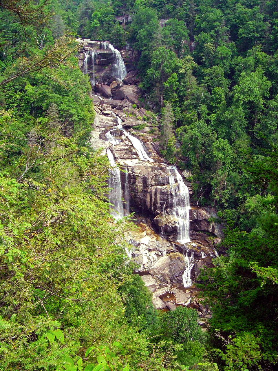
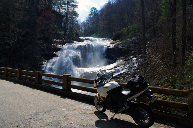
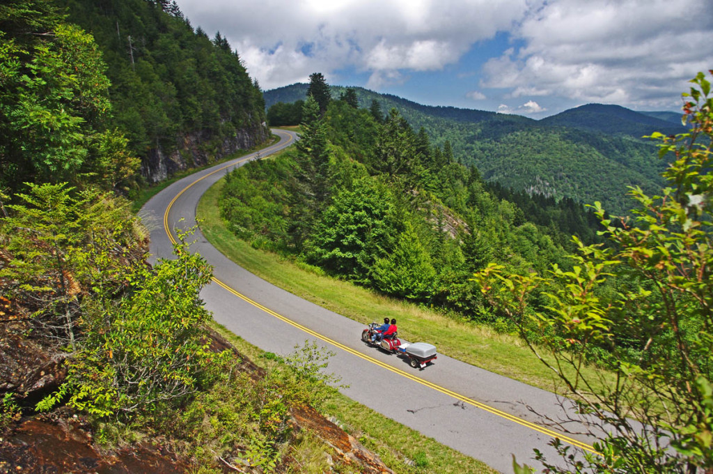
NC 28 / US 64 between Franklin and Highlands, North Carolina is well known for 4 beautiful roadside waterfalls.
Few notice there is a 5th waterfall, at least that’s what the sign says.
Sequoyah Falls is located just outside Highlands. Truth is it’s not a natural waterfall, rather the spillover from the dam on Lake Sequoyah.There’s an unpaved pull off, a sign and a plaque here and it does make a nice place for a stop on your motorcycle ride.
Is it a waterfall? You decide while you savor this beautiful spot on your motorcycle tour of the Blue Ridge. Enjoy!
Wayne Busch searches out the most entertaining roads in the Blue Ridge Mountains then records them on a series of maps which span the Blue Ridge Mountains.
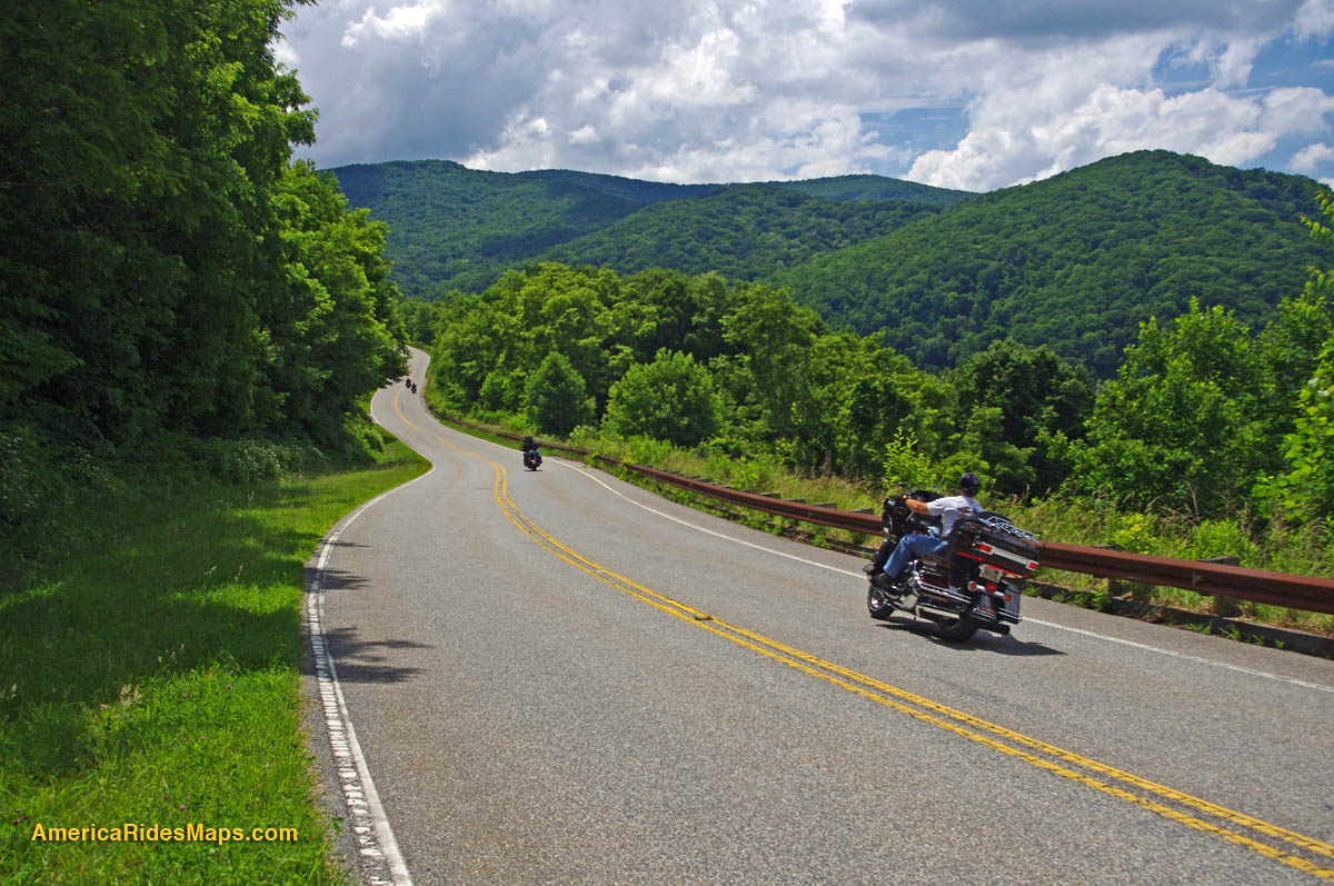
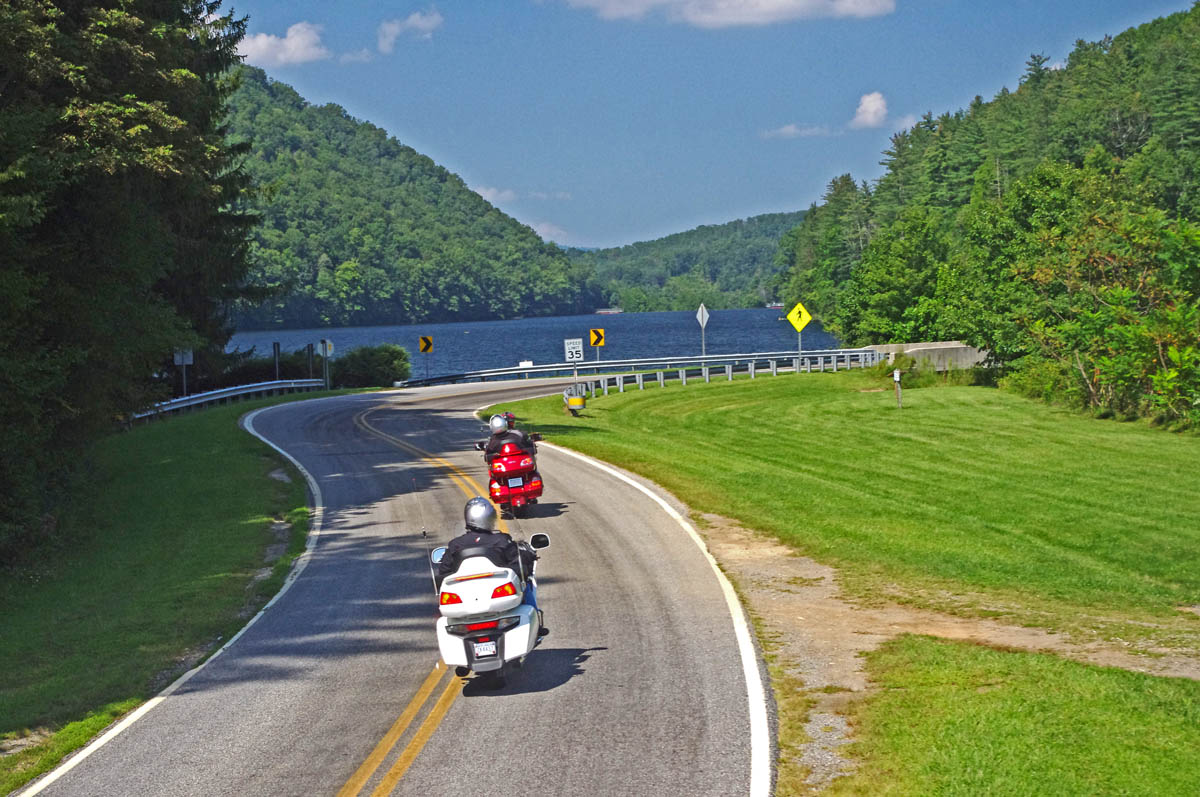
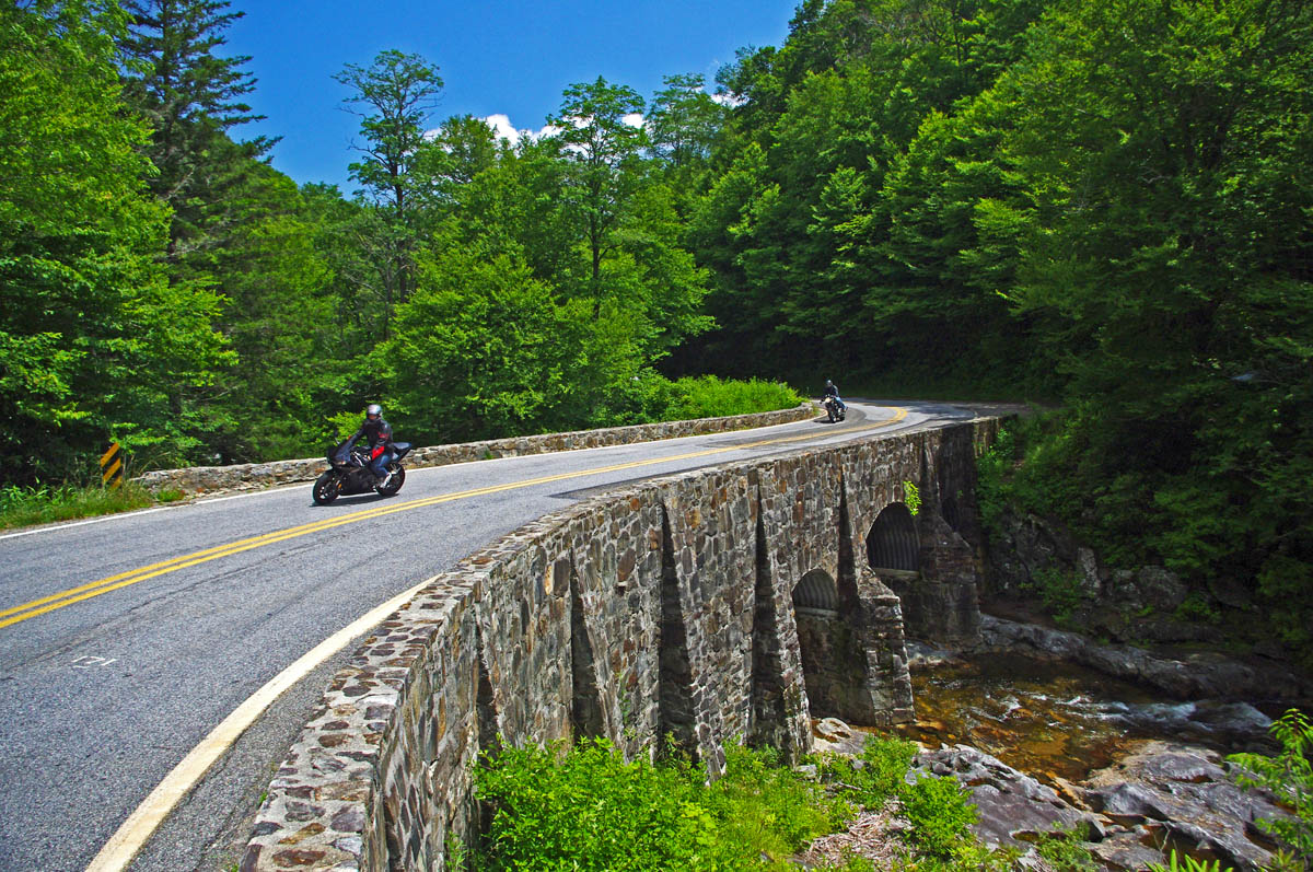
There are more great motorcycle roads in the Blue Ridge and Smoky Mountains than anywhere else. I highlight the best roads then show you the best ways to connect them together into rides. More than a decade of searching has discovered more than 1000 good roads to enjoy. We continue to search so you may enjoy.
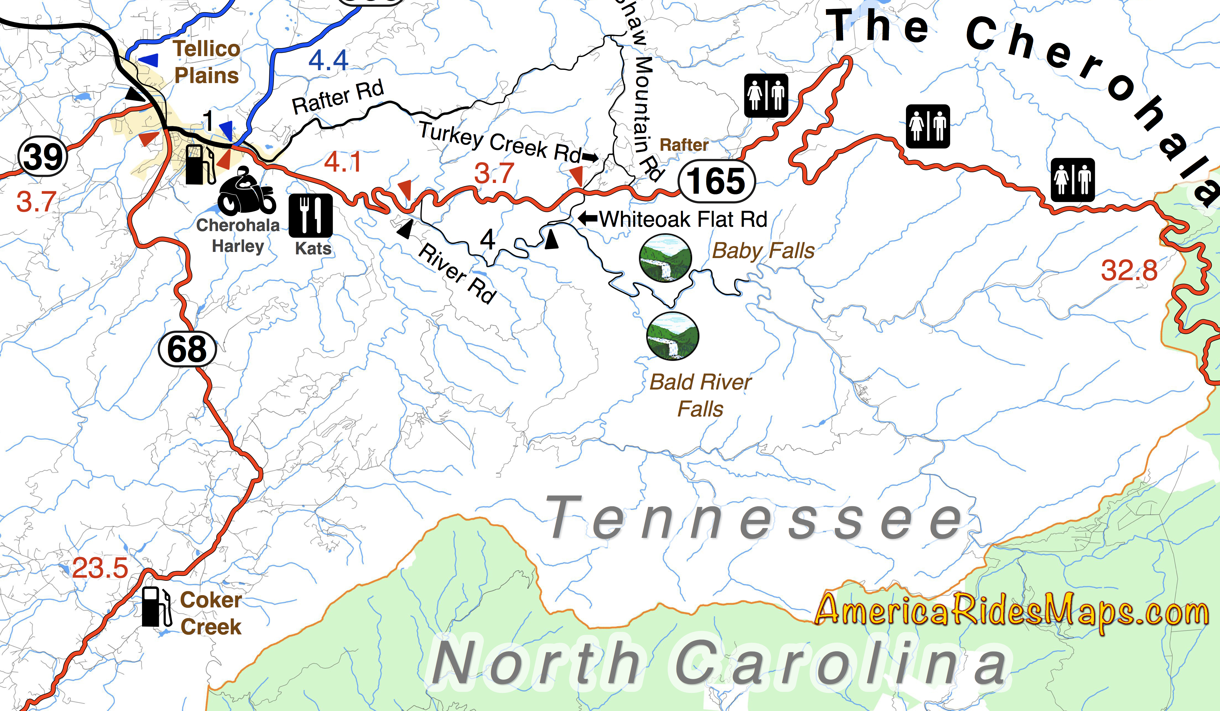
Motorcycle Riders can visit two nice waterfalls near the Tennessee end of the Cherohala Skyway
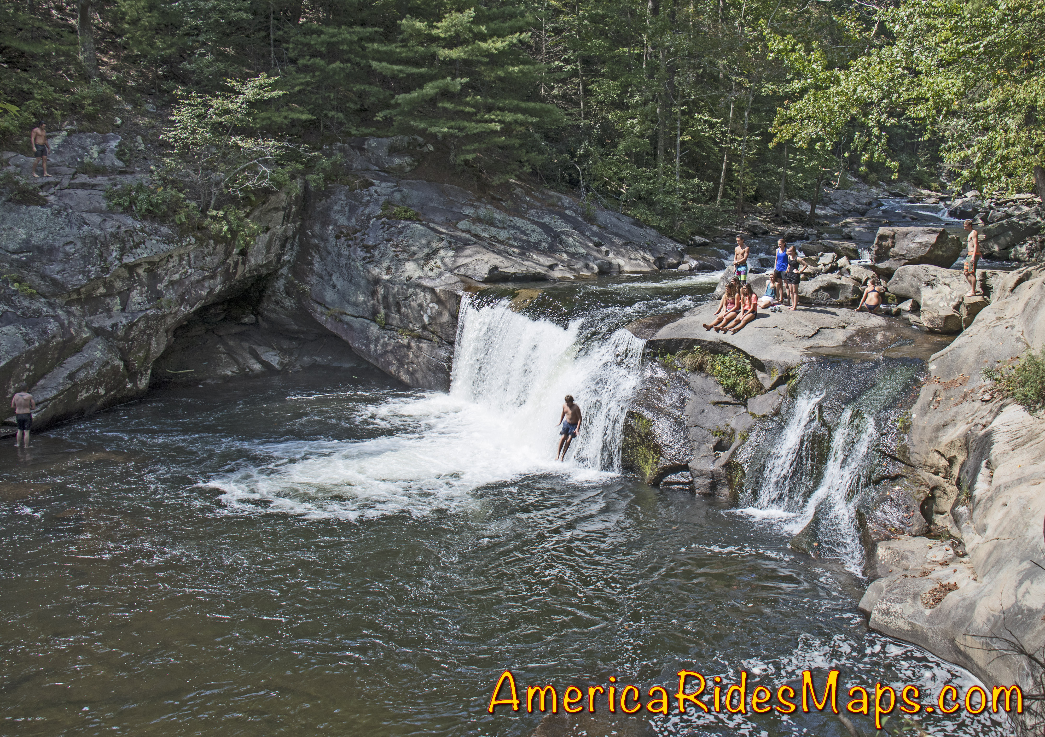
The Cherohala Skyway is one of the best motorcycle rides in the Smoky Mountain area. Bald River Falls is near the Tennessee end of the Skyway. A Forest Service road sign marks the start of River Road which winds upstream to the base of the large waterfall. Most riders find their way to Bald River Falls and get the nice photo from the bridge. Few know there is another waterfall just a short ride up the road – Baby Falls.
Baby Falls are smaller but still impressive. You’ll find more parking, picnic tables, bathrooms, and easy access to the falls. It’s a nice spot for a break, better than the roadside parking at the bigger waterfall.
Don’t miss Baby Falls, it’s the better place for riders to take a few minutes break. You’ll find it this area covered on several America Rides Maps.
Wayne Busch – America Rides Maps
Wayne Busch searches out the most entertaining roads in the Blue Ridge Mountains then records them on a series of maps which span the Blue Ridge Mountains.
There are more great motorcycle roads in the Blue Ridge and Smoky Mountains than anywhere else. I highlight the best roads then show you the best ways to connect them together into rides. More than a decade of searching has discovered more than 1000 good roads to enjoy. We continue to search so you may enjoy.
This new map details the great dual sport rides near the Dragon at Deals Gap, North Carolina, along the long stretch of the Cherohala Skyway, and near Tellico Plains, Tennessee. Enjoy the legendary Tail of the Dragon AND take your adventure bike out in the woods on the same day of great motorcycle rides. ADV Riders will love these detailed maps.
This motorcycle ride map features the great motorcycle roads found near the Nantahala Gorge, as well as the great riding off road riding around Franklin, North Carolina. Enjoy roadside waterfalls, mountain top views, and miles and miles of superb unpaved riding.
Discover motorcycle rides in the vast wild and scenic areas of the Nantahala and Cherokee National Forests on Forest Roads and accessible trails.
America Rides Maps has also produced dual sport motorcycle ride maps of the great adventure rides east of Great Smoky Mountains National Park and the superb roads near the Blue Ridge Parkway south of Smoky Park. They are sold individually and as a 3 map set.
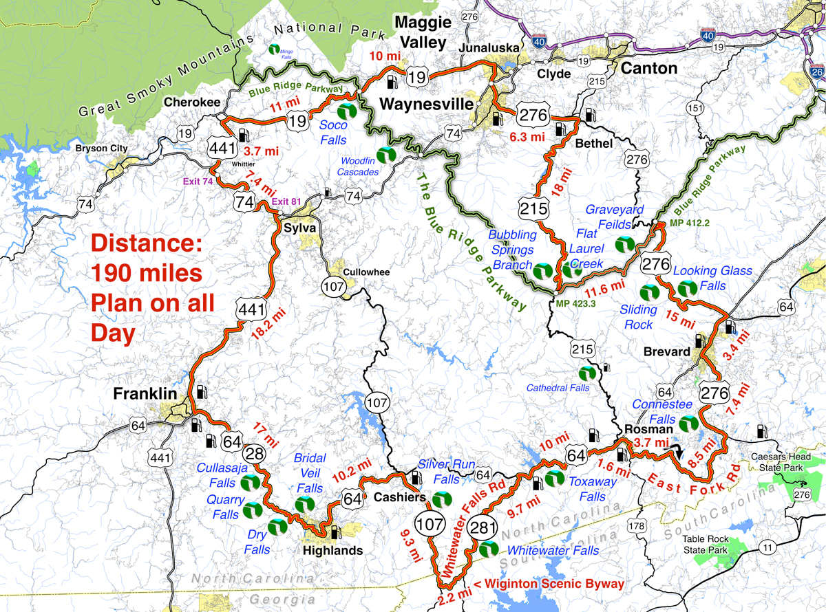
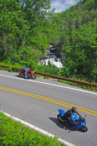
Tour more than 1 dozen roadside waterfalls on this long and scenic day ride.
Smoky Mountains Waterfalls Motorcycle Ride – click for large view
Overview:
Start in Maggie Valley. Follow US 19 west to 441 at Cherokee. Soco Falls on route. Follow US 441 south to Franklin, then US 64 / NC 28 to Highlands. 4 falls along road. Highlands to Cashiers on US 64, then loop south on 107 / 281 to see 2 more. Continue east on US 64, detour south of Brevard then onto US 276 to the Blue Ridge Parkway (3 more) Ride the Parkway to NC 215 then follow it back to US 276 and into Maggie Valley.
Discover the hidden secrets on your motorcycle travels in the Blue Ridge and Smoky Mountains
Detailed Route:
Distance: 190 miles.
Time: All day ride.
Easy to moderate difficulty
Before you go:
Exercise caution! – These are roadside waterfalls, some which are on busy roads with blind curves and limited pull-outs. Pull out with confidence and vigor.
Look but don’t touch – Dangerous conditions lurk around waterfalls. Visitors are killed every year. Very slippery rocks. Powerful currents. Deadly drops.
Plan on more time – Several waterfalls require short walks to get the views. Allow time for multiple stops and photos.
Route:
Easy to find Bubbling Springs Branch is on a sharp curve where it flows under NC 215.
Start in Maggie Valley. Follow US 19 west.
4.1 mi Pass under Blue Ridge Parkway
5.7 mi – Soco Falls. Gravel pull off on left with small signs. Downhill section of road on a curve. Can’t be seen from road. Path and boardwalk lead to 2 converging waterfalls.
15.2 mi Turn left @ traffic light at casino for shortcut to US 441 south. Junction US 19 and Casino Road.
16 mi Turn left @ traffic light onto US 441 south. Junction Casino Road and US 441.
20.1 mi Follow highway 23/74 east. Junction US 441 and highway 23/74 exit 74.
27.3 mi Follow US 441 south. Junction US 441 and highway 23/74 exit 81..
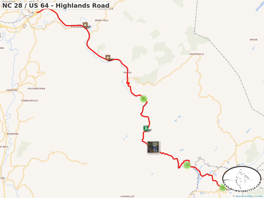
45.3 mi Exit US 441, follow US 64 / NC 28 east. Junction US 441 and US 64 / NC 28 at Franklin.
54.4 mi – Cullasaja Falls. Visible from road on right. Limited and hazardous parking near guardrail on sharp curve.
57.3 mi – Quarry Falls – Visible from road on right. Long paved pulloff on right side of road.
58.2 mi – Dry Falls – Not visible from road. Paved parking on right with signs. Short trail to waterfall. Path continues behind waterfall.
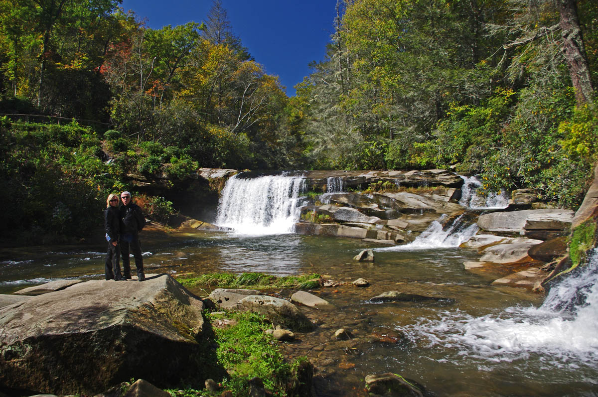
60.8 mi – Bridal Veil Falls – Visible from road on left. Paved pull off. Drive behind the waterfall for a photo.
With permission granted, I stand ready to help you have the ride of your life! Just say YES!
63.5 mi Turn left @ traffic light to continue on US 64. Junction US 64 and NC 28 downtown Highlands.
73.7 mi Turn right @ traffic light onto NC 107 south. Junction US 64 and NC 107 in Cashiers.
77.1 mi – Silver Run Falls – Not visible from road. Poorly marked gravel pull off on left. Trail leads into woods. 1/4 mile walk.
83 mi Turn left onto Wiginton Scenic Byway. Junction Wiginton Scenic Byway and NC 107.
85.2 mi Turn left @ stop sign to head north on NC 281 (Whitewater Falls Road). Junction Wiginton Scenic Byway and NC 281.
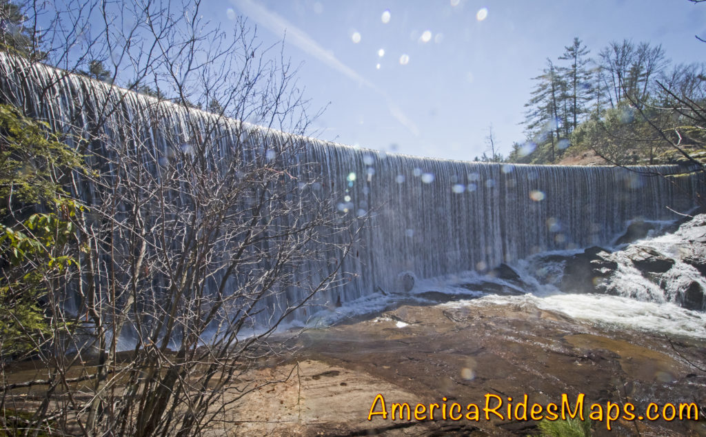
87.6 mi – Whitewater Falls State Park. Not visible from road. $2 fee. 1/4 mile paved walk. Highest waterfall in the east.
94.9 mi Turn right @ stop sign to continue east on US 64. Junction NC 281 and US 64.
97.1 – Toxaway Falls – Not visible from road. Road crosses dam with waterfall below. Difficult to get a good view. Park at Toxaway Village or along road on dam.
105 mi Turn right @ junction US 64 and US 178 at Rosman.
106 mi Turn right @ traffic light in Rosman, exit town.
107 mi Turn left onto East Fork Road. Junction US 178 (Pickins Highway) and East Fork Road.
110 mi Turn right @ stop sign to keep on East Fork Road. Junction East Fork Road and Walnut Hollow Road.
119 mi Turn left @ stop sign to go north on US 276 (Greenville Highway). Junction East Fork Road and US 276.
120 mi – Connestee Falls – Not visible from road. Large sign, trailhead at end of parking lot. Short walk to overlook where 2 waterfalls converge.
126 mi Turn right @ traffic light in Brevard onto US 64. Junction US 276 and US 64.
129 mi Turn left @ traffic light onto US 276 north. Junction US 64 / US 276 / NC 280.
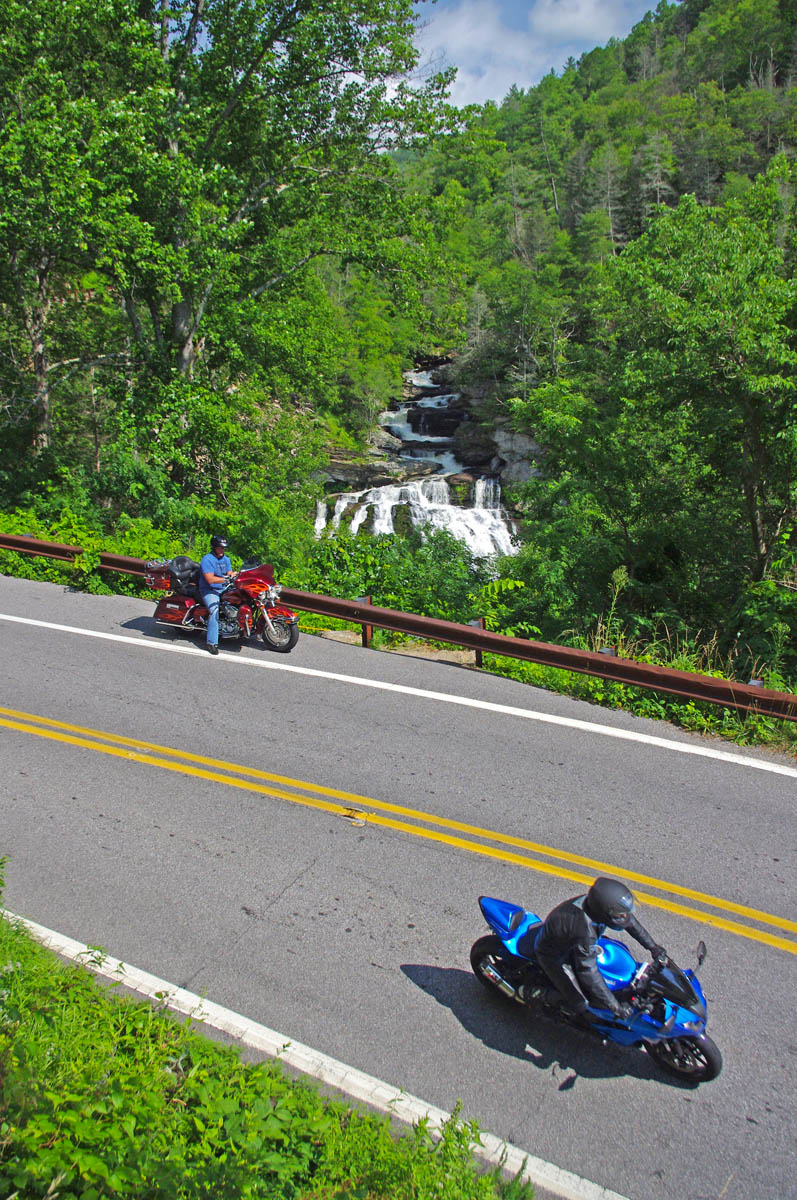
135 mi – Looking Glass Falls – Visible from road. Large paved parking along road on right. Boardwalk to base of falls.
Whitewater Falls, one of the highest in the east.
137 mi – Sliding Rock – Not visible from road. Fee area $2. Paved parking lot. Bathers slide down waterfall.
144 mi Turn right onto parkway ramp. Turn left at the stop sign to head south (towards Cherokee) on the Blue Ridge Parkway. Junction US 276 and Blue Ridge Parkway.
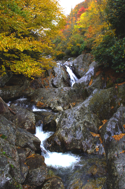
148.5 mi – Graveyard Fields – Not visible from road. 1/3 mile paved walk to top of Second Falls. Trails continue to 2 others.
156 mi Exit Parkway. Turn left (towards Canton) on NC 215. Junction Blue Ridge Parkway and NC 215.
158 mi –Flat Laurel Creek – Visible from road. Hard to find. Look for 3rd gravel pull out on right on the only straight section of road.
160 mi – Bubbling Springs Branch – Visible from road on left. River plunges beneath the roadway on a hairpin curve. Small unpaved parking are just beyond.
174 mi Turn left @ stop sign to follow US 276 into Waynesville.. Junction NC 215 / US 276.
180 mi Turn right @ traffic light in Waynesvile.. Pass through town.
Junction US 276 and Main Street.
181mi Turn left @ traffic light. Junction Main Street and US 276 (Russ Avenue).
183 mi Turn left @ traffic light to return to Maggie Valley. Junction US 276 and US 19.
————————————————————————————
Wayne Busch
– Wayne Busch lives in Waynesville, NC, where he produces the most detailed, comprehensive, up-to-date motorcycle pocket maps of the Blue Ridge and Smoky Mountains to help you get the most of your vacation experience. See them here – AmericaRidesMaps.com
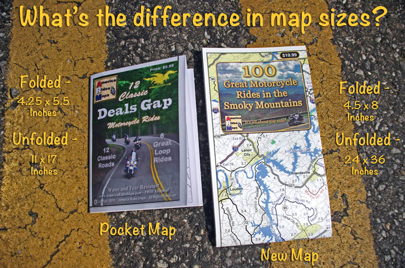
100 Great Smoky Mountain Motorcycle Rides Map – both folded (road use) and unfolded (wall display) versions. Waterproof and durable. Red Roads are best, Blue Roads are best connectors.
100 Great Smoky Mountain Motorcycle Rides is the “grown up” version of our most popular 12 Classic Deals Gap Motorcycle Rides pocket map. This new larger and more detailed map adds in all the great roads that are not featured on the smaller map, more than 100 of them.
Size comparison – pocket maps vs. new map unfolded. More detail, easy to read, tons more roads!
——————————————————————-
4.5 x 8 inches folded
ABOUT:
Discalimer –
There are way more then 100 great motorcycle rides on this map
Most of these roads are peripheral to the actual geologic formation of the Smoky Mountains
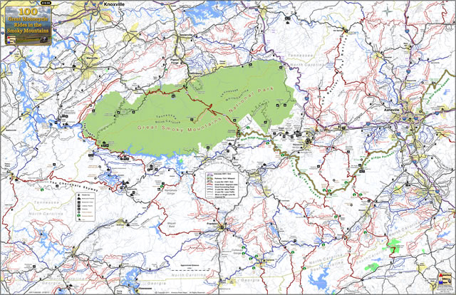
This new larger format map (24×36 inches) combines at least 3 pocket maps (#6, #7, #8) and sections of 2 more (#5, #9) into one larger map that encircles and includes all the best motorcycle rides surrounding Great Smoky Mountains National Park.
This map stretches from Tellico Plains, TN in the west to include the Cherohala Skyway, The Dragon, and connecting roads, to beyond Asheville, NC in the east. It dips into Georgia and South Carolina, and reaches as far north as Knoxville, TN. Within these borders lie some of the best motorcycle roads in the nation.
For the first time visitor – all the great motorcycle roads are at your disposal.
For the return visitor – expand on what you’ve already discovered
I’ve had no time to get them out to sellers so these are the few places they are available and in limited supply at that. Once I return from my motorcycle trip I’ll get more out to the other vendors.
“One of the finest motorcycle rides you’ll ever enjoy” –
Fall color on the North Carolina end of the Cherohala Skyway
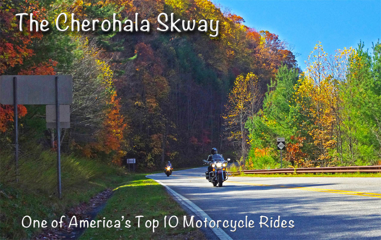
The Cherohala Skyway takes the motorcycle rider on a long and sweeping romp through the mile high ridge lines of remote national forests just west of Great Smoky Mountains National Park. Stunning long range views can be enjoyed from overlooks and rest areas along the park-like road. Traffic is typically light and the curves are challenging and consistent for the 50 mile town-to-town ride through some of the most wild and scenic areas in the Blue Ridge mountains.
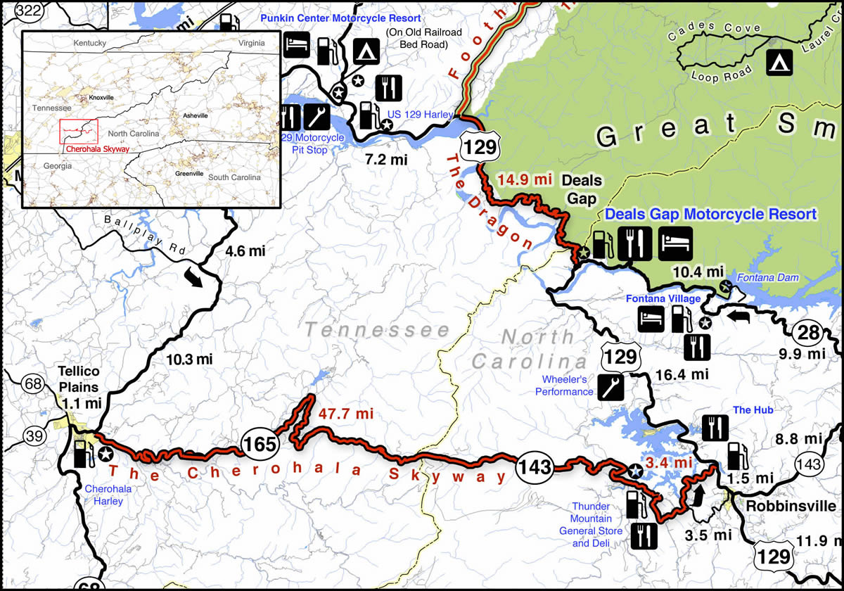
The Cherohala Skyway is near The Dragon at Deals Gap. It runs from Robbinsville, NC to Tellico Plains, TN. Click on map for larger view. Source – America Rides Maps Motorcycle Pocket maps – AmericaRidesMaps.com
Enjoying a summer motorcycle ride on the Cherohala Skyway
The majority of motorcycle riders are drawn to this remote mountainous area to experience the thrill of riding US 129 a.k.a. “The Dragon” which skirts the western border of Great Smoky Mountains National Park nearby. A good number of them find the ride on the Cherohala Skyway far more enjoyable. It’s a relaxing contrast to the commotion and crowds that race back and forth through the Dragon’s legendary curves.
The Cherohala Skyway runs east to west connecting the small towns of Robbinsville, NC, and Tellico Plains, TN. Between them lies a large undeveloped mountainous section of the Cherokee (TN) and Nantahala (NC) National Forests. The made-up name “Cherohala” comes from a combination of the names of the remote forests it runs through.
Flying through the mile high curves near the middle of the long wonderful ride
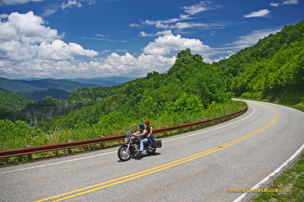
From either end the road makes a gradual climb to reach the 5000 ft heights near the middle section. Two broad lanes with sweeping curves arc through the mountain passes. Scenic overlooks, some with rest areas, yield views of a vast forests often free of visible human impact to the horizon. While the towns at either end have food, gas, and lodging, there is nothing but empty pavement on the 40 or so miles between them.
Springtime on the Tennessee end of the Cherohala Skyway – nice long view of road, click to enlarge
Riding the Cherohala Skyway on a motorcycle you’ll find smooth pavement with good traction save a few bumpy patches here and there and the occasional bit of gravel dragged into turns by cars that run wide. The speed limit is 45 mph though there are many turns where a prudent rider will carry a bit less and the experienced rider will find satisfaction at speed. The overlooks and pull outs are well marked, paved, and have ample parking. Elevation signs along the road signal each 1000 ft change. It’s very much an experience like riding through a national park – similar to riding the the Blue Ridge Parkway (less than an hour east).
Stop to enjoy the views from the nice overlooks on the Cherohala Skyway
As relaxing as that “park-like” experience sounds, the road challenges the motorcycle riders’ skill. The Cherohala Skyway is “big brother” to the nearby Dragon with it’s back-to-back tight turns. The Cherohala Skyway is a ‘super-sized” version of it. The curves open up and relax a bit but they keep coming one after another with the added dimension of long winding climbs and descents.
The Cherohala Skyway and the Dragon are often ridden together in a 123 mile long loop ride which runs north on US 129 to via TN 72, then to Vonore, TN, then south via TN 360 to Tellico Plains, TN, then across the Cherohala Skyway to Robbinsville. When you ride both roads , the contrast is obvious -the need to be hyper alert and vigilant in the parade of bikes on the Dragon is relieved on the Cherohala Skyway. It seems empty by comparison, you can relax and it has all this gorgeous scenery too!
Great views, nice pavement, low traffic, and miles and miles of sweeping curves make the Cherohala Skyway a top motorcycle ride.
The best time for a visit is fall when the leaves are changing. Staying at the eastern (NC) end of the road places you near several other great motorcycle rides like the Dragon and NC 28. Robbinsville, NC is the larger town with more food / lodging options though many like the west end in Tellico Plains, TN for the camping.
The Cherohala Skyway is open all year (except when snow blocks) making it one of the first destinations for southern riders in the spring and a winter play spot for the hardcore adventurer.
Starting up the grade from the North Carolina end of the road on the Cherohala Skyway.
Tips and Advice –
It’s about 50 miles with no gas. Fuel at either end. Be safe – top off.
3000 foot elevation change – it will be cooler, more windy, and wetter at the higher altitudes. Dress for it.
It’s a long, long way if you need help. Ride with that in mind.
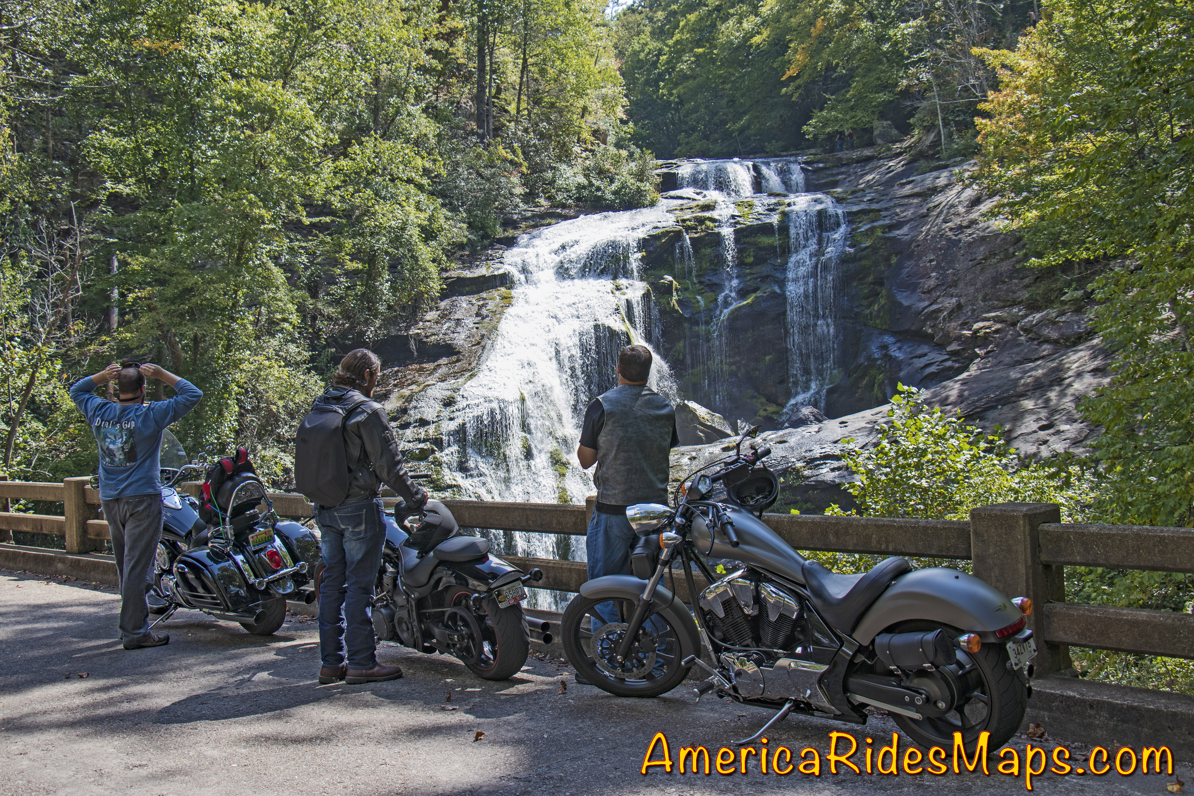
It takes a little effort, but Bald River Falls is worth the trip
Make a side trip to Bald River Falls –
You’ll see a sign for Bald River Falls near the start of the Tennessee end of the Cherohala Skyway. Follow barely paved River Road for several miles, it’s obvious.
———————————————————————————————-
Wayne Busch
– Wayne Busch produces the most detailed and comprehensive motorcycle pocket maps of the hundreds of great roads in the Blue Ridge and Smoky Mountains so you know where the best roads are and how to spend the bulk of your riding time on them.
You’ll find the Cherohala Skyway on America Rides Maps –
Best Motorcycle Rides in North Carolina – A sport bike loop ride
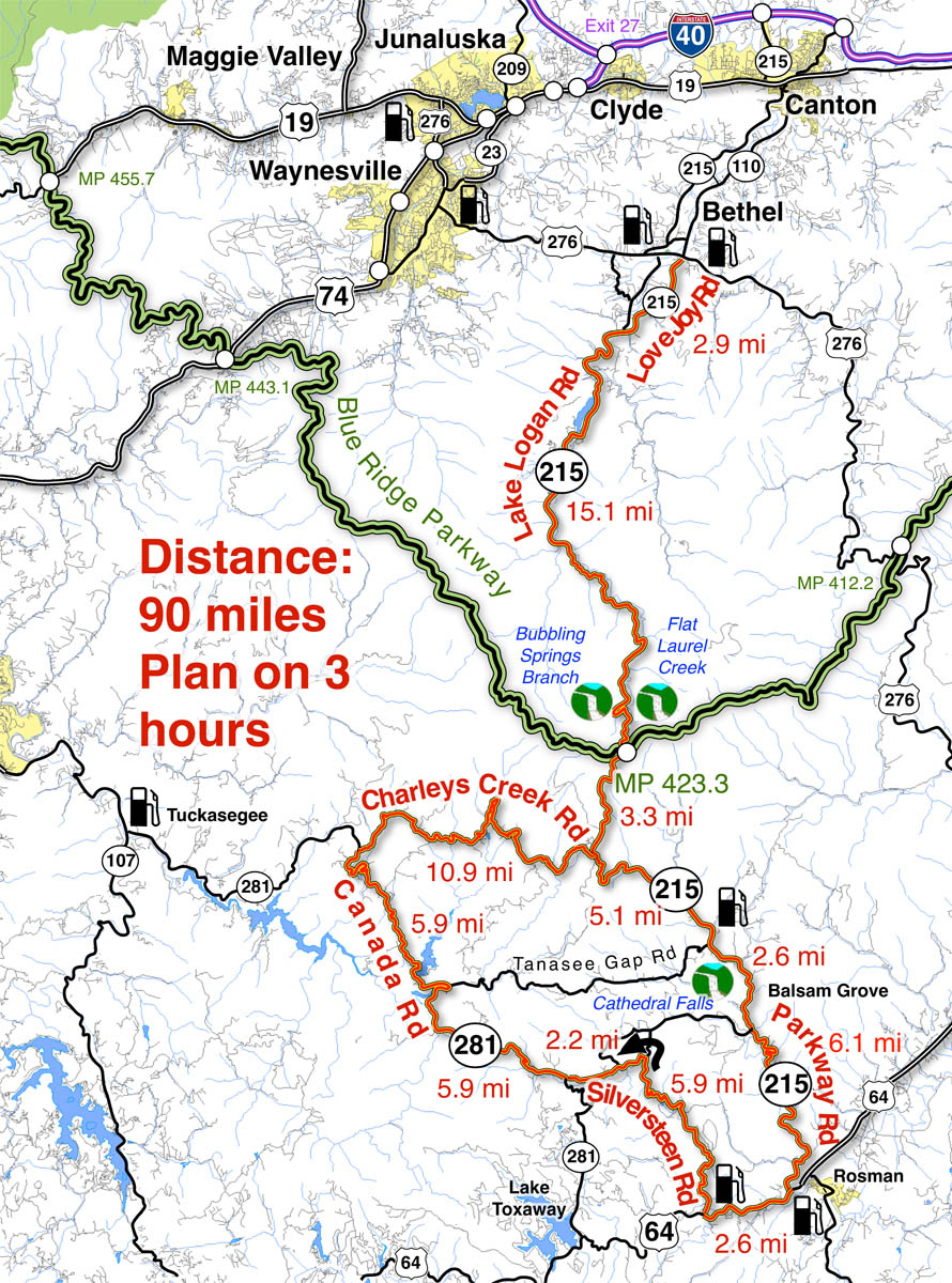
When I’m looking for a “dragon like” challenge close to home, this 90 mile loop satisfies every time!
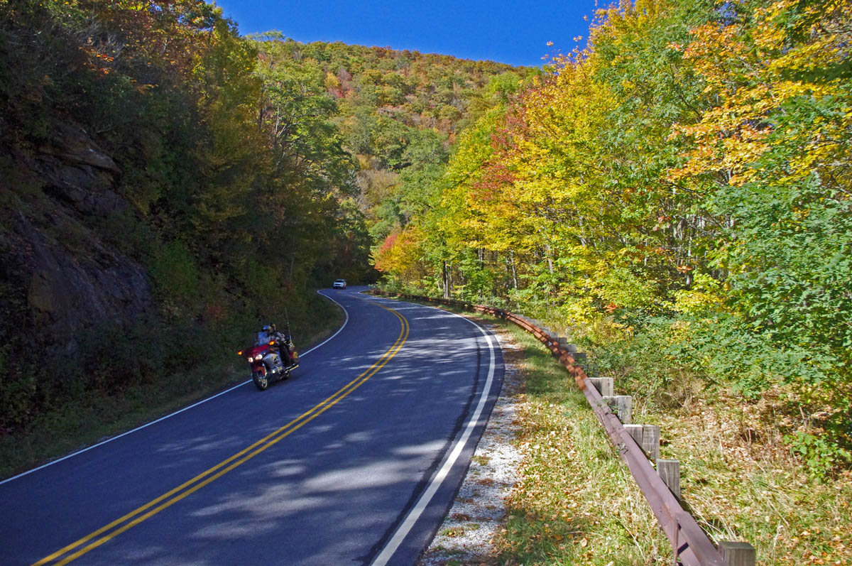
Section of NC 215 near Lake Logan. You’ll find some nice scenery on the popular road. The curves so far are just a warm up for what lies ahead.
As much as I enjoy a ride on the infamous Tail of the Dragon at Deals Gap, it’s a bit of a ride to get out to it from the Waynesville / Maggie Valley area where I live. Fortunately, there are ample challenging roads nearby, and when I really want a peg-scraping ride, this is one of my favorite local loops. For those on sport bikes, it’s a must-do when you are in the area.
The higher you go the better it gets on NC 215. The road crests where it meets the Blue Ridge Parkway, then plunges down the other side of the gap.
The map originates in the small crossroads town of Bethel, NC south of Waynesville, Canton, Maggie Valley, and Junaluska. It can also be done as a side loop off the Blue Ridge Parkway (exit at Beech Gap, MP 423.3, NC 215 – cuts 36 miles off the route).
The curves continue as you descend from the Blue Ridge Parkway with a brief break when you enter a valley. The curves that follow really kick it up!
Length: 90 miles plus your ride to the start in Bethel, NC. Ride time: 3-4 hours Difficulty: Very challenging, tight curves, climbs and descents, sustained, varied road surfaces, all paved
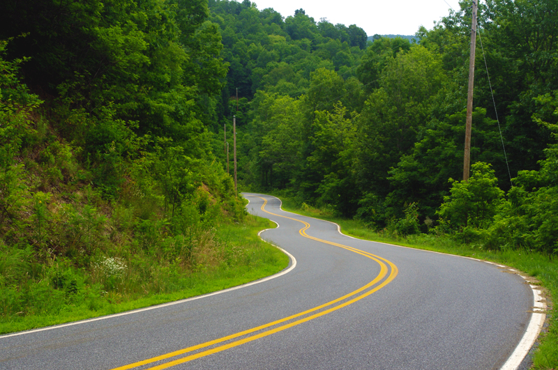
Imagine miles and miles of curves like this one – a.k.a. Silversteen Road
Turn-by-turn route description:
Start at traffic light in Bethel (junction US 276, NC 215, NC 110).
Follow NC 215 – starts as Love Joy Road. Easy section through farmland along river with a few sharp turns.
2.9 mi – Turn left @ stop signto continue on NC 215. Junction Love Joy Road and Lake Logan Rd (NC 215). Moderately difficult. Rolls through houses, some nice curves, section along Lake Logan very nice.
16.8 mi – Pass Sunburst Campground. Enter Pisgah National Forest. Start climb to Blue Ridge Parkway. Road gets more twisty here. Nice stop at a roadside waterfall. Beware loose gravel on road, especially in turns, most likely to be found in the highest sections. Difficult.
17.9 mi – Pass Blue Ridge Parkway ramp. Popular break spot, if not at the junction, go up to the parkway and turn right to reach a nearby overlook with lots of parking. Continue under the parkway on NC 215. Good views from the highest section. Road surface improves south of parkway. Difficult.
35 mi – Turn right @ stop signonto US 64. Junction NC 215 (Parkway Road) and US 64. Just a short section on this sometimes busy road. Easy.
Charlie’s Creek Rd – typical of the wonderfully empty and inviting rides that abound in the Smokies
37.7 mi – Turn right onto Silversteen Road. Junction US 64 and Sliversteeen Rd. Sign warns of tight turns ahead, believe it! Difficult.
38.3 mi – Keep right on Silversteen Rd. Junction Silversteen Rd and Golden Road.Difficult.
43.6 mi – Sharp left turn to stay on Silversteen Road. Junction Silversteen Rd and Macedonia Church Road. If you don’t make this turn, you will end up back on NC 215. Difficult.
45.7 mi – Turn right @ stop sign onto NC 281. Junction Silversteen Road and NC 281 (Canada Road). Nice section, a little loose gravel in places. Difficult.
57.6 mi – Turn right onto Charlies Creek Road. Junction NC 281 (Canada Road) and Charlies Creek Road. Be on your guard, surprising turns on this road. Difficult.
Wolf Creek Dam near the midpoint of NC 281, one of the scenic points on this great motorcycle ride.
68.4 mi – Turn left onto NC 215. Junction Charlies Creek Road and NC 215. Start back on a road you’ve been on previously.
89.7 mi –Follow NC 215 back to Bethel.
You’ll find gas stations in Bethel, on NC 215 on the south side of the Blue Ridge Parkway, and at the turn off US 64 onto Silversteen Road.
Jukebox Junction is a popular diner in Bethel. It’s mostly gas station food for the remainder of the ride.
– Wayne Busch lives in Waynesville, NC, where he produces the most detailed and comprehensive and up-to-date motorcycle pocket maps of the Blue Ridge and Smoky Mountains to help you get the most of your vacation experience. See them here – AmericaRidesMaps.com
Don’t Let This Happen to Your Motorcycle Trip Next Year. A single word can make the difference.
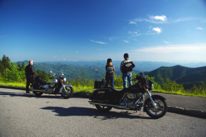
Blue Ridge Parkway view – Give yourself permission to let this happen to you
The end of the year approaches. The holy days are behind us, and I look with dread at the incessant barrage of recaps, summations, and “the year in review” coming in the media as we approach 2013. It can drive me crazy; let’s face it, you and I were there. I’m not a “look back” kinda guy. Been there, done that, memories made, lessons learned.
Nor am I one to embrace the “New Year’s Resolution” mantra as we all know how rarely they endure beyond the morning after hangover. Reality has a painful way of drawing us back to our old habits and familiarity breeds contempt for change.
Don’t deny yourself the experience. Open the door. It’s already there and waiting. You just need to beleive it will happen.
Still, we all dream, desire the adventures in life, the glorious experiences and challenges of our “bucket lists”. If only there were something that could trigger these events, some trick, some key that unlocks that fantasy future of riding our motorcycles on that empty road through a paradise of wonder and beauty, sun on the shoulders, wind in the face.
Discover the hidden secrets on your motorcycle travels in the Blue Ridge and Smoky Mountains
I know the key, I know what makes things happen, and I want to share it with you. It’s one simple word that can change your motorcycle riding future if you embrace it;
– Just say YES.
Give yourself permission. Unlock the doors of possibility. As soon as you say YES, you have created the possibility which was not there before for that great motorcycle trip to happen.
Yes or no? Will this be you on your motorcycle in 2013?
Before the planning, before the goal, before the first step of that 1000 mile journey, you must create the potential for it to happen at all.
With permission granted, I stand ready to help you have the ride of your life! Just say YES!
Sounds kinda kooky and spiritual doesn’t it? But consider the contrast. How likely is it to happen if you instead say NO?
You’ve got nothing to lose, and everything to gain by trying this one simple thing; if you want that bucket list motorcycle ride, that vacation motorcycle trip of a lifetime, that discovery and adventure we two-wheeled souls need to feel alive, give your self permission. Say YES and believe. The rest will follow. I’m here to help.
– Wayne Busch lives in Waynesville, NC, where he produces the most detailed and comprehensive and up-to-date motorcycle pocket maps of the Blue Ridge and Smoky Mountains to help you get the most of your vacation experience. See them here – AmericaRidesMaps.com
Note –while paving is done (it was a quality job) there is still fill work along the shoulders and pavement markings / lines need to be added so expect work crews in the area. It will take a bit for the gravel at the edges of the road to settle in, so you need to be watchful for loose stone in the curves for a while.
We’ve just come in off a great North Carolina motorcycle ride on the newly paved sections of US 276 which connect Waynesville to Brevard just south of Great Smoky Mountains National Park in North Carolina. US 276 crosses the best and most scenic area of the Blue Ridge Parkway at the mid-point on this 30 mile ride.
Best North Carolina motorcycle rides – Jackie gives a big “thumbs up” to the fresh paving on US 276 near the Blue Ridge Parkway
South of the Blue Ridge Parkway, the fresh paving invites motorcycle riders to snake all the way down from the parkway’s heights to popular Looking Glass Falls, one of the most visited roadside waterfalls in the southeast. Along the way you’ll find scenic areas like Pink Beds, informative and historic places like The Cradle of Forestry, and you might even want to plunge 60 feet down a waterfall for a chilly wake-up at Sliding Rock. The entire ride carves and switchbacks through the steep and wooded mountains of the Pisgah National Forest with whitewater streams, dark tree lined passages, and numerous pull-outs to stop ad savor the surroundings.
Best motorcycle rides North Carolina – the south side of US 276 winds through thick forest
North of the Blue Ridge Parkway, US 276 drops more than 1000 feet in a 3 mile plunge from Wagon Road Gap (MP 412.2) to the trailhead at Big East Fork, then it flanks along the slopes of Cold Mountain following the Pigeon River to the Bethel Valley. This section of tight curves is one of the most sustained series of back-to-back turns you’ll come across anywhere AND it’s a steep grade to boot. For the motorcycle rider looking for a challenging stretch of road, this one has all you need!
Why is this important?
US 276 is one leg of a triangle which form a number of the best motorcycle rides in North Carolina I call The Pisgah Triangles. The other long leg of the triangle is NC 215. Several roads form third legs of a series of triangles crossing between NC 215 and US 276 within the upside down “V” formed. The roads which hold the most challenging, steep, curvy, and scenic sections of the rides are found near the top of the triangle and have been in poor repair making a challenging ride even more difficult. Once these sections of road are repaved, the quality of the motorcycle rides on The Pisgah Triangles will beat most, if not all of the best motorcycle rides in North Carolina.
Great Motorcycle Rides in North Carolina – Pisgah Triangles motorcycle map – At least 4 variations, the 3rd is my favorite.
We were delighted to see the upper portions of NC 215 are also receiving a sweet smooth coating of fresh asphalt. There is still a good bit to be done as it’s a much longer run down to the Sunburst Campground at the edge of the national forest. Like US 276, NC 215 traces the course of the Little East Fork of the Pigeon River as it rushes down from the heights.
Best Motorcycle Rides North Carolina – Paving on NC 215 has started from the top down. You can see one lane done here, still a way to go.
Easy to find, convenient to ride, lots of options!
Both US 276 and NC 215 intersect the Blue Ridge Parkway on the highest and most scenic portion of the road. If you are riding the Blue Ridge Parkway it’s easy to hop off and play with these roads or if you are riding through, it’s a short cruise to loop back from the south end at Cherokee and enjoy. I believe most riders are going to enjoy these roads more than The Dragon at Deals Gap as they are not only curvy, but wonderfully scenic and carry very light traffic.
– Wayne Busch lives in Waynesville, NC, where he produces the most detailed and comprehensive and up-to-date motorcycle pocket maps of the Blue Ridge and Smoky Mountains to help you get the most of your vacation experience. See them here – AmericaRidesMaps.com
Great Motorcycle Rides in North Carolina – The Pisgah Triangles Map
Great Motorcycle Rides in North Carolina – Pisgah Triangles motorcycle map – At least 4 variations, the 3rd is my favorite.
Great Motorcycle Rides in North Carolina – The Pisgah Triangles are some of the best motorcycle rides in the world. You’ll see spectacular views, wonderful waterfalls, and ride curves and twists that go on and on and on!
US 276 and NC 215 are two of the finest motorcycle rides you’ll find. Both roads run south from Waynesville / Maggie Valley forming a large upside-down “V”. Connections between these two long roads make 4 triangle shaped rides. Ride a short fun loop or have an all day adventure!
Complete your triangle with – The Blue Ridge Parkway, US 64, East Fork Road,
or SC 11
Great Motorcycle Rides in North Carolina – Pisgah Triangles – Looking Glass Falls on US 276 is one of the most visited roadside waterfalls in North Carolina
Roll into Waynesville or Maggie Valley and ask someone to direct you to the best and most scenic motorcycle rides and their finger will point you to the jagged southern horizon. Home to the highest and best section of the Blue Ridge Parkway, two of the roads that lead out of town and climb to the mile high mountaintops are drop-dead beautiful and filled with the curves and switchbacks that make a biker come alive.
The Pisgah Triangles is a name I use to describe this collection of great motorcycle rides in western North Carolina as so much of it is through the wilderness of the Pisgah National Forest. These are four good options for rides, though are are several others, including some excellent unpaved forest roads for you adventure bikers. There are also roads which lead out to even more fabulous riding not shown on this map.
Great Motorcycle Rides in North Carolina – Pisgah Triangles – NC 215 is the lesser known leg of the Pisgah Triangles, crossing the parkway midway. It’s a popular rest stop in the middle of the wilderness.
Any of these 3 roads – the Blue Ridge Parkway, US 276, and NC 215 are great motorcycle rides you never, ever, tire of enjoying on your motorcycle vacation trip. It’s the first place we local bikers head to as well. Here are 4 outstanding North Carolina motorcycle loop rides you can choose from to get the most out of your precious time while out motorcycle touring in the Blue Ridge.
Great Motorcycle Rides in North Carolina – Pisgah Triangles – Cradle-of-forestry is one of several stops on US 276, along with Pink Beds, Sliding Rock, Looking Glass Falls, Blue Ridge Motorcycle Campground, Jukebox Junction, …
While you could blast through the shortest loop in less than 3 hours, chances are you won’t. There are so many great views you can’t help but stop and admire them along the ride. The first of the Pisgah Triangles is the first motorcycle ride I recommend to visitors after the Blue Ridge Parkway – it’s that good.
Great Motorcycle Rides in North Carolina – Pisgah Triangles -NC 215 – Cathedral Falls is hidden just off the road, but is worth the stop as there are 4 other waterfalls with just a short walk.
The second of the loops climbs to the Blue Ridge Parkway, then down into the next valley near Brevard and Rosman. If you want to include a few roadside waterfalls in your motorcycle tour, this is the way to get in some good ones and enjoy some more great curvy sections of road. I usually avoid using US 64 through Brevard and the traffic on the 4-lane, as the 3rd loop is so much nicer.
Great Motorcycle Rides in North Carolina – Pisgah Triangles – US 276 junction with the Blue Ridge Parkway. As both NC 215 and US 276 connect, you can always hop up and take a quick break with the best of views.
The third loop is just a little tricky as you jump from backroad to backroad, but it is such a nice and scenic motorcycle ride it is worth the effort and one of my favorite motorcycle rides of all. Dodging south of US 64 gets you off the four lane and on to some great rides along trout rivers and streams. Hard not to come back smiling from this one!
Great Motorcycle Rides in North Carolina – Pisgah Triangles – The climbs up to the highest section of the Blue Ridge Parkway then down to the next valley are packed with switchbacks, curves, and twists that are so much fun to ride!
The longest loop takes you into South Carolina to the very edge of the Blue Ridge Mountains, follows a long straight section of the Foothills Scenic Highway (SC 11), then comes back into North Carolina and a wonderfully twisty ride. The plunge into South Carolina from Caesar’s Head State Park is one you’ll remember!
Great Motorcycle Rides in North Carolina – Pisgah Triangles – Chances are you’ll miss this view plunging down from Caesar’s Head State Park into South Carolina and US 276 carves through the tight switchbacks.
Shortest loop 50 miles. 3 hours, more with stops. Longest loop 120 miles – All day ride
Routes:
Loop 1 – use Blue Ridge Parkway. 50 miles, 2 -3 hours or more.
Starts in Waynesville – Leave downtown Waynesville on US 276 south to reach the top point of the Pisgah Triangles.
6.3 miContinue straight at traffic light on US 276.
20.8 miTurn left to follow ramp to the Blue Ridge Parkway at Wagon Road Gap.
20.9 miTurn left at stop sing onto the Blue Ridge Parkway (towards Cherokee).
31.9 miExit the Blue Ridge Parkway at NC 215.
40 mi Turn Left at stop sign onto NC 215 (towards Canton). NC 215 becomes Lake Logan Rd.
49.9 mi End of loop 1 in Bethel. 6.3 miles back to Waynesville on US 276.
Loop 2 – Use US 64. 90 miles, 3-5 hours
Starts in Waynesville – Leave downtown Waynesville on US 276 south
6.3 miPass through the traffic light in Bethel.
20.8 miPass under the Blue Ridge Parkway
35.3 miTurn right @ traffic light onto US 64.
47.8 mi Turn Right onto NC 215 (Parkway Road).
64.8 mi Pass under Blue Ridge Parkway
90+ mi. Follow directions for loop 1 return to Waynesville
Loop 3 – Use East Fork Rd / Wilson Rd. 100 miles, 5 -7 hours
Starts in Waynesville – Leave downtown Waynesville on US 276 south.
35.3 miTurn right @ traffic light onto US 64. Move into the left lane.
35.4 miTurn left @ traffic light onto Ecusta Rd. Follow 1.6 miles to next traffic light at Old Hendersonville Highway.
37 mi Turn right, go about 200 yards, then turn left onto Wilson Rd. Follow Wilson Rd to US 276 (Greenville Highway
40.7 miTurn left @ stop sign onto US 276 (Greenville Highway).
46.1 miTurn right onto East Fork Road.
54.6 mi Turn left to stay on East Fork Road. Watch for gray metal barn on left near this turn. Follow East Fork Road to US 178 (Pickens Highway).
58.3 miTurn right @ stop sign onto US 178 (Pickens Highway) and follow into Rosman.
59 miTurn left @ traffic light when you enter Rosman to reach US 64.
60 mi Turn left at stop sign onto US 64
60.5 miTurn right onto NC 215 (Parkway Road)
95.5 miTurn left onto US 276 in Bethel. 6.3 miles to Waynesville.
Loop 4 – Use NC 11 – (Foothills Scenic Parkway)
Follow Loop 3 directions to mile 46.1. Continue south on Greenville Highway (US 276) into South Carolina.
58.1 mi Turn right @ stop sign onto SC 11. Follow 8.9 mi.
67 miTurn right onto US 178 (Moorefield Memorial Highway). Follow 15.6 miles to Rosman.
Return to Bethel using Loop 3 directions. 120 miles.
Here’s a video that shows riding in the area:
This is it. These are the rides you should do. They have everything you come to the mountains for. This is bucket-list quality stuff. These are some of the best motorcycle rides in North Carolina. Don’t miss the Pisgah Triangles on your next trip.
– Wayne Busch lives in Waynesville, NC, where he produces the most detailed and comprehensive and up-to-date motorcycle pocket maps of the Blue Ridge and Smoky Mountains to help you get the most of your vacation experience. See them here – AmericaRidesMaps.com


 America Rides Maps