I am beginning to think Georgia does not want to be mapped…

I am beginning to think Georgia does not want to be mapped. For more than a year now I have been trying to complete the most comprehensive and detailed map of the northeast corner of Georgia’s unpaved roads and trails. Things could have gone better at times.

Wheel to shop

I’ve made tremendous progress, I can see the light at the end of the tunnel, but it’s been a costly process. It takes about 2 hours for me to get to heart of the map(s) from my home in western NC. I’ve both stayed locally in GA and strategically commuted to knock out sections of it. I’m so bored with the ride down and worse yet, the ride back. I think this will be the 5th rear tire on this project. I’ve had GPS fails requiring replacement and re-riding of the areas, lost a 1 month old iPhone with all my notes and photos, replaced brake pads, sprockets, chain, and had to expand my carrying capacity for all the tools and spare parts I’m coming to need. Today was yet another costly learning experience. I made a judgement error.

I’d just replaced my rear tire on the trail bike, a BMW G650 XChallenge with another aggressive off-road tire. It was exactly what I wanted for the job. A week or so after the hurricane followed by a week long rainy spell I expected sloppy and muddy conditions at best. I dropped my rear tire pressure from 29 PSI to 20 PSI, checked the front was holding steady at 16 PSI, I’d had good performance with these settings many times prior. I was ready.

Tire - Metzler Six Day

I needed an epic day to complete the map, essentially edge-to-edge across both sides of the map. Most of it was expected to be easy forest roads, though I had some difficult parts on the list. I set out early, as soon as there was enough light to see for the long drone south on the highways.
This new tire felt odd, but that’s not unusual with these knobby tires. Each feels different. They take a bit to scrub in and square off on the road before things settle down to a predictable performance. I reached my 120 mile tank range and stopped for gas.My rear tire overheated from the long run on the highways.

melted tire

The tire was coming apart, melting. It was so hot I could smell it. Half the center knobs were gone, others peeling away from the carcass in shreds. While I’d had no issues running other brands of tires at off-road pressures this one did not tolerate it at all.
I stopped, called home to let my wife know to watch my progress on her tracker program as limped home. I aired the tire up and hit the highway with fingers crossed her help would not be needed. I kept to just below the speed limits and made stops to let the tire cool down periodically.

I made it home with not much of that tire left. Sadly I pulled the wheel and headed for the dealer to get the tire replaced. Another day lost, another adventure added to the list.

Tire at the end of the ride

Melted Tire

Perhaps it is “the hand of providence” telling me to take my time, look harder, there’s more to be found, don’t rush too early for the finish line. I do keep finding new roads, new trails, places I’d missed earlier or discovered through research.


Wayne BuschAmerica Rides Maps

Wayne Busch searches out the most entertaining roads in the Blue Ridge Mountains then records them on a series of maps which span the Blue Ridge Mountains.

There are more great motorcycle roads in the Blue Ridge and Smoky Mountains than anywhere else. I highlight the best roads then show you the best ways to connect them together into rides. More than a decade of searching has discovered more than 1000 good roads to enjoy. We continue to search so you may enjoy.

Review the maps, order online hereAmericaRidesMaps.com

Source: America Rides Maps Blog @ Miles-by-Motorcycle.com

https://miles-by-motorcycle.com/51999/blog/63288/i-am-beginning-to-think-georgia-does-not-want-to-be-mapped—

Dual Sport Ride Map Near the Dragon and Cherohala Skyway

Dual Sport Ride Map Near the Dragon and Cherohala Skyway

The Best UNPAVED roads WEST of Smoky Park

The Best Unpaved Motorcycle Roads WEST of Great Smoky Mountains National Park is the third motorcycle ride map of the unpaved roads and trails from America Rides Maps.

This new map details the great dual sport rides near the Dragon at Deals Gap, North Carolina, along the long stretch of the Cherohala Skyway, and near Tellico Plains, Tennessee. Enjoy the legendary Tail of the Dragon AND take your adventure bike out in the woods on the same day of great motorcycle rides. ADV Riders will love these detailed maps.

Dual Sport Motorcycle RidesThis motorcycle ride map features the great motorcycle roads found near the Nantahala Gorge, as well as the great riding off road riding around Franklin, North Carolina. Enjoy roadside waterfalls, mountain top views, and miles and miles of superb unpaved riding.

Discover motorcycle rides in the vast wild and scenic areas of the Nantahala and Cherokee National Forests on Forest Roads and accessible trails.

Dual Sport motorcycle rides TNAmerica Rides Maps has also produced dual sport motorcycle ride maps of the great adventure rides east of Great Smoky Mountains National Park and the superb roads near the Blue Ridge Parkway south of Smoky Park. They are sold individually and as a 3 map set.

See this new map and the others here –

http://americaridesmaps.com/products/the-best-unpaved-roads-west-of-smoky-park

Great Blue Ridge Mountain Motorcycle Rides I found this Year

Great Blue Ridge Mountain Motorcycle Rides I found this Year

– Saluda, Columbus, and the edge of South Carolina

Blue Ridge Motorcycle Rides - Whiteoak Mountain Road

Nearing the top of Whiteoak Mountain Road near Columbus, NC. View into South Carolina and the flat lands. I-26 cuts through the Green River Gorge here.

In my constant search for the best motorcycle rides in the Blue Ridge mountains, this year I expanded one of my motorcycle ride maps further south and discovered some of the nicest biker roads at the North-South Carolina border.

It’s an easy area to reach as I-26 south of Asheville cuts through the heart of it. For those approaching the Blue Ridge Mountains from Charlotte, NC or Spartanburg and Greenville, SC, both I-26 and US 25 funnel through this gap in the mountains converging near the small mountain town of Saluda, NC.

Good motorcycle rides Saluda, NC

Saluda is a small rail side town that sits atop one of the steepest railroad grades in the east, the Saluda Grade.

Saluda is a historic little trackside mountain town. There are few nice nice victorian-era homes, old churches, ice cream, a couple spots to get a bite, touristy small town stuff on Main Street.  I’ve eaten at the Purple Onion Cafe a couple times in Saluda, it’s very good but can be crowded on those sweet summer Saturdays. Good place for a coffee break, some ice cream, or a lunch stop.

Saluda motorcycle rides map

Section of America Rides Maps #5 “Best Roads North & South of Asheville” shows a lot of nice rides around Saluda, NC.

Section of motorcycle ride map #5, “The Best Roads North & South of Asheville, NC”. Best roads shown in red, good connecting roads in blue.

You can’t take a bad road out of Saluda. US 176 runs through town as Main Street. It’s a good road to ride north, a gentle and curvy climb to Flat Rock. The ride is even nicer going south to Tryon, but not below it.  Leaving the middle of downtown Saluda as Greenville Street, it crosses the railroad tracks in the heart of town to take you west as Saluda Road through the forest to intersect Old US 25, another pleasant ride. If you head east from town, Holbert Cove Road winds through the gorge to reach Silver Creek Road or loop back through the tight switchbacks on Green River Cove Road.

Looking north from the top of Whiteoak Mountan near Columbus, NC towards Lake Lure and Asheville.

Looking north from the top of Whiteoak Mountan near Columbus, NC towards Lake Lure and Asheville.

Once you get north of Saluda and through the Green River Gorge you hit the congestion of Hendersonville which continues north into Asheville. Get on the good back roads sooner and leave the highway near Saluda. You can work northeast to Lake Lure or skirt southwest of Hendersonville on some excellent back roads both scenic and challenging away from the traffic.

Caution – The loop ride north of Columbus on Whiteoak Mountain Road  / Skyuka Mountain roads is steep and has some of the tightest switchback turns you’ll find. No place for the inexperienced rider, hesitation or doubt will get you in trouble.

_______________________________________________________________________

Santa - great gift ideaMaps make great holiday gifts! Riding in the Blue Ridge Mountains is made so easy with these detailed ride maps. Give the gift that pays back with the thrills of riding some of the most beautiful and challenging roads in the nation!

See the maps here -> America Rides Maps

Facebook

If you enjoy photos of motorcycle riding in the Blue Ridge and Smoky Mountains, like MY BLUE RIDGE MOTORCYCLING FACEBOOK PAGE.
____________________________________________________________________

wayne busch - Smoky Mountain Motorcycle Rider.com

Wayne Busch

– Wayne Busch lives in Waynesville, NC, where he produces the most detailed and comprehensive and up-to-date motorcycle pocket maps of the Blue Ridge and Smoky Mountains to help you get the most of your vacation experience. See them here – AmericaRidesMaps.com

____________________________________________________________________

Great Blue Ridge Motorcycle Ride Near Highlands, NC

Great Blue Ridge Motorcycle Ride Near Highlands, NC

Horse Cove Road to Whiteside Cove Road has a short section that is unpaved, but it’s worth riding through on your motorcycle adventures.

Best motorcycle rides

The main traffic light in Highlands, NC. Most riders make a turn. Continue straight ahead to ride Horse Cove Road.

Highlands, NC is just a few lies from the borders with Georgia and South Carolina. It’s a popular riding area with many roadside waterfalls. US 64 jogs to the north from town, NC 28 heads south. Both are great rides. If you’re up for a bit of adventure, try going straight to reach Horse Cove Road.

Best Motorcycle Rides - map

Horse Cove Road leads to a 0.8 mile section of graded hardback road. It then becomes Whiteside Road and intersects NC 107 south of Cashiers. The unpaved section is well maintained.

Section of Map #6 – The Best Motorcycle Rides Near Great Smoky Mountains National Park – EAST.

The plunge down the switchbacks on Horse Cove Road is both challenging and beautiful. It continues to twist and roll through thick forest dotted with homes. The unpaved section is smooth enough, you emerge by the lake beneath Whitesides Mountain. Whitesides Cove Road continues the romp through the woods to join NC 107 south of Cashiers.

Best Motorcycle Rides NC

Parked beside the frozen lake beneath the 1000 ft. cliffs of Whiteside Mountain on a winter ride.

You’ll find the best motorcycle rides in the surroundings on Map #6 and Map #7.

If you enjoy photos of motorcycle riding in the Blue Ridge and Smoky Mountains, like MY BLUE RIDGE MOTORCYCLING FACEBOOK PAGE.
____________________________________________________________________

wayne busch - Smoky Mountain Motorcycle Rider.com

Wayne Busch

– Wayne Busch lives in Waynesville, NC, where he produces the most detailed and comprehensive and up-to-date motorcycle pocket maps of the Blue Ridge and Smoky Mountains to help you get the most of your vacation experience. See them here – AmericaRidesMaps.com

____________________________________________________________________

Don’t Let This Happen to Your Motorcycle Trip Next Year

Don’t Let This Happen to Your Motorcycle Trip Next Year. A single word can make the difference.

Enjoy a Blue Ridge Parkway view on a motorcycle trip

Blue Ridge Parkway view – Give yourself permission to let this happen to you

The end of the year approaches. The holy days are behind us, and I look with dread at the incessant barrage of recaps, summations, and “the year in review” coming in the media as we approach 2013. It can drive me crazy; let’s face it, you and I were there. I’m not a “look back” kinda guy. Been there, done that, memories made, lessons learned.

Nor am I one to embrace the “New Year’s Resolution” mantra as we all know how rarely they endure beyond the morning after hangover. Reality has a painful way of drawing us back to our old habits and familiarity breeds contempt for change.

Blue Ridge Parkway-motorcycle-view

Don’t deny yourself the experience. Open the door. It’s already there and waiting. You just need to beleive it will happen.

Still, we all dream, desire the adventures in life, the glorious experiences and challenges of our “bucket lists”. If only there were something that could trigger these events, some trick, some key that unlocks that fantasy future of riding our motorcycles on that empty road through a paradise of wonder and beauty, sun on the shoulders, wind in the face.

Roadside waterfalls abound for the motorcycle rider

Discover the hidden secrets on your motorcycle travels in the Blue Ridge and Smoky Mountains

I know the key, I know what makes things happen, and I want to share it with you. It’s one simple word that can change your motorcycle riding future if you embrace it;

– Just say YES.

Give yourself permission. Unlock the doors of possibility. As soon as you say YES, you have created the possibility which was not there before for that great motorcycle trip to happen.

photo-motorcycles-on-nc-63

Yes or no? Will this be you on your motorcycle in 2013?

Before the planning, before the goal, before the first step of that 1000 mile journey, you must create the potential for it to happen at all.

Motorcycles at Cullasaja Falls in North Carolina's "Land of the Waterfalls"

With permission granted, I stand ready to help you have the ride of your life! Just say YES!

Sounds kinda kooky and spiritual doesn’t it? But consider the contrast. How likely is it to happen if you instead say NO?   

You’ve got nothing to lose, and everything to gain by trying this one simple thing;  if you want that bucket list motorcycle ride, that vacation motorcycle trip of a lifetime, that discovery and adventure we two-wheeled souls need to feel alive, give your self permission. Say YES and believe. The rest will follow. I’m here to help.

America Rides Maps


Making your motorcycle dreams come true in the Blue Ridge an Smoky Mountains.

____________________________________________________________________

wayne busch - Smoky Mountain Motorcycle Rider.com

Wayne Busch

– Wayne Busch lives in Waynesville, NC, where he produces the most detailed and comprehensive and up-to-date motorcycle pocket maps of the Blue Ridge and Smoky Mountains to help you get the most of your vacation experience. See them here – AmericaRidesMaps.com

Total Rider Tech Logo

Learn Total Control

Wayne is an advanced motorcycle instructor for Total Rider Tech teaching Lee Parks Total Control Advanced Rider Courses. Isn’t it time you looked into advanced rider training to ride more confidently and safely? It can transform your mountain riding experience.  Total Rider Tech

____________________________________________________________________

RoadRunner Magazine Event in Maggie Valley – the Wet and the Wild

RoadRunner Magazine Event in Maggie Valleythe Wet and the Wild

I’ve posted in the past how I’m not much of a motorcycle rally kind of guy. I’ve just witnessed an event that’s my ideal of what one should be – all about the ride.

RoadRUNNER event in Maggie Valley

RoadRUNNER event in Maggie Valley – 8 AM start, pouring rain, day after day.  The riders took it in stride and came out to spend the full days riding in the Blue Ridge Mountains.

Picture this – you come to Maggie Valley, NC and check in to your motel. The next morning there are rides scheduled leaving every 10 minutes from 8 AM till 9:30 AM or so.

Choose a loop ride you’d like to do. Pick the kind of riders you’re looking to ride with – i.e., a leisure ride, an adventure ride, etc.

RoadRUNNER Magazine Event in Maggie Valley

RoadRUNNER Magazine Event in Maggie Valley – Choose a loop ride you’d like to do. Choose the pace of the ride you’d find comfortable. Follow the guides. So easy.

The rides are some of the best you may ever experience. The faster groups have additional side loops added in as a bonus. They use some of my best and favorite back roads and people raved about riding these unknown great North Carolina and Tennessee motorcycle roads.

Ride all day. Lunch is arranged along the way. When you get back in the evening, a huge tent awaits with a great meal.

RoadRUNNER event in Maggie Valley

RoadRUNNER event in Maggie Valley – You can see the big tent in the background where dinner is served while riders assemble for their respective groups in the morning.

Wash, rinse, repeat.

T-shirt, hat, all provided and prizes to boot, don’t need to deal with vendors. Very few there anyway, everyone is out riding all day and the fairgrounds is deserted.

————————————————————-

I don’t know about you, but this is my dream of what a motorcycle event should be – ride, ride, ride!

————————————————————–

The location was ideal. Rooms are plentiful and affordable. Maggie Valley, NC sits on the south side of Great Smoky Mountains National Park and is the hub of the best motorcycle rides in the Smoky Mountains. My big map of this area shows more than 150 outstanding motorcycle roads.

The people who came, around 200 of them, came to ride. The weather could have been much better – after about 2 weeks of hot and dry weather in the Smoky Mountains, the moisture returned with a vengeance. It didn’t seem to matter – these riders donned the gear and took it in stride with hardly a whimper.

RoadRUNNER Magazine Event in Maggie Valley - Rental bikes of all sorts were available

RoadRUNNER Magazine Event in Maggie Valley – Rental bikes of all sorts were available – dual-sport / cruisers / sport bikes / sport touring bikes. I got a KLR 650 from GSMmotoRent.com for the dual-sport adventure ride.

I got to tag along on the dual-sport ride on a bike provided by GSMmotoRent.com. Lt. Dan led us on 100 miles of unpaved riding through the national forests and Great Smoky Mountains National Park. It was more fun than I’ve had in a long time. I’ll have a post soon which will tell that tale and show the great photos.

RoadRUNNER Event in Maggie Valley

RoadRUNNER Event in Maggie Valley – There are so many roads to ride – paved and unpaved. Ride to the mountain tops, the waterfalls, and the places most riders never see.

It’s the easiest motorcycle vacation you’ll ever make“just show up and ride”. You can spend all-day every-day riding and return to a god hot meal each evening and a nice Asheville craft brew.

RoadRUNNER Magazine event in Maggie Valley - the adventure ride

RoadRUNNER Magazine event in Maggie Valley – the dual-sport adventure ride was a blast!

For more information, subscribe to RoadRUNNER Magazine herehttps://www.roadrunner.travel/order/subscription – the best motorcycle magazine for the dedicated motorcycle tourer.

For online info, go to http://www.roadrunner.travel/, and don’t forget to LIKE them on Facebookhttp://www.facebook.com/RoadRUNNERmag.

____________________________________________________________________

wayne busch - Smoky Mountain Motorcycle Rider.com

Wayne Busch

– Wayne Busch lives in Waynesville, NC, where he produces the most detailed and comprehensive and up-to-date motorcycle pocket maps of the Blue Ridge and Smoky Mountains to help you get the most of your vacation experience. See them here – AmericaRidesMaps.com

Total Rider Tech Logo

Learn Total Control

Wayne is an advanced motorcycle instructor for Total Rider Tech teaching Lee Parks Total Control Advanced Rider Courses. Isn’t it time you looked into advanced rider training to ride more confidently and safely? It can transform your mountain riding experience.  Total Rider Tech

____________________________________________________________________

Motorcycle Rides In Arizona: Sedona, Scottsdale area

Let’s get the obvious out of the way right now so we can enjoy the rest of the story, “There are more great Motorcycle Rides in the Blue Ridge and Smoky Mountains than anywhere else”. You knew it was coming, and now being said, we can move on.

photo-view-from-room

We had a nice view from our room at the posh 4 Seasons Resort in Scottsdale, AZ.

We flew into Phoenix, stayed in Scottsdale. 

While many riders fantasize about riding cross-country to reach those far-off destinations, I’m so over that. Droning along on the interstates through days of monotonous and uninteresting landscape is a waste of time and tires to me. With just 6 days of travel on my calendar, it would have taken 8 just getting there and back on the bikes. Once again, we flew in and rented a motorcycle to maximize our quality riding time.

Motorcycle Rides in Arizona: Sedona, Scottsdale area - A balloon ride

Motorcycle Rides in Arizona: Sedona, Scottsdale area - A balloon ride really helps you appreciate the harshness of the desert and the general landscape.

Phoenix is a city of 1.5 million people who choose to live in a scalding moonscape unfit for sensible human habitation. Endless months of triple-digit temperatures preserve the volcanic origins of the region as if it was a recent event in geologic time. The rocky remnants of those ash-spewing calderas rise on the horizons like mountainous islands peeking above a deep, deep, rolling sea of gray-brown boulders, rocks, and dust. The entire region is one big blast and fallout zone.

Motorcycle Rides in Arizona: Sedona, Scottsdale area - Spines, thorns, prickles, barbs

Motorcycle Rides in Arizona: Sedona, Scottsdale area - Spines, thorns, prickles, barbs, horns, needles, spikes, everything wants to hurt you!

5% humidity deprives most living things any chance of thriving.  Oxymoronic “river” signs mark parched sandy gulches where runoff collects for a few short minutes before re-vaporizing for the next few weeks – or months. Most every living thing is so bent on survival it threatens all others with spines and needles, fangs and venom to keep them at a distance. Nature has obviously posted the “Do Not Enter” sign.

A long motorcycle ride looping north from Scottsdale

We stuck to local sights the first day, visiting Cave Creek for lunch, and Natural Bridge to the north. The next day, we followed 74 northwest to US 60, then veered north on 89 near Wikenburg. The ride to Wikenburg was pretty miserable, just dry empty desert, highway traffic, vast open spaces.

Motorcycle Rides in Arizona: Sedona, Scottsdale - Natural Bridge, AZ

Motorcycle Rides in Arizona: Sedona, Scottsdale - Natural Bridge, AZ, one of the side trips worth taking.

Route 89 soon climbs through a nice section of switchbacks to gain some elevation. The terrain gets a little more green and hospitable and the riding improves as the road seeks the better passage between the rolling hills. Riding along you are taunted by the “No trucks over 50 ft length X miles ahead on 89”, and when you finally pass through Wilhoit the ride gets nice and curvy and fun.

Motorcycle Rides in Arizona: Sedona, Scottsdale area - A break near Prescott.

Motorcycle Rides in Arizona: Sedona, Scottsdale area - A break near Prescott. Returning the phone calls that come in while I'm riding.

89 then passes through the town of Prescott which so interested us, we discussed the potential for basing there for a future trip. It seems to have a lot to offer. North of Prescott, we veered east on 89A for the best section of road I found this trip – the mountainous portion known as the Mingus Highway.

Motorcycle Rides in Arizona: Sedona, Scottsdale area - Jackie gets ready to descend from the Mingus Highway

Motorcycle Rides in Arizona: Sedona, Scottsdale area - Jackie gets ready to descend from the Mingus Highway through Jerome, the best section of road this trip. Really put the softail through it's paces here!

The Mingus Highway twists and carves through the elevations much like the roads I so enjoy at home in the Smoky Mountains, though the arid scenery could easily convince you it’s a canyon ride in California. Exiting north, the roads plunges down from 6000 foot heights passing through the tiny hamlet of Jerome, clinging to the edge of the slopes nearly a mile above the valley below. A popular stop, we could not afford the delay, though next time it’s worth exploring.

Motorcycle Rides in Arizona: Sedona, Scottsdale area - How pretty is Sedona?

Motorcycle Rides in Arizona: Sedona, Scottsdale area - How pretty is Sedona? Approaching from the west, this is the least scenic of the 3 routes into town.

We passed through Clarkesdale and Cottonwood, to reach the apex of our days ride – Sedona. As beautiful as it was, Sedona was just our lunch stop today, a first visit for me. Surrounded by the red rock monuments, the destination town is a vortex for tourists and caters to the crowds who flock there.

Motorcycle Rides in Arizona: Sedona, Scottsdale area - Cruising through Sedona

Motorcycle Rides in Arizona: Sedona, Scottsdale area - Cruising through Sedona, the town is surrounded by the red rock formations on every horizon.

The ride turned south out of Sedona onto one of the most scenic rides you’ll find as Route 179 winds between the colorful rock formations to Oak Creek. Once you pass the casino at the edge of town, the road runs through unremarkable desert to intersect Interstate 17 and we continued south on the highway for a distance.

Motorcycle Rides in Arizona: Sedona, Scottsdale area - Some of the best and easiest views are right along Route 197 south of Sedona.

Motorcycle Rides in Arizona: Sedona, Scottsdale area - Some of the best and easiest views are right along Route 197 south of Sedona.

We turned east when we reached Route 260 and started climbing into the higher elevations and more interesting and scenic riding. Temperatures dropped as we climbed to 7000 feet and entered the high pine forests. Route 260 became Route 87 as we continued south through the small towns of Strawberry and Pine, and the larger sprawling town of Payson.

Motorcycle rides in Arizona: Sedona, Scottsdale area - Sedona is a popular destination for motorcycle riders for obvious reasons.

Motorcycle rides in Arizona: Sedona, Scottsdale area - Sedona is a popular destination for motorcycle riders for obvious reasons.

Progressing south from Payson on Route 87 the road gains another lane then gradually leads you down from the heights and back out into the Sonoran Desert returning to the city. We covered a little more than 400 miles on this loop ride, the longest of the trip.

 A nice loop ride east of Phoenix / Scottsdale

Motorcycle Rides in Arizona: Sedona, Scottsdale - Riding 188 south is a nice cruiser

Motorcycle Rides in Arizona: Sedona, Scottsdale - Riding 188 south is a nice cruiser ride that includes sections along Theodore Roosevelt Lake

I saw this ride described as a great “cruiser” road and I’ll concur with the assessment. It’s easy riding with nice scenery and relatively little traffic. Route 87 north led us through the gentle sweeping curves that climb to the high desert. We made up names like “boulder city” and “the cactus jungle” to describe distinct areas along the route, and rolled through the essentially treeless national forest to reach Route 188 and turn southeast.

Motorcycle Rides in Arizona: Sedona, Scottsdale area - Turning on to Route 188

Motorcycle Rides in Arizona: Sedona, Scottsdale area - Turning on to Route 188. When you're from the Smoky Mountains, a straight road is a rare sight deserving of a photo!

Route 188 formed the long side of the triangle we rode on this loop. More gentle flowing two lane curves through the dry hills lead to a long ride aside cobalt blue Theodore Roosevelt Lake. It’s pleasant and relaxing riding with the nice contrast of scenery and color.

Motorcycle Rides in Arizona: Sedona, Scottsdale area - Very pleasant ride along Theodore Roosevelt Lake.

Motorcycle Rides in Arizona: Sedona, Scottsdale area - Very pleasant ride along Theodore Roosevelt Lake. Jackie and I pause for a cool drink and to admire the bridge.

Along the way, we stopped at Tonto National Monument to see the historic cliff dwellings. It’s a steep walk up the trail and I wouldn’t wan’t to do it on a hot day, but we enjoyed our visit and the sights.

Motorcycle Rides in Arizona: Sedona, Scottsdale area - Tonto National Monument has historic cliff dwellings

Motorcycle Rides in Arizona: Sedona, Scottsdale area - Tonto National Monument has historic cliff dwellings with a steep hike, but it's a great stop along Roosevelt Lake.

We turned onto the third leg of the triangle, Route 60 in Claypool, and started west toward Phoenix. We passed through miles and miles of massive mining operations and the mountains of tailings, then entered a wonderfully scenic canyon near Top-of-the-world. The steep drop through the spectacular rocky cliffs dumped us at the edge of a vast flat desert basin and a long arrow-straight drone back to the city. We covered about 250 miles on this day.

Sedona Highlights – what to see on a short visit

Sedona is one of the most scenic towns you’ll visit in the southwest, surrounded by towering red rock monuments on every horizon. We spent a day exploring the area and here are my suggestions on how to get the most out of a short visit.

Route 89A approaches town from the west, then exits north. Route 179 junctions with Route 89 in the heart of town leading south.

Motorcycle Rides in Arizona: Sedona, Scottsdale area - Looking west on Route 89A from Sedona

Motorcycle Rides in Arizona: Sedona, Scottsdale area - Looking west on Route 89A from Sedona

Approaching town from the west on 89A, to get one of the best views ride to the top of Airport Road. The view from atop the mesa overlooks the entire town and panorama of breathtaking geography.

Motorcycle Rides in Arizona: Sedona, Scottsdale area - one of the best overlooks of Sedona

Motorcycle Rides in Arizona: Sedona, Scottsdale area - For one of the best overlooks of Sedona, ride up to the top of the mesa on Airport Road. Wow!

North of town, 89A follows Oak Creek Canyon along the river. The deep canyon is forested with tall pine trees that partially obscure the views of the towering cliff walls and you wind you way north. The road gets tighter and tighter than makes a dramatically step climb through a series of switchbacks to top the rim at over 6000 feet. it’s worth the ride to see and experience. Once atop the canyon, 89A continues to Flagstaff and connects to Route 66.

Motorcycle Rides in Arizona: Sedona, Scottsdale area - View from the rim of Oak Creek Canyon north of Sedona.

Motorcycle Rides in Arizona: Sedona, Scottsdale area - View from the rim of Oak Creek Canyon north of Sedona. Follow it into Flagstaff and connect to Route 66.

The easiest way to see the red rocks in all their splendor is to ride down Route 179 south from Sedona. I wouldn’t bother with the Red Rock Loop Road, it’s not as scenic as touted and there is an unpaved section near the middle – more effort than reward. Use the pullouts at the monuments for the nice views and don’t miss a ride up to the Chapel of the Holy Cross for some great views and photos.

Motorcycle Rides in Arizona: Sedona, Scottsdale area - View from the Chapel of the Holy Cross

Motorcycle Rides in Arizona: Sedona, Scottsdale area - View from the Chapel of the Holy Cross just outside Sedona. A short drive with a nice view.

__________________________________________________________________

Wayne Busch

Wayne Busch - Cartographer

Total Rider Tech Logo

Learn Total Control

– Wayne Busch lives in Waynesville, NC, where he produces the most detailed and comprehensive and up-to-date motorcycle pocket maps of the Blue Ridge and Smoky Mountains to help you get the most of your vacation experience. See them here – AmericaRidesMaps.com

Wayne is an advanced motorcycle instructor for Total Rider Tech teaching Lee Parks Total Control Advanced Rider Courses. Isn’t it time you looked into advanced rider training to ride more confidently and safely? It can transform your mountain riding experience.  Total Rider Tech

____________________________________________________________________

A Fun Motorcycle Ride out of Maggie Valley, NC

photo-Wayne-shares-the-secret-roads

A Holiday Motel in Maggie Valley hosted the ride and fed us well!

13 bikes left with me, 2 returned. Here’s what happened on our motorcycle “fun ride” –

I came in Friday night to share my Secret Roads with the riders in Maggie Valley. With 200 great motorcycle rides on my map of the Great Motorcycle Rides of the Smoky Mountains, I helped them plan their rides for Saturday.

I then invited them to come on a “Fun Ride” in the morning.

photo-group-of-bikers

The riders from the A Holiday Motel stop for a group shot on The Rattler Motorcycle route.

So what’s a “Fun Ride”? Quite simply, I’m going out for a ride. You are welcome to tag along. No strings, no hassles, no fees, no one is responsible for you. It’s an opportunity to hook up with a “local” who knows the roads and will likely take you places you’d otherwise never see.

photo-motorcycles-on-the-rattler

Some of the group on NC 209 a.k.a. The Rattler.

A “Fun Ride” invites adventure. The route is decided on the fly. Nothing’s been scouted, no arrangements for meals, stops, etc. The group of riders I met at the A Holiday Motel in Maggie Valley this weekend wanted to ride to Hot Springs, NC and experience parts of “The Rattler” motorcycle ride. I got them on the best sections, and a whole lot more.

photo-motorcycles-on-nc-63

Such a great day to be out riding. Follow the leader!

Adventure? Yesterday I chose one photo stop in a “parking lot” that was more like a minefield, but everyone survived without dropping their bikes. We stopped for lunch at a place I’d never been when we were hungry and it was pretty darned good.  Some got chased by a dog. Each break spot serendipitously had something memorable about it (a parrot riding a motorcycle?). The weather was sweet, the roads clean, and I know there are other stories to be told.

photo-parrot-rides-on-motorcycle

Polly wants a diaper? Poor mans bike alarm? Touch my bike and you'll lose a finger! I wonder what this riders leathers look like! Seen at a stop on our ride through Hot Springs, NC.

The group paired down as the day wore on.  Some needed to be back earlier and followed the quick route home. No big deal, nobody is counting heads at the rest stops or will come back looking for you at the end of the day. We lost one rider when he wore out a tire, and another tagged along with him to insure he made it for repairs. Some followed along only as part of another ride they’d planned for the day. No rules, no hassles, ride your own ride.

photo-belts-show-through-tire

So how good were those roads? This tire tells the tale! Our only mechanical issue of the day and I knew where to get it fixed. Thanks to MR Motorcycle in Asheville for getting him back on the road.

I returned to the A Holiday Motel with two bikes at the end of the day. Others had peeled off at the Leather Shack, the gas stations, or went up for a quick ride on the Blue Ridge Parkway as we came into town. Those two, both women on their own bikes, had really enjoyed the day and had fun. I know I did. At the superb BBQ dinner provided by the A Holiday Motel that night, everyone was very happy after a nice day riding motorcycles through the Smoky Mountains.

photo-motorcycles-on-nc-63

Making our way back on the best section of NC 63. It was a great day of riding. This road was tame after what we'd been through earlier.

The next “Fun Ride” will be based out of The Lodge at Copperhead in Blairsville, Ga. on Saturday, May 19. On Friday evening, I’ll do a short “Secret Roads” presentation and share what I know in hopes you’ll find some great new rides to add to your collection. Afterwards, I’ll be out on the porch, most likely in the vicinity of the very nice bar at the Lodge. Come see me if you’re interested. Kickstands up at 09:30 on Saturday.

photo-the-lodge-at-copperhead

The Lodge at Copperhead near Blairsville, GA sits on the Gauntlet Motorcycle Ride

I’m going out for a ride on Saturday, May 19. Maybe, you’d like to tag along. Bring a full tank and an empty bladder.

A Holiday Motel in Maggie Valley

The Rattler” motorcycle ride

Map – Great Motorcycle Rides of the Smoky Mountains

The Lodge at Copperhead in Blairsville, Ga

__________________________________________________________________

Photo-Wayne Busch

– Wayne Busch lives in Waynesville, NC, where he produces the most detailed and comprehensive and up-to-date motorcycle pocket maps of the Blue Ridge and Smoky Mountains to help you get the most of your vacation experience. See them here – AmericaRidesMaps.com

Total Rider Tech Logo

Learn Total Control

Wayne is an advanced motorcycle instructor for Total Rider Tech teaching Lee Parks Total Control Advanced Rider Courses. Isn’t it time you looked into advanced rider training to ride more confidently and safely? It can transform your mountain riding experience.  Total Rider Tech

____________________________________________________________________

Wolf Creek Bridge TN US 25/74 Closure – Motorcycle Rides

Wayne’s Alternative Detour Rides for Motorcycles – a better biker road  that is shorter and more scenic than the TN DOT route  – with map

Photo-Wolf-Creek-Bridge-Junction

Ignore the signs and ride to the bridge. It's an easy detour and brand new pavement!.

It came out of the blue. Not one hour after I’d sent out my monthly road report of the best motorcycle rides in the Blue Ridge Mountains, I got an alert of the announcement – a 2 year long closure of the Wolf Creek Bridge near the Tennessee / North Carolina state line.

photo-wolf-creek-bridge

They don't make 'em like that anymore! Look at that beautiful 1928 architecture. The best thing about the detour is you get to see the bridge!

Honestly, US 25/70 ( TN Route 9 ) is not a road the majority of Blue Ridge motorcycle riders ever see unless you’re from Tennessee. It is a good way to get to some great motorcycle rides along the NC border. The bulk of the traffic now keeps to Interstate 40 to the west, so it doesn’t carry heavy traffic.

Photo-Fugate-Road

Fugate Road is freshly paved, winding, and narrow, squeezed between the river and the railroad.

Directions:

From Hot Springs –  Ignore the signs that tell of the road being closed ahead as you follow US 25/70 north of town and ride all the way to the closed bridge. Fugate Road is on the left. Follow it 4.8 miles until you reach TN 107. Turn right and follow to reconnect with US 25/70.

From Newport: Turn south on TN 107. Fugate Road will be on the left, turn left and follow it until you arrive at the Wolf Creek Bridge. Follow US 25/70 into Hot Springs, NC.

photo-Fugate-road

Squeezed between the river and the rail, Fugate Road gets too narrow for a painted line in a few places.

Fugate Road follows the railroad tracks along the French Broad River. Recently paved, half of Fugate Road is squeezed on an narrow strip between the water and the railroad tracks. At times it gets too narrow for a painted line and cars slow to sneak past one another. You cross the tracks in the middle of the ride and spend the rest of it married to the other side of the rails.

photo-fugate-road

River, road, and rail. Fugate Road makes a nice alternative detour for motorcycle riders.

Because it’s too narrow, big trucks can’t use this detour. Local and commuter traffic will quickly discover it, though most of the commercial and tourist traffic will be led to the longer official DOT detour route to the north. Fugate road should cut your detour time in half.

image-map-of-wolf-creek-bridge-detour

Click for larger view

If you do take the DOT recommend detour, you can use Rollins Chapel Road to take a short cut and save yourself a few miles.

__________________________________________________________________

Wayne Busch

Wayne Busch - Cartographer

Total Rider Tech Logo

Learn Total Control

– Wayne Busch lives in Waynesville, NC, where he produces the most detailed and comprehensive and up-to-date motorcycle pocket maps of the Blue Ridge and Smoky Mountains to help you get the most of your vacation experience. See them here – AmericaRidesMaps.com

Wayne is an advanced motorcycle instructor for Total Rider Tech teaching Lee Parks Total Control Advanced Rider Courses. Isn’t it time you looked into advanced rider training to ride more confidently and safely? It can transform your mountain riding experience.  Total Rider Tech

____________________________________________________________________

Colorado Mtn vs. Blue Ridge Mtn Motorcycle Rides

Photo-Denver

We based out of Denver. We spent the first afternoon in the city.

After almost 1000 miles in central California and nearly 850 miles in the beautiful mountains of Colorado I still say with confidence “There are more great motorcycle rides in the Blue Ridge & Smoky Mountains then anywhere else”.

I’ve been riding some fantastic scenic and challenging roads. I’ve loved every minute of it. I’d do it all over again (and probably will). There are some awesome motorcycle rides out there.

Still, when you compare them region by region based on quality, quantity, and concentration, I’ve yet to find anywhere that comes close to the great motorcycle rides in the mountains of the southeast.

Photo-Independence-Pass

Independence Pass - the best portion of the 150+ miles between Leadville and Aspen

Fond memories of this Colorado trip are many. Were I to pick the most outstanding of them I’ve experienced I’d have to steer you first to Independence Pass which runs between Leadville and Aspen. It was so good I talked my partners into riding it twice.

Independence Pass is a good long motorcycle ride, 30 – 35 miles. The climb from one side of the divide to the other reaches over 12000 feet in elevation, twice the height you’ll find in the Smokies. Heck, in most cases you’re already higher than the Smoky Mountains from wherever you start a Colorado mountain motorcycle ride.

However, those extreme altitudes come with blessings and costs.

Photo-independence-pass

One of the most dramatic landscapes and toughest rides - Independence Pass

The blessings are many. One of the first things I noted was how clear the Rocky Mountain air is. Accustomed to the blue hazy skies that give the Smoky Mountains their name, the crisp Colorado air is like getting a new pair of glasses – you’re suddenly amazed at how much sharper and vibrant the world appears.

When you’re atop such lofty heights, that clear dry air and deep blue Colorado skies brings a sharp contrast and definition to every vista. I kept thinking it’s impossible to take a bad picture in the mountains of Colorado, it’s so dramatic!

Photo-trail-ridge-road

A break on one of the highest paved roads in the nation - Trail Ridge Road in Rocky Mountains National Park

Those high elevations also provide such commanding views, I’m sure you can see more than 100 miles from some points.

The landscape is dramatic. Imposing at times, stark at others, it’s a land of harsh extremes of searing heat and brutal winters, desolate isolation and hardscrabble existence.

Riding a motorcycle through such a rugged landscape at those elevations though, comes with a price.

The higher you go, the worse the road conditions get. Patches of snow in August hint at how harsh the conditions are. These roads are isolated and remote, and the season for repairs is short. You’re in for some rugged riding and a challenge to tackle at speed on a motorcycle.

Phot0-Leadville

Leadville, CO - elevation 10,200 ft. It might have been the capitol of Colorado had the silver lasted.

The massive scale of the great mountains add to the challenge. Riding a narrow twisty bumpy dirty road with no guardrail and a sheer drop off the edge can be intimidating. Jackie spent the harrowing parts riding in the wrong lane if it hugged the cliff face.

All of the high roads are gated. They are closed to traffic most of the year as they are impassable. The season to enjoy them is short, and you won’t be the only one taking advantage of the narrow window of opportunity. Plan on running into local and tourist traffic, especially on weekends.

photo-trail-ridge-rd

Trail Ridge Road view nearly 12,000 ft. up.

Like in California, these mountain passes stand in isolation. It’s a vast landscape and the distance between roads is just as vast. You’ll spend as much time or more on long straight flat runs across the open prairie getting to the next great motorcycle ride.

I can appreciate the beauty of the high desert, the loneliness of the historic small towns,  the weathered remnants of a cowboy / miner history that dot the landscape even as you scream along with an open throttle to cover the distance, but any fool can twist a wrist into the triple digits in a straight line.

photo-eleven-mile

Near Eleven Mile - one long, rough, straight road across the prairie

Too soon, those rides between the rides become commutes for me, and I long to use anything but the center stripe of my tire rubber. I’m happiest the closer I get to the edge of my tires.

When it comes to non-stop curvy and scenic roads, you just can’t beat the motorcycle rides in the Blue Ridge and Smoky Mountains.

TRIP LOG:

Tuesday:

photo-water-tower

Historic Lodo in Denver - roof top water tank

We flew into Denver Tuesday and spent the afternoon in the historic Lodo section.

Rich in Victorian architecture, it’s the happening place within the great city.

photo-Denver

Old meets new in the city

First stop was a brewery, and once our tanks were full, we spent the evening walking around and taking in the sights.

Wednesday:

We spent the morning doing some hiking near Evergreen.

photo-3-sisters

View atop 3 Sisters

I had fun scrambling to the top of one of the 3 Sisters rock formations.

photo-elk-calf

Young elk

Early in the hike, we rounded a bend to find a huge heard of elk bedded down along the trail.

We picked up the bikes late in the afternoon, and made loose plans for the next few days of riding.

Thursday:

We decided to make it a day ride.

photo-trail-ridge-rd

Sleet and a few flakes up high

The first of the twisty roads was Bear Creek Canyon. Nice, but traffic tempered true enjoyment.

We then followed Clear Creek Canyon Rd and the Peak to Peak Highway to Estes Park.

photo-gas-station

Break just past the middle of nowhere

Entering Rocky Mountains National Park, we cruised Trail Ridge Road.

Turning south, we followed 40 to Winter Park and took our lunch break.

We returned via Berthoud Pass  to the Interstate and made one more pass through Bear Creek Canyon on our way in.

Friday:

We loaded up the bikes for an overnight trip to Aspen and got an early start.

Photo-rampart-range-rd

Rampart Range Rd - finally, a place to exercise a sport bike!

We started with a very nice run through Deer Creek Canyon and I got the first chance to see just what my BMW rental motorcycle capable of.

It led to Pleasant Park Rd, then onto 285 to reach Pine Valley Rd / Deckers Rd.

photo-fattys-pizza

Fatty's Pizza in Brekenridge

We passed the Rampart range and Pikes Peak with a loop south on 67 / Teller County Rd.

24 led us north again till we detoured out to Eleven Mile on SR 90.

Back on 24, we next veered north on 9 into Brekenridge for lunch.

photo-leadville

Stormy skies over Leadville

Next stop was Leadville. Coming into town we hit festival detours so we stopped to see what was going on.

We continued on 24 to Twin Lakes to pick up SR 82 – Independence Pass.

We arrived in Aspen at dinner time and found an affordable room in Snowmass to pass the night.

Saturday:

photo-Independence-pass

Paused in Independence Pass

By 07:30 we were on our way hoping to get to Independence Pass before the traffic to enjoy a “spirited” run on the wild road. We were not disappointed.

Riding a road like this at speed takes every skill you’ve got! It’s terribly rough and broken, gravel and rocks in the turns, bumps, patches, and potholes will have your full attention and you’d better be able to change your line quickly even when your knee nears the pavement.

photo-motorcycle-independence-pass

My wife jackie - outstanding talented rider

We retraced our tracks to Leadville for a good breakfast, passed through Frisco, and got on the Interstate back towards Denver, then left it again at Idaho Springs for a run over Mt. Evans.

Saturday afternoon is not the time for a ride over Mt. Evans. It’s another rough and challenging high mountain road, tight and curvy, and choked with traffic. Bummer.

photo-stopped for a photo

Put that damn camera away and let's get going!

With a final pass through Bear Creek Canyon we returned to Denver.

I was sad to part with my rental bike, a BMW F800 S. I’m really starting to enjoy sport bikes and the beemer was not only quick, but comfortable for all day riding.

Sunday:

We flew home.

We’d hit some of the classic rides. I will go back again. I’m sure there are plenty more roads waiting.

photo-independence pass-us

Wayne (author) and Jackie with our color coordinated rental rides. She really liked the BMW 650 GS riding it as if she'd had one for years. It felt like a chopper with ape hanger bars after riding the sporty F800 S, and I knew I'd made the right choice for me.

_______________________________________________________________________________

Wayne Busch
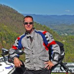
Wayne Busch – Cartographer
– Wayne Busch lives in Waynesville, NC, where he produces the most detailed and comprehensive and up-to-date motorcycle pocket maps of the Blue Ridge and Smoky Mountains to help you get the most of your vacation experience. See them here – AmericaRidesMaps.com