5 Best Motorcycle Rides in the Smoky Mountains

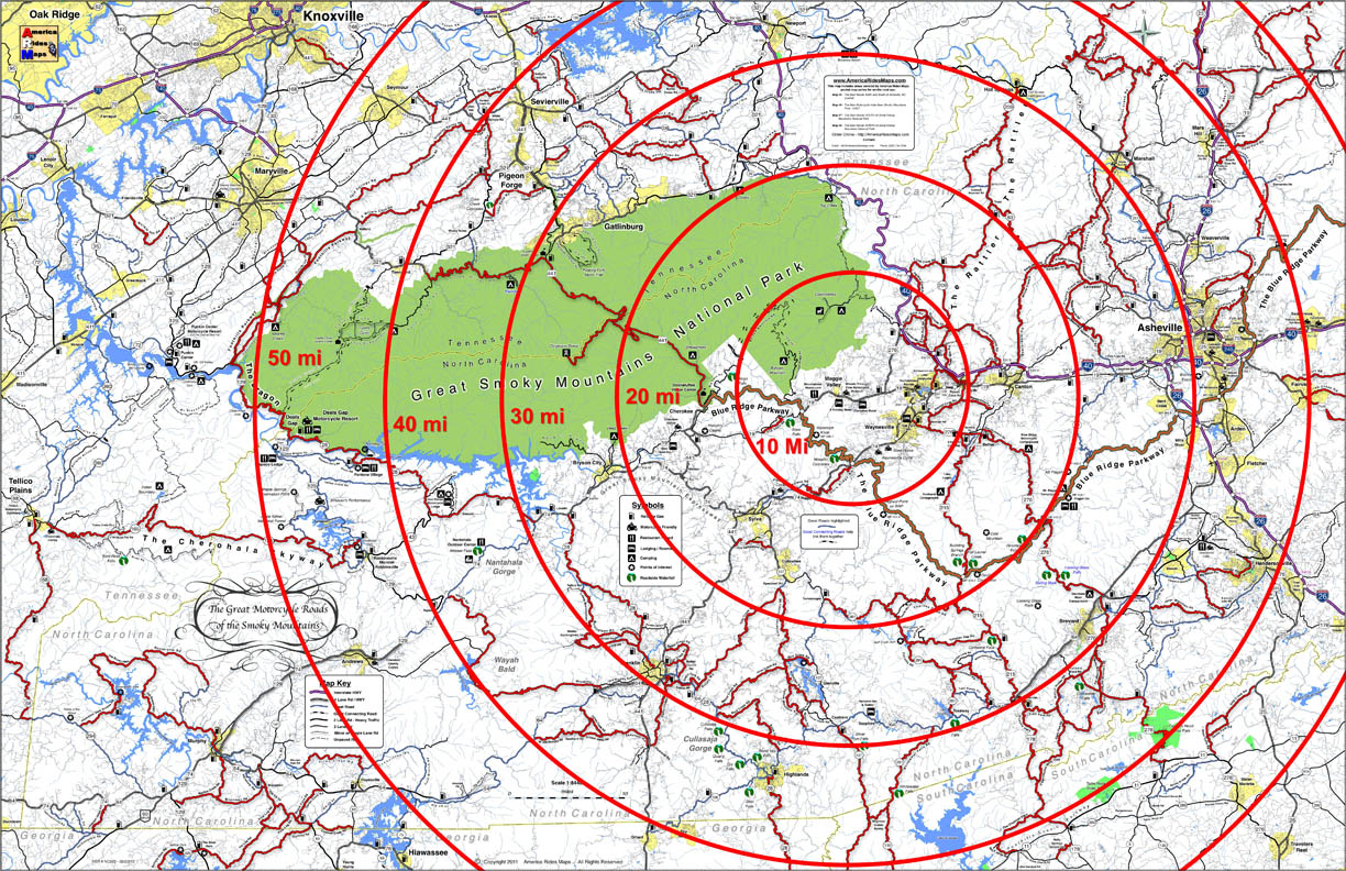
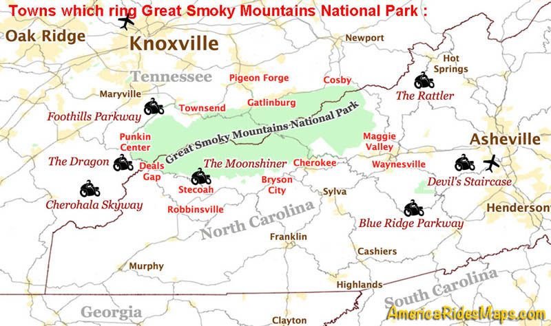
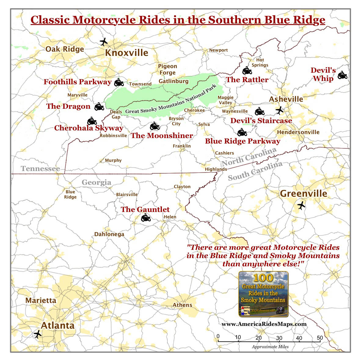
How do motorcycle riders choose from more than 100 outstanding biker roads in the Smoky Mountains?

America Rides Maps suggests these are the roads to hit first when you visit on your motorcycle tour –

Blue Ridge Parkway Highest Point
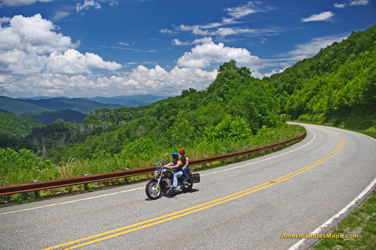
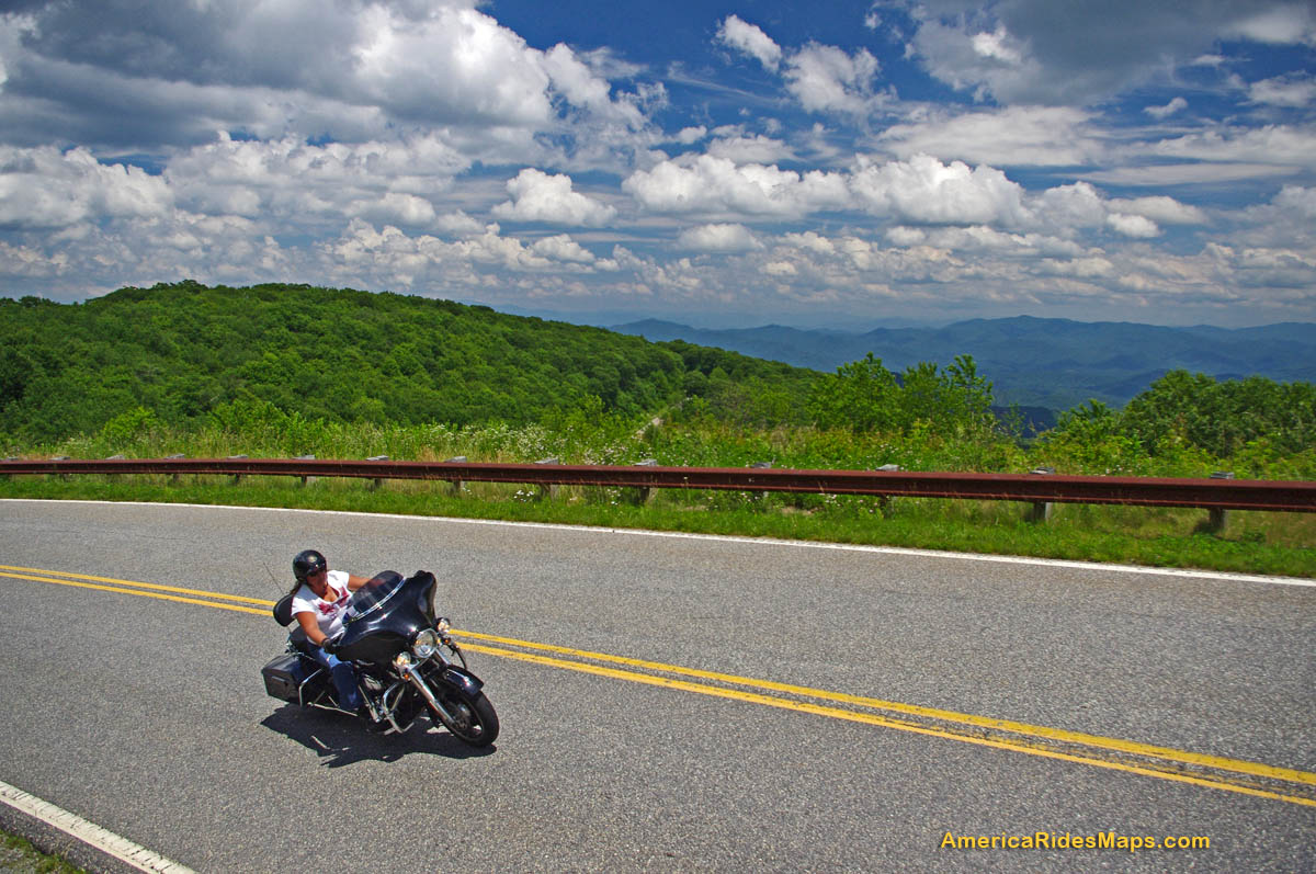
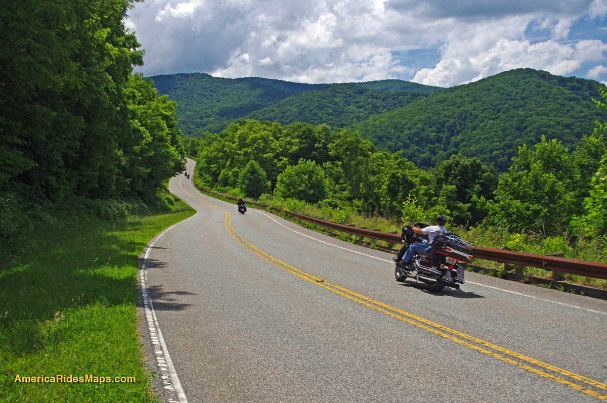
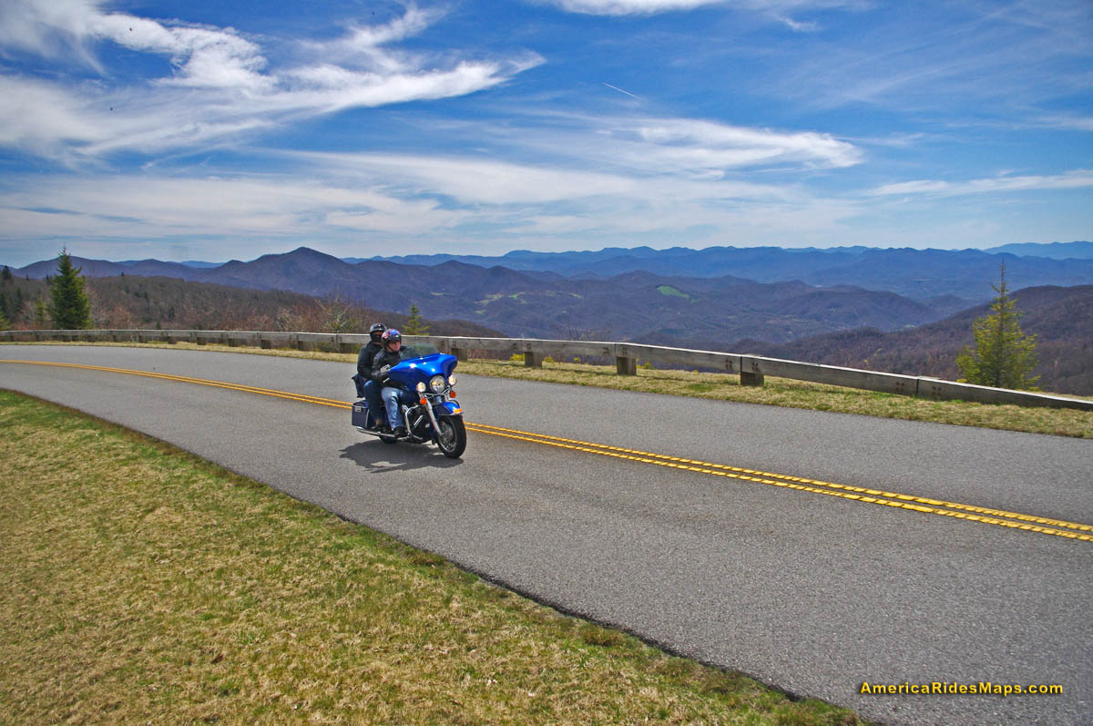
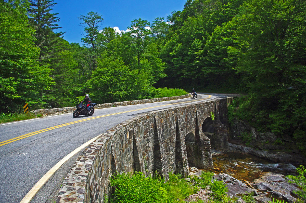
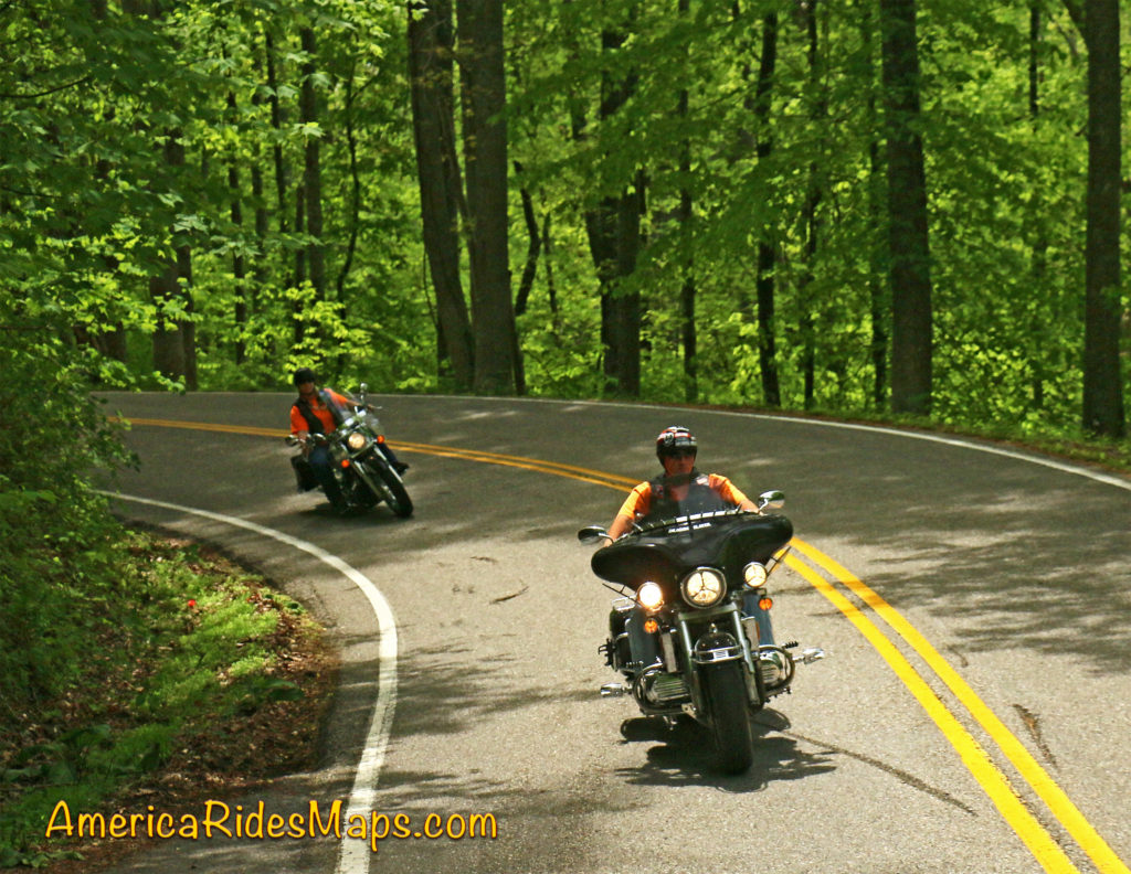
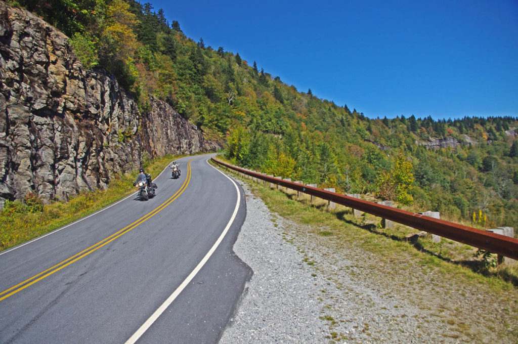
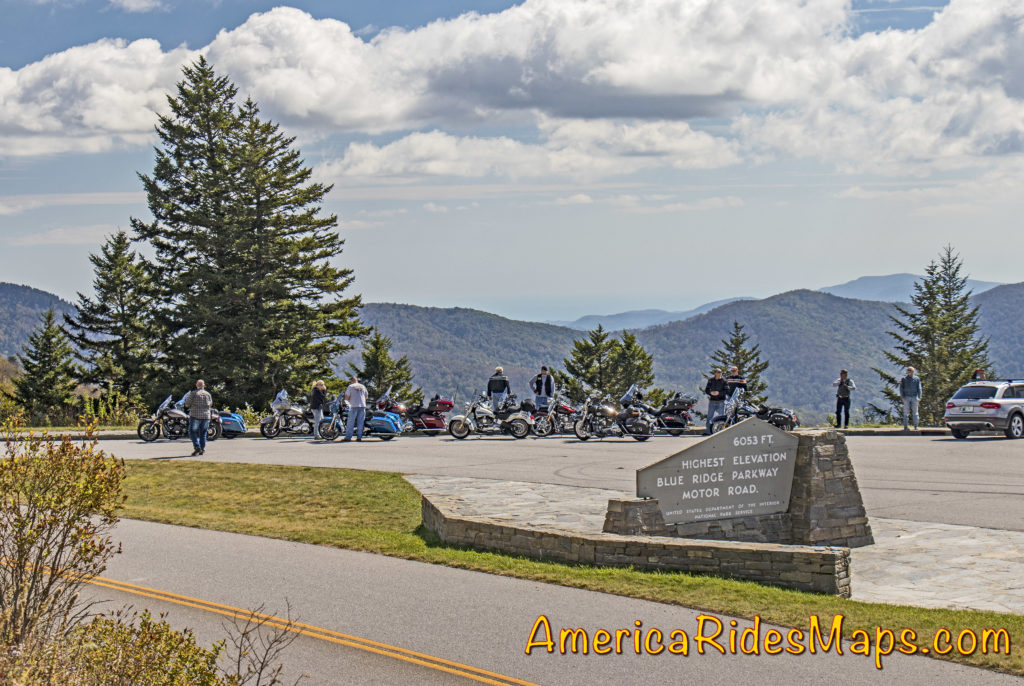
The Blue Ridge Parkway –

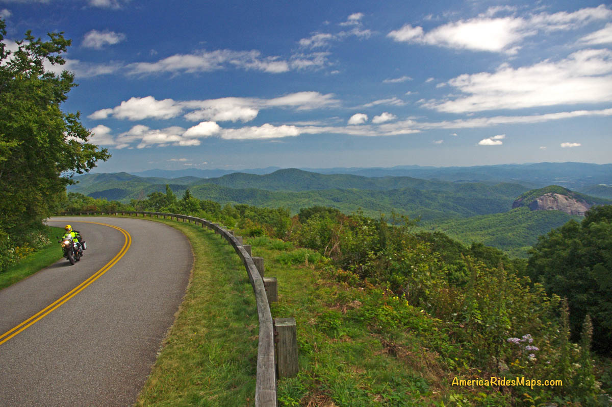
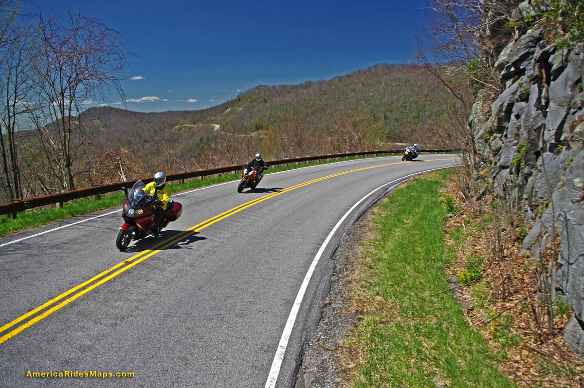
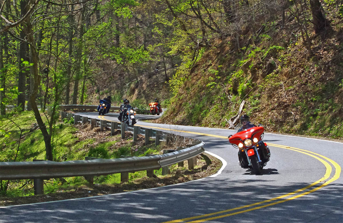
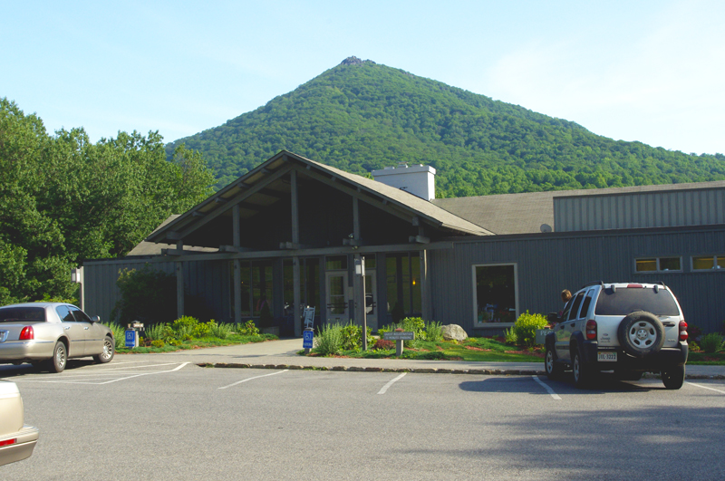
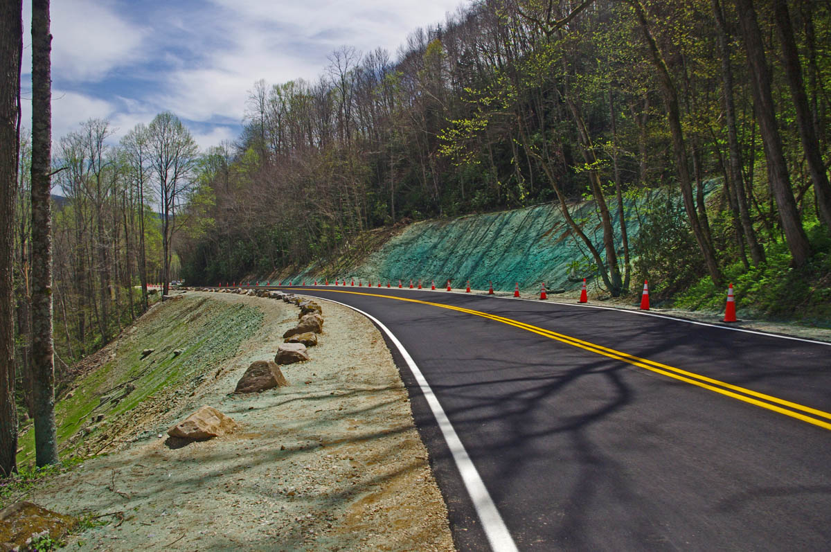
Hands down, the Blue Ridge Parkway should be at the top of your list. The best 50 miles of the 469 mile long scenic road are right here and easy to get to. It’s the highest section of the parkway filled with stunning overlooks as it cuts along the tops of the mile high mountains. Ride the section between US 19 (near Maggie Valley) to US 276 (south of Waynesville). Highlights on this stretch include Waterrock Knob, The Highest Point (classic photo with the sign), the Devils Courthouse, Looking Glass Rock, Second Falls at Graveyard Fields, and so many beautiful viewpoints to enjoy. The grades are gentle, the curves are satisfying. It’s a relaxing and enjoyable ride.

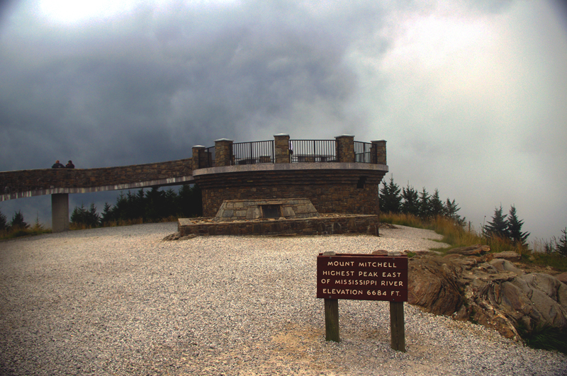
You can do it in a couple of hours or spend the time to stop and savor the sights. If you want to make a day of it, follow the parkway to Great Smoky Mountains National Park and ride across the heart of it on US 441. In the other direction the parkway leads through Asheville then gradually climbs to reach Mt. Mitchell State Park, the highest peak in the east.

More info  – https://miles-by-motorcycle.com/51999/blog/53348/the-best-section-of-the-blue-ridge-parkway
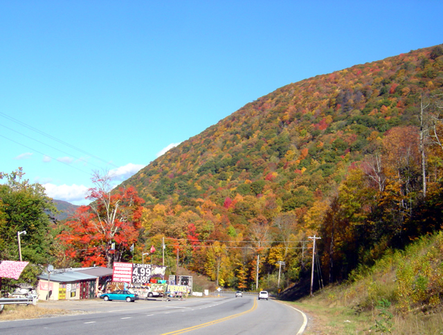
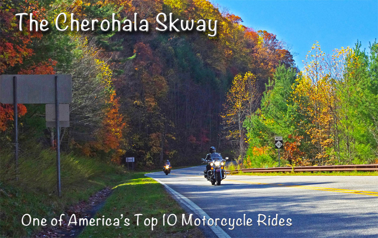
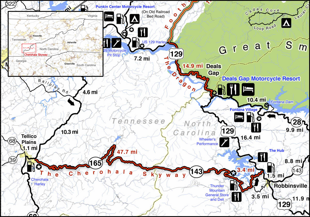
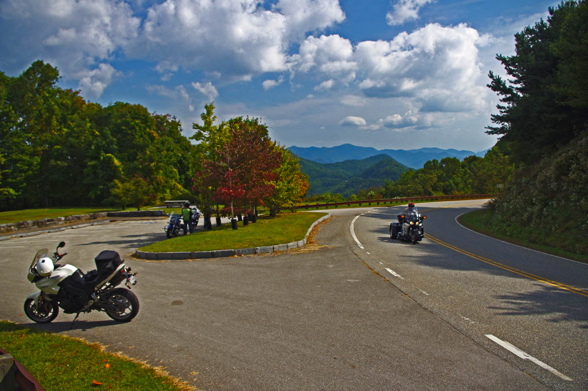
The Dragon

The Dragon & Cherohala Skyway

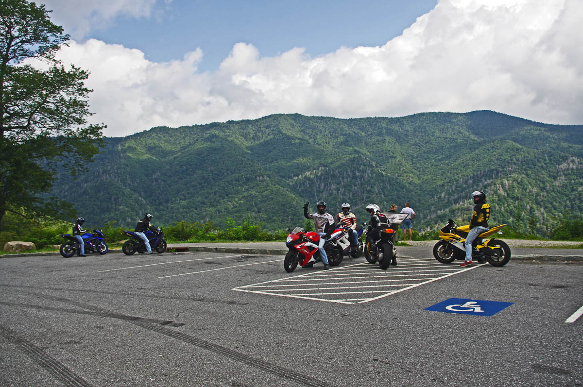
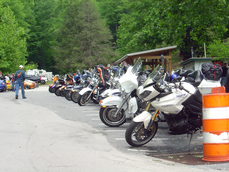
Located on the west side of Great Smoky Mountains National Park, these roads are two of the most popular rides in the Blue Ridge. The legendary Dragon (US 129) draws motorcycle and car enthusiasts to the 13 miles of tight, technical, challenging curves that hug the border of the park. It can get crowded on weekends and while the road has a notorious reputation a casual run is a lot of fun. You’ll see numerous photographers along the route to capture your vacation shots as you pass. Nearly 100 paved pull-offs let you escape the speed demons on your tail or just pause to watch the carnival. It takes about half an hour to run the Dragon.

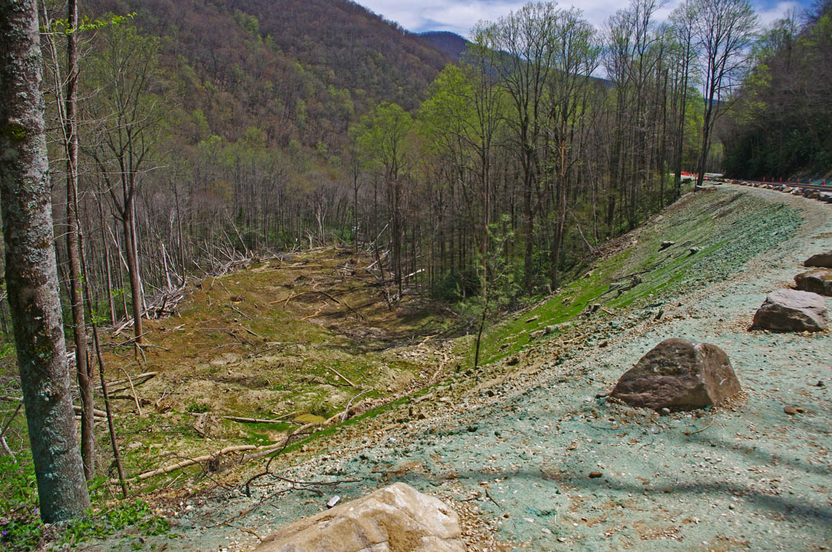
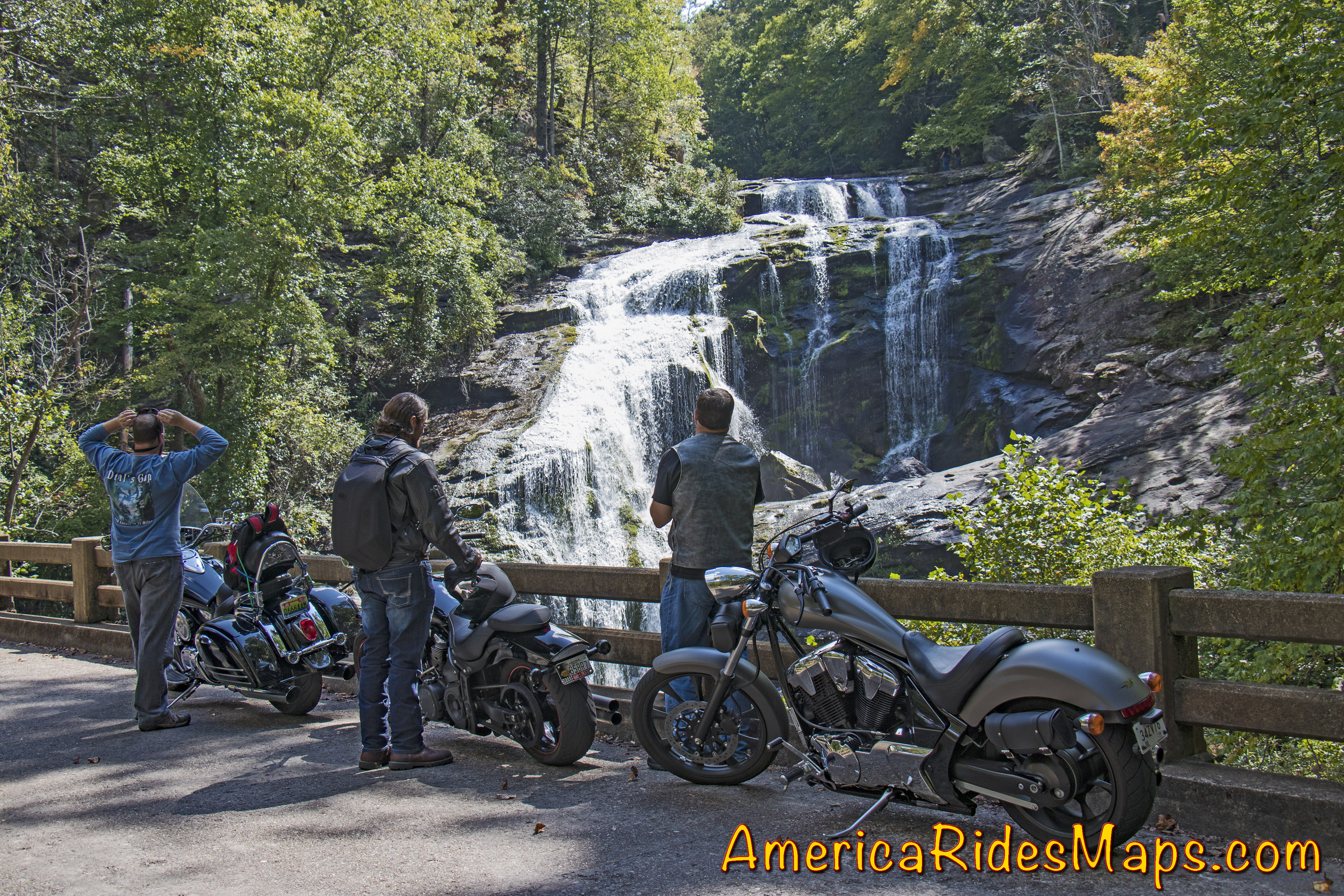
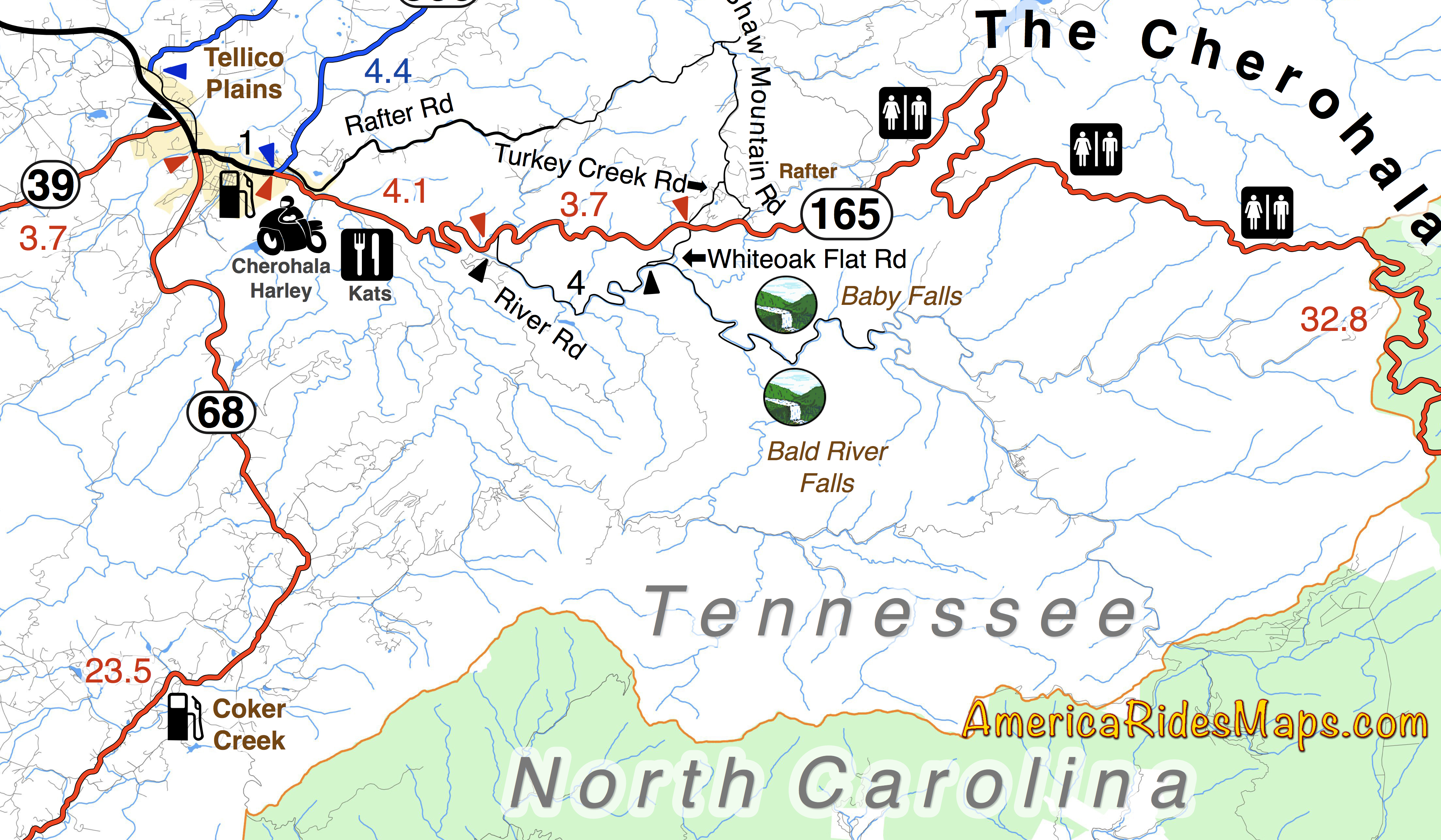
The Cherohala Skyway is very much like the Blue Ridge Parkway running 50 miles between the small towns at either end. It climbs to the highest ridges as it courses through the vast wilderness of the Cherokee and Nantahala National Forests. There are numerous nice overlooks to appreciate the views. The curves are more sweeping, the grades easy, and it’s rarely anything you’d call crowded. There are some tighter sections of road as you come off the Skyway at the North Carolina end to choose from. At the Tennessee end of the ride, look for tiny River Road to lead you out to Bald River Falls and Baby Falls. Plan a couple hours for this road if you go out to the falls.

To make a day of it a popular loop ride combines both passing the Vonore, TN. In NC, US 129 is an easy ride south to Robbinsville, or NC 28 takes you on an awesome curvy ride when headed east.

More info – https://miles-by-motorcycle.com/51999/blog/52688/ride-the-dragon-and-the-cherohala-skyway—loop-ride

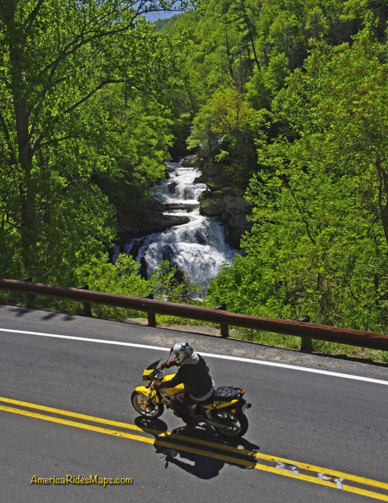
US 64 – The Waterfall Ride –

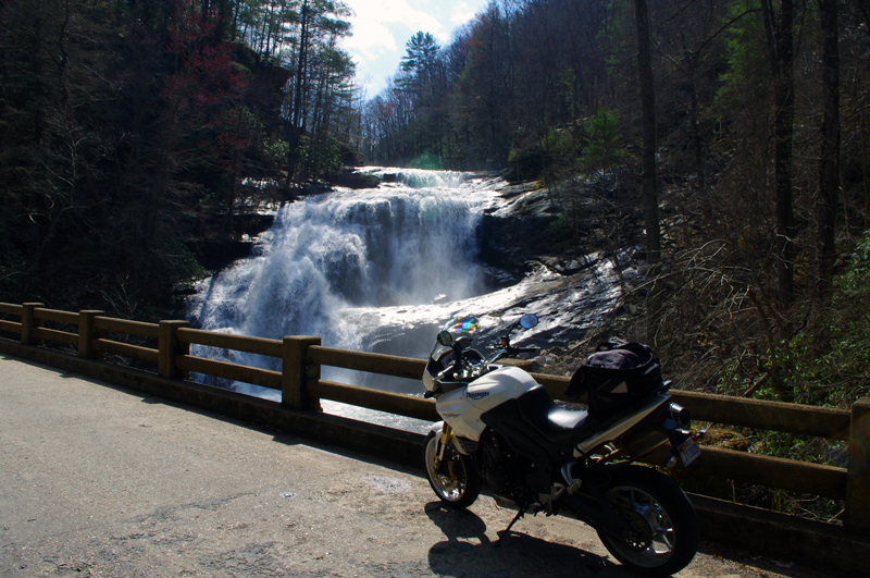
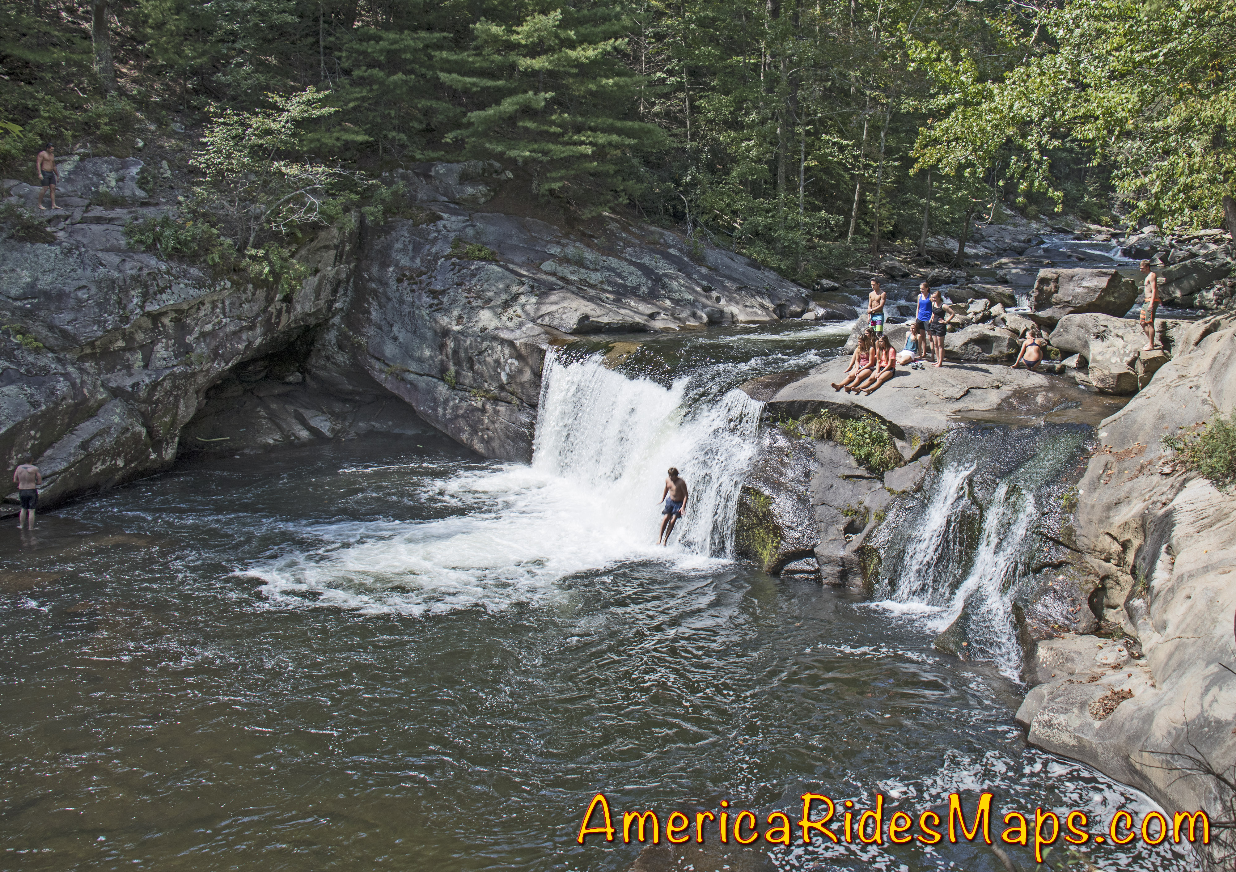
There are many versions of this ride which is anchored to the section on NC 28 / US 64 between Franklin and Highlands, NC. Cullasaja Falls, Dry Falls, Quarry Falls, and Bridal Veil Falls are found in the Cullasaja Gorge making this one of the easiest spots to see a lot of falls in a short distance. West of Franklin, Wayah Road climbs over the mountains to the Nantahala Gorge. Upper Nantahala Falls is on the way. Wesser Falls and Nantahala Falls are found in the Gorge. To the east of Highlands, Toxaway Falls is on US 64, Whitewater Falls is just a few miles south. A bit further east you’ll find Birdrock Falls and Mill Shoals Falls on NC 215, and Looking Glass Falls and Sliding Rock on US 276. There are so many waterfalls you can take a couple days to see all the easy ones.

The linked map (below) shows one way to see a dozen falls in a day on a reasonable length ride. There are many other ways to link the roads and tour the cascades.

More info – https://miles-by-motorcycle.com/51999/blog/52558/the-easy-waterfall-ride

NC 209 - The Rattler

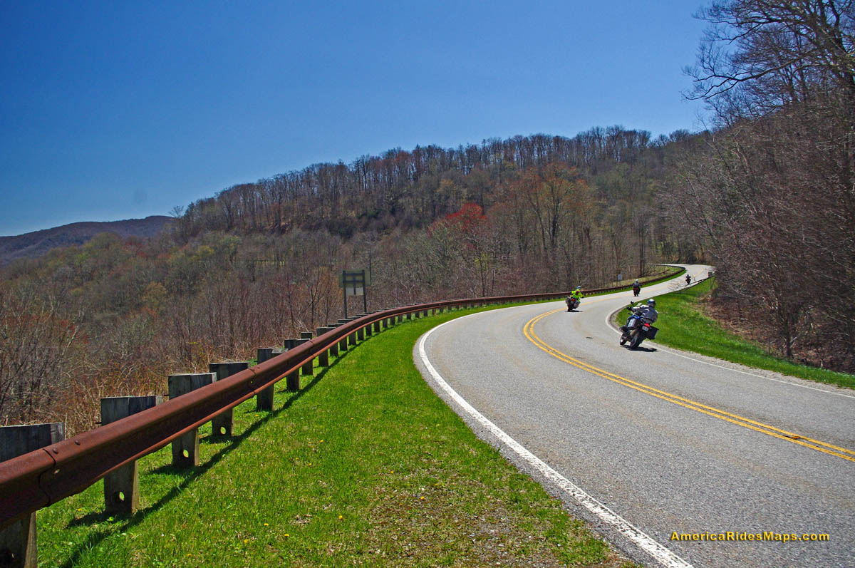
NC 209 – The Rattler –

This easy to access ride on the east side of Great Smoky Mountains National Park is a gem. The 37 mile run from Junaluska to Hot Springs gives you a little bit of everything in nicely spaced doses. There are gentle valley rides, twisty mountain climbs, pretty scenery, rushing rivers, and historic sights. There are a couple spots to eat in Hot Springs and a spa where you can soak in the natural hot spring waters.

The ride takes about an hour. There is a popular loop that can make it a half day ride passing through Marshall then winding over the mountains to return back to NC 209.

More info – https://miles-by-motorcycle.com/51999/blog/52309/the-classic-rattler-loop-ride

NC 215

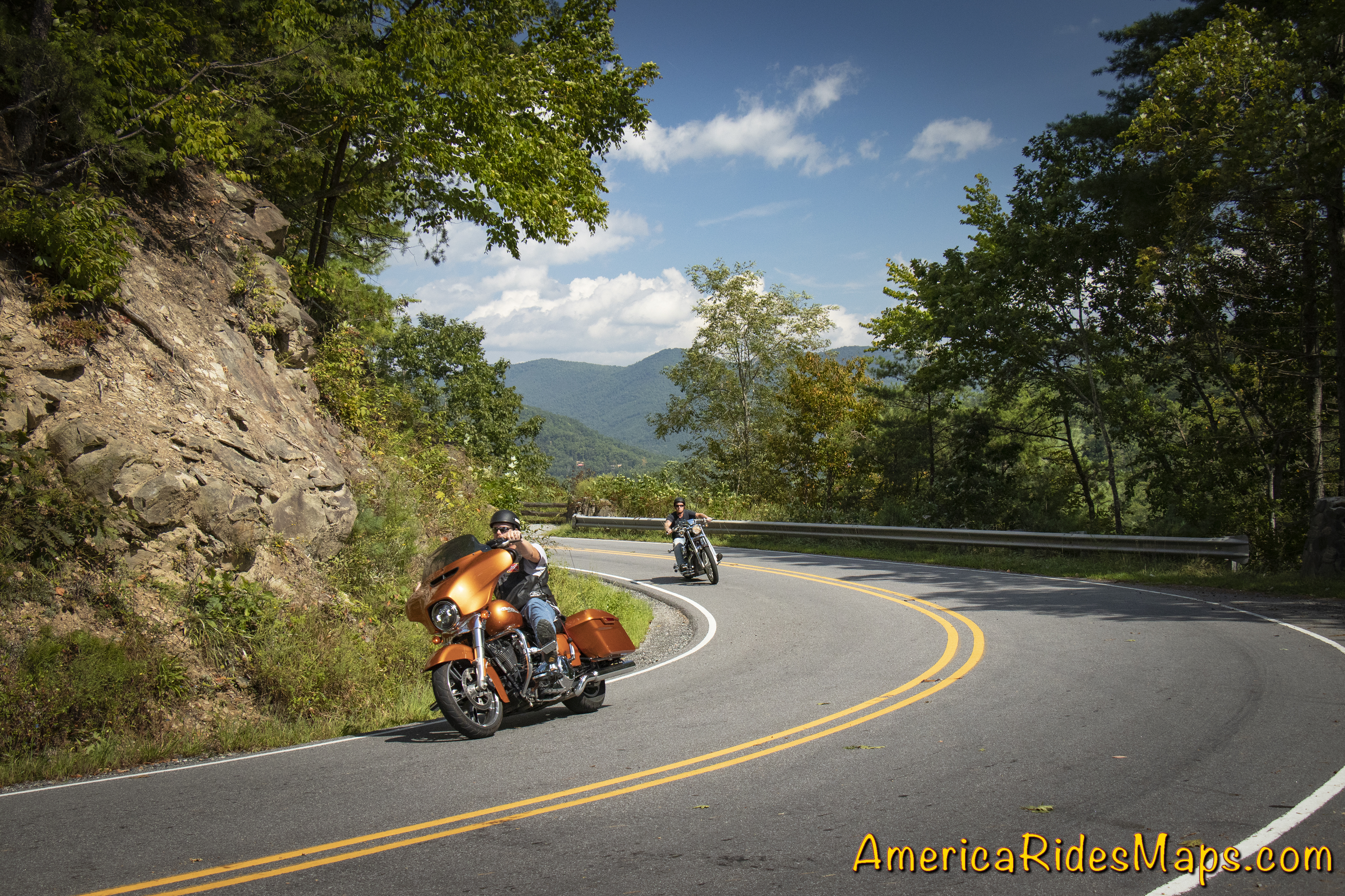
The Copperhead Loop –

This ride has a few versions which are all built off two outstanding roads – US 276 and NC 215. Both of these roads run north to south. The Copperhead Loops are made with roads which run between them. Think triangle, not loop – US 276 and NC 215 meet in Bethel, NC. They then both run south more or less parallel to one another crossing the border into South Carolina.

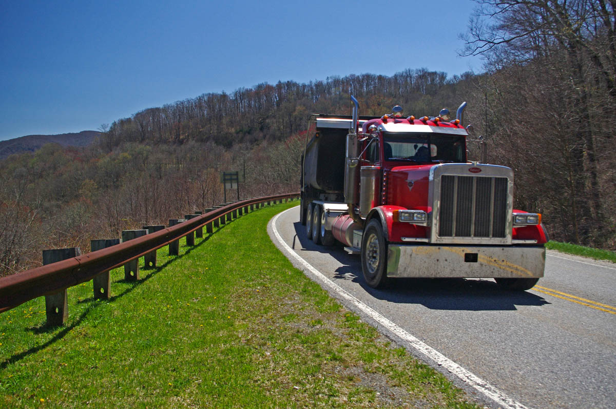
US 276 is the better known of the two roads. From Bethel, it runs along a valley then makes a dramatic climb to intersect the Blue Ridge Parkway. South of the parkway it descends to Brevard with attractions and waterfalls along the way. It then runs into town then shoots south again passing Connestee Falls into South Carolina. It has engaging curves, nice scenery, one of the most popular waterfalls (Looking Glass Falls) , and can get a bit crowded on weekends as so many flock to the beautiful area around the waterfalls.

NC 215 also leaves Bethel to follow a valley, then begins a gradual and twisty climb. It’s more technical than US 276 and the challenges are more sustained. There’s little if any traffic. There are waterfalls along the way.

Both roads reach their first connection at the  Blue Ridge Parkway then drop down the south slopes to reach US 64. US 64 links between Rosman and Brevard, it’s the classic easy connecting route, the “standard” loop. South of US 64, NC 215 becomes US 178. Both it and US 276 continue south into South Carolina to reach the southernmost linking road, SC 11.

More info – https://miles-by-motorcycle.com/51999/blog/53429/best-rides-in-the-blue-ridge—the-copperhead

These roads and many more are catalogued on motorcycle ride maps published by America Rides Maps. Buy them online at http://AmericaRidesMaps.com


Wayne BuschAmerica Rides Maps

Wayne Busch searches out the most entertaining roads in the Blue Ridge Mountains then records them on a series of maps which span the Blue Ridge Mountains.

There are more great motorcycle roads in the Blue Ridge and Smoky Mountains than anywhere else. I highlight the best roads then show you the best ways to connect them together into rides. More than a decade of searching has discovered more than 1000 good roads to enjoy. We continue to search so you may enjoy.

Review the maps, order online hereAmericaRidesMaps.com

Source: America Rides Maps Blog @ Miles-by-Motorcycle.com
https://miles-by-motorcycle.com/51999/blog/53524/5-best-motorcycle-rides-in-the-smoky-mountains

Two Waterfalls off the Cherohala Skyway

Motorcycle Riders can visit two nice waterfalls near the Tennessee end of the Cherohala Skyway

The Cherohala Skyway is one of the best motorcycle rides in the Smoky Mountain area. Bald River Falls is near the Tennessee end of the Skyway. A Forest Service road sign marks the start of River Road which winds upstream to the base of the large waterfall.
Motorcycles at Bald River Falls Most riders find their way to Bald River Falls and get the nice photo from the bridge.  Few know there is another waterfall just a short ride up the road – Baby Falls.

Baby Falls

Baby Falls are smaller but still impressive. You’ll find more parking, picnic tables, bathrooms, and easy access to the falls. It’s a nice spot for a break, better than the roadside parking at the bigger waterfall.

Motorcycle Ride Map Shows Baby Falls

Don’t miss Baby Falls, it’s the better place for riders to take a few minutes break. You’ll find it this area covered on several America Rides Maps.


Wayne BuschAmerica Rides Maps

Wayne Busch searches out the most entertaining roads in the Blue Ridge Mountains then records them on a series of maps which span the Blue Ridge Mountains.

There are more great motorcycle roads in the Blue Ridge and Smoky Mountains than anywhere else. I highlight the best roads then show you the best ways to connect them together into rides. More than a decade of searching has discovered more than 1000 good roads to enjoy. We continue to search so you may enjoy.

Review the maps, order online hereAmericaRidesMaps.com

100 Great Motorcycle Rides in the Smoky Mountains

100 Rides in the Southern Blue Ridge

The Best Motorcycle Rides South of GSMNP

The Best Motorcycle Rides North of GSMNP


Dual Sport Ride Map Near the Dragon and Cherohala Skyway

Dual Sport Ride Map Near the Dragon and Cherohala Skyway

The Best UNPAVED roads WEST of Smoky Park

The Best Unpaved Motorcycle Roads WEST of Great Smoky Mountains National Park is the third motorcycle ride map of the unpaved roads and trails from America Rides Maps.

This new map details the great dual sport rides near the Dragon at Deals Gap, North Carolina, along the long stretch of the Cherohala Skyway, and near Tellico Plains, Tennessee. Enjoy the legendary Tail of the Dragon AND take your adventure bike out in the woods on the same day of great motorcycle rides. ADV Riders will love these detailed maps.

Dual Sport Motorcycle RidesThis motorcycle ride map features the great motorcycle roads found near the Nantahala Gorge, as well as the great riding off road riding around Franklin, North Carolina. Enjoy roadside waterfalls, mountain top views, and miles and miles of superb unpaved riding.

Discover motorcycle rides in the vast wild and scenic areas of the Nantahala and Cherokee National Forests on Forest Roads and accessible trails.

Dual Sport motorcycle rides TNAmerica Rides Maps has also produced dual sport motorcycle ride maps of the great adventure rides east of Great Smoky Mountains National Park and the superb roads near the Blue Ridge Parkway south of Smoky Park. They are sold individually and as a 3 map set.

See this new map and the others here –

http://americaridesmaps.com/products/the-best-unpaved-roads-west-of-smoky-park

Best 1000 Mile Motorcycle Ride You’ll Ever Do

If you’re looking for that epic ride this is one of the best ever!

Motorcycles at overlook in Smoky Park

Enjoy an overlook in Great Smoky Mountains National Park

When you link these mountain roads together you’ll spend almost all your time on 2 lane roads, most of it National Parks or on scenic parkways, and you’ll experience some of the best motorcycle rides in the USA.

Skyline Drive – 105 Miles
The Skyline Drive runs the crest of Shenandoah National Park in Virginia. It starts at Front Royal and runs seamlessly into the Blue Ridge Parkway

Blue Ridge Parkway – 469 Miles

Blue Ridge Parkway View

Blue Ridge Parkway in NC

The Blue Ridge Parkway follows the highest ridge lines of the Blue Ridge Mountains through Virginia and North Carolina. It ends at Great Smoky Mountains National Park.

Great Smoky Mountains National Park – 47 Miles
The most visited National Park in the nation, ride across on US 441 passing from North Carolina into Tennessee at the crest, then turn west on Little River Road. Follow through to the Foothills Parkway.

Foothills Parkway – 17 Miles
Continue west on the scenic Foothills Parkway to reach US 129

The Dragon – 15 Miles

Springtime motorcycle ride on the Cherohala Skyway

The Cherohala Skyway in TN

Turn south on US 129 to enter the Dragon. Pass through and back into North Carolina. Continue south to Robbinsville, NC to head west again on the Cherohala Skyway.

The Cherohala Skyway – 52 Miles
Climb back up into the mountains and return to Tennessee near the mid-point of the ride. Turn south on 68 when you reach Tellico Palins, TN and follow this wonderful road into Georgia.

GA 60 – 23 Miles
Work your way east on GA 60 to Blue Ridge, GA, then continue on one of Georgia’s best motorcycle roads.

The Gauntlet – 133 Miles

Georgia

The Gauntlet ride in GA

Wrap it all up with a loop around the Gauntlet. You may continue on GA 60 or veer north on Skeenah Gap Road to start the loop.

Of course, this is just an overview. It’s a great introduction to riding in the Blue Ridge Mountains, still it only scratches the surface. It’s pretty straightforward to navigate, but you’ll want to do some planning. There are many variations and additions to make it even better.

9 map setYou’ll find this region covered in detail with America Rides Maps. In addition to these well known roads, almost 500 more are highlighted on a series of easy-to-read durable maps that will fit in your pocket with the info you depend on like out-of-the-way gas stations, mileage, and how to best link them all together.

The are more great motorcycle rides in the Blue Ridge Mountains than anywhere else. Any one of America Rides Motorcycle pocket ride maps is a vacation adventure in itself. With the full set you’ll have the freedom to point your wheels in any direction and know you’re on the best rides. Take a look here and see how easy it is – http://shop.americaridesmaps.com/Full-Southeast-Package-All-9-Maps-SE9.htm

————————————————————————————

wayne busch - Smoky Mountain Motorcycle Rider.com

Wayne Busch

– Wayne Busch lives in Waynesville, NC, where he produces the most detailed and comprehensive and up-to-date motorcycle pocket maps of the Blue Ridge and Smoky Mountains to help you get the most of your vacation experience. See them here – AmericaRidesMaps.com

Motorcycle Touring – Towns Near Great Smoky Mountains Park

Motorcycles at overlook in Smoky Park

Enjoying  an overlook on Newfound Road in Great Smoky Mountains National Park

Choose the right place to stay on your Smoky Mountain motorcycle trip

Great Smoky Mountains National Park is the #1 visited park in the nation. Needless to say there are plenty of places to stay in the surrounding area when you come. Those who make the trek by motorcycle not only enjoy the wonders of the park, but are rewarded with some of the most challenging and scenic motorcycle rides in the country at it’s borders.

Bullseye on the test place to stay

Bullseye on the best place to stay

I previously looked for the epicenter of great motorcycle riding, the central point in the middle of all the best motorcycle rides in the Blue Ridge Mountains. The prime location was Maggie Valley, NC on the southeast edge of Great Smoky Mountains National Park, with Waynesville and Cherokee close runners up. I listed the pros and cons of using each as a base camp for your motorcycle trip. (read about it here)

Truth is, there are so many great motorcycle rides to choose from in this mountainous region you’ll never get to them all. While being at the strategic center of all the riding offers more riding choices and opportunities, it’s worth looking at some of these other places which lay on the borders of Great Smoky Mountains National Park.

Map towns around smoky park

Towns which ring Great Smoky Mountains National Park and classic motorcycle rides nearby.

♦♦♦♦ Maggie Valley / Waynesville – located right in the heart of the best motorcycle rides. Waynesville has great food, but few rooms. Maggie Valley has lots of rooms, places to eat, and the Wheels Through Time Motorcycle Museum.  (previously covered, read about it here).

♦♦♦ Cherokee – It’s where the Blue Ridge Parkway meets great Smoky Mountains National Park. Culture, casino, and crowds.  (previously covered, read about it here)

Photo - Great Smoky Mountains Railway Train

Great Smoky Mountains Railroad train in Bryson City

♦♦ Bryson City – Places to stay, camping, good food and drink, the railroad, at first glance Bryson City has a lot to offer. It’s downfall is it’s isolation. It’s located adjacent to 4 lane US 74. It has a nice little downtown where US 19 comes in from Cherokee. Your choices to quickly hop on a good ride without hitting the 4 lane are limited.

– If you’re looking for a nice quiet place to camp on a swimming creek and do a little riding, Bryson City will do you well.

♦♦ StecoahStecoah is a small spot located off NC 28 not far from Fontana Lake. There are cabins available here, though it’s a really popular spot for campers. There are a couple motorcycle campgrounds. NC 28  leads to The Dragon at Deals Gap or you can cut through to Robbinsville and the Cherohala Skyway. There’s a roadside diner. It’s a pretty remote spot so you’ll have to be self-sufficient, the campgrounds have some supplies. The nearest grocery is in Robbinsville, it’s dry county. The Nantahala Gorge is close, the good section of NC 28 starts just a few miles up the road.

– Stay in Stecoah if you’re looking for motorcycle campgrounds near the Dragon.  

Fontana Village Pitstop

Cabins, rooms, camping, meals, Fontana is remote but has all you need.

♦♦♦ Fontana –  Fontana is a good option near The Dragon on NC 28. You ‘ll find camping, cabins, there’s are a decent number of rooms, good meals, a bar, all the comforts. The stretch of NC 28 that it sits on is one of my favorite rides curvy motorcycle rides. You’re only minutes from The Dragon.

– Fontana will serve you well if you want a remote location with all the amenities. Close to the Dragon.

♦♦♦ Robbinsville – There’s nothing but mountains and trees west of Robbinsville and well into Tennessee. The small town sits at the hub of several important roads. US 129 leads north to The Dragon, south to the Nanathala Gorge. The Cherohala Skyway meets it here just north of downtown, NC 143 takes you over the mountain to connect with NC 28. All the good biker roads lead here.

While the town of Robbinsville is small, it’s the biggest small town for miles. There’s a grocery store, a few restaurants, gas station / fast food, one big central chain motel, and lots of biker friendly options and businesses in the town. There are a couple good places to eat.  It’s not a convenient town for walking. There’s no booze here, it’s dry.  Motorcycle rentals in town.

– Robbinsville is the largest town in the area so it has the most to offer. It’s a good base when you want to travel light. Great rides in every direction.

deals-gap-resort-

Deals Gap Motorcycle Resort

♦♦ Deals Gap – Resorts, lodges, cabins, campgrounds are all available but limited. If you want to be as close to The Dragon as possible you’ll be pretty isolated from civilization. This is where you want to stay if you’ve come to focus on riding The Dragon. Do a couple runs through in the morning then head down to the Cherohala Skyway or cruise the lake on NC 28. Get in another run or two through The Dragon in the evening.

– If you want to get the full Dragon experience, stay at Deals Gap. There may be entertainment, night races in the parking lot. 

♦ Punkin Center – Located at the Tennessee end of The Dragon where TN 72 intersects, it’s an ideal spot for riding The Dragon / Cherohala Skyway loop ride. There is a popular motorcycle campground here, a restaurant, and a repair shop.

– If you’re looking for a motorcycle campground on the north side of the park, this one puts you on some of the best roads.  

♦ Townsend – Townsend gets you away from the congestion of Pigeon Forge and Gatlinburg, but you’re still on a pretty major road. It get’s you close to Cades Cove in Great Smoky Mountains National Park. Townsend is a good choice if you want to ride The Dragon, The Cherohala Skyway, and poke around the park. It’s a popular base camp for dual-sport riders doing the unpaved roads in Great Smoky Mountains National Park. Motorcycle rentals available in town.

– Townsend is a good base camp for dual sport riding. 

Gatlinburg-motorcycles

Tourist attractions in Gatlinburg.

♦♦ Gatlinburg / Pigeon Forge

The primary attraction of Gatlinburg and Pigeon Forge is they are so easy to get to. The primary downfall of Galtinburg / Pigeon Forge is everybody goes there.

There’s about 40 miles between the north entrance of Great Smoky Mountains National Park and the city of Knoxville, so this corridor has developed into a tourist vortex. Gatlinburg and Pigeon Forge host all kinds of attractions. There are lots of bargains on rooms and cabins. The downfall here is the tourist traffic and the scarcity of good motorcycle rides. The mountains quickly become valleys outside the park.

There may be some compelling reasons to stay in Gatlinburg and Pigeon Forge, but you’ll likely spend time riding around the park to get to some of the best rides.

– Stay in Gatlinburg if you’re looking for a deal or want a tourist expereince. Accept the traffic, enjoy the attractions, and learn the backroads that will get you through it all.

 Cosby – Cosby is at the “forgotten” eastern end of the park. You’ll find lots of campgrounds along the edge of the park, a couple motels near I-40, little else of note. This area is popular for the unpaved riding both in the park and out into the national forests.

Cosby is a good base camp for dual sport riding. 

————————————————————————————————

100 Great Motorcycle Rides mapin the Smoky MountainsYou can get a map of more than 100 Great Motorcycle Rides near the Smoky Mountains that will show you where the roads are hiding and how they link together into endless wonderful wanderings through the mountains.

Click Here Now
to see more about the map


If you enjoy photos of motorcycle riding in the Blue Ridge and Smoky Mountains, like MY BLUE RIDGE MOTORCYCLING FACEBOOK PAGE.Facebook

____________________________________________________________________

wayne busch - Smoky Mountain Motorcycle Rider.com

Wayne Busch

– Wayne Busch lives in Waynesville, NC, where he produces the most detailed and comprehensive and up-to-date motorcycle pocket maps of the Blue Ridge and Smoky Mountains to help you get the most of your vacation experience. See them here – AmericaRidesMaps.com

____________________________________________________________________

Stay Near the Best Mountain Motorcycle Rides

Stay Near the Best Mountain Motorcycle Rides – 

Great Motorcycle Rides in North Carolina - NC 209, a.k.a. "The Rattler" This is some of the best motorcycle riding you'll find in the world. These riders are looping back to NC 209 on NC 63.This is some of the best motorcycle riding you'll find in the world. These riders are looping back to NC 209 on NC 63.

Great Motorcycle Rides in North Carolina – NC 209, a.k.a. “The Rattler” – This is some of the best motorcycle riding you’ll find in the world. These riders are looping back to NC 209 on NC 63.

So you’ve heard about the amazing motorcycle riding in the Blue Ridge Mountains and you want to come see the best of it it.

Where should you stay to have the best opportunity to ride the greatest number of classic motorcycle rides?

To figure out where the geographic center of the best motorcycle riding was,  I first looked at where all the classic roads were, roads that have been around long enough to have names like “The Dragon”, the “Moonshiner” and “The Gauntlet”. Some of these might be on your bucket list so it’s nice to have them close. I determined the center point between them.

Map of Classic Motorcycle Rides in the Smoky Mountains

Surround yourself with classic rides.

Next I moved a large circle around the center point of the classic rides to figure out when it contained the most good motorcycle rides overall. I made rings at 10 mile intervals, made a few adjustments, and came up with the answer;

Bullseye on the test place to stay

Bullseye on the best place to stay

The target falls on Maggie Valley, Waynesville, Cherokee.

Geographically, Maggie Valley sits at the hub of it all, but any of the towns along the south side of Great Smoky Mountains National Park is going to put you near some outstanding riding.

Here are some pros and cons to help you sort out which of the three places works best for you;

Maggie Valley 


Photo - fall colors at Soco Gap

View heading down from the Blue Ridge Parkway at Soco Gap on US 19 towards Maggie Valley.

Maggie Valley Pros –

  • There are lots of motel rooms, cabins, and campgrounds in the one road town, it caters well to the motorcycle visitor.
  • The best section of the Blue Ridge Parkway is just 10 minutes up the road.
  • The are several good places to eat.
  • Wheels Through Time Motorcycle Museum is there.
  • The small town hosts several biker events each year, including spring and fall rallies.
  • The town is spread along a 4 lane stretch of US 19 with high mountains on looming on every horizon, you really feel like you’re in the mountains.
  • There are liquor stores in town.

Maggie Valley Cons

  • 15 min ride to Waynesville for groceries.
  • If you stay close to the middle of town you can walk to some of the restaurants and pubs, but the town is long and narrow so you’ll probably hop on the bike.

Waynesville

Main Street, downtown Waynesville

Main Street, downtown Waynesville

Waynesville Pros –

  • known for it’s good food and picturesque downtown and atmosphere.
  • There are mountains on every horizon.
  • US 276 leaves from the south end of town and leads to some great rides and the Blue Ridge Parkway

Waynesville Cons –

  • There’s only one motel in the downtown and a couple B&B’s where you can walk to the restaurants, pubs, and stores and galleries.
  • I usually tell visitors – eat in Waynesville, sleep in Maggie Valley unless you can snag one of the few rooms available in town.

Cherokee

One of the many painted bears in Cherokee

One of the many painted bears in Cherokee

Cherokee pros –

  • Strategically located at the south end of the Blue Ridge Parkway and the south entrance to Great Smoky Mountains National Park, Cherokee is obviously worth consideration.
  • There are lots of motels and campgrounds. No outstanding restaurants come to mind, though I don’t pass through Cherokee often.

Cherokee cons –

  • Because Cherokee is a hub of tourist activity it is often congested with traffic. The roads leading in to it are busy, there are few of them, and you’ll end up on riding 4 lane roads like US 441 and US 74 more often.
  • You’re on the Cherokee Reservation, if you want drinks you’ll need to go to Harrah’s Casino.

————————————————————————————————

100 Great Motorcycle Rides mapin the Smoky MountainsYou can get a map of more than 100 Great Motorcycle Rides near the Smoky Mountains that will show you where the roads are hiding and how they link together into endless wonderful wanderings through the mountains.

 Click Here Now
to see more about the map

If you enjoy photos of motorcycle riding in the Blue Ridge and Smoky Mountains, like MY BLUE RIDGE MOTORCYCLING FACEBOOK PAGE.Facebook

____________________________________________________________________

wayne busch - Smoky Mountain Motorcycle Rider.com

Wayne Busch

– Wayne Busch lives in Waynesville, NC, where he produces the most detailed and comprehensive and up-to-date motorcycle pocket maps of the Blue Ridge and Smoky Mountains to help you get the most of your vacation experience. See them here – AmericaRidesMaps.com

____________________________________________________________________

Top 10 Motorcycle Rides – The Cherohala Skyway

“One of the finest motorcycle rides you’ll ever enjoy”  –

Fall color on the North Carolina end of the Cherohala Skyway

Fall color on the North Carolina end of the Cherohala Skyway

The Cherohala Skyway takes the motorcycle rider on a long and sweeping romp through the mile high ridge lines of remote national forests just west of Great Smoky Mountains National Park. Stunning long range views can be enjoyed from overlooks and rest areas along the park-like road. Traffic is typically light and the curves are challenging and consistent for the 50 mile town-to-town ride through some of the most wild and scenic areas in the Blue Ridge mountains.

The Cherohala Skyway is near The Dragon at Deals Gap. It runs from Robbinsville, NC to Tellico Plains, TN.

The Cherohala Skyway is near The Dragon at Deals Gap. It runs from Robbinsville, NC to Tellico Plains, TN. Click on map for larger view.  Source – America Rides Maps Motorcycle Pocket maps – AmericaRidesMaps.com

Enjoying a summer motorcycle ride on the Cherohala Skyway

Enjoying a summer motorcycle ride on the Cherohala Skyway

The majority of motorcycle riders are drawn to this remote mountainous area to experience the thrill of riding US 129 a.k.a. “The Dragon” which skirts the western border of Great Smoky Mountains National Park nearby. A good number of them find the ride on the Cherohala Skyway far more enjoyable. It’s a relaxing contrast to the commotion and crowds that race back and forth through the Dragon’s legendary curves.

The Cherohala Skyway runs east to west connecting the small towns of Robbinsville, NC, and Tellico Plains, TN. Between them lies a large undeveloped mountainous section of the Cherokee (TN) and Nantahala (NC) National Forests. The made-up name “Cherohala” comes from a combination of the names of the remote forests it runs through.

Motorcycle flying through the mile high curves on the Cherohala Skyway

Flying through the mile high curves near the middle of the long wonderful ride

From either end the road makes a gradual climb to reach the 5000 ft heights near the middle section. Two broad lanes with sweeping curves arc through the mountain passes. Scenic overlooks, some with rest areas, yield views of a vast forests often free of visible human impact to the horizon. While the towns at either end have food, gas, and lodging, there is nothing but empty pavement on the 40 or so miles between them.

Springtime motorcycle ride on the Cherohala Skyway

Springtime on the Tennessee end of the Cherohala Skyway – nice long view of road, click to enlarge

Riding the Cherohala Skyway on a motorcycle you’ll find smooth pavement with good traction save a few bumpy patches here and there and the occasional bit of gravel dragged into turns by cars that run wide. The speed limit is 45 mph though there are many turns where a prudent rider will carry a bit less and the experienced rider will find satisfaction at speed. The overlooks and pull outs are well marked, paved, and have ample parking. Elevation signs along the road signal each 1000 ft change. It’s very much an experience like riding through a national park – similar to riding the the Blue Ridge Parkway (less than an hour east).

Stop to enjoy the views from the nice overlooks on the Cherohala Skyway

Stop to enjoy the views from the nice overlooks on the Cherohala Skyway

As relaxing as that “park-like” experience sounds, the road challenges the motorcycle riders’ skill. The Cherohala Skyway is  “big brother” to the nearby Dragon with it’s back-to-back tight turns. The Cherohala Skyway is a ‘super-sized” version of it. The curves open up and relax a bit but they keep coming one after another with the added dimension of long winding climbs and descents.

The Cherohala Skyway and the Dragon are often ridden together in a 123 mile long loop ride which runs north on US 129 to via TN 72, then to Vonore, TN, then south via TN 360 to Tellico Plains, TN, then across the Cherohala Skyway to Robbinsville.  When you ride both roads , the contrast is obvious -the need to be hyper alert and vigilant in the parade of bikes on the Dragon is relieved on the Cherohala Skyway. It seems empty by comparison, you can relax and it has all this gorgeous scenery too!

Great views, nice pavement, low traffic, and miles and miles of sweeping curves make the Cherohala Skyway a top motorcycle ride.

Great views, nice pavement, low traffic, and miles and miles of sweeping curves make the Cherohala Skyway a top motorcycle ride.

The best time for a visit is fall when the leaves are changing. Staying at the eastern (NC) end of the road places you near several other great motorcycle rides like the Dragon and NC 28. Robbinsville, NC is the larger town with more food / lodging options though many like the west end in Tellico Plains, TN for the camping.

The Cherohala Skyway is open all year (except when snow blocks) making it one of the first destinations for southern riders in the spring and a winter play spot for the hardcore adventurer.

Motorcycles starting up the grade from the North Carolina end of the road on the Cherohala Skyway.

Starting up the grade from the North Carolina end of the road on the Cherohala Skyway.

Tips and Advice – 

  • It’s about 50 miles with no gas. Fuel at either end. Be safe – top off.
  • 3000 foot elevation change – it will be cooler, more windy, and wetter at the higher altitudes. Dress for it.
  • It’s a long, long way if you need help. Ride with that in mind.
It takes a little effort, but visiting Bald River Falls on your Cherohala Skyway ride is worth it

It takes a little effort, but Bald River Falls is worth the trip

Make a side trip to Bald River Falls –

You’ll see a sign for Bald River Falls near the start of the Tennessee end of the Cherohala Skyway. Follow barely paved River Road for several miles, it’s obvious.

———————————————————————————————-

wayne busch - Smoky Mountain Motorcycle Rider.com

Wayne Busch

– Wayne Busch produces the most detailed and comprehensive motorcycle pocket maps of the hundreds of great roads in the Blue Ridge and Smoky Mountains so you know where the best roads are and how to spend the bulk of your riding time on them.

You’ll find the Cherohala Skyway on America Rides Maps –

____________________________________________________________________

Smoky Mountain Motorcycle Spring Road Report April 2013

Smoky Mountain Motorcycle Spring Road Report April 2013 – Current conditions for motorcycle touring and Blue Ridge Parkway riders;

Roads affected:

  • Blue Ridge Parkway
  • US 441 through Great Smoky Mountains National Park
  • Cherohala Skyway
  • Fires Creek Road near Hayesville, NC
  • US 276 / NC 215 south of Waynesville, NC
  • US 70 / 25 north of Hot Springs, NC
  • NC 28 north of Franklin
  • NC 197 near Bakersville
photo - Spring on the Blue Ridge Parkway

Spring on the Blue Ridge Parkway

Blue Ridge Parkway – One by one the incidents of road damage sustained over the winter are being or have been repaired. One significant situation remains – the closure of the Blue Ridge Parkway near Mt. Mitchell. Most recent reports indicate it will be resolved mid-May.

Photo-mt-mitchell-highest-in-east

The observation tower atop Mt. Mitchell is worth the trip, but you have to approach from the north until the road is fixed. Pick a sunny clear day.

A section of the Blue Ridge Parkway on this long high lonely stretch of road has been subsiding and slipping down the mountainside for several years. Frequent riders will remember the noticeable dip in the road just south of the entrance to Mt. Mitchell State Park at NC 128. A slide occurred here several years back, it was important to address this situation before another took out the pavement again.

Photo-Peaks-of-Otter-Lodge

The Peaks of Otter Lodge on the Blue Ridge Parkway will reopen soon.

The Peaks of Otter Lodge north of Roanoke is currently closed, though a new concessionaire has taken the contract and it is expected to open soon. Bluffs Lodge at Doughton Park in NC  will remain closed this season, looks like the campground will be open. The Pisgah Inn opened early south of Asheville. Crabtree Falls visitor center is closed this year.

For a detailed list of Parkway facilities and schedule go here – http://www.nps.gov/blri/parknews/blue-ridge-parkway-releases-2013-season-opening-schedule.htm

Download a free printable detour map here – http://smokymountainrider.com/Downloads/parkway-closure-2013.pdf

US 441 through Great Smoky Mountains National Park – Open

photo - reapir on US 441

The newly repaired section of US 441 in Great Smoky Mountains National Park

Work to repair a landslide on the North Carolina side of the only paved road crossing the park was completed a month ahead of schedule. The remained of the road is open though  a few of the roadside attractions like Chimney Tops are closed. Several of the unpaved roads in the park may not open this year due to cutbacks including Heintooga Ridge Road and Balsam Mountain Road.

photo - View of the slide damage below the repairs.

View of the slide damage below the repairs.

Cherohala Skyway – one lane closed, work continues

photo - Cherohala Skyway repair work

Work at the landslide on the Cherohala Skyway is progressing well.

Work on the landslide on the Cherohala Skyway is progressing well. Located on the North Carolina side close to the state line, one lane is closed with traffic regulated through the construction zone with temporary traffic lights and a short delay. Expect to encounter trucks hauling fill on the North Carolina side of the ride. You’ll find a little gravel on the road near the detour, but it is generally clean and in great condition.

photo - truck on the Cherohala Skyway

You will run into trucks hailing fill on the North Carolina side of the slide.

Fires Creek Road – closed for bridge work

A little known road north of Hayesville, NC, and one of my personal favorites to get away from the congestion on US 64, the road is closed for bridge work through October. Such a nice ride. If I scout a better detour, will post.

NC 215 / US 276 – conditions 

These two classic roads south of Waynesville / Maggie Valley both intersect the Blue Ridge Parkway at their midpoints. Each was repaved last year and are very popular rides.

Great Motorcycle Rides in North Carolina - Pisgah Triangles - US 276

Great Motorcycle Rides in North Carolina – Pisgah Triangles – US 276 junction with the Blue Ridge Parkway. As both NC 215 and US 276 connect, you can always hop up and take a quick break with the best of views.

US 276 got a decent paving job and is in good condition. Be wary of gravel in the tight turns on the steep section climbing to reach the Blue Ridge Parkway on the north side. The roadsides were lined with fresh gravel, and it gets kicked into the road by cars and trucks on some of the sharpest curves. Not bad, but be alert.

NC 215 got a “tar and chip” coating which leveled and filled the potholes and cracks, but the surface remains loose in the higher sections. It has improved significantly over the winter. Still watching this road closely as there has been paving equipment parked on the roadside for a few weeks now. A top coat of new asphalt would make this road so much nicer, it could be the destination ride of the season. Will continue to monitor closely and keep my fingers crossed.

The higher you go the better it gets on NC 215.

The higher you go the better it gets on NC 215. The road crests where it meets the Blue Ridge Parkway, then plunges down the other side of the gap.

US 70 / 25 north of Hot Springs, NC

photo-wolf-creek-bridge

They don’t make ’em like that anymore! Look at that beautiful 1928 architecture. Detour via Fugate Road. The best thing about the detour is you get to see the bridge!

The bridge across the French Broad River will remain closed this year at the state line between North Carolina and Tennessee. This section of road connects Hot Springs, NC to Newport, TN. Use Fugate road as a detour. More info / photos here – http://smokymountainrider.com/?p=4239

NC 28 north of Franklin, NC –

One lane closed, sometimes short delays until May 1 as road is widened in this section north of town.

NC 197 near Bakersville, NC –

Bridge replacement through June 30. Detour marked.

____________________________________________________________________

wayne busch - Smoky Mountain Motorcycle Rider.com

Wayne Busch

– Wayne Busch lives in Waynesville, NC, where he produces the most detailed and comprehensive and up-to-date motorcycle pocket maps of the Blue Ridge and Smoky Mountains to help you get the most of your vacation experience. See them here – AmericaRidesMaps.com

Total Rider Tech Logo

Learn Total Control

Wayne is an advanced motorcycle instructor for Total Rider Tech teaching Lee Parks Total Control Advanced Rider Courses. Isn’t it time you looked into advanced rider training to ride more confidently and safely? It can transform your mountain riding experience.  Total Rider Tech

____________________________________________________________________

Feb 9, 2013 – Fresh photos of the landslide on the Cherohala Skyway

Feb 9, 2013 – Fresh photos of the landslide on the Cherohala Skyway

With temps nearing 60, I took the opportunity to ride out and see the landslide up close.

Landslide on the Cherohala Skyway - Temporary stoplights

Landslide on the Cherohala Skyway – Temporary stoplights regulate the flow through the area where one lane of this outstanding motorcycle ride is closed.

A few weeks ago the Smoky Mountain area was hit with drenching rains which caused a number of landslides. The most significant of them is on US 441 in the heart of Great Smoky Mountains National Park. Many of these situations have already been addressed, but some will have effects into the early motorcycle riding season.

Landslide on the Cherohala Skyway  - one lane is closed.

Landslide on the Cherohala Skyway – fortunately there was enough room for a detour, only one lane is closed.

We hope the worst is behind us, but realize we’re only half way through winter. There is still the potential for more slides as the freeze / thaw cycles break rock and this is the time of year when most of them happen. Heavy rain is unusual and this slide is quite extensive. I suspect a retaining wall will eventually be constructed, but I wouldn’t count on a quick fix on this remote section of road.

Landslide on the Cherohala Skyway - The guardrail hangs dramatically

Landslide on the Cherohala Skyway – The guardrail hangs dramatically over the abyss

The slide happened on the North Carolina section of the road about a mile from the border with Tennessee. There are big overlooks on this scenic road located on each side of the slide. It at about 4800 feet elevation though the highest parts of the road are well above 5000 feet high. Views are gorgeous.

Landslide on the Cherohala Skyway - The pavement is undercut

Landslide on the Cherohala Skyway – The pavement is undercut here, getting near the edge made me nervous lest it give way! You can see how extensive and deep the chasm is in this photo.

A lot of soil was lost. It doesn’t seem practical to try to fill it in, the area seems to go 800 – 1000 feet down the mountainside. It has undercut the pavement, getting close to the edge made me a little nervous!

Landslide on the Cherohala  Skyway - remaining slope at the edges.

Landslide on the Cherohala Skyway – This photo shows just how much soil moved. You can see the difference compared to the remaining slope at the edges.

No telling why this section off the road let loose while others remain intact. It doesn’t appear much different or more steep than many other sections. It’s at one of the higher elevations so you wouldn’t think there was a lot of subterranean water flow, yet it happened.

Landslide on the Cherohala Skyway - - A view from the other side

Landslide on the Cherohala Skyway – A view from the other side helps you realize just how big this slide is.

I don’t expect a quick fix. While this is a popular and scenic road, it is not a vital through-way. It’s about as far away from civilization as you can get in this area of the mountains. The North Carolina county in which it occurred is one of the poorest in the state, and there is far more impact on tourism related to the major landslide on US 441 in Great Smoky Mountains National Park.

Landslide on the Cherohala Skywway  For all the hype it's a minor inconvenience

Landslide on the Cherohala Skywway – For all the hype it’s a minor inconvenience on this outstanding motorcycle ride!

It’s not so bad! The traffic lights are quick. There is rarely much traffic on this outstanding motorcycle ride, its still one of the top 10 motorcycle rides in the US despite this minor inconvenience. I would not change my plans, heck, there’s one more unique thing to see on this ride. The overlook closest to the North Carolina side has bathrooms, so it’s a popular place for a break. DO IT!

____________________________________________________________________

wayne busch - Smoky Mountain Motorcycle Rider.com

Wayne Busch

– Wayne Busch lives in Waynesville, NC, where he produces the most detailed and comprehensive and up-to-date motorcycle pocket maps of the Blue Ridge and Smoky Mountains to help you get the most of your vacation experience. See them here – AmericaRidesMaps.com

Total Rider Tech Logo

Learn Total Control

Wayne is an advanced motorcycle instructor for Total Rider Tech teaching Lee Parks Total Control Advanced Rider Courses. Isn’t it time you looked into advanced rider training to ride more confidently and safely? It can transform your mountain riding experience.  Total Rider Tech

____________________________________________________________________

Classic Motorcycle Roads Closed – a blessing?

Classic Motorcycle Roads Closed – a blessing?

Extreme rain causes flooding and washes out many favorite motorcycle rides – here’s an update and what it means for your motorcycle tour plans;

Note: we are hardly out of the woods – all this moisture in the soil could lead to more slides over time, and now with some hard freezes coming in, the freeze/thaw cycles could contribute to more problems as more rock is cracked, split, and loosened.

US 441 – Newfound Gap Road, Great Smoky Mountains National Park

Seems this road is always under construction, over the past year or two, to repair a slide near the top on the Tennessee side of the border. As the only road which crosses the park, right through the heart of it, it carries heavy traffic loads. Now, a large section has washed out about 9 miles north of Cherokee, and it will require a substantial and costly repair.

photo - slide closes park

photo source: Great Smoky Mountains National Park – Newfound Road US 441 hit by slide, park closes

Of all the damage from the recent weather, this is the most significant. While I do show this as a great motorcycle ride on my America Rides motorcycle pocket maps, it’s one of those “if you haven’t done it, you should ride it”, but it’s not one of my favorites due to the traffic, and I typically avoid it.

If you are planning to base a motorcycle vacation out of Gatlinburg / Pigeon Forge, you will now be forced to ride completely around the park to reach many of the best motorcycle rides. While there are some great motorcycle rides on the north side of Great Smoky Mountains National Park, you will also be dealing the the tourist traffic that  floods into this area. I suggest you look at options on the south side of the park instead. Map #8 details the best motorcycle rides free of traffic on the north side of GSMNP, but there are so many more on the south side you will get in more riding by basing your motorcycle trip on the quiet side of the park.

The Cherohala Skyway – NC 143/ TN 165

A significant slide on the North Carolina side of the border, about 1 mile from the state line has taken out one lane of the road and it has been closed. This is one of the nicest rides in the area, and the only road that crosses through this remote area of high mountains, a favorite scenic motorcycle ride often done as a loop ride with the infamous Dragon at Deals Gap.

Photo Source - Graham Star - Slide on Cherohala Skyway takes out 1 lane

Photo Source – Graham Star – Slide on Cherohala Skyway takes out 1 lane

This is a “wait and watch” situation right now to determine how stable the slope is over time. The good news is there is likely enough room for a temporary detour, though the work required to fix the problem will be extensive. I am hopeful, it will reopen before the riding season cranks up.

This road is featured on Map #7,  Map #8, and 12 Classic Deals Gap motorcycle rides.

US 19 – Near Burnsville

This is not a large slide in scope, but the issue is a “house sized boulder” which now sits blocking the road. Complicating the cleanup is a nearby house which is too close to permit blasting of the rock. Plan is to drill in to it and use expanding materials to break it up. I expect this problem will be cleared up relatively quickly.

yancey county slide

Photo source – Yancey County News – Large boulder blocking road

Detours use Jack’s Creek Road and Coxes Creek roads, this area is detailed on Map #5

Blue Ridge Parkway (near MP 455) Soco Gap area, near Maggie Valley

Reports of a small slide in this area seem to be over-hyped. I have hiked to it for inspection, and found a few rocks in the road which I could have cleared with one hand. No worries here.

photo - small slide on Blue Ridge PArkway

The rock slide reported near MP 455 is nothing to worry about. I could have taken care of it myself.

The most significant Blue Ridge Parkway closure in North Carolina is for slope stabilization near Mt. Mitchell. The road is closed here at least through April. You can download a free printable map of my suggested detours for motorcycles that give you other options here – http://smokymountainrider.com/Downloads/parkway-closure-2013.pdf

NC 63 – Leicester Road

I have not had personally investigated this slide, it is reported one lane has been affected. This is a popular motorcycle ride connecting to NC 209 (The Rattler), often used to make loop rides or access Asheville. The slide occurred in the best section of the road, the steep switchbacks that climb over the mountain. No further info on this one right now.

Great Motorcycle Rides in North Carolina - NC 209, a.k.a. "The Rattler" This is some of the best motorcycle riding you'll find in the world. These riders are looping back to NC 209 on NC 63.This is some of the best motorcycle riding you'll find in the world. These riders are looping back to NC 209 on NC 63.

Great Motorcycle Rides in North Carolina – These riders are looping back to NC 209 on NC 63.

Fortunately, there are many other options to make loop rides through this area, you’ll find them them extensively detailed on Map #6

So where are the blessings in all this bad news?

Most of the mess will be tended to by the time the real motorcycle riding season gets going. While 5 important roads are closed, some of them consistently on the “top 10 motorcycle rides” lists, it is only 5. I show nearly 200 other great motorcycle rides in this area, the blessing is you now have the opportunity to get away from the tourist traffic that flocks to these biker roads and discover some of little know and best scenic motorcycle rides detailed on my maps.

____________________________________________________________________

wayne busch - Smoky Mountain Motorcycle Rider.com

Wayne Busch

– Wayne Busch lives in Waynesville, NC, where he produces the most detailed and comprehensive and up-to-date motorcycle pocket maps of the Blue Ridge and Smoky Mountains to help you get the most of your vacation experience. See them here – AmericaRidesMaps.com

Total Rider Tech Logo

Learn Total Control

Wayne is an advanced motorcycle instructor for Total Rider Tech teaching Lee Parks Total Control Advanced Rider Courses. Isn’t it time you looked into advanced rider training to ride more confidently and safely? It can transform your mountain riding experience.  Total Rider Tech

____________________________________________________________________