Press Release: New Blue Ridge Parkway Series of Maps Released

FOR IMMEDIATE RELEASE:

New Blue Ridge Parkway Series of Maps Released

America Rides Maps has just released a new series of motorcycle pocket maps based on the Blue Ridge Parkway which expand the great mountain riding to more than 3000 miles.

Waynesville, North Carolina, USA – October 30, 2009

America Rides Maps now has complete end-to-end coverage of the 469 mile long Blue Ridge Parkway and every great mountain ride in the surroundings! More than 3 years of research and exploration and tens of thousands of miles spent on the motorcycle personally riding, selecting, judging, and cataloging every paved road which connects to and is adjacent to the nations favorite scenic ride are now available in a 7 map package. Designed and created for and by motorcyclists, field tested and proven, these pocket maps are unlike anything else available and are an unparalleled bargain at the $30.00 package price.

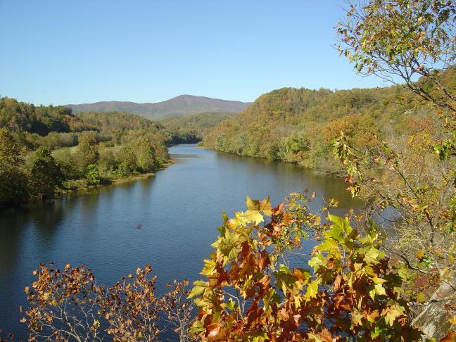
Each year millions make the ride down the scenic Blue Ridge Parkway which traces the highest mountain ridges in Virginia and North Carolina from it’s starting point near Shenandoah National Park just outside Waynesboro, Virginia, to it’s southern end at Great Smoky Mountains National Park near Cherokee, North Carolina. Along the way are spectacular views from high mountain overlooks, historic sites, and rugged natural beauty that has endeared the Blue Ridge Parkway as a national treasure.

America Rides Maps expands this 469 mile park ride to encompass the surrounding mountains highlighting more than 3000 miles of the most enjoyable paved two lane mountain back roads in the country. Designed to be accessible and easy to read, the maps fold simply, fit in a pocket, and highlight the kinds of information motorcyclists desire which other parkway-specific maps lack. They overlap and connect, are numbered in sequence from north to south, and provide such important features as the locations of reliable gas stations, distances between roads and exits, locations of significant attractions as well as all other connecting roads, cities, parks, and items of note to the traveling motorcyclist.

As nice as the ride on the Blue Ridge Parkway is, it provides only a fraction of the wealth of scenic, historic, and rewarding sights found in the surrounding rural mountains. With at least a dozen additional roads on each of the 7 maps selected for their challenge, beauty, and enjoyment, America Rides Maps reveals one of the best kept secrets – there is no greater concentration of fabulous motorcycle rides anywhere else in the nation.

I’d been coming here for more than 20 years and thought I knew of the best roads. It was only after I moved here and spent a few years in the area I realized how little I had discovered” says Wayne Busch, owner and creator of America Rides Maps.

Wayne lives only minutes from one of the most scenic sections of the parkway in Waynesville, North Carolina. A lifelong motorcyclist, he was always enamored with the great ride through the linear park and made frequent trips north from Florida to enjoy it and the surrounding mountains. Once he relocated to the mountains of western North Carolina, he discovered the parkway barely scratched the surface of the depth of great two lane mountain back roads found in the Smoky Mountains.

I met too many people, like me, who thought they knew the area. I’d mention my favorite roads only to find they’d never heard of them or had been driving right past them for years” he reports. In response, heI began making local maps to help people find them.

“I’d take the occasional job leading tours to help make ends meet, and they always went well – I knew the roads so I could tailor the rides as we went to just what my clients were looking for. It confirmed I knew what people liked”. Eventually, he decided to focus all his efforts on producing maps.

“I know what I don’t like about maps, and I am determined to make mine useful” says Busch. I tried a bunch of sizes before settling on pocket maps. Bigger maps are too hard to fold, tough to use in wind, it seems what you want is always on the other side, and they are never handy. They end up in the saddlebag which means you rarely use them. I designed my maps so you can whip them out at a stop sign, quickly find what you need, slip them back in your pocket, and keep moving. That’s the way I ride.”

It seems America Rides Maps is onto something. With a dozen maps in production and thousands sold through their on line store, business is growing while other map makers struggle in an age of GPS and the Internet. They don’t just show you where the roads are, any map does that. America Rides Maps shows you where the RIGHT roads are and highlights them from all the others. Just because it’s a squiggly line on a map doesn’t mean it’s a great ride. You never know until you actually ride it, and that’s what they do. There’s nothing else like them.

America Rides Maps
http://americaridesmaps.com/
706 Underwood Cove Road
Waynesville, North Carolina 28786
(828) 734-2164
Fax: 828-456-5243

Contact:
Wayne Busch / America Rides Maps
America Rides Maps
http://americaridesmaps.com/

wayne@americaridesmaps.com
706 Underwood Cove Road
Waynesville, North Carolina 28786
(828) 734-2164
Fax: 828-456-5243
###

Last Motorcycle Map of Blue Ridge Parkway Ride Done

711.5 miles. New one day record for a mapping expedition. A good chunk of that was on the Interstate though, so it doesn’t really count. Still, that’s a pretty good haul for the shorter days of the fall season when I typically average less than 500 miles per day evaluating two lane mountain back roads to find the best ones for my maps.

It had been raining since first light though never heavy enough to penetrate my gear and soak me through. Although the weather was fairly warm, my electric heated gear helped dry out any seepage. It was an effective tactic which helped keep me toasty warm even with a little dampness. Must give a plug to Gerbing heated motorcycle gear and Fieldshear outwear. 16 hours in the rain and I remained warm, dry, and comfortable.

As darkness came over me and the last of the two lane roads I wanted to explore passed beneath my wheels, I couldn’t justify another night in a motel at peak season prices. Within reach of Roanoke , I-81 was calling me. The daylight was spent making a huge arc from Staunton, east to the Blue Ridge Parkway, south to the outskirts of Lynchburg, and then west across the West Virginia state line on what were mostly disappointing roads. The least likely prospects are left to wrap up the end of a trip, though some jewels were discovered.

Rolling out onto the dark highway the torrents came in waves and any thought of wet clothing was overshadowed by simply trying to see through the squalls kicked up by semi trucks and a smokey visor better suited to bright sunlight than night cruising. At times the best course was to simply lock on the glowing red pair of taillights ahead and follow them wherever they went as the road disappeared in the glare of headlights reflecting on the rain-fogged helmet shield, playing havoc with any detail of lane lines or signage. The worst of it was crossing the mile high mountain pass from Tennessee into North Carolina when the winds kicked up and the midnight darkness was illuminated only once by the flashing blue lights of a string of troopers gathered to work an accident. Without a car to follow I could have easily driven up one of those runaway truck ramps in the blackness of the storm.

So what did I discover? Fewer great roads than expected. It had been a while since I last came this far north on the Blue Ridge Parkway, all the way to it’s end. I did hit it at pretty much the peak of color, and the days prior had been clear and sunny so I could fully enjoy the fall splendor. The trees were putting on a great show, but I am a harsh judge, spoiled by living near the best section of the 469 mile national roadway.

There are a wealth of rocky outcroppings and the occasional long range view. To the east, you are often treated to views looking out over the vast expanse of the Piedmont stretching to the horizon. To the west, you overlook the southern end of the Shenandoah Valley. The mountains here are distinctly separated by broad valleys which make them stand out in contrast to the flatter portions between them. Elevations are lower than near my home base, and the foliage reflects that. More oak and scrub which tends to turn yellow-orange-gold then quickly brown. Occasional bursts of red, but lacking the evergreens, birch, dogwood, and beech, found at higher altitudes to give a full rainbow of hues. Much or the roadway is through forested patches and the overlooks are less dramatic – they frequently highlight streams which course close to the road instead of the more impressive scenery found south. It’s not that it’s not a worthy ride and full of enjoyment, just not as eye-catching as what I am used to seeing. There’s no place like home.

The really dramatic views are found off the parkway, often to the west as the mountains rise again into West Virginia. The roads through the valleys do have an appeal. Rural, farms and dairy pastures, and lots of historic tiny towns, their relevance lost to time. For those with an historic bent, viewing them is rewarding. I appreciate old homes, and they are found in both pristine preservation and admirable depreciation. In general though, these valley roads offer nothing special, though I did find a few exceptions.

Roads connecting to the Blue Ridge Parkway, typically a good location to find great rides, are disappointingly short due to the lower altitudes. Once the descent is made they either empty into towns or connect to unremarkable valley byways. Again, I noted the best of these.
The most interesting areas are found west where the mountains start to rise again. There are still valleys between them, but roads which cross the ridges can be fantastic. The closer you draw to the West Virginia state border, the more likely you’ll find enjoyable riding. It confirms my desire to expand my travels into West Virginia and explore the border area in more depth.

This trip provides the information to complete the last map in the Blue Ridge Parkway series which means I now offer full coverage of every great ride adjacent to the park from end to end, locations of reliable gas stations, and suggestions to make a trip down that roadway a lot more interesting and enjoyable. It shouldn’t take long to put it together as much of the work was completed before I left. First, a day of rest. Expect the newest America Rides Map this week.

First Snow – Blue Ridge Parkway Closes

As if to emphasize the clock is ticking on my efforts to complete the last Blue Ridge Parkway series motorcycle map, the first snow of the season has blanketed the Blue Ridge. It’s not all that unusual, we were due for a good cold snap. Here today, gone tomorrow. Temperatures will soon be back in the 70’s. The inch or so that fell around these parts will be gone by this afternoon.

It probably thrilled the throngs of leaf peepers in the area from parts south who stormed the shops for gloves, scarves, and warm coats. For them, this is just what was needed to make the colors pop and by the end of the week the show should be spectacular. In the mean time they can amuse themselves with a quick trip to Cataloochee Ski area which opens this morning (and will probably close again tomorrow) or visit the elk at Cataloochee who are in full amorous frenzy. No shortage of things to do and see this season.

I read this morning a car slid off the Blue Ridge Parkway yesterday, possibly due to snow and ice, and find the gates closed when I went up to check the conditions. The white stuff won’t last even at the highest elevations and it will be open again shortly.

In the mean time I’ve been diligently progressing on the new map and am right on schedule for a Wednesday departure. The next couple days will be spent laying out the routes, trying to devise the best strategy to cover more than a thousand miles of two lane mountain back roads that surround the northern end of the Blue Ridge Parkway in as short a time as possible. I’ll be straying across the border into West Virginia which clips the corner of this map and scoping out what will most likely be the next state I explore. Time is short, but I’m going to get it done.

NEW MAP! – The Roads of Roanoke and Beyond

I’ve just finished the latest map, The Roads of Roanoke and Beyond. It’s the second of the three map Blue Ridge Parkway – Virginia Series and catalogs 90 miles of the Blue Ridge Parkway as well as more than 2 dozen great roads in the surrounding area. There are also more than 20 good “connector roads” which give you shortcuts or the best routes to reach my top rated rides.

It was an exciting moment when I transferred the overlapping data from this newest map to the raw data file of the last map in the series. I’ll be completing it as quickly as I’m able. Once done, America Rides Maps will offer the most comprehensive collection of great rides along the entire 469 mile length of the Blue Ridge Parkway and enough great riding to give you years of motorcycle touring pleasure.

The race is on as fall weather closes in on us. There’s a lot of preparation before I load up and motor north to begin the reconnaisance. Shorter days mean less miles covered and cooler weather will also bring it’s challenges. I need to locate a new base to work out of. There will be challenges, but I’m looking forward to them.

Little time to take a breath or relax, got to keep pushing to get it done. For now, another milestone has been passed.

More Motorcyle Fall Color

Rain. Sun. Rain. Rain. Sun. Rain.

The weather has been wetter than usual lately so you grab your fun rides when you can. After playing hooky on Thursday, I’ve had to make up for the lost time in the office and the rainy days make that much more tolerable. When the weather broke on Sunday and beautiful blue skies set the emerging fall leaves against a nice backdrop we had to get out for a quick ride to enjoy them.

No agenda, no destination, we just tooled around on some of the local roads close to home. One hand on the throttle, the other holding the camera, I snapped a few photos as we went.

With each passing day the leaves move further towards their final demise with the explosion of color that signals fall is upon us. You can see the changes from day to day. We’ve yet to have any really chilly weather though it’s sure to come soon. In the mean time it’s grab-it-while-it’s-good.

Blah, blah, blah, this is all just filler to give the photos something to hang on to. The pictures are from the lower elevations near Waynesville, Bethel, and Canton and you’ll still note a lot of green on the trees. That won’t last much longer. Even today the understory is far more pronounced with reds and oranges coming on strong to join the yellows and purples that came out a little earlier.

And so the show goes on and we hope for drier weather so we can get out more often and enjoy it. In the mean time, the view from the office windows and the porches will do quite nicely when too wet for casual riding.

Wayne@americaridesmaps.com

>> Go To America Rides Maps.com – http://americaridesmaps.com

A Fall Color Motorcycle Tour

It was a good day to play hooky and who wouldn’t have done the same given the opportunity. When a college buddy called to let me know he was in the area and had brought his motorcycle along with him, I needed little more to tempt me into getting out of the office for a day and enjoying fall as it nears it’s peak of glory. It was a truly great day to be riding though what day isn’t?

George is new to motorcycling and from Florida. Either of those two factors means mountain curves are intimidating. When combined, I was assured this wouldn’t be a day spent testing the edges of the tires and sane riding technique. That’s a good thing really as I’m still riding out the years probation I’m under for abusing my privilege to stay within the DOT’s suggested speed recommendations on our wonderful roads. His choice of rides, a Honda Pacific Coast, also did not lend itself to carving up the corners. It’s one of those giant scooter-looking things, and while it has 800cc’s of grunt, it lacks the attitude to apply it – it’s more of a rolling tupperware party with barely a hint of metal meanness showing anywhere. No problem. With a spanking new tire on the front of my bike, an easy ride to scrub it in would be just the ticket before I put it to proper use another day.

I’d been looking for an excuse to revisit Hot Springs, one of the classic rides in the area. It was fall cool this morning and I threw the heated gear on just in case, though I never needed to plug it in. A quick breakfast at Duval’s in Waynesville, then out NC 209 into the countryside. Blue skies, crystal clear air, and clean roads welcomed us to one of the nicest close-in rides found around here.

We wound through the gentle curves of the pastoral valleys then climbed into the serpentine course through the higher passes. Were it one of my regular rides it could have been a morning of frustration. First a delay due to road work, then mowing, then a farm tractor, then a heavy truck easing down a grade in low gear as we worked our way north. Today these delays simply allowed more time to soak in the surroundings and gave George a chance to get accommodated to the roads without having to maintain a constant push to the edge of his comfort zone.

We paused in Hot Springs and I took a few minutes to explore the town anew. It was once one of my favorite local runs as it is a great ride to get there, and is surrounded by a wealth of fantastic two lane back roads. I’d make the hour trip out, amuse myself with loops through the mountains of North Carolina and Tennessee, then circle back into town for a beer and buffalo burger at the Paddler’s Pub. The pub was always filled with bikers and the parking lot was a showcase of machines from near and far. It burned down last winter and has yet to be rebuilt, though I was encouraged to see piles of new cinder block stacked where it once stood.

I’ve yet to try any of the other small cafés that inhabit the tiny town, and this morning it was too early to give any a test run. The Iron Horse Station looks promising. I told George some of the history and errata of the place. There really are natural hot mineral springs here you can visit and soak in. It was a refuge in early days for those who came to enjoy them for “health” reasons, but the grand old spa resort had also succumbed to fire years ago. The town had served as an internment camp for German prisoners during WWII. The Appalachian Trail, that 2000 mile long footpath that stretches from Georgia to Maine, passes right through the heart of it to cross on the bridge over the French Broad River. It’s a popular place for whitewater rafters who come to ride the challenges of the rapids found on river. The surrounding national forests are full of hiking trails. That’s an awful lot of attractions for a town so small it doesn’t even have a traffic light.

We continued north along beautiful NC 212 as it traces the river where fly fisherman often outnumber the trout, then I detoured off on one of my secret little back roads to head into Tennessee. Climbing, dipping and carving through the hillsides, George convinced me this road was so good I had to add it to my Hot Springs map. I suppose he’s right, I’ll revisit that map and beef it up with a few more of roads I’d kept to myself up until now.

From Rocky Fork, Tennessee, we turned south to return to North Carolina and lunch called for a stop in Mars Hill. We landed at the El Dorado Latin Grill to satisfy my craving for a Cuban sandwich, though George’s chicken thighs with blueberry chipoltle sauce was the special of the day and he reported it was excellent.

I-26 filled the short gap between Mars Hill and Weaverville where George had stayed with relatives. I wanted to show him a good road right in town then get up on the Blue Ridge Parkway to give him the full monty on our one day tour. You can tell leaf peeping season is upon us as soon as you hit the parkway.

We plodded along through the boring section of the Blue Ridge Parkway that encircles Asheville. The road declines from the higher mountains north to reach a low point south of the city as it fords the French Broad River on an elevated causeway. From there it becomes far more interesting as you climb to it’s highest and most scenic section. As we gained altitude the turning of the leaves played out in colorful splendor.

If you know just where to look, you can get an awesome view of the Biltmore Mansion sitting castle-like amongst the surrounding forests, though I didn’t stop to share the view. We passed through tunnel after tunnel each time bursting out into the bright sunlight and just a little more color on the trees as we climbed higher and higher to reach Mt. Pisgah. I paused at selected overlooks to enjoy the panoramic views which stretched far into the hills of South Carolina and Great Smokey Mountains National Park to the north. The Pisgah Inn, Graveyard Fields, Looking Glass Rock, and The Devil’s Courthouse all had full parking areas as we stopped to enjoy them. Already at the higher elevations the peak of the color may have passed. Graveyard fields was a spectacular red and brown, though looking down on the ridges below showed much of the seasonal rainbow was yet to appear in the forests. Only the tips of the ridges had been touched by the paint brush of autumn and plenty of yet green leaves wait for their final curtain call.

Completing our loop we left the parkway at NC 215 wanting to share my wife’s favorite local road with my good friend and rolled through the never-ending curves of color that led us back to Waynesville and then my home. Jackie was home from work and we enjoyed the premier local past time of sitting on the porch reveling in a good days travels and the tales that go with them.

As he prepared to leave George thanked me for the days tour. “You know, the Blue Ridge Parkway was really nice, I’ve seen it before from a car and it’s a whole new experience on a motorcycle. But those little back roads you took me on were what really made the day, I’ve never done anything like that, it was the best experience I’ve ever had on a motorcycle, I enjoyed them more than anything else.”

Safe travels George. Good to see you again and even better to spend a day riding with you. You know we’ve always got a room ready for you when you get the chance to come back.

Wayne@americaridesmaps.com

>> Go To America Rides Maps.comhttp://americaridesmaps.com

You Never Know Until You Ride It

I‘m back from my most recent trip mapping Virginia. It was one heck of an expedition averaging more than 500 miles per day on my motorcycle, mostly on two lane back roads. Areas I thought would be really good turned out to have little appeal. The area I thought would largely be a waste of time turned out to be one of the best. You never know until you ride it, that’s why I do what I do.

I revisited some sections on the last map which overlap into this one which revealed previous roads connected to fabulous new roads. I’ll be making some minor changes to “
North Carolina / Virginia Border Rides” to reflect these new discoveries. There are some outstanding rides you really shouldn’t miss which cross the borders of these two maps.

The central point of this second Virginia map is the city of Roanoke. The
Blue Ridge Parkway cuts through the heart of the map touching on the very edges of the city. I explored a few roads close in to the city. While most of us don’t get on the bike to ride the urban landscape, should you be staying near, there are a couple rides in close you may want to do to catch a nice view or a sunset from up high. Surprisingly few paved roads connect to the Blue Ridge Parkway on this map, so knowing where they are and which way the closest gas station is will be helpful.

The highest ridges of the mountains and the Blue Ridge Parkway run in close to the city. The character of them changes as you move north leaving the rolling hills of southern Virginia behind to enter the more mountainous and scenic peaks north of the city. Roads to the south side quickly entered rolling but relatively flat country and while there are more roads, I found fewer and fewer of them engaging me and making me want to come back and ride them again. I have a lot to eliminate based on this reconnaissance.
On the other hand, north of the city is the place I enjoyed most. Here the various mountain ranges are distinct, separated by long valleys. The roads which run through these long vallies are far more curvy than they appear on a map and some of the views are wonderful. Be warned though, I’m going to try to describe some of these roads as “adventure” roads. Some will like them better than others.
As I ripped along them on a bike built for this kind of terrain, bouncy, tight, sometimes technical in demeanor, I thought about what it would be like riding shotgun on a big cruiser, fully loaded, doing more hanging on than enjoying the beautiful scenery. I think your passenger might find the experience a bit demanding if done at a hurried pace. I’ll try to identify these roads for you. On the other hand, at a relaxed pace and with the camera handy, I felt like I was riding through a national park at times. I can’t help but recommend them.

There’s one more map to go in this series to fully cover the entire range of the Blue Ridge Parkway and the surrounding areas. I’ll do my best to crank this one out by the end of the week. For the first time this year I plugged in my heated gear and really needed it as I climbed the high passes from Tennessee into North Carolina on the midnight ride home. It’s going to be regular kit from now on. I have once again paused on the West Virginia border and stared into what looks like the promised land. I’m pretty sure I know where the sequel to these maps will lie.

Wayne@americaridesmaps.com

>> Go To America Rides Maps.com http://americaridesmaps.com