Great Blue Ridge Motorcycle Ride Near Highlands, NC

Great Blue Ridge Motorcycle Ride Near Highlands, NC

Horse Cove Road to Whiteside Cove Road has a short section that is unpaved, but it’s worth riding through on your motorcycle adventures.

Best motorcycle rides

The main traffic light in Highlands, NC. Most riders make a turn. Continue straight ahead to ride Horse Cove Road.

Highlands, NC is just a few lies from the borders with Georgia and South Carolina. It’s a popular riding area with many roadside waterfalls. US 64 jogs to the north from town, NC 28 heads south. Both are great rides. If you’re up for a bit of adventure, try going straight to reach Horse Cove Road.

Best Motorcycle Rides - map

Horse Cove Road leads to a 0.8 mile section of graded hardback road. It then becomes Whiteside Road and intersects NC 107 south of Cashiers. The unpaved section is well maintained.

Section of Map #6 – The Best Motorcycle Rides Near Great Smoky Mountains National Park – EAST.

The plunge down the switchbacks on Horse Cove Road is both challenging and beautiful. It continues to twist and roll through thick forest dotted with homes. The unpaved section is smooth enough, you emerge by the lake beneath Whitesides Mountain. Whitesides Cove Road continues the romp through the woods to join NC 107 south of Cashiers.

Best Motorcycle Rides NC

Parked beside the frozen lake beneath the 1000 ft. cliffs of Whiteside Mountain on a winter ride.

You’ll find the best motorcycle rides in the surroundings on Map #6 and Map #7.

If you enjoy photos of motorcycle riding in the Blue Ridge and Smoky Mountains, like MY BLUE RIDGE MOTORCYCLING FACEBOOK PAGE.
____________________________________________________________________

wayne busch - Smoky Mountain Motorcycle Rider.com

Wayne Busch

– Wayne Busch lives in Waynesville, NC, where he produces the most detailed and comprehensive and up-to-date motorcycle pocket maps of the Blue Ridge and Smoky Mountains to help you get the most of your vacation experience. See them here – AmericaRidesMaps.com

____________________________________________________________________

How I Dress for Winter Motorcycle Riding in the Blue Ridge

How I Dress for Winter Motorcycle Riding in the Blue Ridge

How I Dress for Winter Motorcycle Riding in the Blue Ridge

How I Dress for Winter Motorcycle Riding in the Blue Ridge – Clear skies, great views, low traffic are some of the rewards of winter riding. Dress right and it’s no big deal.

Don’t let the cold weather put an end to your motorcycle riding season. If you dress well for it, winter riding can be comfortable and fun even here in the mountains. It’s not all snow and ice all the time here in the Smokies. Even the highest sections of the Blue Ridge Parkway stay open for most of the winter. Here are some of my personal tips on dressing for winter motorcycle riding in the Blue Ridge and Smoky Mountains, what works best for me.

Dress to adapt to the changing temperature. Often winter days start out very cold then get milder once the sun is high. Bundle up for the chilly start then simply zip your jacket open and loosen the seals at the wrists a bit once it warms. Using vents keeps you from having to stop and peel off layers.

How I Dress for Winter Motorcycle Riding in the Blue Ridge

How I Dress for Winter Motorcycle Riding in the Blue Ridge – With the right clothes, you can ride all day in conditions like this and never be cold.

Cinch and Seal – Before you head out, close all the vents on your jacket. Cinch wrists, ankles, and neck to keep out drafts and seal the warm air in. Snug up any adjustment straps on your jacket to trap warm air better.

A full face helmet is warmer – a balaclava or thin hoodie under the helmet helps when it’s really cold. Manage fogging by cracking the visor just the right amount, flipping it up at stops. Lifting your chin increases air flow, it sometimes works. Eventually your helmet temp equilibrates until you come to a stop again, etc. Fogging problems usually go away as the day gets warmer. Keep visors clean.

Get “Expedition weight” long underwear – go for the warmest, the best quality. You don’t want big seams, buttons and flaps, keep it simple and comfortable.

Landslide on the Cherohala Skyway last year. It was a gorgeous day in February.

Landslide on the Cherohala Skyway last February. It was a gorgeous day, don’t pass up these great opportunities to enjoy winter on your motorcycle.

Seal your inner layer – make your outer shirt a windblock layer that extends up your neck to the chin, and have a zipper so you can vent it. It’ll hold heat better and a zipper lets you vent when it warms.

Put the linings back in – If you took those quilted linings out of your jacket and pants for the summer, put them back in, as well as any waterproof or wind blocking linings.

2 socks, 2 gloves – Start with a warm thinner sock, then add a heavy duty second sock that extends up to your calf. Thin glove liners add heat under a good lined gauntlet style outer glove.

How I Dress for Winter Motorcycle Riding in the Blue Ridge

How I Dress for Winter Motorcycle Riding in the Blue Ridge – you can see so much more in winter when the leaves rare off the trees. It’s a new landscape to enjoy.

If you ultimately decide you enjoy year round motorcycle riding, heated electric gear is the way to go. It’s a big expense, but it lasts for many years. Go all the way and get dual controllers – you’ll want your exposed gloves warmer than your covered vest.

There is one thing you can do to help keep your motorcycle running or stored during the winter months – install a battery tender. It’s as simple as adding a couple wires to your battery terminals for the plug/connector, or if the bike is put up for the winter, just attaching a couple clamps to the battery terminals. Cold weather kills batteries, a battery tender will kept it alive and fresh and extend it’s life for many years. 

Photo-Whitesides-mountain-nc-motorcycle-by-frozen-lake

How I Dress for Winter Motorcycle Riding in the Blue Ridge – A minute after this photo was taken my bike lay on its side and I couldn’t pick it up on the ice. Read about it here – http://smokymountainrider.com/?p=1650

http://smokymountainrider.com/?p=1650

Got a winter riding question or tip to share?

If you enjoy photos of motorcycle riding in the Blue Ridge and Smoky Mountains, like MY BLUE RIDGE MOTORCYCLING FACEBOOK PAGE.
____________________________________________________________________

wayne busch - Smoky Mountain Motorcycle Rider.com

Wayne Busch

– Wayne Busch lives in Waynesville, NC, where he produces the most detailed and comprehensive and up-to-date motorcycle pocket maps of the Blue Ridge and Smoky Mountains to help you get the most of your vacation experience. See them here – AmericaRidesMaps.com

____________________________________________________________________

Motorcyclists – Never Underestimate the Weather on the Blue Ridge Parkway

I sometimes do dumb things on a motorcycle. Learn from my mistakes, I’ve made a lot of them.

Forecast – High’s in the 50’s, windy, partly cloudy, 10% chance of rain, IN WAYNESVILLE, NC. I’d become pretty complacent regarding the weather as it had been an unusually warm fall so far. The morning wasn’t too bad for what was supposed to be the DAY BEFORE our first cold snap – high 40’s and an unexpected wet driveway overnight greeted me and my morning coffee as I started the day on the porch of my cabin. Low clouds raced overhead, there was little wind at all IN MY LITTLE COVE.

Blue Ridge Parkway - Fall color at Second Falls , Graveyard Fields on the Blue Ridge Parkway. Head-turning gorgeous.

Blue Ridge Parkway – Fall color at Second Falls , Graveyard Fields on the Blue Ridge Parkway. Head-turning gorgeous.

I wanted new photos to feed MY BLUE RIDGE MOTORCYCLING FACEBOOK PAGE at the peak of fall color in the Blue Ridge Mountains. I post a couple each day for my motorcycle riding friends and they sure do seem to like them as I currently have something like 33,000 people who check in to see them. So I set aside the day to run up to Boone, NC on the Blue Ridge Parkway and see the colors so I could report back and tell them what to expect and where to go to see it.

Fall Colors on the Blue Ridge Parkway near Waynesville

Fall Colors on the Blue Ridge Parkway near Waynesville a couple days ago.

“It’s not too bad” I thought, no need for the long johns or the Gerbings Heated motorcycle riding gear. It would be dry and mostly sunny, I can handle this, no problem. I packed up the morning motorcycle map orders, hit the post office, then I-40 east to Asheville to pick up the Blue Ridge Parkway and head north.

Fall colors near the highest point on the Blue Ridge Parkway

Fall colors near the highest point on the Blue Ridge Parkway from my collection.

I got on the Blue Ridge Parkway at US 74 and started the pleasant ride north. The colors along the Asheville corridor and leading up to Craggy Gardens were spectacular! My goal was the Linn Cove Viaduct at Grandfather Mountain. The plan was to race up there to get some photos, then take my time coming back shooting more along the way as the lighting would be better. It was  getting a bit cloudy, so I’d surely get better shots later in the day on the return.

Charlies Creek Road

Charlie’s Creek Road – Not only will you find some of the best hidden pockets of leaf color, but you have one of the best rides of your life.

I quickly found myself doddering along behind the light tourist traffic at 25 mph. “Don’t be an asshole” – just enjoy the sights and behave” I told myself. That lasted about 3 minutes before I started darting around the cars. Damn, it was chilly as I approached Craggy Gardens and a light rain started.

I hit the clouds climbing to Mt. Mitchell, highest peak in the east. “That’s normal”, I told myself, “it’s always cloudy here”, its still early in the day. It was getting cold now, and I saw the first SNOW along the roadside. Wished I’d put on the heated gear. The wind was beyond “blustery” by now.

Approaching Mt. Mitchell, I saw the first snow along the roadside.

Approaching Mt. Mitchell, I saw the first snow along the roadside.

It was another hour and then some to reach Grandfather Mountain. I scrambled up on the rocks for the photo of the Linn Cove Viaduct and shivered violently in the bitter gusty winds waiting for the sun to hit it while a motorcycle was crossing and get the photos I wanted. I never got the perfect shot, but after  almost an hour I was shaking so violently I just gave up. It was too cloudy and I recognized the beginnings of hypothermia. It would be a long ride back, and the temperature was dropping.

Blue Ridge Parkway Linn Cove Viaduct Fall

Here’s the best shot I got with motorcycles. Waiting to see one yesterday was like waiting for Bigfoot and his family to come out and pose. The smart riders hunkered down and stayed in.

The fall colors at Grandfather Mountain were unbelievable, though only during the very rare moments when the sun peaked through the heavy cloud cover. It finally just all went gray in the sky above, and I couldn’t stand it any longer. I had to get back.

The wind was wailing now, the rain of leaves horizontal, and the times when the sun poked through the racing clouds were fleeting. I sped through Little Switzerland, trying to relax as my body shook violently from the cold so I could maintain control of the bike at speed. Wheels kicking out on the wet leaves, the tick-tick-tick on the helmet told me the rain had turned to sleet. Breathing as shallow as I could to keep the visor from fogging, I poured on the throttle to get this pain over with as quickly as possible.

Linn Cove Viaduct Fall Colors

Best shot from the day. It was a long cold wait to get it.

Getting photos had long been dismissed as any priority, it was all about escaping my predicament now. Underdressed, the climb to Mt. Mitchell was brutal, just get it over with. I passed the park and the sleet turned to tiny white flecks – it was snowing.

Coming into Asheville I looked to the west and home. The skies were blue, the sun was shining, it was exactly as the forecast predicted.

Lessons Re-learned:

  • It’s always more extreme up on the parkway – colder, wetter, windier. Don’t be fooled sitting on the porch.
  • Weather in the mountains varies widely and can change quickly. Check the forecast in several places.

If you enjoy photos of motorcycle riding in the Blue Ridge and Smoky Mountains, like MY BLUE RIDGE MOTORCYCLING FACEBOOK PAGE.
____________________________________________________________________

wayne busch - Smoky Mountain Motorcycle Rider.com

Wayne Busch

– Wayne Busch lives in Waynesville, NC, where he produces the most detailed and comprehensive and up-to-date motorcycle pocket maps of the Blue Ridge and Smoky Mountains to help you get the most of your vacation experience. See them here – AmericaRidesMaps.com

____________________________________________________________________

Feb 9, 2013 – Fresh photos of the landslide on the Cherohala Skyway

Feb 9, 2013 – Fresh photos of the landslide on the Cherohala Skyway

With temps nearing 60, I took the opportunity to ride out and see the landslide up close.

Landslide on the Cherohala Skyway - Temporary stoplights

Landslide on the Cherohala Skyway – Temporary stoplights regulate the flow through the area where one lane of this outstanding motorcycle ride is closed.

A few weeks ago the Smoky Mountain area was hit with drenching rains which caused a number of landslides. The most significant of them is on US 441 in the heart of Great Smoky Mountains National Park. Many of these situations have already been addressed, but some will have effects into the early motorcycle riding season.

Landslide on the Cherohala Skyway  - one lane is closed.

Landslide on the Cherohala Skyway – fortunately there was enough room for a detour, only one lane is closed.

We hope the worst is behind us, but realize we’re only half way through winter. There is still the potential for more slides as the freeze / thaw cycles break rock and this is the time of year when most of them happen. Heavy rain is unusual and this slide is quite extensive. I suspect a retaining wall will eventually be constructed, but I wouldn’t count on a quick fix on this remote section of road.

Landslide on the Cherohala Skyway - The guardrail hangs dramatically

Landslide on the Cherohala Skyway – The guardrail hangs dramatically over the abyss

The slide happened on the North Carolina section of the road about a mile from the border with Tennessee. There are big overlooks on this scenic road located on each side of the slide. It at about 4800 feet elevation though the highest parts of the road are well above 5000 feet high. Views are gorgeous.

Landslide on the Cherohala Skyway - The pavement is undercut

Landslide on the Cherohala Skyway – The pavement is undercut here, getting near the edge made me nervous lest it give way! You can see how extensive and deep the chasm is in this photo.

A lot of soil was lost. It doesn’t seem practical to try to fill it in, the area seems to go 800 – 1000 feet down the mountainside. It has undercut the pavement, getting close to the edge made me a little nervous!

Landslide on the Cherohala  Skyway - remaining slope at the edges.

Landslide on the Cherohala Skyway – This photo shows just how much soil moved. You can see the difference compared to the remaining slope at the edges.

No telling why this section off the road let loose while others remain intact. It doesn’t appear much different or more steep than many other sections. It’s at one of the higher elevations so you wouldn’t think there was a lot of subterranean water flow, yet it happened.

Landslide on the Cherohala Skyway - - A view from the other side

Landslide on the Cherohala Skyway – A view from the other side helps you realize just how big this slide is.

I don’t expect a quick fix. While this is a popular and scenic road, it is not a vital through-way. It’s about as far away from civilization as you can get in this area of the mountains. The North Carolina county in which it occurred is one of the poorest in the state, and there is far more impact on tourism related to the major landslide on US 441 in Great Smoky Mountains National Park.

Landslide on the Cherohala Skywway  For all the hype it's a minor inconvenience

Landslide on the Cherohala Skywway – For all the hype it’s a minor inconvenience on this outstanding motorcycle ride!

It’s not so bad! The traffic lights are quick. There is rarely much traffic on this outstanding motorcycle ride, its still one of the top 10 motorcycle rides in the US despite this minor inconvenience. I would not change my plans, heck, there’s one more unique thing to see on this ride. The overlook closest to the North Carolina side has bathrooms, so it’s a popular place for a break. DO IT!

____________________________________________________________________

wayne busch - Smoky Mountain Motorcycle Rider.com

Wayne Busch

– Wayne Busch lives in Waynesville, NC, where he produces the most detailed and comprehensive and up-to-date motorcycle pocket maps of the Blue Ridge and Smoky Mountains to help you get the most of your vacation experience. See them here – AmericaRidesMaps.com

Total Rider Tech Logo

Learn Total Control

Wayne is an advanced motorcycle instructor for Total Rider Tech teaching Lee Parks Total Control Advanced Rider Courses. Isn’t it time you looked into advanced rider training to ride more confidently and safely? It can transform your mountain riding experience.  Total Rider Tech

____________________________________________________________________

Classic Motorcycle Roads Closed – a blessing?

Classic Motorcycle Roads Closed – a blessing?

Extreme rain causes flooding and washes out many favorite motorcycle rides – here’s an update and what it means for your motorcycle tour plans;

Note: we are hardly out of the woods – all this moisture in the soil could lead to more slides over time, and now with some hard freezes coming in, the freeze/thaw cycles could contribute to more problems as more rock is cracked, split, and loosened.

US 441 – Newfound Gap Road, Great Smoky Mountains National Park

Seems this road is always under construction, over the past year or two, to repair a slide near the top on the Tennessee side of the border. As the only road which crosses the park, right through the heart of it, it carries heavy traffic loads. Now, a large section has washed out about 9 miles north of Cherokee, and it will require a substantial and costly repair.

photo - slide closes park

photo source: Great Smoky Mountains National Park – Newfound Road US 441 hit by slide, park closes

Of all the damage from the recent weather, this is the most significant. While I do show this as a great motorcycle ride on my America Rides motorcycle pocket maps, it’s one of those “if you haven’t done it, you should ride it”, but it’s not one of my favorites due to the traffic, and I typically avoid it.

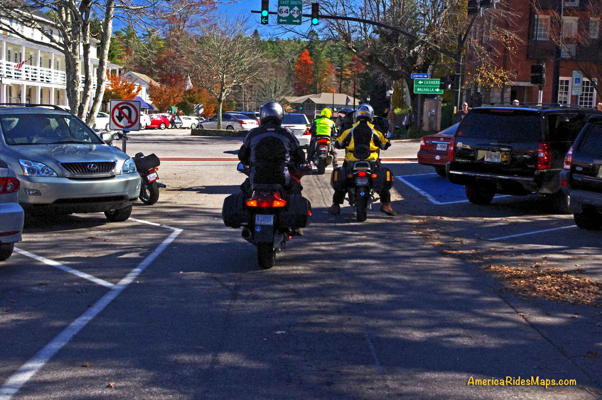
If you are planning to base a motorcycle vacation out of Gatlinburg / Pigeon Forge, you will now be forced to ride completely around the park to reach many of the best motorcycle rides. While there are some great motorcycle rides on the north side of Great Smoky Mountains National Park, you will also be dealing the the tourist traffic that  floods into this area. I suggest you look at options on the south side of the park instead. Map #8 details the best motorcycle rides free of traffic on the north side of GSMNP, but there are so many more on the south side you will get in more riding by basing your motorcycle trip on the quiet side of the park.

The Cherohala Skyway – NC 143/ TN 165

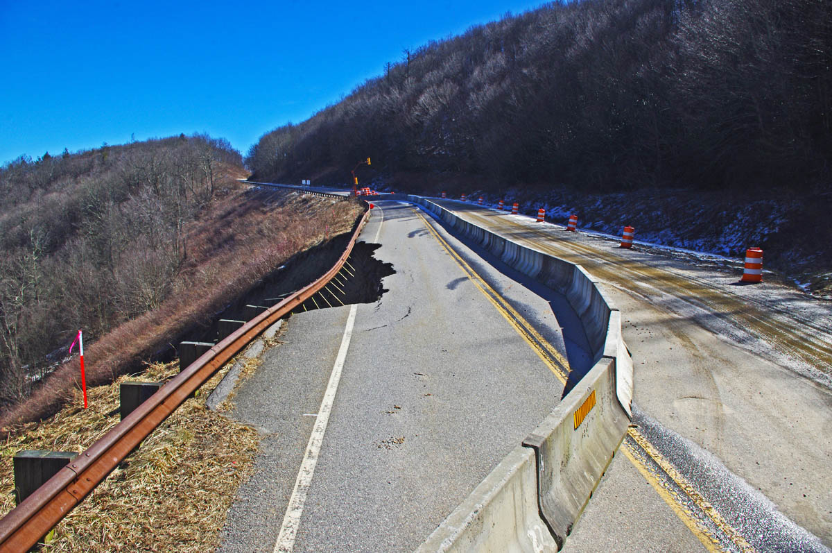
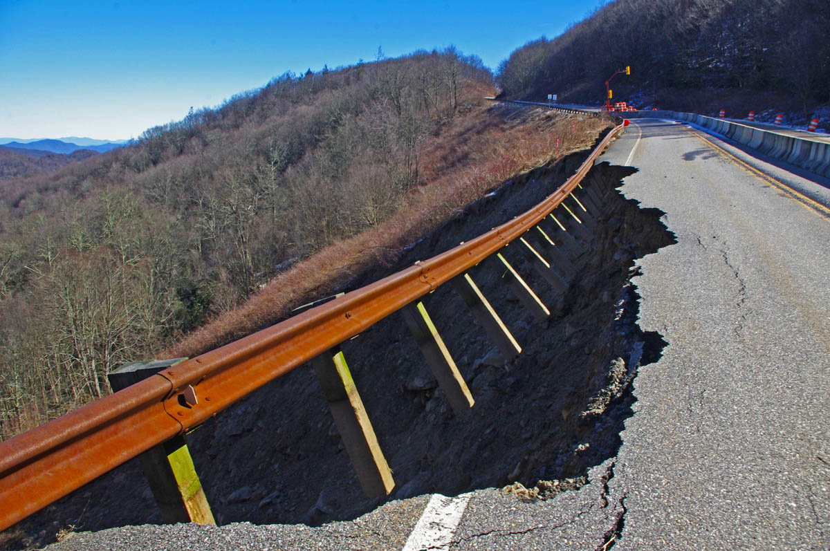
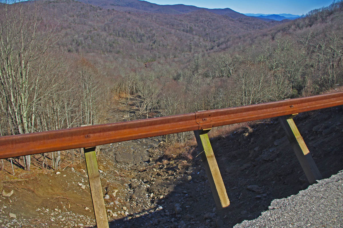
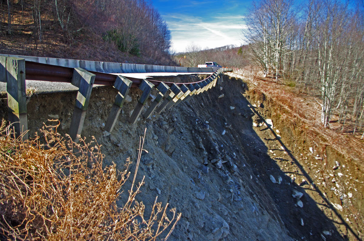
A significant slide on the North Carolina side of the border, about 1 mile from the state line has taken out one lane of the road and it has been closed. This is one of the nicest rides in the area, and the only road that crosses through this remote area of high mountains, a favorite scenic motorcycle ride often done as a loop ride with the infamous Dragon at Deals Gap.

Photo Source - Graham Star - Slide on Cherohala Skyway takes out 1 lane

Photo Source – Graham Star – Slide on Cherohala Skyway takes out 1 lane

This is a “wait and watch” situation right now to determine how stable the slope is over time. The good news is there is likely enough room for a temporary detour, though the work required to fix the problem will be extensive. I am hopeful, it will reopen before the riding season cranks up.

This road is featured on Map #7,  Map #8, and 12 Classic Deals Gap motorcycle rides.

US 19 – Near Burnsville

This is not a large slide in scope, but the issue is a “house sized boulder” which now sits blocking the road. Complicating the cleanup is a nearby house which is too close to permit blasting of the rock. Plan is to drill in to it and use expanding materials to break it up. I expect this problem will be cleared up relatively quickly.

yancey county slide

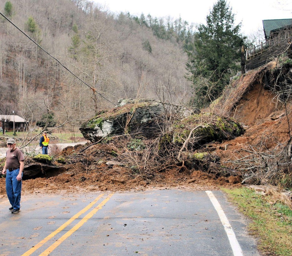
Photo source – Yancey County News – Large boulder blocking road

Detours use Jack’s Creek Road and Coxes Creek roads, this area is detailed on Map #5

Blue Ridge Parkway (near MP 455) Soco Gap area, near Maggie Valley

Reports of a small slide in this area seem to be over-hyped. I have hiked to it for inspection, and found a few rocks in the road which I could have cleared with one hand. No worries here.

photo - small slide on Blue Ridge PArkway

The rock slide reported near MP 455 is nothing to worry about. I could have taken care of it myself.

The most significant Blue Ridge Parkway closure in North Carolina is for slope stabilization near Mt. Mitchell. The road is closed here at least through April. You can download a free printable map of my suggested detours for motorcycles that give you other options here – http://smokymountainrider.com/Downloads/parkway-closure-2013.pdf

NC 63 – Leicester Road

I have not had personally investigated this slide, it is reported one lane has been affected. This is a popular motorcycle ride connecting to NC 209 (The Rattler), often used to make loop rides or access Asheville. The slide occurred in the best section of the road, the steep switchbacks that climb over the mountain. No further info on this one right now.

Great Motorcycle Rides in North Carolina - NC 209, a.k.a. "The Rattler" This is some of the best motorcycle riding you'll find in the world. These riders are looping back to NC 209 on NC 63.This is some of the best motorcycle riding you'll find in the world. These riders are looping back to NC 209 on NC 63.

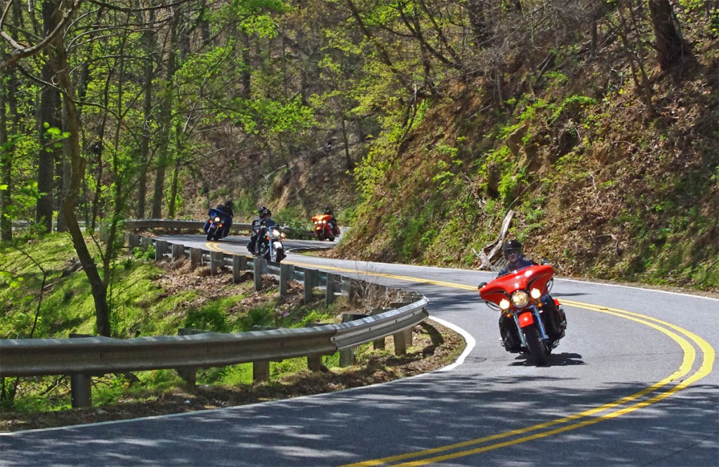
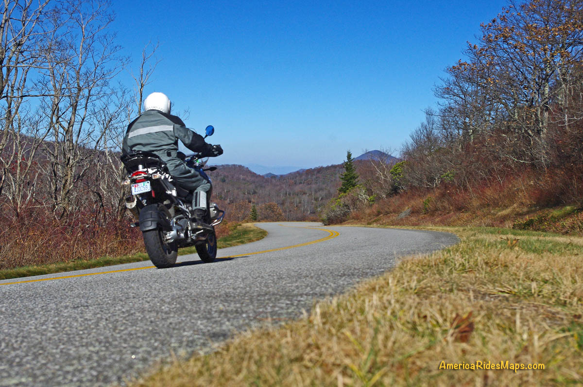
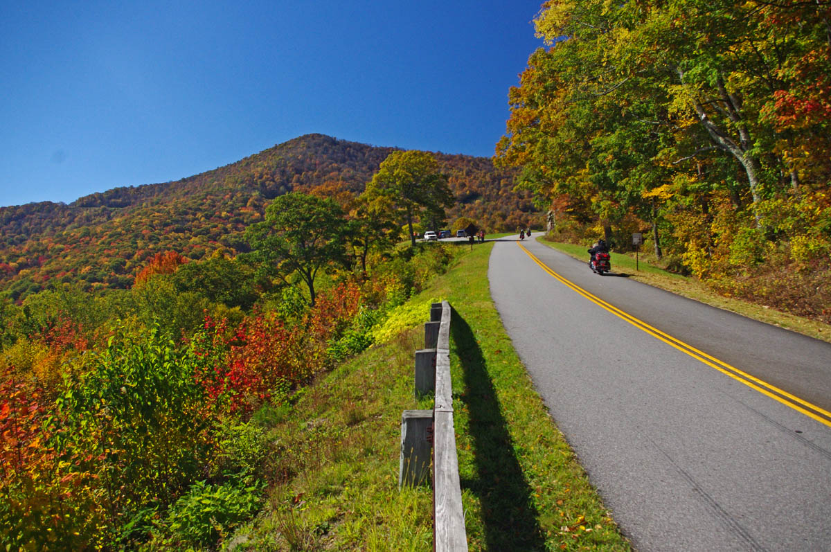
Great Motorcycle Rides in North Carolina – These riders are looping back to NC 209 on NC 63.

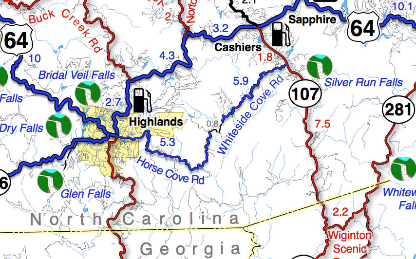
Fortunately, there are many other options to make loop rides through this area, you’ll find them them extensively detailed on Map #6

So where are the blessings in all this bad news?

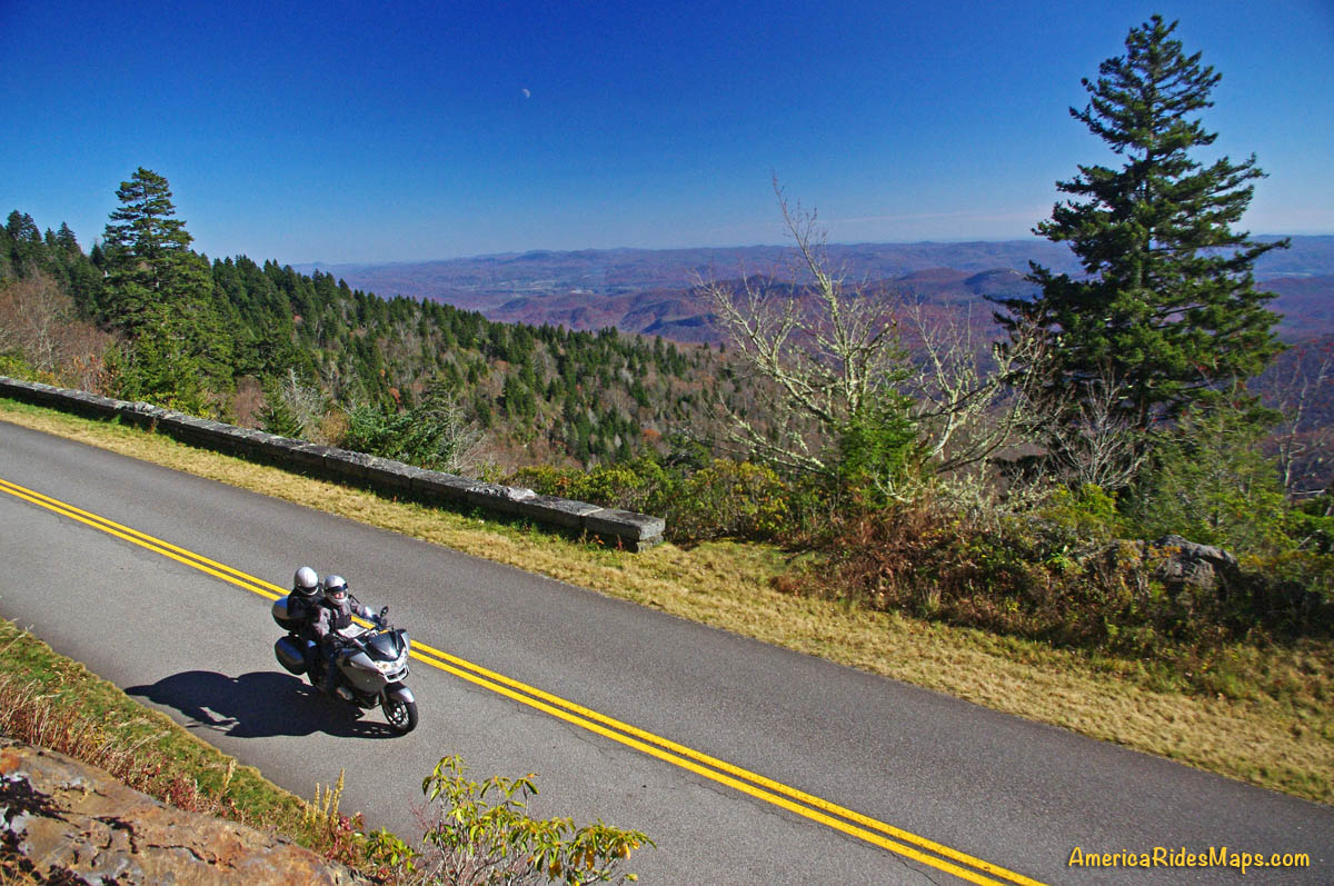
Most of the mess will be tended to by the time the real motorcycle riding season gets going. While 5 important roads are closed, some of them consistently on the “top 10 motorcycle rides” lists, it is only 5. I show nearly 200 other great motorcycle rides in this area, the blessing is you now have the opportunity to get away from the tourist traffic that flocks to these biker roads and discover some of little know and best scenic motorcycle rides detailed on my maps.

____________________________________________________________________

wayne busch - Smoky Mountain Motorcycle Rider.com

Wayne Busch

– Wayne Busch lives in Waynesville, NC, where he produces the most detailed and comprehensive and up-to-date motorcycle pocket maps of the Blue Ridge and Smoky Mountains to help you get the most of your vacation experience. See them here – AmericaRidesMaps.com

Total Rider Tech Logo

Learn Total Control

Wayne is an advanced motorcycle instructor for Total Rider Tech teaching Lee Parks Total Control Advanced Rider Courses. Isn’t it time you looked into advanced rider training to ride more confidently and safely? It can transform your mountain riding experience.  Total Rider Tech

____________________________________________________________________

Motorcycles use caution – Rocks and Ice on the Blue Ridge Parkway

Early spring means early season motorcycle riding on the Blue Ridge Parkway, but nightly freezes cause lots of small rock slides.

photo-rocky-section-along-blue-ridge-parkway

Rocky sections along the parkway are prone to slides

The National Park Service has done an outstanding job keeping the Blue Ridge Parkway open through the winter season as much as possible. I can’t remember spending as much time up there on my motorcycle, usually I’m on skis this time of year.

photo-rocky-section-along-blue-ridge-parkway

Rocks in the road are a common hazard

Warm and sunny days through this mild winter often find me pointing my wheels to the high country to take advantage of the nearly empty scenic road as it carves along the high ridge tops more than 5000 ft in elevation. Clear winter skies mean you can see into the surrounding states on the horizon, and the naked trees reveal what is hidden in the forested valleys spread out below.

photo-rocky-section-along-blue-ridge-parkway

If you see evidence of a large slide, be alert for the smaller ones which often follow.

Once darkness comes, the temperatures dive below freezing and sheets of ice build on the wet rock faces that line the roadway. As the sun warms them the next day, the ice melts and rains down along the roadside, and the repetitive freezing and melting cracks and loosens the rocks above causing small slides.

photo-rocky-section-along-blue-ridge-parkway

When the sun hits the rocks, the ice quickly melts and falls.

The park service is quick to remove the bigger slides as they occur and you’ll see the piles of rock pushed to the roadside. Throughout the day the process continues and it’s not uncommon to find rocks in the road when the road carves along the rocky cliffs.

photo-rocky-section-along-blue-ridge-parkway

Rocks, ice, and water litter this section of the road

Be alert whenever you see exposed rock along the roadside, particularly when rounding shady curves. The road may be clear where the sun rarely reaches, but as you come into the sunny side there may be surprises in the road.

1 minute video shows how noisy and active the melting and falling ice can be. It’s worth a stop to watch the spectacle.

__________________________________________________________________

Wayne Busch

Wayne Busch - Cartographer

Total Rider Tech Logo

Learn Total Control

– Wayne Busch lives in Waynesville, NC, where he produces the most detailed and comprehensive and up-to-date motorcycle pocket maps of the Blue Ridge and Smoky Mountains to help you get the most of your vacation experience. See them here – AmericaRidesMaps.com

Wayne is an advanced motorcycle instructor for Total Rider Tech teaching Lee Parks Total Control Advanced Rider Courses. Isn’t it time you looked into advanced rider training to ride more confidently and safely? It can transform your mountain riding experience.  Total Rider Tech

____________________________________________________________________

Motorcycle Riding on the Blue Ridge Parkway – in January?

I should be in Vegas – luck is with me today. Although the weather has been unseasonably warm here in the Smoky Mountains this week, it’s also been wet. Not that “Old Testament” deluge kind of wet, but a wintery wet with light but persistent rains.

photo-winter-view-of-cold-mountain

A winter view of Cold Mountain from the Blue Ridge Parkway near Mt. Pisgah.

In a normal year we’d have a bit of white on the ground, and I did see a rare patch or two today. It’s not the ideal season for motorcycling the Blue Ridge Parkway. In fact, the Blue Ridge Parkway is normally closed to traffic through this season due to the frigid conditions.

When I saw the sun this morning I knew a motorcycle ride was in order. There’s a weather front passing over with a few hours of blue sky before the snow moves in tonight. I wrapped up the mornings work and fired up the bike.

Photo-wayne-on-parkway

The weather looked great to the south, what a difference the other direction.

I just wanted a nice little ride. The threatening clouds on the northern horizon foretold this break in the weather was temporary, so I chose to just head south from Waynesville on US 276 and ride up to the Blue Ridge Parkway and back after running a few errands in town.

US 276 is a well know road to motorcycle riders and part of a classic loop called the “Pisgah Triangle” south of Waynesville. US 276 forms one leg of the triangle, the Blue Ridge Parkway the second, and NC 215 the third. It’s a “must do” fun ride if you’re in the Waynesville / Maggie Valley area.

photo-winter-view-blue-ridge-parkway

Winter riding in the Smoky Mountains can be as beautiful as the summer, just in a different way.

It takes about 25 minutes to ride out across Bethel Valley then follow the Big East Fork of the Pigeon River in the Pisgah National Forest and make the steep and twisting climb to the heights of the Blue Ridge Parkway at the Wagon Road Gap. The ramp to the Blue Ridge Parkway leads to the large parking area  overlooking Cold Mountain  (MP 412.2).

The overlook is accessible year-round. The parkway is gated on either side. The south gate (towards Cherokee) was closed, but the north gate to Mt. Pisgah was open so I took advantage of the opportunity to snap a few photos.

photo-clouds-on-the-blue-ridge-parkway

By the time I turned back, those clouds had swallowed up everything.

The blue skies didn’t last long, and by the time I had turned around nearing Asheville, the clouds were swallowing the views. The wind was gusting and I started to hit some wet stuff on the way back. Some of it was white.

It was a rare treat this time of year. Next time you’re passing through, take a motorcycle ride on the Pisgah Triangle. I had a great time on just one leg of it, and the other two are better!

haywood-county-postcard

A postcard from Haywood County, North Carolina shows the Pisgah Triangle

__________________________________________________________________

Wayne Busch

Wayne Busch - Cartographer

Total Rider Tech Logo

Learn Total Control

– Wayne Busch lives in Waynesville, NC, where he produces the most detailed and comprehensive and up-to-date motorcycle pocket maps of the Blue Ridge and Smoky Mountains to help you get the most of your vacation experience. See them here – AmericaRidesMaps.com

Wayne is an advanced motorcycle instructor for Total Rider Tech teaching Lee Parks Total Control Advanced Rider Courses. It’s time you looked into advanced rider training to ride more confidently and safely, it will change your mountain riding experience. It worked so well for me I became an instructor! Total Rider Tech

____________________________________________________________________

First Day of Winter – Let’s Ride the Blue Ridge Parkway!

So here it is, winter is officially upon us today and I spent the best of it on my motorcycle on the Blue Ridge Parkway.

I couldn’t stand it any longer. It was so warm when I took the dog out this morning I knew I was going to HAVE to get on the bike. The weatherman says rain is coming to the Smoky Mountains so I knew I’d need an early start.

photo-wayne-at-lake-junaluska-dam

I would have settled for a nice short ride - (if you believe that, you don't know me very well)

“Just a short ride” I told my wife.

If nothing else I’d top up the near-empty tank and make a short spin of it. Thinking of someplace close I could get a photo, I headed to the dam at Lake Junaluska. Sure looked like rain was coming. Got my photo, then where?

It’s been so unusually warm lately, I decided to ride over to Maggie Valley and see if the Blue Ridge Parkway was open. Slim chance of it, but just maybe….

Photo-Wayne-celebrates-at Waterrock-Knob

Made it to Waterrock Knob! Enveloped in clouds, raining, but totally unexpected at this time of year. That would have been enough for most riders - it just goaded me to push on.

Passing the man made snow at Tony’s Tube World as I left the valley, I started to consider alternatives. If snow could linger down low, it would sure be too cold up high for the parkway to be open. If it wasn’t, I could always cruise over to Cherokee.

I turned onto the ramp to the Blue Ridge Parkway at Soco Gap, and sure enough, the gates towards Cherokee were closed when I reached the top. Oh well.

motorcycle-at-fork-ridge-overlook-1st-day-of-winter

I stopped for a photo when I came down to the mile-high Fork Ridge overlook. You can see the cloud ceiling a few hundred feet above me and the clouds in the valleys below.

As long as I was here, might as well ride over to see if the gates were closed heading south though the chances were even slimmer as the parkway climbs to some of the highest parts in that direction.

Surprise, surprise, the gates were open and I rolled on the throttle!

I didn’t think I’d get far, but I might at least get a photo from one of the lower overlooks. As I climbed, I came nearer and nearer to the cloud bank that socked in the mountain tops. Still, the road was clear.

Photo-first-day-of-winter-on-blue-ridge-parkway

It was a good day for riding so long as you stayed down low. At 4000 feet, the Woodfin Valley overlook shows it's fine at the lower elevations. I couldn't resist going higher.

I was stoked when I reached Waterrock Knob. Totally enveloped in thick clouds and peppering light rain, I stopped for another photo. This was awesome and a rare occasion this far into the cold season.

I was happy as I continued towards the next exit at US 74 in Waynesville, dropping back below the ceiling of clouds and out of the rain.

I almost left the parkway at Waynesville (see my video of Waynesville), as the next section of the Blue Ridge Parkway leads to the highest point on the road. No way it would be open. Still, I was curious as to how far I would get and amazed to find the gates open as I crossed over the highway.

photo-wayne-rides-his-motorcycle-to-the highest-point-on-the-parkway

Can't believe it! I rode to the highest point on the Blue Ridge Parkway on the first day of winter. Same day last year we got a snow that covered the yard until well into march.

I began climbing again, and before long was back in the wet cloud bank. Except for a few stray cars, I had the road to myself and enjoyed it with enthusiasm.

It was windy and poor visibility when I reached the high point, but it was another unexpected treat. Took another photo to remember it by.

I rode the rest of the way to Beech Gap and NC 215 in heavy wet fog (here’s a wicked ride nearby). No views to speak of, and lots of rocks and debris from the small slides that occur where rocky faces run close to the road. Winter thaws and freezes cause a lot of little slides during this season but it’s not much of a problem as no one is there to be affected by them.

photo-fall-on-nc215-great-motorcycle-ride

Road condition has improved marginally since this fall photo of NC 215 following the resurfacing. Still plenty of loose gravel and slippery corners to negotiate. Not for the faint-of-heart. It will improve, but how much?

The ride home via NC 215 (see my video of NC 215)is unchanged from my last visit – the road is till a mess. If riding sharp turns on loose gravel isn’t your thing, you will want to avoid it a while longer until things clean up.

Same day last year, we got snow so deep it laid in my yard for 3 months. This year I’m riding. I think I like this year better!

_______________________________________________________________________________

Wayne Busch

Wayne Busch - Cartographer

Total Rider Tech Logo

Learn Total Control

– Wayne Busch lives in Waynesville, NC, where he produces the most detailed and comprehensive and up-to-date motorcycle pocket maps of the Blue Ridge and Smoky Mountains to help you get the most of your vacation experience. See them here – AmericaRidesMaps.com

Wayne is an advanced motorcycle instructor for Total Rider Tech teaching Lee Parks Total Control Advanced Rider Courses. It’s time you looked into advanced rider training to ride more confidently and safely, it will change your mountain riding experience. It worked so well for me I became an instructor! Total Rider Tech

_______________________________________________________________________________

Blue Ridge Parkway Opens Soon, Smoky Mountain Motorcycles Everywhere!

Motorcycle the Blue Ridge Parkway

We parked our motorcycles at the Blue Ridge Parkway gates at Wagon Road Gap. It wasn't open today, but it will be soon.

I knew before we reached the top of the climb the gates to the Blue Ridge Parkway would be closed. The fresh layer of road salt as we glided through the last of the hairpin curves on our motorcycle ride up US 276 south of Waynesville, North Carolina, were evidence of the lingering snow I’d seen on the mountainsides last night. Thin sheets of ice on the roadside rock faces reminded me just how different the world is when you climb up high where the Blue Ridge Parkway crowns the ridge tops.

Photo - waterfall along Buck Springs Trail

Many come to enjoy the hiking nearby. One of several small cascades the Buck Springs Trail shares on it's 6 mile run to the Pisgah Inn.

In the midday warmth, the dusting of white had vanished, but it was not long gone. We found the gates closed at Wagon Road Gap, but a nearly full parking lot at the Cold Mountain overlook proved we were not the only ones who were eager to enjoy the emergence of spring via the nations most popular motorcycle ride.

Photo - Blue Ridge PArkway overlook - Cold Mountain

Cold Mountain Overlook at Wagon Road Gap, Blue Ridge Parkway - Even with the parkway closed, plenty came out to enjoy the hiking, the scenery, and the warm weather on such a nice day.

Photo - Jackie on her Beemer

Come on, Let's Go ! This is great!

It’s early for the Blue Ridge Parkway to be open to traffic at the south end. This is the highest, and in my opinion, the best section of the entire 469 mile motorcycle ride.  If you see just one piece of the Blue Ridge Parkway on your motorcycle vacation, this should be it, the section from Asheville to the south end of the parkway at Great Smoky Mountains National Park near Cherokee. Because it’s the highest section, it’s usually the last to open for the start of the spring season.

The number of outstanding roads that surround and connect to the Blue Ridge Parkway in this area is enough to keep you busy for a season and then some. It was just one stop on a great day of motorcycle rides that followed.  I think we passed more bikes then cars on our ride. If you had a motorcycle, you were out to enjoy it today.

Photo - view from Crabtree Mountain Road

A view from Crabtree Mountain Road north of Canton. You can see a portion of it as it snakes it's way through the pass. Soon, this will all be green and spring flowers.

We doubled back via US 276 then cruised through Canton and headed north on Crabtree Mountain Road. I’d forgotten what a steep climb it was and how tight the switchback  curves are that bring you to the nice overlook at the top of the mountain pass. Up one side, down the other, then follow the serpentine path of the stream that flows through the valley. On to NC 209, out to Hot Springs, then hop from one great motorcycle ride to the next until you’ve had your fill.

Photo - view form blue ridge parkway overlook

Before long, everything will be green and flowers!

It won’t be long until weather like this will be what we expect every day in the Smoky Mountains. The fields are already turning green. The first tiny leaves are emerging on the brush. Buds are fat and swelling almost ready to burst on the trees. Soon, the hillsides will explode with color as all that pent up winter energy is freed. From what I’ve seen so far, the motorcycles are ready for it. Are you?

_______________________________________________________________________________

Wayne Busch
Wayne Busch – Cartographer
– Wayne Busch lives in Waynesville, NC, where he produces the most detailed and comprehensive and up-to-date motorcycle pocket maps of the Blue Ridge and Smoky Mountains to help you get the most of your vacation experience. See them here – AmericaRidesMaps.com 

Rare Valentines Day Parkway Motorcycle Ride

I made my first motorcycle ride on the Blue Ridge Parkway today way earlier than expected. I found the gates open in Blowing Rock and I turned south to enjoy what winter had to show. A few deep snowdrifts still lingered along the road in shady spots, but most of the rest had melted.  It was good to be back on the nations most popular motorcycle ride. I can’t wait for the southern section to open.

Photo - Feb ride on the parkway

Stopped on the Blue Ridge Parkway near Grandfather Mountain. The Lynn Cove Viaduct is just above my bike. Beautiful day even with the high winds.

I enjoyed some great views of Grandfather Mountain and the Lynn Cove Viaduct. It was lined with snow and very pretty. The Blue Ridge Parkway is wonderfully free of the gravel and salt that covers nearly every other road in the Smoky Mountains right now, though there were a few spots with some sand on them. There was a high wind advisory in effect today and it was howling up on the ride, but I enjoyed it all the same. No trees had come down (yet), though there were some branches to dodge. Keep your eyes out for rocks in the road with the thaw, and crews are out working on projects.

Photo - Lynn Cove Viaduct

The Lynn Cove Viaduct. It's the newest section of the Blue Ridge Parkway, the last piece completed in 1983. It was cutting edge for the time.

My fun was too short as I hit the first road closure south of Grandfather Mountain. I ducked around it with one of my fun little shortcuts, but had to leave Blue Ridge Parkway in Linville. I couldn’t resist making up run up the Diamondback on the way home. It was in pristine shape and I was on the edge of my tires until the last few switchbacks near the top of the mountain. Here I ran into the sand and salt again and wiggled my way to the top as quickly as it would allow. Unfortunately the parkway was closed here at both exits. I’m still thankful for what I got!

Photo - grandfather Mountain

It's no wonder this area is so well known. There is a great view of the Viaduct from below on US 221 and it's an outstanding motorcycle ride from Grandfather Mountain to Blowing Rock as is the Blue Ridge Parkway.

Tomorrow, a short video of the ride up the Diamondback.

_______________________________________________________________________________

Wayne Busch
Wayne Busch – Cartographer
– Wayne Busch lives in Waynesville, NC, where he produces the most detailed and comprehensive and up-to-date motorcycle pocket maps of the Blue Ridge and Smoky Mountains to help you get the most of your vacation experience. See them here – AmericaRidesMaps.com