I sometimes do dumb things on a motorcycle. Learn from my mistakes, I’ve made a lot of them.
Forecast – High’s in the 50’s, windy, partly cloudy, 10% chance of rain, IN WAYNESVILLE, NC. I’d become pretty complacent regarding the weather as it had been an unusually warm fall so far. The morning wasn’t too bad for what was supposed to be the DAY BEFORE our first cold snap – high 40’s and an unexpected wet driveway overnight greeted me and my morning coffee as I started the day on the porch of my cabin. Low clouds raced overhead, there was little wind at all IN MY LITTLE COVE.
Blue Ridge Parkway – Fall color at Second Falls , Graveyard Fields on the Blue Ridge Parkway. Head-turning gorgeous.
I wanted new photos to feed MY BLUE RIDGE MOTORCYCLING FACEBOOK PAGE at the peak of fall color in the Blue Ridge Mountains. I post a couple each day for my motorcycle riding friends and they sure do seem to like them as I currently have something like 33,000 people who check in to see them. So I set aside the day to run up to Boone, NC on the Blue Ridge Parkway and see the colors so I could report back and tell them what to expect and where to go to see it.
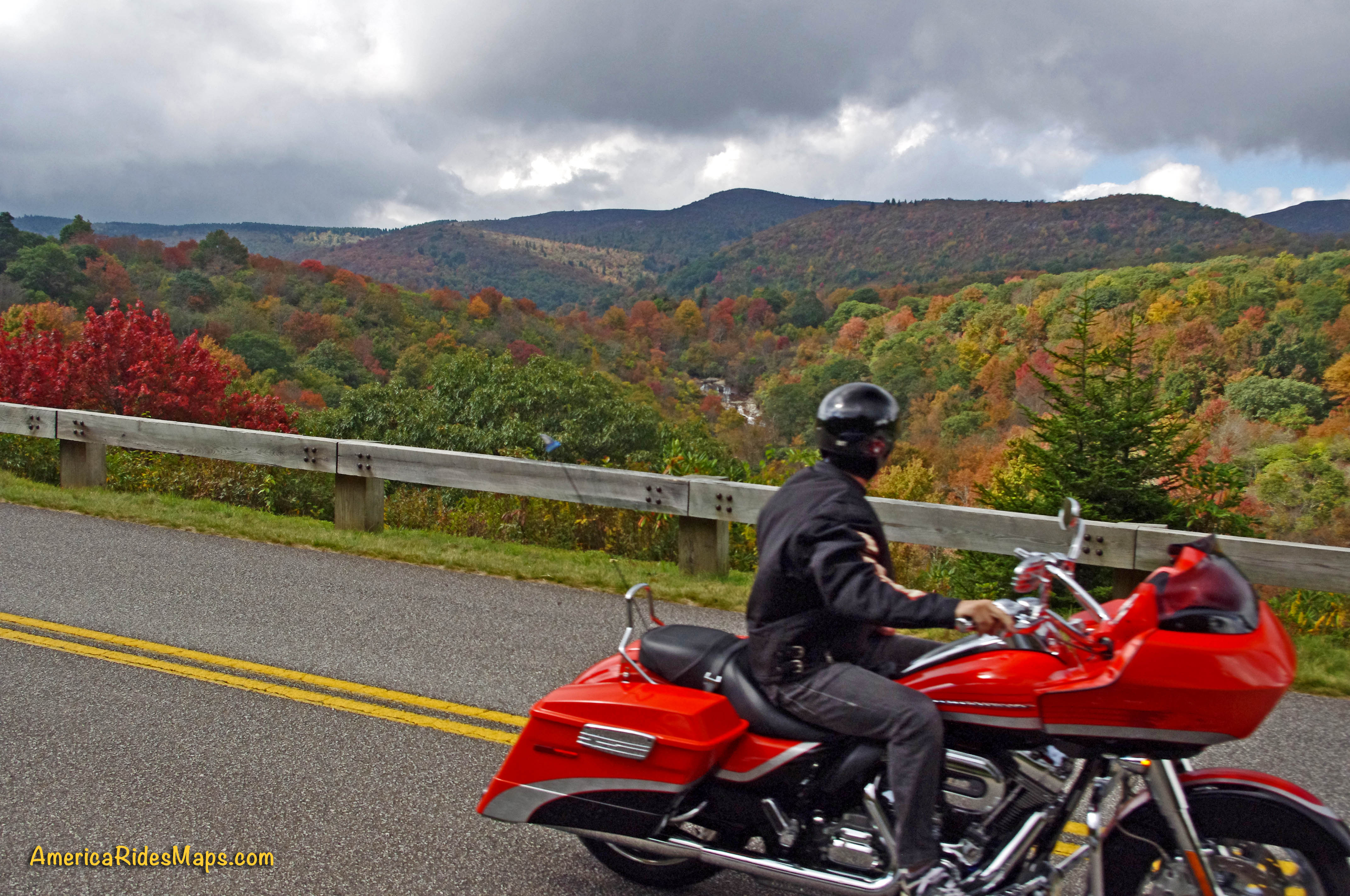
Fall Colors on the Blue Ridge Parkway near Waynesville a couple days ago.
“It’s not too bad” I thought, no need for the long johns or the Gerbings Heated motorcycle riding gear. It would be dry and mostly sunny, I can handle this, no problem. I packed up the morning motorcycle map orders, hit the post office, then I-40 east to Asheville to pick up the Blue Ridge Parkway and head north.
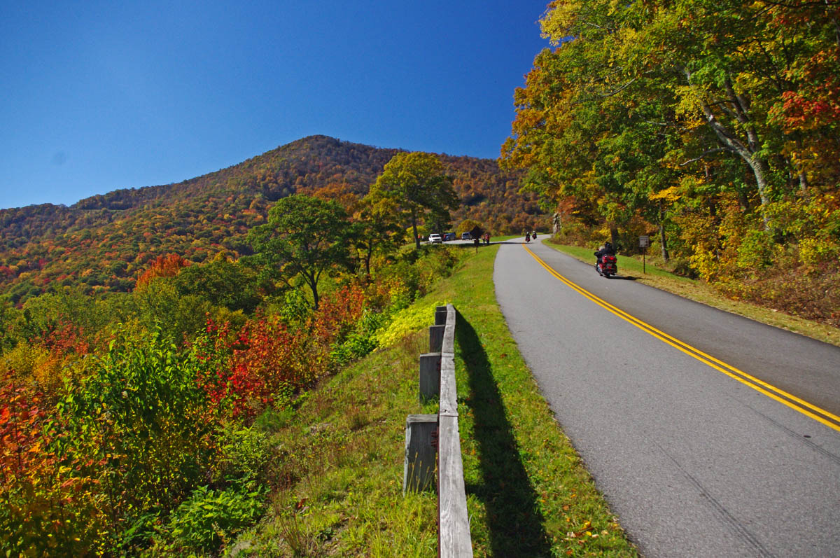
Fall colors near the highest point on the Blue Ridge Parkway from my collection.
I got on the Blue Ridge Parkway at US 74 and started the pleasant ride north. The colors along the Asheville corridor and leading up to Craggy Gardens were spectacular! My goal was the Linn Cove Viaduct at Grandfather Mountain. The plan was to race up there to get some photos, then take my time coming back shooting more along the way as the lighting would be better. It was getting a bit cloudy, so I’d surely get better shots later in the day on the return.

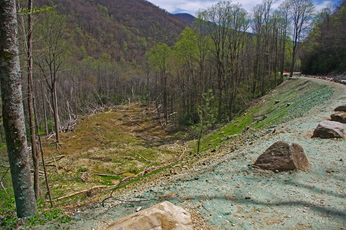
Charlie’s Creek Road – Not only will you find some of the best hidden pockets of leaf color, but you have one of the best rides of your life.
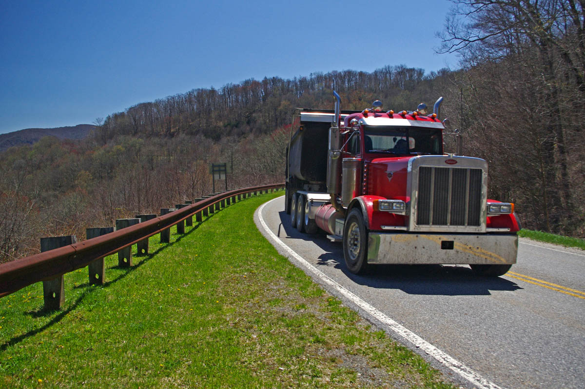
I quickly found myself doddering along behind the light tourist traffic at 25 mph. “Don’t be an asshole” – just enjoy the sights and behave” I told myself. That lasted about 3 minutes before I started darting around the cars. Damn, it was chilly as I approached Craggy Gardens and a light rain started.
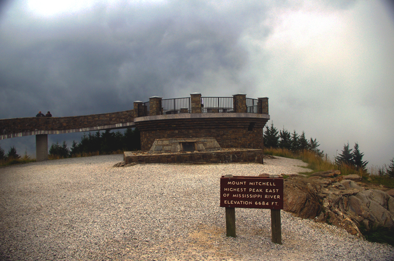
I hit the clouds climbing to Mt. Mitchell, highest peak in the east. “That’s normal”, I told myself, “it’s always cloudy here”, its still early in the day. It was getting cold now, and I saw the first SNOW along the roadside. Wished I’d put on the heated gear. The wind was beyond “blustery” by now.
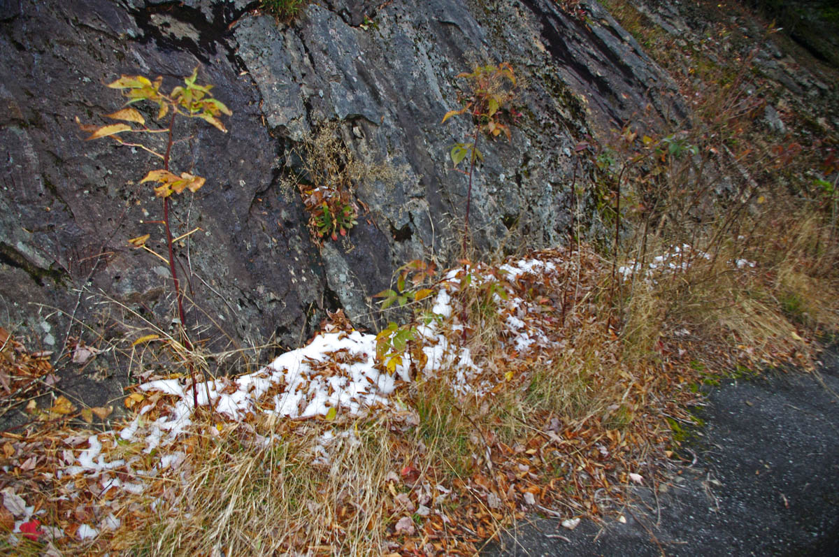
Approaching Mt. Mitchell, I saw the first snow along the roadside.
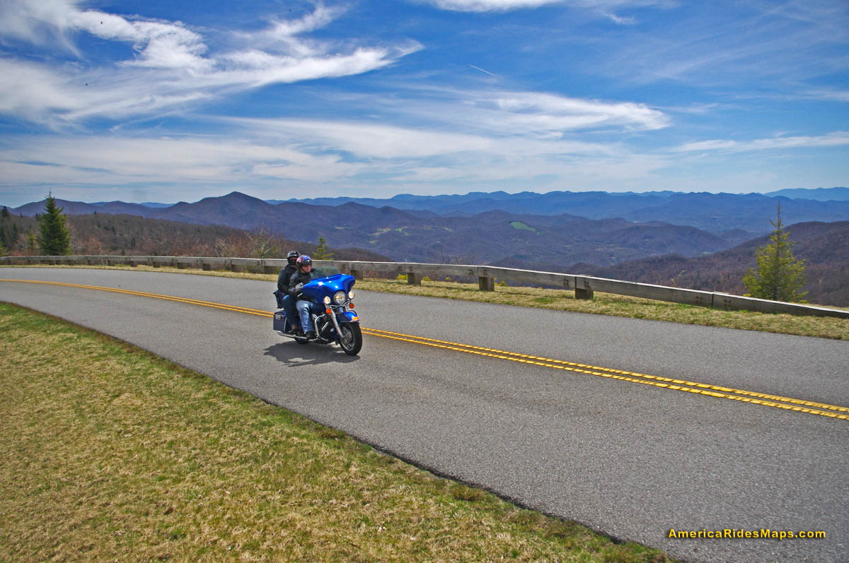
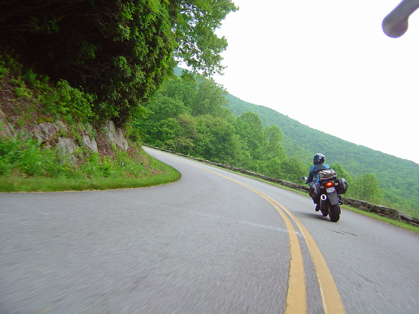
It was another hour and then some to reach Grandfather Mountain. I scrambled up on the rocks for the photo of the Linn Cove Viaduct and shivered violently in the bitter gusty winds waiting for the sun to hit it while a motorcycle was crossing and get the photos I wanted. I never got the perfect shot, but after almost an hour I was shaking so violently I just gave up. It was too cloudy and I recognized the beginnings of hypothermia. It would be a long ride back, and the temperature was dropping.
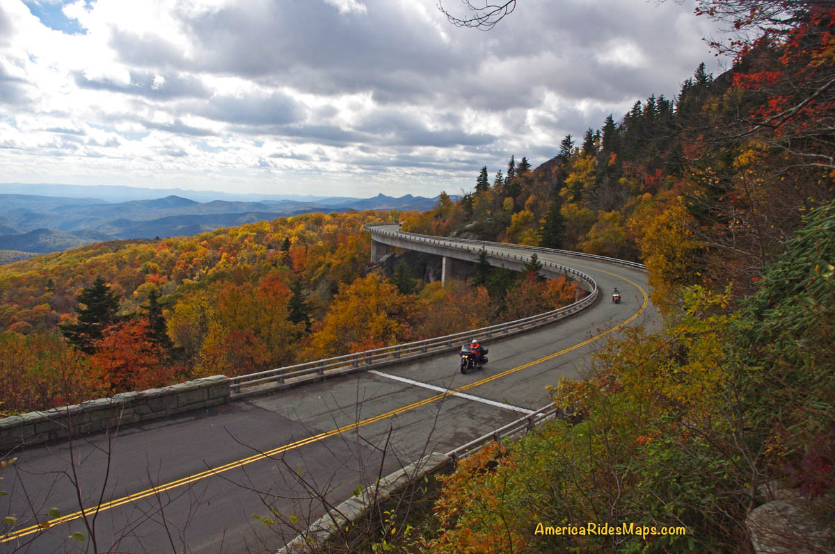
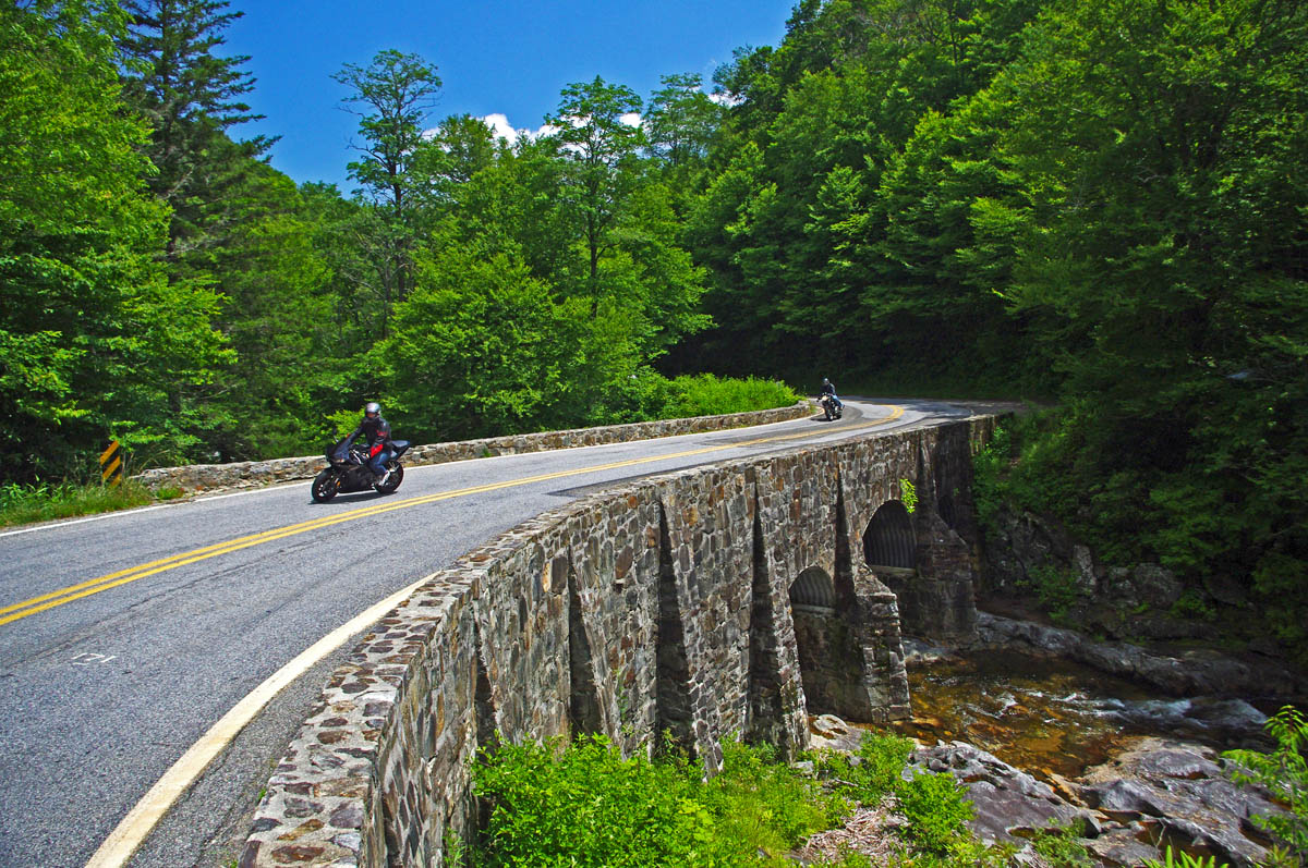
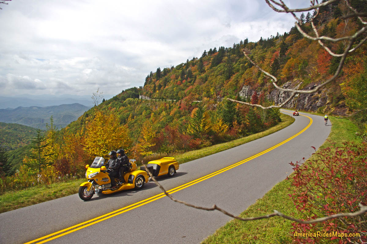
Here’s the best shot I got with motorcycles. Waiting to see one yesterday was like waiting for Bigfoot and his family to come out and pose. The smart riders hunkered down and stayed in.
The fall colors at Grandfather Mountain were unbelievable, though only during the very rare moments when the sun peaked through the heavy cloud cover. It finally just all went gray in the sky above, and I couldn’t stand it any longer. I had to get back.
The wind was wailing now, the rain of leaves horizontal, and the times when the sun poked through the racing clouds were fleeting. I sped through Little Switzerland, trying to relax as my body shook violently from the cold so I could maintain control of the bike at speed. Wheels kicking out on the wet leaves, the tick-tick-tick on the helmet told me the rain had turned to sleet. Breathing as shallow as I could to keep the visor from fogging, I poured on the throttle to get this pain over with as quickly as possible.
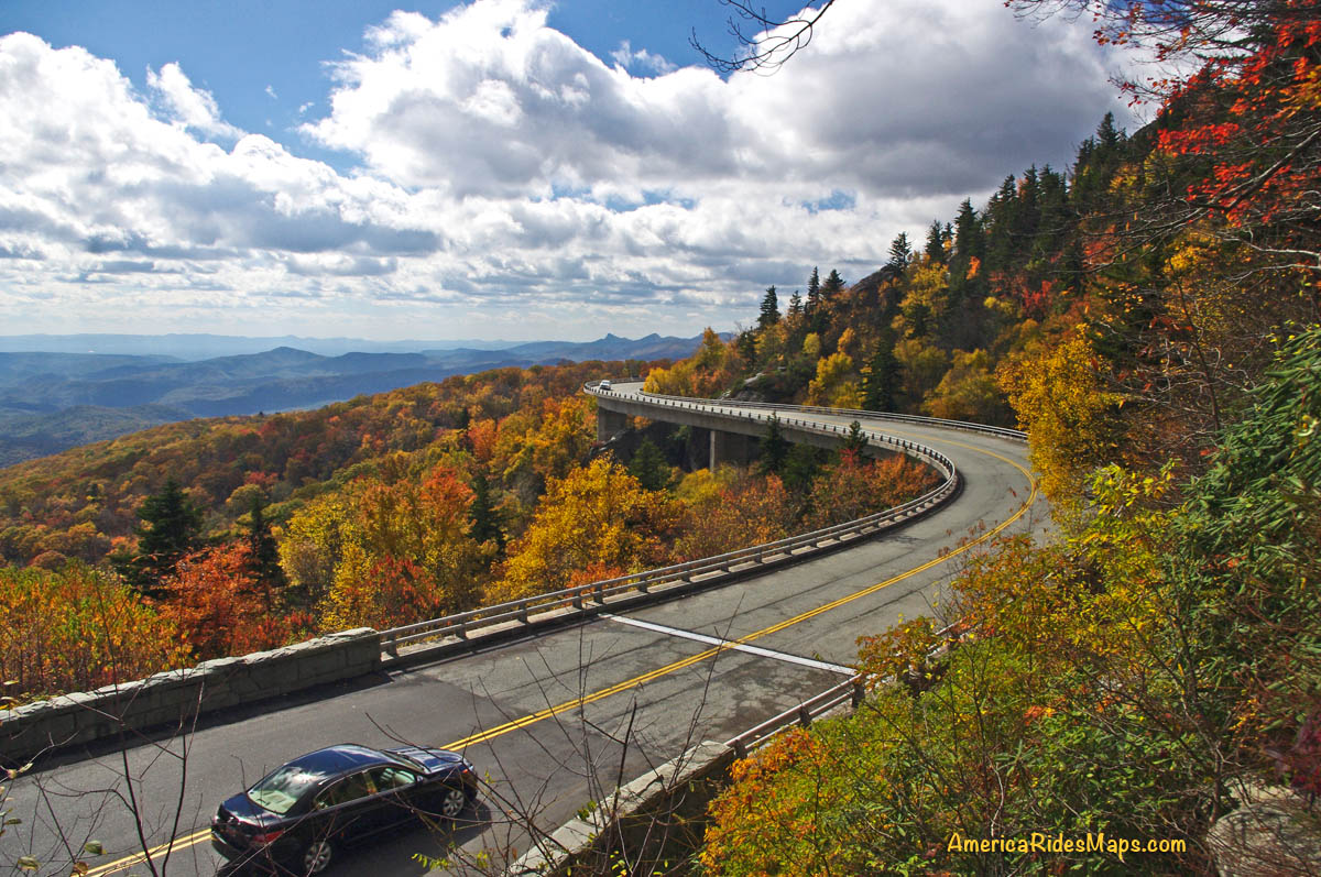
Best shot from the day. It was a long cold wait to get it.
Getting photos had long been dismissed as any priority, it was all about escaping my predicament now. Underdressed, the climb to Mt. Mitchell was brutal, just get it over with. I passed the park and the sleet turned to tiny white flecks – it was snowing.
Coming into Asheville I looked to the west and home. The skies were blue, the sun was shining, it was exactly as the forecast predicted.
Lessons Re-learned:
- It’s always more extreme up on the parkway – colder, wetter, windier. Don’t be fooled sitting on the porch.
- Weather in the mountains varies widely and can change quickly. Check the forecast in several places.
If you enjoy photos of motorcycle riding in the Blue Ridge and Smoky Mountains, like MY BLUE RIDGE MOTORCYCLING FACEBOOK PAGE.
____________________________________________________________________

Wayne Busch
– Wayne Busch lives in Waynesville, NC, where he produces the most detailed and comprehensive and up-to-date motorcycle pocket maps of the Blue Ridge and Smoky Mountains to help you get the most of your vacation experience. See them here – AmericaRidesMaps.com
____________________________________________________________________