About Wayne Busch

Wayne Busch has introduced thousands of motorcyclists to the best two lane mountain roads in the US helping them get the most enjoyment and adventure out of their travels. His easy to use pocket maps focus on the most exciting and memorable rides. Maximize your valuable time and expand your experiences. There are thousands of miles of undiscovered two lane treasures. Wayne searches them out and gathers them in a format that is comprehensive, easy to use, and inexpensive. His maps include the best rides near the Blue Ridge Parkway, North Georgia, the Smokies, West Virginia, and beyond. Wayne has been featured in Western North Carolina Magazine, the Smoky Mountain News, Full Throttle Magazine, and worked with Speed TV / Speed Channel, promoting the great riding found in the mountains. He’s your online resource helping you get the most out of your precious travel time and find what others miss.

Two Waterfalls off the Cherohala Skyway

Motorcycle Riders can visit two nice waterfalls near the Tennessee end of the Cherohala Skyway

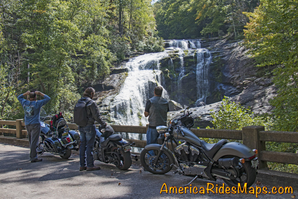
The Cherohala Skyway is one of the best motorcycle rides in the Smoky Mountain area. Bald River Falls is near the Tennessee end of the Skyway. A Forest Service road sign marks the start of River Road which winds upstream to the base of the large waterfall.
Motorcycles at Bald River Falls Most riders find their way to Bald River Falls and get the nice photo from the bridge.  Few know there is another waterfall just a short ride up the road – Baby Falls.

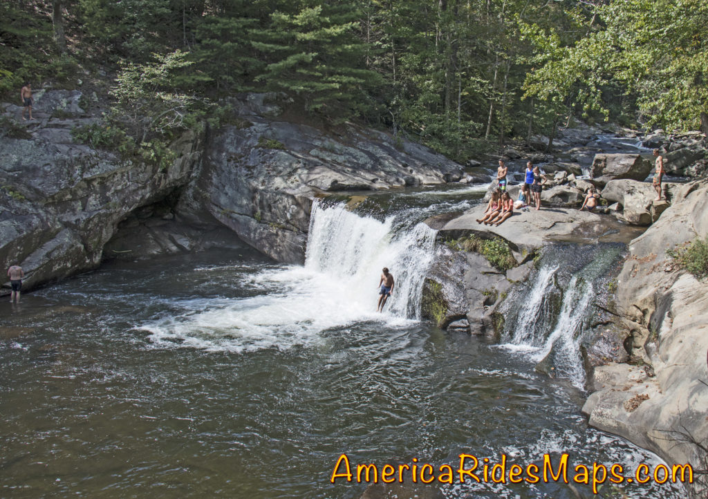
Baby Falls

Baby Falls are smaller but still impressive. You’ll find more parking, picnic tables, bathrooms, and easy access to the falls. It’s a nice spot for a break, better than the roadside parking at the bigger waterfall.

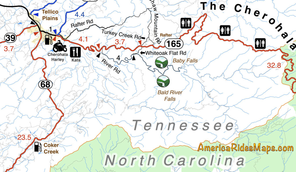
Motorcycle Ride Map Shows Baby Falls

Don’t miss Baby Falls, it’s the better place for riders to take a few minutes break. You’ll find it this area covered on several America Rides Maps.


Wayne BuschAmerica Rides Maps

Wayne Busch searches out the most entertaining roads in the Blue Ridge Mountains then records them on a series of maps which span the Blue Ridge Mountains.

There are more great motorcycle roads in the Blue Ridge and Smoky Mountains than anywhere else. I highlight the best roads then show you the best ways to connect them together into rides. More than a decade of searching has discovered more than 1000 good roads to enjoy. We continue to search so you may enjoy.

Review the maps, order online hereAmericaRidesMaps.com

100 Great Motorcycle Rides in the Smoky Mountains

100 Rides in the Southern Blue Ridge

The Best Motorcycle Rides South of GSMNP

The Best Motorcycle Rides North of GSMNP


A Good Motorcycle Ride – The Road to Nowhere

Road to Nowhere Motorcycle RideA scenic motorcycle ride on an abandoned road in Great Smoky Mountains National Park.

Road to Nowhere Motorcycle Ride Map

Lake View Drive in Great Smoky Mountains National Park was planned to arc around the north shore of Fontana Lake to connect to the southern lake loop road (NC 28) at the Fontana Dam. The project was abandoned about half way through and has come to be known as “The Road to Nowhere”.

Road to Nowhere Motorcycle RideThe road starts in Bryson City, NC as Everett Street. This is a great motorcycle ride to add to your lunch plans, a nice little side trip. There are a lot of good places to eat in Bryson City. One of them, The Cork and Bean, sits at the corner of this route (Everett St. / Main St.) in town.

The road climbs gently from town arcing to the west as Fontana Road. Its a section of gentle flowing curves.

Road to Nowhere Motorcycle RideThere is a sign at the park border. The road gets much tighter and from here on with curve after curve the whole way.

There are a few spots to pull off and get views of the lake.

The road ends at a paved parking loop. A series of brown slats barricade the road beyond.  You can just see the stone arch tunnel where the road ends from the turn-around. Hiking only once through the tunnel.

Road to Nowhere end Motorcycle RideThere are many stories and controversies over this road. Some see it as a boondoggle. The government has yet to compensate for the land. A family cemetery was isolated, the park service periodically ferries them by boat. Regardless, the result is a really curvy ride with some nice views we can enjoy.

It’s 8.5 miles from town to the end of the road, so you can make it a quick out-and-back ride or stop to savor the views and the wildlife. There are other nice roads nearby if you enjoy exploring the more adventurous back roads including some good unpaved roads.

Road to Nowhere Motorcycle RideYou’ll find this road on map #7,Map #8, Map 100 Great Motorcycle Rides in the Smoky Mountains, and others from America Rides Maps. There are more great motorcycle roads in the Blue Ridge Mountains than anywhere else – find them here;

AmericaRidesMaps.com


Wayne BuschAmerica Rides Maps

Wayne Busch searches out the most entertaining roads in the Blue Ridge Mountains then records them on a series of maps which span the Blue Ridge Mountains.

There are more great motorcycle roads in the Blue Ridge and Smoky Mountains than anywhere else. I highlight the best roads then show you the best ways to connect them together into rides. More than a decade of searching has discovered more than 1000 good roads to enjoy. We continue to search so you may enjoy.

Review the maps, order online hereAmericaRidesMaps.com

Dual Sport Ride Map Near the Dragon and Cherohala Skyway

Dual Sport Ride Map Near the Dragon and Cherohala Skyway

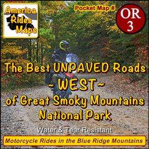
The Best UNPAVED roads WEST of Smoky Park

The Best Unpaved Motorcycle Roads WEST of Great Smoky Mountains National Park is the third motorcycle ride map of the unpaved roads and trails from America Rides Maps.

This new map details the great dual sport rides near the Dragon at Deals Gap, North Carolina, along the long stretch of the Cherohala Skyway, and near Tellico Plains, Tennessee. Enjoy the legendary Tail of the Dragon AND take your adventure bike out in the woods on the same day of great motorcycle rides. ADV Riders will love these detailed maps.

Dual Sport Motorcycle RidesThis motorcycle ride map features the great motorcycle roads found near the Nantahala Gorge, as well as the great riding off road riding around Franklin, North Carolina. Enjoy roadside waterfalls, mountain top views, and miles and miles of superb unpaved riding.

Discover motorcycle rides in the vast wild and scenic areas of the Nantahala and Cherokee National Forests on Forest Roads and accessible trails.

Dual Sport motorcycle rides TNAmerica Rides Maps has also produced dual sport motorcycle ride maps of the great adventure rides east of Great Smoky Mountains National Park and the superb roads near the Blue Ridge Parkway south of Smoky Park. They are sold individually and as a 3 map set.

See this new map and the others here –

http://americaridesmaps.com/products/the-best-unpaved-roads-west-of-smoky-park

Motorcycle Loop ride near Floyd, VA

Motorcycle Loop ride near Floyd, VA

Downtown Floyd, VA

Downtown Floyd, VA

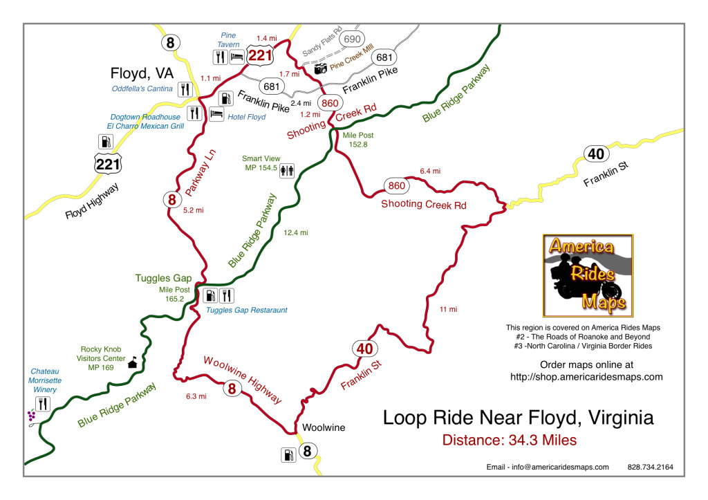
This motorcycle loop ride near Floyd, Virginia intersects the Blue Ridge Parkway at two points. You can do either half (north or south of the parkway) or the whole 34.3 miles.

The small and historic town of Floyd, Virginia is located about 5 miles from the Blue Ridge Parkway, about 160 miles into the 469 mile ride. Noted for it’s celebration of local music, the picturesque shops, and a few very good places to eat and stay, Floyd makes a nice layover on your Blue Ridge Parkway motorcycle tour.

Southern Virginia Countryside

Southern Virginia Countryside

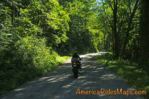
This motorcycle loop ride gives you a nice taste of the variety of great roads found in the southern Virginia region which surround the town of Floyd. Rolling hills, pastoral farms, lazy rivers and streams predominate the landscape. You’ll find both relaxed cruising, tight and twisty climbs, and tiny little back roads sneaking through the hills. It’s an opportunity to slip into town and refuel your bike and belly, or make a spicy diversion off the relaxed riding of the park road.

Shooting Creek Road

Shooting Creek Road

Directions (clockwise):

Starting in downtown Floyd where VA 8 and US 221 cross, follow US 221 north 2.5 miles to reach Shooting Creek Road (VA 860).

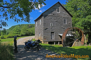
Shooting Creek Road is a tiny back road which leads out through the farmland then into the woods as it traces along the waterway. If you watch for unpaved VA 690 at a sharp curve, you’ll see the Pine Creek Mill, a nice stop for a photo.

Pine Creek Mill

Pine Creek Mill

Shooting Creek Road crosses Franklin Pike then continues south to reach the Blue Ridge Parkway. It is poorly marked at the parkway. Cross the park road and continue south to reach VA 40.

VA 40 has both easy cruising and some very tight curves as it takes you east to Woolwine to meet VA 8.

VA 8 will take you north climbing to reach the Blue Ridge Parkway at Tuggles Gap. You’ll find both easy cruising and some exciting hairpins are you reach the crest. Pass under the parkway and continue back into Floyd.

Motorcycle loop ride map near Floyd, VA

Click for full size

————————————————————————————

wayne busch - Smoky Mountain Motorcycle Rider.com

Wayne Busch

– Wayne Busch lives in Waynesville, NC, where he produces the most detailed, comprehensive, up-to-date motorcycle pocket maps of the Blue Ridge and Smoky Mountains to help you get the most of your vacation experience. See them here – AmericaRidesMaps.com

3 Days on A Race Bike – Enough?

3 days with a Ducati Panigale 1199 - Angeles crest Highway, CA

3 days with a Ducati Panigale 1199 – Angeles crest Highway, CA

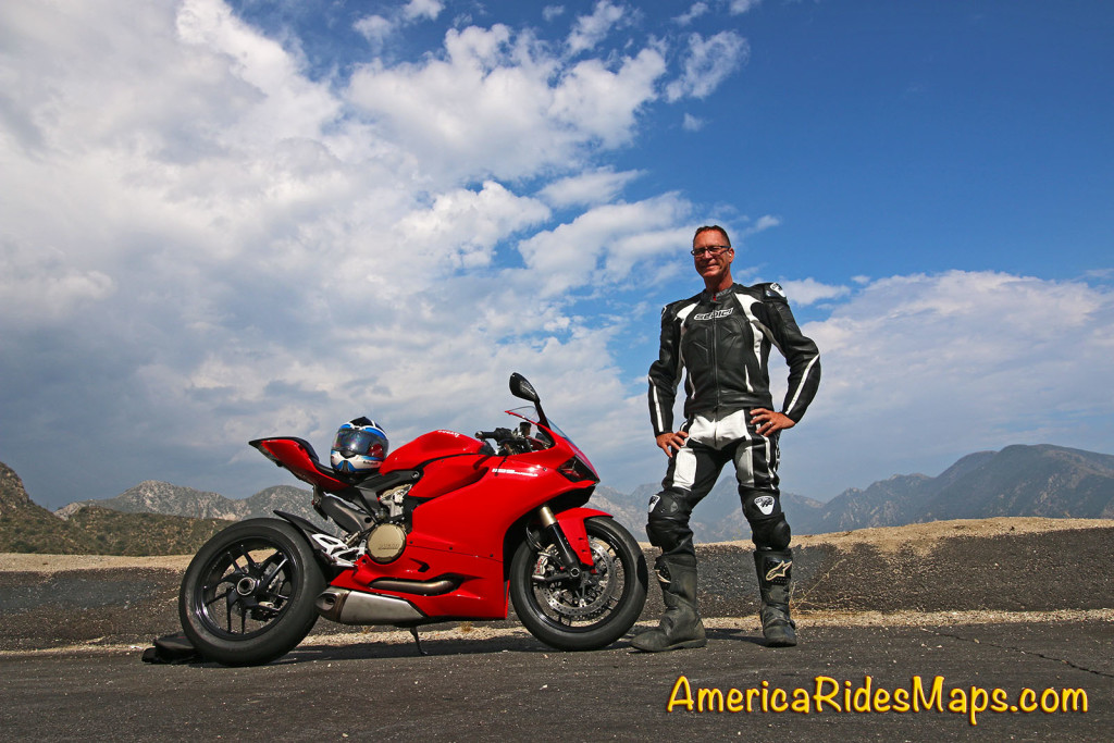
I just spent the better part of 3 days with a Ducati Panigale 1199 in California. It was kind of a bucket list thing, I wanted the experience. Would I buy one? Only if I win the lottery.

The good, bad, and beautiful –

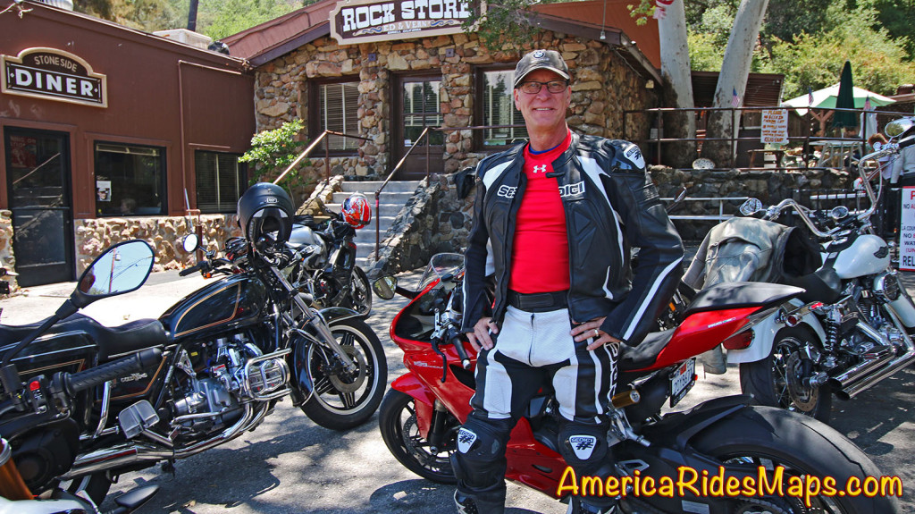
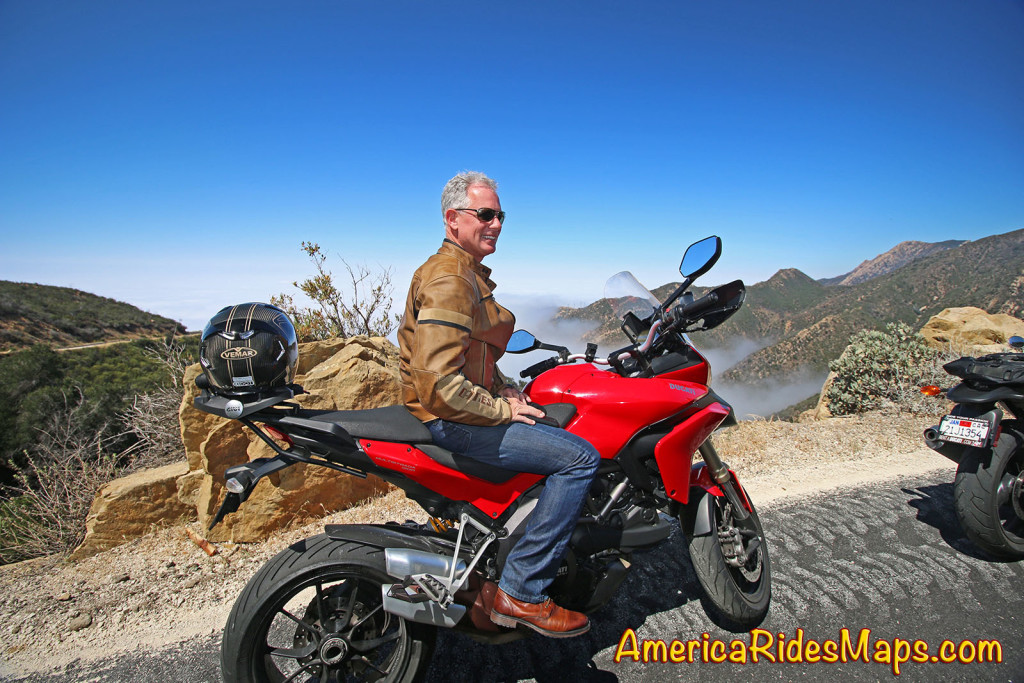
Wayne The Rock Store, Mulholland Highway, CA

Wayne at The Rock Store, Mulholland Highway, CA

It was loud, even with earplugs, but in a way the best rock-and-roll should be loud to be done right. The Ducati sound is so sweet, so iconic, it just seemed the way it’s supposed to be – like the potato-potato of a Harley, it is a musical experience that reaches deep into your soul and makes you feel like Superman. All I could think about was “The cops are gonna hear me coming”.

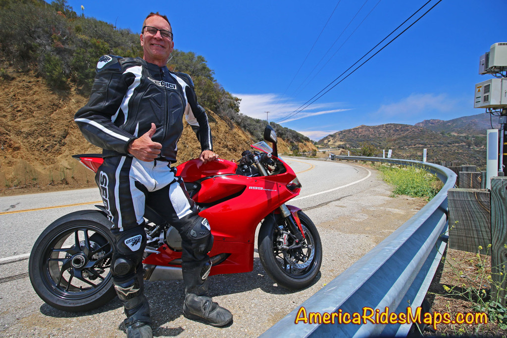
Wayne - Mulholland Highway, CA

Wayne – Mulholland Highway, CA

It was more comfortable than I expected, but stiffer than previous race bikes I’ve been on. The body position is not so extreme it puts too much pressure on your hands, legs are a bit cramped, but overall it did not tire me out, I can ride it for days. The suspension was designed for speeds never attained on the street, ideal for the triple digits, but brutal on a normal road. I once missed a freeway exit as I was chattering so harshly on a rough section I couldn’t read the signs. You must ride like a jockey to see where you’re going if the road gets rough.

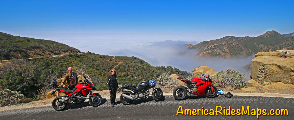
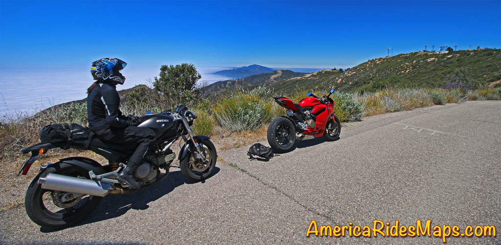
Andy and Jackie on Gibraltar Road, east of Santa Barbara - View of the Pacific fog.

Andy and Jackie on Gibraltar Road, east of Santa Barbara – View of the Pacific fog.

It’s hot as hell if you’re not clipping along at 70 mph+. The heat coming off that highly tuned engine cooks your thighs, butt and all the sensitive spots, especially at low speeds. Combined with a thin hard seat I swear I’m bruised down below. Freeway traffic demands lane-splitting just to keep moving and tolerate the burn.

East Camino Cielo Road - A stop to savor the views

East Camino Cielo Road – A stop to savor the views

It’s not the best canyon carver. This bike is made for the velvet-smooth high speed sweeping turns of a race track. It doesn’t fall into tight turns, you don’t flick it about. It can cut through the tight stuff but you’ve got set up properly and be smooth as glass as it will easily run away from you if you’re not focused. You can get in trouble in a blink on this thing.

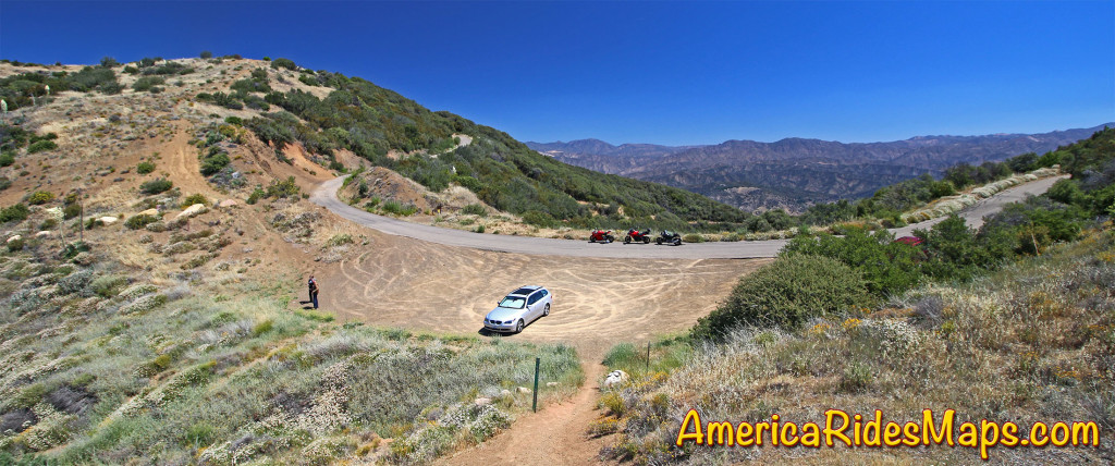
Jackie on E. Camino Cielo Rd - sea fog to the left of the crest, the hot inland to the right.

Jackie on E. Camino Cielo Rd – sea fog to the left of the crest, the hot inland to the right.

Which brings us to the best part – the power seems infinite. It’s always there. More than you need. I never got confident enough to really let it rip – it was ripping at mid range. Hitting the upper revs was insane. With a quick-shifter, keeping the front wheel on the ground in the first 3 gears required gentle use of the throttle even in “Sport Mode”. I never switched to “Race Mode”. Enough was enough. I was suitably impressed.

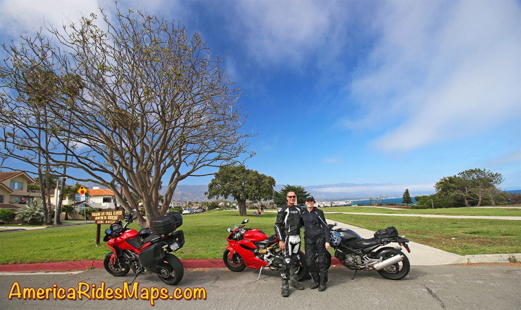
Wayne and Jackie at Cold Springs Tavern

Wayne and Jackie at Cold Springs Tavern

Would I rent one again from RentADucati.com? Maybe. I barely missed getting tickets this time. Coming down off the Angeles Crest Highway (Route 2) at twice the speed limit I made a snap decision to pull off and get a photo just before a trooper rounded the curve ahead of me. I would have been nailed. Coming up behind a car on the Maricopa Highway (Route 33) east of Ojia saved me a second time. My luck and license wouldn’t last with a bike like this. But on rare occasions, maybe I’ll do it one more time!

Wayne and Jackie in Santa Barbara

Wayne and Jackie in Santa Barbara

Special thanks to Andy, our companion, photographer, and a great rider! He made this trip come together.

I can't thank Andy enough for making this trip so outstanding!

I can’t thank Andy enough for making this trip so outstanding!

For more info see –  http://www.rentaducati.com

————————————————————————————

wayne busch - Smoky Mountain Motorcycle Rider.com

Wayne Busch

– Wayne Busch lives in Waynesville, NC, where he produces the most detailed, comprehensive, up-to-date motorcycle pocket maps of the Blue Ridge and Smoky Mountains to help you get the most of your vacation experience. See them here – AmericaRidesMaps.com


Smoky Mountain Waterfalls Motorcycle Ride

Tour more than 1 dozen roadside waterfalls on this long and scenic day ride.
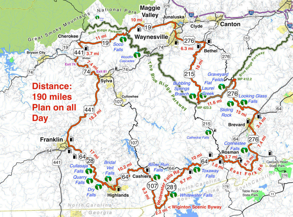
Smoky Mountains Waterfalls Motorcycle Ride

Smoky Mountains Waterfalls Motorcycle Ride – click for large view

Overview: 

Start in Maggie Valley. Follow US 19 west to 441 at Cherokee. Soco Falls on route. Follow US 441 south to Franklin, then US 64 / NC 28 to Highlands. 4 falls along road. Highlands to Cashiers on US 64, then loop south on 107 / 281 to see 2 more. Continue east on US 64, detour south of Brevard then onto US 276 to the Blue Ridge Parkway (3 more) Ride the Parkway to NC 215 then follow it back to US 276 and into Maggie Valley.
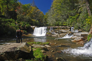
Roadside waterfalls abound for the motorcycle rider

Discover the hidden secrets on your motorcycle travels in the Blue Ridge and Smoky Mountains

Detailed Route:

Distance: 190 miles.

Time: All day ride.

Easy to moderate difficulty

Before you go:

  • Exercise caution! – These are roadside waterfalls, some which are on busy roads with blind curves and limited pull-outs. Pull out with confidence and vigor.
  • Look but don’t touch – Dangerous conditions lurk around waterfalls. Visitors are killed every year. Very slippery rocks. Powerful currents. Deadly drops.
  • Plan on more time – Several waterfalls require short walks to get the views. Allow time for multiple stops and photos.

Route:
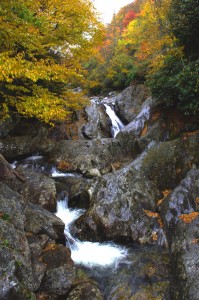
Photo-Bubbling-Springs-Branch-on-NC 215

Easy to find Bubbling Springs Branch is on a sharp curve where it flows under NC 215.

Start in Maggie Valley. Follow US 19 west.

4.1 mi Pass under Blue Ridge Parkway

5.7 miSoco Falls. Gravel pull off on left with small signs. Downhill section of road on a curve. Can’t be seen from road. Path and boardwalk lead to 2 converging waterfalls.

15.2 mi Turn left @ traffic light at casino for shortcut to US 441 south. Junction US 19 and Casino Road.

16 mi Turn left @ traffic light onto US 441 south. Junction Casino Road and US 441.

20.1 mi Follow highway 23/74 east. Junction US 441 and highway 23/74 exit 74.

27.3 mi Follow US 441 south. Junction US 441 and highway 23/74 exit 81..

45.3 mi Exit US 441, follow US 64 / NC 28 east. Junction US 441 and US 64 / NC 28 at Franklin.

54.4 mi – Cullasaja Falls. Visible from road on right. Limited and hazardous parking near guardrail on sharp curve.

57.3 mi Quarry Falls – Visible from road on right. Long paved pulloff on right side of road.

58.2 mi – Dry Falls – Not visible from road. Paved parking on right with signs. Short trail to waterfall. Path continues behind waterfall.

60.8 mi – Bridal Veil Falls – Visible from road on left. Paved pull off. Drive behind the waterfall for a photo.
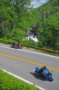
Motorcycles at Cullasaja Falls in North Carolina's "Land of the Waterfalls"

With permission granted, I stand ready to help you have the ride of your life! Just say YES!

63.5 mi Turn left @ traffic light to continue on US 64. Junction US 64 and NC 28 downtown Highlands.

73.7 mi Turn right @ traffic light onto NC 107 south. Junction US 64 and NC 107 in Cashiers.

77.1 miSilver Run Falls – Not visible from road. Poorly marked gravel pull off on left. Trail leads into woods. 1/4 mile walk.

83 mi Turn left onto Wiginton Scenic Byway. Junction Wiginton Scenic Byway and NC 107.

85.2 mi Turn left @ stop sign to head north on NC 281 (Whitewater Falls Road). Junction Wiginton Scenic Byway and NC 281.

87.6 miWhitewater Falls State Park. Not visible from road. $2 fee. 1/4 mile paved walk. Highest waterfall in the east.

94.9 mi Turn right @ stop sign to continue east on US 64. Junction NC 281 and US 64.

97.1Toxaway Falls – Not visible from road. Road crosses dam with waterfall below. Difficult to get a good view. Park at Toxaway Village or along road on dam.

105 mi Turn right @ junction US 64 and US 178 at Rosman.

106 mi Turn right @ traffic light in Rosman, exit town.

107 mi Turn left onto East Fork Road. Junction US 178 (Pickins Highway) and East Fork Road.

110 mi Turn right @ stop sign  to keep on East Fork Road. Junction East Fork Road and Walnut Hollow Road.

119 mi Turn left @ stop sign to go north on US 276 (Greenville Highway). Junction East Fork Road and US 276.

120 miConnestee Falls – Not visible from road. Large sign, trailhead at end of parking lot. Short walk to overlook where 2 waterfalls converge.

126 mi Turn right @ traffic light in Brevard onto US 64. Junction US 276 and US 64.

129 mi Turn left @ traffic light onto US 276 north. Junction US 64 / US 276 / NC 280.

135 miLooking Glass Falls – Visible from road. Large paved parking along road on right. Boardwalk to base of falls.
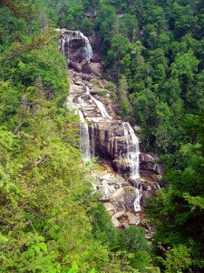
Photo-whitewater-falls-nc

Whitewater Falls, one of the highest in the east.

137 mi – Sliding Rock – Not visible from road. Fee area $2. Paved parking lot. Bathers slide down waterfall.

144 mi Turn right onto parkway ramp. Turn left at the stop sign to head south (towards Cherokee) on the Blue Ridge Parkway. Junction US 276 and Blue Ridge Parkway.

148.5 mi – Graveyard Fields – Not visible from road. 1/3 mile paved walk to top of Second Falls. Trails continue to 2 others.

156 mi Exit Parkway. Turn left (towards Canton) on NC 215. Junction Blue Ridge Parkway and NC 215.

158 mi –  Flat Laurel Creek – Visible from road. Hard to find. Look for 3rd gravel pull out on right on the only straight section of road.

160 miBubbling Springs Branch – Visible from road on left. River plunges beneath the roadway on a hairpin curve. Small unpaved parking are just beyond.

174 mi Turn left @ stop sign to follow US 276 into Waynesville.. Junction NC 215 / US 276.

180 mi Turn right @ traffic light in Waynesvile.. Pass through town.

Junction US 276 and Main Street.

181mi Turn left @ traffic light. Junction Main Street and US 276 (Russ Avenue).

183 mi Turn left @ traffic light to return to Maggie Valley. Junction US 276 and US 19.

————————————————————————————

wayne busch - Smoky Mountain Motorcycle Rider.com

Wayne Busch

– Wayne Busch lives in Waynesville, NC, where he produces the most detailed, comprehensive, up-to-date motorcycle pocket maps of the Blue Ridge and Smoky Mountains to help you get the most of your vacation experience. See them here – AmericaRidesMaps.com
Motorcycle Loop Ride near Hot Springs, NC

French Broad River in Hot Springs, NC

French Broad River

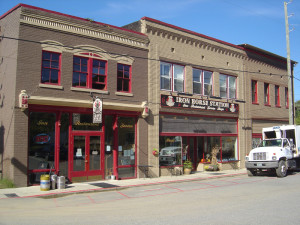
The small historic town of Hot Springs, NC, has long been a familiar pit stop for mountain area motorcycle riders. It is situated north and west of Asheville near the border with Tennessee on the banks of the French Broad River. The town is popular with rafters and hikers, has couple biker friendly places to eat, and there are natural hot springs to soak in at the spa.

Hot Springs, NC

Hot Springs, NC

Motorcycle riders are attracted to this area for the wonderful and tricky two lane back roads which thread through the surrounding mountains. The newfound popularity of NC 209 a.k.a. “The Rattler” as one of the top 10 motorcycle rides in the Blue Ridge Mountains is bringing more motorcycle touring enthusiasts to discover this playground of nice biker roads.

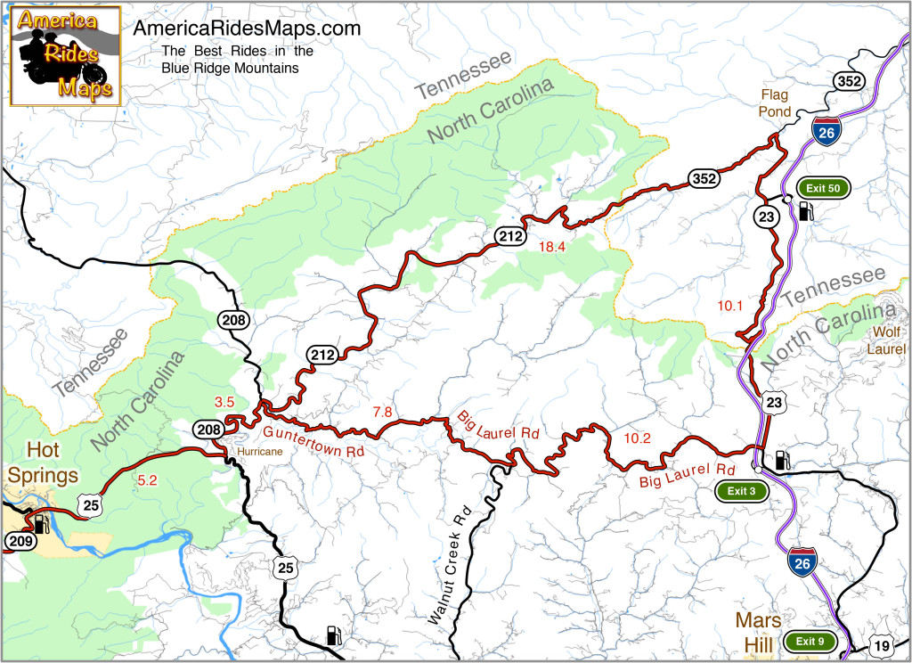
Hot Springs to Flag Pond Motorcycle Ride Map

The map shows a motorcycle loop ride that takes you across the border to Flag Pond, TN., then loops you back to Hot Springs.

  • Leaving Hot Springs, go east on US 25 / 70 making the gentle climb then descent to the junction with NC 208 at Hurricane.
  • Turn north (left) and follow NC 208 along the winding river. As you come to the junction of NC 208 and NC 212 note the small bridge over the creek. Guntertown Road is on the right just before the bridge, NC 212 is at the stop sign once you cross the bridge.
  • The north leg ( NC 212 / TN 352 ) of the triangle shaped motorcycle ride is a pretty nice cruise following along creeks and streams for the most part with a few tricky curves thrown in to keep you on your toes.
  • The east leg ( TN 23 / US 23 ) is pretty relaxed riding, there are a couple passing zones on the long inclines. You’ll want to keep an eye out for the turn onto Big Laurel Road, then hold on for the wild ride back.
  • Big Laurel Road is the south leg of the loop and full of tricky curves. Be alert for scattered debris in a couple of the hairpins around bluff faces. Walnut Creek Road spurs off to the south, be sure you veer in the correct direction when you reach this junction to remain on Big Laurel Road.
  • Guntertown Road leads you east to the small bridge on NC 208. Retrace your path to return to Hot Springs.
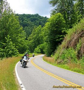
Motorcycles on Big Laurel Road

Big Laurel Road

The roads in this area can be extremely challenging and tight. If you prefer an easier course, the ride to Flag Pond on NC 212 / TN 352 can be done out-and-back. There is a large pull off riders use for a break at the junction of TN 352 & TN 23.

————————————————————————————

wayne busch - Smoky Mountain Motorcycle Rider.com

Wayne Busch

– Wayne Busch lives in Waynesville, NC, where he produces the most detailed, comprehensive, up-to-date motorcycle pocket maps of the Blue Ridge and Smoky Mountains to help you get the most of your vacation experience. See them here – AmericaRidesMaps.com
Motorcycle Awareness Month – The Wrong Way Down

Motorcycle Awareness Month – The Wrong Way Down

A controversial viewpoint that looks at motorcycle safety from the other side of the looking glass

I’m a lifelong motorcyclist. I’m a professional rider, I earn my bread from the seat of my bike. I been a trainer, had training, been all over the country and overseas, led tours, coordinated events and rallies, read the books and every accident study I can get to. I’ve had my share of spills, close calls, and mistakes and I’ve got the scars to remember them by.

May is motorcycle awareness monthMotorcycle Awareness Month doesn’t even make the list of  “commemorative months” on wikipedia and is about as effective as “National Ice Cream Month” (which does make the list) – It’s the wrong approach to the problem of how to be safer riding a motorcycle on our increasing dangerous roads.

Image - Watch out for Motorcycles

False Hope

“Watch our for Bikers” is wishful thinking. It puts the responsibility on someone else – “You need to watch out for me”. Believing that little yellow diamond is going to penetrate the brain of a pony-tailed soccer mom with a minivan full of kids rushing to get to the little  league game is quite a leap of faith. Or that the road warrior salesman is going to suddenly take his mind off his next meeting as he’s fighting his way through the traffic on his way to Des Moines. That the old codger in the Buick with a line of traffic a half mile behind him is going to suddenly wake up and recognize there are other vehicles on the road? That teen is gonna put away the cell phone and start driving the car? Not my experieince. Not the real world. YOU need to watch out for YOU.

Even if you could get through and alert every other driver on the road you’re not going to change the laws of physics. Motorcycles are just plain hard to see because they are the smallest vehicle out on the roads. They are comparatively rare so people don’t expect them. They are easy to lose track of surrounded by so many larger vehicles. Every one of us knows a driver can look right at you and not see you coming. Accept it – you’re virtually invisible to others the road.

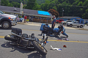
motorcycle-wreck-maggieThe “motorcycle awareness” that will keep you alive longest is the awareness that you are responsible for your own safety on the road. You need to up your riding game. Distracted driving is the leading contributor to accidents on our roadways. The counter strategy is increased awareness on the part of the motorcyclist, not all the other people out on the road. They’re not going to change, you need to change to adapt to the conditions that exist.

We know the most common causes of motorcycle accidents related to other vehicles – car pulls out or turns in front of motorcycle, car changes lanes on highway into motorcycle, car runs into motorcycle stopped at intersection.

The motorcycle awareness we need is to deal with these situations as riders as effectively as possible. This is what happens – expect it and assume it will every time.

  • Ride as if that car IS going to pull out or turn in front of you. Be prepared to react to it. Every car, every time.
  • Constantly be aware of your position to surrounding traffic on the road and don’t ride in blind spots. Don’t assume that car next to you sees you – if he needs to swerve I’ll bet he’d rather hit you than a truck. Move out of the situation. When they crowd in on you get out of the situation as soon as possible.
  • Position yourself to be visible when stopped. Don’t sit right behind a car, move out to create a silhouette that stands out from behind. Keep the bike in gear and have an escape route ready in case you see that car running up on you too fast.

learn-to-ride-safe

The roads are getting more crowded and more dangerous. There are new challenges to face. People are just going to keep doing what they’re doing, they are not going to change. If you want to be safer, take your safety in your own hands – the others are too busy to bother.

————————————————————————————

wayne busch - Smoky Mountain Motorcycle Rider.com

Wayne Busch

– Wayne Busch lives in Waynesville, NC, where he produces the most detailed and comprehensive and up-to-date motorcycle pocket maps of the Blue Ridge and Smoky Mountains to help you get the most of your vacation experience. See them here – AmericaRidesMaps.com

Motorcycle Friendly – Still Mountain Restaurant, Hot Springs, NC

Motorcycle Friendly – Still Mountain Restaurant, Hot Springs, NC

UPDATE – This Restaurant has closed.

On a classic “lunch run” ride here’s one option for the lunch stop.

Still Mountain Restaurant, Hot Springs

Motorcycle friendly Still Mountain Restaurant, Hot Springs, NC.

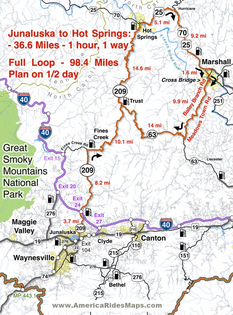
One of the nicest motorcycle rides you’ll do in the Smoky Mountain area of North Carolina and Tennessee is NC 209, a.k.a “The Rattler”. This 30+ mile ride through the mountains and valleys of North Carolina runs from Junaluska (Maggie Valley, Waynesville) to Hot Springs. Scenic, challenging, historic, it makes for a nice “lunch run” as an out-and-back ride or the first leg of numerous loop rides you can build with other great connecting roads.

Motorcycle Friendly Still Mountain Restaurant

Motorcycle Friendly Still Mountain Restaurant – you can’t miss it in tiny Hot Springs.

Hot Springs is one of the many historic little mountain towns that dot the landscape. Once  an important stop on the Knoxville, TN to Asheville, NC corridor, it is mostly forgotten now that the Interstate bypasses it to the west. It’s a pass-through town on the Appalachian Trail, a popular place for whitewater rafting, and there are natural hot springs where you can go soak your keister for a few bucks. On weekends, it’s a gathering spot for the bikers who flock to ride the outstanding motorcycle roads in the surrounding region.

Motorcycle Friendly Still Mountain Restaurant

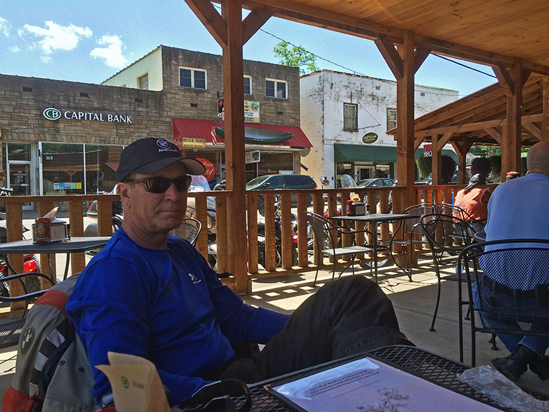
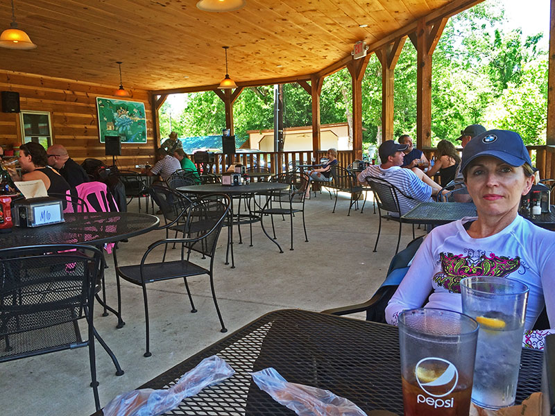
Motorcycle Friendly Still Mountain Restaurant – a big comfortable porch, tasty food, and live music on this day.

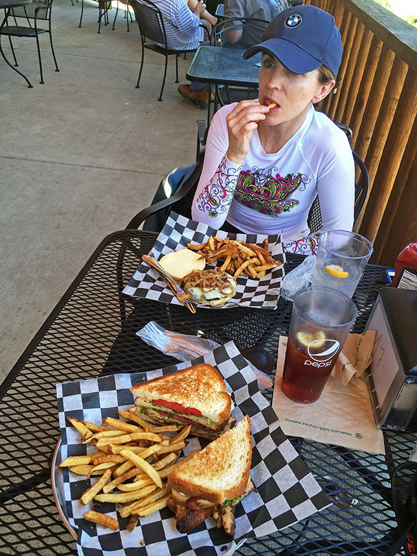
Comfortable, easy to find, and with tasty food, the Still Mountain Restaurant is usually full of bikers though the occasional Appalachian Trail hiker drops in for some civilized fare on their 1500 mile walk in the wilds. You’ll feel right at home here.

Biker Friendly Still Mountain Restaurant

Biker Friendly Still Mountain Restaurant – Thumbs up!

You’ll find NC 209 and another 50+ great rides in the area on America Rides Motorcycle Pocket maps #6 as well as the 100 Great Motorcycle Rides in the Smoky Mountains.

Great Motorcycle Rides in North Carolina - NC 209, a.k.a. "The Rattler".

Great Motorcycle Rides in North Carolina – NC 209, a.k.a. “The Rattler”. Do it as an out-and-back or make a nice loop ride – one of many ways to go on this great biker road

More Rattler info here

————————————————————————————

wayne busch - Smoky Mountain Motorcycle Rider.com

Wayne Busch

– Wayne Busch lives in Waynesville, NC, where he produces the most detailed and comprehensive and up-to-date motorcycle pocket maps of the Blue Ridge and Smoky Mountains to help you get the most of your vacation experience. See them here – AmericaRidesMaps.com

Best 1000 Mile Motorcycle Ride You’ll Ever Do

If you’re looking for that epic ride this is one of the best ever!

Motorcycles at overlook in Smoky Park

Enjoy an overlook in Great Smoky Mountains National Park

When you link these mountain roads together you’ll spend almost all your time on 2 lane roads, most of it National Parks or on scenic parkways, and you’ll experience some of the best motorcycle rides in the USA.

Skyline Drive – 105 Miles
The Skyline Drive runs the crest of Shenandoah National Park in Virginia. It starts at Front Royal and runs seamlessly into the Blue Ridge Parkway

Blue Ridge Parkway – 469 Miles

Blue Ridge Parkway View

Blue Ridge Parkway in NC

The Blue Ridge Parkway follows the highest ridge lines of the Blue Ridge Mountains through Virginia and North Carolina. It ends at Great Smoky Mountains National Park.

Great Smoky Mountains National Park – 47 Miles
The most visited National Park in the nation, ride across on US 441 passing from North Carolina into Tennessee at the crest, then turn west on Little River Road. Follow through to the Foothills Parkway.

Foothills Parkway – 17 Miles
Continue west on the scenic Foothills Parkway to reach US 129

The Dragon – 15 Miles

Springtime motorcycle ride on the Cherohala Skyway

The Cherohala Skyway in TN

Turn south on US 129 to enter the Dragon. Pass through and back into North Carolina. Continue south to Robbinsville, NC to head west again on the Cherohala Skyway.

The Cherohala Skyway – 52 Miles
Climb back up into the mountains and return to Tennessee near the mid-point of the ride. Turn south on 68 when you reach Tellico Palins, TN and follow this wonderful road into Georgia.

GA 60 – 23 Miles
Work your way east on GA 60 to Blue Ridge, GA, then continue on one of Georgia’s best motorcycle roads.

The Gauntlet – 133 Miles

Georgia

The Gauntlet ride in GA

Wrap it all up with a loop around the Gauntlet. You may continue on GA 60 or veer north on Skeenah Gap Road to start the loop.

Of course, this is just an overview. It’s a great introduction to riding in the Blue Ridge Mountains, still it only scratches the surface. It’s pretty straightforward to navigate, but you’ll want to do some planning. There are many variations and additions to make it even better.

9 map setYou’ll find this region covered in detail with America Rides Maps. In addition to these well known roads, almost 500 more are highlighted on a series of easy-to-read durable maps that will fit in your pocket with the info you depend on like out-of-the-way gas stations, mileage, and how to best link them all together.

The are more great motorcycle rides in the Blue Ridge Mountains than anywhere else. Any one of America Rides Motorcycle pocket ride maps is a vacation adventure in itself. With the full set you’ll have the freedom to point your wheels in any direction and know you’re on the best rides. Take a look here and see how easy it is – http://shop.americaridesmaps.com/Full-Southeast-Package-All-9-Maps-SE9.htm

————————————————————————————

wayne busch - Smoky Mountain Motorcycle Rider.com

Wayne Busch

– Wayne Busch lives in Waynesville, NC, where he produces the most detailed and comprehensive and up-to-date motorcycle pocket maps of the Blue Ridge and Smoky Mountains to help you get the most of your vacation experience. See them here – AmericaRidesMaps.com