The Birthplace of Tennessee – Best Seen on a Motorcycle

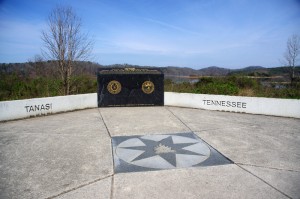
Photo - marble campfire

Who knows where this is?

It was the middle of nowhere yet it was the center of everything. I’d stumbled upon the birthplace of Tennessee.

I had low expectations. My research told me most of the roads I’d be riding today would hold little interest to the typical motorcycle rider who had come to ride The Dragon at Deals Gap and the Cherohala Skyway. None of the roads I’d ride on my 450+ mile travels would come anywhere close to those legends. Still, the morning held a surprise I never expected and made the efforts worthwhile.
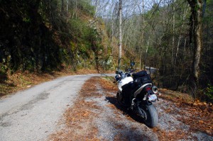
Photo - Cherokee National Forest Road

Parked along Pleasant Mountain Road. It's typical of other roads nearby - of little interest to most. Still I check them all.

Arriving in Tellico Plains, Tennessee, after an early morning motorcycle ride where I’d had the whole of the Cherohala Skyway to myself, I pointed my wheel north onto TN 360 and my workday began. Within a few miles I’d reach the point where I’d previously abandoned my search for great motorcycle rides and the explorations would resume. Rounding a curve a green street sign flashed past with a name I recognized and I clamped on the brakes to swing around.

I could rule this road out as soon as I saw it, it was doubtful it would be of any interest. Consulting my map, I saw it connected to another I wanted to investigate, so I snicked into first gear determined to make quick work of White Plains Road and move on.

Photo - Tanasi Monument

The Tansi Monument - Tennessee gets it's name from here

It met Smoky Branch Road in a few miles where they both intersected Citico Road. I’d eventually loop back through Smoky Branch Road, also of little interest. Obviously Citico Road was the daddy in this area, the main thoroughfare of better quality, decent pavement, and sporting a faded double yellow line, a proper road.

I expected it would quickly peter out, but after several miles it continued to wind and snake through the mostly bland countryside and I started to wonder if it actually went somewhere in the big empty white space on the map. Curiosity aroused, I couldn’t resist investigating the Tanasi Memorial Site when the sign appeared.

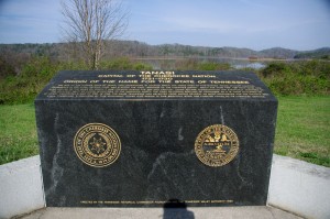
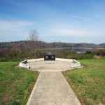
Photo - Tanasi Monument

The empty and isolated setting quickly fills with visions of what must have been

Never heard of it. Turning the motorcycle onto Bacon Ferry Road I ventured out into the nothingness on the barely paved bumpy and potholed  single lane that led out onto a low finger of land surrounded by Tellico Lake. I rode past the pull-off, but a quick glance towards the lake had me circling back when I saw the shoreside monument.

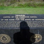
Photo - Tanasi inscription

Inscription transcribed below

Tanasi

Capital of the Cherokee Nation

1721-1730

Origin of the Name for the State of Tennessee

The site of the former town of Tanasi, now underwater, is located about 300 yards west of this marker. Tanasi attained political prominence in 1721 when its civil chief was elected the first “Emperor of the Cherokee Nation”. About the same time, the town name was also applied to the river on which it was located. During the mid 18th century, Tansi became overshadowed and eventually absorbed by the adjacent town of Chota, which was to the immediate north. The first recorded spelling of Tennessee as it is today occured on Henry Timberlakes map of 1762. In 1796, the name Tennessee was selected from among several as most appropriate for the nation’s 16th state. Therfore, symbolized by this monument, those who reside in this beautiful state are forever linked to its Cherokee heritage.

Pho

Cherokee Tanasi to Tennessee - State. A heritage preserved and honored.

I don’t much adhere to theories of “vortexes” or spirituality, but there’s something about this site that is powerful enough to make it worth a visit, it will be on the new map. It’s worth the ride out to it. See it if you have the chance.

_______________________________________________________________________________

Wayne Busch
Wayne Busch – Cartographer
– Wayne Busch lives in Waynesville, NC, where he produces the most detailed and comprehensive and up-to-date motorcycle pocket maps of the Blue Ridge and Smoky Mountains to help you get the most of your vacation experience. See them here – AmericaRidesMaps.com 
Smoky Mountain Motorcycles Everywhere with Spring Like Weather

Motorcycles were everywhere in the Smoky Mountains this weekend with the arrival of spring-like weather. Temperatures in the 60’s were a welcome relief from this unusually harsh and snowy winter that hasn’t given us motorcycle riders much of a break since November.

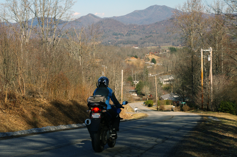
Photo-Jackie-enjoys-smoky-mountains-view-on-motorcycle

On a back road near the border of Great Smoky Mountains National Park. Looking north towards Tennessee.

Though snow still lingered in many places, few could resist the urge to fire up the bike and get out to enjoy the fabulous mountain motorcycle riding near Great Smoky Mountains National Park. The Blue Ridge Parkway remains closed for the season but that’s of little consequence to motorcycle riders here who enjoy a wealth of two lane back roads that stretch to every horizon.

Photo-Jackie-rides-her-motorcycle-near-Great-Smoky-Mountains-National-Park

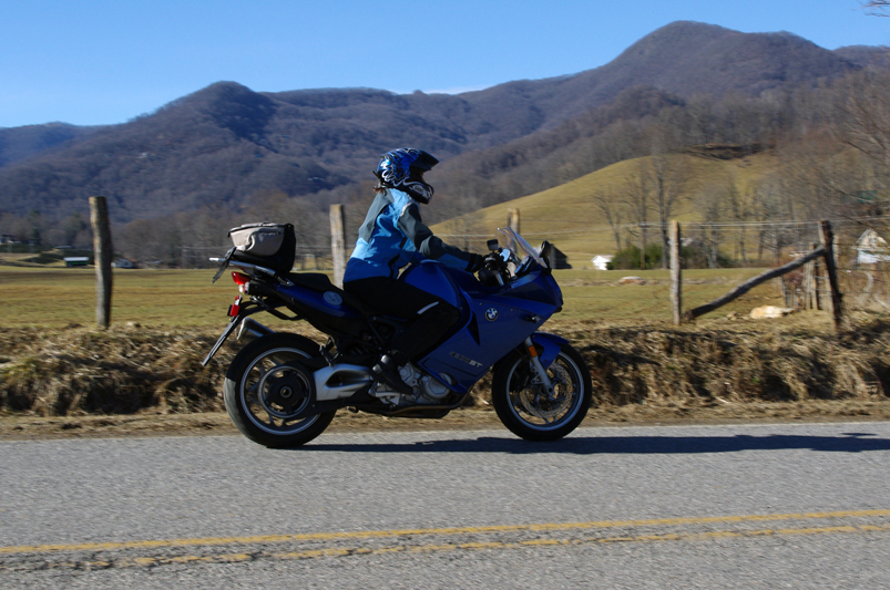
Jackie rides by with Purchase Knob in Great Smoky Mountains National Park in the background. She loves her BMW F800 ST.

It’s about time we had a break in the weather (hope you did too). In a normal winter (is there such a thing anymore?) the cold spells are broken up by these warm ones and year round riding is pursued by many happy motorcycle enthusiasts throughout the Blue Ridge Mountains.

Photo-Jackie-rides-her-motorcycle-near-Great-Smoky-Mountains-National-Park

Clear blue skies and warm winter sunshine had motorcyclists out on all the back roads.

We shot more video for the NC 215 Winter Project but mostly we just made the best of this nice break. We played around on roads through Canton, Bethel, Maggie Valley, made some loops out into the Pisgah National Forest, and went into Waynesville for lunch. It was packed with people in T-shirts enjoying the great food and shopping Waynesville’s historic and quaint downtown is known for.


NC 215 – A Great North Carolina Motorcycle Ride (teaser)

Sure there will be more cold weather to come before spring. I’m hoping things will get back to normal and we’ll have more great days of riding like these. This was great!

_______________________________________________________________________________

Wayne Busch
Wayne Busch – Cartographer
– Wayne Busch lives in Waynesville, NC, where he produces the most detailed and comprehensive and up-to-date motorcycle pocket maps of the Blue Ridge and Smoky Mountains to help you get the most of your vacation experience. See them here – AmericaRidesMaps.com 
New Deals Gap Motorcycle Map Nears Completion – Your Chance For Input

Photo - Smoky Mountain Rider and BMW Girl at the Tail of the Dragon

Smoky Mountain Rider and BMW Girl at the Dragon

Having completed a series of motorcycle ride maps covering the full scope of the Blue Ridge Parkway from end to end describing more than 3000 miles of the most outstanding motorcycle rides along its entire length, I’ve now been commissioned to produce the ultimate and best map available for the motorcycle rider planning a motorcycle vacation trip to Deals Gap, home of the infamous “Dragon” motorcycle ride.

Due to the success of the Blue Ridge Parkway motorcycle ride maps as well as others which expand the areas covered into Georgia and South Carolina, I invested in new hardware and software to take America Rides Maps to the next level. This new Deals Gap map will be the first to take full advantage of the improvements and I am impressed with the output to date.

Maintaining the handy pocket map size which makes the maps easy to use and conveniently accessible, as well as the most affordable motorcycle ride maps available at the ridiculously low price of $5 each, this latest America Rides map will guide the Dragon rider to a dozen or more additional great motorcycle rides in the surrounding area including the best section of the Blue Ridge Parkway, as well as the most notable rides in the Smoky Mountains of Tennessee and North Carolina and touching on north Georgia and South Carolina.

The scope of the map covers the largest area yet tackled to include approach routes to Deals Gap from all points of the compass making navigation to reach the Dragon easy. Once there, it leads you to enough additional good motorcycle rides to fill a week of vacation time or more. The back side of the map will describe the various routes as well as give details about riding them.

image-raw-map

The Ultimate Deals Gap Map Nears Completion

As I wrap this project up, now is the time for your input as to which features are most important to you. I typically include out of the way reliable gas stations, notable attractions, and a handful of selected eateries, campgrounds, and motorcycle dealers and repair shops. Unlike my other maps which are only available online, this Deals Gap map will be provided by vendors in the area. As such, the frequent updates I normally provide to the maps will not be as easy to accomplish and I want to get this first edition as complete as possible as once maps are distributed they will not be updated as frequently.

Send your suggestions to info@americaridesmaps.com . If your suggestion is incorporated into this new map, I’ll send you a copy in appreciation. It should be wrapped up in about a week, so if you’ve got a great idea shoot it to me immediately. I’ve got to get this done, the open road beckons and I’m itching to get away from my office and ride.

What’s The Best Section of the Blue Ridge Parkway?

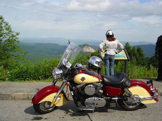
Photo - Admiring the view from the Looking Glass Rock overlook

Photo - Admiring the view from the Looking Glass Rock overlook

Easy question. It’s in North Carolina. I can almost see it from my window. I moved here to be close to it and enjoy it on my motorcycle. I know every twist and bump. The best section of the Blue Ridge Parkway with the best ride runs south from Asheville to Soco Gap near motorcycle friendly Maggie Valley.

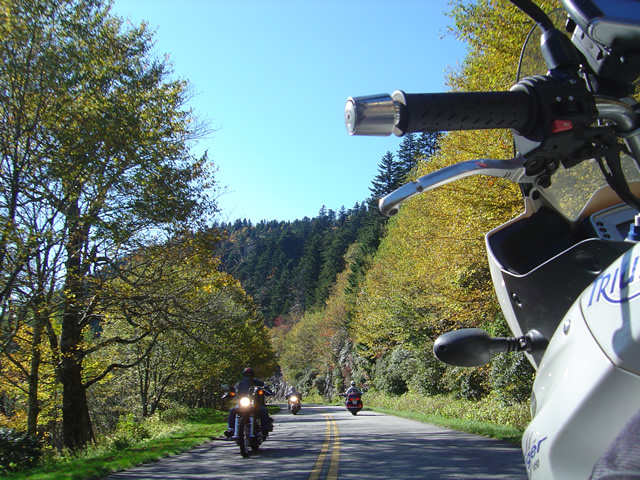
Photo - As falls comes so do the bikes

Photo - As falls comes so do the bikes on the Blue Ridge Parkway

Why is it the best? It’s the highest and most scenic section. There are more great pull-outs here than any other stretch. Most of it is above 5000 feet. It has everything motorcycle riders come for. Waterfalls, impressive rock formations, winding tunnels, pristine wilderness, vast stretches of rolling mountains on every horizon, and one of the best places to eat on the parkway, the Pisgah Inn. When I used to run  motorcycle tours through this section I‘d always figure about 4 hours to hit the highlights and sometimes it was a tight schedule. If you see only one section of the Blue Ridge Parkway, this should be it.

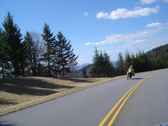
Photo - Early in the spring traffic is light and skies are clear

Early in the spring traffic is light and skies are clear on the Blue Ridge Parkway

Make this one of your prime destinations on your motorcycle vacation, but don’t limit yourself to the parkway while you’re here. You could spend weeks riding the fabulous roads which snake through the Smoky Mountains you see from those overlooks. They are packed with more waterfalls, scenery that will fill your camera, and some of the most challenging motorcycle roads you’ll ever ride.

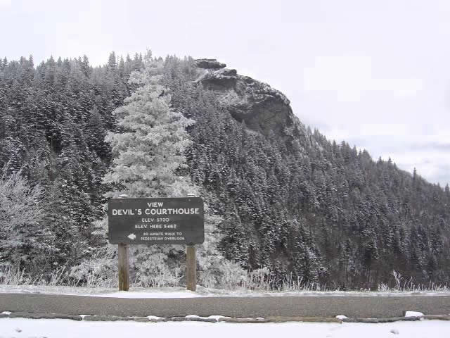
Photo - Devil's Courthouse snow covered in Winter

Spectacular Devil's Courthouse snow covered in winter

Impressive any time of year, I never take this section of the Blue Ridge Parkway for granted and visit almost every week. It never disappoints. It one of the most scenic motorcycle rides anywhere.