Colorado Mtn vs. Blue Ridge Mtn Motorcycle Rides

Photo-Denver

We based out of Denver. We spent the first afternoon in the city.

After almost 1000 miles in central California and nearly 850 miles in the beautiful mountains of Colorado I still say with confidence “There are more great motorcycle rides in the Blue Ridge & Smoky Mountains then anywhere else”.

I’ve been riding some fantastic scenic and challenging roads. I’ve loved every minute of it. I’d do it all over again (and probably will). There are some awesome motorcycle rides out there.

Still, when you compare them region by region based on quality, quantity, and concentration, I’ve yet to find anywhere that comes close to the great motorcycle rides in the mountains of the southeast.

Photo-Independence-Pass

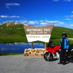
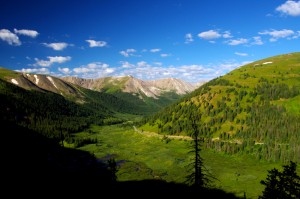
Independence Pass - the best portion of the 150+ miles between Leadville and Aspen

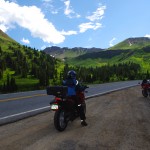
Fond memories of this Colorado trip are many. Were I to pick the most outstanding of them I’ve experienced I’d have to steer you first to Independence Pass which runs between Leadville and Aspen. It was so good I talked my partners into riding it twice.

Independence Pass is a good long motorcycle ride, 30 – 35 miles. The climb from one side of the divide to the other reaches over 12000 feet in elevation, twice the height you’ll find in the Smokies. Heck, in most cases you’re already higher than the Smoky Mountains from wherever you start a Colorado mountain motorcycle ride.

However, those extreme altitudes come with blessings and costs.

Photo-independence-pass

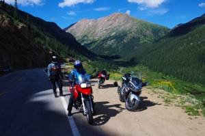
One of the most dramatic landscapes and toughest rides - Independence Pass

The blessings are many. One of the first things I noted was how clear the Rocky Mountain air is. Accustomed to the blue hazy skies that give the Smoky Mountains their name, the crisp Colorado air is like getting a new pair of glasses – you’re suddenly amazed at how much sharper and vibrant the world appears.

When you’re atop such lofty heights, that clear dry air and deep blue Colorado skies brings a sharp contrast and definition to every vista. I kept thinking it’s impossible to take a bad picture in the mountains of Colorado, it’s so dramatic!

Photo-trail-ridge-road

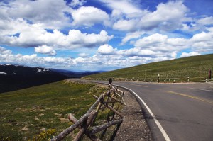
A break on one of the highest paved roads in the nation - Trail Ridge Road in Rocky Mountains National Park

Those high elevations also provide such commanding views, I’m sure you can see more than 100 miles from some points.

The landscape is dramatic. Imposing at times, stark at others, it’s a land of harsh extremes of searing heat and brutal winters, desolate isolation and hardscrabble existence.

Riding a motorcycle through such a rugged landscape at those elevations though, comes with a price.

The higher you go, the worse the road conditions get. Patches of snow in August hint at how harsh the conditions are. These roads are isolated and remote, and the season for repairs is short. You’re in for some rugged riding and a challenge to tackle at speed on a motorcycle.
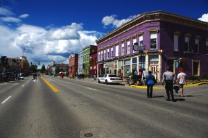
Phot0-Leadville

Leadville, CO - elevation 10,200 ft. It might have been the capitol of Colorado had the silver lasted.

The massive scale of the great mountains add to the challenge. Riding a narrow twisty bumpy dirty road with no guardrail and a sheer drop off the edge can be intimidating. Jackie spent the harrowing parts riding in the wrong lane if it hugged the cliff face.

All of the high roads are gated. They are closed to traffic most of the year as they are impassable. The season to enjoy them is short, and you won’t be the only one taking advantage of the narrow window of opportunity. Plan on running into local and tourist traffic, especially on weekends.

photo-trail-ridge-rd

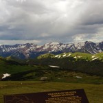
Trail Ridge Road view nearly 12,000 ft. up.

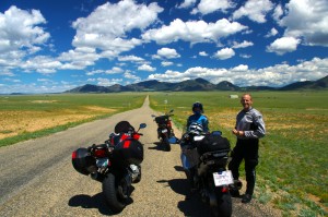
Like in California, these mountain passes stand in isolation. It’s a vast landscape and the distance between roads is just as vast. You’ll spend as much time or more on long straight flat runs across the open prairie getting to the next great motorcycle ride.

I can appreciate the beauty of the high desert, the loneliness of the historic small towns,  the weathered remnants of a cowboy / miner history that dot the landscape even as you scream along with an open throttle to cover the distance, but any fool can twist a wrist into the triple digits in a straight line.

photo-eleven-mile

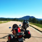
Near Eleven Mile - one long, rough, straight road across the prairie

Too soon, those rides between the rides become commutes for me, and I long to use anything but the center stripe of my tire rubber. I’m happiest the closer I get to the edge of my tires.

When it comes to non-stop curvy and scenic roads, you just can’t beat the motorcycle rides in the Blue Ridge and Smoky Mountains.

TRIP LOG:

Tuesday:

photo-water-tower

Historic Lodo in Denver - roof top water tank

We flew into Denver Tuesday and spent the afternoon in the historic Lodo section.

Rich in Victorian architecture, it’s the happening place within the great city.

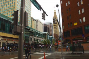
photo-Denver

Old meets new in the city

First stop was a brewery, and once our tanks were full, we spent the evening walking around and taking in the sights.

Wednesday:

We spent the morning doing some hiking near Evergreen.

photo-3-sisters

View atop 3 Sisters

I had fun scrambling to the top of one of the 3 Sisters rock formations.

photo-elk-calf

Young elk

Early in the hike, we rounded a bend to find a huge heard of elk bedded down along the trail.

We picked up the bikes late in the afternoon, and made loose plans for the next few days of riding.

Thursday:

We decided to make it a day ride.

photo-trail-ridge-rd

Sleet and a few flakes up high

The first of the twisty roads was Bear Creek Canyon. Nice, but traffic tempered true enjoyment.

We then followed Clear Creek Canyon Rd and the Peak to Peak Highway to Estes Park.

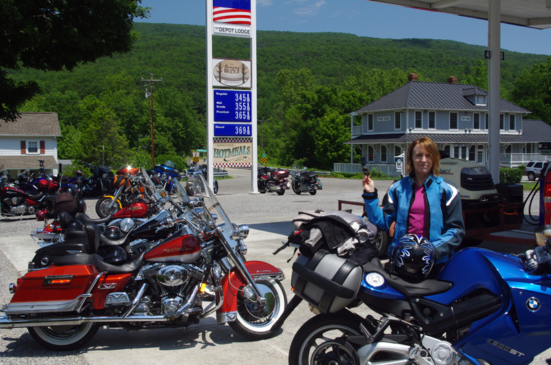
photo-gas-station

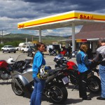
Break just past the middle of nowhere

Entering Rocky Mountains National Park, we cruised Trail Ridge Road.

Turning south, we followed 40 to Winter Park and took our lunch break.

We returned via Berthoud Pass  to the Interstate and made one more pass through Bear Creek Canyon on our way in.

Friday:

We loaded up the bikes for an overnight trip to Aspen and got an early start.

Photo-rampart-range-rd

Rampart Range Rd - finally, a place to exercise a sport bike!

We started with a very nice run through Deer Creek Canyon and I got the first chance to see just what my BMW rental motorcycle capable of.

It led to Pleasant Park Rd, then onto 285 to reach Pine Valley Rd / Deckers Rd.

photo-fattys-pizza

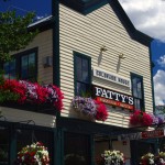
Fatty's Pizza in Brekenridge

We passed the Rampart range and Pikes Peak with a loop south on 67 / Teller County Rd.

24 led us north again till we detoured out to Eleven Mile on SR 90.

Back on 24, we next veered north on 9 into Brekenridge for lunch.

photo-leadville

Stormy skies over Leadville

Next stop was Leadville. Coming into town we hit festival detours so we stopped to see what was going on.

We continued on 24 to Twin Lakes to pick up SR 82 – Independence Pass.

We arrived in Aspen at dinner time and found an affordable room in Snowmass to pass the night.

Saturday:

photo-Independence-pass

Paused in Independence Pass

By 07:30 we were on our way hoping to get to Independence Pass before the traffic to enjoy a “spirited” run on the wild road. We were not disappointed.

Riding a road like this at speed takes every skill you’ve got! It’s terribly rough and broken, gravel and rocks in the turns, bumps, patches, and potholes will have your full attention and you’d better be able to change your line quickly even when your knee nears the pavement.

photo-motorcycle-independence-pass

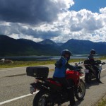
My wife jackie - outstanding talented rider

We retraced our tracks to Leadville for a good breakfast, passed through Frisco, and got on the Interstate back towards Denver, then left it again at Idaho Springs for a run over Mt. Evans.

Saturday afternoon is not the time for a ride over Mt. Evans. It’s another rough and challenging high mountain road, tight and curvy, and choked with traffic. Bummer.

photo-stopped for a photo

Put that damn camera away and let's get going!

With a final pass through Bear Creek Canyon we returned to Denver.

I was sad to part with my rental bike, a BMW F800 S. I’m really starting to enjoy sport bikes and the beemer was not only quick, but comfortable for all day riding.

Sunday:

We flew home.

We’d hit some of the classic rides. I will go back again. I’m sure there are plenty more roads waiting.
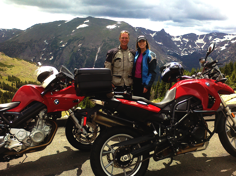
photo-independence pass-us

Wayne (author) and Jackie with our color coordinated rental rides. She really liked the BMW 650 GS riding it as if she'd had one for years. It felt like a chopper with ape hanger bars after riding the sporty F800 S, and I knew I'd made the right choice for me.

_______________________________________________________________________________

Wayne Busch
Wayne Busch – Cartographer
– Wayne Busch lives in Waynesville, NC, where he produces the most detailed and comprehensive and up-to-date motorcycle pocket maps of the Blue Ridge and Smoky Mountains to help you get the most of your vacation experience. See them here – AmericaRidesMaps.com 
Motorcycle Friendly Places – Hampton Inn & Suites, Sapphire, NC

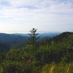
photo-US-64-view-Cashiers

One of my favorite views is just 10 mins from the Hampton.

Few places rival the beauty surrounding Sapphire, NC. The small town and those surrounding it host some of the most expensive real estate in the Blue Ridge Mountains. Flanked by massive granite balds, host to the Cullasja River Gorge with it’s many roadside waterfalls, and nestled amongst the wilds of several national forests with views that will take your breath away, the area is laced with outstanding motorcycle rides.

Photo-view-from-NC-215

Above the clouds on my morning ride

On any weekend, 2 lane US 64 throbs and buzzes with motorcycles who come to play on the wonderfully twisty and scenic roads. Of course other tourists come as well, and US 64 rarely gives the motorcycle rider the freedom to enjoy its serpentine turns to full delight as they insist you share the road. Few tourists ever venture off the main drag though, and the many back roads which course over the mountains and along the valley streams give the biker what he really came for – great rides with outstanding views devoid of traffic.

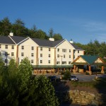
Photo-Hampton-Inn-Sapphire-NC

Hampton Inn & Suites, Sapphire, NC

Sitting in the heart of all this, the Hampton Inn & Suites in Sapphire makes an ideal place to base out of for an enjoyable stay while exploring all the region has to offer. Level parking, set back from the road, and close to good dinging and other amenities, the Hampton provides a quiet and relaxing place with a decor and atmosphere that reflects the quality of the surrounding area. I toured 3 different styles of room each of which deserves the descriptor – “posh”. I would be very happy to stay in any of them, it’s the kind of place I seek out in my travels.

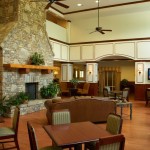
Photo-lobby-at-hampton-inn-sapphire-nc

A comfortable place to gather and relax

It looks like an ideal place for those groups of motorcycle riders looking for a time they’ll remember fondly and come back to. 2 meeting rooms are available. The lobby is spacious and inviting, a good place to gather. All the amenities are at hand.

Photo-room-at-hampton-inn-sapphire-nc

Ride hard, rest easy.

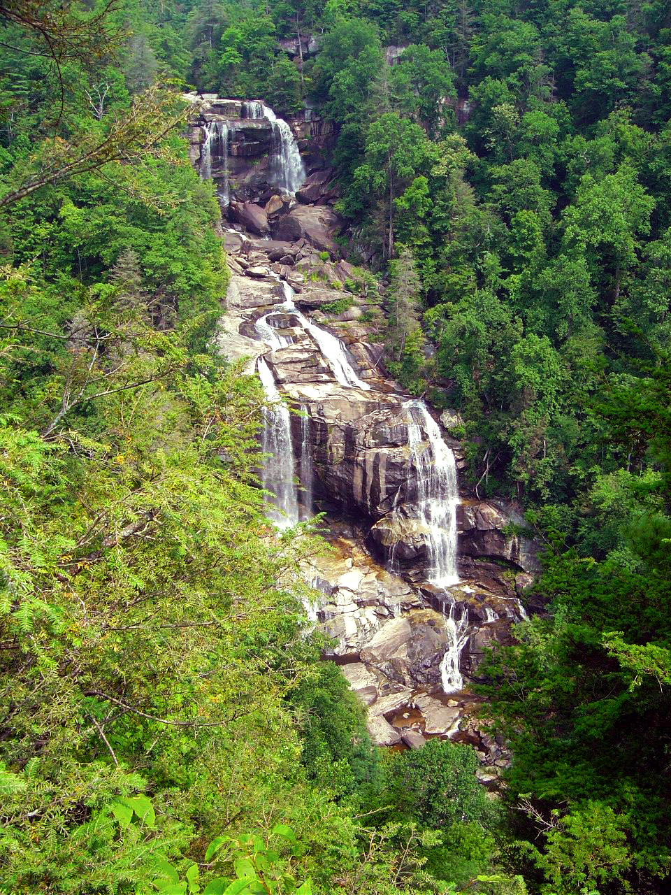
The greatest thing about the Hampton is location. Roll out the driveway and you’re on the ride. Go west through Cashiers and Highlands to ride Wayah Bald and the Nantahala Gorge. The roads to the north – well, every time I go though there I come back thinking I don’t get that way often enough, they are so nice. Head east, and you enter my favorite area in all the mountains, home to some of the best rides I know of. To the south, the twisties which lead into South Carolina are outstanding. Whitewater Falls,

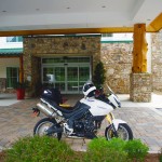
Photo-entrance-hampton-inn-sapphire-nc

Put your bike here.

the highest in the east is just a short ride from the hotel. The Dragon at Deals Gap is about an hour away, though the roads which lead you to it will have you all warmed up and ready to go when you get there, then go on to tackle the Cherohala Skyway. The best section of the Blue Ridge Parkway is the closest. As I add all these up, staying here makes a lot of sense.

Photo-Charlies-Creek-Rd

One of the roads I took going home

The sales manager was a rider, so she knows you guys. You’re welcome here. I’ll be adding the Hampton Inn Sapphire to the maps ASAP. The more I think about it, the more sense it makes to plan a stay here. It’s a total immersion in motorcycle rider’s bliss – point your wheel in any direction and the good roads are right there.

SAVE 10% on weekends, SAVE 20% during the week – Call and ask for your Smoky Mountain Rider / America Rides Maps discount.

Hampton Inn and Suites Cashiers/Sapphire Valley, N.C
3245 US 64 East
Sapphire, NC 28774
http://www.hamptoncashiersnc.com


Photo-whitewater-falls-nc

If waterfalls turn you on, you'll be in heaven. The Hampton sits at the heart of the "Land of the Waterfalls". Whitewater Falls, the highest in the east, is just a short ride, as are many others.

_______________________________________________________________________________

Wayne Busch
Wayne Busch – Cartographer
– Wayne Busch lives in Waynesville, NC, where he produces the most detailed and comprehensive and up-to-date motorcycle pocket maps of the Blue Ridge and Smoky Mountains to help you get the most of your vacation experience. See them here – AmericaRidesMaps.com 
Ever seen the Dragon’s Breath on your Deals Gap motorcycle ride?

NC-28-motorcycle

The Dragons breath envelopes riders on NC 28 near Deals Gap

OK, so I made the Dragon‘s Breath thing up – at least the name. The phenomenon is real though, something you may encounter when riding NC 28 along Cheoah Lake on your way to or from The Dragon at Deals Gap.

NC-28-Fontana-lake

NC 28 - Cheoah Lake fog (or is it?) - Remember, there's a Dragon nearby.

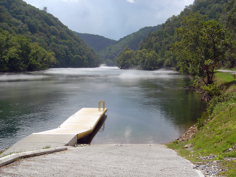
The fog, which can be pretty thick at times, is a common occurrence on warm summer days. The water which drives the turbines at nearby Fontana Dam is drawn from the deepest coldest depths of Fontana Lake. When there is enough moisture in the warm air, it condenses when it comes near the cold water of Cheoah Lake.

NC-28-fontana-lake-

NC 28 - Sometimes the NC 28 bridge below the dam sits on a cloud

Fontana-Dam

Below the Fontana Dam

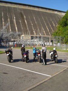
A nice side trip when you are in the area is a stop at the Fontana Dam. You can access the bottom of the dam once you cross the bridge over Cheoah Lake. Turn right and follow the paved road to the power station. To see the dam from the top, and you should it’s one of the highest in the east, use the road which intersects NC 28 just beyond Fontana Village. It’s easy to find, it’s the only stop sign on NC 28.

You find NC 28, the Fontana Dam, The Dragon, the Cherohala Skyway, other nearby attractions and scores of two lane twisty back roads which make for great Smoky Mountain motorcycle rides on America Rides Maps;

_______________________________________________________________________________

Wayne Busch
Wayne Busch – Cartographer
– Wayne Busch lives in Waynesville, NC, where he produces the most detailed and comprehensive and up-to-date motorcycle pocket maps of the Blue Ridge and Smoky Mountains to help you get the most of your vacation experience. See them here – AmericaRidesMaps.com 
 

Motorcycle Friendly Places – Paint Bank General Store, VA

Photo-Paint-Bank-General-Store

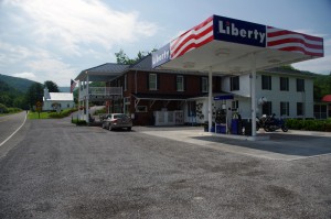
Morning at the Paint Bank General Store, Paint Bank, VA

Though it’s only 1/2 hour west of Roanoke, the tiny hamlet of Paint Bank on Highway 311 sits like a jewel surrounded by rolling green hills and pastoral country that makes the busy city seem a million miles away. This is spectacular motorcycle riding country and bikers flock here to enjoy the long winding rides through narrow valleys which lead south towards Blacksburg, Christiansburg, and Pembroke. The beautiful wilds of West Virginia lie just over the western horizon, and the roads north twist and turn through forests teaming with wildlife.

Photo-Paint-Bank-General-Store

A for-real General Store! Cool!

Jackie and I came in from the north on VA 615, a ride through woods so wild we had to cruise with care to avoid all the critters in the roadway. Deer and turkey were abundant, a slew of painted turtles awaited their doom on the pavement, a fox, hawks, and all sorts of other animals either watched us pass or darted off into the greenery as we approached.  We paused in Newcastle for a rest, then pointed our wheels west on 311 to make the curvy fabulous climb and descent over Potts Mountain into the valley to arrive at scenic Paint Bank.

Photo-Paint-Bank-General-Store-motorcycles

The lunch crowd has arrived!

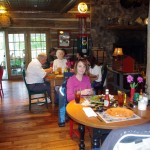
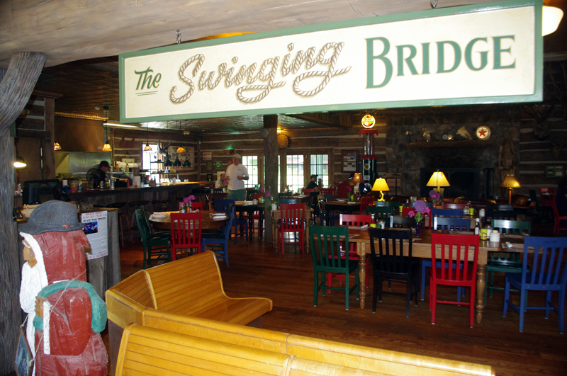
Eager to get on to the next curvy climb we stopped at the Paint Bank General Store for a potty break and to top off our tanks, but as the noon hour approached we soon abandoned our ride into West Virginia to return to the Paint Bank General Store, lured back by the promise of tasty locally raised buffalo burgers in the inviting and charming rustic setting of the Swinging Bridge Restaurant.

Photo-Swinging-Bridge-restaurant

The buffalo burgers were great!

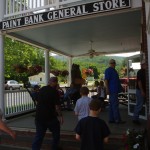
In the short time we’d been gone the parking lot at the Paint Bank General Store had been taken over by motorcycles with the same ambitions as us and more arrived every few minutes. “Motorcycle parking only” signs lined the periphery of the  lot and the crowd of bikes spilled over to fill the remaining space. Some milled about on the porch, others hosed the bugs off their chrome with the convenient hose, but most found their way to the restaurant to enjoy the food and comfortable atmosphere.

Photo-Paint-Bank-General-Store

Bikers flock here for lunch

The Paint Bank General Store – A unique place in a beautiful setting with gas and good food surrounding by outstanding motorcycle rides and biker friendly. What more do you need?

Paint Bank General Store

Swinging Bridge Restaurant

Paint Bank info

Photo-Paint-Bank-General-Store

Great food, wonderful riding, the Paint Bank General Store and Swinging Bridge Restaurant was one of the highlights of our Virginia motorcycle riding

Photo-Swinging-Bridge-Restaurant

Great food in a fun and relaxing atmosphere at the Swinging Bridge Restaurant located in the back of the Paint Bank General Store.

_______________________________________________________________________________

Wayne Busch
Wayne Busch – Cartographer
– Wayne Busch lives in Waynesville, NC, where he produces the most detailed and comprehensive and up-to-date motorcycle pocket maps of the Blue Ridge and Smoky Mountains to help you get the most of your vacation experience. See them here – AmericaRidesMaps.com 
How to Make a good Deals Gap Motorcycle Ride Better –

Adding these two roads to one of the four most popular Smoky Mountain motorcycle loop rides near the The Dragon at Deals Gap makes the least of them measure up to the others.

Photo - morning on the Cherohala Skway

Morning on the Cherohala Skyway. I'm parked on the state line between North Carolina and Tennessee.

Smoky Mountain / Blue Ridge motorcycle riders who flock to ride The Dragon at Deals Gap typically take in other rides when in the area. One of the best Smoky Mountain motorcycle rides is a loop through Vonore and Tellico Plains, TN to take in the Cherohala Skyway. Another popular circuit is to loop around Great Smoky Mountains National Park crossing through the heart of the Smoky Mountains on US 441. A third great loop ride links NC 28 at Franklin, NC to Nantahala Gorge via Wayah Road. All of these are great loop rides in the Blue Ridge with unique characters.

The fourth most popular ride is to take the Cherohala Skyway west to Tellico Plains, then go south on TN 68. You then use TN 123 / NC 294 to head east, and follow US 74 / 129 north through the Nantahala Gorge to return to The Dragon at Deals Gap. This loop ride starts out with the outstanding scenery and enjoyable sweeping curves of the 50 mile long Cherohala Skyway as it crosses the Snowbird Mountain Range of the Blue Ridge. It gets nice again once you enter the curvy sections a few miles south of Tellico Plains on NC 68. It’s gets better and better the further south you go, though NC 68 can carry a bit of traffic on weekends.

Photo - Field of the Woods

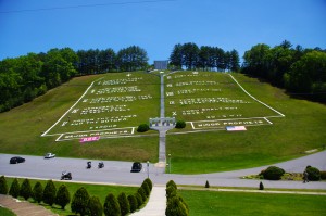
The 10 Commandments at Fields of the Wood - big enough God can read them

Once you turn east on TN 123 / NC 294, the ride is still pretty good, but the road opens up and the ride is not as scenic and challenging as you progress. Here’s how to punch it back up to outstanding.

Watch for Fields of the Wood, it’s the closest landmark to the turn off onto Hiawassee Dam Access Road. Fields of the Wood is worth a stop to see and a nice place for a break. Those with devout religious leanings will be inspired by the hillside with the ten commandments written out in stone, as well as numerous other Biblical icons and monuments. For those inspired more by hellacious and challenging roads, Hiawassee Dam Access Road is next leading to devilish twists and curves.

Photo - Hiawassee Dam

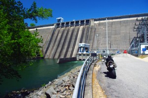
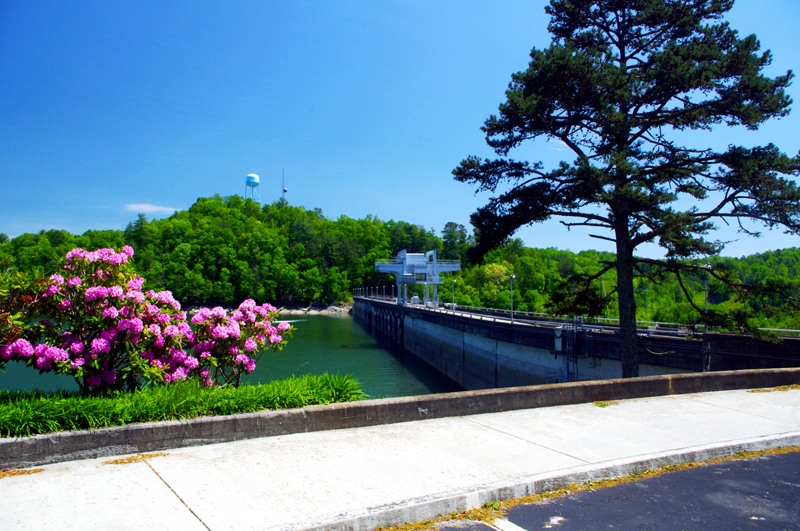
The Hiawassee Dam is a nice spot for a break.

Turn onto Hiawassee Dam Access Road to start the fun. You may encounter a little traffic approaching the dam on weekends as many come for boat access to the lake and river. Once past the dam, the excellent and challenging road continues a course around the west side of the lake. Turn right onto Joe Brown Highway when you reach the end of Hiawassee Dam Access Road.

Joe Brown Highway is hardly what any of us think of when the word “highway” comes to mind. This isolated and remote twisty two lane back road is packed with curve after curve and some pretty decent Smoky Mountain scenery, though you’ll be paying more attention to the road than the horizons. It’s a whole lot of fun, usually carries very little traffic, and may be the best section of the entire loop, a nice contrast to the sweeping curves of the Cherohala Skyway.

Photo - Nantahala Outdoor Center

The Nantahala Outdoor Center on the river is another great break spot with bathrooms, good food, nice views, and the place to arrange a river trip.

Joe Brown Highway runs you right through downtown Murphy, NC to intersect US 129 / 74 at the junction with US 64 East. Turn north to follow the four lane to Andrews where it funnels down to two lanes again for the ride through scenic Nantahala Gorge. You’re bound to run into traffic in Nantahala Gorge, but the scenery along the popular whitewater river makes up for it. Avoid the gorge on weekends when possible as the buses hauling rafters and kayakers tend to bottle things up.

Once through Nantahala Gorge, turn left onto NC 28 and back into the twists and curves to return to The Dragon at Deals Gap.

Photo - View from Hiawassee Dam Overlook

There are nice spots for a break both atop and below the Hiawassee Dam. The road runs across it then continues around the lake.

_______________________________________________________________________________

Wayne Busch
Wayne Busch – Cartographer
– Wayne Busch lives in Waynesville, NC, where he produces the most detailed and comprehensive and up-to-date motorcycle pocket maps of the Blue Ridge and Smoky Mountains to help you get the most of your vacation experience. See them here – AmericaRidesMaps.com 
The Motorcycle Ride that Shouldn’t Be There – Go with the Flow

Photo - old mill in Tennessee

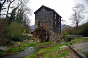
Sights like these are the rewards for exploring the back roads. So few ever see them.

“Turn around. Go back. You’re missing something”. The signs were there, little hints and clues that more was going on than meets the eye. It was near time to head for home but I couldn’t shake those compelling thoughts and I swung the motorcycle around.

I’m not unfamiliar with the area. I’d studied it in depth and detail and ridden through it seeking out great motorcycle rides of which I’d already found a slew. I was on such an exploration now following a road I’d selected as having a good chance of being a decent ride, and it had rewarded me with a nice twisty rolling romp through the foothills of English Mountain in Tennessee that my motorcycle seemed to enjoy as much as I did. Still, I felt there was more here.

Photo - Douglas Dam, Sevierville, Tennessee

My travels included a stop at the Douglas Dam near Sevierville. While not very scenic in winter, it's a nice place for a break.

I wasn’t sure exactly where I was. It’s not that I was lost, I knew contextually where I was in relation to other roads and landmarks. But the road names were not familiar anymore, they didn’t match what I had planned out on paper. That happens often enough as I don’t so much ride by the suggestions on the map but by how the roads flow one into another – the natural route. I’d turned left at the stop sign to see where this new road connected to the main artery, but I’d seen it maintained it’s character to the right as well, and it was calling me back.

The natural flow of a ride is something thats very hard to pick out from a map or satellite imagery.  When a web of roads connected and intersect, there’s typically a path of least resistance. It’s the instinctual choice you make when two roads meet, the split second decision you make to follow the dominant or more interesting road as you cruise along. It’s the way that keeps you moving, keeps the ride going, it’s what you’re looking for.

Photo - B&W view from the Foothills Parkway

It was a cool, damp, overcast day, a mood better captured without color. View from the Foothills Parkway on my way home.

I couldn’t ignore the clues. The old mill I’d stumbled upon meant this was a long established community that had been connected enough to support such commerce. There would be old roads leading to it. There was the sign for Hidden Caverns – roads to tourist attractions are usually well kept. As I started up the valley, the “Chains and 4-Wheel Drive Required in Winter” sign told me somebody had a reason to go this way, even when the snows come.

The climb was “steep as a mules face” and I expected the quality of the pavement to evaporate as I reached the heights, yet it maintained. Heck, there was even a painted line you could make out in places – that’s a good sign. I rolled on with pretty much certainty the road would just end when the mountaintop was reached, but it didn’t. It snaked around the crest a bit, then plunged down the back side. It was easy to pick the right path up high as all the connecting roads were unpaved, but as I cascaded towards the valley I went with the flow, following the natural course of one road leading into another. The lower I got the more certain I was this ride would lead to familiar territory, but where would it come out?

I finally came to a stop sign and recognized where I’d arrived. I knew this next road, it was one I’d already selected as a great motorcycle ride. It led to more. I then realized where I must have travelled, through an area where I didn’t think there was a decent paved road, an empty white space on the map no longer. It had already been a good day. This great motorcycle ride was the icing on the cake. I can’t wait to go back!

_______________________________________________________________________________

Wayne Busch
Wayne Busch – Cartographer
– Wayne Busch lives in Waynesville, NC, where he produces the most detailed and comprehensive and up-to-date motorcycle pocket maps of the Blue Ridge and Smoky Mountains to help you get the most of your vacation experience. See them here – AmericaRidesMaps.com 

Finding Great Motorcycle Rides North of Smoky Mountains National Park

Another long day on the road, another loop of Great Smoky Mountains National Park, in search of the best motorcycle rides north of the big forest. The wonderfully warm weather we’ve been enjoying has slipped back into the winter norms, though it was still nice to be out riding. The day ended with a long ride home in the rain with temps in the 40’s but it was well worth it.

Photo - roadside waterfall near Wears Valley

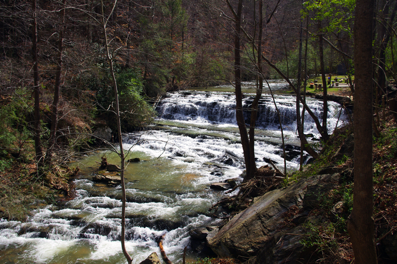
Waterfall along US 321 near Wears Valley, TN. While it's pretty to look at, US 321 is one of the last roads you want to be caught on if you're looking for enjoyable riding. Even mid-winter, the traffic takes all the fun out of the ride.

While I’ve pretty much scoured the mountains from north Georgia to north Virginia looking for the best motorcycle rides for America Rides Maps, this area north of Great Smoky Mountains National Park is one I’ve shunned until now. I know the tourist routes through it – and avoided it because of them. The traffic and congestion that is drawn to Gatlinburg, Sevierville, and the surrounding cities chokes the major roads so much it takes all the enjoyment out of riding a motorcycle. With Knoxville, Oak Ridge, and Maryville all growing and expanding, the winding mountain roads bare a heavy burden of local and commercial traffic. Add to that the millions of tourists drawn by the nations most visited National Park, the Smokies, and things can grind to a miserable crawl.

Photo - tree in roadway

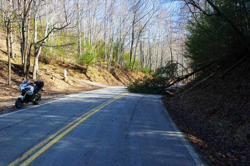
High winds recently, including today, keep you on your toes on the back roads. If you're not skirting around trees, you're dodging rocks loosened by rains. Some of these roads still have a good deal of gravel and sand left from the last snow. You come to expect this of winter riding in the mountains.

It’s a tangled web of roads along the north side of the smokies, but I’m already happy with what I’ve found. Sorting through them has been full of surprises. As always, if you really look for them, great motorcycle rides are there to be found. I’ve already got some real gems, roads I ride over and over in my travels. I can duck in and out of Gatlinburg with little care for the traffic on some great hidden roads. I’ve already found ways to cruise right through all the chaos like it didn’t exist. Now I’m seeking the roads that link all these gems together, and I found a bunch more today.

At this rate, the new motorcycle ride map will be finished soon. I’ve found great rides near The Dragon at Deals Gap few know about. I’ve discovered some that play with the Foothills Scenic Parkway. A few go into Great Smoky Mountains National Park. The best ones though, are those that are just the roads less traveled. If you’re in a car, there are faster or more direct ways to reach your destination. On a motorcycle, destination doesn’t matter so much – it’s all about the ride, and these are some great rides!

_______________________________________________________________________________

Wayne Busch
Wayne Busch – Cartographer
– Wayne Busch lives in Waynesville, NC, where he produces the most detailed and comprehensive and up-to-date motorcycle pocket maps of the Blue Ridge and Smoky Mountains to help you get the most of your vacation experience. See them here – AmericaRidesMaps.com 
Great Food in a Gas Station? Hello, Caffe Rel!

Photo - Hot Spot Gas Station in Franklin

You can't miss the huge Hot Spot gas station in Franklin, home to the Caffe Rel.

I’ve been hearing tales of Caffe Rel for quite a while but a good restaurant in a gas station? It was just a bit hard to believe. Nor does Franklin, NC come to mind when I’m thinking of great places to eat. It does now.

Let’s say I had my doubts when I pulled into the Hot Spot gas station in downtown Franklin. It is a very nice gas station. Big, new, clean. You can’t miss it. We arrived around 5:30 and there were already cars in all the spaces outside.

I had heard the place was small. It wasn’t as small as I supposed, but seating is limited. Get there early. It’s really nice on the inside. It’s not well set up for large parties – tables seat 4, there are a couple that will hold 6, but room is limited and if you come in with a huge group don’t expect to share a table.

Photo - Caffe Rel sign

Still seems odd - a decent restaurant connected to the Hot Spot convenience store.

The menu is extensive and I was surprised at some of the offerings. It’s got a French theme, but also covers a variety of cuisines. One of the specials of the evening was “snails and tails“,  the tails being crawfish. I chose another crawfish dish. We also tried the mountain trout (great), the french style roast beef (excellent), shrimp and grits (not the typical southern recipe, but a nice twist), and assorted ravioli. Everybody got a great meal and we had very good service. What more can you ask for?

So what has this got to do with Smoky Mountain motorcycle riding? A lot of motorcycle riders find their way to Franklin. It’s nice to know those good places to stop when you come to a decent sized town.

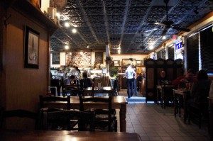
Photo - inside Caffe Rel

It's surprisingly nice inside. The food will surprise you as well.

Franklin, NC is one of those towns located at the crossroads of several great motorcycle rides. US 64 passes on the south side of town. Go east to see 4 great roadside waterfalls on the way to Highlands. Wayah Road lies just 5 miles to the west. The great motorcycle ride over Wayah Bald into the Nantahlala River gorge is a classic. The Moonshiner 28 runs north to lead you to the Dragon at Deals Gap. US 441 takes you to Cherokee and the start of the Blue Ridge Parkway. You’re only half an hour from some of the great motorcycle rides in north Georgia. Those are just the well known motorcycle rides in Franklin. There are plenty more on my America Rides Maps.

Photo - inside Caffe Rel

The next time you're near Franklin, remember the Caffe Rel and try to stop during the off hours.

I didn’t find a web site for Caffe Rel, but then, they don’t have a bathroom either. Use the one in the gas station. Maybe it has a web site. Don’t much care.

We’ll be revisiting the Caffe Rel, looking for opportunities to stop during the off hours. By normal meal times, the place is packed. Hope you get a chance to try it.

_______________________________________________________________________________

Wayne Busch
Wayne Busch – Cartographer
– Wayne Busch lives in Waynesville, NC, where he produces the most detailed and comprehensive and up-to-date motorcycle pocket maps of the Blue Ridge and Smoky Mountains to help you get the most of your vacation experience. See them here – AmericaRidesMaps.com 
I Just Keep Finding More Great Motorcycle Rides

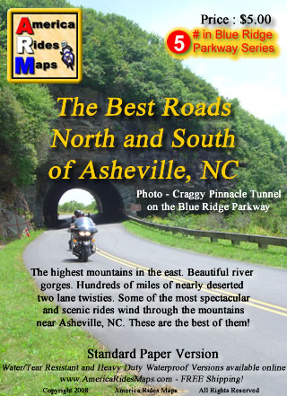
Image - Map CoverAsheville

Map - The Best Roads North and South of Asheville, NC - the revision is so close to being done.

I’ve resigned myself to the fact it’s going to take at least one more day on the road to investigate some roads for the revision of America Rides MapsThe Best Roads North and South of Asheville, NC“. I’ve already added more than a dozen new roads to the hundreds of miles of great motorcycle rides I’d already charted, roads which link the existing great rides together and expand the options to stay out on the two lane back roads enjoying the twisty bliss of carving through the tallest mountains in the east. I’ve got at least a dozen more yet to be evaluated and judged.

I systematically go through each of the dozen maps I now produce, re-evaluating each of the roads by riding them again, noting any changes along the way to insure you get the most up to date and best ride info I can produce. I’ve been reworking this Asheville map for well over a month now and thought I was closing in on wrapping it up. I sat down to knock off the last chunk of it today, and as the clock now approaches midnight my efforts have only yielded yet more possibilities that must be explored. The devil is in the details, and I too often find as I get down to the final detail work I start to ask questions. Has this road been paved? Is there a way to find a link between these two great rides? If this road was so good, what about this one nearby? The questions just keep coming and I research them as best I can then pencil in the ones I can’t rule out. There are enough unanswered to warrant another long day in the saddle, maybe two.

I’ll spend tomorrow getting things as close to finished as I can. Then, I’ll go out on the road and spend the day or two that’s needed to ride each and every one of them to see if they measure up. Though my last trip was very rewarding, this time I suspect it will be mostly disappointment – that’s the norm. Still, if one or two of them pan out, I’ll come home happy. These are the last of the last, kind of like sifting through the tailings at a gold mine to see if any small nuggets were missed. A real bonus is finding another reliable out of the way gas station. Maybe, just maybe, I’ll stumble across a real jewel. You never know until you ride it.


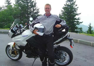
Photo - Wayne and his motorcycle

A couple more days on the road should do it. I'm really excited to get to the next map, I have some big plans for expansion.

Addendum: This region north of Asheville is one of the most undiscovered areas of great mountain motorcycle rides. Few venture into this area though there are a wealth of fabulous motorcycle rides through the tallest mountains in the east virtually devoid of any traffic. This time of year, when leaf peepers clog most of the backroads, you can ride all day through this area and count the cars on one hand. This map will give you a vacations worth of great rides and you’ll still come back for the ones you didn’t get to.

America Rides Maps – nobody covers the Smoky Mountains as comprehensively so you can make the most of your precious riding time.

_______________________________________________________________________________

Wayne Busch
Wayne Busch – Cartographer
– Wayne Busch lives in Waynesville, NC, where he produces the most detailed and comprehensive and up-to-date motorcycle pocket maps of the Blue Ridge and Smoky Mountains to help you get the most of your vacation experience. See them here – AmericaRidesMaps.com

Just Completed – Update to Blue Ridge Parkway Motorcycle Pocket Map #1

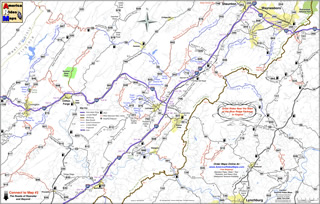
Image - Map Side

Map Side

I am proud to announce the release of the most recently updated America Rides Maps Motorcycle Pocket Map in the Blue Ridge Parkway Series – VA016; “Great Rides Near the Start of the Blue Ridge Parkway in Virginia“. It’s taken more than a month of working on it every spare minute to bring it into the new and improved format and incorporate more than 50 additional miles of great motorcycle rides in this region. It contains more than 40 roads which either cross, connect, or lie adjacent to the north end of the Blue Ridge Parkway with detailed info, descriptions of the rides, locations of gas stations and points of interest, and more.

While I’d hoped new cartographic software would speed production times, the process of conversion from simple graphic images to fully digital representations is as laborious and meticulous as before. The benefits are recognized in the ease of future updates as well as the improved clarity that is gained. As I’m constantly updating and improving all the maps, more than a dozen which cover the Smoky Mountains from north Georgia to north Virginia, the effort is worth it. There is nothing else like America Rides Maps motorcycle pocket maps, and best of all I’ve been able to improve the maps without increasing the price, already the lowest on the market.

Image - Description of rides

Description of the rides on the back of each map

I’ve sold thousands of maps and get lots of thankful emails from customers. You love them. Here’s an email I got from a professional motorcycle tour guide, someone who covers thousand of miles in the region and knows it well –

“Your maps are truly awesome.  As you know I have also ridden many miles in NC and surrounding areas laying out our Tours for Blue Strada.  Just yesterday, I was studying your “Best Roads South of GSMNP East.”  You have done riders and drivers a huge service by pointing out all the important little details along the way… I love the Red & Blue definitions of Great and Good roads..  but just looking at gas stations.. and the waterfalls locations make these maps fantastic.  (In fact, I need to get the whole set for NC and GA).  Anyone coming here to ride without a guide could do no better than to get a set of your maps and just start studying the options… of which there are so many… and making their own Tour.  I’m going to send my motorcycle renters your direction in the future… they will be better off than trying to use my Tour maps… “

Bill Kniegge
www.bluestradatours.com
www.wheeljockey.com
POB 1336
Waxhaw, NC 28173
704 292 8801

Get the most out of your motorcycle vacation. Expand the horizons of your motorcycle tour. Discover the roads and sights others will never see. Whether you’re looking for the best shortcut or would prefer to take the long way around, these inexpensive, easy to use, fit in your pocket maps are the best thing going and I can get them to you in just a few days.

Wayne@americaridesmaps.com
http://americaridesmaps.comsee videos of the maps in use

www.bluestradatours.comexpert tours and motorcycle rentals

www.wheeljockey.comI love this gadget. It makes maintenance on the road a breeze.

_______________________________________________________________________________

Wayne Busch

Wayne Busch - Cartographer


– Wayne Busch lives in Waynesville, NC, where he produces the most detailed and comprehensive and up-to-date motorcycle pocket maps of the Blue Ridge and Smoky Mountains to help you get the most of your vacation experience. See them here – AmericaRidesMaps.com