Why so many great motorcycles rides in the Blue Ridge & Smoky Mountains?

Why are there so many great motorcycle rides in the mountains of the southeast? It’s a combination of geography, history and climate.

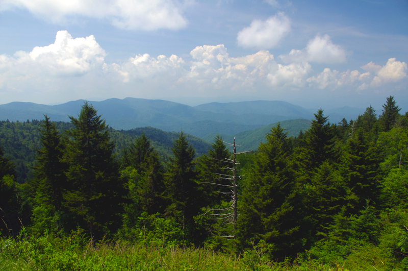
photo-black-mountains

One of my favorite Blue Ridge Parkway overlooks of the Black Mountain Range - highest in the east.

Geographically, the Blue Ridge and Smoky Mountains are very, very, old. Over the eons of time mountains once taller than Everest have weathered, eroded, and subsided to where their heights never much exceed 6000 feet in elevation. Compared to the lofty Rocky mountains in the midwest and the great Sierra Range on the far coast, those in the east are half the size.

While those western mountains soar to dramatic heights, it’s not without a cost. The lower elevations of the Blue Ridge Mountains make them accessible in every season. The softer, gentler topography of the mountains of the east makes building and maintaining roads to connect the valleys and towns more feasible.

photo-penland-post-office

Post office, Penland, NC - the Blue Ridge Mountains are rich with historic sights waiting to be discovered on your rides

History favors the mountains of the east as well. Settlement of our country began on the east coast and gradually moved inward as the population grew. Hill by hill, valley by valley, one small settlement at a time, the trails leading to them became the roads we now enjoy. More people, more time, more roads to connect them all together.

Finally there’s the climate, which is heavily influenced by altitude. The mild wet climate of the east promotes the growth of the dense forests and makes growing crops and farming much easier. The high dry desert climate of the west holds sparse vegetation, harsh conditions, and long cold winters.
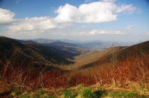
Photo - morning on the Cherohala Skway

View from the Cherohala Skyway in early March - mild climate means year round riding in the Blue Ridge Mountains

Life gets even tougher as you go up into the high mountains of the west. Crops can’t grow at the extreme elevations, and were it not for mining and timber, those vast western mountains would be even less populated than they are now. Fewer people means fewer roads in general, and building and maintaing those that pass through the high places is much more difficult and costly.

Finally, the development of the Interstate Highway system works to favor of the high quality of the motorcycle rides in the east.  As more people used them to move into the west, the fewer local roads and passes there became more crowded. More people on fewer roads, many of which open for only part of the year, means more congestion and traffic in the west.

Photo-Charlies-Creek-Rd

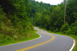
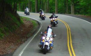
Charlie's Creek Rd - typical of the wonderfully empty and inviting rides that abound in the Smokies

In the Blue Ridge and Smoky Mountains, when the traffic moved to the Interstate Highways, it relieved the pressure on the back roads. One of the greatest pleasures of riding a motorcycle in the Blue Ridge Mountains is the absence of traffic. The selection of two lane, empty, winding roads through beautifully scenic and historic places just never seems to end.

Recently back from my motorcycle touring in the mountains of California, then Colorado, my appreciation for the bounty of great motorcycle rides in the Smoky and Blue Ridge Mountains is refreshed. While I loved the dramatic change of scenery, the vast distances and scale of things to the west, one thing became crystal clear –

Photo-motorcycles-on-parkway

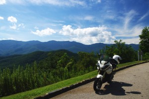
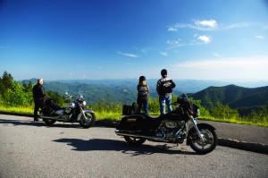
Bikers pause to admire the stunning views in the Smoky Mountains

Out west, you are on a mountain. It’s a harsher, more extreme landscape, you are a temporary interloper. In the Blue Ridge and Smoky Mountains, you are in the mountains. They cradle and surround you, it’s a comfortable and welcoming environment.

I enjoy my travels and motorcycle rides in other places, but there is simply nothing which comes close to the quality and quantity of outstanding motorcycle rides right in my back yard. While lots of bikers pay a visit, I doubt they much scratch the surface of the gold mine of motorcycle riding that exists here. I know, I’ve mapped hundreds of these great motorcycle rides, thousands of miles of two lane twisties, it’s what I do for a living.

Photo-motorcycles-on-the-dragon

Some roads, like the Dragon at Deals Gap are well known - a wealth of others await your discovery!

Half the population of the US lives within a days ride of the Blue Ridge and Smoky Mountains. It’s an easy trip to get here. It’s affordable and convenient. The motorcycle rides are beautiful, scenic, challenging, and the mountains are full of roads that thrill the motorcycle rider, more than can be visited in a season, let alone a single motorcycle vacation tour.

I’ve said it before, and continue to preach – “There are more great motorcycle rides in the Blue Ridge and Smoky Mountains than anywhere else”.  

Why not start planning your motorcycle trip right now?

Still need convincing? Visit www.AmericaRidesMaps.com to see just how many great roads there are waiting for you!

_______________________________________________________________________________

Wayne Busch

Wayne Busch - Cartographer

Total Rider Tech Logo

Learn Total Control

– Wayne Busch lives in Waynesville, NC, where he produces the most detailed and comprehensive and up-to-date motorcycle pocket maps of the Blue Ridge and Smoky Mountains to help you get the most of your vacation experience. See them here – AmericaRidesMaps.com

Wayne is an advanced motorcycle instructor for Total Rider Tech teaching Lee Parks Total Control Advanced Rider Courses. It’s time you looked into advanced rider training to ride more confidently and safely, it will change your mountain riding experience. It worked so well for me I became an instructor! Total Rider Tech

_______________________________________________________________________________

Central California vs. Smoky Mountain Motorcycle Rides

Photo-Santa-Barbara-view

Santa Barbara - coast & mountains

Earlier this year some magazine came out with a list of top 10 motorcycle rides. The Blue Ridge Parkway made the list. The Dragon at Deals Gap made the list. Others had me wondering what criteria they used to judge them.

I’ve been all across the US and I’m convinced the best motorcycle riding is in the Blue Ridge / Smoky Mountains, but I’m trying to keep an open mind. When the opportunity came to visit Santa Barbara on the California coast,  I made arrangements to insure I’d explore central California by motorcycle to see how west coast mountain riding compared to home sweet home.

Photo-CA-150

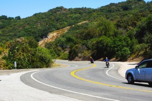
Nice section of CA 150 near Ojai

I’ve previously been on sections of the Pacific Coast Highway. It’s fabulously scenic, but there’s not a whole lot about it that drives me to want to carve through it on a motorcycle to get the most out of the ride. I remember too much time plodding along behind duffers with lines of cars behind them, not rolling on the throttle to course through the curves and drop a knee towards the pavement. I did ride the Ventura Highway several times, and that Eagle’s song jumps into your mind as soon as you see the sign.

My explorations this trip would be through central California, leaving the congestion of the coastal roads behind for the more challenging mountain passes. Unfortunately, this required time-wasting commutes on the expressway to reach them.

Photo-view-from-CA-33

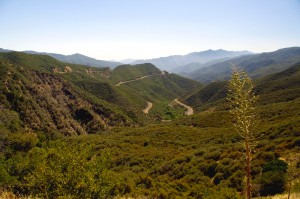
You can see the Channel Islands from atop CA 33

The highlight of all that highway riding was experiencing lane sharing when traffic backed up, which it frequently did. Not for the meek, the skinny Ducati sport bike I was on was perfectly suited for darting between the lines of slower cars, flitting into every hole that opened, and filtering through the traffic.  Surprisingly, the cars and trucks made room for you to pass. I guess it beats having a speeding bike scrape along your car. It was fun and I felt like I was given a free pass to cheat at the game.  I think we need more lane sharing in the US.

Photo-Ca-58

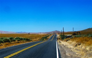
CA 58 a long, lonely ride to reach the twisties

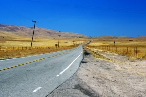
I was a little disappointed to find the rides out to reach the mountain passes long and quite tame. While there was less traffic, it’s still far busier then you’ll find secondary roads in my Blue Ridge Mountains back home.

I first went south from Santa Barabara to Carpenteria, then headed inland to Ojai. Most of the towns are pretty cool, they look like great places to visit, but not what I’d come to do.

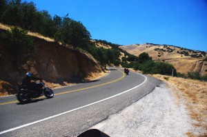
Leaving Ojai, my first run across the mountains on CA 33 had me feeling more at home. CA 33 is a good long run with curves that reminded me more of the Cherohala Skyway then the Dragon– a little more open and sweeping in comparison to the tight and technical curves I so enjoy back home.

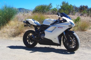
The Ducati 848 made enjoying the canyon rides at a spirited pace easy. While the suspension was set up way to stiff for my liking, it always provided as much traction as I asked for, the bike ran the curves like it was on a rial. It was a challenge to keep from hitting triple digits when the road opened up, a challenge I failed many times.

Photo-bikes-on-CA-58

A long twisty section makes CA 58 so great

Once over the mountains I came down into the oil fields and farmlands near Maricopa. I then headed north through the desert where temps were just shy of 100 degrees to pick up the next great ride near McKittrick, CA 58. Fortunately, I’d topped up the tank as the “No services next 70 miles” signs appeared. CA 58 was another outstanding ride through high open mountain passes, great curves, and  a whole of of fun. Lot’s of bikes on this ride, it’s a great one so long as you’re up in the mountains. Once you come down, things straighten out again. I was reminded of the midwest where you ride a road that runs like an arrow to the horizon for miles and miles until you come to a 20 mph right angle turn to do it all over again and again.

photo-wine-country

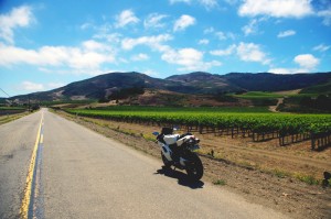
Cruising through wine country on Foxen Canyon and Santa Rosa Rds

I got bored on these long straight runs and after a while the speed crept up and up until I was playing a game to see if I could launch the bike off the hilltops as a the Ducati stretched it’s legs out and sang at the top of it’s booming baritone voice. I looped back through Santa Margarita then limped into San Luis Obispo with the reserve light crying out for a drink of fresh petrol. I wasted a bit of time looking for gas as every station was flagged off with yellow tape. They were all getting some kind of service done and I was running on fumes when I finally found one that had one bank of pumps in operation. I waited my turn in the long lines that had formed, then headed south on the freeway to return home.

Photo-coastal-fog

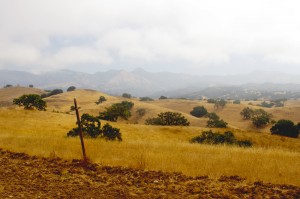
The coastal fog travels well inland and persists till after noon - Foxen Canyon Rd

The next day I headed north this time, taking CA 154 through the dense morning fog that rolls in off the ocean. My destination was Foxen Canyon Rd, a decent ride, but not as challenging as those I’d previously been on. Most of this day was in wine country and it was more scenic then I’d seen on the east side of the mountains. I worked my way from Santa Maria to Lompoc, then found a nice ride on Santa Rosa Rd. Passing through Solvang, I returned to Santa Barbara on CA 154, then got on the freeway and went back south to Carpenteria to make a few more runs on CA 33.

So how do the California motorcycle rides I was on compare to the Blue Ridge & Smoky Mountain motorcycle rides I know so well?

Photo-Ducati-848

The Ducati 848 - a precision guided missile - too much for all but the best riders

While the California rides were longer, so were the distances between them – they stood in isolation. Here in the Smokies, you finish one great road to continue your motorcycle ride on the next. You spend far more time in the nice sections and finding a long straight stretch of road means you made a wrong turn and left the mountains. I missed the green trees, the rushing mountain streams, the little waterfalls around the bends. The California countryside is dry, if not desert, close to it. Towns are much further apart, and you’ve got to pay attention to gas stations – when in doubt, top it out. You may have a long ride before you find another.

Photo-oil-derricks

Sometimes there are more oil derricks than trees

Many of the California roads were rough and bumpy – a patchwork of asphalt and concrete layer upon layer. I thought we had some rough rods, but I’m beginning to think we don’t have it so bad after all.

In the same amount of area I covered to reach just a few great motorcycle rides in California, there would have been a hundred or so in the Smokies and never  a 4 lane road or highway needed. I continue to believe there are more great motorcycle rides in the Blue Ridge and Smoky Mountains than any other area of the country.

To quote the now ex-governator, “I’ll be back”. Admittedly, I’ve barely touched the huge state of California. It’s a nice contrast to the motorcycle rides we have back home in the Smoky Mountains and makes me appreciate how great we’ve got it back east.

_______________________________________________________________________________
Wayne Busch
Wayne Busch – Cartographer
– Wayne Busch lives in Waynesville, NC, where he produces the most detailed and comprehensive and up-to-date motorcycle pocket maps of the Blue Ridge and Smoky Mountains to help you get the most of your vacation experience. See them here – AmericaRidesMaps.com 

The Blue Ridge Parkway – Old World Craftsmanship Endures

Photo--Blue-Ridge-Parkway-Sign

Blue Ridge Parkway - History preserved

As you make that Blue Ridge Parkway motorcycle ride this year you will encounter one major detour near Doughton Park just south of the Virginia border in North Carolina. Within this stretch of road, the beautifully crafted stone walls which line the shoulders of the Blue Ridge Parkway are being restored and foundations added to insure they endure long into the future.  Originally built by master stone masons brought from Europe, descendants of the original craftsmen now labor to re-craft the work done by their grandfathers.  This video shows the care being taken to preserve the historic legacy of the national park insuring each stone is returned to its original position.

While the park service has routed traffic north on a detour which takes you through Sparta, I’ve identified another more challenging and scenic detour route that will take you on a ride that gets you away from all the other traffic and takes you to sights those others miss seeing. This video shows you the details of what I believe is a better detour route for motorcycle travelers –

Use this link to download a map of this detour route you can print at home and take with you on your journey. goo.gl/pCRdP

This section of the Blue Ridge Parkway is detailed on America Rides Maps Map #3 – North Carolina / Virginia Border Rides, part of the 6 map Blue Ridge Parkway set.

_______________________________________________________________________________
Wayne Busch
Wayne Busch – Cartographer
– Wayne Busch lives in Waynesville, NC, where he produces the most detailed and comprehensive and up-to-date motorcycle pocket maps of the Blue Ridge and Smoky Mountains to help you get the most of your vacation experience. See them here – AmericaRidesMaps.com 

Popular Blue Ridge Parkway feature destroyed

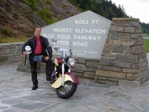
photo-sign-at-the-highest-point-on-the-Blue-Ridge-Parkway

The sign at the highest point on the Blue Ridge Parkway

What a surprise as our motorcycles rounded the bend on my favorite section of the Blue Ridge Parkway July 4 to find a familiar and highly visited overlook feature missing. We had to stop for a closer look.

It’s one of those classic photo opportunities on your Blue Ridge Parkway motorcycle ride – the highest point of the 469 mile roadway is prominently marked with a large sign at the popular overlook. You can pull your bikes right in front of it and get that great picture to commemorate your visit – until now. That sign is missing.

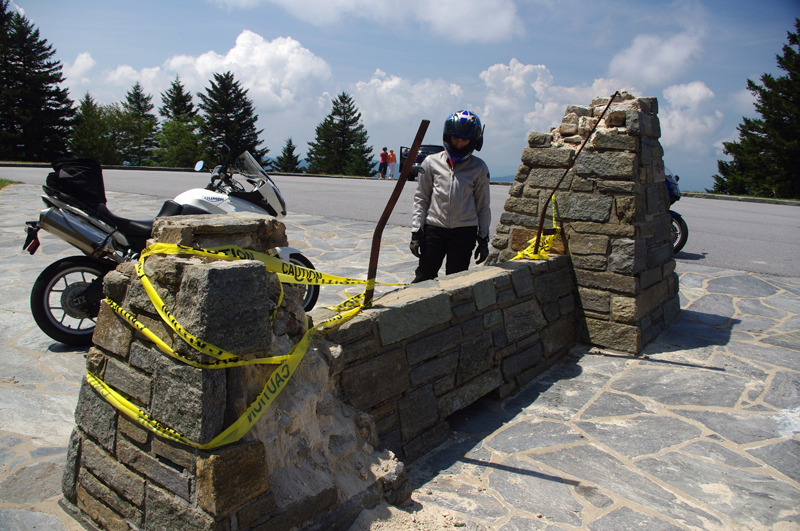
Photo-sign-destroyed-on-Blue-Ridge-Parkway

It used to be a classic photo spot - pull your bikes in front of the sign and get the picture for your scrapbook

My first though was it had been struck by a car. It would have had to be a big car though, at least an SUV, maybe even a small truck, but the evidence did not show signs of a collision.

Photo-sign-destoryed-on-Blue-Rdige-Parkway

Surveying the damage we speculate the sign was pushed over. Look at the bent steel supports, and the damage to the rock pillars up high.

The damage was too high, and it appeared more as if it had occurred from the top down. The twisted steel and fractured rock indicated the sign had probably been forced down by high wind, though it must have been one heck of a blow. Perhaps it was a tornado or one of those micro-burst events. At over 6000 feet elevation you can experience some pretty severe weather.

Photo-view-from-highest-point-on-the-Blue-Ridge-Parkway

The view from the highest point on the Blue Ridge Parkway.

Still, this sign has stood through harsh conditions for many years. I’m glad I wasn’t up high when this damage occurred. We’ve had extraordinarily unusual weather in the Smoky Mountains this year. Until now, I would have told you tornados don’t happen in the mountains. Great Smoky Mountains National Park has experienced a couple, you can still see the twisted steel tower in the middle of the lake at Deals Gap left when that cyclone blew through, and  I no longer know what to expect. Times are changing and the southeast has been pummeled with twisters this year.

If it’s the end-of-times, I’m going out riding my motorcycle. Watch me flash by in the twister like the wicked witch in the Wizard of Oz. See you on the yellow brick road.

You’ll find this outstanding motorcycle riding area featured on America Rides Maps “The Best Motorcycle Rides South of Great Smoky Mountains National Park

_______________________________________________________________________________
Wayne Busch
Wayne Busch – Cartographer
– Wayne Busch lives in Waynesville, NC, where he produces the most detailed and comprehensive and up-to-date motorcycle pocket maps of the Blue Ridge and Smoky Mountains to help you get the most of your vacation experience. See them here – AmericaRidesMaps.com 

Motorcycle friendly Blue Ridge Parkway lodging – Fiddlers Roost

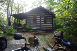
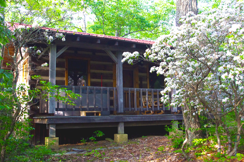
Photo-fiddlers-roost-cabin

Our cabin at Fiddlers Roost

Fiddler’s Roost Cabins are just off the Blue Ridge Parkway near milepost 214 and offer the motorcycle rider a nice place to stay. Just down the road from the Blue Ridge Music Center, the cabins are small but cozy, well fitted, and comfortable.

Our stay was brief, and it was hot, so we did not partake of the hot tub on the porch. We just needed a comfortable place to pass the night, and thats what we got.

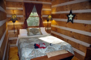
Photo-Fiddlers-Roost-Cabins-bedroom

Bedroom - cozy and comfortable

We also missed out on the breakfast delivered to our door the next morning. While it’s reported to be outstanding, it doesn’t arrive until 9:30 – 10 AM and we had too many miles to go to postpone our journeys for the day.

The cabins are fairly isolated so you have privacy. Access is via a gravel road with a bit of incline which had me wondering about how well it would be negotiated by a fully loaded bike with two riders. The road was in decent shape and we had no issues.

The isolation comes at a price – there’s no food nearby, it’s a 10 minute ride into Galax to get a bite to eat. If you’re packing your own vittles, there is a refrigerator and stove in the cabins.

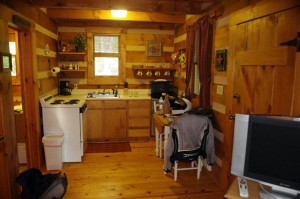
Photo-Fiddlers-Roost-cabins-kitchen

The Kitchen

We made the ride, grabbed dinner at a Chinese restaurant, then returned to the cabin to enjoy a bottle of Chateau Morrisette wine and some cheese we’d picked up on our way to the cabin on the Blue Ridge Parkway.

Overall, it’s a nice place to stay, maybe a little too slow paced for road warriors like us who are up early, ride long and hard, and come in late.

Fiddler’s Roost Cabins

Photo-Fiddlers-Roost-cabins-view

Nice little cabins in a nice setting

_______________________________________________________________________________
Wayne Busch
Wayne Busch – Cartographer
– Wayne Busch lives in Waynesville, NC, where he produces the most detailed and comprehensive and up-to-date motorcycle pocket maps of the Blue Ridge and Smoky Mountains to help you get the most of your vacation experience. See them here – AmericaRidesMaps.com 


What is a Blue Ridge Parkway Milepost?

AWMXDX9J8QT9

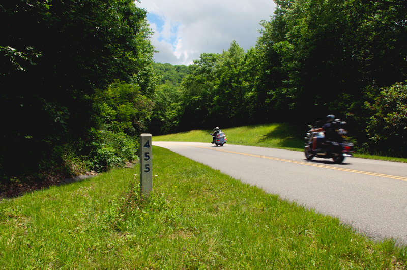
photo-blue-ridge-parkway-milepost

Blue Ridge Parkway milepost 455 not far from Waynesville, NC

When planning your Blue Ridge Parkway motorcycle ride you’ll find references to mileposts handy. Every mile along the Blue Ridge Parkway, you’ll find a concrete post with the mileage of the 469.1 mile long motorcycle ride displayed. Miles run from north to south, the further south you go, the higher they get. The milepost shown here, #455, is near the southern end not far from Waynesville.

Mileposts make navigation much easier and better allow you to track your progress on your Blue Ridge Parkway motorcycle vacation tour.

_______________________________________________________________________________

Wayne Busch
Wayne Busch – Cartographer
– Wayne Busch lives in Waynesville, NC, where he produces the most detailed and comprehensive and up-to-date motorcycle pocket maps of the Blue Ridge and Smoky Mountains to help you get the most of your vacation experience. See them here – AmericaRidesMaps.com 

2SearchBlogs Web

Favorite Blue Ridge Parkway Motorcycle Pit Stops – Chateau Morrisette, VA

Photo-Chateau Morisette on the Blue Ridge Parkway

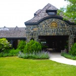
Chateau Morrisette on the Blue Ridge Parkway

The romantic relationship we have with Chateau Morrisette winery on the Blue Ridge Parkway goes back to a motorcycle trip many years ago. Tired and hungry from a long day on the lower Virginia section of the Blue Ridge Parkway, we stumbled in looking for a bite to eat only to find the kitchen had just stopped serving for lunch. Our disappointment must have radiated as the chef emerged from the kitchen, took one look at us, and said, I’ll take care of them”.

photo-Restaurant-terrace-at Chateau-Morrisette

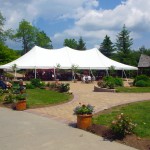
The Restaurant Terrace

We were seated on the beautiful mediterranean style porch with it’s panoramic views of the rolling Virginia countryside. A short time later sandwiches arrived at the table and we devoured one of the best meals we’d had in days. I remember a delicious portabello mushroom  on crustini bread draped in a melted cheese which we accompanied by a glass of Black Dog Red wine and knew we’d found a  heavenly oasis.  I’ve never missed a chance to stop at the Chateau Morrisette since nor ever been disappointed.

Photo-tasting-room-at-chateau-morrisette

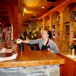
The tasting room

Over the years, the winery has grown in size and reputation. In times past it was one of the few landmarks you could easily identify from the Blue Ridge Parkway. Far out across one of those idyllic mountain farm fields, a long low series of signs spelled out the name of the winery in large letters. Gone now, the only way to find  it is to know where it is and watch for it. Success has meant one of the few advertisements along the Blue Ridge Parkway is no longer needed, and the parkway ethic is enhanced by it’s absence.

photo-terrace-at-chateau-morrisette

Live entertainment is common on weekends

While the restaurant remains much as I remember it, the new building at the vinyard is now the hub of activity. The regal architecture hosts the tasting room, gift shop, and is the sales outlet for the wines. The terrace outside is the gathering and resting place where patrons sit and enjoy their glasses of local vintage to the accompaniment of snacks and often live entertainment.

Photo-Chateau-Morrisette-Restaurant

Chateau Morrisette Restaurant

On a weekend visit you’re happy to be on a motorcycle where you can slip into corners in the crowded parking lot. There are frequent events, a stage on the beautiful grounds for concerts and such, it seems there’s always something going on at this popular destination.

Chateau Morrisette winery

Chateau Morrisette is locate at milepost 168.8 on the Blue Ridge Parkway south of Tuggles Gap. Look for Black Ridge Road, then spur off quickly onto Winery Road. You’ll arrive in 0.6 miles.

photo-Chateau-Morrisette-Wine

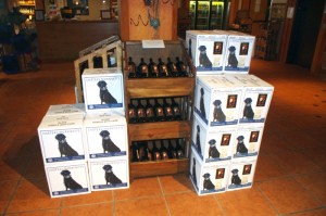
Chateau Morrisette's Black Dog Wines - Tasty

You’ll find Chateau Morrisette and all the surrounding great motorcycle rides in the area on America Rides Maps #3 of the Complete Blue Ridge Parkway seriesNorth Carolina / Virginia Border Rides.

_______________________________________________________________________________

Wayne Busch
Wayne Busch – Cartographer
– Wayne Busch lives in Waynesville, NC, where he produces the most detailed and comprehensive and up-to-date motorcycle pocket maps of the Blue Ridge and Smoky Mountains to help you get the most of your vacation experience. See them here – AmericaRidesMaps.com 


Blue Ridge Motorcycle Touring – Natural Bridge, Virginia

In general, I avoid the touristy sights on my motorcycle travels as I get my kicks from the road. It’s the hundreds of great motorcycle rides in the Blue Ridge and Smoky Mountains I most enjoy, and that is best done with the kickstand up and the throttle open. I need a pretty good reason to park the motorcycle and go for a walk, and Natural Bridge, Virginia, is worth time the time to stop and see.

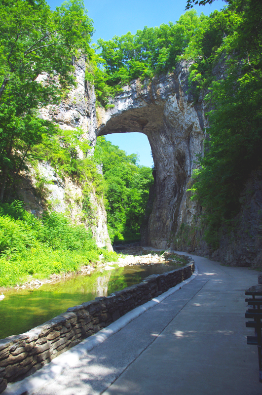
Photo-Natural-Bridge-view

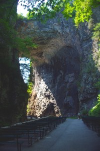
The Natural Bridge, a Viriginia landmark worth seeing.

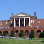
Photo-Natural-Bridge-Hotel

The Natural Bridge Hotel, a historic landmark

Natural Bridge has been around for a long time. It was already a tourist destination when Thomas Jefferson visited. This 200 foot high natural arch started as a cavern millennia ago. Over the eons erosion collapsed the majority of it leaving only the dramatic and inspiring rock formation that has drawn thousands of spectators over the last few centuries.

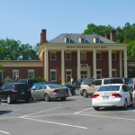
Photo-Natural-Bridge-Entrance-and-Gift-Shop

Natural Bridge Entrance and Gift Shop

This long history was part of the attraction for me. There are many early sketches and historic reports of the landmark displayed in the museum, it is part of our national heritage. This legacy though has come at the cost of commercialization of the natural attraction with manufactured ones added to woo the crowds and entice them to part with their dollars.

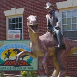
Photo-Cowboy-on-a-dinosaur

I managed to escape the Dinosaur Kingdom

We passed on the wax museum, the butterfly room, and most all the other man-made enhancements designed to lure the tourist. I was particularly amused by the hook for the “Escape from the Dinosaur Kingdom” with a statue of a cowboy riding a dinosaur. Easy to pass on that one, I’m quite satisfied with the Flintsone’s version of pre-history. Yabba-dabba dumb, but I’ll bet the kids like it as well as the Haunted Monster Museum.

Photo-Indian-village

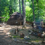
The Indian Village re-creation.

We did walk the trail to view the re-created native indian village, but it pales in comparison to the main attraction.

We paid $18 a piece for a ticket that gave us partial access to all the attractions. All we really wanted to see was the Natural Bridge. It’s a short walk and worth the time, and while I we could have seen all the other kitschy stuff, I felt my money well spent avoiding it.

A side trip to Natural Bridge, Virginia is an easy and pleasant ride from the Blue Ridge Parkway. Exit near the James River Visitor Center on US 501 (milepost 63.7) or VA 130  a couple miles north (milepost 61.6, and the better ride). Follow Us 501 / VA 130 to Glasgow, turning right on VA 130 to pass through the small town for another 4 miles or so. Don’t worry, you can’t miss it when you arrive.

Photo-Natural-Bridge-view

View of the other side of the Natural Bridge

Natural Bridge, Virginia

The Natural Bridge and other scenic attractions nearby are found on Map #1 of the 6 map Blue Ridge Parkway series of motorcycle pocket maps by America Rides Maps. Don’t miss all the great motorcycle rides in this area.

Image-map-cover

Great rides Near the Start of the Blue Ridge Parkway in Virginia

_______________________________________________________________________________
Wayne Busch
Wayne Busch – Cartographer
– Wayne Busch lives in Waynesville, NC, where he produces the most detailed and comprehensive and up-to-date motorcycle pocket maps of the Blue Ridge and Smoky Mountains to help you get the most of your vacation experience. See them here – AmericaRidesMaps.com 

Motorcycle Touring – Sights: Spectacular Roadside Waterfall in VA

Photo-Falling_spring-VA

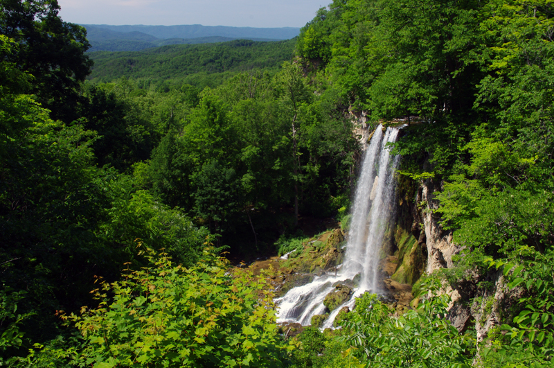
Falling Spring on US 220 north of Covington, VA

Located about 4 miles north of Covington, Virginia, Falling Spring has been an attraction referenced as far back as Thomas Jefferson. It’s an easy to locate, well marked pull off on this curvy section of US 220 (a.k.a Sam Snead Highway).

Jackie and I passed through here Sunday on our motorcycle ride as we explored the wealth of great motorcycle roads west of the north end of the Blue Ridge Parkway. It’s a popular rest stop for bikers who flock to ride this great section of US 220 north of Covington. After revisiting Sam Snead Highway I’ve decided it should be upgraded on my America Rides Maps. I currently show only the portion south from the falls as being a great ride, while in truth the entire section from VA 39 south is outstanding. As much as I’d like to give it my top rating, due to the traffic load I can only feel right listing it as a “Good Connector” road.

For the casual cruiser who’s just out to enjoy the ride through the spectacular scenic countryside it’s a superb motorcycle ride. For those looking for a more spirited approach to the twisty sections, of which there are plenty, you’ll want to ride this one during the off hours and preferably during the week.

This roadside waterfall and the surrounding great motorcycle rides in the area are found on map #1 of The Complete Blue Ridge Parkway 6 Map Series from America Rides Maps.

_______________________________________________________________________________
Wayne Busch
Wayne Busch – Cartographer
– Wayne Busch lives in Waynesville, NC, where he produces the most detailed and comprehensive and up-to-date motorcycle pocket maps of the Blue Ridge and Smoky Mountains to help you get the most of your vacation experience. See them here – AmericaRidesMaps.com 

Asheville Lodging Bargain for Blue Ridge Parkway Motorcycle Travelers

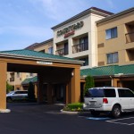
Photo - Courtyard Marriott Asheville

Courtyard Marriott - Asheville

Courtyard Marriott and SpringHill Suites in Asheville is offering motorcycle travelers a 20% DISCOUNT on your stay and all you’ve got to do is tell them I sent you! How cool is that?

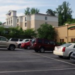
Springhill Suites - Asheville

SpringHill Suites - Carrabbas between the two inns

You know what a difference it makes to stay in a nice, comfortable, clean and quiet place where you can decompress and relax when you’ve been piling on the miles. You’ll appreciate knowing there’s something good waiting for you in Asheville, an easy-to-find place you can count on for a quality experience that welcomes motorcycle riders like you.

Photo - Corporate at Marriott

Lynn Prater, John Zellers, Christy Shamp, Teresa Taylor sincerely want your motorcycle business

Marriott Hotels honestly want to serve the motorcycle traveler and show you a good time in one of the top destination cities in the southeast – Asheville, North Carolina. Just 5 minutes from the Blue Ridge Parkway exit at US 70 just south of the Folk Art Center, it’s s straight shot and easy ride to outstanding and convenient accommodations.

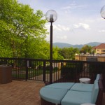
Photo - View from the SpringHill Suites

View from the SpringHill Suites

Thank Sales Manager Christy Shamp for the favor. I met her at the Asheville Bikefest as she and her crew spent the long hours staffing a table next to mine promoting a charitable cause. We got to talking during our breaks and she was quite enthused about the motorcycle riders she was meeting at the event as well as the Yamaha factory crew they hosted at the SpringHill Suites. Christy’s corporate team was coming to town the following week and she asked if I’d come by and tell them about what I do.

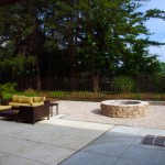
Photo - Firepit at the Courtyard by Marriott

Firepit at the Courtyard by Marriott

So I spent a few minutes with corporate, toured both inns with Christy, and saw what they had to offer the motorcycle rider. I’m convinced they sincerely want your motorcycle business. Here’s what I found:

  • It’s barely 5 minutes from the Blue Ridge Parkway and a straight shot to get there
  • Both the SpringHill Suites and Courtyard Marriott sit well back from the road away from the noise of the traffic. Nor does the back of them border the highway. It’s pretty quiet for such a good location on the edge of downtown.
  • Level paved secure easy parking – can accommodate trailers
  • There’s a Carabbas between the inns, a Starbucks, and plenty of great places to eat nearby.
  • It’s about 2 minutes to get on I-240 to scoot around the city and just as easy to get downtown to enjoy what makes Asheville such a popular destination.
  • Enjoy a nice view of the mountains on the horizon from your room, the pool, or the outdoor fire pit.
Photo - Parkway exit 70W

Use the US 70 West exit on the Blue Ridge Parkway and just follow the road.

Everyone I met was happy, enthusiastic, and accommodating which pretty much describes a visit to Asheville. It’s consistently in the top 5 US travel destinations and continues to win awards (Beer City USA 3 years in a row!). A presidential visit is no longer out of the ordinary, a few movie stars reside on the surrounding slopes, and the Blue Ridge Parkway hugs the east side of the city. In a word – it’s easy.

Here’s a strategy to try when you visit Asheville– ride downtown and find a place to park. Walk a block in any direction. You’ve most likely arrived at or passed some excellent dining. It’s hard to find a bad meal in Asheville and you don’t have to go far.

Courtyard by Marriott
SpringHill Suites by Marriott
phone: 828-252-5831
fax: 828-281-1069
email: ashevillessc@mckibbonhotels.com
www.courtyardasheville.com
www.springhillsuitesasheville.com

_______________________________________________________________________________
Wayne Busch
Wayne Busch – Cartographer
– Wayne Busch lives in Waynesville, NC, where he produces the most detailed and comprehensive and up-to-date motorcycle pocket maps of the Blue Ridge and Smoky Mountains to help you get the most of your vacation experience. See them here – AmericaRidesMaps.com