Tail of the Dragon Closed – Great Rides Nearby – Hot Springs

No new info on the rock slide which has closed the Tail of the Dragon at Deals Gap. In a previous post I suggested some great rides nearby in the “Land of the Waterfalls” and provided a video sample. It’s just one great spot near the Tail of the Dragon with great motorcycle rides nearby, here’s another.

Photo - View of Hot Springs, NC

Hot Springs, NC - A town so small it fits on one photo.

This time I’m going to direct you to an area which sees little traffic, yet contains some fabulous and challenging motorcycle rides with some enjoyable sights and scenery. It’s an area most motorcycle tourists either drive right past on their way into the region or sample only the most notable road. Trust me, there is a lot there to explore and enjoy.

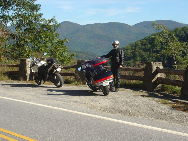
Photo - A roadside view near Hot Springs

Pausing to admire the view near Hot Springs, NC

I urge you to spend some time riding the great roads found in the mountains east of Great Smoky Mountains National Park. The Smoky Mountains do not end at the border of the park, in fact they continue their long run northward reaching their greatest heights north of Asheville, North Carolina at Mt. Mitchell, highest peak in the east just off the Blue Ridge Parkway. The mountains between the park and Mt. Mitchell are spectacular and beautiful, the valleys dotted with rural farms and tiny hamlets, sections of wild national forest, and roads which trace the serpentine courses of rushing mountain streams.

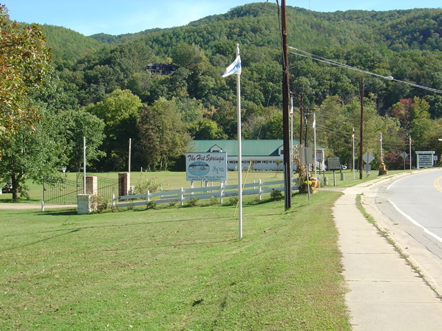
Photo - entrance to the Hot Springs Spa

Entrance to the Hot Springs Spa - Natural Mineral Baths and Massage

The hub of this great motorcycle riding area is the small and historic town of Hot Springs. It’s a good place to pause for lunch, do a little sightseeing, and maybe pay a visit to the natural hot springs which give the town its name. Long popular with hikers (the Appalachian Trail passes through town), fly fisherman, and whitewater rafters and kayakers on the French Broad River, it’s also a popular local motorcycle watering hole as it’s a convenient ride from Asheville.

Photo - French Broad River at Hot Springs

The French Broad River flows through Hot Springs

Honestly, there’s not a lot to the town. No traffic light. One gas station. A few shops and restaurants, a campground, and of course the Hot Springs Spa. You can capture the whole thing in a photo. It’s the roads and the beautiful countryside which surrounds that makes it worth the visit.

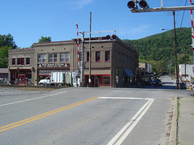
Photo - Iron Horse Station, Hot Springs

Iron Horse Station - One of several places to grab a bite and quench your thirst in Hot Springs.

If you take but one ride into the area, do the classic section of NC 209 which runs from Lake Junaluska to the heart of town. It’s such a nice ride. It takes about an hour one way. It’s a local classic. Be aware there is plenty more out there if you know where to look for it.

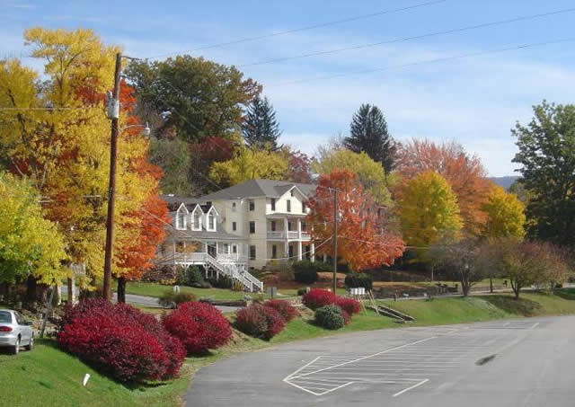
Photo - Fall Color at Lake Junaluska

One of the best rides, NC 209, starts near Lake Junaluska

I’ve been working on a video to showcase the area, though the severe winter pretty much closed the door on that for a long while. I’ll be getting back to it ASAP. Here’s the sample that gives you a good idea of what to expect:

http://www.youtube.com/watch?v=3hsCLMCIUOo

For more detail on the area look to America Rides Maps ” East of the Smokies, West of Asheville, All Around Hot Springs” map which catalogues about 400 miles of the best roads in this small area.

Don’t worry, there’s still more great riding alternatives to come in future posts. Closing the Tail of the Dragon opens the door to you discovering just how much you’ve been missing.

Motorcycle Vacation Planning – Great Ride Alternatives

SEE SOME WATERFALLS!

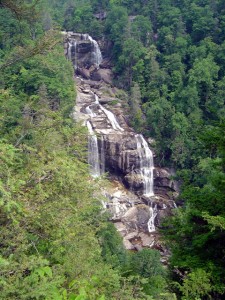
Photo - Whitewater Falls Highest in the east

Whitewater Falls - Highest in the east

With the Tail of the Dragon at Deals Gap on the North Carolina / Tennessee state line now closed due to a rock slide, many who have made reservations in advance may be wondering what to do. Before you cancel those reservations, consider there are plenty of alternatives to discover great motorcycle rides in the area within easy reach.

The Cherohala Skyway, Tennessee’s version of the Blue Ridge Parkway, remains open and is a fine ride, though be aware much of the regional traffic will be shifting onto it. It’s not quite the challenge to ride, but it makes up the deficiency with great scenery as it climbs to over 5000 feet before entering North Carolina.

Of course, NC 28 which intersects US 129 in North Carolina at the southern end of the Tail of the Dragon will be there for those looking for a more challenging motorcycle route. With the Dragon closed, I suspect traffic on it will be light. Don’t let this road fool you, it “bites” more riders than the Dragon in that it is not as predictable. Where the Dragon has one turn after another, you know what to expect,  NC 28 has some more open stretches where you can pick up speed only to find the upcoming 10 mph corner is far sharper than you are ready for.

Many motorcycle tourers who ride this section of NC 28 don’t realize it continues further south into South Carolina and miss out on a great section of road. It grows to 4 lanes as it reaches the intersection with the Great Smoky Mountains Expressway, continues a few miles on the highway, then diverts south again to become a wonderful two lane road again. All in all, it’s more than 100 miles of truly great motorcycle riding with but a few interruptions where it passes through Franklin and Highlands.

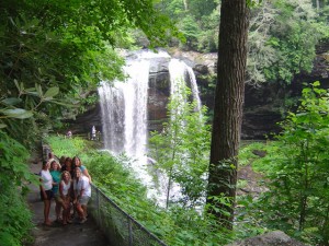
Photo - Dry Falls

Dry Falls - You can walk behind them

The first area I highly recommend you spend some time motorcycle riding is often called the “Land of the Waterfalls”. Comprised primarily of the wild mountains of the Nantahala and Pisgah National Forests, this area south of Great Smoky Mountains National Park hosts one of the greatest collections of easy to view roadside waterfalls in the nation including the highest waterfall east of the Rockies.

This rugged area is laced with challenging and scenic motorcycle roads including the highest and most beautiful section of the Blue Ridge Parkway. Springtime is the best season to see them before the summer leaves obscure the views.

Here’s a video sample of them from America Rides Maps;

http://www.youtube.com/watch?v=eBrB5lrtZ9I

Don’t let the closure of the Tail of the Dragon ruin your motorcycle vacation. There are plenty of great rides just over the hill. These are some of the best, more to come.

Contact http://americaridesmaps.com for more suggestions and advice.

New Rock Slide Affects Motorcycle Vacation Plans to Smokies

Add yet another rock slide to the long list of road closures in the mountains of western North Carolina and eastern Tennessee. This one in particular will affect many motorcycle vacation plans to visit one of the most popular and well known rides in the region, the infamous Tail of the Dragon on US 129 at Deals Gap. Located along the western border of Great Smoky Mountains National Park, the 13 mile stretch of US 129 with it’s 311 curves draws hundreds of thousands of motorcycle and sports car enthusiasts each year who come to experience the challenging stretch of road.

It’s been an exceptional year for rock slides in the Smokies, the most notable being the massive slide along the eastern edge of Great Smoky Mountains National Park which has closed Interstate 40 for months. With both the east and west routes around the park closed, the only route allowing north-south travel from Tennessee to North Carolina is US 411 which cuts through the heart of the park and it too has been the scene of slides. US 441 is presently open, though cleanup continues on the northern spur road.

The Tail of the Dragon is still accessible from the North Carolina side. From Tennessee, the best route is through Tellico Plains and onto the Cherohala Skyway. Expect increased traffic loads on TN 68 approaching Tellico Plains due to yet another rock slide on US 64-74 in the Ocoee River Gorge which has shifted traffic onto it. As far as I can tell, it is still possible to reach Pumpkin Center from Vonure on the north end of the Dragon via the popular Dragon – Cherohala loop ride. Still, even more traffic will now be using these roads and you may want to reconsider visiting the area until things improve.

I’ve been reporting on the status of all the rock slides and road closures in my newsletter which you’ll find archived here – http://budurl.com/3smm. As there are so many, so widely scattered, it may be the easiest place to find all the information without bouncing around to various DOT sites (they are rarely as up to date). With so much going on, I’ll probably post an extra edition or two to keep you apprised of the situation and help with your motorcycle vacation plans. There is a lot going on you need to be aware of including the progress on the clean up to the Blue Ridge Parkway after severe winter storm damage, the closed section there, and all the roads which have been closed in Great Smoky Mountains National Park for paving.

If you have early year travel plans to Robbinsville, Townsend, Gatlinburg, Pigeon Forge, Great Smoky Mountains National Park, or Franklin, I suggest you consider them carefully. Better alternative destinations for motorcycle touring would include Maggie Valley and Asheville. I’m am working with local lodgers to find you the best deals and affordable as well as luxury motorcycle friendly accommodations. I’ll be stepping up those efforts. Please email me for help. The changes in traffic patterns have severely impacted their business and there are some deals to be had. Watch the blog as I review them.

Finally, for America Rides Maps patrons, I want you to be aware these rock slides have impacted 3 of the 4 loop rides on the most popular map “Maggie Valley to Deals Gap and the Cherohala Skyway”. I strongly urge you to look at the “Waterfall Package” for the best alternative. These two maps will lead you into some of my favorite areas unaffected by the changing traffic patterns and open up a wealth of fantastic rides which are too often overlooked. These roads are the first place I head when looking for great riding, the first place I take tour groups, and hold everything you’ve come to expect from a motorcycle vacation in the Smokies.

It Doesn’t Get More Motorcycle Friendly Than This!

A lot of motels and lodgers CLAIM they are motorcycle friendly, even hang out a cute little sign. Few will show you hospitality like this and at a price that will have you inviting your buddies along! A Holiday Motel in Maggie Valley, North Carolina, only 5 miles from the best section of the Blue Ridge Parkway, stands out. Check out this video from last summer;


http://www.youtube.com/watch?v=zvUaArTyhOo

They are located in the heart of town, walking distance to restaurants and bars, have a restaurant on site for breakfast, offer covered parking for your bike right in front of your room and rocking chairs to sit and enjoy the view of the sunset reflecting off your chrome.

Add to that a bike wash area, grills and picnic tables, a fire pit, a pool, a horse shoe pit, clean rooms at surprisingly low prices, and personal attention and hospitality that goes beyond what you expect, nestled in the friendly mountains which line every horizon.

Don’t come alone! They’ll set up a tent for groups and cater your party, even bring out the big projection screen to watch your favorite movies.

Here’s what one visitor had to say –


http://www.youtube.com/watch?v=yGgsBURxBv4

I know Gabi and Rob personally and you’ve got my promise they’ll show you a great time and help you have one of the best motorcycle vacations ever. I wouldn’t be recommending them otherwise.

Rob & Gabi Edwards
A Holiday Motel – Your Preferred Lodging
828-926-1186
877-686-4386
www.holidaymotel.net

Blue Ridge Parkway On Ice – Photos / Video

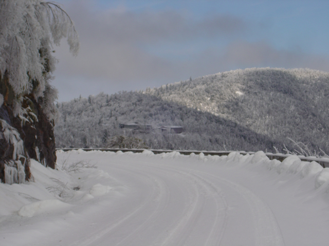
With all the snow and cold weather we’ve had this winter, riding the motorcycle has been only a dream. This afternoon, we headed up to the Blue Ridge Parkway to enjoy it in full winter glory.

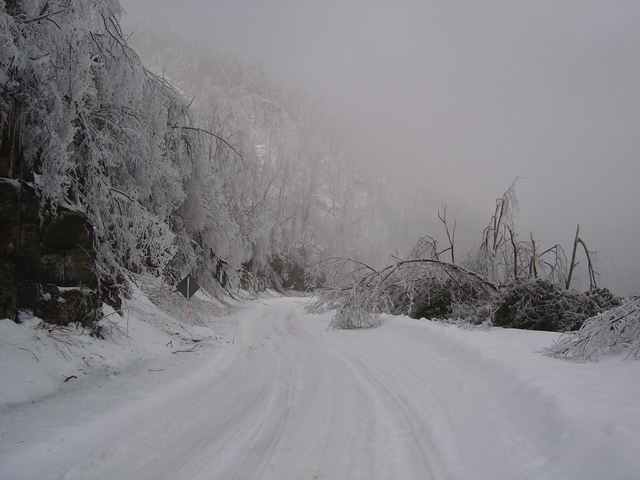
An ice storm hit last night. Damage was extensive.

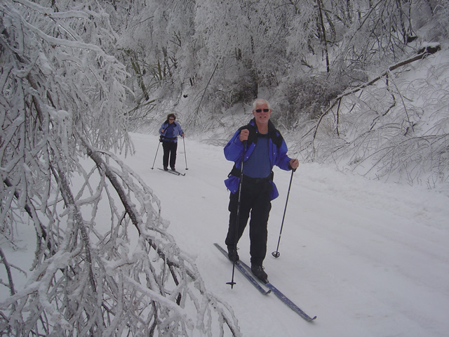
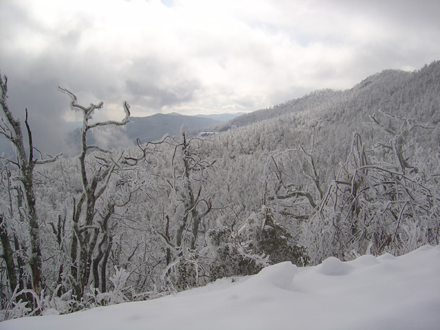
While “Snowmageddon” hit Washington we were largely spared it’s fury in the high mountains of western North Carolina. We picked up a few more inches here and there to what was already a significant accumulation. What we did get with this storm was ice. You can see the trees bent over from the weight of it.

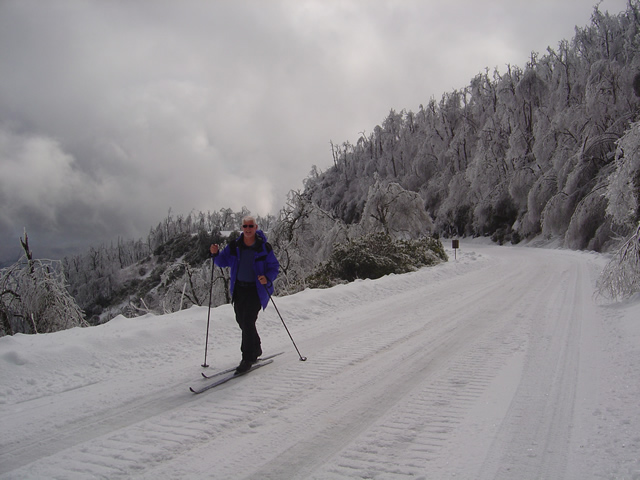
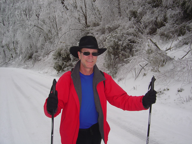
Photo - skiing the parkway

Cross country skiing on the highest sections of the Blue Ridge Parkway

For those of us who live here, the Blue Ridge Parkway becomes our winter playground when it closes for the colder season. This section has seen park service traffic to maintain a communications tower. It made for nice skiing.

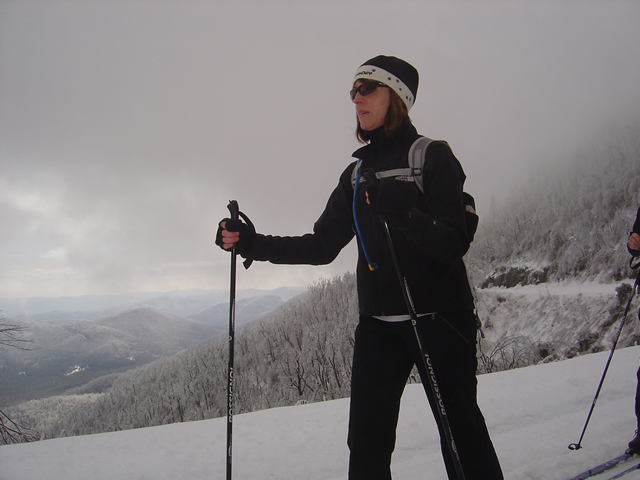
Jackie Skiing

When the snow is good, the skiing here is great

We started at Wagon Road Gap where US 276 and the Parkway meet at on of the highest crossings. From there, we headed east towards Asheville.

Ice was bringing down trees the whole time we were out.

The coating of rhyme ice, while beautiful, was causing extensive damage. The surroundings were filled with the almost constant sound of limbs and even entire trees breaking from the weight of the ice. Large branches lay everywhere. In places, every tree had been snapped and I saw none higher than about 12 feet, their tops broken off. A hike in the woods would be deadly.

Heavy ice coats and brings down surrounding trees.

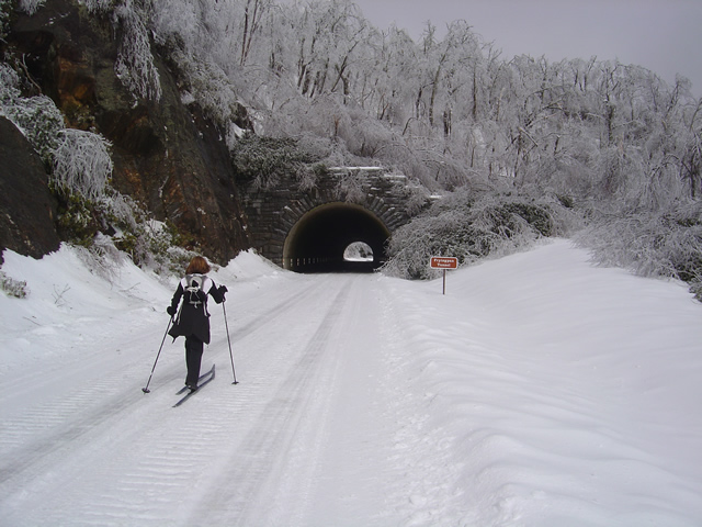
We skied as far as the Pisgah Inn near Mount Pisgah passing through the Frying Pan Tunnel. Along the way we ran into a convoy of rangers hauling in equipment to repair the communications tower which must have been damaged by the storm or its aftermath.

Jackie approaches the Frying Pan Tunnel.

Being one of the highest and most rugged sections of the Blue Ridge Parkway, there are more tunnels in this area than any other. Most are not very long, like this one, though the majority are curved. This is a spectacular scenic area in summer. What a contrast and compliment in winter.

The group pauses to take off skis to walk through the tunnel.

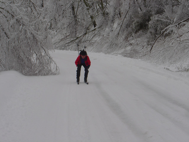
The nice thing about this route is it’s a very gentle climb from Wagon Road Gap to Mount Pisgah. Up hill on the way out, but downhill on the way back. Skiing takes on a whole new aspect when you change from uphill to downhill.

Wayne makes up some time on the downhill sections.

By the time we reached the Pisgah Inn it was shrouded in thick cloud and I couldn’t get any close up photos of it or Mt.Pisgah. The inn is closed of course, though the joke of the day was getting a beer and a meal once we reached it.

The Pisgah Inn seen from distance.

Few people ever see the Blue Ridge Parkway like this. It is admittedly a rare occurrence in recent times, at least until this year. Now it’s to the point we look at this a realize just how much snow has already melted and remember how deep it once was. We’ve not had ice like this though, and it will be spring before we realize just how much impact it had.

Wayne, the author,makes the most of a snowy winter

My wife shot some video of our excursion and posted it on You Tube. It really captures the scenery and the experience, and shows just how bad a skier I really am. Enjoy.

Motorcycle Waterfall Tour

[

]

This video shows a dozen or so of the roadside waterfalls included on America Rides Maps “The Best Roads South of Great Smoky Mountains National Park – EAST“.

When combined with the companion map “The Best Roads South of Great Smoky Mountains National Park – WEST“, nearly 20 roadside waterfalls can be enjoyed on your rides through the mountains of North Carolina.

Neither of these maps is purposely designed to focus on waterfalls, rather they guide you to the most exciting and beautiful undiscovered back roads which wind throughout the wild woods of the mountains just south of our nations most popular national park. There are plenty of other spectacular sights to see. Visit America Rides Maps to discover thousands of miles of two lane mountain roads packed with scenery, devoid of traffic, and more!


Wayne Busch - AMERICA RIDES MAPS

Wayne Busch – AMERICA RIDES MAPS

Wayne@americaridesmaps.com

>> Go To America Rides Maps.comhttp://americaridesmaps.com