Motorcycle + Ice + Fun = Minor Damage

A minute after this photo was taken my bike lay on its side and I couldn’t pick it up.
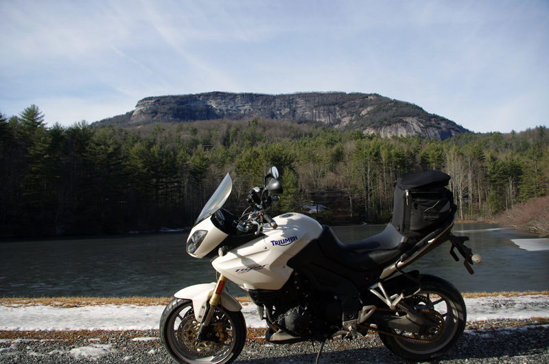
Photo-Whitesides-mountain-nc-motorcycle-by-frozen-lake

A minute after this photo was taken my bike lay on its side and I couldn't pick it up. Whiteside Mountain in the background has the highest cliffs in the east.

It was the last of the roads I planned to explore on a winter motorcycle riding dayin the Blue Ridge Mountains. I stopped at this frozen lake to take the picture beneath the 1000 foot cliffs of Whiteside Mountain. As I tried to turn the bike around and leave, my foot slipped on the icy gravel and down it went. Each time I tried to pick it up the wheels just skated on the frozen ground and I couldn’t get the leverage to lift it. Within minutes I was exhausted, out of breath, and starting to seriously wonder just how I was going to get out of this predicament.
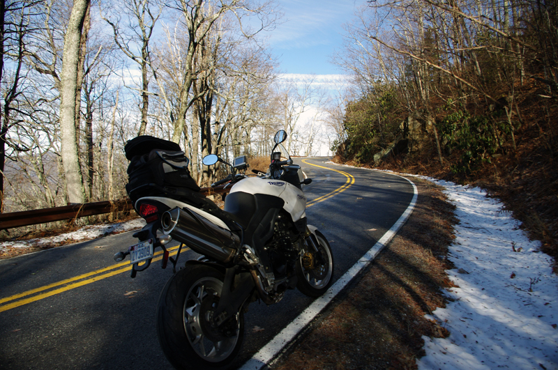
Photo-motorcycle-on-icy-US-276

I didn't realize how icy US 276 was until I stopped. My feet skidded on the thin coat of black ice that covered parts of the road. It had been a long slow climb to get this far.

Had I any sense I would have turned back this morning and put this off, but I’ve set a deadline for this motorcycle ride map revision. After several days of a hard cold followed by rain, I figured the roads should be in better shape now with the relatively warmer weather. When the frostless morning came with 33 degrees on the thermometer and the promise of sunshine, I was elated to get back out on the road. It wasn’t as warm as I thought.

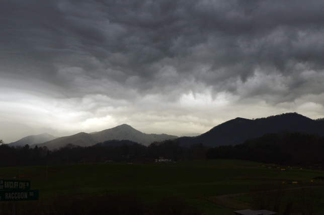
Photo-view-of-mountains-in-clouds-from-Blue-Ridge-Parkway

As I looked south when I crossed the Blue Ridge Parkway my destination lay beneath that bank of clouds near those mountaintop islands on the left horizon.

Heading out things appeared to be fine. The rains melted all but the last clumps of snow the plows had skidded to the roadside. The ride out through the Bethel Valley was as usual. Once I entered the Pisgah Forest and started the winding climb to crest the Blue Ridge Parkway it got interesting.
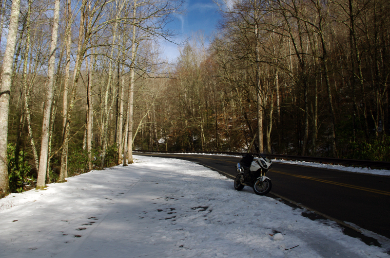
photo-motorcycle-on-snowy-US-276

I thought conditions would get better once I started down the south side of the mountains but if got worse until I reached US 64 in Brevard.

This is where I’m supposed to entertain you
with how hard it was, how bad the roads were,
that it was all harrowing moments
of slips and slides and near spills –
That’s not how I recall it.

I play with conditions like these,
flirting with the balance
at the the edge of control.
Find the sweet spot of the given moment,
do my best to guide the slides,
find the rhythm of the road,
and push as far as I dare let it go.
That’s what I remember –

It took 2 hours instead of one
to reach the South Carolina border,
but once I came down off Caesar’s Head
the ice was gone.
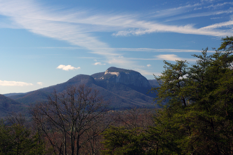
Photo-table-rock-south-carolina

Table Rock in Table Rock State Park, South Carolina, viewed from US 276 coming down through the hairpin turns that descend from Caesar's Head State Park.

I picked up a few new roads in South Carolina for you to enjoy on your motorcycle vacation tour this year including one that was so promising I’m going to research the potential for mapping in that area. While I had to be vigilant for salt and sand, I had lots of fun on motorcycle rides old and new to me. As soon as I crossed back into North Carolina the snow and ice was back.
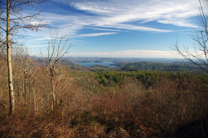
photo-winter-view-lake-jocassee-sc

A view of Lake Jocassee, SC from the Wiginton Scenic Byway as I climb back into snowy North Carolina. Whitewater Falls, highest in the east, feeds the lake.

I knew it was probably a waste of time to ride out into Whitesides Cove, but I know this great spot to get a picture. There’s always the chance the unpaved portion to Highlands has been improved. Unless I check periodically I don’t know when one of these two lane twisties has had an upgrade and is worth adding to my Blue Ridge motorcycle ride maps.
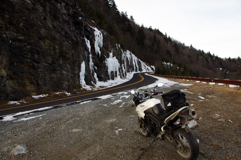
Photo-ice-on-NC-215

By spring these rocks on US 215 near the Beech Gap exit of the Blue Ridge Parkway will be coated with ice several feet thick.

You already know I got out of the jam. It sure wasn’t pretty. For a second I thought – “take a picture of this”, then a wiff of gasoline told me the longer it the bike lay there the less likely it would start. Little chance of someone passing by to help on this isolated road. The sun was getting low, things were already frozen, it would be a long cold night.  It was time to be working my way home.

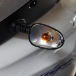
Photo-broken-lens

New lens already on order

I flushed with adrenaline when those thoughts hit, carefully considered the mechanics, dug my feet in, and with my back to the bike I half lifted-half wresteled the beast up with a quivering slo-mo almost failed heave. A broken turn lamp lens lay on the ground, the mirrors had twisted out of position, but otherwise the mud would wash away when I got home.

Hooray – I think that completes the roadwork I needed to finish up this new motorcycle ride map. I plan to have it ready by Christmas. It not only combines 2 existing maps into one, but adds more than a dozen new motorcycle roads I’ve never published before. It also gets nearly all the roadside waterfalls on a single map. This will be one of my most popular ride maps yet!

Visit America Rides Maps.com – the most inexpensive & comprehensive motorcycle ride maps available

_______________________________________________________________________________

Wayne Busch
Wayne Busch – Cartographer
– Wayne Busch lives in Waynesville, NC, where he produces the most detailed and comprehensive and up-to-date motorcycle pocket maps of the Blue Ridge and Smoky Mountains to help you get the most of your vacation experience. See them here – AmericaRidesMaps.com 
A Winter Day Searching for Great Smoky Mountain Motorcycle Rides

The Smoky Mountains of the Blue Ridge aren’t waiting for the official arrival of the solstice – winter time is pretty much here and now. Last week was messy, wrapping up with a deluge of rain.  When the weather broke a little yesterday, I finally got out to do some motorcycle riding. I waited for the sun to get high enough to minimize any icy patches on the road, then set out on a cold and mostly overcast day. It’s good that I did. It looks like we’re in for a cold wet stretch of dismal gray skies and the constant threat of rain or snow over the next few days. It’s hardly the kind of winter weather that inspires one to go dashing over the river and through the woods on your motorcycle no matter how much Grandma wants to see you. When the skies clear, you shouldn’t chance missing the opportunity to get out and ride. The good riding days will be more and more rare.

Photo - morning clouds bring us snow

After yesterdays break in the weather, clouds are moving back in this morning. Rain will turn to snow tonight, but not a significant amount. Blustery for the next few days.

I spent the afternoon prospecting for great motorcycle rides near Hendersonville, Mountain Home, Pisgah Forest, and Mills River. I’d not paid this area much attention before as it was not a piece of real estate previously included in one of my motorcycle maps.  There’s relatively high traffic and congestion around here and I tend to avoid going through, but I’m already thinking about the Asheville Bikefest in the spring and I want to become more knowledgable of this nearby area. It turns out there are a number of nice roads passing through it and I managed to locate and explore several good new ones I can now recommend as more enjoyable alternatives to the main roads.

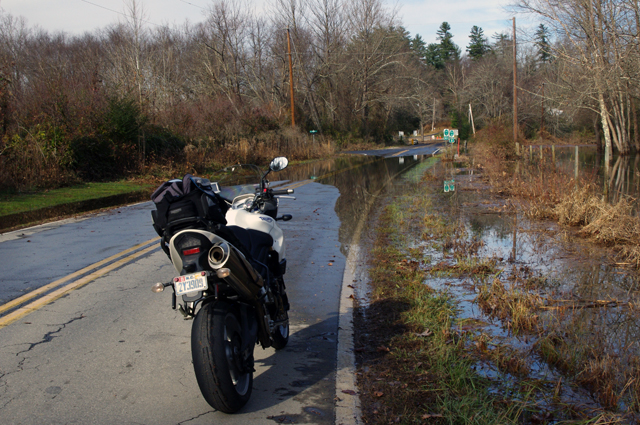
Photo - flooded road near Mills River

This area got hammered by recent heavy rains and I forded a few flooded roads this afternoon. While some were several feet deep yesterday and some cars got stranded, the water was only inches deep today.

Located south and slightly west of Asheville, the mountains in this area are not as high as those to the north in the Pisgah Forest. There are a number of rivers which flow through here, some farmland, a few high end neighborhoods, and some rugged and forested areas like the Dupont Forest with it’s many waterfalls. I -26 runs north-south just a few miles east and the border with South Carolina in only minutes away. It’s a pretty area, but the mountains of the Pisgah Forest and the Blue Ridge Parkway to the north overshadow it.

Photo - Looking Glass Falls

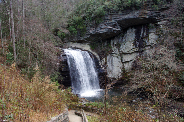
I commuted via US 276 from Waynesville to Brevard to reach the area. No ride on US 276 is complete without a stop at Looking Glass Falls.

The areas I have left to scout for this map revision (in progress) are scattered across 4 states. I’ve still got to press a little further into South Carolina then sweep west into the corner of Georgia to look at one potentially good road. The bulk of the remaining riding is in Tennessee, just north of Great Smoky Mountains National Park. I’ll need two really good days to thoroughly re-explore that area.

If the weather doesn’t break soon, I’ll start working on the next map, the companion to this one. I’ve got plenty to occupy my time. Still, I’d rather be out riding.

_______________________________________________________________________________

Wayne Busch
Wayne Busch – Cartographer
– Wayne Busch lives in Waynesville, NC, where he produces the most detailed and comprehensive and up-to-date motorcycle pocket maps of the Blue Ridge and Smoky Mountains to help you get the most of your vacation experience. See them here – AmericaRidesMaps.com 

Photos From Another Great Smoky Mountain Motorcycle Riding Day

Photo - 15 mph road sign

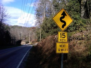
15 MPH NEXT 6 MILES - You've probably discovered a good ride when you see signs like this.

So I’m wrapping up this new motorcycle ride map which covers best motorcycle rides in the eastern half of Great Smoky Mountains National Park and I’m finally to the “get out and ride” stage. Most of the really tedious work is done, the stuff that keeps me in front of the computer. Today I took the afternoon to go out and ride some of the closer roads and it was superb.

When I do a map revision, I typically re-ride almost all the roads from the existing map to re-familiarize myself with them.  I think it’s the best way to judge newly discovered roads against the others I already know by making a fresh comparison. As some of my maps now have more than 50 featured roads I’ve got a lot of miles to cover. Sometimes a road I once considered top-notch pales a bit when new and better ones are discovered. When I do find a new road, I then seek out the best routes to connect them all together. All-in-all it adds up to a lot of mileage.

With a good frost this morning and temperatures that never creeped out of the 40’s, I saw only a few other motorcycles out on the road.  It was warm enough to leave the heated gear on the coat rack. Mid-week traffic was light and it was a great day to be out on the bike. Recent rains had helped clear the roads of the de-icing coating and gravel that had been laid down during the last cold snap.

Photo - Mountain view from one of the roads

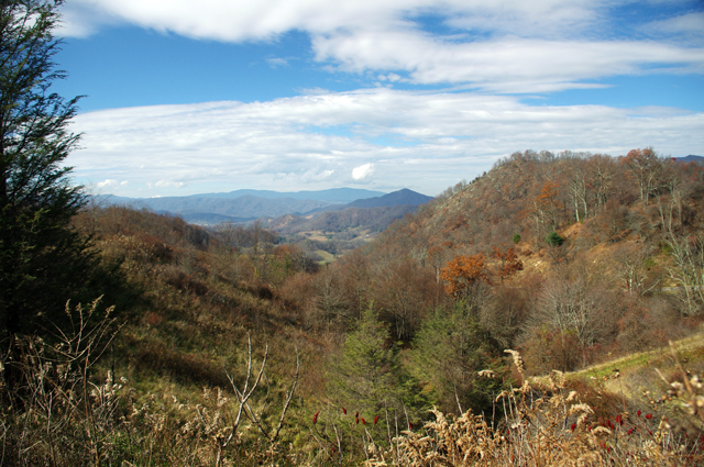
I snapped this photo atop the climb one of the great new roads made over a mountain. Views are sometimes better once the leaves are off the trees.

As is usual only a few of the new roads were really good rides though the two I found were so outstanding either would have made for a successful day. I routed my commute between them to include NC 215 so I could shoot some more video along the way for the upcoming production. Damn, that road is fun now that the south end has been repaved. The fresh asphalt has been exposed long enough that the oily surface has aged and the grip on the baby bottom smooth tarmac is outstanding. It’s a Jeckyl and Hyde experience though – as soon as you pass under the Blue Ridge Parkway the new pavement ends and the road quality becomes dangerous in places. Be on your toes where they started patching and paving the north side. I wonder if it didn’t get compacted enough as the gravel in the asphalt is loose. It’s really hard to see how bad it is until you’re in it and by then you’re slipping and sliding just as you enter the hairpin curves.

Photo - NC 215 winter view

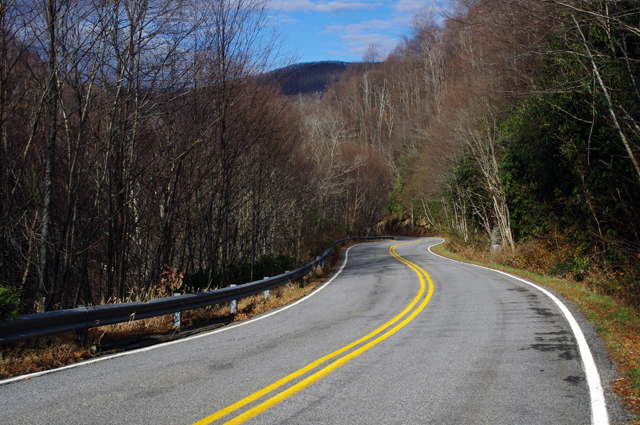
Winter riding has it's own beauty - I enjoy the contrast to summers lush growth. This is NC 215 south of the parkway, one of the better sections.

The first road I added was one surprisingly close to home – Crabtree Mountain Road. The last time I explored it there was a long section that wasn’t paved. That’s not unusual in the mountains. The easy sections along the valley floors get paved. The steep sections that climb up and over the mountain passes don’t as it requires so much effort and expense to prepare and then maintain a decent roadbed in the steep and rocky terrain.

Photo - View from Crabtree Mountain Rd

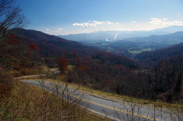
Outstanding views from atop the pass on Crabtree Mountain Road. The smoke plume from paper mill in Canton is easy to spot

Crabtree Mountain Road connects NC 209 (now known as “The Rattler” video here) to NC 215 at the town of Canton. It not only makes a connection between two already great rides, but is a great motorcycle ride on it’s own merits. The scenery in the valley is picturesque as the road winds along with the course of a stream through a collection of nice curves, then darts south to start the steep climb over a high pass. Two of the photos included were from the high point on the road. It then plunges down the mountainside through a series of hairpin turns and switchbacks before it runs into Thickety Road and connects to NC 215 near I-40. Watch for gravel near the top of the pass, but otherwise the road is in good condition and a nice ride.

Photo - Silversteen Road

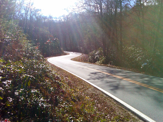
High quality pavement on Silversteen Road gives you the confidence to exploit the unending series of curves.

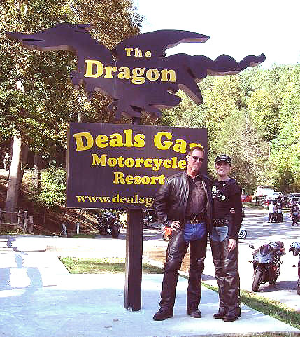
The second road I added was near Lake Toxaway and I suspect it may become one of my new favorites. Silversteen Road connects the fabulous riding on NC 281 to one of the twistiest sections of US 64. This road had me thinking of The Dragon at Deals Gap. Though a third shorter than the Dragon at at 8.1 miles in length, the tight curves are relentless throughout the ride. Also, like the Dragon, while it doesn’t offer much in the way of scenery, you’re too engaged in just maintaining control to let your eyes wander to the horizon. It’s easy to find from NC 281 as it intersects on a hairpin curve, and the southern end at at US 64 is marked by a gas station.

Progress is going to have to wait a week as I’m taking a short vacation. I be back in the saddle after Thanksgiving. I posted some of the video I shot today at my Youtube Channel – http://youtube.com/americaridesmaps. Until then, enjoy the ride.

http://www.youtube.com/watch?v=t1HbSTAk7C4

_______________________________________________________________________________

Wayne Busch
Wayne Busch – Cartographer
– Wayne Busch lives in Waynesville, NC, where he produces the most detailed and comprehensive and up-to-date motorcycle pocket maps of the Blue Ridge and Smoky Mountains to help you get the most of your vacation experience. See them here – AmericaRidesMaps.com 
 

Motorcycle Friendly – Shady Valley Country Store and My Video of The Snake

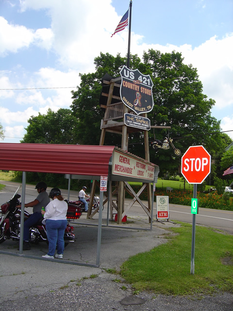
Photo - The Tower at the Shady Valley Country Store

If you miss the tower at the Shady Valley Country Store you've been riding way too long. Time to stop for a rest.

I passed through Shady Valley, Tennessee on my motorcycle earlier this week and finally took the time to stop in at the The Shady Valley Country Store , see the place, and meet Kimberly and David Dail.

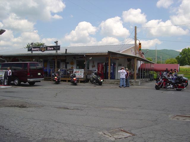
Photo- Shady Valley Country Store

Just look for all the motorcycles at the Shady Valley Country Store. Everyone stops here, it's the best place for miles and miles.

Don’t worry about having difficulty finding the Shady Valley Country Store while you’re out motorcycle touring. If you miss the tower in the parking lot at the crossroads of US 421, TN 133, and TN 91, your probably fixin’ to die in some horrible accident, you’ve been out in the sun too long.

Photo - Snake Burger

Three bites wide and thick as your thumb, a Snake Burger will satisfy. It was really good.

Come inside the spacious building, find a table, and get Kimberly or Dave to fix you up with something to cool your brain. While you’re at it, try a Snake Burger. They’re huge, they’re good, or you might want to try a heaping fried bologna sandwich instead. David’s not stingy when it comes to portions, you get your monies worth.

Photo - Inside view of the Shady Valley Country Store

Plenty of room, lots of tables, good food, a great place to either cool off or warm up inside the Shady Valley Country Store.

I filled the tank with Snake Venom at the pump outside, then headed back to finish my motorcycle ride home. I shot a little video of the section of US 421 between Mountain City and The Shady Valley Country Store to give you a taste of the kind of motorcycle riding you’ll experience on The Snake. There are some better videos at the store as well as T-shirts and other Snake charms to help you remember your visit.

http://www.youtube.com/watch?v=SPaoEexDxcU

While I was there I got an education on The Snake and learned it encompasses more roads than I’d thought. I’m amending the maps now and new versions will be available at The Shady Valley Country Store. There’s some great motorcycle riding found here and The Shady Valley Country Store sits at the crossroads of it. Add it to your list of places to visit and ride on your motorcycle vacation. From the Blue Ridge Parkway, exit at Boone and follow US 421 north.

Photo - Kimberly and David Dial at the Shady Valley Country Store

Kimberly and David are friendly and will insure you get what you need. Come see them.

The Shady Valley Country Storehttp://www.shadyvalleycountrystore.com

_______________________________________________________________________________

Wayne Busch

Wayne Busch - Cartographer


– Wayne Busch lives in Waynesville, NC, where he produces the most detailed and comprehensive and up-to-date motorcycle pocket maps of the Blue Ridge and Smoky Mountains to help you get the most of your vacation experience. See them here – AmericaRidesMaps.com
 

Motorcycle Friendly Eateries – Rock Bottom Sports Grill, Hot Springs, NC

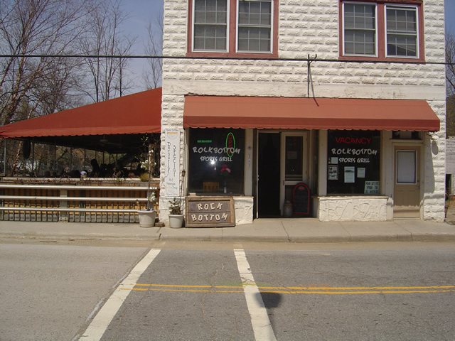
Photo - Rock Bottom Sports Grill in Hot Springs, NC

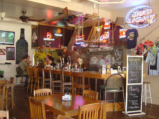
The Rock Bottom Sports Grill in Hot Springs, NC - Biker Friendly

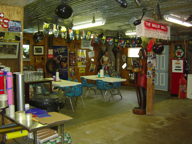
I spent a bit of the beautiful weekend in Hot Springs, NC, getting the final footage for my upcoming video about one of North Carolina’s classic motorcycle rides – NC 209. While we were there I made a lunch stop at the Rock Bottom Sports Grill in the heart of town.

Photo - the bar at the Rock Bottom Sports Grill

It was too nice a day to be inside at the bar - everyone was out on the porch overlooking the stream and enjoying their meals

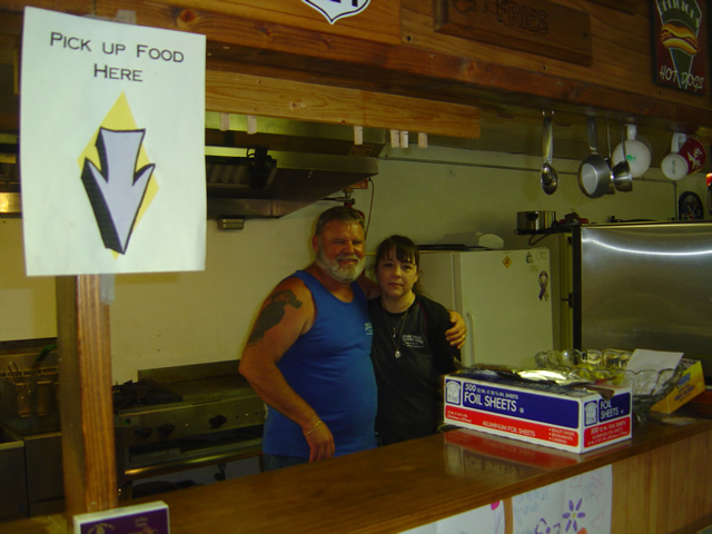
I was lucky enough to catch Melissa, the owner there on Easter Sunday. She’d come in to put out the fires that developed over the holiday weekend. They’d been swamped with business and she was doing her best to locate more staples and replenish the menu on a day when many suppliers were closed for the holiday. The photos of the bar and inside of the restaurant are misleading – with the beautiful weather, the covered porch outside was packed with diners enjoying their meals while overlooking the creek which flows aside the building.

Our food was good, though they’d run out of buffalo burgers, always a treat when I can find them. The standard version fit the bill quite nicely and I overheard several complimentary comments about the fries – there are very tasty.

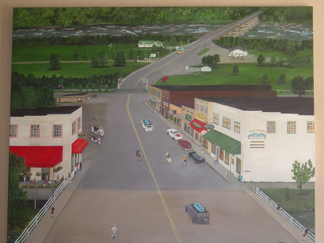
Photo of painting of the town of Hot Springs, NC

Photo of painting of the town of Hot Springs, NC - river rafting, backpackers passing through on the Appalachian Trail, how many motorcycles can you spot?

My visit had another purpose. As route master for the Asheville Bikefest, I’m trying to visit any many locations as I can prior to the May 13 – 16th event to not only alert them of the traffic it is likely to generate, but verify they are welcome to biker business. Before I start telling thousands of motorcyclists of great places to stop while enjoying the wonderful two lane mountain roads I’ll suggest to them for their visit, I want to insure they are welcome there. No problems with the Rock Bottom Sports Grill in Hot Springs. Melissa has been riding for years, made the pilgrimage to Sturgis last year, and is looking forward to seeing you and insuring you have a great time.

Photo - another interior shot

Got to talk with the still photographer - entirely missed the crowds outside on the porch.

I’m pulling the video together as time permits, expect to learn a lot more about Hot Springs and the fabulous motorcycle riding in the surrounding area. Here’s the Teaser I put together before the snow shut things down. The full version is coming soon;

http://www.youtube.com/watch?v=3hsCLMCIUOo

50 Great Motorcycle Roads Near the Tail of the Dragon

Photo - Jackie and her BMW

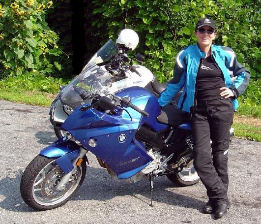
Even #1 Riding Partner, my wife Jackie (a.k.a. BMW Girl), has not ridden all the roads - yet!

I was wondering this morning just how many great motorcycle rides I’d discovered in the areas I’ve suggested as alternatives since the Tail of the Dragon at Deals Gap closed due to the recent rock slide.

So far, I’ve posted info about several areas;

Photo - Jackie rides

Does this bike make my butt look FAST?

I pulled out my America Rides Maps and starting counting. I hit 50 long before I got to the last maps that covered the great motorcycle riding areas I’d been describing. Closer to 70, probably more. I tried not to count rides where the road changes names along it’s course twice or even three times. It gets a little confusing, there are just so many.

Don’t let the rock slide at the Tail of the Dragon obstruct your motorcycle vacation planning. It could be a blessing in disguise. After all, Deals Gap is not known for it’s scenery, mountain views, waterfalls, or picturesque countryside. Imagine what waits just over the hill.

Visit  or contact http://americaridesmaps.com for more info.

Motorcycle Vacation Planning – Great Ride Alternatives

SEE SOME WATERFALLS!

Photo - Whitewater Falls Highest in the east

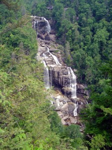
Whitewater Falls - Highest in the east

With the Tail of the Dragon at Deals Gap on the North Carolina / Tennessee state line now closed due to a rock slide, many who have made reservations in advance may be wondering what to do. Before you cancel those reservations, consider there are plenty of alternatives to discover great motorcycle rides in the area within easy reach.

The Cherohala Skyway, Tennessee’s version of the Blue Ridge Parkway, remains open and is a fine ride, though be aware much of the regional traffic will be shifting onto it. It’s not quite the challenge to ride, but it makes up the deficiency with great scenery as it climbs to over 5000 feet before entering North Carolina.

Of course, NC 28 which intersects US 129 in North Carolina at the southern end of the Tail of the Dragon will be there for those looking for a more challenging motorcycle route. With the Dragon closed, I suspect traffic on it will be light. Don’t let this road fool you, it “bites” more riders than the Dragon in that it is not as predictable. Where the Dragon has one turn after another, you know what to expect,  NC 28 has some more open stretches where you can pick up speed only to find the upcoming 10 mph corner is far sharper than you are ready for.

Many motorcycle tourers who ride this section of NC 28 don’t realize it continues further south into South Carolina and miss out on a great section of road. It grows to 4 lanes as it reaches the intersection with the Great Smoky Mountains Expressway, continues a few miles on the highway, then diverts south again to become a wonderful two lane road again. All in all, it’s more than 100 miles of truly great motorcycle riding with but a few interruptions where it passes through Franklin and Highlands.

Photo - Dry Falls

Dry Falls - You can walk behind them

The first area I highly recommend you spend some time motorcycle riding is often called the “Land of the Waterfalls”. Comprised primarily of the wild mountains of the Nantahala and Pisgah National Forests, this area south of Great Smoky Mountains National Park hosts one of the greatest collections of easy to view roadside waterfalls in the nation including the highest waterfall east of the Rockies.

This rugged area is laced with challenging and scenic motorcycle roads including the highest and most beautiful section of the Blue Ridge Parkway. Springtime is the best season to see them before the summer leaves obscure the views.

Here’s a video sample of them from America Rides Maps;

http://www.youtube.com/watch?v=eBrB5lrtZ9I

Don’t let the closure of the Tail of the Dragon ruin your motorcycle vacation. There are plenty of great rides just over the hill. These are some of the best, more to come.

Contact http://americaridesmaps.com for more suggestions and advice.

Tail of the Dragon Closed for Months? Motorcycles Should Go Elsewhere.

Photo - Smoky Mountain Rider and BMW Girl at the Tail of the Dragon

Smoky Mountain Rider and BMW Girl at the Tail of the Dragon

The rumor mill is churning and I’m trying to sort through it all, but this much seems official. Tennessee has closed the Tail of the Dragon (US 129 at Deals Gap) from the rock slide are to the state line. Even though North Carolina offered to provide traffic enforcement, Tennessee has declined the offer and closed the most popular motorcycle ride in the region until the situation is resolved.

How long will it remain closed, I’ve seen various estimates. Initially one lane was reopened at the site of the slide, but closed the next day. Then there was talk it would be reopened by today. Now the rumors emerging are indicating it will be two months as blasting and bolting are required to stabilize the site. I’ve not seen an official proclamation yet.

I’d like to again urge you re-evalute your motorcycle vacation planning to explore other areas in the surroundings. With all the road closures currently in effect, the traffic loads are shifting onto what few back roads remain and the quality of motorcycle riding in this area will be seriously diminished.

The good news is there are a wealth of fabulous alternatives, hundreds of miles of great two lane uncongested twisty mountain back roads in the immediate area for your motorcycle touring enjoyment that are too often overlooked due to the Dragon’s notoriety. You can get free advice and recommendations on your motorcycle vacation plans by contacting http://americaridesmaps.com. I will be following up with suggested alternatives.

Ride Like A Pro On the Dragon Video – Motorcycle Crashes Like These Can Be Avoided


http://www.youtube.com/watch?v=ekkUzhh9E9A

Do You have Jerry “Motorman” Palladino’s Ride Like A Pro Video? I bought one years ago and it changed my motorcycle riding skills dramatically. Consider the cost of the mistakes you see in the motorcycle ride video above and compare that to the cost of the CD and a little practice time? Let Jerry show you how to Ride Your Motorcycle Like A Pro. He’s got lots of tips, videos and instruction at his web site.

Whether your riding the Blue Ridge Parkway, the Tail of the Dragon, or just tooling around your home turf, the skills and techniques you learn will make you a much more competent and safe motorcycle rider.

Don’t end up on Deals Gap’s tree of shame or worse.


http://www.youtube.com/watch?v=1o3fPCT3-Xk

http://www.ridelikeapro.com/