Motorcycle Friendly – Still Mountain Restaurant, Hot Springs, NC

Motorcycle Friendly – Still Mountain Restaurant, Hot Springs, NC

UPDATE – This Restaurant has closed.

On a classic “lunch run” ride here’s one option for the lunch stop.

Still Mountain Restaurant, Hot Springs

Motorcycle friendly Still Mountain Restaurant, Hot Springs, NC.

One of the nicest motorcycle rides you’ll do in the Smoky Mountain area of North Carolina and Tennessee is NC 209, a.k.a “The Rattler”. This 30+ mile ride through the mountains and valleys of North Carolina runs from Junaluska (Maggie Valley, Waynesville) to Hot Springs. Scenic, challenging, historic, it makes for a nice “lunch run” as an out-and-back ride or the first leg of numerous loop rides you can build with other great connecting roads.

Motorcycle Friendly Still Mountain Restaurant

Motorcycle Friendly Still Mountain Restaurant – you can’t miss it in tiny Hot Springs.

Hot Springs is one of the many historic little mountain towns that dot the landscape. Once  an important stop on the Knoxville, TN to Asheville, NC corridor, it is mostly forgotten now that the Interstate bypasses it to the west. It’s a pass-through town on the Appalachian Trail, a popular place for whitewater rafting, and there are natural hot springs where you can go soak your keister for a few bucks. On weekends, it’s a gathering spot for the bikers who flock to ride the outstanding motorcycle roads in the surrounding region.

Motorcycle Friendly Still Mountain Restaurant

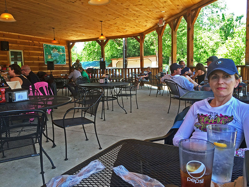
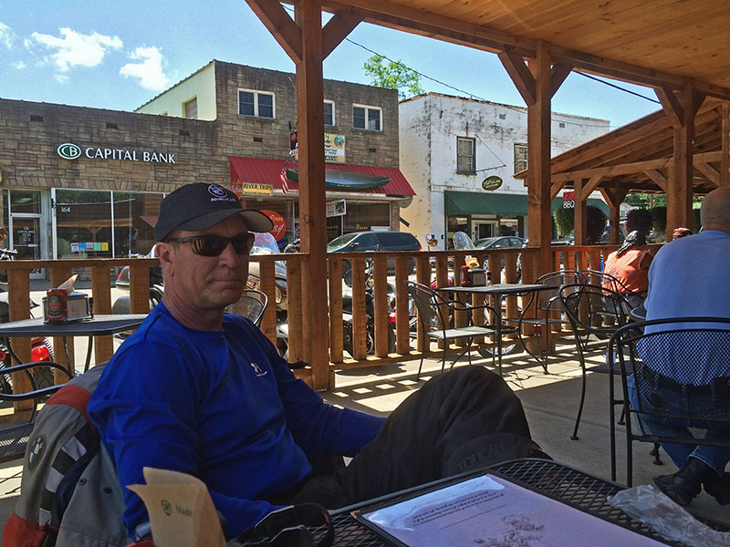
Motorcycle Friendly Still Mountain Restaurant – a big comfortable porch, tasty food, and live music on this day.

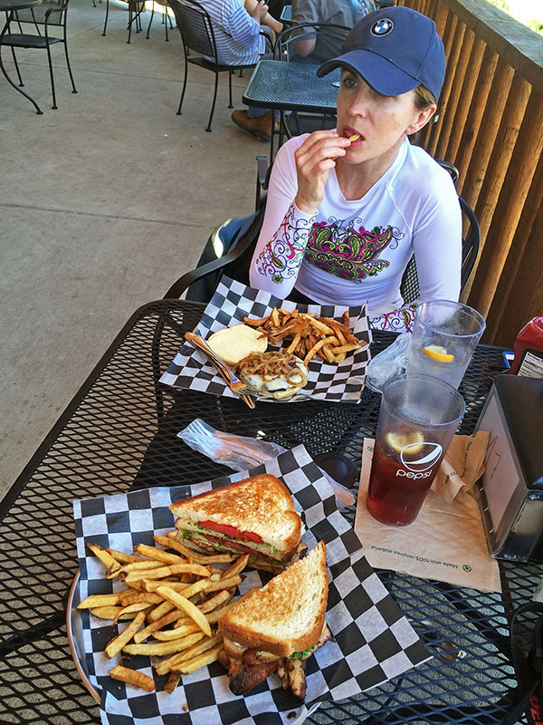
Comfortable, easy to find, and with tasty food, the Still Mountain Restaurant is usually full of bikers though the occasional Appalachian Trail hiker drops in for some civilized fare on their 1500 mile walk in the wilds. You’ll feel right at home here.

Biker Friendly Still Mountain Restaurant

Biker Friendly Still Mountain Restaurant – Thumbs up!

You’ll find NC 209 and another 50+ great rides in the area on America Rides Motorcycle Pocket maps #6 as well as the 100 Great Motorcycle Rides in the Smoky Mountains.

Great Motorcycle Rides in North Carolina - NC 209, a.k.a. "The Rattler".

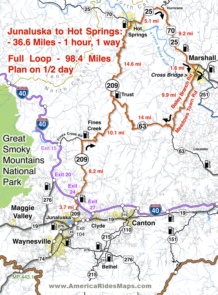
Great Motorcycle Rides in North Carolina – NC 209, a.k.a. “The Rattler”. Do it as an out-and-back or make a nice loop ride – one of many ways to go on this great biker road

More Rattler info here

————————————————————————————

wayne busch - Smoky Mountain Motorcycle Rider.com

Wayne Busch

– Wayne Busch lives in Waynesville, NC, where he produces the most detailed and comprehensive and up-to-date motorcycle pocket maps of the Blue Ridge and Smoky Mountains to help you get the most of your vacation experience. See them here – AmericaRidesMaps.com

How to Make a good Deals Gap Motorcycle Ride Better –

Adding these two roads to one of the four most popular Smoky Mountain motorcycle loop rides near the The Dragon at Deals Gap makes the least of them measure up to the others.

Photo - morning on the Cherohala Skway

Morning on the Cherohala Skyway. I'm parked on the state line between North Carolina and Tennessee.

Smoky Mountain / Blue Ridge motorcycle riders who flock to ride The Dragon at Deals Gap typically take in other rides when in the area. One of the best Smoky Mountain motorcycle rides is a loop through Vonore and Tellico Plains, TN to take in the Cherohala Skyway. Another popular circuit is to loop around Great Smoky Mountains National Park crossing through the heart of the Smoky Mountains on US 441. A third great loop ride links NC 28 at Franklin, NC to Nantahala Gorge via Wayah Road. All of these are great loop rides in the Blue Ridge with unique characters.

The fourth most popular ride is to take the Cherohala Skyway west to Tellico Plains, then go south on TN 68. You then use TN 123 / NC 294 to head east, and follow US 74 / 129 north through the Nantahala Gorge to return to The Dragon at Deals Gap. This loop ride starts out with the outstanding scenery and enjoyable sweeping curves of the 50 mile long Cherohala Skyway as it crosses the Snowbird Mountain Range of the Blue Ridge. It gets nice again once you enter the curvy sections a few miles south of Tellico Plains on NC 68. It’s gets better and better the further south you go, though NC 68 can carry a bit of traffic on weekends.

Photo - Field of the Woods

The 10 Commandments at Fields of the Wood - big enough God can read them

Once you turn east on TN 123 / NC 294, the ride is still pretty good, but the road opens up and the ride is not as scenic and challenging as you progress. Here’s how to punch it back up to outstanding.

Watch for Fields of the Wood, it’s the closest landmark to the turn off onto Hiawassee Dam Access Road. Fields of the Wood is worth a stop to see and a nice place for a break. Those with devout religious leanings will be inspired by the hillside with the ten commandments written out in stone, as well as numerous other Biblical icons and monuments. For those inspired more by hellacious and challenging roads, Hiawassee Dam Access Road is next leading to devilish twists and curves.

Photo - Hiawassee Dam

The Hiawassee Dam is a nice spot for a break.

Turn onto Hiawassee Dam Access Road to start the fun. You may encounter a little traffic approaching the dam on weekends as many come for boat access to the lake and river. Once past the dam, the excellent and challenging road continues a course around the west side of the lake. Turn right onto Joe Brown Highway when you reach the end of Hiawassee Dam Access Road.

Joe Brown Highway is hardly what any of us think of when the word “highway” comes to mind. This isolated and remote twisty two lane back road is packed with curve after curve and some pretty decent Smoky Mountain scenery, though you’ll be paying more attention to the road than the horizons. It’s a whole lot of fun, usually carries very little traffic, and may be the best section of the entire loop, a nice contrast to the sweeping curves of the Cherohala Skyway.

Photo - Nantahala Outdoor Center

The Nantahala Outdoor Center on the river is another great break spot with bathrooms, good food, nice views, and the place to arrange a river trip.

Joe Brown Highway runs you right through downtown Murphy, NC to intersect US 129 / 74 at the junction with US 64 East. Turn north to follow the four lane to Andrews where it funnels down to two lanes again for the ride through scenic Nantahala Gorge. You’re bound to run into traffic in Nantahala Gorge, but the scenery along the popular whitewater river makes up for it. Avoid the gorge on weekends when possible as the buses hauling rafters and kayakers tend to bottle things up.

Once through Nantahala Gorge, turn left onto NC 28 and back into the twists and curves to return to The Dragon at Deals Gap.

Photo - View from Hiawassee Dam Overlook

There are nice spots for a break both atop and below the Hiawassee Dam. The road runs across it then continues around the lake.

_______________________________________________________________________________

Wayne Busch
Wayne Busch – Cartographer
– Wayne Busch lives in Waynesville, NC, where he produces the most detailed and comprehensive and up-to-date motorcycle pocket maps of the Blue Ridge and Smoky Mountains to help you get the most of your vacation experience. See them here – AmericaRidesMaps.com 

Tail of the Dragon Closed – Great Rides Nearby – Hot Springs

No new info on the rock slide which has closed the Tail of the Dragon at Deals Gap. In a previous post I suggested some great rides nearby in the “Land of the Waterfalls” and provided a video sample. It’s just one great spot near the Tail of the Dragon with great motorcycle rides nearby, here’s another.

Photo - View of Hot Springs, NC

Hot Springs, NC - A town so small it fits on one photo.

This time I’m going to direct you to an area which sees little traffic, yet contains some fabulous and challenging motorcycle rides with some enjoyable sights and scenery. It’s an area most motorcycle tourists either drive right past on their way into the region or sample only the most notable road. Trust me, there is a lot there to explore and enjoy.

Photo - A roadside view near Hot Springs

Pausing to admire the view near Hot Springs, NC

I urge you to spend some time riding the great roads found in the mountains east of Great Smoky Mountains National Park. The Smoky Mountains do not end at the border of the park, in fact they continue their long run northward reaching their greatest heights north of Asheville, North Carolina at Mt. Mitchell, highest peak in the east just off the Blue Ridge Parkway. The mountains between the park and Mt. Mitchell are spectacular and beautiful, the valleys dotted with rural farms and tiny hamlets, sections of wild national forest, and roads which trace the serpentine courses of rushing mountain streams.

Photo - entrance to the Hot Springs Spa

Entrance to the Hot Springs Spa - Natural Mineral Baths and Massage

The hub of this great motorcycle riding area is the small and historic town of Hot Springs. It’s a good place to pause for lunch, do a little sightseeing, and maybe pay a visit to the natural hot springs which give the town its name. Long popular with hikers (the Appalachian Trail passes through town), fly fisherman, and whitewater rafters and kayakers on the French Broad River, it’s also a popular local motorcycle watering hole as it’s a convenient ride from Asheville.

Photo - French Broad River at Hot Springs

The French Broad River flows through Hot Springs

Honestly, there’s not a lot to the town. No traffic light. One gas station. A few shops and restaurants, a campground, and of course the Hot Springs Spa. You can capture the whole thing in a photo. It’s the roads and the beautiful countryside which surrounds that makes it worth the visit.

Photo - Iron Horse Station, Hot Springs

Iron Horse Station - One of several places to grab a bite and quench your thirst in Hot Springs.

If you take but one ride into the area, do the classic section of NC 209 which runs from Lake Junaluska to the heart of town. It’s such a nice ride. It takes about an hour one way. It’s a local classic. Be aware there is plenty more out there if you know where to look for it.

Photo - Fall Color at Lake Junaluska

One of the best rides, NC 209, starts near Lake Junaluska

I’ve been working on a video to showcase the area, though the severe winter pretty much closed the door on that for a long while. I’ll be getting back to it ASAP. Here’s the sample that gives you a good idea of what to expect:

http://www.youtube.com/watch?v=3hsCLMCIUOo

For more detail on the area look to America Rides Maps ” East of the Smokies, West of Asheville, All Around Hot Springs” map which catalogues about 400 miles of the best roads in this small area.

Don’t worry, there’s still more great riding alternatives to come in future posts. Closing the Tail of the Dragon opens the door to you discovering just how much you’ve been missing.

Back Home & Back To Work

Photo – It’s Good To Be Home

Came home Saturday evening. My niece was visiting Sunday so it was time to wrap things up. We spent the day whitewater rafting on the French Broad river north of Asheville near Hot Springs. It was the first time I’d been on that river. I look forward to returning in my kayak. The rapids are pretty challenging in a small boat, though they were fairly tame in a raft. There are bigger rapids further down the river, but the water is too low right now to raft them.

I got nearly all the mapping done, enough to do the initial layout. There is one small pocket I need to revisit and there is always one last trip to actually string together some loop rides. I found some really great roads, some in unexpected areas. There will be far more on this map than I’d planned.

I barely touched the second map, only one small corner explored. If the rest of it turns out half as good, there will be some fantastic rides on the next Virginia map as well. It’s surprising what you find if you really go looking for it.

I covered just shy of 1200 miles in the 3 days. My new Blackberry PDA worked fine. I have copious notes to digest. I spent most of the day rebuilding the office. The computers and printers are back up, the new battery power source is installed. I’m adjusting to a new desk and chair. Tomorrow I’ll get to the production area where I lay things out, storage, folding and packaging. I hauled out years worth of old junk and de-cluttered everything. I’m hoping to make things more efficient. We’ll see how it works out over the next few days. I am eager to discover how this new map lays out once I start plotting all the new roads. I think it’s going to be a really good one. Now, what to call it?

Wayne@americaridesmaps.com

>> Go To America Rides Maps.com http://americaridesmaps.com