5 Best Motorcycle Rides in the Smoky Mountains

How do motorcycle riders choose from more than 100 outstanding biker roads in the Smoky Mountains?

America Rides Maps suggests these are the roads to hit first when you visit on your motorcycle tour –
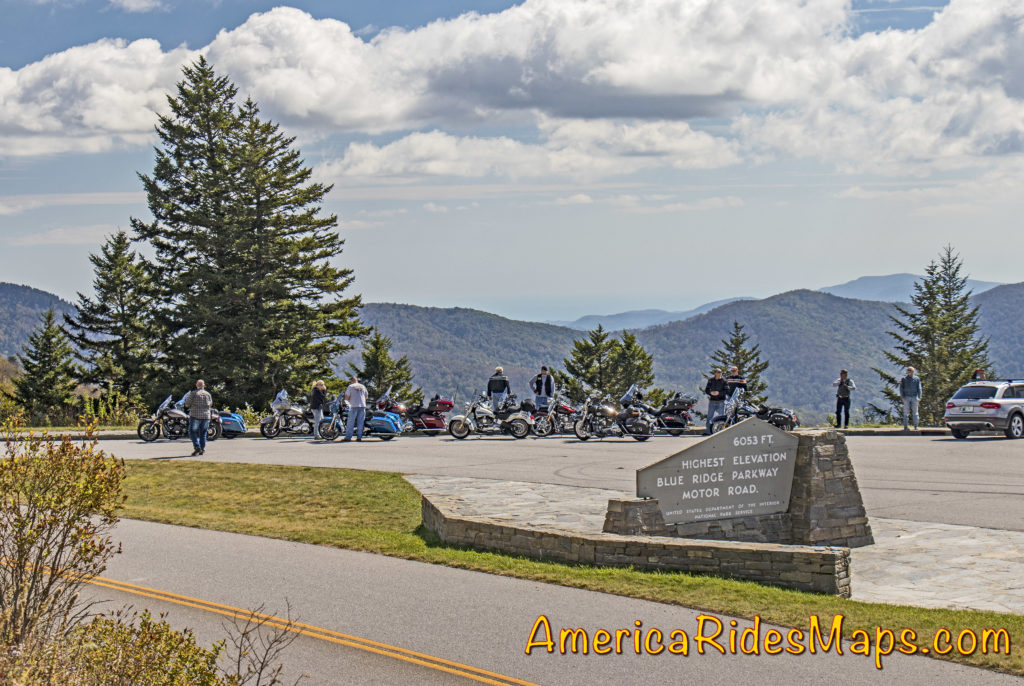
Blue Ridge Parkway Highest PointThe Blue Ridge Parkway –

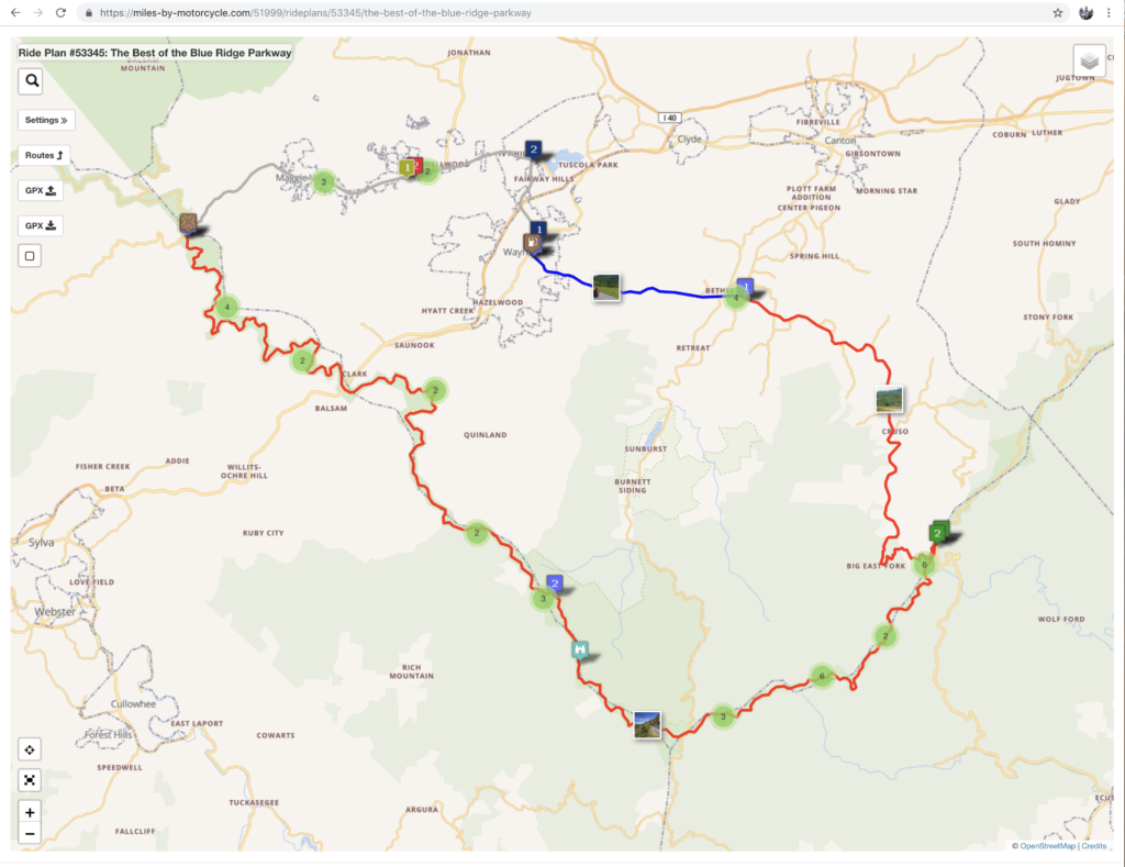
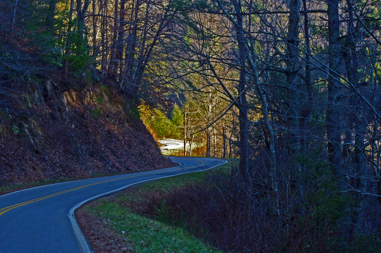
Hands down, the Blue Ridge Parkway should be at the top of your list. The best 50 miles of the 469 mile long scenic road are right here and easy to get to. It’s the highest section of the parkway filled with stunning overlooks as it cuts along the tops of the mile high mountains. Ride the section between US 19 (near Maggie Valley) to US 276 (south of Waynesville). Highlights on this stretch include Waterrock Knob, The Highest Point (classic photo with the sign), the Devils Courthouse, Looking Glass Rock, Second Falls at Graveyard Fields, and so many beautiful viewpoints to enjoy. The grades are gentle, the curves are satisfying. It’s a relaxing and enjoyable ride.

You can do it in a couple of hours or spend the time to stop and savor the sights. If you want to make a day of it, follow the parkway to Great Smoky Mountains National Park and ride across the heart of it on US 441. In the other direction the parkway leads through Asheville then gradually climbs to reach Mt. Mitchell State Park, the highest peak in the east.

More info  – https://miles-by-motorcycle.com/51999/blog/53348/the-best-section-of-the-blue-ridge-parkway
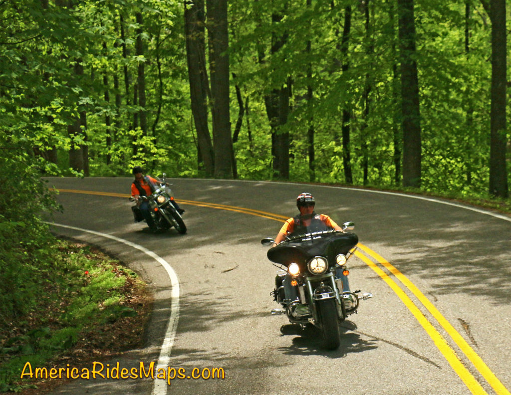
The Dragon

The Dragon & Cherohala Skyway

Located on the west side of Great Smoky Mountains National Park, these roads are two of the most popular rides in the Blue Ridge. The legendary Dragon (US 129) draws motorcycle and car enthusiasts to the 13 miles of tight, technical, challenging curves that hug the border of the park. It can get crowded on weekends and while the road has a notorious reputation a casual run is a lot of fun. You’ll see numerous photographers along the route to capture your vacation shots as you pass. Nearly 100 paved pull-offs let you escape the speed demons on your tail or just pause to watch the carnival. It takes about half an hour to run the Dragon.

The Cherohala Skyway is very much like the Blue Ridge Parkway running 50 miles between the small towns at either end. It climbs to the highest ridges as it courses through the vast wilderness of the Cherokee and Nantahala National Forests. There are numerous nice overlooks to appreciate the views. The curves are more sweeping, the grades easy, and it’s rarely anything you’d call crowded. There are some tighter sections of road as you come off the Skyway at the North Carolina end to choose from. At the Tennessee end of the ride, look for tiny River Road to lead you out to Bald River Falls and Baby Falls. Plan a couple hours for this road if you go out to the falls.

To make a day of it a popular loop ride combines both passing the Vonore, TN. In NC, US 129 is an easy ride south to Robbinsville, or NC 28 takes you on an awesome curvy ride when headed east.

More info – https://miles-by-motorcycle.com/51999/blog/52688/ride-the-dragon-and-the-cherohala-skyway—loop-ride
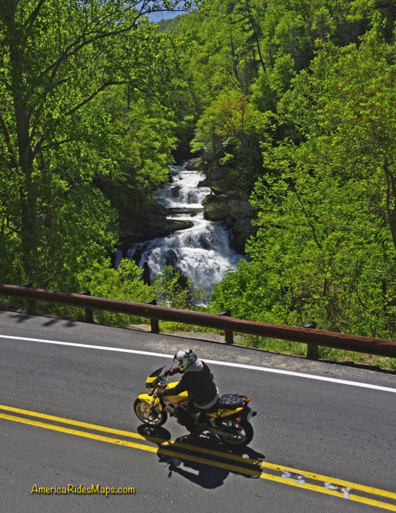
US 64 – The Waterfall Ride –

There are many versions of this ride which is anchored to the section on NC 28 / US 64 between Franklin and Highlands, NC. Cullasaja Falls, Dry Falls, Quarry Falls, and Bridal Veil Falls are found in the Cullasaja Gorge making this one of the easiest spots to see a lot of falls in a short distance. West of Franklin, Wayah Road climbs over the mountains to the Nantahala Gorge. Upper Nantahala Falls is on the way. Wesser Falls and Nantahala Falls are found in the Gorge. To the east of Highlands, Toxaway Falls is on US 64, Whitewater Falls is just a few miles south. A bit further east you’ll find Birdrock Falls and Mill Shoals Falls on NC 215, and Looking Glass Falls and Sliding Rock on US 276. There are so many waterfalls you can take a couple days to see all the easy ones.

The linked map (below) shows one way to see a dozen falls in a day on a reasonable length ride. There are many other ways to link the roads and tour the cascades.

More info – https://miles-by-motorcycle.com/51999/blog/52558/the-easy-waterfall-ride
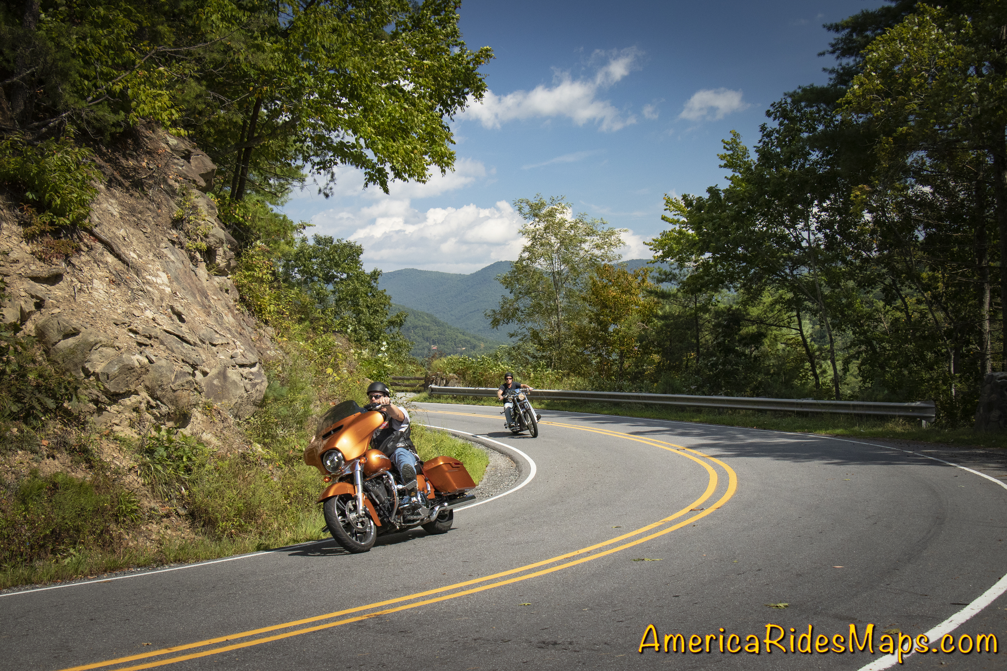
NC 209 - The Rattler

NC 209 – The Rattler –

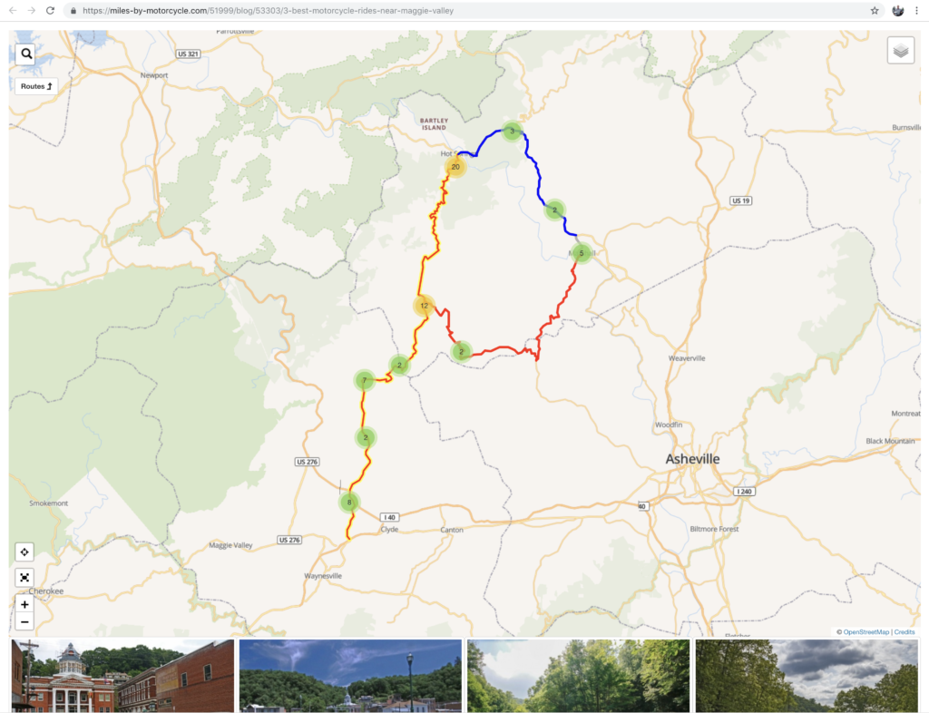
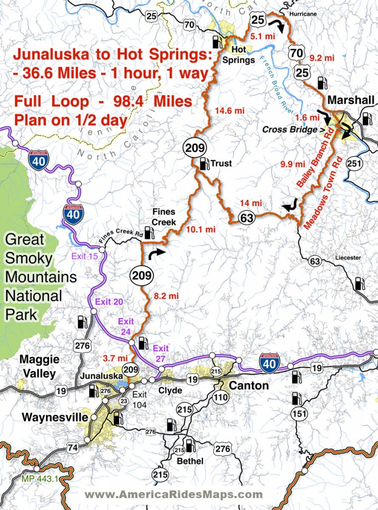
This easy to access ride on the east side of Great Smoky Mountains National Park is a gem. The 37 mile run from Junaluska to Hot Springs gives you a little bit of everything in nicely spaced doses. There are gentle valley rides, twisty mountain climbs, pretty scenery, rushing rivers, and historic sights. There are a couple spots to eat in Hot Springs and a spa where you can soak in the natural hot spring waters.

The ride takes about an hour. There is a popular loop that can make it a half day ride passing through Marshall then winding over the mountains to return back to NC 209.

More info – https://miles-by-motorcycle.com/51999/blog/52309/the-classic-rattler-loop-ride
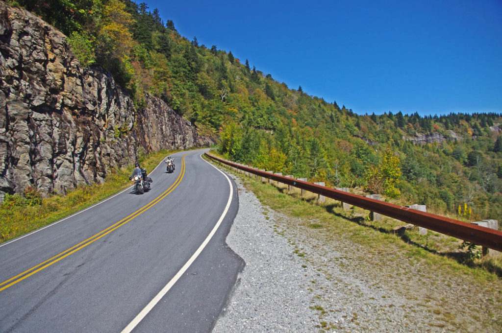
NC 215

The Copperhead Loop –

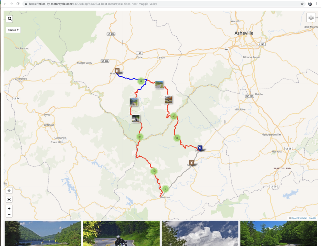
This ride has a few versions which are all built off two outstanding roads – US 276 and NC 215. Both of these roads run north to south. The Copperhead Loops are made with roads which run between them. Think triangle, not loop – US 276 and NC 215 meet in Bethel, NC. They then both run south more or less parallel to one another crossing the border into South Carolina.

US 276 is the better known of the two roads. From Bethel, it runs along a valley then makes a dramatic climb to intersect the Blue Ridge Parkway. South of the parkway it descends to Brevard with attractions and waterfalls along the way. It then runs into town then shoots south again passing Connestee Falls into South Carolina. It has engaging curves, nice scenery, one of the most popular waterfalls (Looking Glass Falls) , and can get a bit crowded on weekends as so many flock to the beautiful area around the waterfalls.

NC 215 also leaves Bethel to follow a valley, then begins a gradual and twisty climb. It’s more technical than US 276 and the challenges are more sustained. There’s little if any traffic. There are waterfalls along the way.

Both roads reach their first connection at the  Blue Ridge Parkway then drop down the south slopes to reach US 64. US 64 links between Rosman and Brevard, it’s the classic easy connecting route, the “standard” loop. South of US 64, NC 215 becomes US 178. Both it and US 276 continue south into South Carolina to reach the southernmost linking road, SC 11.

More info – https://miles-by-motorcycle.com/51999/blog/53429/best-rides-in-the-blue-ridge—the-copperhead

These roads and many more are catalogued on motorcycle ride maps published by America Rides Maps. Buy them online at http://AmericaRidesMaps.com


Wayne BuschAmerica Rides Maps

Wayne Busch searches out the most entertaining roads in the Blue Ridge Mountains then records them on a series of maps which span the Blue Ridge Mountains.

There are more great motorcycle roads in the Blue Ridge and Smoky Mountains than anywhere else. I highlight the best roads then show you the best ways to connect them together into rides. More than a decade of searching has discovered more than 1000 good roads to enjoy. We continue to search so you may enjoy.

Review the maps, order online hereAmericaRidesMaps.com

Source: America Rides Maps Blog @ Miles-by-Motorcycle.com
https://miles-by-motorcycle.com/51999/blog/53524/5-best-motorcycle-rides-in-the-smoky-mountains

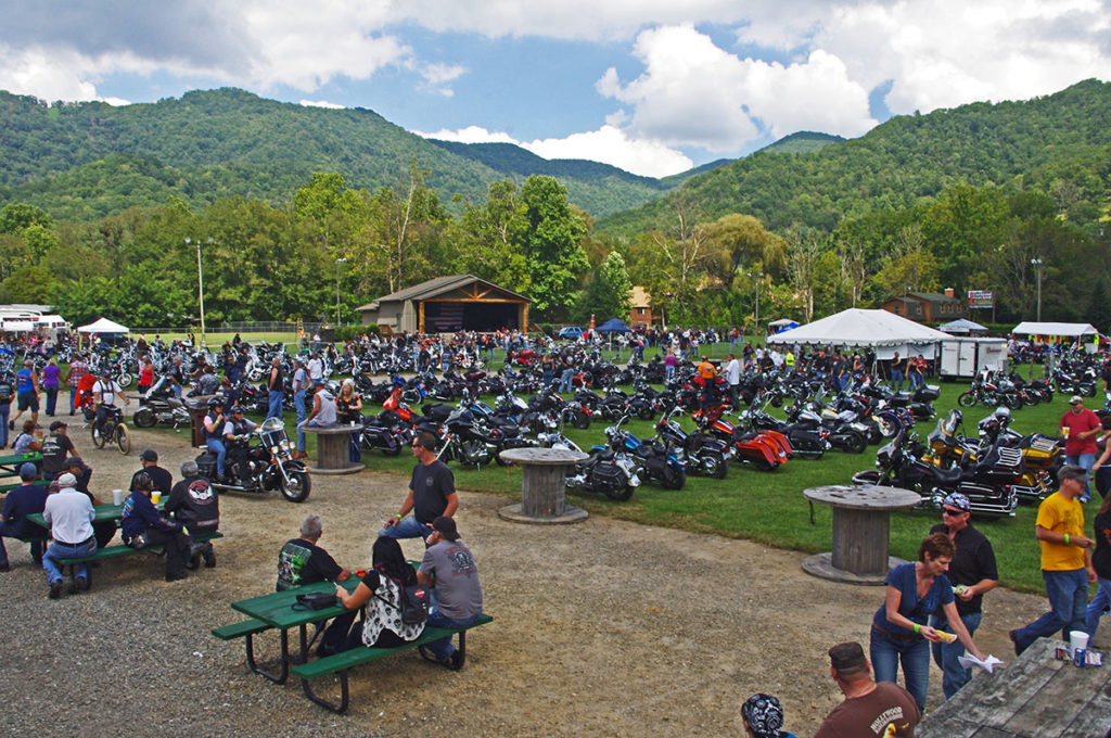
3 Best Motorcycle Rides Near Maggie Valley

Located on the quiet south side of Great Smoky Mountains National Park, Maggie Valley is the hub of the best motorcycle rides in the USA.

More than 100 great motorcycle rides surround the mountain town. It’s home to the Wheels Through Time Motorcycle Museum. Numerous rallies and festivals take place throughout the warm season.

Maggie Valley, NC

Maggie Valley, NC

Here are three of the best motorcycle rides nearby –

1) The Best of the Blue Ridge Parkway –

Best of the Blue Ridge Parkway Map

Best of the Blue Ridge Parkway Map

http://miles-by-motorcycle.com/51999/rideplans/53345/the-best-of-the-blue-ridge-parkway

2) The Copperhead Loop –

Copperhead Loop Map

Copperhead Loop Map

http://miles-by-motorcycle.com/51999/rideplans/53346/the-copperhead-loop

3) The Rattler –

Rattler Loop Map

Rattler Loop Map

http://miles-by-motorcycle.com/51999/rideplans/53347/the-classic-rattler-loop-ride

GPX tracks of these rides can be downloaded from the individual ride plans with a Miles-by-Motorcycle.com subscription


Wayne BuschAmerica Rides Maps

Wayne Busch searches out the most entertaining roads in the Blue Ridge Mountains then records them on a series of maps which span the Blue Ridge Mountains.

There are more great motorcycle roads in the Blue Ridge and Smoky Mountains than anywhere else. I highlight the best roads then show you the best ways to connect them together into rides. More than a decade of searching has discovered more than 1000 good roads to enjoy. We continue to search so you may enjoy.

Review the maps, order online hereAmericaRidesMaps.com

These Roads are found on America Rides Maps –

#6 The Best Motorcycle Rides Near Smoky Mountains Park – EAST

12 Classic Deals Gap Motorcycle Rides

100 Great Motorcycle Rides in the Smoky Mountains

The Best Unpaved Roads EAST of Smoky Park

Source: America Rides Maps Blog @ Miles-by-Motorcycle.com
https://miles-by-motorcycle.com/51999/blog/53303/3-best-motorcycle-rides-near-maggie-valley

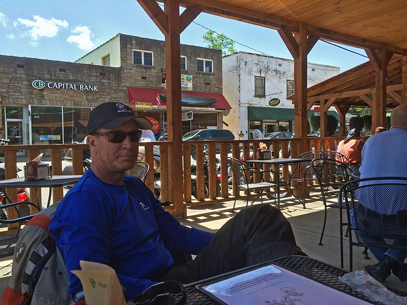
Motorcycle Friendly – Still Mountain Restaurant, Hot Springs, NC

Motorcycle Friendly – Still Mountain Restaurant, Hot Springs, NC

UPDATE – This Restaurant has closed.

On a classic “lunch run” ride here’s one option for the lunch stop.

Still Mountain Restaurant, Hot Springs

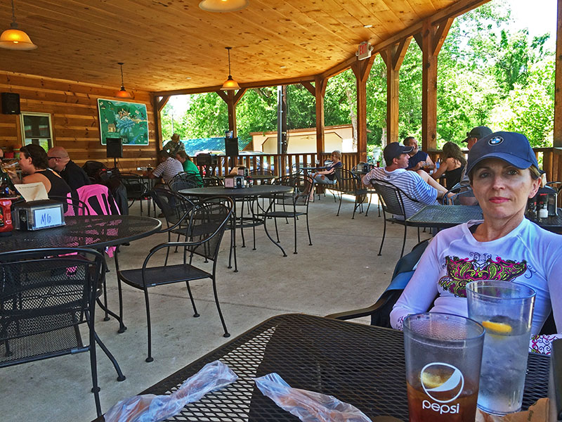
Motorcycle friendly Still Mountain Restaurant, Hot Springs, NC.

One of the nicest motorcycle rides you’ll do in the Smoky Mountain area of North Carolina and Tennessee is NC 209, a.k.a “The Rattler”. This 30+ mile ride through the mountains and valleys of North Carolina runs from Junaluska (Maggie Valley, Waynesville) to Hot Springs. Scenic, challenging, historic, it makes for a nice “lunch run” as an out-and-back ride or the first leg of numerous loop rides you can build with other great connecting roads.

Motorcycle Friendly Still Mountain Restaurant

Motorcycle Friendly Still Mountain Restaurant – you can’t miss it in tiny Hot Springs.

Hot Springs is one of the many historic little mountain towns that dot the landscape. Once  an important stop on the Knoxville, TN to Asheville, NC corridor, it is mostly forgotten now that the Interstate bypasses it to the west. It’s a pass-through town on the Appalachian Trail, a popular place for whitewater rafting, and there are natural hot springs where you can go soak your keister for a few bucks. On weekends, it’s a gathering spot for the bikers who flock to ride the outstanding motorcycle roads in the surrounding region.

Motorcycle Friendly Still Mountain Restaurant

Motorcycle Friendly Still Mountain Restaurant – a big comfortable porch, tasty food, and live music on this day.

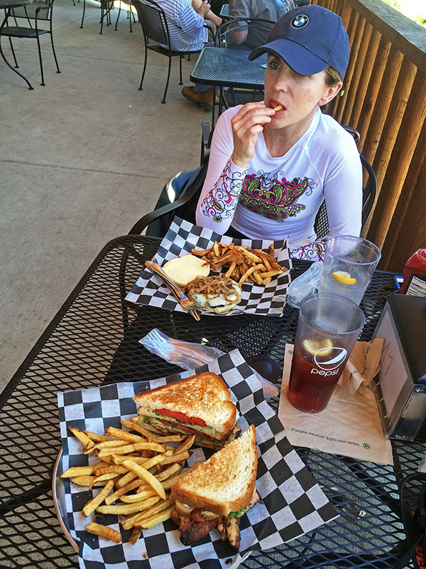
Comfortable, easy to find, and with tasty food, the Still Mountain Restaurant is usually full of bikers though the occasional Appalachian Trail hiker drops in for some civilized fare on their 1500 mile walk in the wilds. You’ll feel right at home here.

Biker Friendly Still Mountain Restaurant

Biker Friendly Still Mountain Restaurant – Thumbs up!

You’ll find NC 209 and another 50+ great rides in the area on America Rides Motorcycle Pocket maps #6 as well as the 100 Great Motorcycle Rides in the Smoky Mountains.

Great Motorcycle Rides in North Carolina - NC 209, a.k.a. "The Rattler".

Great Motorcycle Rides in North Carolina – NC 209, a.k.a. “The Rattler”. Do it as an out-and-back or make a nice loop ride – one of many ways to go on this great biker road

More Rattler info here

————————————————————————————

wayne busch - Smoky Mountain Motorcycle Rider.com

Wayne Busch

– Wayne Busch lives in Waynesville, NC, where he produces the most detailed and comprehensive and up-to-date motorcycle pocket maps of the Blue Ridge and Smoky Mountains to help you get the most of your vacation experience. See them here – AmericaRidesMaps.com

Smoky Mountain Motorcycle Rides – Meadow Fork Rd

Two good motorcycle roads are found along NC 209, a.k.a. “The Rattler“. They make a nice side loop on the popular motorcycle ride from Junaluska to Hot Springs in North Carolina. 

Photo-Meadow-Fork-Rd-View

A section of Meadow Fork Road which demonstrates the character of the curves through much of the ride.

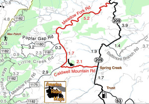
Meadow Fork Road Map

Meadow Fork Road spurs off NC 209 about 7 miles south of Hot Springs. The road follows the twisty banks of a whitewater creek for quite a while climbing gently on the challenging and scenic run. It  leads into the Pisgah National Forest where it becomes one of many unpaved forest roads high in the mountains.

Photo-The-Rattler-Motorcycle-Ride

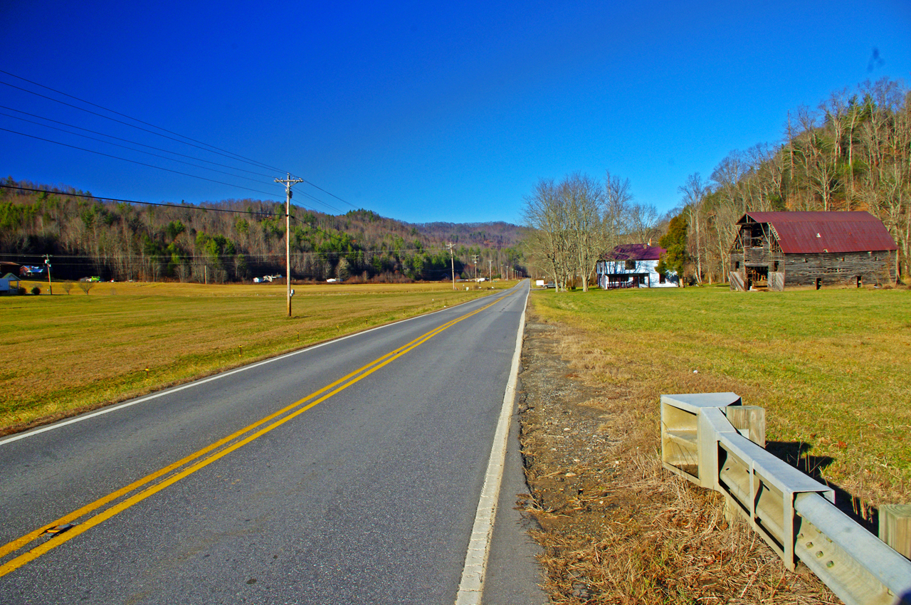
The 1.7 mile section of NC 209 which crosses the Spring Creek valley is the straightest road I can think of in western North Carolina. View approaching Caldwell Mountain Road

Caldwell Mountain Road meets Meadow Fork Road in 6.9 miles. 2.1 mile long Caldwell Mountain Road will take you over the mountain and down to meet NC 209 near the middle of the long straight stretch across the Spring Creek Valley.

photo-NC209-The-Rattler-motorcycle-ride-campground-sign

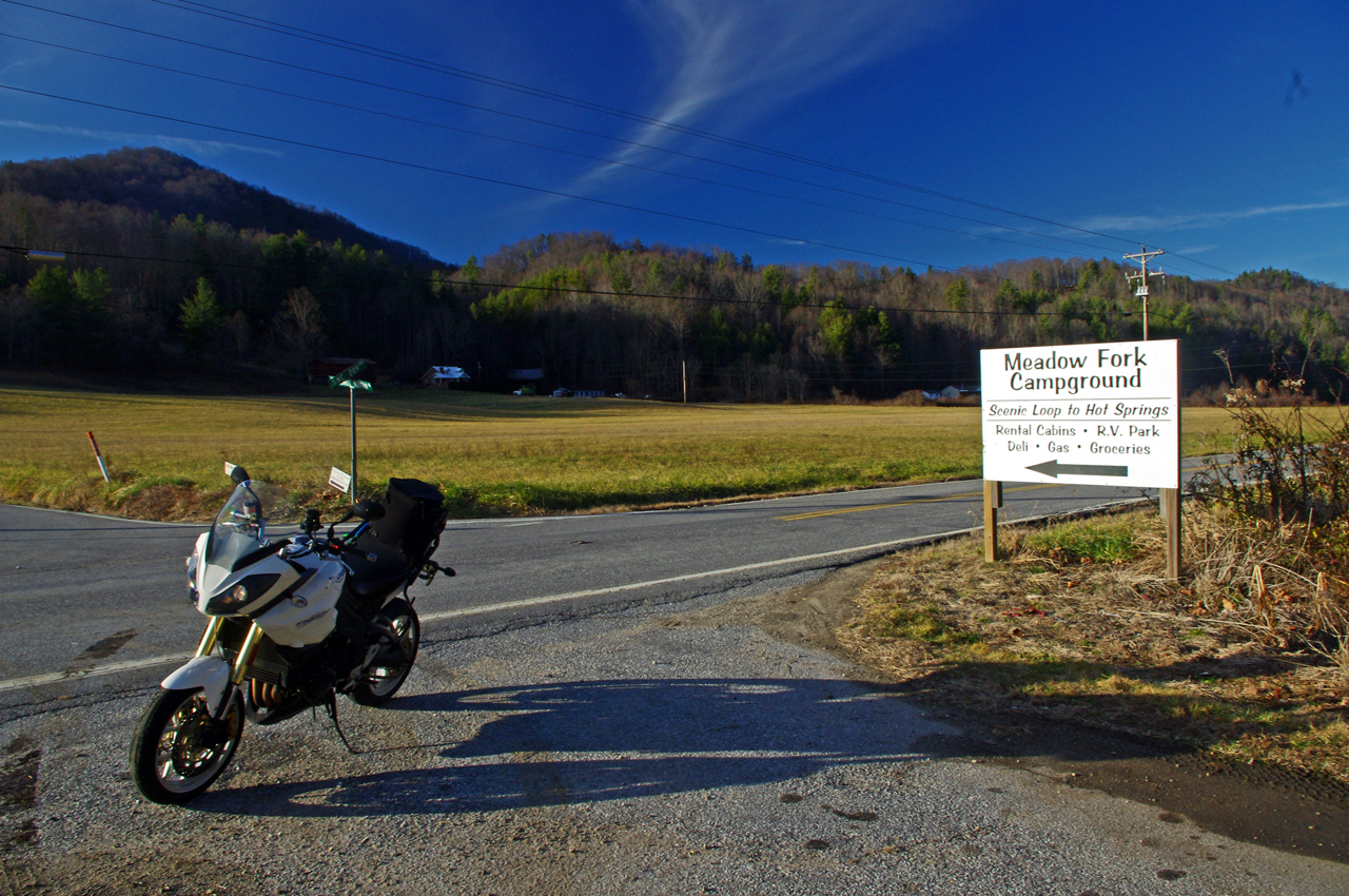
Caldwell Mountain Rd is easy to find. Ride to the middle of the long straight stretch of NC 209 in Spring Creek. Look for the sign for Meadow Fork Campground.

Caldwell Mountain Road and Meadow Fork Road form a nice loop on the west side of NC 209 when joined together. It’s a good way to vary the ride to and from Hot Springs and  see a few different sights.

Photo-road-sign

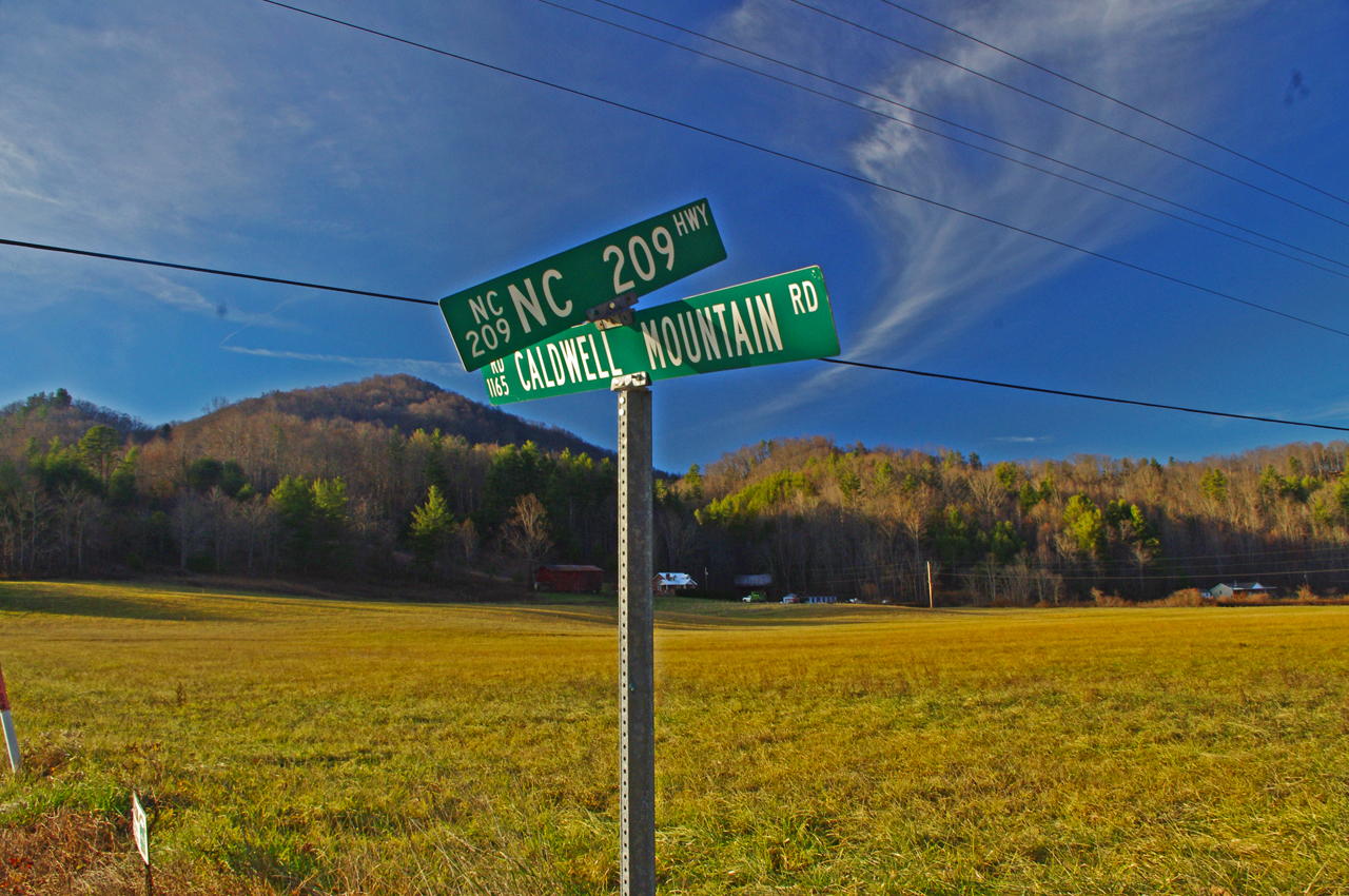
The sign may be a little crooked, but so is Caldwell Mountain Rd .

Both Meadow Fork and Caldwell Mountains Roads are paved, though if you miss turning at their junction you will run out of pavement before long when Meadow Fork Road reaches the National Forest. If you are on a dual-sport or adventure bike, this is one way to access the great unpaved roads that lead up to Max Patch bald and wind into Tennessee and the eastern edge of Great Smoky Mountains National Park. (See map OR-1)

Photo-Caldwell-Mountain_rd-motorcycle-ride

One of the few long range views on Caldwell Mountain Rd. You’ll probably be looking at the road instead.

Both of these roads are easy to find from NC 209. Their junctions are well marked. There is a prominent sign for the Meadow Fork Campground which marks the junction and it’s easy to spot Caldwell Mountain Road cutting across the felids in the valley as you approach.

Photo-Motorcycle-Ride-Meadow-Fork

Never far from the edge of the roaring creek, Meadow Fork Road twists through steep rocky hill sides and small valleys and coves.

Caldwell Mountain Road has some nice curves on the climbs and a few brief long range views. The pavement is a little bumpy in places, but generally is pretty good overall.

Photo-motorcycle -ride-meadow-fork-rd

There are some very pleasant views along Meadow Fork Road and lots of places to pause and enjoy it.

Meadow Fork Road follows the Roaring Fork River from NC 209 as it carves through the mountains for 7 miles to reach the junction with Caldwell Mountain Road. The road  traces the bank of the river  making it a nice curvy motorcycle ride for the most part. The pavement is in good shape – a long section near the river washed out and was replaced a few years ago with nice new pavement.

Photo-junction-NC-209-Meadow-fork-rd

The junction of Meadow Fork Rd and NC 209 is easy to spot though it may come up on you quickly as you come around a curve on either side.

Neither road has scenery you’ll be framing on the wall, though in general it’s pretty nice with small remote and isolated coves and valleys, the whitewater river along the road, and lots of hundred year old barns and the like.

Photo-start-of-Meadow-Fork-Rd

Just a peek down Meadow Fork Road shows what lies ahead.

This side loop off NC 209 adds a nice diversion, a little something different, without adding a significant amount of time to the longer motorcycle ride on classic NC 209 – The Rattler.

photo-junction-meadow-fork-caldwell-mountain

The junction of Meadow Fork Rd and Caldwell Mountain Rd is easy to spot, so navigation of this ride is easy and you can focus on enjoying the roads.

Related – Map and info about NC 209 – a.k.a “The Rattler”

America Rides Maps Map #6 – The Best Motorcycle Rides EAST of Great Smoky Mountains National Park

_______________________________________________________________________________

Wayne Busch

Wayne Busch – Cartographer

Total Rider Tech Logo

Learn Total Control

– Wayne Busch lives in Waynesville, NC, where he produces the most detailed and comprehensive and up-to-date motorcycle pocket maps of the Blue Ridge and Smoky Mountains to help you get the most of your vacation experience. See them here – AmericaRidesMaps.com

Wayne is an advanced motorcycle instructor for Total Rider Tech teaching Lee Parks Total Control Advanced Rider Courses. It’s time you looked into advanced rider training to ride more confidently and safely, it will change your mountain riding experience. It worked so well for me I became an instructor! Total Rider Tech

_______________________________________________________________________________

Good Biker Roads – US 76 in Georgia – Motorcycle Map change

US 76 in Georgia between Clayton and Hiawasse is a good biker road.

It’s not one of “the best motorcycle roads” in north Georgia,

– but it’s a good motorcycle ride that rates high enough that I’ve decided to upgrade it on America Rides Maps #9 The Best Rides in the North Georgia Mountains to the “good connector” category.

map-image-US-76-Georgia

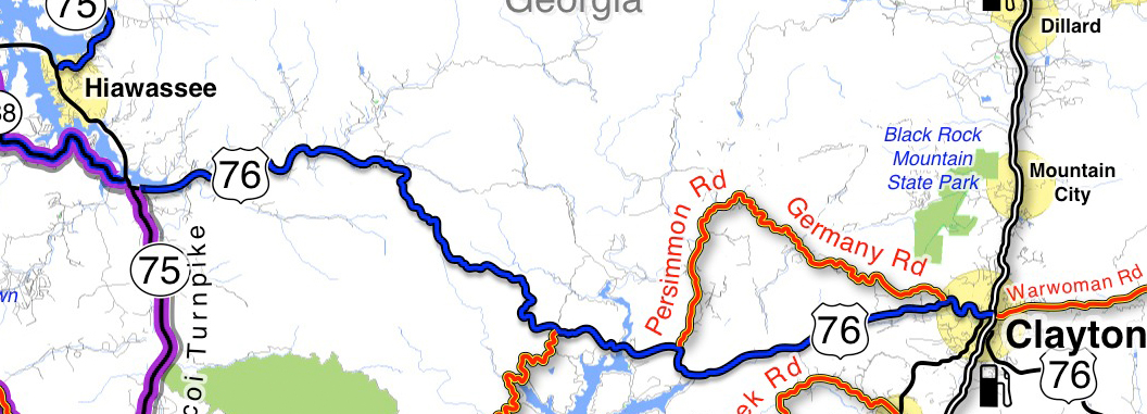
US 76 is now shown as a "good connector" on America Rides Maps (blue highlight). You can see there are other great rides which link to it along this section. I show you which roads are worth riding!

How I show the roads: I list “good connector” roads on my America Rides Maps highlighted blue to help you find the best ways to link together the best motorcycle rides which I show in red.  There’s no way I’ll ever rate this section of US 76 in Georgia as a great biker road (shown highlighted red on America Rides Maps) as it carries too much traffic. That’s what usually disqualifies or downgrades what would otherwise be great motorcycle rides – too much traffic.

Description of this section of US 76: The blue highlighted section of US 76 shown on the map is flatter and more open to the west, dotted with houses which thin out as you head east. It then enters a section of National Forest and makes a gentle climb over a mountain with a nice section of curves – nothing extreme, but a lot of them and they can be fun if you’re not caught behind slow traffic. Houses, then businesses start appearing as you near Clayton, the road is more twisty at this end.

Where can I get this map? #9 The Best Rides in the North Georgia Mountains

PS – current map owners may have noted something else – the purple highlighted roads. They are part of “The Gauntlet” motorcycle ride in georgia’s blue ridge mountains. (Trying something new, if it works out you’l see more of it – you know I’m constantly changing and improving America Rides Maps.

Comments? Did I make the right choice?

_______________________________________________________________________________

Wayne Busch

Wayne Busch - Cartographer

Total Rider Tech Logo

Learn Total Control

– Wayne Busch lives in Waynesville, NC, where he produces the most detailed and comprehensive and up-to-date motorcycle pocket maps of the Blue Ridge and Smoky Mountains to help you get the most of your vacation experience. See them here – AmericaRidesMaps.com

Wayne is an advanced motorcycle instructor for Total Rider Tech teaching Lee Parks Total Control Advanced Rider Courses. It’s time you looked into advanced rider training to ride more confidently and safely, it will change your mountain riding experience. It worked so well for me I became an instructor! Total Rider Tech

_______________________________________________________________________________

 You’ll find US 76 and all the other good biker roads on America Rides Maps #9 The Best Rides in the North Georgia Mountains 

Motorcycle Riders Enjoying Blue Ridge Parkway Fall Color

This year, I spent the peak of the leaf season riding my motorcycle on the Blue Ridge Parkway. I photographed the scenery and captured other riders on their motorcycle vacation as they roared past. I selected some of the better ones and a few video clips to share memories with those of you who made it this year and to show those of you who are coming next what they’ve missed out on.

Watch on YouTube http://youtu.be/fQEqdbrt1fI

_______________________________________________________________________________

Wayne Busch

Wayne Busch - Cartographer

Total Rider Tech Logo

Learn Total Control

– Wayne Busch lives in Waynesville, NC, where he produces the most detailed and comprehensive and up-to-date motorcycle pocket maps of the Blue Ridge and Smoky Mountains to help you get the most of your vacation experience. See them here – AmericaRidesMaps.com

Wayne is an advanced motorcycle instructor for Total Rider Tech teaching Lee Parks Total Control Advanced Rider Courses. It’s time you looked into advanced rider training to ride more confidently and safely, it will change your mountain riding experience. It worked so well for me I became an instructor! Total Rider Tech

_______________________________________________________________________________

The Best Motorcycle Rides NORTH of Great Smoky Mountains National Park – NEW MAP

Photo - map cover

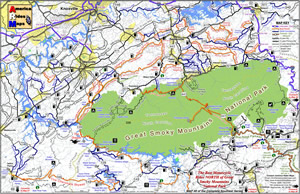
The newest motorcycle pocket map, “The Best Motorcycle Rides NORTH of Great Smoky Mountains National Park,” is the latest release from America Rides Maps adding a host of  great new motorcycle roads never publicized before to the already extensive collection from north Georgia to north Virginia.


The focus of this map was to locate and identify the best rides, shortcuts, and bypasses to avoid the traffic and congestion in one of the most popular tourist areas in the nation – the north side of Great Smoky Mountains National Park.

“I’ve avoided this area for years” says Wayne Busch, cartographer, explorer, and designer for America Rides Maps. “Now I have new favorite roads I ride again and again”.

Photo - image of map

The most thorough coverage of Great Smoky Mountains National Park

Having completed the revisions and updates to the 6 Map Blue Ridge Parkway Series this winter, this new map is the second of three  maps which will form the Smoky Mountain Series.

The first, “The Best Motorcycle Rides Near Smoky Park – EAST “ contains the southern end of the Blue Ridge Parkway near Cherokee and follows it east to Asheville.

The third map in the Smoky Mountain Series will combine and expand on several maps which currently detail the wealth of great motorcycle rides south of the national park.

Between the three maps, more than 100 outstanding motorcycle rides will be detailed surrounding Great Smoky Mountains National Park.

“I‘ve already got the most detailed and comprehensive coverage of great motorcycle rides which connect or lie adjacent to the entire length of the 469.1 mile long Blue Ridge Parkway”, Wayne reports, “These maps expand that parkway experience and add to it some of the most challenging motorcycle roads found anywhere including the famous “Dragon” at Deals Gap”.

Expect the final map in the Smoky Mountain Series, “The Best Motorcycle Rides SOUTH of Great Smoky Mountains National Park”  in about a month.

America Rides Maps – http://AmericaRidesMaps.com – The most comprehensive, inexpensive, easy to use motorcycle pocket maps

BUY THIS MAP HERE  – http://shop.americaridesmaps.com/Map-8-Best-Rides-NORTH-of-Smoky-Park-NC020.htm

  • Standard Paper – $5.00
  • Water / Tear Resistant – (Best Value) – $5.99
  • Heavy Duty Waterproof – $8.00

Free Shipping via 1st Class mail included!

_______________________________________________________________________________

Wayne Busch
Wayne Busch – Cartographer
– Wayne Busch lives in Waynesville, NC, where he produces the most detailed and comprehensive and up-to-date motorcycle pocket maps of the Blue Ridge and Smoky Mountains to help you get the most of your vacation experience. See them here – AmericaRidesMaps.com 

Another Great Motorcycle Ride to be Added to the List – My Secret

It’s not all that frequently I miss a great motorcycle ride in my explorations. I really try to be thorough as well as intuitive, so few slip by. Still, I can’t claim to know ALL the great roads in the southern Appalachians, just the vast majority of them. I continue to find more, and quite embarrassingly, they are too often close to home. Everyone believes they know ALL the great roads right in their back yard. Time and again I am proven wrong, and that’s not such a bad thing.

Stop reading now if you think I am giving this one away. No photos, no road names, nada. I just gave away 30 routes at the Asheville Bikefest for free and people gobbled them up. Nor is this a post about the Asheville Bikefest, I think you may be getting sick of hearing about that, but be cautioned, there will be more to come. The event was far more successful than expected and stuff is flooding in. The only reason I mention the event is because I found this great road because of it.

As Route Master for the Asheville Bikefest (there I go again, last time) I spoke with countless people helping them find the best rides in the area and getting them to see the most in the time they had. When you’re passionate about something, even work becomes fun. I went almost non-stop for four days and I had a great time. That’s why I founded America Rides Maps.

So anyway, this guy wants me to direct him to one of the two dozen local roadside waterfalls, which I do, so he can get of picture of his bike behind it. Yeah, you can actually drive behind this waterfall right off the road. He didn’t find it. Why, I don’t know, it’s one of the most obvious roadside waterfalls there is but that doesn’t matter. What matters is this guy doesn’t give up. He gets directions which lead him off into the forest. He rides and rides everything in sight, exploring places I know better than to go. He never finds it.

The next day he comes back to me and tells me he couldn’t find the waterfall. I’m a bit incredulous, it’s so easy. I redirect him. He relates his adventures and tells me he found this awesome motorcycle ride. I’m dubious. If he couldn’t find the easy waterfall do I believe him now? I made a mental note of it nonetheless. About an hour later I’m talking to a couple of women. They’re buying maps of the areas closest to them (we all think we know our own back yard), right down the street from the “event which will not be named again in this post. Out of curiosity, I ask if they know of this road the guy mentioned. “I live on that road, it’s great!”

So I can’t resist. Today I have to check it out. It rocks. Who cares how or why I missed it.   I’ll add it to the “The Best Roads South of Great Smoky Mountains State Park – EAST” map tomorrow. The other routes in the area I’d previously identified were detours around a congested town and a four lane section of road which formed one leg of a 100 mile+ triangle of superb riding. Now I think I’m looking forward to the detour more than the great rides that lead to it.

I have some more leads to follow up. I know some will be disappointing. I think I’ve done at least one and rejected it, my standards are high, but you never know. I’d be very pleased to find another jewel.

Motorcycle Friendly Lodging – Maggie Valley, NC – Creek Wood Village Resort

I’ve found another place which welcomes the motorcycle vacation traveler looking for a place to either spend the night or base out of to enjoy the hundreds of miles of great motorcycle rides just over the hill. It’s just a few miles off the Blue ridge Parkway from the Soco Gap exit.

Photo - aerial view of the cabins on the roaring creek

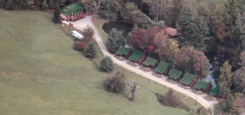
Aerial view of the cabins on the roaring creek at Creek Wood Village Resort

Photo - motorcycleCreek Wood Village Resort is located in the heart of Maggie Valley, directly behind the Maggie Valley Festival Grounds on three and one half FLAT acres with easy access for motorcycles and trailers. It’s convenient to most everything in town including the restaurants, shops, waterholes and Wheels Through Time motorcycle museum.

They have one, two and three bedroom cabins, all with full kitchens, fireplaces, color cable T.V. and the most beautiful views of the mountains.

Photo - one of the cabins

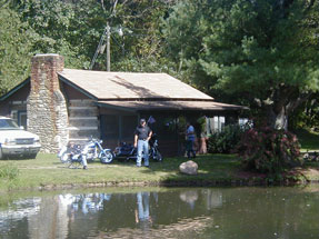
Historic and comfortable cabins are waiting for you.

No hectic life style here. Just kick back and set on your porch, enjoy the mountains, reflect your day in the quiet pond or listen to the water rushing through the nearby creek,  and take in the views after a great day of riding some of the best touring rides around.

Totally motorcycle friendly, they also have two fishing ponds and 650 foot of rushing creek.

Celebrate Blue Ridge Parkway Anniversary 75


Photo - View of the Blue Ridge Parkway from Waterrock Knob overlook

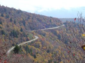
View of the Blue Ridge Parkway from the Waterrock Knob overlook.

2010 kicks off with celebration of our nations most popular national parks 75th anniversary. Construction on the 469 mile long Blue Ridge Parkway scenic road was started in September, 1935 at Cumberland Knob near the border between North Carolina and Virginia (milepost 217.5), though it would take 52 years until the last section was completed in September, 1987 not far from where it all began.

The mission of the Blue Ridge Parkway is to provide a scenic link between two of the easts grandest parks, Shenandoah National Park in Virginia, and Great Smoky Mountains National Park in North Carolina. Inspired by great rides built in the parks of the American west and patterned after earlier scenic roads in the east, the Blue Ridge Parkway was constructed utilizing native materials to emphasize and highlight extraordinary views worthy of national recognition and preservation. In making that link, the Blue Ridge Parkway in some ways eclipsed these other national parks and opened up the isolated and remote areas of the Smoky Mountains for all to enjoy.

Nowadays, more than 18 million people each year come to enjoy the relaxing and inspiring views found along this two lane ribbon of asphalt, more than 1/4 of them on motorcycles. The Blue Ridge Parkway has become our nations most classic ride. What better year to celebrate and enjoy it?

I’ll be highlighting some of those celebrations and relating the often controversial history of one of the best rides anywhere in future posts. Here’s a video to get you started.

For more info about the Blue Ridge Parkway go to http://blueridgeparkway.org

For info about celebrations and events go to http://www.blueridgeparkway75.org/