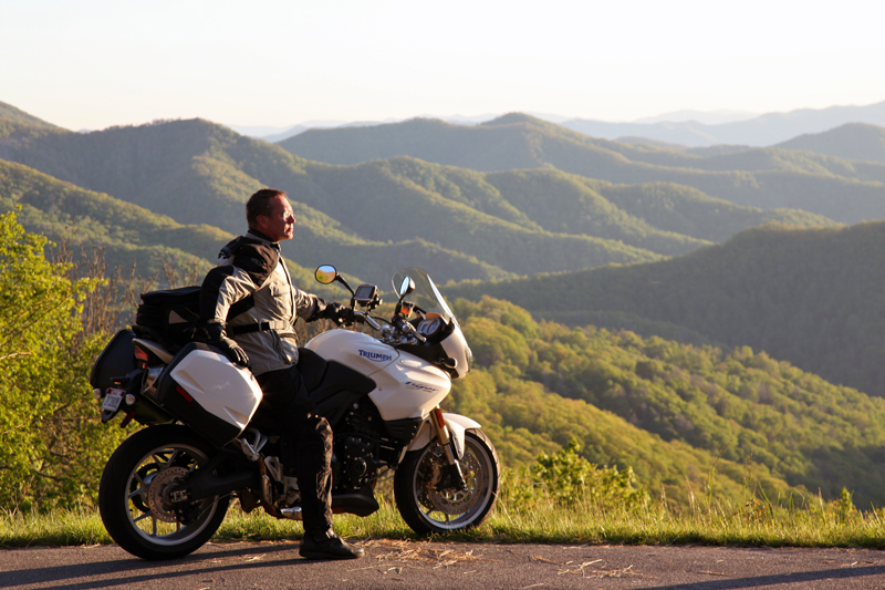
Smoky Mountain Waterfalls Motorcycle Ride

Tour more than 1 dozen roadside waterfalls on this long and scenic day ride.

Smoky Mountains Waterfalls Motorcycle Ride

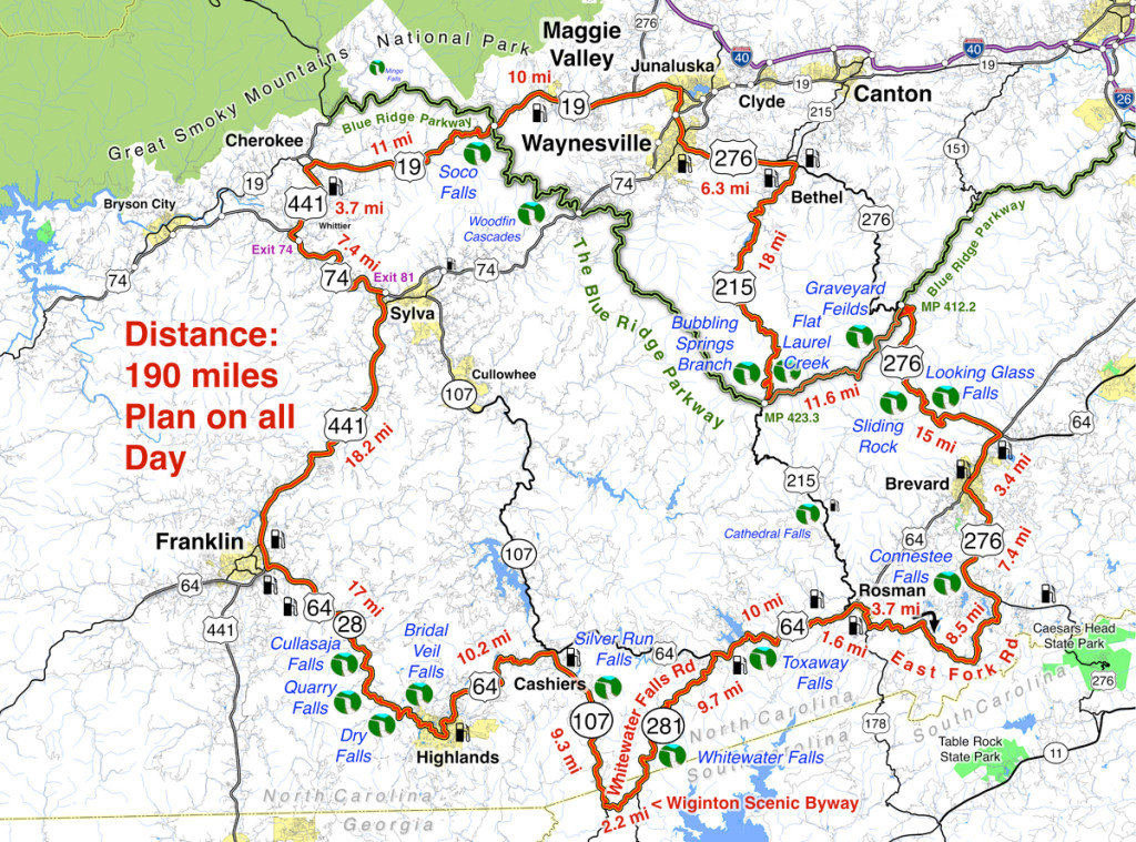
Smoky Mountains Waterfalls Motorcycle Ride – click for large view

Overview: 

Start in Maggie Valley. Follow US 19 west to 441 at Cherokee. Soco Falls on route. Follow US 441 south to Franklin, then US 64 / NC 28 to Highlands. 4 falls along road. Highlands to Cashiers on US 64, then loop south on 107 / 281 to see 2 more. Continue east on US 64, detour south of Brevard then onto US 276 to the Blue Ridge Parkway (3 more) Ride the Parkway to NC 215 then follow it back to US 276 and into Maggie Valley.

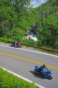
Roadside waterfalls abound for the motorcycle rider

Discover the hidden secrets on your motorcycle travels in the Blue Ridge and Smoky Mountains

Detailed Route:

Distance: 190 miles.

Time: All day ride.

Easy to moderate difficulty

Before you go:

  • Exercise caution! – These are roadside waterfalls, some which are on busy roads with blind curves and limited pull-outs. Pull out with confidence and vigor.
  • Look but don’t touch – Dangerous conditions lurk around waterfalls. Visitors are killed every year. Very slippery rocks. Powerful currents. Deadly drops.
  • Plan on more time – Several waterfalls require short walks to get the views. Allow time for multiple stops and photos.

Route:

Photo-Bubbling-Springs-Branch-on-NC 215

Easy to find Bubbling Springs Branch is on a sharp curve where it flows under NC 215.

Start in Maggie Valley. Follow US 19 west.

4.1 mi Pass under Blue Ridge Parkway

5.7 miSoco Falls. Gravel pull off on left with small signs. Downhill section of road on a curve. Can’t be seen from road. Path and boardwalk lead to 2 converging waterfalls.

15.2 mi Turn left @ traffic light at casino for shortcut to US 441 south. Junction US 19 and Casino Road.

16 mi Turn left @ traffic light onto US 441 south. Junction Casino Road and US 441.

20.1 mi Follow highway 23/74 east. Junction US 441 and highway 23/74 exit 74.

27.3 mi Follow US 441 south. Junction US 441 and highway 23/74 exit 81..

45.3 mi Exit US 441, follow US 64 / NC 28 east. Junction US 441 and US 64 / NC 28 at Franklin.

54.4 mi – Cullasaja Falls. Visible from road on right. Limited and hazardous parking near guardrail on sharp curve.

57.3 mi Quarry Falls – Visible from road on right. Long paved pulloff on right side of road.

58.2 mi – Dry Falls – Not visible from road. Paved parking on right with signs. Short trail to waterfall. Path continues behind waterfall.

60.8 mi – Bridal Veil Falls – Visible from road on left. Paved pull off. Drive behind the waterfall for a photo.

Motorcycles at Cullasaja Falls in North Carolina's "Land of the Waterfalls"

With permission granted, I stand ready to help you have the ride of your life! Just say YES!

63.5 mi Turn left @ traffic light to continue on US 64. Junction US 64 and NC 28 downtown Highlands.

73.7 mi Turn right @ traffic light onto NC 107 south. Junction US 64 and NC 107 in Cashiers.

77.1 miSilver Run Falls – Not visible from road. Poorly marked gravel pull off on left. Trail leads into woods. 1/4 mile walk.

83 mi Turn left onto Wiginton Scenic Byway. Junction Wiginton Scenic Byway and NC 107.

85.2 mi Turn left @ stop sign to head north on NC 281 (Whitewater Falls Road). Junction Wiginton Scenic Byway and NC 281.

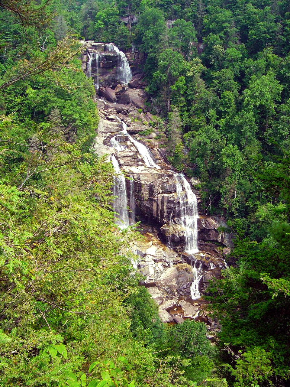
87.6 miWhitewater Falls State Park. Not visible from road. $2 fee. 1/4 mile paved walk. Highest waterfall in the east.

94.9 mi Turn right @ stop sign to continue east on US 64. Junction NC 281 and US 64.

97.1Toxaway Falls – Not visible from road. Road crosses dam with waterfall below. Difficult to get a good view. Park at Toxaway Village or along road on dam.

105 mi Turn right @ junction US 64 and US 178 at Rosman.

106 mi Turn right @ traffic light in Rosman, exit town.

107 mi Turn left onto East Fork Road. Junction US 178 (Pickins Highway) and East Fork Road.

110 mi Turn right @ stop sign  to keep on East Fork Road. Junction East Fork Road and Walnut Hollow Road.

119 mi Turn left @ stop sign to go north on US 276 (Greenville Highway). Junction East Fork Road and US 276.

120 miConnestee Falls – Not visible from road. Large sign, trailhead at end of parking lot. Short walk to overlook where 2 waterfalls converge.

126 mi Turn right @ traffic light in Brevard onto US 64. Junction US 276 and US 64.

129 mi Turn left @ traffic light onto US 276 north. Junction US 64 / US 276 / NC 280.

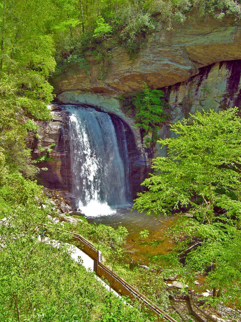
135 miLooking Glass Falls – Visible from road. Large paved parking along road on right. Boardwalk to base of falls.

Photo-whitewater-falls-nc

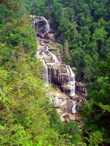
Whitewater Falls, one of the highest in the east.

137 mi – Sliding Rock – Not visible from road. Fee area $2. Paved parking lot. Bathers slide down waterfall.

144 mi Turn right onto parkway ramp. Turn left at the stop sign to head south (towards Cherokee) on the Blue Ridge Parkway. Junction US 276 and Blue Ridge Parkway.

148.5 mi – Graveyard Fields – Not visible from road. 1/3 mile paved walk to top of Second Falls. Trails continue to 2 others.

156 mi Exit Parkway. Turn left (towards Canton) on NC 215. Junction Blue Ridge Parkway and NC 215.

158 mi –  Flat Laurel Creek – Visible from road. Hard to find. Look for 3rd gravel pull out on right on the only straight section of road.

160 miBubbling Springs Branch – Visible from road on left. River plunges beneath the roadway on a hairpin curve. Small unpaved parking are just beyond.

174 mi Turn left @ stop sign to follow US 276 into Waynesville.. Junction NC 215 / US 276.

180 mi Turn right @ traffic light in Waynesvile.. Pass through town.

Junction US 276 and Main Street.

181mi Turn left @ traffic light. Junction Main Street and US 276 (Russ Avenue).

183 mi Turn left @ traffic light to return to Maggie Valley. Junction US 276 and US 19.

————————————————————————————

wayne busch - Smoky Mountain Motorcycle Rider.com

Wayne Busch

– Wayne Busch lives in Waynesville, NC, where he produces the most detailed, comprehensive, up-to-date motorcycle pocket maps of the Blue Ridge and Smoky Mountains to help you get the most of your vacation experience. See them here – AmericaRidesMaps.com

Great Blue Ridge Motorcycle Ride Near Highlands, NC

Great Blue Ridge Motorcycle Ride Near Highlands, NC

Horse Cove Road to Whiteside Cove Road has a short section that is unpaved, but it’s worth riding through on your motorcycle adventures.

Best motorcycle rides

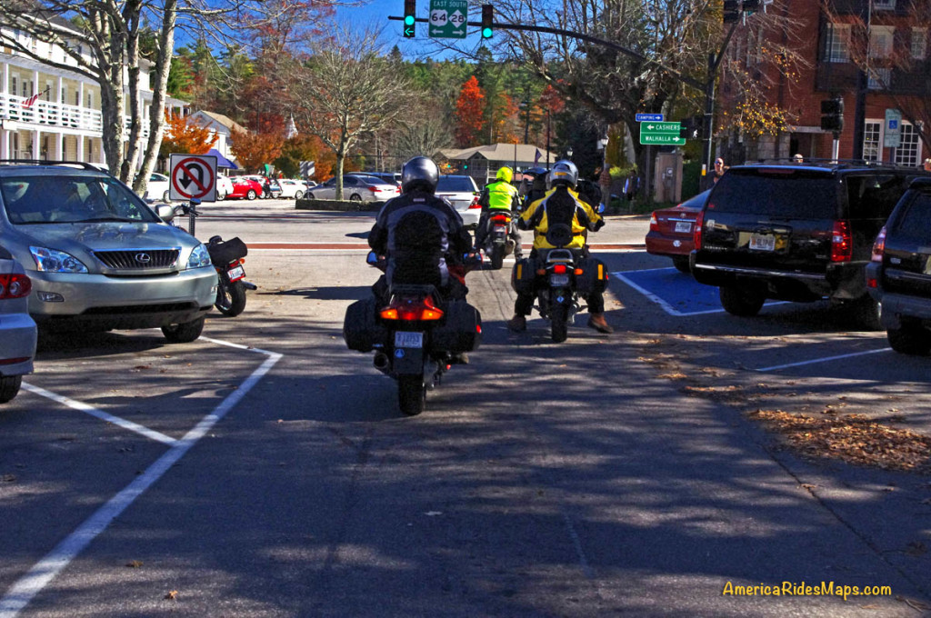
The main traffic light in Highlands, NC. Most riders make a turn. Continue straight ahead to ride Horse Cove Road.

Highlands, NC is just a few lies from the borders with Georgia and South Carolina. It’s a popular riding area with many roadside waterfalls. US 64 jogs to the north from town, NC 28 heads south. Both are great rides. If you’re up for a bit of adventure, try going straight to reach Horse Cove Road.

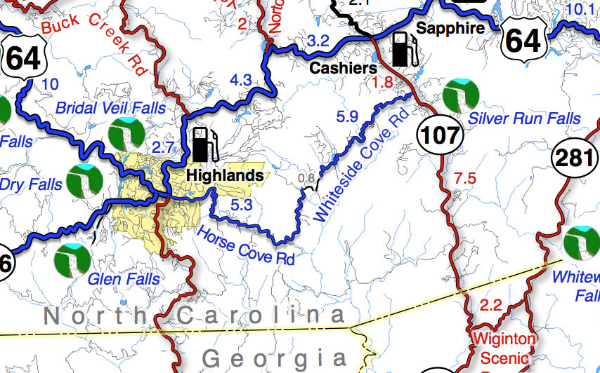
Best Motorcycle Rides - map

Horse Cove Road leads to a 0.8 mile section of graded hardback road. It then becomes Whiteside Road and intersects NC 107 south of Cashiers. The unpaved section is well maintained.

Section of Map #6 – The Best Motorcycle Rides Near Great Smoky Mountains National Park – EAST.

The plunge down the switchbacks on Horse Cove Road is both challenging and beautiful. It continues to twist and roll through thick forest dotted with homes. The unpaved section is smooth enough, you emerge by the lake beneath Whitesides Mountain. Whitesides Cove Road continues the romp through the woods to join NC 107 south of Cashiers.

Best Motorcycle Rides NC

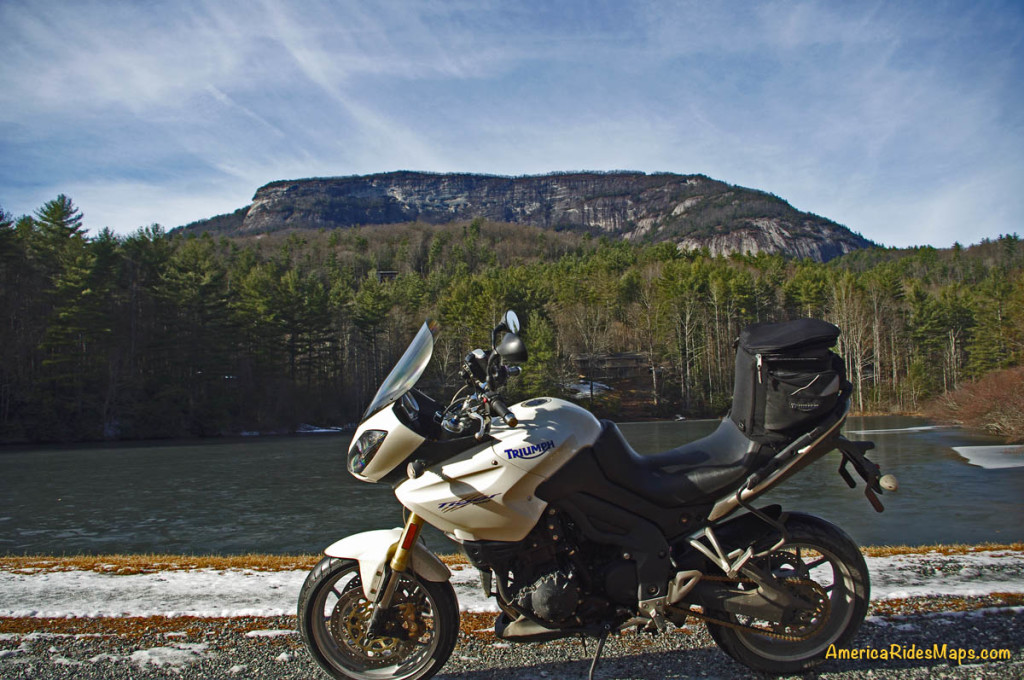
Parked beside the frozen lake beneath the 1000 ft. cliffs of Whiteside Mountain on a winter ride.

You’ll find the best motorcycle rides in the surroundings on Map #6 and Map #7.

If you enjoy photos of motorcycle riding in the Blue Ridge and Smoky Mountains, like MY BLUE RIDGE MOTORCYCLING FACEBOOK PAGE.
____________________________________________________________________

wayne busch - Smoky Mountain Motorcycle Rider.com

Wayne Busch

– Wayne Busch lives in Waynesville, NC, where he produces the most detailed and comprehensive and up-to-date motorcycle pocket maps of the Blue Ridge and Smoky Mountains to help you get the most of your vacation experience. See them here – AmericaRidesMaps.com
____________________________________________________________________

Great Motorcycle Rides in North Carolina – Pisgah Triangles

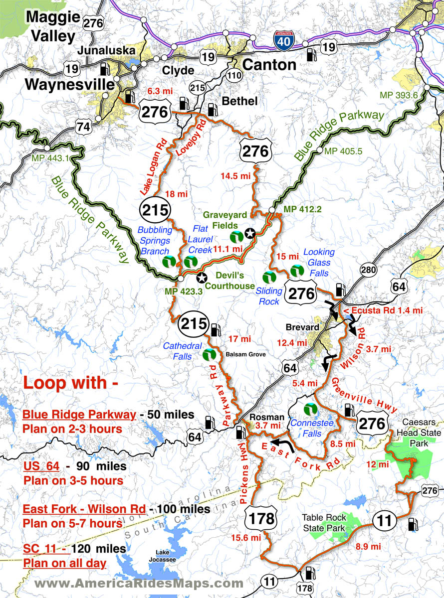
Great Motorcycle Rides in North Carolina – The Pisgah Triangles Map

Great Motorcycle Rides in North Carolina - Pisgah Triangles motorcycle map

Great Motorcycle Rides in North Carolina – Pisgah Triangles motorcycle map – At least 4 variations, the 3rd is my favorite.

Great Motorcycle Rides in North Carolina – The Pisgah Triangles are some of the best motorcycle rides in the world. You’ll see spectacular views, wonderful waterfalls, and ride curves and twists that go on and on and on!

US 276 and NC 215 are two of the finest motorcycle rides you’ll find. Both roads run south from Waynesville / Maggie Valley forming a large upside-down “V”. Connections between these two long roads make 4 triangle shaped rides.  Ride a short fun loop or have an all day adventure!

Complete your triangle with – The Blue Ridge Parkway, US 64, East Fork Road,
or SC 11

Great Motorcycle Rides in North Carolina - Pisgah Triangles

Great Motorcycle Rides in North Carolina – Pisgah Triangles – Looking Glass Falls on US 276 is one of the most visited roadside waterfalls in North Carolina

Roll into Waynesville or Maggie Valley and ask someone to direct you to the best and most scenic motorcycle rides and their finger will point you to the jagged southern horizon. Home to the highest and best section of the Blue Ridge Parkway, two of the roads that lead out of town and climb to the mile high mountaintops are drop-dead beautiful and filled with the curves and switchbacks that make a biker come alive.

The Pisgah Triangles is a name I use to describe this collection of great  motorcycle rides in western North Carolina as so much of it is through the wilderness of the Pisgah National Forest. These are four good options for rides, though are are several others, including some excellent unpaved forest roads for you adventure bikers. There are also roads which lead out to even more fabulous riding not shown on this map.

Great Motorcycle Rides in North Carolina - Pisgah Triangles - NC 215

Great Motorcycle Rides in North Carolina – Pisgah Triangles – NC 215 is the lesser known leg of the Pisgah Triangles, crossing the parkway midway. It’s a popular rest stop in the middle of the wilderness.

Any of these 3 roads – the Blue Ridge Parkway, US 276, and NC 215 are great motorcycle rides you never, ever, tire of enjoying on your motorcycle vacation trip. It’s the first place we local bikers head to as well. Here are 4 outstanding North Carolina motorcycle loop rides you can choose from to get the most out of your precious time while out motorcycle touring in the Blue Ridge.

Great Motorcycle Rides in North Carolina - Pisgah Triangles - Cradle-of-Forestry

Great Motorcycle Rides in North Carolina – Pisgah Triangles – Cradle-of-forestry is one of several stops on US 276, along with Pink Beds, Sliding Rock, Looking Glass Falls, Blue Ridge Motorcycle Campground, Jukebox Junction, …

While you could blast through the shortest loop in less than 3 hours, chances are you won’t. There are so many great views you can’t help but stop and admire them along the ride. The first of the Pisgah Triangles is the first motorcycle ride I recommend to visitors after the Blue Ridge Parkway – it’s that good.

Great Motorcycle Rides in North Carolina - Pisgah Triangles -NC-215-cathedral-falls

Great Motorcycle Rides in North Carolina – Pisgah Triangles -NC 215 – Cathedral Falls is hidden just off the road, but is worth the stop as there are 4 other waterfalls with just a short walk.

The second of the loops climbs to the Blue Ridge Parkway, then down into the next valley near Brevard and Rosman. If you want to include a few roadside  waterfalls in your motorcycle tour, this is the way to get in some good ones and enjoy some more great curvy sections of road. I usually avoid using US 64 through Brevard and the traffic on the 4-lane, as the 3rd loop is so much nicer.

Great Motorcycle Rides in North Carolina - Pisgah Triangles - US 276

Great Motorcycle Rides in North Carolina – Pisgah Triangles – US 276 junction with the Blue Ridge Parkway. As both NC 215 and US 276 connect, you can always hop up and take a quick break with the best of views.

The third loop is just a little tricky as you jump from backroad to backroad, but it is such a nice and scenic motorcycle ride it is worth the effort and one of my favorite motorcycle rides of all. Dodging south of US 64 gets you off the four lane and on to some great rides along trout rivers and streams. Hard not to come back smiling from this one!


Great Motorcycle Rides in North Carolina - Pisgah Triangles -

Great Motorcycle Rides in North Carolina – Pisgah Triangles – The climbs up to the highest section of the Blue Ridge Parkway then down to the next valley are packed with switchbacks, curves, and twists that are so much fun to ride!

The longest loop takes you into South Carolina to the very edge of the Blue Ridge Mountains, follows a long straight section of the Foothills Scenic Highway (SC 11), then comes back into North Carolina and a wonderfully twisty ride. The plunge into South Carolina from Caesar’s Head State Park is one you’ll remember!

Great Motorcycle Rides in North Carolina - Pisgah Triangles - view from Caesar's Head

Great Motorcycle Rides in North Carolina – Pisgah Triangles – Chances are you’ll miss this view plunging down from Caesar’s Head State Park into South Carolina and US 276 carves through the tight switchbacks.

Shortest loop 50 miles. 3 hours, more with stops.
Longest loop 120 miles – All day ride 

Routes:

Loop 1 – use Blue Ridge Parkway. 50 miles, 2 -3 hours or more.

Starts in Waynesville  – Leave downtown Waynesville on US 276 south to reach the top point of the Pisgah Triangles.

6.3 mi Continue straight at traffic light on US 276.

20.8 mi Turn left to follow ramp to the Blue Ridge Parkway at Wagon Road Gap.

20.9 mi Turn left at stop sing onto the Blue Ridge Parkway (towards Cherokee).

31.9 mi Exit the Blue Ridge Parkway at NC 215.

40 mi Turn Left at stop sign onto NC 215 (towards Canton). NC 215 becomes Lake Logan Rd.

 49.9 mi End of loop 1 in Bethel. 6.3 miles back to Waynesville on US 276.

Loop 2 – Use US 64. 90 miles, 3-5 hours

Starts in Waynesville  – Leave downtown Waynesville on US 276 south

6.3 mi Pass through the traffic light in Bethel.

20.8 mi Pass under the Blue Ridge Parkway

35.3 mi Turn right @ traffic light onto US 64. 

47.8 mi Turn Right onto NC 215 (Parkway Road).

64.8 mi Pass under Blue Ridge Parkway

90+ mi. Follow directions for loop 1 return to Waynesville

Loop 3 – Use East Fork Rd /  Wilson Rd. 100 miles, 5 -7 hours

Starts in Waynesville  – Leave downtown Waynesville on US 276 south.

35.3 mi Turn right @ traffic light onto US 64. Move into the left lane.

35.4 mi Turn left @ traffic light onto Ecusta Rd. Follow 1.6 miles to next traffic light at Old Hendersonville Highway.

37 mi Turn right, go about 200 yards, then turn left onto Wilson Rd. Follow Wilson Rd to US 276 (Greenville Highway

40.7 mi Turn left @ stop sign onto US 276 (Greenville Highway).

46.1 mi Turn right onto East Fork Road.

54.6 mi Turn left to stay on East Fork Road. Watch for gray metal barn on left near this turn. Follow East Fork Road to US 178 (Pickens Highway).

58.3 mi Turn right @ stop sign onto US 178 (Pickens Highway) and follow into Rosman.

59 mi Turn left @ traffic light when you enter Rosman to reach US 64.

60 mi Turn left at stop sign onto US 64

60.5 mi Turn right onto NC 215 (Parkway Road)

95.5 mi Turn left onto US 276 in Bethel. 6.3 miles to Waynesville.

Loop 4 – Use NC 11 – (Foothills Scenic Parkway)

Follow Loop 3 directions to mile 46.1. Continue south on Greenville Highway (US 276)  into South Carolina.

58.1 mi Turn right @ stop sign onto SC 11. Follow 8.9 mi.

67 mi Turn right onto US 178 (Moorefield Memorial Highway). Follow 15.6 miles to Rosman.

Return to Bethel using Loop 3 directions. 120 miles.

Here’s a video that shows riding in the area:

This is it. These are the rides you should do. They have everything you come to the mountains for. This is bucket-list quality stuff. These are some of the best motorcycle rides in North Carolina. Don’t miss the Pisgah Triangles on your next trip.

You find these great motorcycle rides on America Rides Maps #6 – The Best Motorcycle Rides Near Smoky Park – EAST  http://shop.americaridesmaps.com/6-The-Best-Motorcycle-Rides-Near-Smoky-Mountains-Park-EAST-NC017.htm

__________________________________________________________________

Wayne Busch

Wayne Busch – Cartographer

Total Rider Tech Logo

Learn Total Control

– Wayne Busch lives in Waynesville, NC, where he produces the most detailed and comprehensive and up-to-date motorcycle pocket maps of the Blue Ridge and Smoky Mountains to help you get the most of your vacation experience. See them here – AmericaRidesMaps.com
Wayne is an advanced motorcycle instructor for Total Rider Tech teaching Lee Parks Total Control Advanced Rider Courses. Isn’t it time you looked into advanced rider training to ride more confidently and safely? It can transform your mountain riding experience.  Total Rider Tech

____________________________________________________________________

North Carolina + Motorcycle + Camera + Rain = Waterfalls!

Photo-clouds-move-in-on-the-Blue-ridge-Parkway

As the clouds moved in, I left the Blue Ridge Parkway color behind.

I’ve been taking every opportunity to get out on the motorcycle on the Blue Ridge Parkway and photograph one of the best years for fall leaf color in a long time. I’ve captured some great shots so far. Yesterday though, the weather changed and the high places were quickly enveloped in cloudy wetness so thick I could barely see. Resigned to give up the day to the weather, I stowed the camera and left the Blue Ridge Parkway at Beech Gap (map) to return home to Waynesville via NC 215.

photo-Flat-Laurel-Creek-on-NC 215

Easy to miss, Flat Laurel Creek cascades down the rock faces - 3rd pull out on right, first long straight section of road from top

Currently, a ride on NC 215 is a Jekyll & Hyde experience.  South of the Blue Ridge Parkway, this popular motorcycle ride is an exquisite pleasure as it plunges down from the heights to reach US 64 near Rosman. Recently paved, this southern section of  the road courses through the  Pisgah National Forest, with stunning views from the high parts and challenging curves and bends that thrill.

Photo-Bubbling-Springs-Branch-on-NC 215

Easy to find Bubbling Springs Branch is on a sharp curve where it flows under NC 215.

In contrast, the north end of NC 215 is a nightmare for the motorcyclist and I’ve heard many bikers cursing the experience of surviving the twisty descent on a road now strewn with loose gravel after recent road “improvements”.  It got a “tar & chip” repair job a few weeks back which addressed the breaks in the pavement, but left a slippery legacy to negotiate turns that are a handful on a road with ideal conditions. Riding it on a motorcycle now is an experience that brings dread to the minds of most.

Coming down in the rain, already wet, I took my time and paused along the route to capture some shots of the scenery most motorcyclists will miss as all their attention is focused on staying upright on this challenging road.

Photo-East-Fork-Pigeon-River

The river calms briefly near the Sunburst Campground with an easy to find pull off along this section.

There are many hidden secrets along this stretch of NC 215 as it traces the course of the Little East Fork of the Pigeon River though most blast right by them. It’s worth taking a little time to pause and explore.

The river is never far from the road, and several small streams add to the torrent along the way. For those who enjoy hiking, the trails through this area are ripe with outstanding scenery.

The Little East Fork eventually reaches Lake Logan where it is captured by a dam. It then continues on to join the Big East Fork before it continues it’s run on through Canton, NC then on into Tennessee where I-40 cuts through a dramatic gorge at the state lines. Eventually it flows through Pigeon Forge, TN, then on to join the great rivers beyond.

Photo-Lake-Logan-North-Carolina

The river pools behind the dam at Lake Logan, then continues on.

Forced to slow down by the road, the rain, and the rocks, I enjoyed a ride most others despise. NC 215 will always be one of our favorite local North Carolina motorcycle rides. I’m hopeful it will see a proper paving in the future, but if not, it will still be a road I visit often and recommend to others. The gravel will eventually be cast along the roadside by traffic.

Don’t be put off by the condition of NC 215. Take your time, go easy, and you’ll be rewarded with some outstanding sights along this classic North Carolina motorcycle ride. It will only get better with time.

_______________________________________________________________________________

Wayne Busch

Wayne Busch - Cartographer

Total Rider Tech Logo

Learn Total Control

– Wayne Busch lives in Waynesville, NC, where he produces the most detailed and comprehensive and up-to-date motorcycle pocket maps of the Blue Ridge and Smoky Mountains to help you get the most of your vacation experience. See them here – AmericaRidesMaps.com
Wayne is an advanced motorcycle instructor for Total Rider Tech teaching Lee Parks Total Control Advanced Rider Courses. It’s time you looked into advanced rider training to ride more confidently and safely, it will change your mountain riding experience. It worked so well for me I became an instructor! Total Rider Tech

_______________________________________________________________________________

You’ll find NC 215 and some of the best motorcycle rides in this outstanding area along with a guide to more than a dozen roadside waterfalls on America Rides Maps “The Best Motorcycle Rides EAST of Great Smoky Mountains National Park

Motorcycle Friendly Places – Hampton Inn & Suites, Sapphire, NC

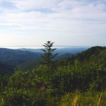
photo-US-64-view-Cashiers

One of my favorite views is just 10 mins from the Hampton.

Few places rival the beauty surrounding Sapphire, NC. The small town and those surrounding it host some of the most expensive real estate in the Blue Ridge Mountains. Flanked by massive granite balds, host to the Cullasja River Gorge with it’s many roadside waterfalls, and nestled amongst the wilds of several national forests with views that will take your breath away, the area is laced with outstanding motorcycle rides.

Photo-view-from-NC-215

Above the clouds on my morning ride

On any weekend, 2 lane US 64 throbs and buzzes with motorcycles who come to play on the wonderfully twisty and scenic roads. Of course other tourists come as well, and US 64 rarely gives the motorcycle rider the freedom to enjoy its serpentine turns to full delight as they insist you share the road. Few tourists ever venture off the main drag though, and the many back roads which course over the mountains and along the valley streams give the biker what he really came for – great rides with outstanding views devoid of traffic.

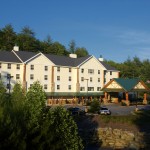
Photo-Hampton-Inn-Sapphire-NC

Hampton Inn & Suites, Sapphire, NC

Sitting in the heart of all this, the Hampton Inn & Suites in Sapphire makes an ideal place to base out of for an enjoyable stay while exploring all the region has to offer. Level parking, set back from the road, and close to good dinging and other amenities, the Hampton provides a quiet and relaxing place with a decor and atmosphere that reflects the quality of the surrounding area. I toured 3 different styles of room each of which deserves the descriptor – “posh”. I would be very happy to stay in any of them, it’s the kind of place I seek out in my travels.

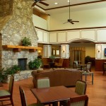
Photo-lobby-at-hampton-inn-sapphire-nc

A comfortable place to gather and relax

It looks like an ideal place for those groups of motorcycle riders looking for a time they’ll remember fondly and come back to. 2 meeting rooms are available. The lobby is spacious and inviting, a good place to gather. All the amenities are at hand.

Photo-room-at-hampton-inn-sapphire-nc

Ride hard, rest easy.

The greatest thing about the Hampton is location. Roll out the driveway and you’re on the ride. Go west through Cashiers and Highlands to ride Wayah Bald and the Nantahala Gorge. The roads to the north – well, every time I go though there I come back thinking I don’t get that way often enough, they are so nice. Head east, and you enter my favorite area in all the mountains, home to some of the best rides I know of. To the south, the twisties which lead into South Carolina are outstanding. Whitewater Falls,

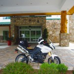
Photo-entrance-hampton-inn-sapphire-nc

Put your bike here.

the highest in the east is just a short ride from the hotel. The Dragon at Deals Gap is about an hour away, though the roads which lead you to it will have you all warmed up and ready to go when you get there, then go on to tackle the Cherohala Skyway. The best section of the Blue Ridge Parkway is the closest. As I add all these up, staying here makes a lot of sense.

Photo-Charlies-Creek-Rd

One of the roads I took going home

The sales manager was a rider, so she knows you guys. You’re welcome here. I’ll be adding the Hampton Inn Sapphire to the maps ASAP. The more I think about it, the more sense it makes to plan a stay here. It’s a total immersion in motorcycle rider’s bliss – point your wheel in any direction and the good roads are right there.

SAVE 10% on weekends, SAVE 20% during the week – Call and ask for your Smoky Mountain Rider / America Rides Maps discount.

Hampton Inn and Suites Cashiers/Sapphire Valley, N.C
3245 US 64 East
Sapphire, NC 28774
http://www.hamptoncashiersnc.com


Photo-whitewater-falls-nc

If waterfalls turn you on, you'll be in heaven. The Hampton sits at the heart of the "Land of the Waterfalls". Whitewater Falls, the highest in the east, is just a short ride, as are many others.

_______________________________________________________________________________

Wayne Busch
Wayne Busch – Cartographer
– Wayne Busch lives in Waynesville, NC, where he produces the most detailed and comprehensive and up-to-date motorcycle pocket maps of the Blue Ridge and Smoky Mountains to help you get the most of your vacation experience. See them here – AmericaRidesMaps.com 
New Map – The Best Motorcycle Rides SOUTH of Great Smoky Mountains National Park

Image - View of Map

Map #7 - The Best Motorcycle Rides South of Great Smoky Mountains National Park

I’m proud to announce the release of America Rides Maps latest compilation of great motorcycle rides in the Blue Ridge Mountains and the final map to complete a series of three maps which detail close to 200 good motorcycle roads surrounding Great Smoky Mountains National Park.

Map #7, The Best Roads South of Great Smoky Mountains National Park, covers the region west from Maggie Valley, North Carolina, to Tellico Plains, Tennessee, extending south to cross the borders into South Carolina and Georgia. More than 30 of the roads rate being listed as outstanding rides highlighted in red, and another 20 are shown as great connecting roads highlighted in blue to link them all together.  The Best Roads South of Great Smoky Mountains National Park includes a guide to 9 roadside waterfalls, numerous out-of-the-way gas stations, sights and attractions, and motorcycle friendly locations.

dragon-motorcycles

Motorcycles flock to ride the Dragon at Deals Gap

This is THE MAP for motorcycle riders making a trip down the Blue Ridge Parkway then on to the Dragon at Deals Gap.

It includes the final sections of the Blue Ridge Parkway into Cherokee, North Carolina, the popular 125 mile long Dragon /  Cherohala Skyway loop ride, the Nantahala River Gorge, Wayah Bald, the Cullasaja River Gorge, a surprising wealth of hidden back roads near Franklin, NC, and variations on rides surrounding the Dragon at Deals Gap few ever discover.

The Smoky Park Motorcycle Map Series includes –

Nearly 200 roads are described in this map package which weave through some of the highest mountains in the east, cross extensive scenic national forests and park lands, see dozens of roadside waterfalls, including every ride within Great Smoky Mountains National Park, it’s the most extensive and comprehensive collection of great motorcycle rides in this area ever assembled.


Photo by Jim Miller Photography

Photo by Jim Miller Photography - This area is so remote and wild you'll find hundred mile views with no evidence of human occupation to be seen.


“This map takes my best selling map, combines it with another, and adds new roads I’ve discovered to make the ultimate map for visitors to the Dragon at Deals Gap, it’s all you need!”

_______________________________________________________________________________

Wayne Busch
Wayne Busch – Cartographer
– Wayne Busch lives in Waynesville, NC, where he produces the most detailed and comprehensive and up-to-date motorcycle pocket maps of the Blue Ridge and Smoky Mountains to help you get the most of your vacation experience. See them here – AmericaRidesMaps.com 
Another Great Motorcycle Ride to be Added to the List – My Secret

It’s not all that frequently I miss a great motorcycle ride in my explorations. I really try to be thorough as well as intuitive, so few slip by. Still, I can’t claim to know ALL the great roads in the southern Appalachians, just the vast majority of them. I continue to find more, and quite embarrassingly, they are too often close to home. Everyone believes they know ALL the great roads right in their back yard. Time and again I am proven wrong, and that’s not such a bad thing.

Stop reading now if you think I am giving this one away. No photos, no road names, nada. I just gave away 30 routes at the Asheville Bikefest for free and people gobbled them up. Nor is this a post about the Asheville Bikefest, I think you may be getting sick of hearing about that, but be cautioned, there will be more to come. The event was far more successful than expected and stuff is flooding in. The only reason I mention the event is because I found this great road because of it.

As Route Master for the Asheville Bikefest (there I go again, last time) I spoke with countless people helping them find the best rides in the area and getting them to see the most in the time they had. When you’re passionate about something, even work becomes fun. I went almost non-stop for four days and I had a great time. That’s why I founded America Rides Maps.

So anyway, this guy wants me to direct him to one of the two dozen local roadside waterfalls, which I do, so he can get of picture of his bike behind it. Yeah, you can actually drive behind this waterfall right off the road. He didn’t find it. Why, I don’t know, it’s one of the most obvious roadside waterfalls there is but that doesn’t matter. What matters is this guy doesn’t give up. He gets directions which lead him off into the forest. He rides and rides everything in sight, exploring places I know better than to go. He never finds it.

The next day he comes back to me and tells me he couldn’t find the waterfall. I’m a bit incredulous, it’s so easy. I redirect him. He relates his adventures and tells me he found this awesome motorcycle ride. I’m dubious. If he couldn’t find the easy waterfall do I believe him now? I made a mental note of it nonetheless. About an hour later I’m talking to a couple of women. They’re buying maps of the areas closest to them (we all think we know our own back yard), right down the street from the “event which will not be named again in this post. Out of curiosity, I ask if they know of this road the guy mentioned. “I live on that road, it’s great!”

So I can’t resist. Today I have to check it out. It rocks. Who cares how or why I missed it.   I’ll add it to the “The Best Roads South of Great Smoky Mountains State Park – EAST” map tomorrow. The other routes in the area I’d previously identified were detours around a congested town and a four lane section of road which formed one leg of a 100 mile+ triangle of superb riding. Now I think I’m looking forward to the detour more than the great rides that lead to it.

I have some more leads to follow up. I know some will be disappointing. I think I’ve done at least one and rejected it, my standards are high, but you never know. I’d be very pleased to find another jewel.