We started from the Soco Rd Exit (US 19) on the Blue Ridge Parkway @ MP 455.7
Absolutely gorgeous weather over the holiday weekend did not go to waste. We took advantage of the opportunity to enjoy riding a “tourist” loop we typically avoid. While the good folks were in church, we knew the traffic would be light and the timing would be right to get out for a Smoky Mountain motorcycle ride that would take us by some of the best scenery the area has to offer and a trip through the Land of the Waterfalls.

Museum of the Cherokee Indian
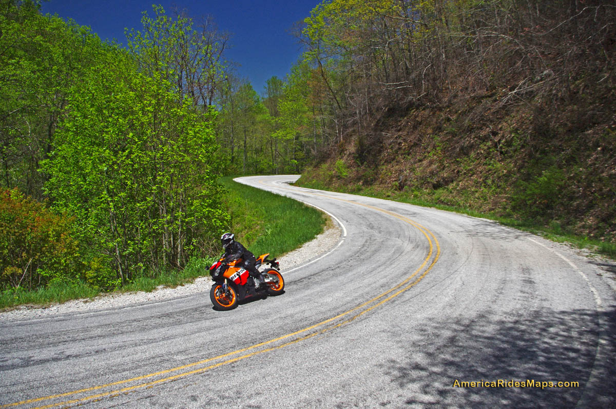
We made our way to Maggie Valley and started the loop from the Soco Gap exit on the Blue Ridge Parkway at MP 455.7. Careening down through the curves towards Cherokee, we had the road to ourselves and got the rare chance to enjoy this twisty section of two lane which is normally crowded with travelers and commuters.

Cherokee is full of these bears
Cherokee was quiet as we sneaked into town for a quick photo then continued on US 19 into Bryson City on the south side of Great Smoky Mountains National Park. On Easter Sunday, the trains of the Great Smoky Mountain Railroad sat in reverence as we passed through the back side of town to check out a road I’d been curious about – (I never stop looking for new roads for America Rides Maps).

Great Smoky Mountains Railroad train in Bryson City
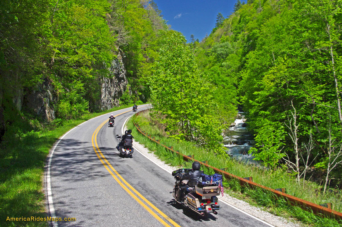
After 10 minutes on the Great Smoky Mountains Expressway (US 74 /19/23/28), we forked south into the Nantahala Gorge and paused for a break at the Nantahala Outdoor Center on the river. From now on, this beautiful road which follows the course of one of the most popular whitewater rivers in the east will be filled with lumbering buses hauling rafters and kayakers upstream for the chilly and thrilly ride through the rapids. Thanks to the holiday, there was no commercial traffic, though plenty of others were here to enjoy the hiking, biking, and other pursuits in this hub of outdoor activity.

The Rivers End Restaurant sits on the Natahala River at NOC.
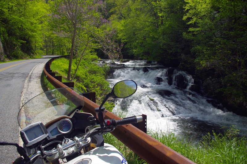
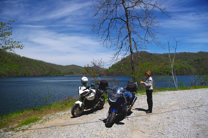
Enduring 10 miles of relatively light traffic, we turned off for the climb over Wayah Bald. Snaking up along the cascading river, we passed fishermen gracefully floating their flies in the quiet pools beneath the numerous falls, then paused for a picnic lunch on the shore of crystal clear alpine Nantahala Lake.

Jackie cruises Wayah Road
The ride across the top of the mountain is more challenging than it is scenic filled with curves and twists that attract riders to this favorite motorcycle route. Easing down through the hairpin curves on the back side of the hump, the road traces the course of another stream which builds to flow into the Little Tennessee River once you reach Franklin. We passed through town then headed south again on US 64 / NC 28 to enter the Cullasaja River Gorge.

The ride along the river on Wayah Road is spectacular!
It looked like our luck was changing as we found ourselves behind several cars, but each peeled off on side roads before we reached the outstanding curves that carve through the rugged canyon and we actually got to enjoy the ride at speed. That is a rare treat and we appreciated it. Good rains this spring have the waterfalls roaring and they were spectacular.

Picnic lunch at alpine Nantahala Lake
There are four easy to spot major waterfalls along this stretch of US 64 leading into Highlands, Cullasaja Falls (the largest), Dry Falls, Quarry Falls, and delicate Bridal Veil Falls. We stopped for a unique photo at Bridal Veil Falls where a small paved loop runs behind the cascade.

Cullasaja Falls on US 64 / NC 28
The remainder of the ride on US 64 is outstanding for scenery but by mid afternoon the tourist traffic was picking up and we did not always get to exploit the wonderful curves as much as we would have liked. The horizons are flanked with glimpses of the highest naked cliffs in North Carolina, some more than 1000 feet tall, and you cruise through some of the most expensive real estate in the country.
We completed the loop by heading north again on US 215 from Rosman climbing to reach the highest section of the Blue Ridge Parkway on a freshly paved road that snakes through outstanding turns and scenery that make it one of the locals favorite rides.

Jackie poses for a photo on her motorcycle behind Bridal Veil Falls just outside Highlands, NC on US 64 / NC 28. How cool is that?
Click on photos for larger view
_______________________________________________________________________________

- Wayne Busch – Cartographer
– Wayne Busch lives in Waynesville, NC, where he produces the most detailed and comprehensive and up-to-date motorcycle pocket maps of the Blue Ridge and Smoky Mountains to help you get the most of your vacation experience. See them here – AmericaRidesMaps.com

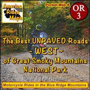
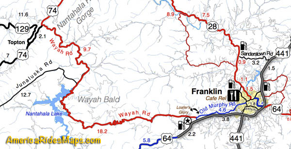
 This motorcycle ride map features the great motorcycle roads found near the Nantahala Gorge, as well as the great riding off road riding around Franklin, North Carolina. Enjoy roadside waterfalls, mountain top views, and miles and miles of superb unpaved riding.
 America Rides Maps has also produced dual sport motorcycle ride maps of the great adventure rides east of Great Smoky Mountains National Park and the superb roads near the Blue Ridge Parkway south of Smoky Park. They are sold individually and as a 3 map set.