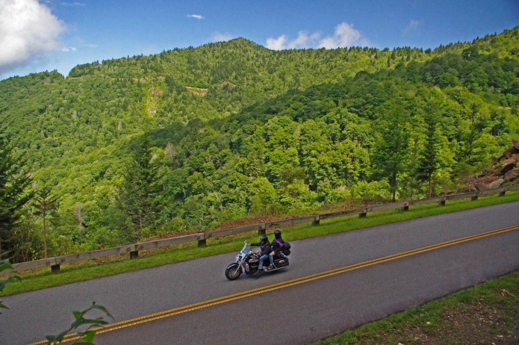
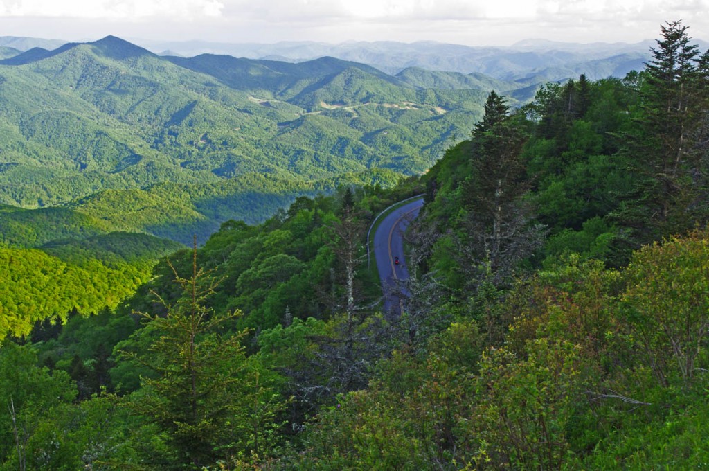
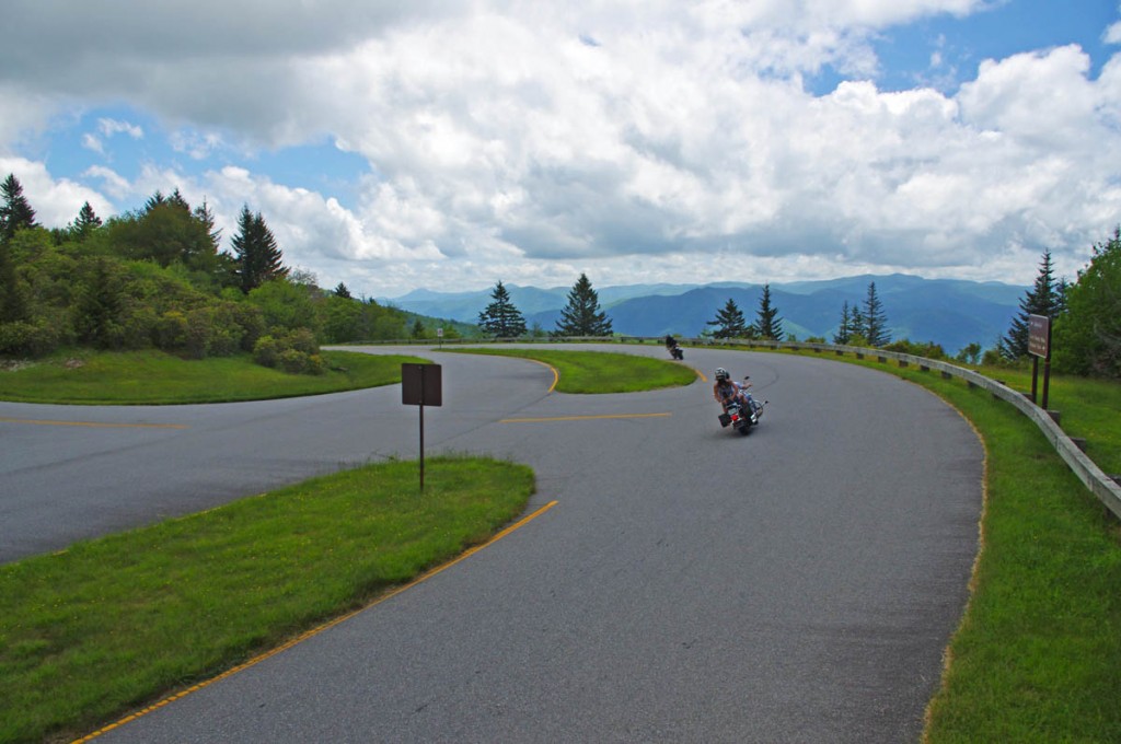
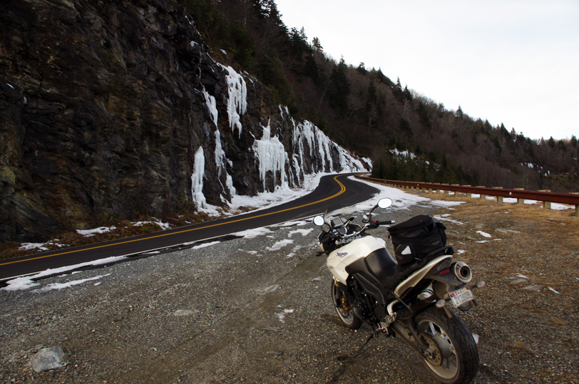
Great Motorcycle Rides – Is it a Waterfall or Not?

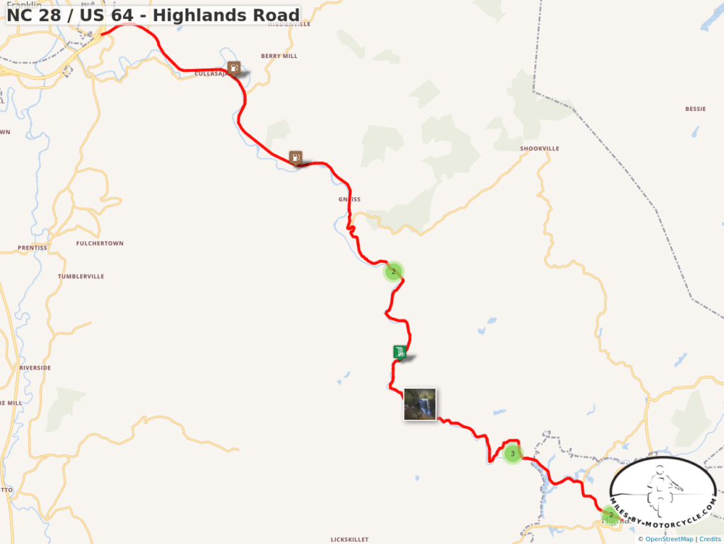
NC 28 / US 64 between Franklin and Highlands, North Carolina is well known for 4 beautiful roadside waterfalls. 

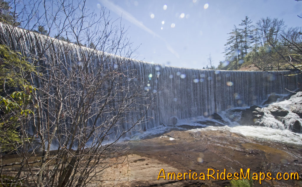
Few notice there is a 5th waterfall, at least that’s what the sign says.

Seqoyah Falls

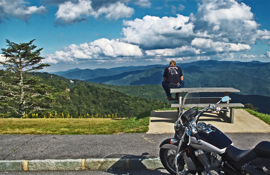
Sequoyah Falls is located just outside Highlands. Truth is it’s not a natural waterfall, rather the spillover from the dam on Lake Sequoyah.There’s an unpaved pull off, a sign and a plaque here and it does make a nice place for a stop on your motorcycle ride.

Is it a waterfall? You decide while you savor this beautiful spot on your motorcycle tour of the Blue Ridge.  Enjoy!

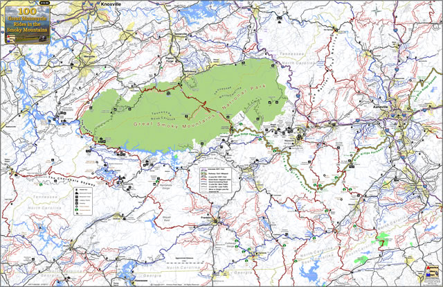
You’ll find this road and 99 other outstanding motorcycle rides in the area on map – 100 Great Motorcycle Rides in the Smoky Mountains

100 Great Smoky Mountain Motorcycle Rides Map

100 Great Smoky Mountain Motorcycle Rides Map

Do you like riding to see waterfalls? You might also like – 

Smoky Mountain Waterfalls Motorcycle Ride


Wayne BuschAmerica Rides Maps

Wayne Busch searches out the most entertaining roads in the Blue Ridge Mountains then records them on a series of maps which span the Blue Ridge Mountains.

There are more great motorcycle roads in the Blue Ridge and Smoky Mountains than anywhere else. I highlight the best roads then show you the best ways to connect them together into rides. More than a decade of searching has discovered more than 1000 good roads to enjoy. We continue to search so you may enjoy.

Review the maps, order online hereAmericaRidesMaps.com

Source: America Rides Maps Blog @ Miles-by-Motorcycle.com
https://miles-by-motorcycle.com/51999/blog/53982/great-motorcycle-rides—is-it-a-waterfall-or-not-

Motorcycle Loop Ride near Hot Springs, NC

French Broad River in Hot Springs, NC

French Broad River

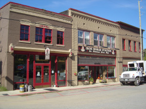
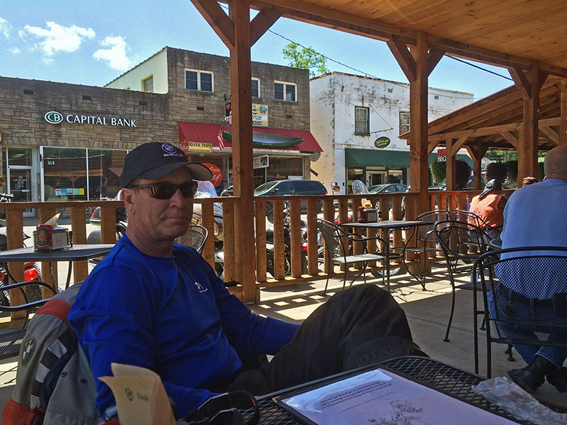
The small historic town of Hot Springs, NC, has long been a familiar pit stop for mountain area motorcycle riders. It is situated north and west of Asheville near the border with Tennessee on the banks of the French Broad River. The town is popular with rafters and hikers, has couple biker friendly places to eat, and there are natural hot springs to soak in at the spa.

Hot Springs, NC

Hot Springs, NC

Motorcycle riders are attracted to this area for the wonderful and tricky two lane back roads which thread through the surrounding mountains. The newfound popularity of NC 209 a.k.a. “The Rattler” as one of the top 10 motorcycle rides in the Blue Ridge Mountains is bringing more motorcycle touring enthusiasts to discover this playground of nice biker roads.

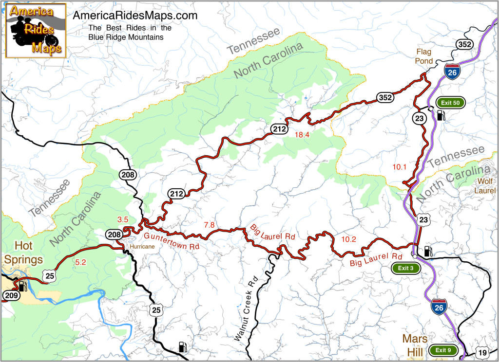
Hot Springs to Flag Pond Motorcycle Ride Map

The map shows a motorcycle loop ride that takes you across the border to Flag Pond, TN., then loops you back to Hot Springs.

  • Leaving Hot Springs, go east on US 25 / 70 making the gentle climb then descent to the junction with NC 208 at Hurricane.
  • Turn north (left) and follow NC 208 along the winding river. As you come to the junction of NC 208 and NC 212 note the small bridge over the creek. Guntertown Road is on the right just before the bridge, NC 212 is at the stop sign once you cross the bridge.
  • The north leg ( NC 212 / TN 352 ) of the triangle shaped motorcycle ride is a pretty nice cruise following along creeks and streams for the most part with a few tricky curves thrown in to keep you on your toes.
  • The east leg ( TN 23 / US 23 ) is pretty relaxed riding, there are a couple passing zones on the long inclines. You’ll want to keep an eye out for the turn onto Big Laurel Road, then hold on for the wild ride back.
  • Big Laurel Road is the south leg of the loop and full of tricky curves. Be alert for scattered debris in a couple of the hairpins around bluff faces. Walnut Creek Road spurs off to the south, be sure you veer in the correct direction when you reach this junction to remain on Big Laurel Road.
  • Guntertown Road leads you east to the small bridge on NC 208. Retrace your path to return to Hot Springs.
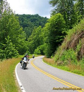
Motorcycles on Big Laurel Road

Big Laurel Road

The roads in this area can be extremely challenging and tight. If you prefer an easier course, the ride to Flag Pond on NC 212 / TN 352 can be done out-and-back. There is a large pull off riders use for a break at the junction of TN 352 & TN 23.

————————————————————————————

wayne busch - Smoky Mountain Motorcycle Rider.com

Wayne Busch

– Wayne Busch lives in Waynesville, NC, where he produces the most detailed, comprehensive, up-to-date motorcycle pocket maps of the Blue Ridge and Smoky Mountains to help you get the most of your vacation experience. See them here – AmericaRidesMaps.com

Motorcycle Friendly – Still Mountain Restaurant, Hot Springs, NC

Motorcycle Friendly – Still Mountain Restaurant, Hot Springs, NC

UPDATE – This Restaurant has closed.

On a classic “lunch run” ride here’s one option for the lunch stop.

Still Mountain Restaurant, Hot Springs

Motorcycle friendly Still Mountain Restaurant, Hot Springs, NC.

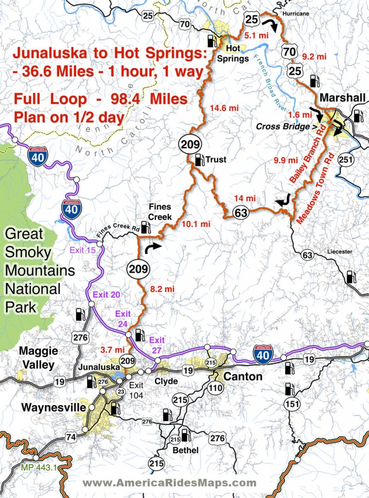
One of the nicest motorcycle rides you’ll do in the Smoky Mountain area of North Carolina and Tennessee is NC 209, a.k.a “The Rattler”. This 30+ mile ride through the mountains and valleys of North Carolina runs from Junaluska (Maggie Valley, Waynesville) to Hot Springs. Scenic, challenging, historic, it makes for a nice “lunch run” as an out-and-back ride or the first leg of numerous loop rides you can build with other great connecting roads.

Motorcycle Friendly Still Mountain Restaurant

Motorcycle Friendly Still Mountain Restaurant – you can’t miss it in tiny Hot Springs.

Hot Springs is one of the many historic little mountain towns that dot the landscape. Once  an important stop on the Knoxville, TN to Asheville, NC corridor, it is mostly forgotten now that the Interstate bypasses it to the west. It’s a pass-through town on the Appalachian Trail, a popular place for whitewater rafting, and there are natural hot springs where you can go soak your keister for a few bucks. On weekends, it’s a gathering spot for the bikers who flock to ride the outstanding motorcycle roads in the surrounding region.

Motorcycle Friendly Still Mountain Restaurant

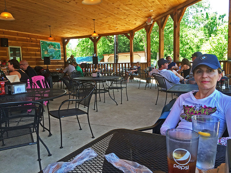
Motorcycle Friendly Still Mountain Restaurant – a big comfortable porch, tasty food, and live music on this day.

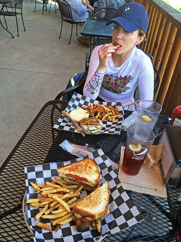
Comfortable, easy to find, and with tasty food, the Still Mountain Restaurant is usually full of bikers though the occasional Appalachian Trail hiker drops in for some civilized fare on their 1500 mile walk in the wilds. You’ll feel right at home here.

Biker Friendly Still Mountain Restaurant

Biker Friendly Still Mountain Restaurant – Thumbs up!

You’ll find NC 209 and another 50+ great rides in the area on America Rides Motorcycle Pocket maps #6 as well as the 100 Great Motorcycle Rides in the Smoky Mountains.

Great Motorcycle Rides in North Carolina - NC 209, a.k.a. "The Rattler".

Great Motorcycle Rides in North Carolina – NC 209, a.k.a. “The Rattler”. Do it as an out-and-back or make a nice loop ride – one of many ways to go on this great biker road

More Rattler info here

————————————————————————————

wayne busch - Smoky Mountain Motorcycle Rider.com

Wayne Busch

– Wayne Busch lives in Waynesville, NC, where he produces the most detailed and comprehensive and up-to-date motorcycle pocket maps of the Blue Ridge and Smoky Mountains to help you get the most of your vacation experience. See them here – AmericaRidesMaps.com

Best Blue Ridge Parkway Overlooks by Motorcycle

Best Blue Ridge Parkway Overlooks by Motorcycle – Waterrock Knob

Waterrock Knob Overlook
Elevation – 5820 feet
Milepost – 451.2

Best Blue Ridge Parkway Overlooks by Motorcycle - Waterrock Knob

Best Blue Ridge Parkway Overlooks by Motorcycle – Waterrock Knob is a beautiful spot with outstanding views

Easy to find, convenient to reach from nearby towns of Waynesville and Maggie Valley, Waterrock Knob is a popular stop when motorcycle riding on the Blue Ridge Parkway.

Best Blue Ridge Parkway Overlooks - waterrock knob view

Best Blue Ridge Parkway Overlooks – It’s a steady climb to Waterrock Knob from either direction on the Blue Ridge Parkway. It’s only 18 miles from the south end of the ride.

Once you’ve passed the highest point on the Blue Ridge Parkway it’s all downhill to the southern end at Great Smoky Mountains National Park just outside Cherokee, NC.

Best Blue Ridge Parkway Overlook by Motorcycle - Waterrock Knob

Best Blue Ridge Parkway Overlook by Motorcycle – Waterrock Knob – view looking south into South Carolina and Georgia.

It’s hardly time to pull in the clutch and coast – there are a few good mountains you’ll need to climb along the way. One of them is Waterrock Knob.

Best Blue Ridge Parkway Overlooks by Motorcycle - Waterrock Knob view

Best Blue Ridge Parkway Overlooks by Motorcycle – Waterrock Knob view – looking east into South Carolina. Clear days provide outstanding views. Take some time and enjoy.

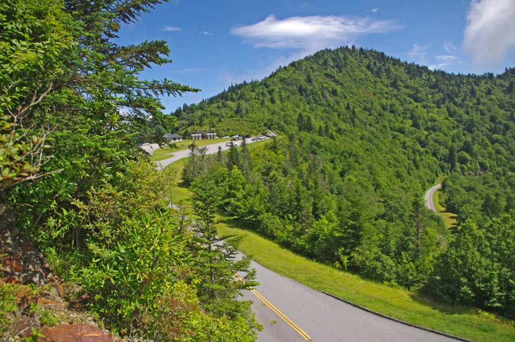
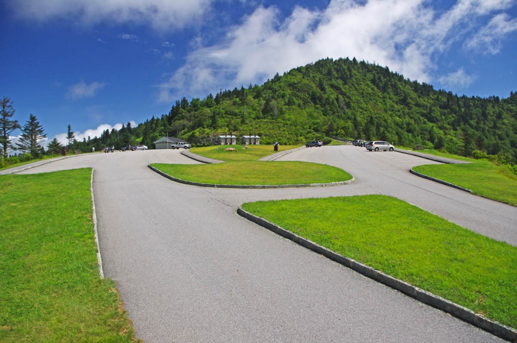
Just 10 miles from the south end of the Blue Ridge Parkway, Waterrock Knob is a large overlook sitting near the mountain top with outstanding views both east and west. On clear days it’s easy to spot Harrah’s Casino in Cherokee almost 20 miles distant.

Best Blue Ridge Parkway Overlooks by Motorcycle - Waterrock Knob  - the turn

Best Blue Ridge Parkway Overlooks by Motorcycle – It’s easy to spot the short access road that leads to Waterrock Knob as the parkway divides here for one brief section

The overlook is located on a short spur road that is well marked and easy to spot – the road briefly becomes divided here with a median as you reach the top of the climb.

Best Blue Ridge Parkway Overlooks by Motorcycle - west view

Best Blue Ridge Parkway Overlooks by Motorcycle – looking west, you can see the casino in Cherokee almost 20 miles distant

The overlook has a large parking lot, bathrooms, and a Blue Ridge Parkway Visitor Center. A  strenuous footpath makes a 1 mile climb to the top of the mountain. There are several picnic tables and it’s a nice place for it.

Best Blue Ridge Parkway Overlooks by Motorcycle - Waterrock Knob

Best Blue Ridge Parkway Overlooks by Motorcycle – It’s a great place for a pit stop at Waterrock Knob, plenty of room and places to view from, and a visitor center with info and bling.

Best Blue Ridge Parkway Overlooks - Waterrock Knob - map

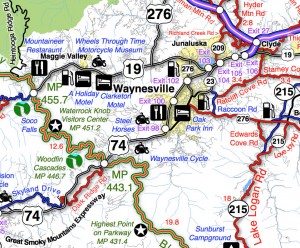
Best Blue Ridge Parkway Overlooks – Waterrock Knob – map – a section of Map #6 shows where to find Waterrock Knob on the Blue Ridge Parkway. There are lots of other things to see nearby.

You’ll find Waterrock Knob on America Rides Motorcycle pocket maps –

#6 The Best Motorcycle Rides Near Smoky Mountains Park – EAST
http://shop.americaridesmaps.com/6-The-Best-Motorcycle-Rides-Near-Smoky-Mountains-Park-EAST-NC017.htm

#7 The Best Motorcycle Rides SOUTH of GSMNP
http://shop.americaridesmaps.com/7-The-Best-Motorcycle-Rides-SOUTH-of-GSMNP-NC021.htm

____________________________________________________________________

wayne busch - Smoky Mountain Motorcycle Rider.com

Wayne Busch

– Wayne Busch lives in Waynesville, NC, where he produces the most detailed and comprehensive and up-to-date motorcycle pocket maps of the Blue Ridge and Smoky Mountains to help you get the most of your vacation experience. See them here – AmericaRidesMaps.com

Total Rider Tech Logo

Learn Total Control

Wayne is an advanced motorcycle instructor for Total Rider Tech teaching Lee Parks Total Control Advanced Rider Courses. Isn’t it time you looked into advanced rider training to ride more confidently and safely? It can transform your mountain riding experience.  Total Rider Tech

____________________________________________________________________

Best Blue Ridge Parkway Overlooks by Motorcycle

Best Blue Ridge Parkway Overlooks by Motorcycle – Highest Point

Richland Balsam Overlook
Elevation – 6053 feet
Milepost – 431.4 

Best Blue Ridge Parkway Overlooks - highest point

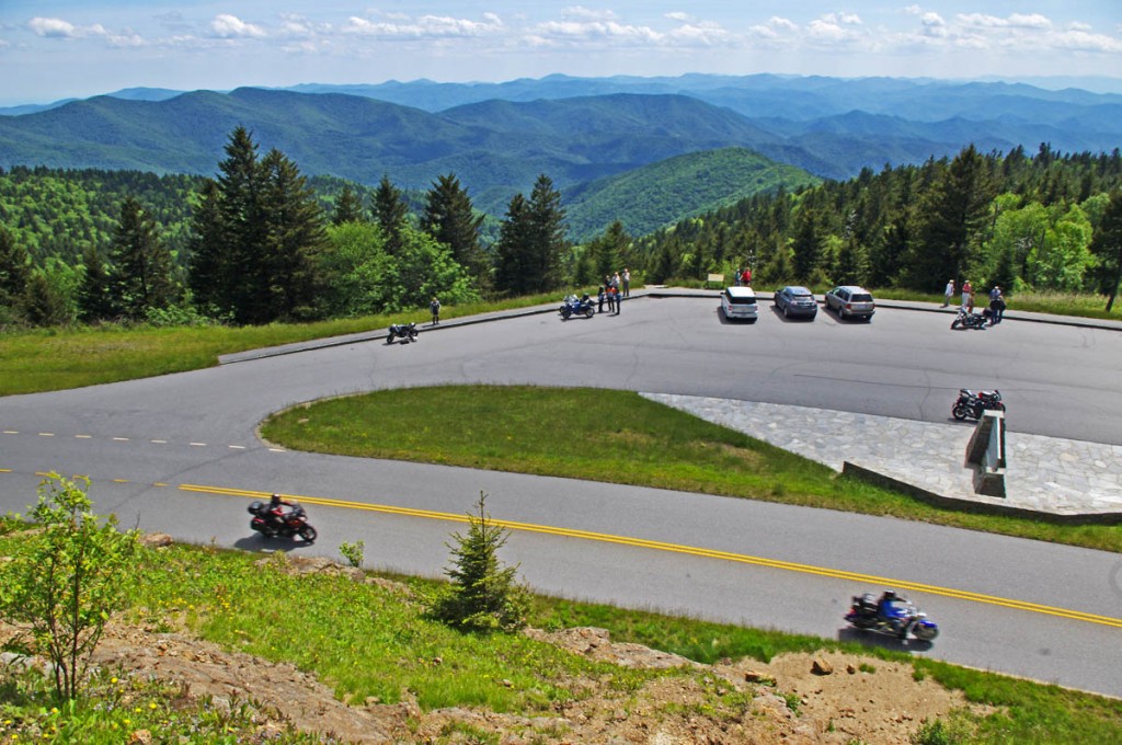
Best Blue Ridge Parkway Overlooks – highest point. The long sweeping overlook  provides expansive views of the mountains which comprise ‘The Land of the Waterfalls”

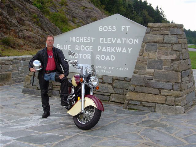
The highest point on the Blue Ridge Parkway is in North Carolina at milepost 431.4. Here, the nations top motorcycle ride reaches an elevation of 6053 feet as it carves it’s way along  the southern exposure of the Balsam mountain range.

Best Blue Ridge Parkway Overlooks by Motorcycle - highest point

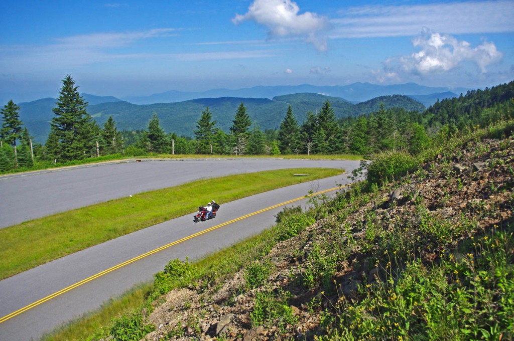
Best Blue Ridge Parkway Overlooks by Motorcycle – Getting your picture with the sign at the highest point on the Blue Ridge Parkway is one of those “must have” photos from your trip to reach the long paved overlook which spans the radius of the curve around the mountain.

There is no dramatic climb to reach the long paved overlook which spans the radius of the broad curve around the mountain. The Blue Ridge Parkway maintains a steady altitude through this long remote and isolated section of the national park rarely dipping below 5000 feet. While the grades are gentle, the curves are full of surprises and the drop-offs along the roadside inspire a real respect for the altitude on this best motorcycle ride in the USA.

Best Blue Ridge Parkway Overlooks by Motorcycle - high point

Best Blue Ridge Parkway Overlooks by Motorcycle – peer into several states from the highest point on clear days, but it not place to be in bad weather

Only 37.7 miles from the southern end of the Blue Ridge Parkway at Great Smoky Mountains National Park near Cherokee, NC, a ride to the high point is an easy one to squeeze in even if you’re not on an end-to-end parkway ride on your motorcycle. From Asheville, Waynesville and Maggie Valley, it’s a wonderful way to spend a few hours riding a motorcycle on one of the the best scenic motorcycle rides you’ll find anywhere.

Best Blue Ridge Parkway Overlooks by Motorcycle - high point

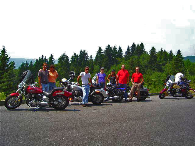
Best Blue Ridge Parkway Overlooks by Motorcycle – Few can resist a stop at the high point. The large parking area is able to handle the crowds, and it’s a great lace to get shots of large groups of riders.

As you might suspect, this spot is one of the most remote and isolated on your Blue Ridge Parkway motorcycle ride. It’s a long ride for gas, tank up before you go. The high parts get the wet weather first – if it looks cloudy from the valley, you may not see much when you get up high. It will be a lot cooler than down in the valley and more windy, be prepared.

Best Blue Ridge Parkway Overlooks by Motorcycle - high point

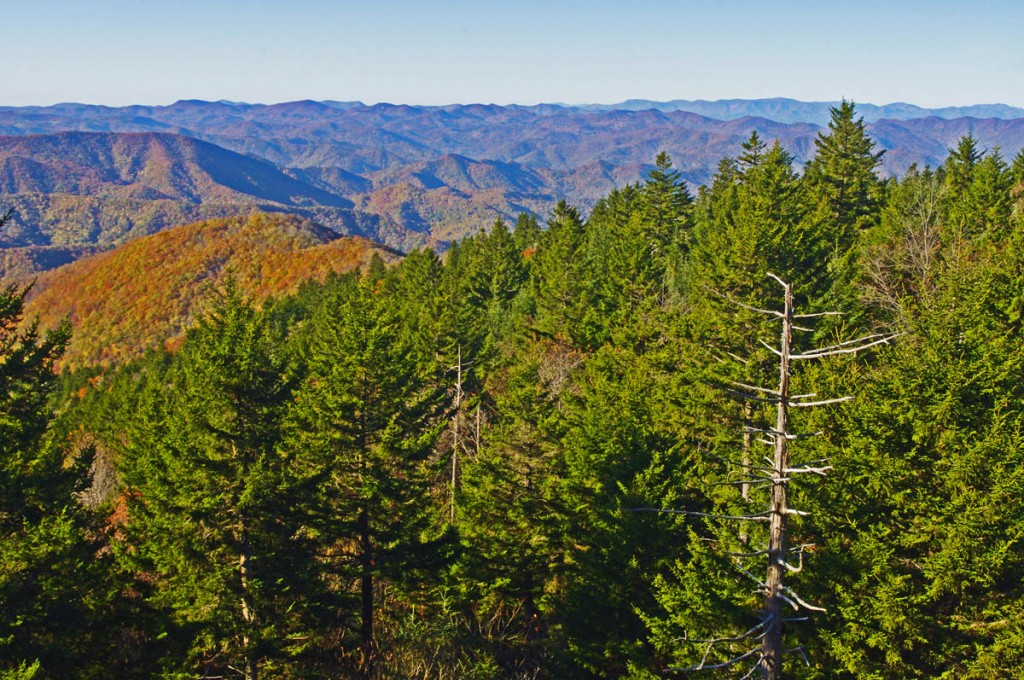
Best Blue Ridge Parkway Overlooks by Motorcycle – A fall view from the high point overlook. Clear days are just spectacular!

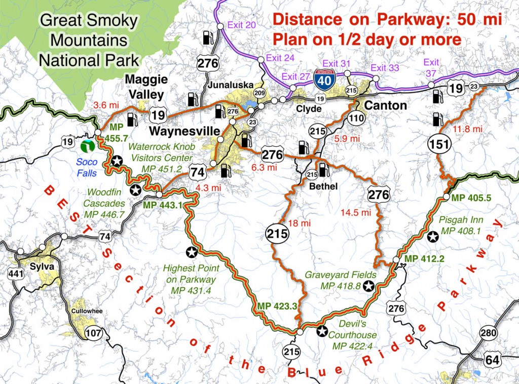
Map of the best section of the Blue Ridge Parkway

Blue Ridge Parkway Map best

Map of the best 50 mile section of the Blue Ridge Parkway shows the location of the high point and the ways to reach it from nearby towns. Click for larger image –

See a 360 degree panoramic view at Virtual Blue Ridge – http://www.virtualblueridge.com/parkway_tour/overlooks/00431b.asp

image-motorcycle-ride-map-cover

You’ll find the highest point on the Blue Ridge Parkway on America Rides Maps motorcycle pocket map

#6 The Best Motorcycle Rides Near Smoky Mountains National Park – EAST http://shop.americaridesmaps.com/6-The-Best-Motorcycle-Rides-Near-Smoky-Mountains-Park-EAST-NC017.htm

____________________________________________________________________

wayne busch - Smoky Mountain Motorcycle Rider.com

Wayne Busch

– Wayne Busch lives in Waynesville, NC, where he produces the most detailed and comprehensive and up-to-date motorcycle pocket maps of the Blue Ridge and Smoky Mountains to help you get the most of your vacation experience. See them here – AmericaRidesMaps.com

Total Rider Tech Logo

Learn Total Control

Wayne is an advanced motorcycle instructor for Total Rider Tech teaching Lee Parks Total Control Advanced Rider Courses. Isn’t it time you looked into advanced rider training to ride more confidently and safely? It can transform your mountain riding experience.  Total Rider Tech

____________________________________________________________________

Nice Motorcycle Ride Near Maggie Valley, North Carolina

The locals know this good biker road well. Shouldn’t you?

Hard to believe Jan 1, 2012, and we’re out for a spin on the bikes. Unusually warm, the day also brought some showers so we kept our ride short and local. As we’re pretty much surrounded by great motorcycle rides here in the Waynesville / Maggie Valley area, even those short rides can be a lot of fun.

photo-jackie-on-rabbit-skin-road

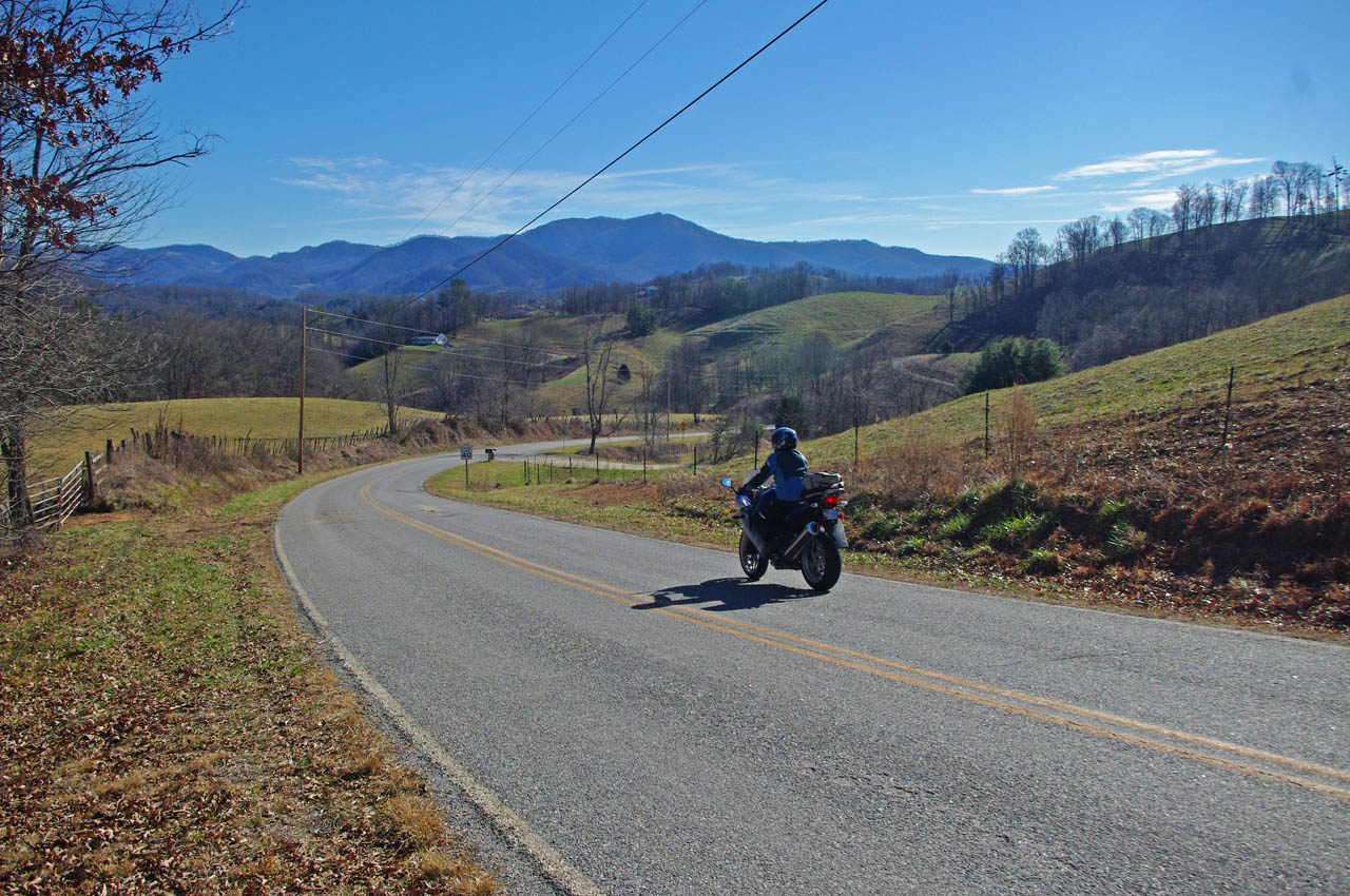
Jackie welcomes the New Year with a ride on Rabbit Skin Road. Nice curves, nice views, it’s a local favorite.

Rabbit Skin Road is easy to find. From Waynesville / Maggie Valley, head north on US 276 across the broad expanse of Jonathan Valley as it skirts the edge of Great Smoky Mountains National Park. The top of the ridge line to the west is the park border. To the north you’ll see more impressive mountains including 6000 Max Patch Bald. Even though it’s a long straight stretch of 4 lane, US 276 is a scenic and relaxing ride and a good chance to get settled on the bike before the challenge that is soon to come.

US 276 ends at the intersection with Interstate 40 at Exit 20. Pass under the Interstate as if you are continuing north to Tennessee and look for Rabbit Skin Road on the right before you head up the ramp to the highway.

This video includes some shots of the bridge where the roads meet

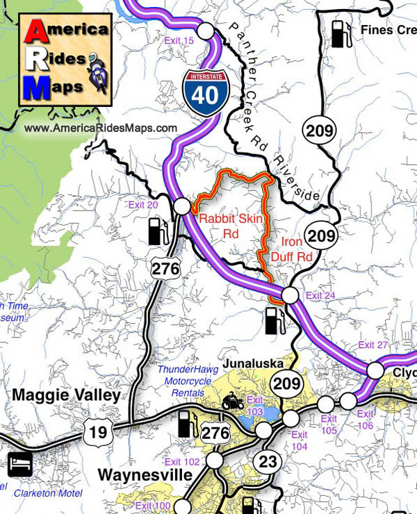
Rabbit Skin Road is one of several very challenging and scenic motorcycle rides through the mountains which lie north of Waynesville / Lake Junaluska / and Maggie Valley. It’s only 3.5 miles in length, but it doesn’t really end, it just continues on as Iron Duff Road for another 4.1 miles before it connects to NC 209 (a.k.a. The Rattler) near Exit 24 on Interstate 40.

The junction of Rabbit Skin Road and Iron Duff Road occurs at a bridge which crosses the Pigeon River. Across the river, are two more good motorcycle rides, Riverside Road and Panther Creek Road. Still more good motorcycle rides link to them.

While none of these roads is very long, all of them are scenic and fun to ride, and they interconnect. They are good toknow about when you have only a short time available to get in a motorcycle ride or are darting out for a cruise between rainy spells. If you know where they are, you can just keep linking roads together and spend a couple hours looping through the mountains and never leave the county nor ride the same one twice.

Image-map-shows-the-motorcycle-ride

Rabbit Skin Road and Iron Duff Road – Local Favorites


All Roads Lead to Maggie

The Rattler

America Rides Maps Map #6 – The Best Motorcycle Rides EAST of Great Smoky Mountains National Park

_______________________________________________________________________________

Wayne Busch

Wayne Busch – Cartographer

Total Rider Tech Logo

Learn Total Control

– Wayne Busch lives in Waynesville, NC, where he produces the most detailed and comprehensive and up-to-date motorcycle pocket maps of the Blue Ridge and Smoky Mountains to help you get the most of your vacation experience. See them here – AmericaRidesMaps.com

Wayne is an advanced motorcycle instructor for Total Rider Tech teaching Lee Parks Total Control Advanced Rider Courses. It’s time you looked into advanced rider training to ride more confidently and safely, it will change your mountain riding experience. It worked so well for me I became an instructor! Total Rider Tech

_______________________________________________________________________________

Motorcycle + Ice + Fun = Minor Damage

A minute after this photo was taken my bike lay on its side and I couldn’t pick it up.

Photo-Whitesides-mountain-nc-motorcycle-by-frozen-lake

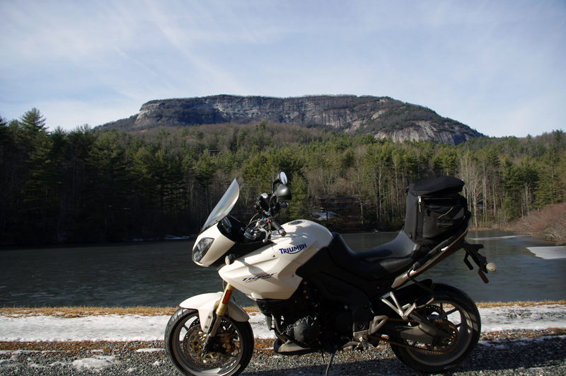
A minute after this photo was taken my bike lay on its side and I couldn't pick it up. Whiteside Mountain in the background has the highest cliffs in the east.

It was the last of the roads I planned to explore on a winter motorcycle riding dayin the Blue Ridge Mountains. I stopped at this frozen lake to take the picture beneath the 1000 foot cliffs of Whiteside Mountain. As I tried to turn the bike around and leave, my foot slipped on the icy gravel and down it went. Each time I tried to pick it up the wheels just skated on the frozen ground and I couldn’t get the leverage to lift it. Within minutes I was exhausted, out of breath, and starting to seriously wonder just how I was going to get out of this predicament.

Photo-motorcycle-on-icy-US-276

I didn't realize how icy US 276 was until I stopped. My feet skidded on the thin coat of black ice that covered parts of the road. It had been a long slow climb to get this far.

Had I any sense I would have turned back this morning and put this off, but I’ve set a deadline for this motorcycle ride map revision. After several days of a hard cold followed by rain, I figured the roads should be in better shape now with the relatively warmer weather. When the frostless morning came with 33 degrees on the thermometer and the promise of sunshine, I was elated to get back out on the road. It wasn’t as warm as I thought.

Photo-view-of-mountains-in-clouds-from-Blue-Ridge-Parkway

As I looked south when I crossed the Blue Ridge Parkway my destination lay beneath that bank of clouds near those mountaintop islands on the left horizon.

Heading out things appeared to be fine. The rains melted all but the last clumps of snow the plows had skidded to the roadside. The ride out through the Bethel Valley was as usual. Once I entered the Pisgah Forest and started the winding climb to crest the Blue Ridge Parkway it got interesting.

photo-motorcycle-on-snowy-US-276

I thought conditions would get better once I started down the south side of the mountains but if got worse until I reached US 64 in Brevard.

This is where I’m supposed to entertain you
with how hard it was, how bad the roads were,
that it was all harrowing moments
of slips and slides and near spills –
That’s not how I recall it.

I play with conditions like these,
flirting with the balance
at the the edge of control.
Find the sweet spot of the given moment,
do my best to guide the slides,
find the rhythm of the road,
and push as far as I dare let it go.
That’s what I remember –

It took 2 hours instead of one
to reach the South Carolina border,
but once I came down off Caesar’s Head
the ice was gone.

Photo-table-rock-south-carolina

Table Rock in Table Rock State Park, South Carolina, viewed from US 276 coming down through the hairpin turns that descend from Caesar's Head State Park.

I picked up a few new roads in South Carolina for you to enjoy on your motorcycle vacation tour this year including one that was so promising I’m going to research the potential for mapping in that area. While I had to be vigilant for salt and sand, I had lots of fun on motorcycle rides old and new to me. As soon as I crossed back into North Carolina the snow and ice was back.

photo-winter-view-lake-jocassee-sc

A view of Lake Jocassee, SC from the Wiginton Scenic Byway as I climb back into snowy North Carolina. Whitewater Falls, highest in the east, feeds the lake.

I knew it was probably a waste of time to ride out into Whitesides Cove, but I know this great spot to get a picture. There’s always the chance the unpaved portion to Highlands has been improved. Unless I check periodically I don’t know when one of these two lane twisties has had an upgrade and is worth adding to my Blue Ridge motorcycle ride maps.

Photo-ice-on-NC-215

By spring these rocks on US 215 near the Beech Gap exit of the Blue Ridge Parkway will be coated with ice several feet thick.

You already know I got out of the jam. It sure wasn’t pretty. For a second I thought – “take a picture of this”, then a wiff of gasoline told me the longer it the bike lay there the less likely it would start. Little chance of someone passing by to help on this isolated road. The sun was getting low, things were already frozen, it would be a long cold night.  It was time to be working my way home.

Photo-broken-lens

New lens already on order

I flushed with adrenaline when those thoughts hit, carefully considered the mechanics, dug my feet in, and with my back to the bike I half lifted-half wresteled the beast up with a quivering slo-mo almost failed heave. A broken turn lamp lens lay on the ground, the mirrors had twisted out of position, but otherwise the mud would wash away when I got home.

Hooray – I think that completes the roadwork I needed to finish up this new motorcycle ride map. I plan to have it ready by Christmas. It not only combines 2 existing maps into one, but adds more than a dozen new motorcycle roads I’ve never published before. It also gets nearly all the roadside waterfalls on a single map. This will be one of my most popular ride maps yet!

Visit America Rides Maps.com – the most inexpensive & comprehensive motorcycle ride maps available

_______________________________________________________________________________

Wayne Busch
Wayne Busch – Cartographer
– Wayne Busch lives in Waynesville, NC, where he produces the most detailed and comprehensive and up-to-date motorcycle pocket maps of the Blue Ridge and Smoky Mountains to help you get the most of your vacation experience. See them here – AmericaRidesMaps.com 

Video – Fall Leaf Status – a Motorcycle Ride on NC 209

http://www.youtube.com/watch?v=en5xcyY_kcc

A compilation of video clips from a weekend motorcycle ride to Hot Springs, North Carolina to show the current status of the fall leaf color in the Smoky Mountains.

Jackie and I have been out enjoying the fall colors at every chance. I shot this video on an afternoon ride out to Hot Springs to see what the leaves looked at in the lower altitudes. Some of the leaves have already dropped at the higher elevations on the Blue Ridge Parkway. We saw some nice color near Linville and also near Soco Gap and the lower areas of the Blue Ridge Parkway near Waynesville.

There’s still a surprising amount of green on the trees so this show will go on for a while longer. It’s not as dramatic as when everything comes in at once, rather, you stumble across pockets of it here and their that are really nice. I hope the mild weather continues as I have more roads to explore for America Rides Maps before the winter starts to limit my rides.

_______________________________________________________________________________

Wayne Busch
Wayne Busch – Cartographer
– Wayne Busch lives in Waynesville, NC, where he produces the most detailed and comprehensive and up-to-date motorcycle pocket maps of the Blue Ridge and Smoky Mountains to help you get the most of your vacation experience. See them here – AmericaRidesMaps.com 

Video – The Diamondback Motorcycle Ride Near the Blue Ridge Parkway

http://www.youtube.com/watch?v=wmUlsQzX-fw

Ride along with Jackie (from America Rides Maps)  as she careens down the Diamondback Motorcycle Route. Accessed from the Blue Ridge Parkway, this is one of those side roads you should add to your motorcycle vacation plan. The Diamondback is one of the big three motorcycle rides in North Carolina, joining the Snake and the Dragon in the pantheon of classic and challenging rides. Included are scenes from the Switzerland Inn, one of the top motorcycle friendly destinations on the Blue Ridge Parkway.

You can find videos of other great Smoky Mountain motorcycle rides, video tips, and more at America Rides Maps YouTube channel – http://www.youtube.com/user/americaridesmaps

_______________________________________________________________________________

Wayne Busch

Wayne Busch - Cartographer


– Wayne Busch lives in Waynesville, NC, where he produces the most detailed and comprehensive and up-to-date motorcycle pocket maps of the Blue Ridge and Smoky Mountains to help you get the most of your vacation experience. See them here – AmericaRidesMaps.com


Motorcycle Touring the Blue Ridge Parkway in One Day – What was it Like?

On Thursday I rode the Blue Ridge Parkway on my motorcycle from the start at Waynesboro, Virginia, 469 miles to the southern end at Great Smoky Mountains National Park in North Carolina. As I progressed I paused to snap photos and posted them on Facebook and Twitter. Here’s a recap of the experience;
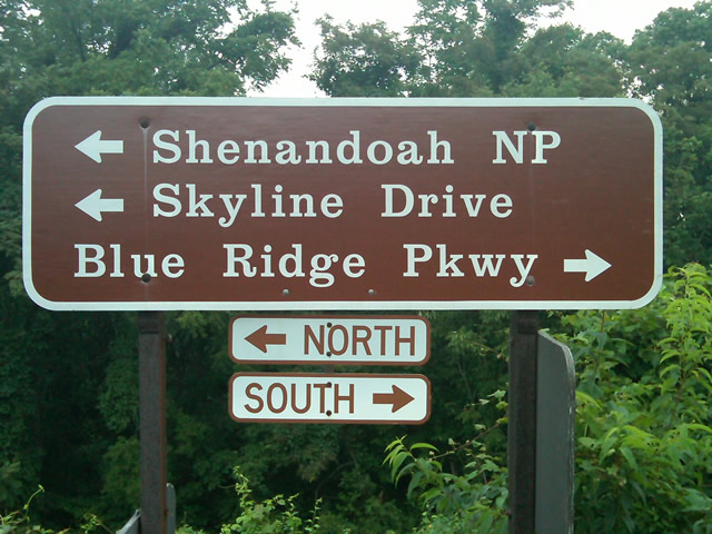
Photo - sign at start of Blue Ridge Parkway

The Blue Ridge Parkway starts where the Skyline Drive ends near Waynesboro, Virginia.

I chose to start at the north end as I knew I’d need to leave at daybreak. The morning fog has been so heavy at the southern end I didn’t want to chance it slowing me down or making for pictures of nothing but white mist. I spent the previous night in Richmond and left before 5 AM to make the 1 1/2 hour ride to Waynesboro in the darkness.
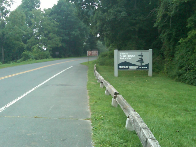
Photo - sign at the start of the Blue Ridge Parkway in Virginia

I took these photos the previous day as I expected it would be too dark to take them on the actual trip. I was right.

I fueled up in Waynesboro, grabbed a cup of coffee and a pack of doughnuts to sustain me, and headed on my way. It would be the last time I stopped to eat or drink. 469 miles is a long way at the 45 mph speed limit. I had no time to waste. At least that was my attitude early on.
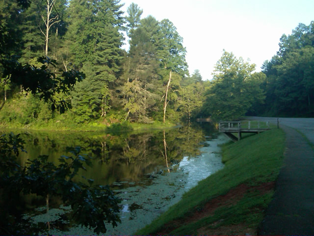
Photo - morning at the lake on Otter Creek

The sun comes up at the lake on Otter Creek. Easy ride so far.

I had the road to myself in the early morning twilight. Within a few minutes I’d seen both deer and turkey. The road starts a gradual climb to elevation here though nothing like the heights reached further south. With no other traffic on the road, my speed crept up a bit, something I’d fight the remainder of the trip. As you get comfortable and into the rhythm of the road, the temptation to take things at your more comfortable pace is always there taunting you. Knowing how far I had left to go didn’t help.
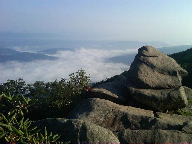
Photo - Above the clouds approaching Roanoke

I paused at this overlook to top up on oil, lube what was left of the chain, and take a few moments to savor the views I was rushing by.

I was also facing the challenge of not knowing if my chain would last the trip. It was already shot before I left, adjusted to the end of the swingarm, far beyond the normal limit. It now sagged precariously and was making noises that had me wondering when it would snap. I’d never seen a chain smoke when lubed before, and I took advantage of opportunities to slather it with lubricant whenever my concerns peaked. I prayed it would not jump the sprockets when carving through a turn and catapult me into a rock face or over a precipice.
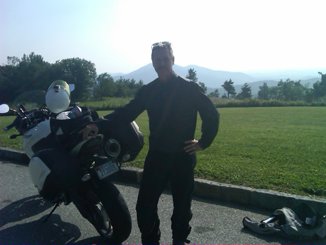
Photo - me and my bike along the Blue Ridge Parkway

A fellow biker snapped this photo of me at a rest stop. Riding from Florida to Maine and back, he and his wife were enjoying the parkway on their return.

Traffic remained surprisingly light through the morning with few holdups to pass slower vehicles. I watched the parkway wake up, the rangers and maintenance crews come to work and start their labors. Finding cell phone coverage to post my photos was always a challenge. You never know when it will be available, sometimes there in what looks like the most unlikely spots, other times absent where you think it should be a strong signal.
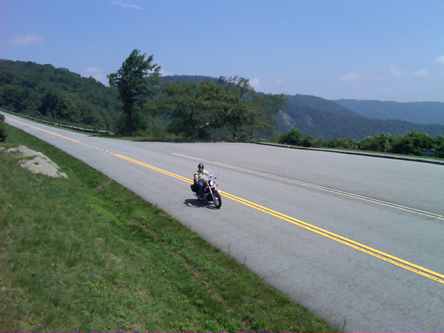
Photo - near Doughton Park

By mid morning there were plenty of other motorcycles on the road. This photo was taken somewhere near Doughton Park.

My first stop for gas necessitated a detour into Floyd, VA. Knowing where the nearest gas stations are is one reason I map the area so throughly. You can waste a lot of time looking for them if you don’t know which way to go. While in Floyd I popped in for a minute to see Derek at the Hotel Floyd, one of my favorite places to stay.
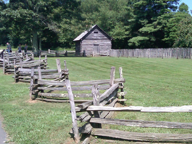
Photo - Historic cabin on the Blue Ridge Parkway

There are a few historic cabins along the road in southern Virginia.

As I crossed into North Carolina and entered the high mountains I knew cell phone coverage would be much more limited. The curves tightened up bit and the road was often wet from spotty showers. It would be another day with temps approaching near 100 in the valleys, but at elevation things remained tolerable so long as I was moving. I somehow avoided all but a slight peppering of rain which felt wonderful at the time.
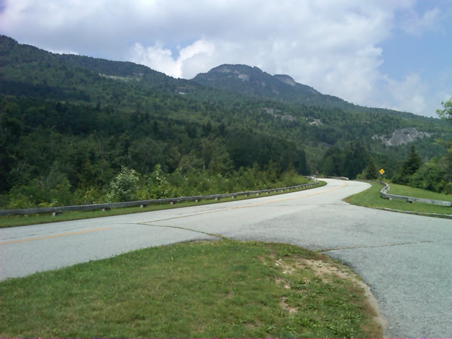
Photo - Grandfather Mountain

Passing Grandfather Mountain I felt I was back on home turf though still a long, long way to go.

Delays had been brief so far, and I planned my next fuel stop to coincide with a quick stop to say hello at the Switzerland Inn in Little Switzerland, one of my favorite places to eat or overnight. I fueled up in Spruce Pine. It was tempting to get a good meal, but I forced myself to press on. The real hold ups came as I approached Asheville. Tree crews and road construction caused significant delays and I hit the “commuter section” during evening rush hour.
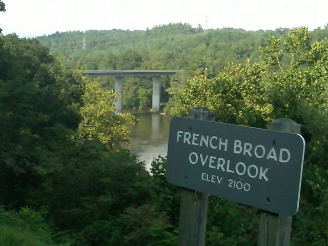
Photo - French Broad River Overlook

It was a great relief to finally cross the French Broad River southwest of Asheville and begin the climb to the highest and most scenic section of the Blue Ridge Parkway.

The sun was drawing near the horizon as I carved my way along the high ridge tops of the section of the Blue Ridge Parkway I consider my back yard. Thunderheads lurked and the road was wet in places, but my luck continued.
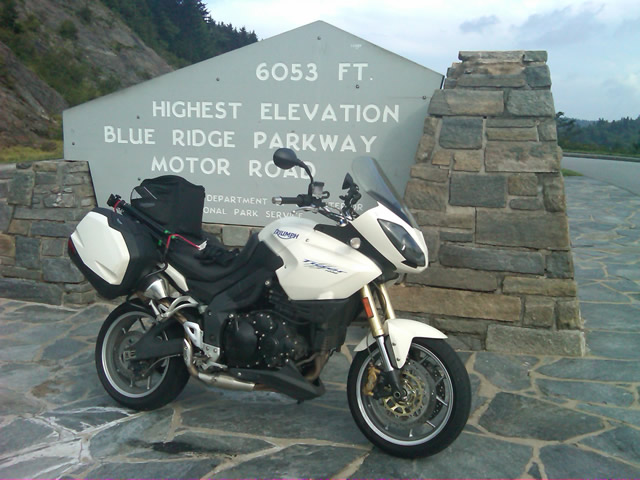
Photo - at the highest point on the Blue Ridge Parkway

Reaching the highest point on the Blue Ridge Parkway, I knew there was less than 40 miles to go to reach my goal.

I reached the southern end of the 469 mile ride with daylight to spare and took a pause at the Oconoluftee Visitor Center in Great Smoky Mountains National Park. I grabbed a few photos but found the battery was now dead on my cell phone. Here they are now –
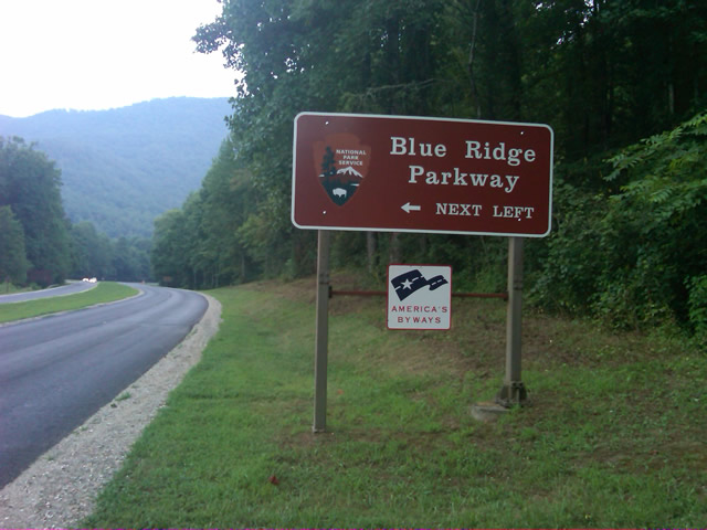
Photo - start of the Blue Ridge Parkway in North Carolina

The Southern end of the Blue Ridge Parkway near the Oconoluftee Visitor Center.

While my Blue Ridge Parkway in a day adventure was completed, I still needed to get home. Noting the evening traffic, I chose to avoid going into Cherokee and got back on the Blue Ridge Parkway now headed in the opposite direction. I rode through to Soco Gap, then passed through Maggie Valley to finally get to my home in Waynesville.
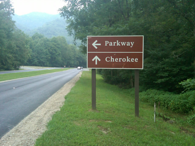
Photo - sign at the southern end of the Blue Ridge Parkway

Go through Cherokee or back the way I'd come? I chose to return home via the Blue Ridge Parkway of course.

My chain lasted the trip. My rear tire is bald. It’s time for some service on the engine. New parts are on order and it will take this week to get the bike roadworthy again. Next week? I might just poke into east Tennessee. I’ve too long ignored the area between Great Smoky Mountains National Park and Knoxville. If I can locate at least a dozen good rides there it will warrant a new motorcycle pocket map. I discovered some great roads along the Virginia / West Virginia border on this trip, several of which will be added to existing America Rides Maps. It will take a few more trips north to determine how the map of that region will lay out but it will come. For now, it’s catch up on the work I left, update the existing maps with the new rides I discovered, and make preparations for the roads ahead.

America Rides Maps on Facebook

America Rides Maps on Twitter

America Rides Maps – the best motorcycle pocket maps money can buy

_______________________________________________________________________________

Wayne Busch

Wayne Busch - Cartographer


– Wayne Busch lives in Waynesville, NC, where he produces the most detailed and comprehensive and up-to-date motorcycle pocket maps of the Blue Ridge and Smoky Mountains to help you get the most of your vacation experience. See them here – AmericaRidesMaps.com