Good Motorcycle Rides – Little Savannah Road

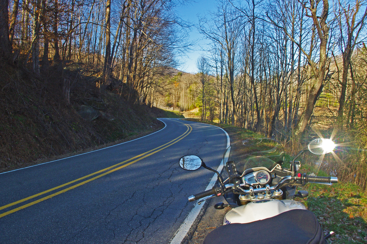
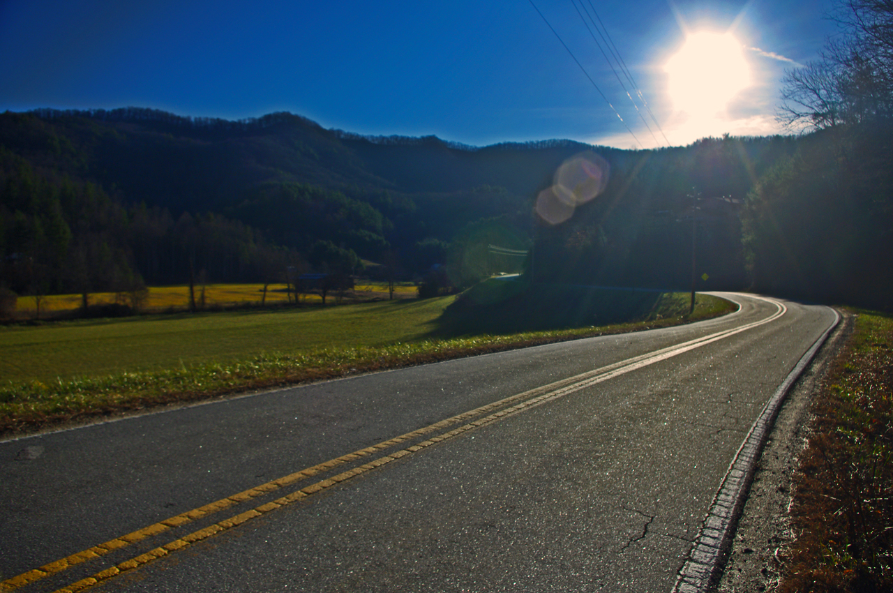
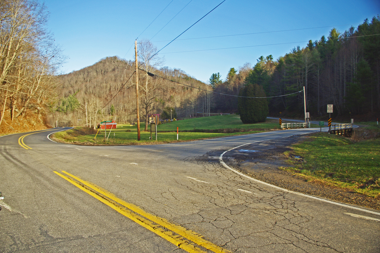
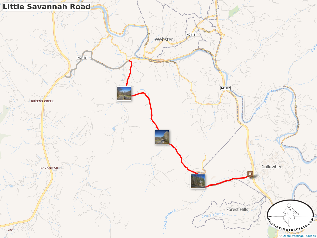
This useful mountain backroad lets you bypass the traffic and congestion around Dillsboro, Sylva, and Cullowhee, NC.

Click to go to interactive map

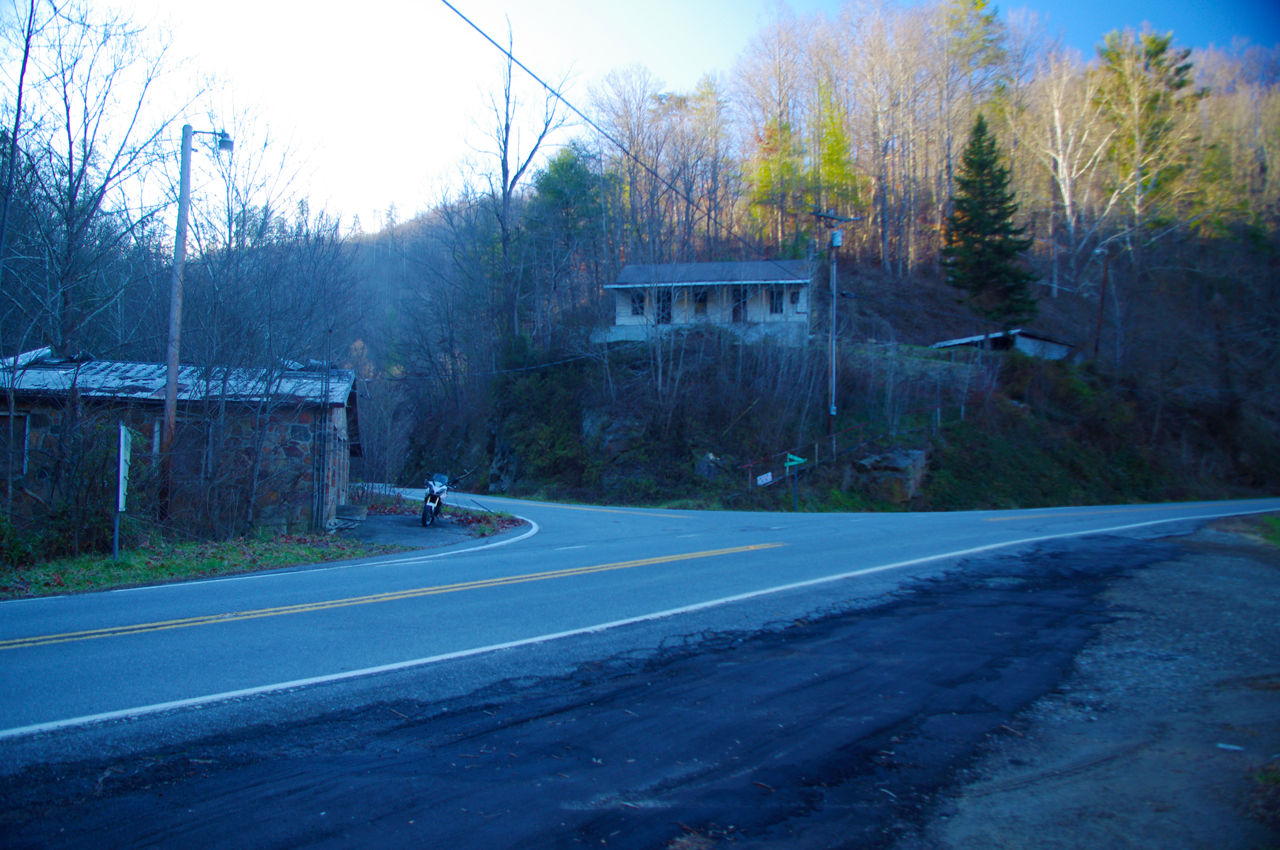
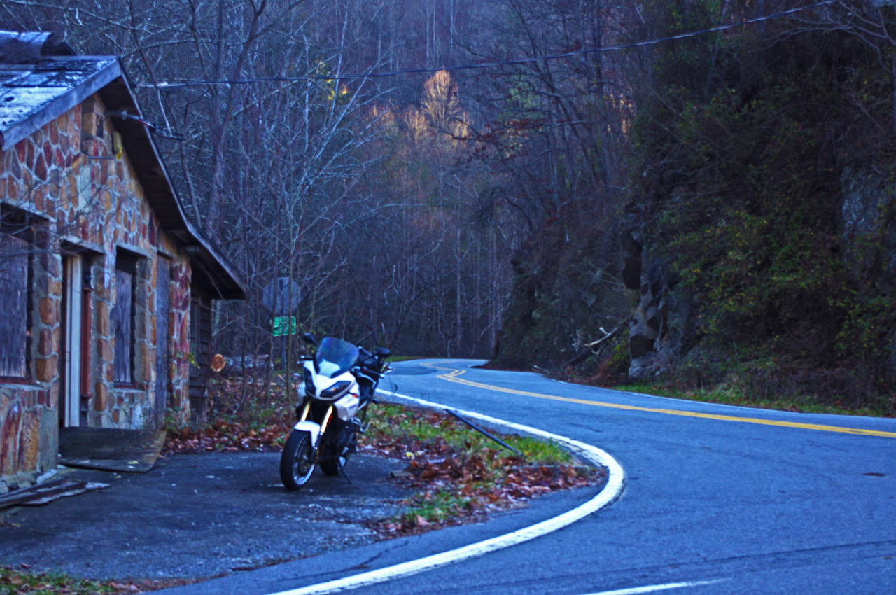
Little Savannah Road can save you time and give you a much better ride than the main roads. This two lane twisty backroad is a great way to link US 441 to NC 107 without passing through Dillsboro and Sylva. A short section of Webster Road (NC 116) completes the bypass.


Wayne BuschAmerica Rides Maps

Wayne Busch searches out the most entertaining roads in the Blue Ridge Mountains then records them on a series of maps which span the Blue Ridge Mountains.

There are more great motorcycle roads in the Blue Ridge and Smoky Mountains than anywhere else. I highlight the best roads then show you the best ways to connect them together into rides. More than a decade of searching has discovered more than 1000 good roads to enjoy. We continue to search so you may enjoy.

Review the maps, order online hereAmericaRidesMaps.com

This Good Motorcycle Ride and many others can be found on motorcycle ride maps –

Map #7 – The Best Motorcycle Rides Near Smoky Park – SOUTH

Map – 100 Great Motorcycle Rides in the Smoky Mountains

Map – 100 Rides in the Southern Blue Ridge

Map OR2 – The Best Unpaved Roads SOUTH of Smoky Park

Source: America Rides Maps Blog @ Miles-by-Motorcycle.com
https://miles-by-motorcycle.com/51999/blog/53224/good-motorcycle-rides—little-savannah-road

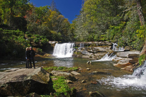
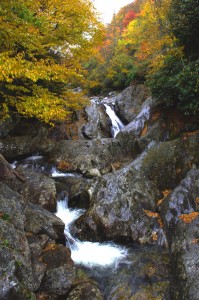
Smoky Mountain Waterfalls Motorcycle Ride

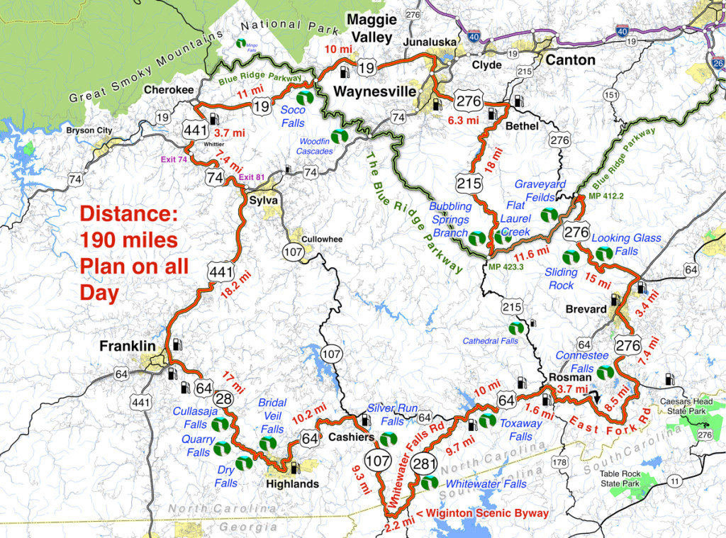
Tour more than 1 dozen roadside waterfalls on this long and scenic day ride.

Smoky Mountains Waterfalls Motorcycle Ride

Smoky Mountains Waterfalls Motorcycle Ride – click for large view

Overview: 

Start in Maggie Valley. Follow US 19 west to 441 at Cherokee. Soco Falls on route. Follow US 441 south to Franklin, then US 64 / NC 28 to Highlands. 4 falls along road. Highlands to Cashiers on US 64, then loop south on 107 / 281 to see 2 more. Continue east on US 64, detour south of Brevard then onto US 276 to the Blue Ridge Parkway (3 more) Ride the Parkway to NC 215 then follow it back to US 276 and into Maggie Valley.

Roadside waterfalls abound for the motorcycle rider

Discover the hidden secrets on your motorcycle travels in the Blue Ridge and Smoky Mountains

Detailed Route:

Distance: 190 miles.

Time: All day ride.

Easy to moderate difficulty

Before you go:

  • Exercise caution! – These are roadside waterfalls, some which are on busy roads with blind curves and limited pull-outs. Pull out with confidence and vigor.
  • Look but don’t touch – Dangerous conditions lurk around waterfalls. Visitors are killed every year. Very slippery rocks. Powerful currents. Deadly drops.
  • Plan on more time – Several waterfalls require short walks to get the views. Allow time for multiple stops and photos.

Route:

Photo-Bubbling-Springs-Branch-on-NC 215

Easy to find Bubbling Springs Branch is on a sharp curve where it flows under NC 215.

Start in Maggie Valley. Follow US 19 west.

4.1 mi Pass under Blue Ridge Parkway

5.7 miSoco Falls. Gravel pull off on left with small signs. Downhill section of road on a curve. Can’t be seen from road. Path and boardwalk lead to 2 converging waterfalls.

15.2 mi Turn left @ traffic light at casino for shortcut to US 441 south. Junction US 19 and Casino Road.

16 mi Turn left @ traffic light onto US 441 south. Junction Casino Road and US 441.

20.1 mi Follow highway 23/74 east. Junction US 441 and highway 23/74 exit 74.

27.3 mi Follow US 441 south. Junction US 441 and highway 23/74 exit 81..

45.3 mi Exit US 441, follow US 64 / NC 28 east. Junction US 441 and US 64 / NC 28 at Franklin.

54.4 mi – Cullasaja Falls. Visible from road on right. Limited and hazardous parking near guardrail on sharp curve.

57.3 mi Quarry Falls – Visible from road on right. Long paved pulloff on right side of road.

58.2 mi – Dry Falls – Not visible from road. Paved parking on right with signs. Short trail to waterfall. Path continues behind waterfall.

60.8 mi – Bridal Veil Falls – Visible from road on left. Paved pull off. Drive behind the waterfall for a photo.

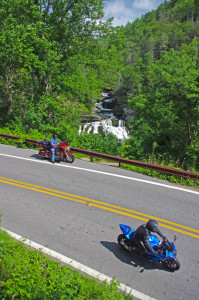
Motorcycles at Cullasaja Falls in North Carolina's "Land of the Waterfalls"

With permission granted, I stand ready to help you have the ride of your life! Just say YES!

63.5 mi Turn left @ traffic light to continue on US 64. Junction US 64 and NC 28 downtown Highlands.

73.7 mi Turn right @ traffic light onto NC 107 south. Junction US 64 and NC 107 in Cashiers.

77.1 miSilver Run Falls – Not visible from road. Poorly marked gravel pull off on left. Trail leads into woods. 1/4 mile walk.

83 mi Turn left onto Wiginton Scenic Byway. Junction Wiginton Scenic Byway and NC 107.

85.2 mi Turn left @ stop sign to head north on NC 281 (Whitewater Falls Road). Junction Wiginton Scenic Byway and NC 281.

87.6 miWhitewater Falls State Park. Not visible from road. $2 fee. 1/4 mile paved walk. Highest waterfall in the east.

94.9 mi Turn right @ stop sign to continue east on US 64. Junction NC 281 and US 64.

97.1Toxaway Falls – Not visible from road. Road crosses dam with waterfall below. Difficult to get a good view. Park at Toxaway Village or along road on dam.

105 mi Turn right @ junction US 64 and US 178 at Rosman.

106 mi Turn right @ traffic light in Rosman, exit town.

107 mi Turn left onto East Fork Road. Junction US 178 (Pickins Highway) and East Fork Road.

110 mi Turn right @ stop sign  to keep on East Fork Road. Junction East Fork Road and Walnut Hollow Road.

119 mi Turn left @ stop sign to go north on US 276 (Greenville Highway). Junction East Fork Road and US 276.

120 miConnestee Falls – Not visible from road. Large sign, trailhead at end of parking lot. Short walk to overlook where 2 waterfalls converge.

126 mi Turn right @ traffic light in Brevard onto US 64. Junction US 276 and US 64.

129 mi Turn left @ traffic light onto US 276 north. Junction US 64 / US 276 / NC 280.

135 miLooking Glass Falls – Visible from road. Large paved parking along road on right. Boardwalk to base of falls.

Photo-whitewater-falls-nc

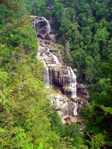
Whitewater Falls, one of the highest in the east.

137 mi – Sliding Rock – Not visible from road. Fee area $2. Paved parking lot. Bathers slide down waterfall.

144 mi Turn right onto parkway ramp. Turn left at the stop sign to head south (towards Cherokee) on the Blue Ridge Parkway. Junction US 276 and Blue Ridge Parkway.

148.5 mi – Graveyard Fields – Not visible from road. 1/3 mile paved walk to top of Second Falls. Trails continue to 2 others.

156 mi Exit Parkway. Turn left (towards Canton) on NC 215. Junction Blue Ridge Parkway and NC 215.

158 mi –  Flat Laurel Creek – Visible from road. Hard to find. Look for 3rd gravel pull out on right on the only straight section of road.

160 miBubbling Springs Branch – Visible from road on left. River plunges beneath the roadway on a hairpin curve. Small unpaved parking are just beyond.

174 mi Turn left @ stop sign to follow US 276 into Waynesville.. Junction NC 215 / US 276.

180 mi Turn right @ traffic light in Waynesvile.. Pass through town.

Junction US 276 and Main Street.

181mi Turn left @ traffic light. Junction Main Street and US 276 (Russ Avenue).

183 mi Turn left @ traffic light to return to Maggie Valley. Junction US 276 and US 19.

————————————————————————————

wayne busch - Smoky Mountain Motorcycle Rider.com

Wayne Busch

– Wayne Busch lives in Waynesville, NC, where he produces the most detailed, comprehensive, up-to-date motorcycle pocket maps of the Blue Ridge and Smoky Mountains to help you get the most of your vacation experience. See them here – AmericaRidesMaps.com

Stay Near the Best Mountain Motorcycle Rides

Stay Near the Best Mountain Motorcycle Rides – 

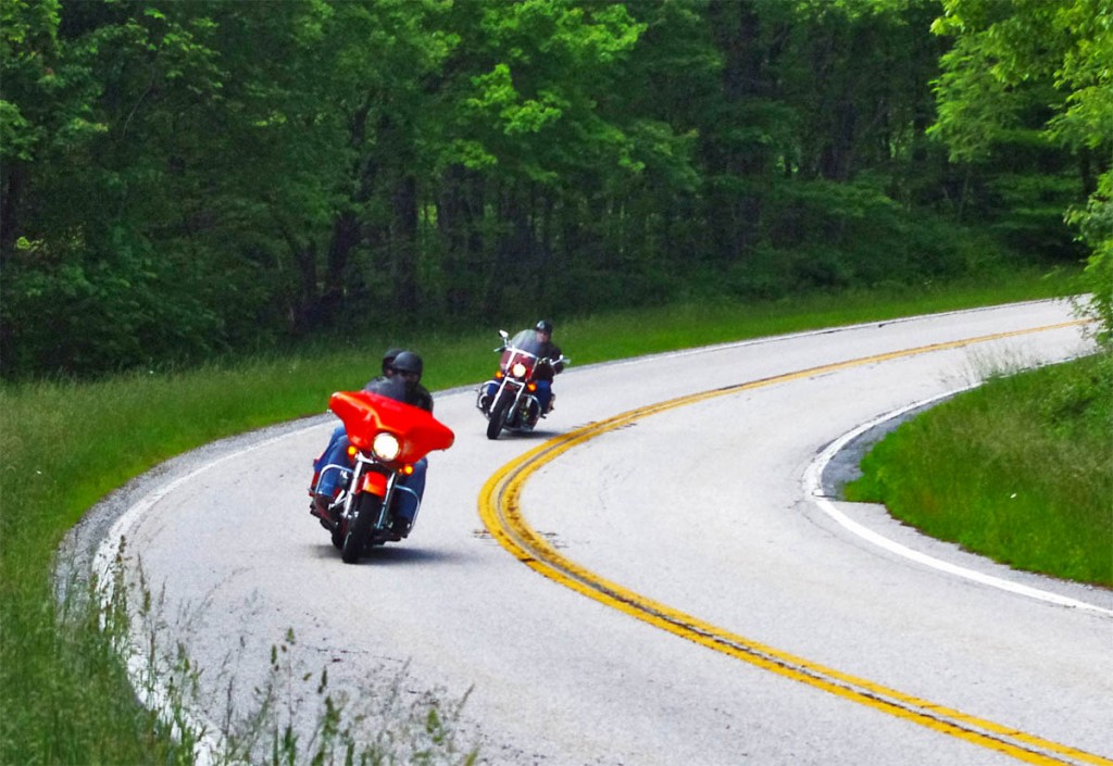
Great Motorcycle Rides in North Carolina - NC 209, a.k.a. "The Rattler" This is some of the best motorcycle riding you'll find in the world. These riders are looping back to NC 209 on NC 63.This is some of the best motorcycle riding you'll find in the world. These riders are looping back to NC 209 on NC 63.

Great Motorcycle Rides in North Carolina – NC 209, a.k.a. “The Rattler” – This is some of the best motorcycle riding you’ll find in the world. These riders are looping back to NC 209 on NC 63.

So you’ve heard about the amazing motorcycle riding in the Blue Ridge Mountains and you want to come see the best of it it.

Where should you stay to have the best opportunity to ride the greatest number of classic motorcycle rides?

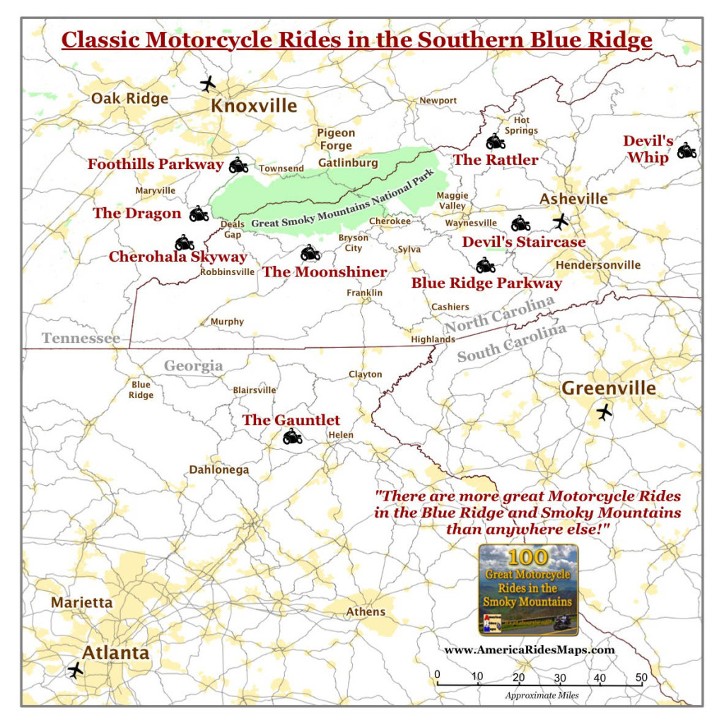
To figure out where the geographic center of the best motorcycle riding was,  I first looked at where all the classic roads were, roads that have been around long enough to have names like “The Dragon”, the “Moonshiner” and “The Gauntlet”. Some of these might be on your bucket list so it’s nice to have them close. I determined the center point between them.

Map of Classic Motorcycle Rides in the Smoky Mountains

Surround yourself with classic rides.

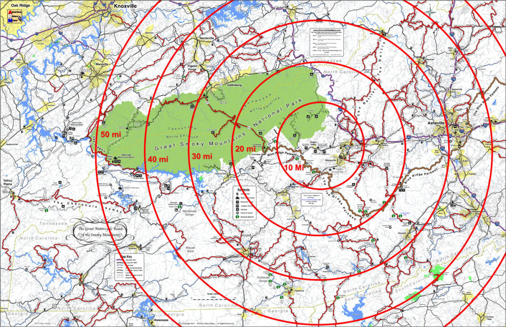
Next I moved a large circle around the center point of the classic rides to figure out when it contained the most good motorcycle rides overall. I made rings at 10 mile intervals, made a few adjustments, and came up with the answer;

Bullseye on the test place to stay

Bullseye on the best place to stay

The target falls on Maggie Valley, Waynesville, Cherokee.

Geographically, Maggie Valley sits at the hub of it all, but any of the towns along the south side of Great Smoky Mountains National Park is going to put you near some outstanding riding.

Here are some pros and cons to help you sort out which of the three places works best for you;

Maggie Valley 


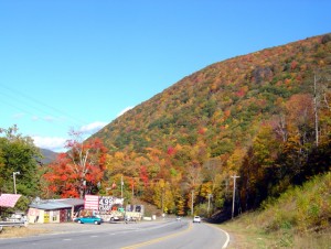
Photo - fall colors at Soco Gap

View heading down from the Blue Ridge Parkway at Soco Gap on US 19 towards Maggie Valley.

Maggie Valley Pros –

  • There are lots of motel rooms, cabins, and campgrounds in the one road town, it caters well to the motorcycle visitor.
  • The best section of the Blue Ridge Parkway is just 10 minutes up the road.
  • The are several good places to eat.
  • Wheels Through Time Motorcycle Museum is there.
  • The small town hosts several biker events each year, including spring and fall rallies.
  • The town is spread along a 4 lane stretch of US 19 with high mountains on looming on every horizon, you really feel like you’re in the mountains.
  • There are liquor stores in town.

Maggie Valley Cons

  • 15 min ride to Waynesville for groceries.
  • If you stay close to the middle of town you can walk to some of the restaurants and pubs, but the town is long and narrow so you’ll probably hop on the bike.

Waynesville

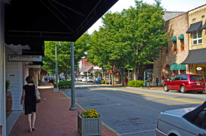
Main Street, downtown Waynesville

Main Street, downtown Waynesville

Waynesville Pros –

  • known for it’s good food and picturesque downtown and atmosphere.
  • There are mountains on every horizon.
  • US 276 leaves from the south end of town and leads to some great rides and the Blue Ridge Parkway

Waynesville Cons –

  • There’s only one motel in the downtown and a couple B&B’s where you can walk to the restaurants, pubs, and stores and galleries.
  • I usually tell visitors – eat in Waynesville, sleep in Maggie Valley unless you can snag one of the few rooms available in town.

Cherokee

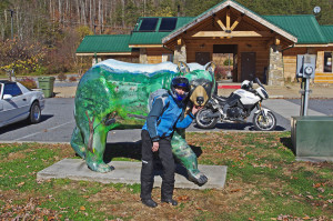
One of the many painted bears in Cherokee

One of the many painted bears in Cherokee

Cherokee pros –

  • Strategically located at the south end of the Blue Ridge Parkway and the south entrance to Great Smoky Mountains National Park, Cherokee is obviously worth consideration.
  • There are lots of motels and campgrounds. No outstanding restaurants come to mind, though I don’t pass through Cherokee often.

Cherokee cons –

  • Because Cherokee is a hub of tourist activity it is often congested with traffic. The roads leading in to it are busy, there are few of them, and you’ll end up on riding 4 lane roads like US 441 and US 74 more often.
  • You’re on the Cherokee Reservation, if you want drinks you’ll need to go to Harrah’s Casino.

————————————————————————————————

100 Great Motorcycle Rides mapin the Smoky MountainsYou can get a map of more than 100 Great Motorcycle Rides near the Smoky Mountains that will show you where the roads are hiding and how they link together into endless wonderful wanderings through the mountains.

 Click Here Now
to see more about the map

If you enjoy photos of motorcycle riding in the Blue Ridge and Smoky Mountains, like MY BLUE RIDGE MOTORCYCLING FACEBOOK PAGE.Facebook

____________________________________________________________________

wayne busch - Smoky Mountain Motorcycle Rider.com

Wayne Busch

– Wayne Busch lives in Waynesville, NC, where he produces the most detailed and comprehensive and up-to-date motorcycle pocket maps of the Blue Ridge and Smoky Mountains to help you get the most of your vacation experience. See them here – AmericaRidesMaps.com

____________________________________________________________________

Fun Motorcycle Rides in Georgia from The Lodge at Copperhead

Fun Motorcycle Rides in Georgia from The Lodge at Copperhead –

Fun motorcycle rides in Georgia GA 348

Fun motorcycle rides in Georgia GA 348 – a couple of the riders who tagged along on the Fun Ride out of The Lodge at Copperhead

A couple photos from the last “fun ride” out of The Lodge at Copperhead in Blairsville. The Lodge at Copperhead is the southern gateway to the Blue Ridge Mountains and the fantastic riding begins at their doorstep.

Fun Motorcycle Rides in Georgia-leaving the Lodge at Copperhead

Fun Motorcycle Rides in Georgia – getting ready to head out with half a dozen bikes to ride the back roads of Georgia’s Blue Ridge Mountains

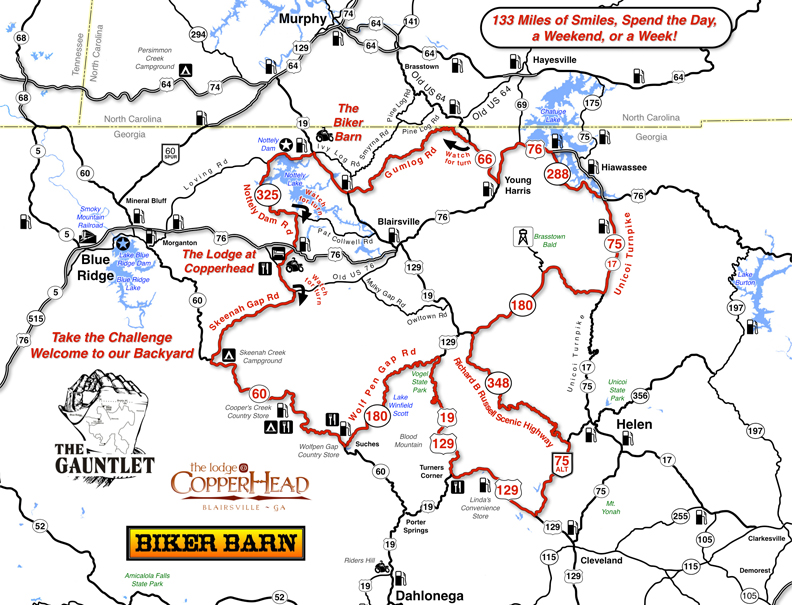
Literally leave the front gate of The Lodge at Copperhead and you’re on The Gauntlet motorcycle ride, a fantastic sampling of the great motorcycle roads that draw bikers from all around.


Fun Motorcycle Rides in Georgia - Get a free map of The Gauntlet at the Biker Barn on US 129 near Blairsville.

Fun Motorcycle Rides in Georgia – Get a free map of The Gauntlet at the Biker Barn on US 129 near Blairsville.

Get your free map at the Biker Barn and get the most out of your ride!

“Fun Rides” are free, just a chance to get out with others and ride some of the best roads in the area. No guides, no rules, they happen on the fly and are usually full of adventures. I always try to throw in a few roads you might never see otherwise.

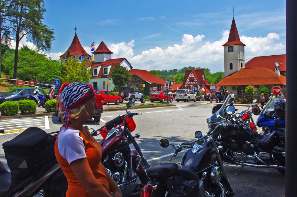
Fun Motorcycle Rides in Georgia - Helen

Fun Motorcycle Rides in Georgia – Helen, Georgia, a German Alps themed town, is a popular stop for both bikers and the masses of other tourists

Fun Motorcycle Rides in Georgia - The Lodge at Copperhead

Fun Motorcycle Rides in Georgia – The Lodge at Copperhead

Next fun ride will be in Maggie Valley or Asheville, NC – I’m making arrangements now. Sign up for the short monthly newsletter if you want to know about the next opportunity. Use this link to sign up now – http://americaridesmaps.com/signupform.html

__________________________________________________________________

Wayne Busch

Wayne Busch – Cartographer

Total Rider Tech Logo

Learn Total Control

– Wayne Busch lives in Waynesville, NC, where he produces the most detailed and comprehensive and up-to-date motorcycle pocket maps of the Blue Ridge and Smoky Mountains to help you get the most of your vacation experience. See them here – AmericaRidesMaps.com

Wayne is an advanced motorcycle instructor for Total Rider Tech teaching Lee Parks Total Control Advanced Rider Courses. Isn’t it time you looked into advanced rider training to ride more confidently and safely? It can transform your mountain riding experience.  Total Rider Tech

____________________________________________________________________

Motorcycle Rides In Arizona: Sedona, Scottsdale area

Let’s get the obvious out of the way right now so we can enjoy the rest of the story, “There are more great Motorcycle Rides in the Blue Ridge and Smoky Mountains than anywhere else”. You knew it was coming, and now being said, we can move on.
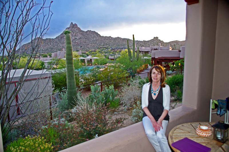
photo-view-from-room

We had a nice view from our room at the posh 4 Seasons Resort in Scottsdale, AZ.

We flew into Phoenix, stayed in Scottsdale. 

While many riders fantasize about riding cross-country to reach those far-off destinations, I’m so over that. Droning along on the interstates through days of monotonous and uninteresting landscape is a waste of time and tires to me. With just 6 days of travel on my calendar, it would have taken 8 just getting there and back on the bikes. Once again, we flew in and rented a motorcycle to maximize our quality riding time.

Motorcycle Rides in Arizona: Sedona, Scottsdale area - A balloon ride

Motorcycle Rides in Arizona: Sedona, Scottsdale area - A balloon ride really helps you appreciate the harshness of the desert and the general landscape.

Phoenix is a city of 1.5 million people who choose to live in a scalding moonscape unfit for sensible human habitation. Endless months of triple-digit temperatures preserve the volcanic origins of the region as if it was a recent event in geologic time. The rocky remnants of those ash-spewing calderas rise on the horizons like mountainous islands peeking above a deep, deep, rolling sea of gray-brown boulders, rocks, and dust. The entire region is one big blast and fallout zone.
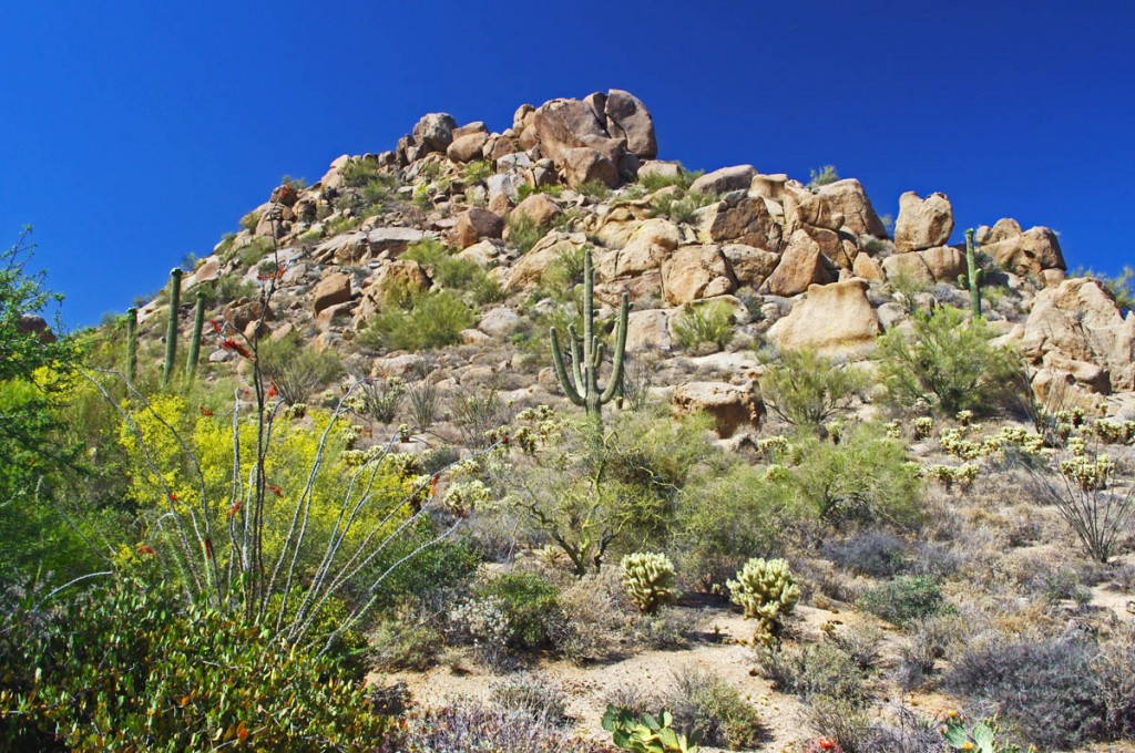
Motorcycle Rides in Arizona: Sedona, Scottsdale area - Spines, thorns, prickles, barbs

Motorcycle Rides in Arizona: Sedona, Scottsdale area - Spines, thorns, prickles, barbs, horns, needles, spikes, everything wants to hurt you!

5% humidity deprives most living things any chance of thriving.  Oxymoronic “river” signs mark parched sandy gulches where runoff collects for a few short minutes before re-vaporizing for the next few weeks – or months. Most every living thing is so bent on survival it threatens all others with spines and needles, fangs and venom to keep them at a distance. Nature has obviously posted the “Do Not Enter” sign.

A long motorcycle ride looping north from Scottsdale

We stuck to local sights the first day, visiting Cave Creek for lunch, and Natural Bridge to the north. The next day, we followed 74 northwest to US 60, then veered north on 89 near Wikenburg. The ride to Wikenburg was pretty miserable, just dry empty desert, highway traffic, vast open spaces.
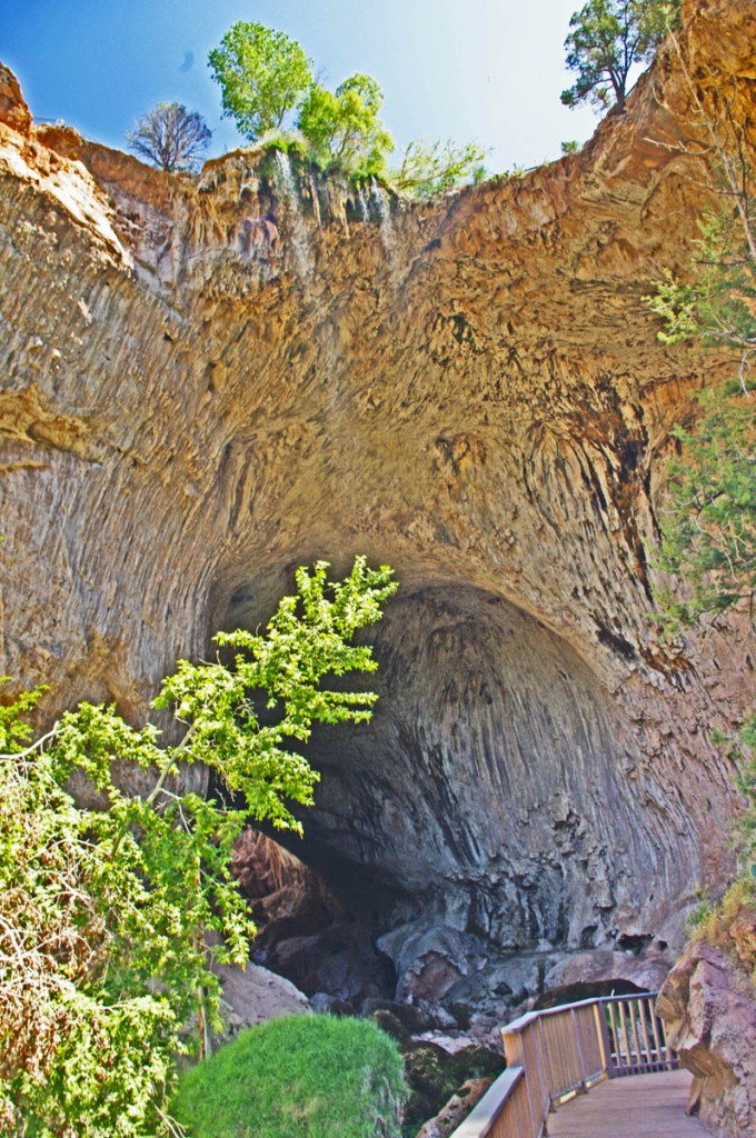
Motorcycle Rides in Arizona: Sedona, Scottsdale - Natural Bridge, AZ

Motorcycle Rides in Arizona: Sedona, Scottsdale - Natural Bridge, AZ, one of the side trips worth taking.

Route 89 soon climbs through a nice section of switchbacks to gain some elevation. The terrain gets a little more green and hospitable and the riding improves as the road seeks the better passage between the rolling hills. Riding along you are taunted by the “No trucks over 50 ft length X miles ahead on 89”, and when you finally pass through Wilhoit the ride gets nice and curvy and fun.
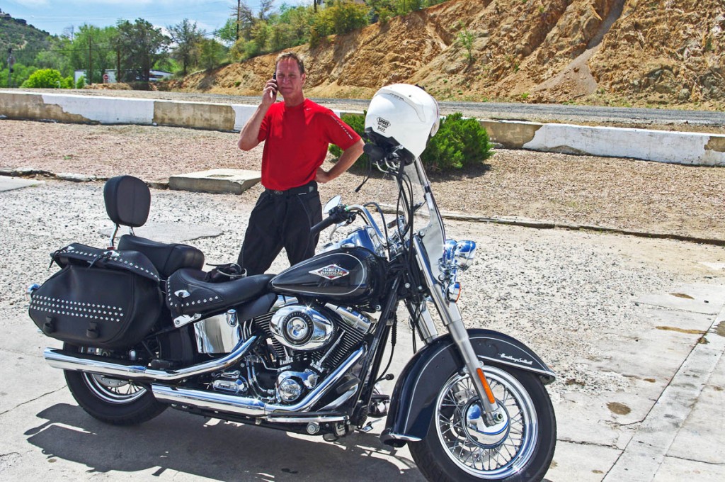
Motorcycle Rides in Arizona: Sedona, Scottsdale area - A break near Prescott.

Motorcycle Rides in Arizona: Sedona, Scottsdale area - A break near Prescott. Returning the phone calls that come in while I'm riding.

89 then passes through the town of Prescott which so interested us, we discussed the potential for basing there for a future trip. It seems to have a lot to offer. North of Prescott, we veered east on 89A for the best section of road I found this trip – the mountainous portion known as the Mingus Highway.
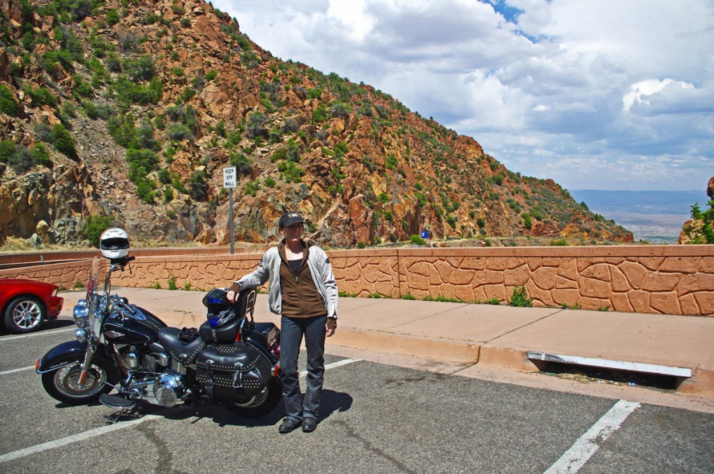
Motorcycle Rides in Arizona: Sedona, Scottsdale area - Jackie gets ready to descend from the Mingus Highway

Motorcycle Rides in Arizona: Sedona, Scottsdale area - Jackie gets ready to descend from the Mingus Highway through Jerome, the best section of road this trip. Really put the softail through it's paces here!

The Mingus Highway twists and carves through the elevations much like the roads I so enjoy at home in the Smoky Mountains, though the arid scenery could easily convince you it’s a canyon ride in California. Exiting north, the roads plunges down from 6000 foot heights passing through the tiny hamlet of Jerome, clinging to the edge of the slopes nearly a mile above the valley below. A popular stop, we could not afford the delay, though next time it’s worth exploring.
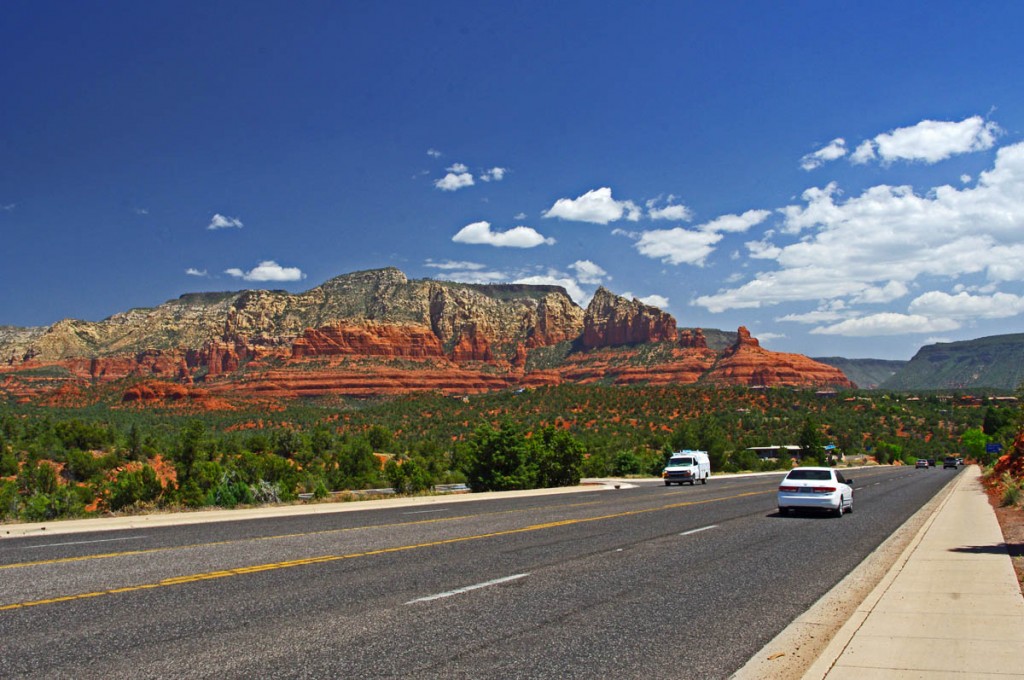
Motorcycle Rides in Arizona: Sedona, Scottsdale area - How pretty is Sedona?

Motorcycle Rides in Arizona: Sedona, Scottsdale area - How pretty is Sedona? Approaching from the west, this is the least scenic of the 3 routes into town.

We passed through Clarkesdale and Cottonwood, to reach the apex of our days ride – Sedona. As beautiful as it was, Sedona was just our lunch stop today, a first visit for me. Surrounded by the red rock monuments, the destination town is a vortex for tourists and caters to the crowds who flock there.
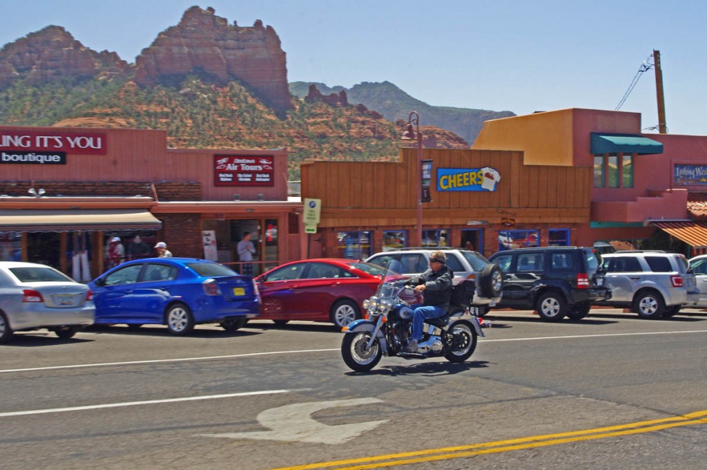
Motorcycle Rides in Arizona: Sedona, Scottsdale area - Cruising through Sedona

Motorcycle Rides in Arizona: Sedona, Scottsdale area - Cruising through Sedona, the town is surrounded by the red rock formations on every horizon.

The ride turned south out of Sedona onto one of the most scenic rides you’ll find as Route 179 winds between the colorful rock formations to Oak Creek. Once you pass the casino at the edge of town, the road runs through unremarkable desert to intersect Interstate 17 and we continued south on the highway for a distance.

Motorcycle Rides in Arizona: Sedona, Scottsdale area - Some of the best and easiest views are right along Route 197 south of Sedona.

Motorcycle Rides in Arizona: Sedona, Scottsdale area - Some of the best and easiest views are right along Route 197 south of Sedona.

We turned east when we reached Route 260 and started climbing into the higher elevations and more interesting and scenic riding. Temperatures dropped as we climbed to 7000 feet and entered the high pine forests. Route 260 became Route 87 as we continued south through the small towns of Strawberry and Pine, and the larger sprawling town of Payson.
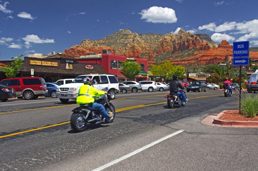
Motorcycle rides in Arizona: Sedona, Scottsdale area - Sedona is a popular destination for motorcycle riders for obvious reasons.

Motorcycle rides in Arizona: Sedona, Scottsdale area - Sedona is a popular destination for motorcycle riders for obvious reasons.

Progressing south from Payson on Route 87 the road gains another lane then gradually leads you down from the heights and back out into the Sonoran Desert returning to the city. We covered a little more than 400 miles on this loop ride, the longest of the trip.

 A nice loop ride east of Phoenix / Scottsdale
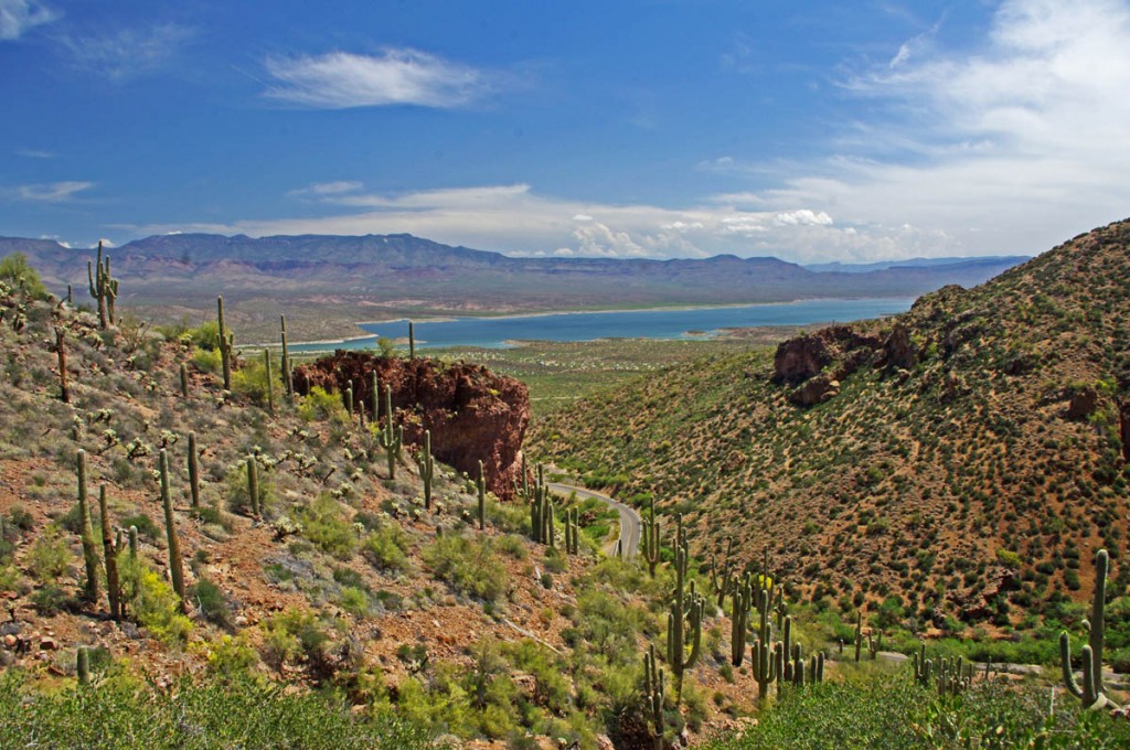
Motorcycle Rides in Arizona: Sedona, Scottsdale - Riding 188 south is a nice cruiser

Motorcycle Rides in Arizona: Sedona, Scottsdale - Riding 188 south is a nice cruiser ride that includes sections along Theodore Roosevelt Lake

I saw this ride described as a great “cruiser” road and I’ll concur with the assessment. It’s easy riding with nice scenery and relatively little traffic. Route 87 north led us through the gentle sweeping curves that climb to the high desert. We made up names like “boulder city” and “the cactus jungle” to describe distinct areas along the route, and rolled through the essentially treeless national forest to reach Route 188 and turn southeast.
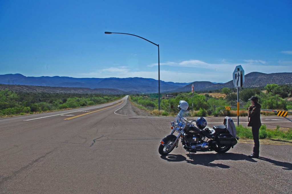
Motorcycle Rides in Arizona: Sedona, Scottsdale area - Turning on to Route 188

Motorcycle Rides in Arizona: Sedona, Scottsdale area - Turning on to Route 188. When you're from the Smoky Mountains, a straight road is a rare sight deserving of a photo!

Route 188 formed the long side of the triangle we rode on this loop. More gentle flowing two lane curves through the dry hills lead to a long ride aside cobalt blue Theodore Roosevelt Lake. It’s pleasant and relaxing riding with the nice contrast of scenery and color.
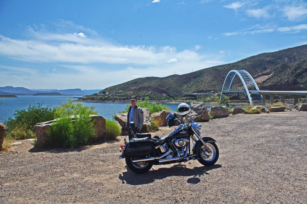
Motorcycle Rides in Arizona: Sedona, Scottsdale area - Very pleasant ride along Theodore Roosevelt Lake.

Motorcycle Rides in Arizona: Sedona, Scottsdale area - Very pleasant ride along Theodore Roosevelt Lake. Jackie and I pause for a cool drink and to admire the bridge.

Along the way, we stopped at Tonto National Monument to see the historic cliff dwellings. It’s a steep walk up the trail and I wouldn’t wan’t to do it on a hot day, but we enjoyed our visit and the sights.
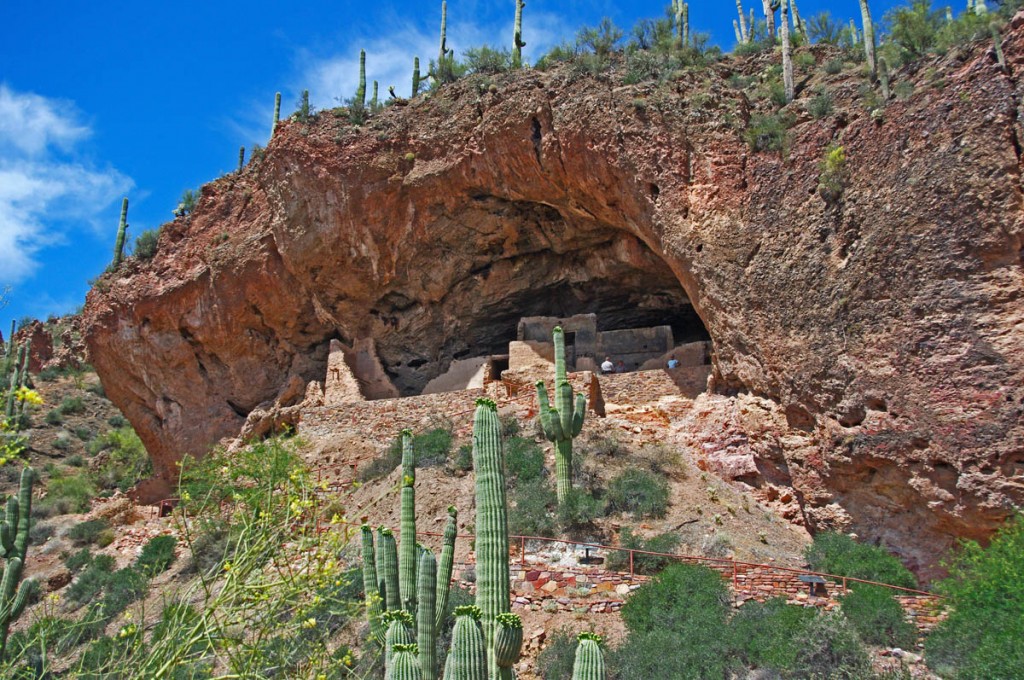
Motorcycle Rides in Arizona: Sedona, Scottsdale area - Tonto National Monument has historic cliff dwellings

Motorcycle Rides in Arizona: Sedona, Scottsdale area - Tonto National Monument has historic cliff dwellings with a steep hike, but it's a great stop along Roosevelt Lake.

We turned onto the third leg of the triangle, Route 60 in Claypool, and started west toward Phoenix. We passed through miles and miles of massive mining operations and the mountains of tailings, then entered a wonderfully scenic canyon near Top-of-the-world. The steep drop through the spectacular rocky cliffs dumped us at the edge of a vast flat desert basin and a long arrow-straight drone back to the city. We covered about 250 miles on this day.

Sedona Highlights – what to see on a short visit

Sedona is one of the most scenic towns you’ll visit in the southwest, surrounded by towering red rock monuments on every horizon. We spent a day exploring the area and here are my suggestions on how to get the most out of a short visit.

Route 89A approaches town from the west, then exits north. Route 179 junctions with Route 89 in the heart of town leading south.
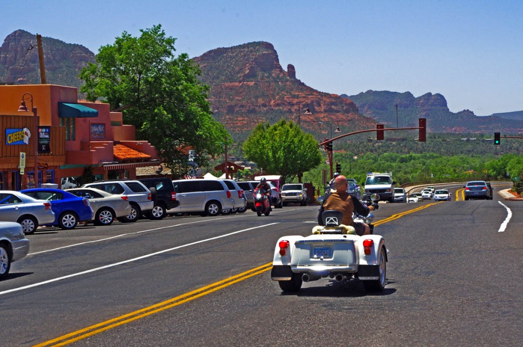
Motorcycle Rides in Arizona: Sedona, Scottsdale area - Looking west on Route 89A from Sedona

Motorcycle Rides in Arizona: Sedona, Scottsdale area - Looking west on Route 89A from Sedona

Approaching town from the west on 89A, to get one of the best views ride to the top of Airport Road. The view from atop the mesa overlooks the entire town and panorama of breathtaking geography.
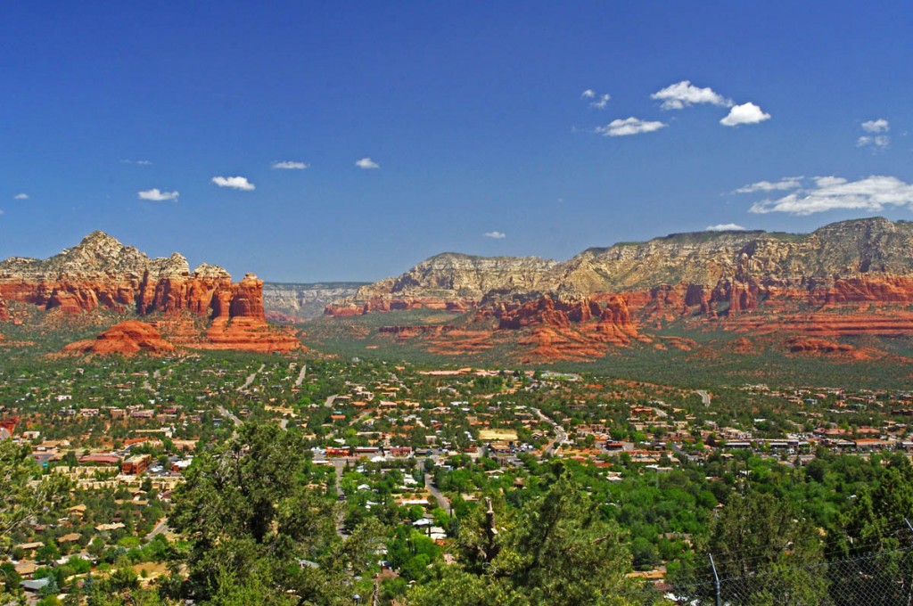
Motorcycle Rides in Arizona: Sedona, Scottsdale area - one of the best overlooks of Sedona

Motorcycle Rides in Arizona: Sedona, Scottsdale area - For one of the best overlooks of Sedona, ride up to the top of the mesa on Airport Road. Wow!

North of town, 89A follows Oak Creek Canyon along the river. The deep canyon is forested with tall pine trees that partially obscure the views of the towering cliff walls and you wind you way north. The road gets tighter and tighter than makes a dramatically step climb through a series of switchbacks to top the rim at over 6000 feet. it’s worth the ride to see and experience. Once atop the canyon, 89A continues to Flagstaff and connects to Route 66.
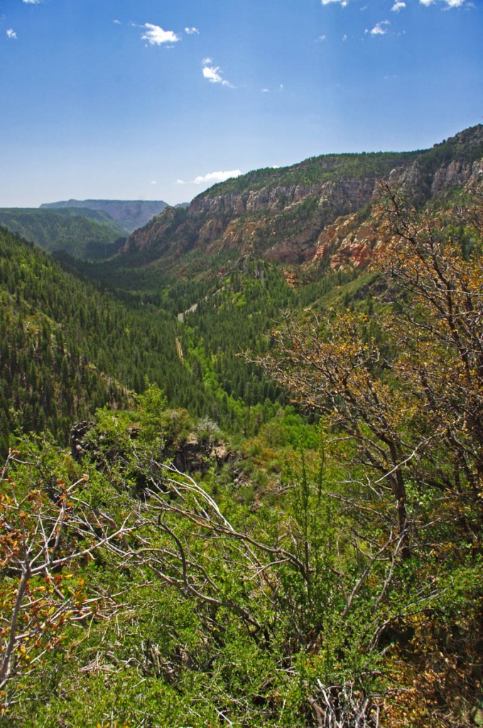
Motorcycle Rides in Arizona: Sedona, Scottsdale area - View from the rim of Oak Creek Canyon north of Sedona.

Motorcycle Rides in Arizona: Sedona, Scottsdale area - View from the rim of Oak Creek Canyon north of Sedona. Follow it into Flagstaff and connect to Route 66.

The easiest way to see the red rocks in all their splendor is to ride down Route 179 south from Sedona. I wouldn’t bother with the Red Rock Loop Road, it’s not as scenic as touted and there is an unpaved section near the middle – more effort than reward. Use the pullouts at the monuments for the nice views and don’t miss a ride up to the Chapel of the Holy Cross for some great views and photos.
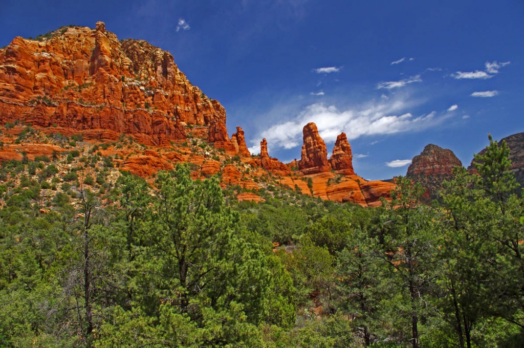
Motorcycle Rides in Arizona: Sedona, Scottsdale area - View from the Chapel of the Holy Cross

Motorcycle Rides in Arizona: Sedona, Scottsdale area - View from the Chapel of the Holy Cross just outside Sedona. A short drive with a nice view.

__________________________________________________________________

Wayne Busch

Wayne Busch - Cartographer

Total Rider Tech Logo

Learn Total Control

– Wayne Busch lives in Waynesville, NC, where he produces the most detailed and comprehensive and up-to-date motorcycle pocket maps of the Blue Ridge and Smoky Mountains to help you get the most of your vacation experience. See them here – AmericaRidesMaps.com

Wayne is an advanced motorcycle instructor for Total Rider Tech teaching Lee Parks Total Control Advanced Rider Courses. Isn’t it time you looked into advanced rider training to ride more confidently and safely? It can transform your mountain riding experience.  Total Rider Tech

____________________________________________________________________

Smoky Mountain Motorcycle Rides – Meadow Fork Rd

Two good motorcycle roads are found along NC 209, a.k.a. “The Rattler“. They make a nice side loop on the popular motorcycle ride from Junaluska to Hot Springs in North Carolina. 

Photo-Meadow-Fork-Rd-View

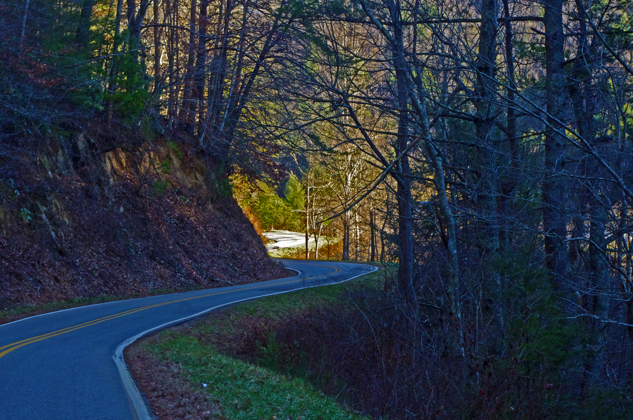
A section of Meadow Fork Road which demonstrates the character of the curves through much of the ride.

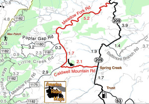
Meadow Fork Road Map

Meadow Fork Road spurs off NC 209 about 7 miles south of Hot Springs. The road follows the twisty banks of a whitewater creek for quite a while climbing gently on the challenging and scenic run. It  leads into the Pisgah National Forest where it becomes one of many unpaved forest roads high in the mountains.

Photo-The-Rattler-Motorcycle-Ride

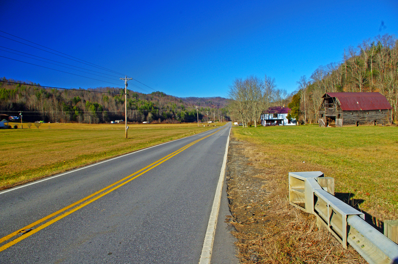
The 1.7 mile section of NC 209 which crosses the Spring Creek valley is the straightest road I can think of in western North Carolina. View approaching Caldwell Mountain Road

Caldwell Mountain Road meets Meadow Fork Road in 6.9 miles. 2.1 mile long Caldwell Mountain Road will take you over the mountain and down to meet NC 209 near the middle of the long straight stretch across the Spring Creek Valley.

photo-NC209-The-Rattler-motorcycle-ride-campground-sign

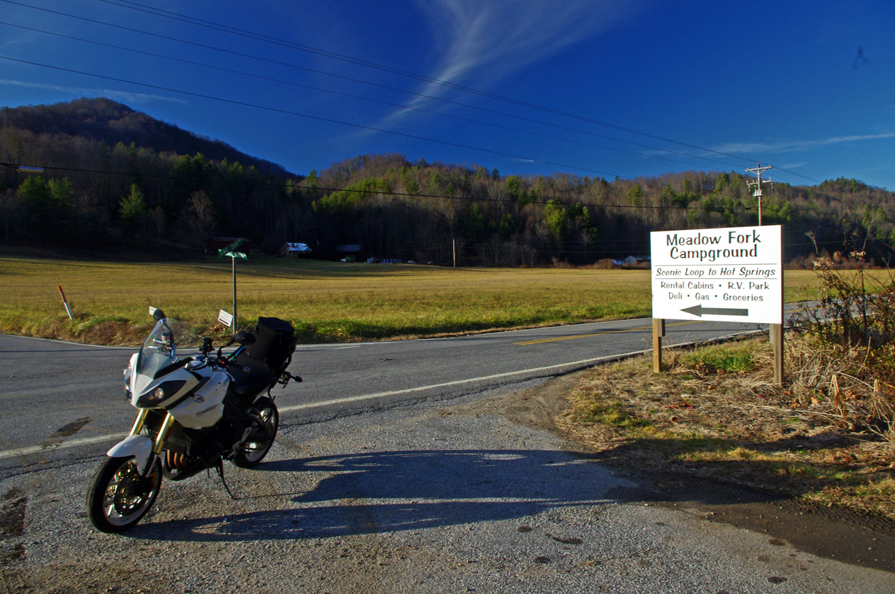
Caldwell Mountain Rd is easy to find. Ride to the middle of the long straight stretch of NC 209 in Spring Creek. Look for the sign for Meadow Fork Campground.

Caldwell Mountain Road and Meadow Fork Road form a nice loop on the west side of NC 209 when joined together. It’s a good way to vary the ride to and from Hot Springs and  see a few different sights.

Photo-road-sign

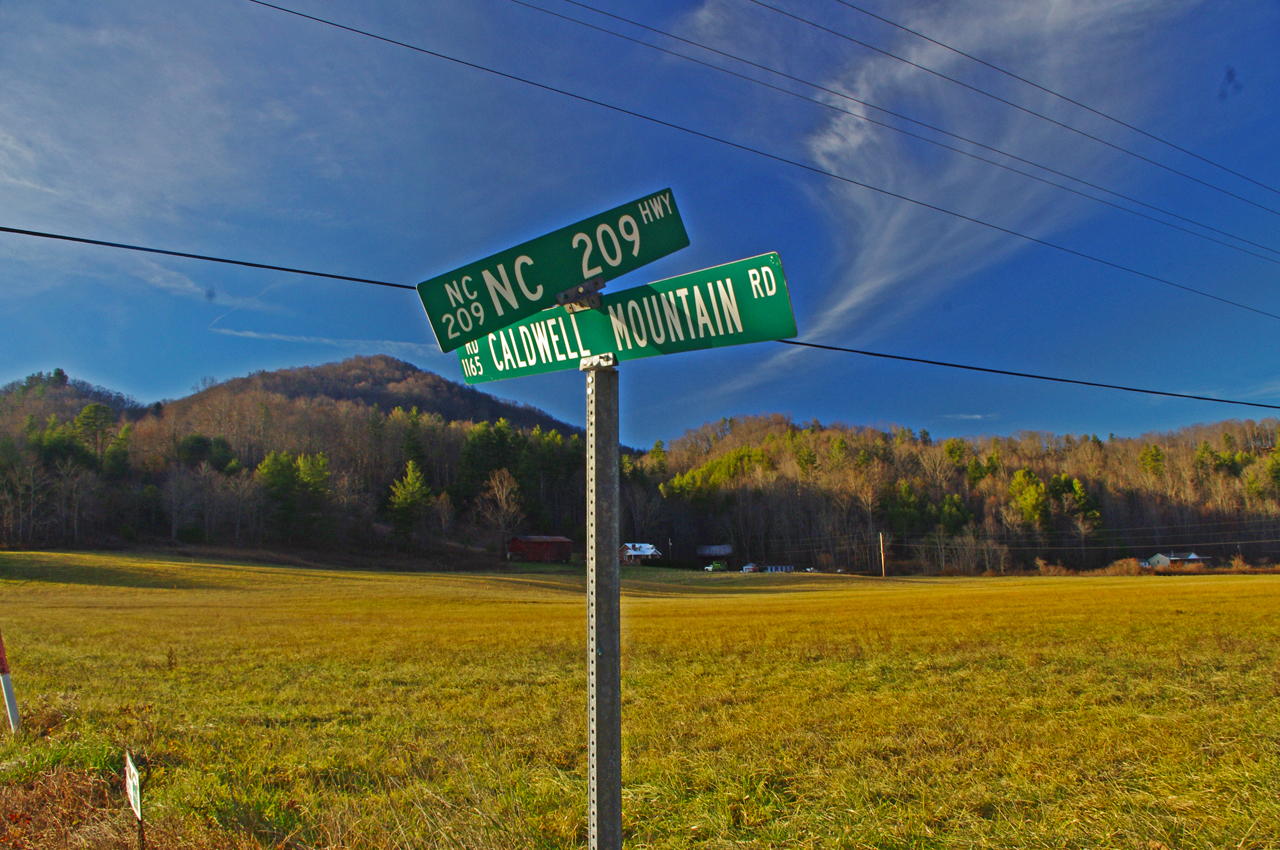
The sign may be a little crooked, but so is Caldwell Mountain Rd .

Both Meadow Fork and Caldwell Mountains Roads are paved, though if you miss turning at their junction you will run out of pavement before long when Meadow Fork Road reaches the National Forest. If you are on a dual-sport or adventure bike, this is one way to access the great unpaved roads that lead up to Max Patch bald and wind into Tennessee and the eastern edge of Great Smoky Mountains National Park. (See map OR-1)

Photo-Caldwell-Mountain_rd-motorcycle-ride

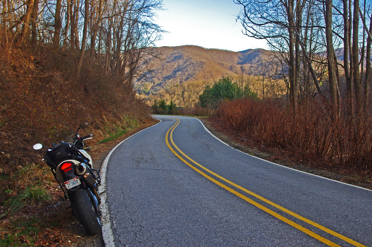
One of the few long range views on Caldwell Mountain Rd. You’ll probably be looking at the road instead.

Both of these roads are easy to find from NC 209. Their junctions are well marked. There is a prominent sign for the Meadow Fork Campground which marks the junction and it’s easy to spot Caldwell Mountain Road cutting across the felids in the valley as you approach.

Photo-Motorcycle-Ride-Meadow-Fork

Never far from the edge of the roaring creek, Meadow Fork Road twists through steep rocky hill sides and small valleys and coves.

Caldwell Mountain Road has some nice curves on the climbs and a few brief long range views. The pavement is a little bumpy in places, but generally is pretty good overall.

Photo-motorcycle -ride-meadow-fork-rd

There are some very pleasant views along Meadow Fork Road and lots of places to pause and enjoy it.

Meadow Fork Road follows the Roaring Fork River from NC 209 as it carves through the mountains for 7 miles to reach the junction with Caldwell Mountain Road. The road  traces the bank of the river  making it a nice curvy motorcycle ride for the most part. The pavement is in good shape – a long section near the river washed out and was replaced a few years ago with nice new pavement.

Photo-junction-NC-209-Meadow-fork-rd

The junction of Meadow Fork Rd and NC 209 is easy to spot though it may come up on you quickly as you come around a curve on either side.

Neither road has scenery you’ll be framing on the wall, though in general it’s pretty nice with small remote and isolated coves and valleys, the whitewater river along the road, and lots of hundred year old barns and the like.

Photo-start-of-Meadow-Fork-Rd

Just a peek down Meadow Fork Road shows what lies ahead.

This side loop off NC 209 adds a nice diversion, a little something different, without adding a significant amount of time to the longer motorcycle ride on classic NC 209 – The Rattler.

photo-junction-meadow-fork-caldwell-mountain

The junction of Meadow Fork Rd and Caldwell Mountain Rd is easy to spot, so navigation of this ride is easy and you can focus on enjoying the roads.

Related – Map and info about NC 209 – a.k.a “The Rattler”

America Rides Maps Map #6 – The Best Motorcycle Rides EAST of Great Smoky Mountains National Park

_______________________________________________________________________________

Wayne Busch

Wayne Busch – Cartographer

Total Rider Tech Logo

Learn Total Control

– Wayne Busch lives in Waynesville, NC, where he produces the most detailed and comprehensive and up-to-date motorcycle pocket maps of the Blue Ridge and Smoky Mountains to help you get the most of your vacation experience. See them here – AmericaRidesMaps.com

Wayne is an advanced motorcycle instructor for Total Rider Tech teaching Lee Parks Total Control Advanced Rider Courses. It’s time you looked into advanced rider training to ride more confidently and safely, it will change your mountain riding experience. It worked so well for me I became an instructor! Total Rider Tech

_______________________________________________________________________________
How Long Does It Take To Ride The Blue Ridge Parkway?

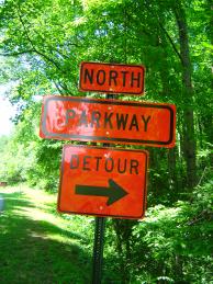
Photo - Detour sign on the Blue Ridge Parkway

It’s not a detour, it’s an opportunity to explore!

10 Hours, 47 minutes, and 27 seconds, so long as you get at least 469 miles from one tank of gas, don’t eat, wear a diaper, and they miraculously resolve all the Blue Ridge Parkway closures and detours. Obviously, that’s not the answer you are looking for.

Riding the Blue Ridge Parkway end-to-end on a motorcycle is a goal for many. It’s our nations classic motorcycle ride. But in planning your motorcycle trip, it is a goal that should be approached like sex – you don’t try to see how fast you can get it done and really enjoy it. Realistically, you could do this great ride in two long days, just to say you’ve done it, but the “I’m an idiot award” would be waiting for you at the end of your scenic ride.

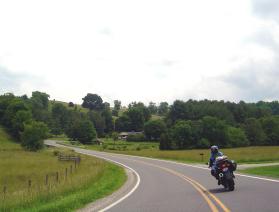
Photo - motorcycle on a Virginia section with caption "Never rush the Parkway - it's meant to be savored".

Never rush the Parkway, it’s meant to be savored.

The more time you put into it, the more pleasure you will get out of your motorcycle vacation. It would be better to focus on exploring small sections of the Blue Ridge Parkway and truly enjoying them. It’s not going anywhere. You can always come back to it. The same spot in the morning is a new experience in the evening, another view with a change of seasons.”

Look at those detours as opportunities to explore the thousands of miles of great roads that surround the Blue Ridge Parkway. The mountains are full of good rides which are devoid of traffic, chock full of scenery, and often more challenging and rewarding to explore.

If you must hurry through, or cover the distance for whatever reason, note those places that were special to you and plan on coming back. The Blue Ridge Parkway is best when you’re not moving at all.

For info about Blue Ridge Parkway Road Closures,
go to http://www.nps.gov/blri/planyourvisit/roadclosures.htm


Wayne Busch - AMERICA RIDES MAPS

Wayne Busch – AMERICA RIDES MAPS

America Rides Maps

The Most Dangerous Road for Motorcycles?

Charlies Creek Road

Charlies Creek Road - even the sign is crooked


“That’s the most dangerous road we ride” my wife commented after a recent morning outing.

It’s my favorite road!”, I responded.

“I know, but it’s still dangerous” she reiterated.

We talked a bit more about it and the things she finds most dangerous are the things I enjoy as an added challenge.

“I still like it, it’s just a dangerous road” says Jackie.

Jackie’s no lightweight. We rode dual-purpose bikes all over the country years ago, she can throw a motorcycle around. Now, astride her Beemer, she often gives the boys a run for their money on the twisty roads. She can handle herself and I enjoy watching her flow through the curves. And no, we’re not talking about the infamous “Tail of the Dragon“. That’s just another ride for us compared to this.

riding Charlies Creek Road

Be ready to get some lean on when riding Charlies Creek Road

Photo – Wayne prepares to get some lean on in a curve on Charlie’s Creek Road

What makes Charlies Creek Road a challenge is it’s unpredictability. You just never know what it’s going to throw at you next, and it throws everything in the book along it’s 10.1 mile length making it seem a whole lot longer. Mixed pavement, potholes, bumpy repairs, loose gravel, climbs, descents, first gear hairpins interspersed with sections of relatively straight road that lure you to roll on the throttle then snare unsuspecting riders with turns which shut down on them the deeper in you get. Cresting a rise you never know what lies on the other side, which way it will dive. Is there a patch of loose gravel in the next corner, a flock of turkeys in the road, will the tires maintain their grip on that concrete bridge littered with sand and rocks, what’s with this freakin turn, it’s getting tighter? How many seasons before some bear hunter discovers my rusted bike and bleached bones if I lose it out here in the middle of nowhere?

It’s a handful it you approach it cautiously. Come at it with vigor, and it will test everything you’ve got. My kind of road. Beware of Charlies Creek Road, it’s the most dangerous road we ride. It’s also my favorite and I do it as often as I can. Just don’t try to keep up with me. I know it pretty darn well. Respect it or it will eat you.

Note – Charlies Creek Road runs between NC 215 and NC 281. It’s found on America Rides Maps “#6 – The Best Motorcycle Roads EAST of Great Smoky Mountains National Park”.

>> Go To America Rides Maps.comhttp://americaridesmaps.com

_______________________________________________________________________________
Wayne Busch

Wayne Busch - Cartographer

– Wayne Busch lives in Waynesville, NC, where he produces the most detailed and comprehensive and up-to-date motorcycle pocket maps of the Blue Ridge and Smoky Mountains to help you get the most of your vacation experience. See them here – AmericaRidesMaps.com
 
See “Map #6 – The Best Motorcycle Roads EAST of Great Smoky Mountains National Park”