Motorcycles Celebrate Anniversary at The Lodge at Copperhead

photo-the-lodge-at-copperhead

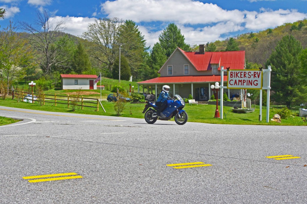
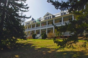
The Lodge at Copperhead near Blairsville, GA sits on the Gauntlet Motorcycle Ride

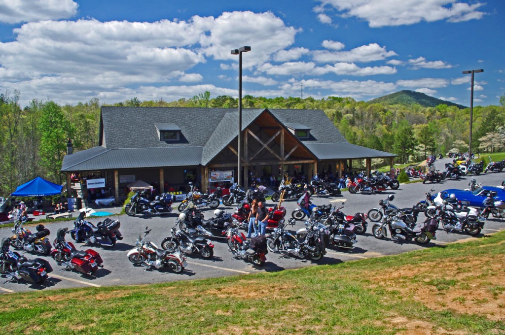
While riding through north Georgia on our motorcycles, Jackie and I stopped in at The Lodge at Copperhead in Blairsville  yesterday. It was their anniversary and quite a celebration – a car show / bike show, poker run, live music, loads of prizes, and a healthy turnout.

Photo-the-Lodge-at-Copperhead-Dining

Jackie and I had lunch in the dining room. It was after 2, the crowd had thinned.

We’d spent the morning riding the great motorcycle rides that surround the lodge and planned to make it our lunch stop. Probably not the best day to come for lunch, the place was packed with bikers.  It’s one of my favorite biker friendly stops when in north Georgia.

photo-jackie-on-motorcycle

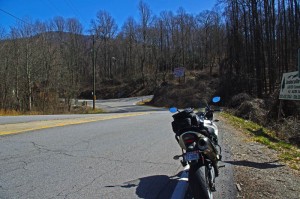
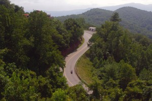
Jackie makes the turn onto GA 60, one of our favorite motorcycle roads in Georgia.

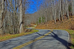
I’ve recently added nearly a dozen roads to my motorcycle maps of this area and we had a great motorcycle ride as I toured Jackie through a half dozen or more roads she’d never seen -they are there if you know where to find them. Of course, we also hit a few old favorites we never tire of as well.

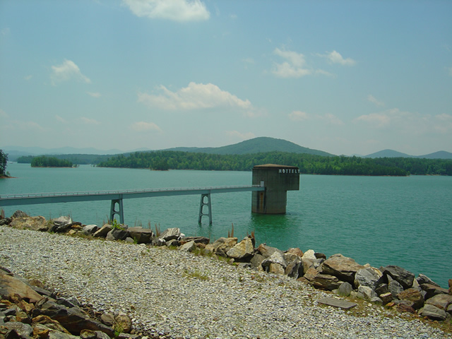
Photo - View from the Nottely Dam

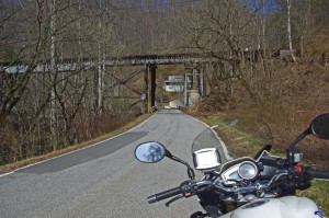
Riding across the Nottely Dam in North Georgia

Spring is early and the motorcycle riders have been enjoying it! Maybe it’s the high price of gas, but there seem to be less cars on the road – all the better for us on two wheels. It’s a great time to make a trip to the enjoy the fabulous motorcycle rides in north Georgia.

photo-skeenah-creek-mill

Georgia holds great riding, historic spots, and wonderful scenery for the motorcycle rider

If you’ve ridden the Blue Ridge Mountains in north Georgia before, you know it’s time to come back. If you haven’t been there yet, it’s worth the effort to get on your bike and ride a day to get here and experience it for yourself.

__________________________________________________________________

Wayne Busch

Wayne Busch - Cartographer

Total Rider Tech Logo

Learn Total Control

– Wayne Busch lives in Waynesville, NC, where he produces the most detailed and comprehensive and up-to-date motorcycle pocket maps of the Blue Ridge and Smoky Mountains to help you get the most of your vacation experience. See them here – AmericaRidesMaps.com

Wayne is an advanced motorcycle instructor for Total Rider Tech teaching Lee Parks Total Control Advanced Rider Courses. Isn’t it time you looked into advanced rider training to ride more confidently and safely? It can transform your mountain riding experience.  Total Rider Tech

____________________________________________________________________

Motorcycle Detour for I-75 Slide near Jellico, TN

If you’re headed south to Daytona from the midwest, here’s a alternate route for motorcycles that will help you avoid the traffic – 

Coming home from a Total Rider Tech instructor training in Chicago yesterday, I ran into the roadblock on I-75 near the Tennessee / Kentucky state line. On the ride up I noted the rushing streams and rivers from recent storms and apparently Sinking Creek washed out and undermined a section of I-75 causing the southbound lane to subside and be closed at exit 160.

Even at 4 AM my cartographers instincts compelled me to look for an alternate route for my 2 wheeled friends that would get them away from the traffic that would now choke the “official” detour route which leads you down US 25W through La Follette.

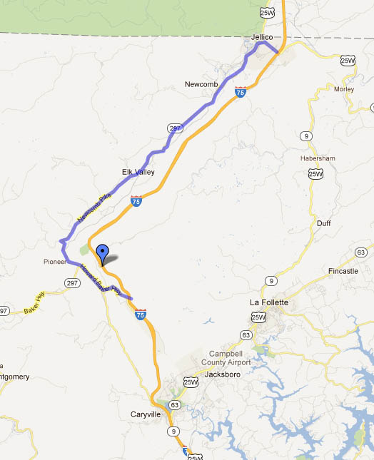
Screenshot of Google Map

The "official" detour routs you east through La Follette. I've identified another way to the west that you should enjoy more.

Link to Google Map Route – http://maps.google.com/maps/ms?msid=211107090297552226361.0004bb0ddf208a14a207c&msa=0&ll=36.408573,-83.946533&spn=0.584666,1.489334

Pass through Jellico, keeping left at the intersection in town with US 25W. Follow TN 297 south as it twists and winds through Newcomb and Elk Valley. Turn left onto TN 63 (Howard Baker HWY) to reconnect to the interstate just below the slide area at exit 141. There are a couple gas stations at this exit. It’s actually a pretty engaging ride for the motorcycle rider that you can enjoy, plan on 30 minutes or so without other traffic.

I did not scout the “official” route, though it looks like it too has some tight and twisty bits at the north end. Get a few big semi’s on this road and traffic is bound to slow to a crawl.

__________________________________________________________________

Wayne Busch

Wayne Busch - Cartographer

Total Rider Tech Logo

Learn Total Control

– Wayne Busch lives in Waynesville, NC, where he produces the most detailed and comprehensive and up-to-date motorcycle pocket maps of the Blue Ridge and Smoky Mountains to help you get the most of your vacation experience. See them here – AmericaRidesMaps.com

Wayne is an advanced motorcycle instructor for Total Rider Tech teaching Lee Parks Total Control Advanced Rider Courses. Isn’t it time you looked into advanced rider training to ride more confidently and safely? It can transform your mountain riding experience.  Total Rider Tech

____________________________________________________________________

Good Motorcycle Rides near Waynesville and Maggie Valley, NC

The last place I want to be riding a motorcycle is the 4-lane highway when there are so many good 2 lane back roads in North Carolina.

photo-turn-onto-candlestick-lane

Turn off the highway onto Candlestick Lane

For most motorcycle riders, covering the distance between Waynesville and Sylva means a relatively pleasant ride on four lane divided NC Highway 74 (The Great Smoky Mountains Expressway). As far as highways go, it is a nice ride winding down from Balsam Mountain and it rarely gets enough traffic to be annoying.

Lately though, I’ve been covering the relatively short distance on a few nice little back roads which I’ve grown very fond of. Since so many motorcycle touring riders pass through and stay in this area, I think they should know about them. If you’re riding near Cherokee, Maggie Valley, Waynesville, or Sylva, these roads may come in handy.

photo-turn-onto-cabin-flats

Next turn onto Cabin Flats Road.

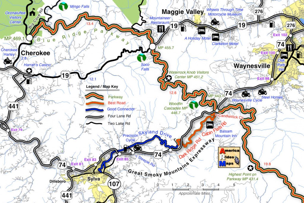
Both ends meet the Highway (US 74). The Waynesville end starts near the Blue Ridge Parkway Exit for Waynesville (MP 443.1) where it intersects US 74. Pass under the parkway then exit left onto Candlestick Lane. It’s an obvious intersection, well marked, look for the signs to Balsam, Balsam Mountain Inn, Moonshine Creek Campground.

Candlestick Circle is just a short loop off the highway, turn right onto Cabin Flats Rd. Cabin Flats Road winds along the railroad tracks a short distance, then makes a hairpin turn across them.  Balsam Mountain Inn sits on the hill above.

photo-balsam-mountain-inn

The Balsam Mountain Inn – historic, good food

It’s been a long while side I last visited, but the historic inn (1905) is both scenic and the food used to be very, very, good. You can imagine it’s heyday when it was a stop on the tracks in the middle of nowhere.

Cabin Flats Road will morph into Dark Ridge Road and start a twisting course alongside a stream through the mountain passes. The railroad also follows this narrow valley and you’ll often see it off in the woods crossing the stream on bridges and trestles.

photo-Dark-Ridge-Rd

Dark Ridge Road – more fun than the 4 lane

Dark Ridge Road, the railroad, the highway, and the stream cross each other several times on the way to Sylva in a twisted mountain mess. You go under the highway, under the railroad, over the stream several times on the ride.

Dark Ridge Road meets Skyland Road at a stop sign just after you cross the railroad tracks. Turn left (the road quickly peters out if you go right).

photo-trestle-on-skyland-rd

Under the tracks on Skyland Rd

The first part of Skyland Road is nice and there are several good spots to stop and get a look at the now rushing whitewater stream.

The second half looses it’s appeal as it draws near Sylva and the suburbs of the town. You can follow the road all the way into Sylva. You may note the prominent fork right onto Chipper Curve Rd – it will bring you closer to downtown.

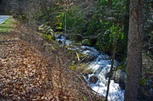
photo-creek

Whitewater Creek along Skyland Rd

You can hop on-off this ride at 2 points and get back on the highway. One of them is obvious, a mile or so after you get on Skyland Rd. The other, Steeple Road, is closer to Sylva and is the best way to get back on the highway without going into town. Precision Cycles and a BP station mark it at the highway.

map

Click on photos and map for larger views

__________________________________________________________________

Wayne Busch

Wayne Busch – Cartographer

Total Rider Tech Logo

Learn Total Control

– Wayne Busch lives in Waynesville, NC, where he produces the most detailed and comprehensive and up-to-date motorcycle pocket maps of the Blue Ridge and Smoky Mountains to help you get the most of your vacation experience. See them here – AmericaRidesMaps.com

Wayne is an advanced motorcycle instructor for Total Rider Tech teaching Lee Parks Total Control Advanced Rider Courses. Isn’t it time you looked into advanced rider training to ride more confidently and safely? It can transform your mountain riding experience.  Total Rider Tech

____________________________________________________________________

Great Motorcycle Ride Rivals the Tail of the Dragon

You hear a lot of folks say “I know of roads better than the Tail of the Dragon, but I, like you, am often doubtful of such claims.

The Dragon at Deals Gap is pretty much the benchmark motorcycle ride to measure and compare to. There are darned good reasons the Tail of the Dragon is legendary. But what about those other roads?

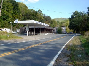
Photo - Start of ride on south end

This abandoned gas station/store on Banner Elk Highway (SR 194) alerts you to the start of the ride. The road is just beyond it.

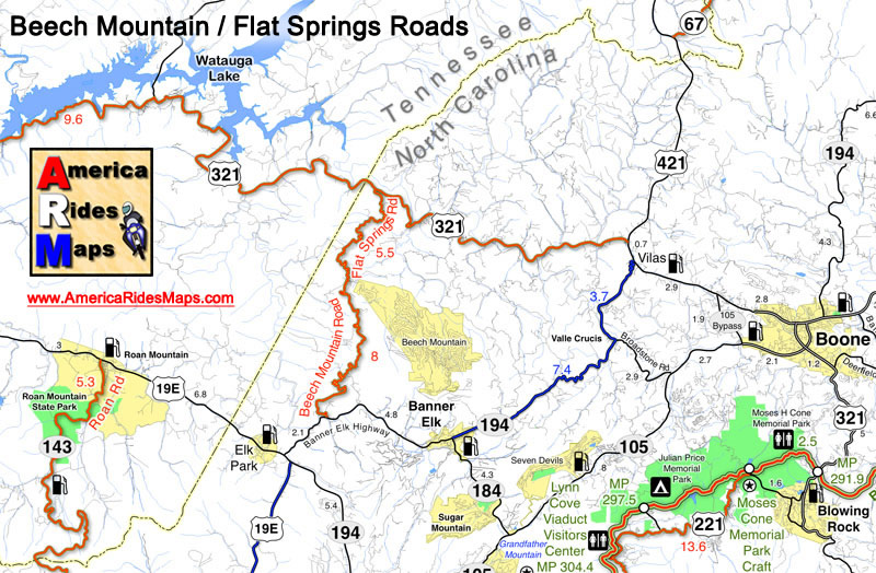
Here’s one I really enjoy, Beech Mountain / Flat Springs Road. I won’t claim it’s better than the Dragon, but it ranks right up there.

The pavement is not as good in places. There are connecting roads and driveways so you’ve got to ride alert, watch for gravel and sand at those connections and in tight turns. There are no motorcycle resorts at either end. Still, Beech Mountain Road is an excellent, challenging , and fun ride.

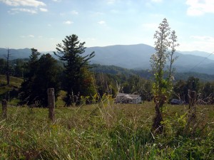
Photo - view from road

View of what I think is Roan Mountain. It's not the rare views that make Beech Mountain / Flat Springs Roads good, it's the ride.

This great motorcycle ride is labeled as Beech Mountain Road on the south side of Beech Mountain, then becomes Flat Springs Road once you start descending the north side of the mountain.

Grades are steeper than the Dragon but generally mild. It’s a bit longer. Best of all it’s a road I use to bypass traffic and avoid going through large towns and the city of Boone.

I use it often when I’m headed up to Tennessee and Virginia to ride The Snake and the great roads nearby, and it’s also in the neighborhood of Roan Mountain and the Murder Mountain Ride. It’s a good one to know about and add to your list of great back roads.

Image - Map shows location of Beech Mountain Road

Beech Mountain / Flat Springs Road help you avoid all the traffic to the east.

So how does it stack up?

I was going through my video files one day and found two that were nearly identical. Same camera angle. Same bike. A complete ride through both roads. So I matched them up side by side to see how the roads compare in a contest. The outcome was surprising!


_______________________________________________________________________________

Wayne Busch

Wayne Busch - Cartographer

Total Rider Tech Logo

Learn Total Control

– Wayne Busch lives in Waynesville, NC, where he produces the most detailed and comprehensive and up-to-date motorcycle pocket maps of the Blue Ridge and Smoky Mountains to help you get the most of your vacation experience. See them here – AmericaRidesMaps.com

Wayne is an advanced motorcycle instructor for Total Rider Tech teaching Lee Parks Total Control Advanced Rider Courses. It’s time you looked into advanced rider training to ride more confidently and safely, it will change your mountain riding experience. It worked so well for me I became an instructor! Total Rider Tech

_______________________________________________________________________________

100 Best Motorcycle Rides in the Smoky Mountains

Motorcycle Map – Best Motorcycle Rides in the Smoky Mountains

America Rides Maps announces its first large format motorcycle ride map. Available in 24 x 36 inch and 31 x 48 sizes.

Image of map the Best Motorcycle Rides in the Smoky Mountains

Image of map the Best Motorcycle Rides in the Smoky Mountains - B&W version. Click for a closer look at all the detail!

The only map of its kind, The Best Motorcycle Rides in the Smoky Mountains highlights more than 100 of the best motorcycle rides and more than 50 good connecting roads to tie them all together into endless loops and touring routes.

This map is produced in Black & White  so YOU CAN CUSTOMIZE IT to fit your needs. Use colored markers to highlight where you’ve been or lay out where you want to go.

Santa - great gift ideaPlaning your motorcycle vacation trip has never been easier!

Hang it on the wall to show all the places you’ve been on your motorcycle vacation tours.

Got a favorite place to stay in the Smokies? Discover all the hidden riding nearby. Make the best use of your riding time, ride on on all the best roads,  avoid traffic and congestion.

$24.99 price includes free shipping and handling – First Class US Mail – average 2-3 day delivery. Ships unfolded.

Read more and order here: 

 The Best Motorcycle Rides in the Smoky Mountains

http://shop.americaridesmaps.com/The-Great-Motorcycle-Rides-of-the-Smoky-Mountains-BW-NC023BW.htm

Curious? Need more info? Email info@americaridesmaps.com

_______________________________________________________________________________

Wayne Busch

Wayne Busch - Cartographer

– Wayne Busch lives in Waynesville, NC, where he produces the most detailed and comprehensive and up-to-date motorcycle pocket maps of the Blue Ridge and Smoky Mountains to help you get the most of your vacation experience. See them here – AmericaRidesMaps.com
 

Good Biker Roads – US 76 in Georgia – Motorcycle Map change

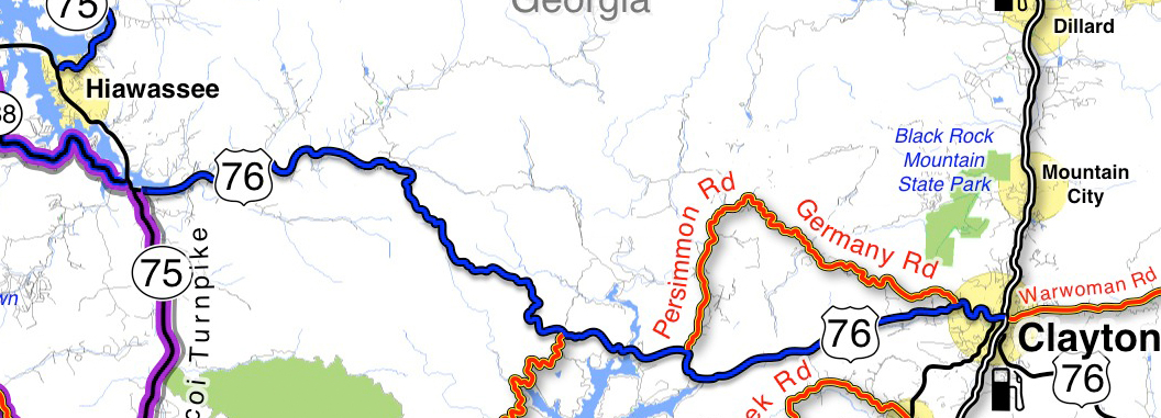
US 76 in Georgia between Clayton and Hiawasse is a good biker road.

It’s not one of “the best motorcycle roads” in north Georgia,

– but it’s a good motorcycle ride that rates high enough that I’ve decided to upgrade it on America Rides Maps #9 The Best Rides in the North Georgia Mountains to the “good connector” category.

map-image-US-76-Georgia

US 76 is now shown as a "good connector" on America Rides Maps (blue highlight). You can see there are other great rides which link to it along this section. I show you which roads are worth riding!

How I show the roads: I list “good connector” roads on my America Rides Maps highlighted blue to help you find the best ways to link together the best motorcycle rides which I show in red.  There’s no way I’ll ever rate this section of US 76 in Georgia as a great biker road (shown highlighted red on America Rides Maps) as it carries too much traffic. That’s what usually disqualifies or downgrades what would otherwise be great motorcycle rides – too much traffic.

Description of this section of US 76: The blue highlighted section of US 76 shown on the map is flatter and more open to the west, dotted with houses which thin out as you head east. It then enters a section of National Forest and makes a gentle climb over a mountain with a nice section of curves – nothing extreme, but a lot of them and they can be fun if you’re not caught behind slow traffic. Houses, then businesses start appearing as you near Clayton, the road is more twisty at this end.

Where can I get this map? #9 The Best Rides in the North Georgia Mountains

PS – current map owners may have noted something else – the purple highlighted roads. They are part of “The Gauntlet” motorcycle ride in georgia’s blue ridge mountains. (Trying something new, if it works out you’l see more of it – you know I’m constantly changing and improving America Rides Maps.

Comments? Did I make the right choice?

_______________________________________________________________________________

Wayne Busch

Wayne Busch - Cartographer

Total Rider Tech Logo

Learn Total Control

– Wayne Busch lives in Waynesville, NC, where he produces the most detailed and comprehensive and up-to-date motorcycle pocket maps of the Blue Ridge and Smoky Mountains to help you get the most of your vacation experience. See them here – AmericaRidesMaps.com

Wayne is an advanced motorcycle instructor for Total Rider Tech teaching Lee Parks Total Control Advanced Rider Courses. It’s time you looked into advanced rider training to ride more confidently and safely, it will change your mountain riding experience. It worked so well for me I became an instructor! Total Rider Tech

_______________________________________________________________________________

 You’ll find US 76 and all the other good biker roads on America Rides Maps #9 The Best Rides in the North Georgia Mountains 

Motorcycle Friendly – Skyline Village Inn, Little Switzerland

photo-skyline-inn

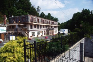
The Skyline Inn, Little Switzerland, NC

Located right at the start of the Diamondback Motorcycle Ride, the Skyline Village Inn offers a scenic stay, good food, a nice selection of beer and wine, and one of the most unique and historic places to stay on the Blue Ridge Parkway.

First of all, the Skyline Village Inn has a story and it’s a great one. (If you want all the details click here and go the their site in a minute). In a nutshell, the Skyline Village Inn was built as a front to cover up a huge moonshine operation which operated out of secret caverns beneath it. When not brewing corn, they used their free time to do intricate stone and woodwork throughout the building and grounds. Some of the wood inlay work on the tables in the lounge belongs in a museum. They give tours of the moonshiners caverns. I didn’t ask if they still sell “shine”, but the beer and wine on hand is diverse and high quality.

photo-skline-inn-woodwork

Those moonshiners used 17 kinds of local wood

The building was constructed in the 1930’s and 40’s, before small roadside motels came into vogue, so it has an authentic historic atmosphere that permeates the entire place. Those moonshiners built with quality and it endures.

The Skyline Village Inn sits high atop the ridge with commanding views. You can see the beautiful stone arch where the Blue Ridge Parkway passes over NC 226 down the road at the Spruce Pine exit at milepost 331 from out front of the Inn. The rooms open onto a porch where you can sit to enjoy the view.

Best of all for the motorcycle rider, the  Skyline Village Inn sits at the head of the Diamondback Motorcycle Ride, one of North Carolina’s most popular rides. Just roll out  of the covered motorcycle parking and you’re on the ride.

photo-motorcycle-NC-226

Rider nears the top of NC 226. Shot from the overlook across from the Skyline Inn


While the Diamondback is popular, the ride they like to send you on from the Skyline Village Inn is the Murder Mountain Ride. You can do the short version of the Diamondback Loop down 226A then back up 226 in about 45 minutes. The Murder Mountain Ride is much more of a commitment, about 3 1/2 hours minimum, but it includes a traverse of spectacular Roan Mountain and some of the twistiest and most enjoyable roads in North Carolina and a bit of Tennessee. (See Murder Mountain Ride Description / Map here)

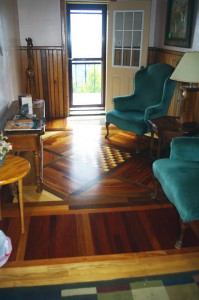
photo-room-at-skyline-inn

A room at the Skyline Inn

If you want to stay somewhere you’ll remember and can tell (good) stories about, consider the Skyline Village Inn on your Blue Ridge Parkway motorcycle ride.

Skyline Village Inn

Murder Mountain Ride

Diamondback Motorcycle Ride


_______________________________________________________________________________

Wayne Busch

Wayne Busch – Cartographer

Total Rider Tech Logo

Learn Total Control

– Wayne Busch lives in Waynesville, NC, where he produces the most detailed and comprehensive and up-to-date motorcycle pocket maps of the Blue Ridge and Smoky Mountains to help you get the most of your vacation experience. See them here – AmericaRidesMaps.com

Wayne is an advanced motorcycle instructor for Total Rider Tech teaching Lee Parks Total Control Advanced Rider Courses. It’s time you looked into advanced rider training to ride more confidently and safely, it will change your mountain riding experience. It worked so well for me I became an instructor! Total Rider Tech

_______________________________________________________________________________

Central California vs. Smoky Mountain Motorcycle Rides

Photo-Santa-Barbara-view

Santa Barbara - coast & mountains

Earlier this year some magazine came out with a list of top 10 motorcycle rides. The Blue Ridge Parkway made the list. The Dragon at Deals Gap made the list. Others had me wondering what criteria they used to judge them.

I’ve been all across the US and I’m convinced the best motorcycle riding is in the Blue Ridge / Smoky Mountains, but I’m trying to keep an open mind. When the opportunity came to visit Santa Barbara on the California coast,  I made arrangements to insure I’d explore central California by motorcycle to see how west coast mountain riding compared to home sweet home.
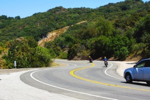
Photo-CA-150

Nice section of CA 150 near Ojai

I’ve previously been on sections of the Pacific Coast Highway. It’s fabulously scenic, but there’s not a whole lot about it that drives me to want to carve through it on a motorcycle to get the most out of the ride. I remember too much time plodding along behind duffers with lines of cars behind them, not rolling on the throttle to course through the curves and drop a knee towards the pavement. I did ride the Ventura Highway several times, and that Eagle’s song jumps into your mind as soon as you see the sign.

My explorations this trip would be through central California, leaving the congestion of the coastal roads behind for the more challenging mountain passes. Unfortunately, this required time-wasting commutes on the expressway to reach them.
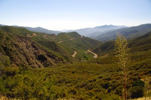
Photo-view-from-CA-33

You can see the Channel Islands from atop CA 33

The highlight of all that highway riding was experiencing lane sharing when traffic backed up, which it frequently did. Not for the meek, the skinny Ducati sport bike I was on was perfectly suited for darting between the lines of slower cars, flitting into every hole that opened, and filtering through the traffic.  Surprisingly, the cars and trucks made room for you to pass. I guess it beats having a speeding bike scrape along your car. It was fun and I felt like I was given a free pass to cheat at the game.  I think we need more lane sharing in the US.
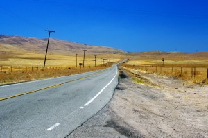
Photo-Ca-58

CA 58 a long, lonely ride to reach the twisties

I was a little disappointed to find the rides out to reach the mountain passes long and quite tame. While there was less traffic, it’s still far busier then you’ll find secondary roads in my Blue Ridge Mountains back home.

I first went south from Santa Barabara to Carpenteria, then headed inland to Ojai. Most of the towns are pretty cool, they look like great places to visit, but not what I’d come to do.

Leaving Ojai, my first run across the mountains on CA 33 had me feeling more at home. CA 33 is a good long run with curves that reminded me more of the Cherohala Skyway then the Dragon– a little more open and sweeping in comparison to the tight and technical curves I so enjoy back home.

The Ducati 848 made enjoying the canyon rides at a spirited pace easy. While the suspension was set up way to stiff for my liking, it always provided as much traction as I asked for, the bike ran the curves like it was on a rial. It was a challenge to keep from hitting triple digits when the road opened up, a challenge I failed many times.
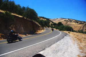
Photo-bikes-on-CA-58

A long twisty section makes CA 58 so great

Once over the mountains I came down into the oil fields and farmlands near Maricopa. I then headed north through the desert where temps were just shy of 100 degrees to pick up the next great ride near McKittrick, CA 58. Fortunately, I’d topped up the tank as the “No services next 70 miles” signs appeared. CA 58 was another outstanding ride through high open mountain passes, great curves, and  a whole of of fun. Lot’s of bikes on this ride, it’s a great one so long as you’re up in the mountains. Once you come down, things straighten out again. I was reminded of the midwest where you ride a road that runs like an arrow to the horizon for miles and miles until you come to a 20 mph right angle turn to do it all over again and again.
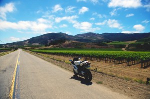
photo-wine-country

Cruising through wine country on Foxen Canyon and Santa Rosa Rds

I got bored on these long straight runs and after a while the speed crept up and up until I was playing a game to see if I could launch the bike off the hilltops as a the Ducati stretched it’s legs out and sang at the top of it’s booming baritone voice. I looped back through Santa Margarita then limped into San Luis Obispo with the reserve light crying out for a drink of fresh petrol. I wasted a bit of time looking for gas as every station was flagged off with yellow tape. They were all getting some kind of service done and I was running on fumes when I finally found one that had one bank of pumps in operation. I waited my turn in the long lines that had formed, then headed south on the freeway to return home.
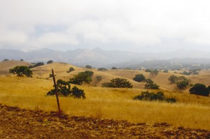
Photo-coastal-fog

The coastal fog travels well inland and persists till after noon - Foxen Canyon Rd

The next day I headed north this time, taking CA 154 through the dense morning fog that rolls in off the ocean. My destination was Foxen Canyon Rd, a decent ride, but not as challenging as those I’d previously been on. Most of this day was in wine country and it was more scenic then I’d seen on the east side of the mountains. I worked my way from Santa Maria to Lompoc, then found a nice ride on Santa Rosa Rd. Passing through Solvang, I returned to Santa Barbara on CA 154, then got on the freeway and went back south to Carpenteria to make a few more runs on CA 33.

So how do the California motorcycle rides I was on compare to the Blue Ridge & Smoky Mountain motorcycle rides I know so well?
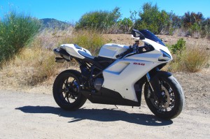
Photo-Ducati-848

The Ducati 848 - a precision guided missile - too much for all but the best riders

While the California rides were longer, so were the distances between them – they stood in isolation. Here in the Smokies, you finish one great road to continue your motorcycle ride on the next. You spend far more time in the nice sections and finding a long straight stretch of road means you made a wrong turn and left the mountains. I missed the green trees, the rushing mountain streams, the little waterfalls around the bends. The California countryside is dry, if not desert, close to it. Towns are much further apart, and you’ve got to pay attention to gas stations – when in doubt, top it out. You may have a long ride before you find another.
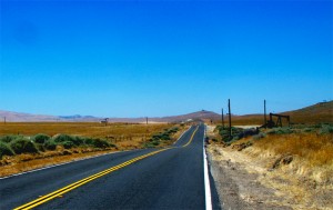
Photo-oil-derricks

Sometimes there are more oil derricks than trees

Many of the California roads were rough and bumpy – a patchwork of asphalt and concrete layer upon layer. I thought we had some rough rods, but I’m beginning to think we don’t have it so bad after all.

In the same amount of area I covered to reach just a few great motorcycle rides in California, there would have been a hundred or so in the Smokies and never  a 4 lane road or highway needed. I continue to believe there are more great motorcycle rides in the Blue Ridge and Smoky Mountains than any other area of the country.

To quote the now ex-governator, “I’ll be back”. Admittedly, I’ve barely touched the huge state of California. It’s a nice contrast to the motorcycle rides we have back home in the Smoky Mountains and makes me appreciate how great we’ve got it back east.

_______________________________________________________________________________

Wayne Busch
Wayne Busch – Cartographer
– Wayne Busch lives in Waynesville, NC, where he produces the most detailed and comprehensive and up-to-date motorcycle pocket maps of the Blue Ridge and Smoky Mountains to help you get the most of your vacation experience. See them here – AmericaRidesMaps.com 

Motorcycle Friendly Places – Hampton Inn & Suites, Sapphire, NC

photo-US-64-view-Cashiers

One of my favorite views is just 10 mins from the Hampton.

Few places rival the beauty surrounding Sapphire, NC. The small town and those surrounding it host some of the most expensive real estate in the Blue Ridge Mountains. Flanked by massive granite balds, host to the Cullasja River Gorge with it’s many roadside waterfalls, and nestled amongst the wilds of several national forests with views that will take your breath away, the area is laced with outstanding motorcycle rides.

Photo-view-from-NC-215

Above the clouds on my morning ride

On any weekend, 2 lane US 64 throbs and buzzes with motorcycles who come to play on the wonderfully twisty and scenic roads. Of course other tourists come as well, and US 64 rarely gives the motorcycle rider the freedom to enjoy its serpentine turns to full delight as they insist you share the road. Few tourists ever venture off the main drag though, and the many back roads which course over the mountains and along the valley streams give the biker what he really came for – great rides with outstanding views devoid of traffic.

Photo-Hampton-Inn-Sapphire-NC

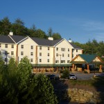
Hampton Inn & Suites, Sapphire, NC

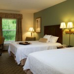
Sitting in the heart of all this, the Hampton Inn & Suites in Sapphire makes an ideal place to base out of for an enjoyable stay while exploring all the region has to offer. Level parking, set back from the road, and close to good dinging and other amenities, the Hampton provides a quiet and relaxing place with a decor and atmosphere that reflects the quality of the surrounding area. I toured 3 different styles of room each of which deserves the descriptor – “posh”. I would be very happy to stay in any of them, it’s the kind of place I seek out in my travels.

Photo-lobby-at-hampton-inn-sapphire-nc

A comfortable place to gather and relax

It looks like an ideal place for those groups of motorcycle riders looking for a time they’ll remember fondly and come back to. 2 meeting rooms are available. The lobby is spacious and inviting, a good place to gather. All the amenities are at hand.

Photo-room-at-hampton-inn-sapphire-nc

Ride hard, rest easy.

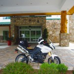
The greatest thing about the Hampton is location. Roll out the driveway and you’re on the ride. Go west through Cashiers and Highlands to ride Wayah Bald and the Nantahala Gorge. The roads to the north – well, every time I go though there I come back thinking I don’t get that way often enough, they are so nice. Head east, and you enter my favorite area in all the mountains, home to some of the best rides I know of. To the south, the twisties which lead into South Carolina are outstanding. Whitewater Falls,

Photo-entrance-hampton-inn-sapphire-nc

Put your bike here.

the highest in the east is just a short ride from the hotel. The Dragon at Deals Gap is about an hour away, though the roads which lead you to it will have you all warmed up and ready to go when you get there, then go on to tackle the Cherohala Skyway. The best section of the Blue Ridge Parkway is the closest. As I add all these up, staying here makes a lot of sense.

Photo-Charlies-Creek-Rd

One of the roads I took going home

The sales manager was a rider, so she knows you guys. You’re welcome here. I’ll be adding the Hampton Inn Sapphire to the maps ASAP. The more I think about it, the more sense it makes to plan a stay here. It’s a total immersion in motorcycle rider’s bliss – point your wheel in any direction and the good roads are right there.

SAVE 10% on weekends, SAVE 20% during the week – Call and ask for your Smoky Mountain Rider / America Rides Maps discount.

Hampton Inn and Suites Cashiers/Sapphire Valley, N.C
3245 US 64 East
Sapphire, NC 28774
http://www.hamptoncashiersnc.com


Photo-whitewater-falls-nc

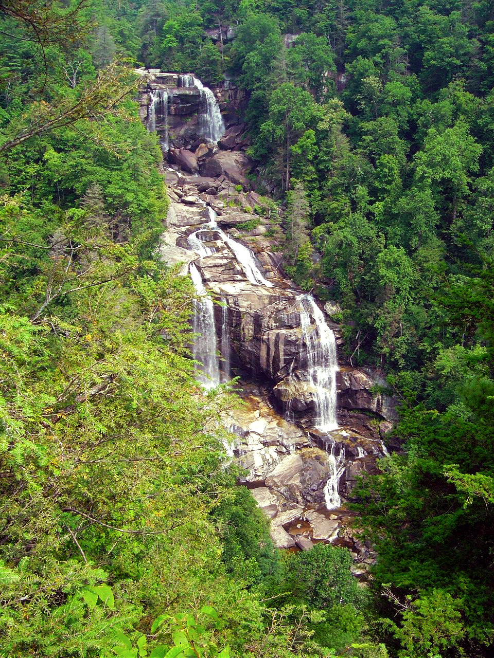
If waterfalls turn you on, you'll be in heaven. The Hampton sits at the heart of the "Land of the Waterfalls". Whitewater Falls, the highest in the east, is just a short ride, as are many others.

_______________________________________________________________________________

Wayne Busch
Wayne Busch – Cartographer
– Wayne Busch lives in Waynesville, NC, where he produces the most detailed and comprehensive and up-to-date motorcycle pocket maps of the Blue Ridge and Smoky Mountains to help you get the most of your vacation experience. See them here – AmericaRidesMaps.com 
Best Motorcycle Rides in North Georgia – digital soon?

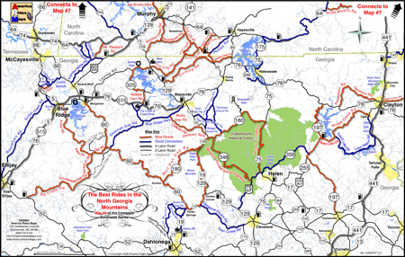
Wow! It’s taken me 18 months to completely revise and update all my Smoky Mountain / Blue Ridge motorcycle ride maps, but the last of them is done – Map #9 “The Best Rides in the North Georgia Mountains” has been released.

image-best-rides-in-the-north-georgia-mountains

Roads are really bold, map is easy to and quick to read. Road descriptions on back of map.

If you have one of my Georgia motorcycle maps you honestly don’t need to replace the map you have. I had almost all of the really outstanding Georgia motorcycle rides on the earlier version. I did find a couple more really nice north Georgia motorcycle rides on the periphery of the main area of the map as you make your way to the classic rides  – you’ve got to ride GA 60,  Blood Mountain area, and I love to play back and forth across the North Carolina state line.

image-georgia-motorcycle-map

Map #9 - The Best Rides in the North Georgia Mountains

So what’s the big deal? The reason this revision took so long was prepare the maps for digital use! I’ve looked at phone apps but decided the limiting factor in the mountains is reception. Live GPS positioning via phone just isn’t there yet for this region.

A solution I’ve been testing instead is map downloads which can be scaled and used from an ipad, ipod, iphone, or any other smart phone provided you’ve got a decent sized memory card. Got your phone? You’ve got your maps. It worked well on the ipad. I’ll be testing ipod, iphone, etc. next. If it goes well, you can expect to see them available in about 2-3 weeks.
So what about GPS? Next project. I have the software. I need the time.

See more about the new map here – goo.gl/ifTNr

_______________________________________________________________________________

Wayne Busch
Wayne Busch – Cartographer
– Wayne Busch lives in Waynesville, NC, where he produces the most detailed and comprehensive and up-to-date motorcycle pocket maps of the Blue Ridge and Smoky Mountains to help you get the most of your vacation experience. See them here – AmericaRidesMaps.com