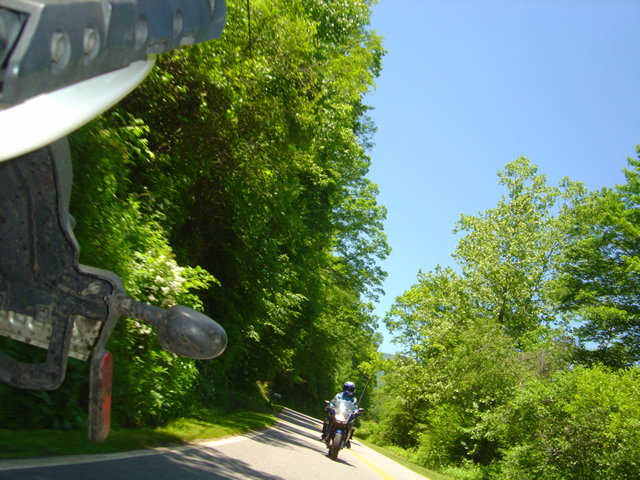
Good Motorcycle Rides – Little Savannah Road

This useful mountain backroad lets you bypass the traffic and congestion around Dillsboro, Sylva, and Cullowhee, NC.

Click to go to interactive map

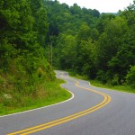
Little Savannah Road can save you time and give you a much better ride than the main roads. This two lane twisty backroad is a great way to link US 441 to NC 107 without passing through Dillsboro and Sylva. A short section of Webster Road (NC 116) completes the bypass.


Wayne BuschAmerica Rides Maps

Wayne Busch searches out the most entertaining roads in the Blue Ridge Mountains then records them on a series of maps which span the Blue Ridge Mountains.

There are more great motorcycle roads in the Blue Ridge and Smoky Mountains than anywhere else. I highlight the best roads then show you the best ways to connect them together into rides. More than a decade of searching has discovered more than 1000 good roads to enjoy. We continue to search so you may enjoy.

Review the maps, order online hereAmericaRidesMaps.com

This Good Motorcycle Ride and many others can be found on motorcycle ride maps –

Map #7 – The Best Motorcycle Rides Near Smoky Park – SOUTH

Map – 100 Great Motorcycle Rides in the Smoky Mountains

Map – 100 Rides in the Southern Blue Ridge

Map OR2 – The Best Unpaved Roads SOUTH of Smoky Park

Source: America Rides Maps Blog @ Miles-by-Motorcycle.com
https://miles-by-motorcycle.com/51999/blog/53224/good-motorcycle-rides—little-savannah-road

Motorcycle Friendly Places – Hampton Inn & Suites, Sapphire, NC

photo-US-64-view-Cashiers

One of my favorite views is just 10 mins from the Hampton.

Few places rival the beauty surrounding Sapphire, NC. The small town and those surrounding it host some of the most expensive real estate in the Blue Ridge Mountains. Flanked by massive granite balds, host to the Cullasja River Gorge with it’s many roadside waterfalls, and nestled amongst the wilds of several national forests with views that will take your breath away, the area is laced with outstanding motorcycle rides.

Photo-view-from-NC-215

Above the clouds on my morning ride

On any weekend, 2 lane US 64 throbs and buzzes with motorcycles who come to play on the wonderfully twisty and scenic roads. Of course other tourists come as well, and US 64 rarely gives the motorcycle rider the freedom to enjoy its serpentine turns to full delight as they insist you share the road. Few tourists ever venture off the main drag though, and the many back roads which course over the mountains and along the valley streams give the biker what he really came for – great rides with outstanding views devoid of traffic.

Photo-Hampton-Inn-Sapphire-NC

Hampton Inn & Suites, Sapphire, NC

Sitting in the heart of all this, the Hampton Inn & Suites in Sapphire makes an ideal place to base out of for an enjoyable stay while exploring all the region has to offer. Level parking, set back from the road, and close to good dinging and other amenities, the Hampton provides a quiet and relaxing place with a decor and atmosphere that reflects the quality of the surrounding area. I toured 3 different styles of room each of which deserves the descriptor – “posh”. I would be very happy to stay in any of them, it’s the kind of place I seek out in my travels.

Photo-lobby-at-hampton-inn-sapphire-nc

A comfortable place to gather and relax

It looks like an ideal place for those groups of motorcycle riders looking for a time they’ll remember fondly and come back to. 2 meeting rooms are available. The lobby is spacious and inviting, a good place to gather. All the amenities are at hand.

Photo-room-at-hampton-inn-sapphire-nc

Ride hard, rest easy.

The greatest thing about the Hampton is location. Roll out the driveway and you’re on the ride. Go west through Cashiers and Highlands to ride Wayah Bald and the Nantahala Gorge. The roads to the north – well, every time I go though there I come back thinking I don’t get that way often enough, they are so nice. Head east, and you enter my favorite area in all the mountains, home to some of the best rides I know of. To the south, the twisties which lead into South Carolina are outstanding. Whitewater Falls,

Photo-entrance-hampton-inn-sapphire-nc

Put your bike here.

the highest in the east is just a short ride from the hotel. The Dragon at Deals Gap is about an hour away, though the roads which lead you to it will have you all warmed up and ready to go when you get there, then go on to tackle the Cherohala Skyway. The best section of the Blue Ridge Parkway is the closest. As I add all these up, staying here makes a lot of sense.

Photo-Charlies-Creek-Rd

One of the roads I took going home

The sales manager was a rider, so she knows you guys. You’re welcome here. I’ll be adding the Hampton Inn Sapphire to the maps ASAP. The more I think about it, the more sense it makes to plan a stay here. It’s a total immersion in motorcycle rider’s bliss – point your wheel in any direction and the good roads are right there.

SAVE 10% on weekends, SAVE 20% during the week – Call and ask for your Smoky Mountain Rider / America Rides Maps discount.

Hampton Inn and Suites Cashiers/Sapphire Valley, N.C
3245 US 64 East
Sapphire, NC 28774
http://www.hamptoncashiersnc.com


Photo-whitewater-falls-nc

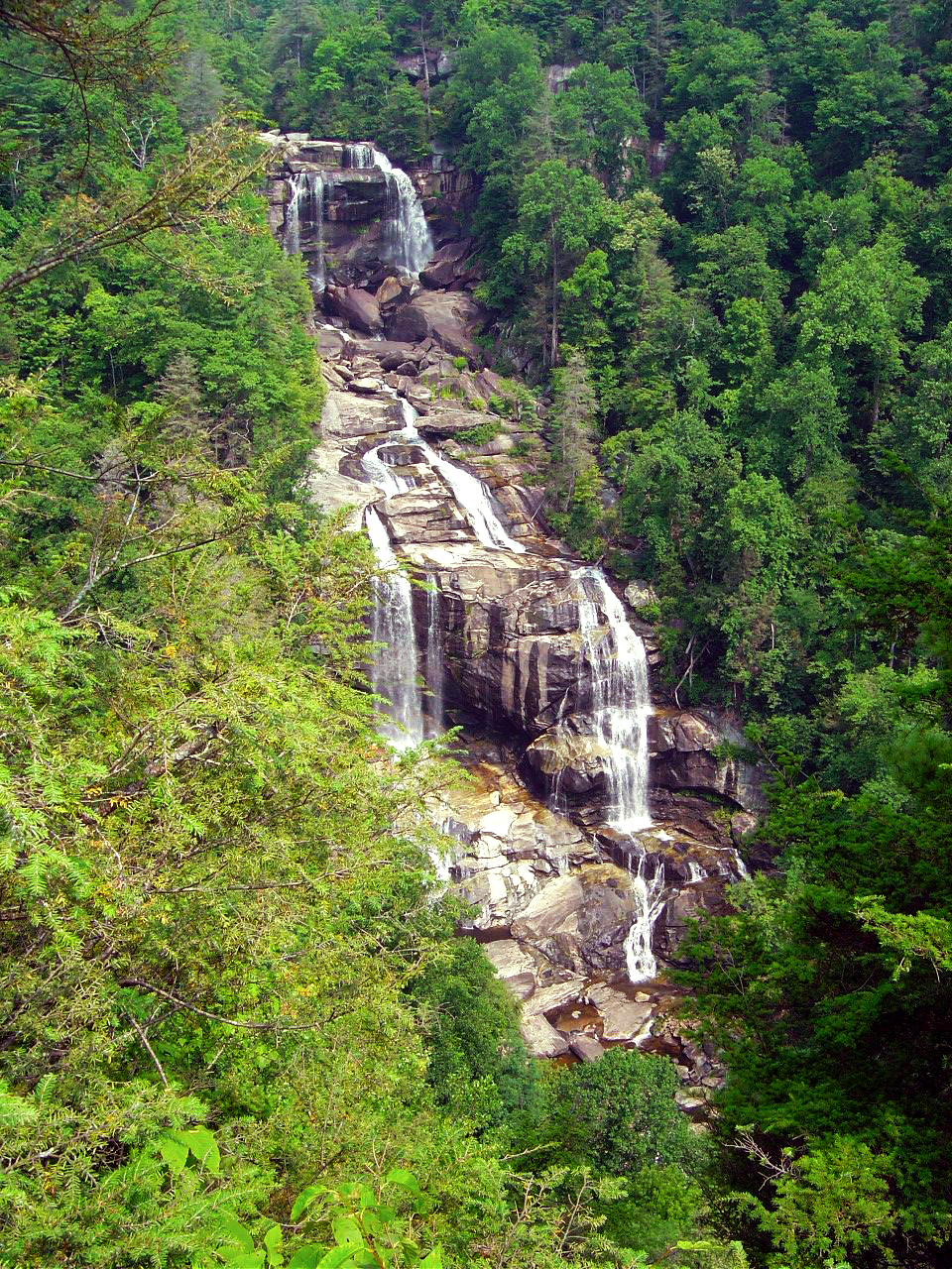
If waterfalls turn you on, you'll be in heaven. The Hampton sits at the heart of the "Land of the Waterfalls". Whitewater Falls, the highest in the east, is just a short ride, as are many others.

_______________________________________________________________________________

Wayne Busch
Wayne Busch – Cartographer
– Wayne Busch lives in Waynesville, NC, where he produces the most detailed and comprehensive and up-to-date motorcycle pocket maps of the Blue Ridge and Smoky Mountains to help you get the most of your vacation experience. See them here – AmericaRidesMaps.com 

Good News / Bad News at Onion Mountain Road Near Franklin

Photo - work on Onion Mountain road

For a road that is going nowhere, they are doing a nice job of getting you there. Lets hope they find the funds to finish it this year.

On my way back from Georgia I decided to make a detour to investigate the progress on Onion Mountain Road east of Franklin, NC. This is one of my “pet” roads, one I’ve been watching ever since they started paving it last year. The work completed prior to the winter shut down really got my hopes up that this ridge top two lane would eventually be completely paved once warmer weather returned. The good news is the crews are back at it.

The bad news though, puts a damper on the whole situation. I was excited to follow a dump truck up the winding road, though a little dismayed to see the weight of the passing trucks was already damaging what had been an excellent paving job. Proceeding out onto the gravel section (no change from where  it had begun last year), I soon ran into the work crew. They have no expectation to complete the paving all the way through this year, funding has been cut. Why they are bothering with what they are doing is a mystery to me, it will be just another road to nowhere.

I’ll keep watching. Once paved, Onion Mountain Road will link a number a great motorcycle roads and allow you to avoid pretty but heavily trafficked US 64. I went ahead and added more of the surrounding roads to my America Rides Maps motorcycle pocket map “The Best Roads South of Great Smoky Mountains National Park – WEST” and am considering adding a few more once I give them another look. We’ll see how things develop.

_______________________________________________________________________________

Wayne Busch

Wayne Busch - Cartographer


– Wayne Busch lives in Waynesville, NC, where he produces the most detailed and comprehensive and up-to-date motorcycle pocket maps of the Blue Ridge and Smoky Mountains to help you get the most of your vacation experience. See them here – AmericaRidesMaps.com


A Good Tip Leads to More Great Motorcycle Rides Near the Dragon

Droning west on the Great Smoky Mountains Expressway this morning, my mind tends to wander. The greatest challenge of the highway is simply maintaining the legal limit leaving plenty of brain cells free to engage in other things. My wife rides alongside on her Beemer so I have something to look at every once and a while and count my blessings of how fortunate I am to have someone like her to come along with me today. The thought that comes to the forefront is “Just how many motorcycles are there on the road?”

It was far easier to snap a photo on the rare straight stretches - overall the roads were wonderfully curvy.

As the main artery between the Blue Ridge Parkway and the Dragon at Deals Gap, it’s no wonder there are a lot of motorcycle riders on this stretch of highway 23 / 74. Both the Parkway and the Dragon draw millions of two wheeled vacationers to the area every year. Still, we’re a good bit east of Cherokee, the southern endpoint of the Blue Ridge Parkway, and within minutes we’ve passed scores of bikes headed in the opposite direction.

Photo-motorcycle-follows-nice-views

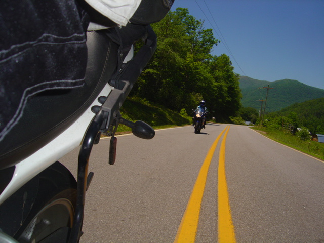
The roads we explored followed winding streams and creeks through rolling farm lands in a broad mountain valley. Plenty of great long range views.

We’re only going as far as NC 28 south today, about 45 minutes ride time to reach Lauada, and early on I wonder if we’ll pass 100 riders. I start to keep a loose count, but within 20 minutes or so it’s obvious the number will easily exceed that, and question answered, my mind drifts to other things. Turning off the highway onto two lane NC 28 we plunge south into the twisties and the bikes keep sweeping past us in the other direction.

Photo - Jackie rounds a curve

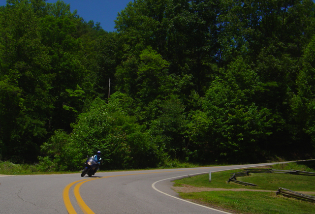
The pavement is generally excellent for back roads, and you can enjoy the ride with gusto. Just be wary for a little gravel now and then.

I’m following up on a tip from Brad at the Deals Gap Motorcycle Resort. I spent some time with him Friday and he suggested I revisit an area I’d previously sketched over. I knew there were a couple of nice rides hidden away around Franklin, but he hinted they could be linked together to make a nice route. I’d done some scouting on the way home that day, and I saw promise. Today was the day we’d put it all together and see if it added up to getting a place on my America Rides Maps.

Photo - Jackie leads

The only traffic we found was when we approached the main road. If you stick to the perimeter route you'll see very little if any and it's more curvy and fun.

It took about four hours for a thorough assessment. We checked out every one of the roads in the area, confirmed the unpaved areas remained so (I only focus on paved roads), the dead ends were still dead, and the links that joined the roads together followed a more or less natural flow or the turn points were easy enough to locate. When we completed our task, I had assembled an outstanding ride that will certainly be the next addition to America Rides Maps. I’ll add it tomorrow morning.

Photo - a day meant for riding a motorcycle

I highly recommend NC 28. These roads make it even better. Great to know when there's traffic. You can jump off and enjoy the ride again.

I make a claim to know almost every great motorcycle ride from North Georgia to North Virginia. While I can’t claim I know them all, I’ve just learned another, and we saw only one other bike the whole time we were exploring the area. Now that’s what I’m looking for.

America Rides Maps

New Rock Slide Affects Motorcycle Vacation Plans to Smokies

Add yet another rock slide to the long list of road closures in the mountains of western North Carolina and eastern Tennessee. This one in particular will affect many motorcycle vacation plans to visit one of the most popular and well known rides in the region, the infamous Tail of the Dragon on US 129 at Deals Gap. Located along the western border of Great Smoky Mountains National Park, the 13 mile stretch of US 129 with it’s 311 curves draws hundreds of thousands of motorcycle and sports car enthusiasts each year who come to experience the challenging stretch of road.

It’s been an exceptional year for rock slides in the Smokies, the most notable being the massive slide along the eastern edge of Great Smoky Mountains National Park which has closed Interstate 40 for months. With both the east and west routes around the park closed, the only route allowing north-south travel from Tennessee to North Carolina is US 411 which cuts through the heart of the park and it too has been the scene of slides. US 441 is presently open, though cleanup continues on the northern spur road.

The Tail of the Dragon is still accessible from the North Carolina side. From Tennessee, the best route is through Tellico Plains and onto the Cherohala Skyway. Expect increased traffic loads on TN 68 approaching Tellico Plains due to yet another rock slide on US 64-74 in the Ocoee River Gorge which has shifted traffic onto it. As far as I can tell, it is still possible to reach Pumpkin Center from Vonure on the north end of the Dragon via the popular Dragon – Cherohala loop ride. Still, even more traffic will now be using these roads and you may want to reconsider visiting the area until things improve.

I’ve been reporting on the status of all the rock slides and road closures in my newsletter which you’ll find archived here – http://budurl.com/3smm. As there are so many, so widely scattered, it may be the easiest place to find all the information without bouncing around to various DOT sites (they are rarely as up to date). With so much going on, I’ll probably post an extra edition or two to keep you apprised of the situation and help with your motorcycle vacation plans. There is a lot going on you need to be aware of including the progress on the clean up to the Blue Ridge Parkway after severe winter storm damage, the closed section there, and all the roads which have been closed in Great Smoky Mountains National Park for paving.

If you have early year travel plans to Robbinsville, Townsend, Gatlinburg, Pigeon Forge, Great Smoky Mountains National Park, or Franklin, I suggest you consider them carefully. Better alternative destinations for motorcycle touring would include Maggie Valley and Asheville. I’m am working with local lodgers to find you the best deals and affordable as well as luxury motorcycle friendly accommodations. I’ll be stepping up those efforts. Please email me for help. The changes in traffic patterns have severely impacted their business and there are some deals to be had. Watch the blog as I review them.

Finally, for America Rides Maps patrons, I want you to be aware these rock slides have impacted 3 of the 4 loop rides on the most popular map “Maggie Valley to Deals Gap and the Cherohala Skyway”. I strongly urge you to look at the “Waterfall Package” for the best alternative. These two maps will lead you into some of my favorite areas unaffected by the changing traffic patterns and open up a wealth of fantastic rides which are too often overlooked. These roads are the first place I head when looking for great riding, the first place I take tour groups, and hold everything you’ve come to expect from a motorcycle vacation in the Smokies.

Great New Motorcycle Road Still Waits Completion

Ahh, fresh tarmac. I wasn’t long into the serpentine climb up the mountain I realized this road was better than I’d expected. It had taken an hour to get here, but then I didn’t take the fastest route. Instead, I took the fun route, revisiting some of my favorite and most enjoyable rides on the southeast course towards Franklin, North Carolina. Taking the highway doesn’t save that much time anyway. There is no direct route from Waynesville to Franklin through the mountains of western North Carolina. There are no direct routes anywhere. That’s what makes it motorcycle heaven. You’re not going to save much time taking the four lane, might as well take the back roads and enjoy the ride.

Photo - A view of Onion Mountain Road

A section of Onion Mountain Road which has been paved.

I’d already accepted the disappointment that Onion Mountain Road was not yet completed having passed the eastern end of it on my way down. I could only afford a quick glance at the junction while keeping focus through the screaming tight descending hairpin curve, but even a brief view was enough to reveal this end was not yet paved. Knee down, bike laid over on the edge of the tires, it was far more important to concentrate on just how much throttle to roll on coming out of the turn before I  jumped to the other side of the motorcycle and laid it into the next curve. I was having way too much fun to circle back, I’d check it out from the other end.

Photo - Where the pavement ends and the road beyond

2.1 miles in the pavement ends but the roadbed has been laid. The remaining portion should see asphalt with warmer spring weather.

Every time I ride through here I find myself thinking I don’t come this way often enough. These roads are stellar in quality,  some of the most challenging found anywhere. There’s rarely anything you could call traffic. Most travelers choose the “main” roads to pass through this rugged area of high peaks and forests leaving the back roads delightfully empty and welcome to enjoy at your own comfortable pace.

I turned west when I reached US 64 the principle east-west route through the area and headed towards Franklin, then turned north on 441 to make my approach to Onion Mountain Road and select the best connections. The detour and construction signs were still up, though obscured by black plastic now that the road was open to traffic again. Another hint the project was still in the works. While I’d hoped to find it completed, the road reports were cryptic in saying the road would be closed for paving until December.  Once the cold weather sets in, the asphalt plants shut down. Come spring, they’ll pull the plastic off the signs and resume work (I hope).

I assume the situation will be similar to the section of NC 281 which was paved last year and is now part of one of my favorite loop rides. They get as much done as they can preparing the roadbed before winter. When things warm enough, it’s fairly quick work to come back and lay down the asphalt. Judging by what they’ve done so far, it’s going to be eagerly awaited. It’s the prep work that takes the time, cutting into the embankments and filling the road, adding culverts and bridges where needed.

Photo - A view from the roadside.

The panoramic views are some of the best found in the area. They should get even better higher up.

Only 6.2 miles long, you might wonder why I’m so excited about this road. It’s isolated from any towns, just a remote section going from nowhere to nowhere else. Once fully paved, it will make a strategic connection between other great rides that will allow you to avoid the traffic on US 64 and open options to link them together, more ways to bypass the four lane highway and town traffic. There’s that, and then there’s the road itself. Making the climb up Onion Mountain is one beautiful arc after another. As you gain altitude the road frequently follows a narrow ridge dropping precipitously on both sides. The views, especially with the leaves off the trees are some of the best panoramic sights in the region.  It will be one of those roads where you pull over and take out the camera to remember it. When coupled with the other fabulous rides in the  surroundings,  it will be one you not only treasure but want to come back to and ride again.

2.1 miles of it are paved, then it abruptly turns to gravel. I didn’t ride it through, though I could see the 4.1 mile section remaining had been prepped. From the end of the paved section it continues to climb up the mountain and I expect the views will get even better. I’ll keep watching it for progress and make another visit in the spring. As soon as it’s ready, I’ll add it to the map of this area with the best connecting roads, probably another 15 miles of great riding for you to enjoy. With luck, it will be climbing the list of classic rides by summer and I’ll be frequenting the area more often.

Wayne Busch - AMERICA RIDES MAPS

Wayne Busch – AMERICA RIDES MAPS

Wayne@americaridesmaps.com

>> Go to America Rides Maps.comhttp://americaridesmaps.com