How to Make a good Deals Gap Motorcycle Ride Better –

Adding these two roads to one of the four most popular Smoky Mountain motorcycle loop rides near the The Dragon at Deals Gap makes the least of them measure up to the others.

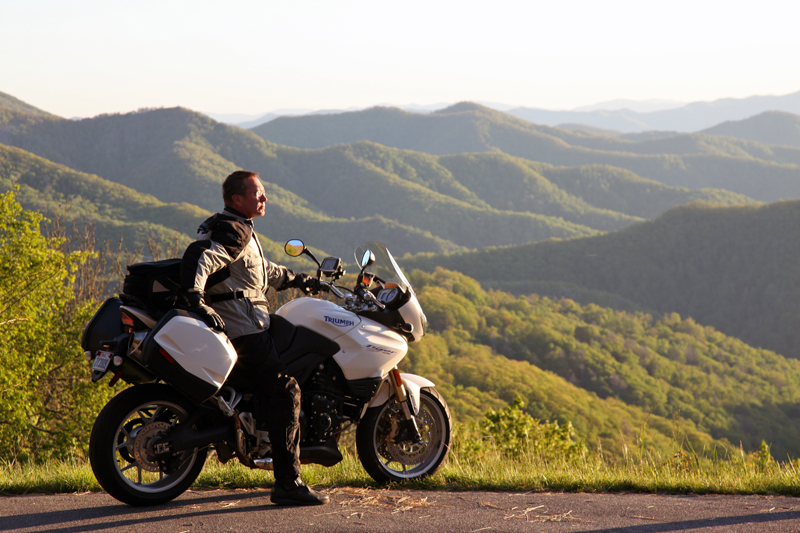
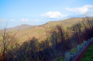
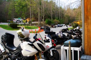
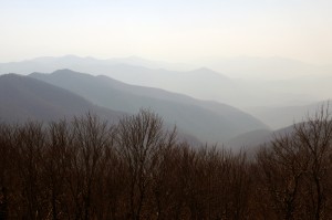
Photo - morning on the Cherohala Skway

Morning on the Cherohala Skyway. I'm parked on the state line between North Carolina and Tennessee.

Smoky Mountain / Blue Ridge motorcycle riders who flock to ride The Dragon at Deals Gap typically take in other rides when in the area. One of the best Smoky Mountain motorcycle rides is a loop through Vonore and Tellico Plains, TN to take in the Cherohala Skyway. Another popular circuit is to loop around Great Smoky Mountains National Park crossing through the heart of the Smoky Mountains on US 441. A third great loop ride links NC 28 at Franklin, NC to Nantahala Gorge via Wayah Road. All of these are great loop rides in the Blue Ridge with unique characters.

The fourth most popular ride is to take the Cherohala Skyway west to Tellico Plains, then go south on TN 68. You then use TN 123 / NC 294 to head east, and follow US 74 / 129 north through the Nantahala Gorge to return to The Dragon at Deals Gap. This loop ride starts out with the outstanding scenery and enjoyable sweeping curves of the 50 mile long Cherohala Skyway as it crosses the Snowbird Mountain Range of the Blue Ridge. It gets nice again once you enter the curvy sections a few miles south of Tellico Plains on NC 68. It’s gets better and better the further south you go, though NC 68 can carry a bit of traffic on weekends.

Photo - Field of the Woods

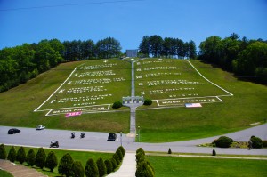
The 10 Commandments at Fields of the Wood - big enough God can read them

Once you turn east on TN 123 / NC 294, the ride is still pretty good, but the road opens up and the ride is not as scenic and challenging as you progress. Here’s how to punch it back up to outstanding.

Watch for Fields of the Wood, it’s the closest landmark to the turn off onto Hiawassee Dam Access Road. Fields of the Wood is worth a stop to see and a nice place for a break. Those with devout religious leanings will be inspired by the hillside with the ten commandments written out in stone, as well as numerous other Biblical icons and monuments. For those inspired more by hellacious and challenging roads, Hiawassee Dam Access Road is next leading to devilish twists and curves.

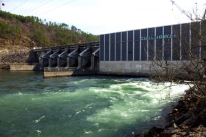
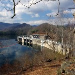
Photo - Hiawassee Dam

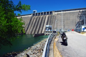
The Hiawassee Dam is a nice spot for a break.

Turn onto Hiawassee Dam Access Road to start the fun. You may encounter a little traffic approaching the dam on weekends as many come for boat access to the lake and river. Once past the dam, the excellent and challenging road continues a course around the west side of the lake. Turn right onto Joe Brown Highway when you reach the end of Hiawassee Dam Access Road.

Joe Brown Highway is hardly what any of us think of when the word “highway” comes to mind. This isolated and remote twisty two lane back road is packed with curve after curve and some pretty decent Smoky Mountain scenery, though you’ll be paying more attention to the road than the horizons. It’s a whole lot of fun, usually carries very little traffic, and may be the best section of the entire loop, a nice contrast to the sweeping curves of the Cherohala Skyway.
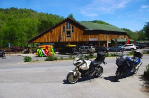
Photo - Nantahala Outdoor Center

The Nantahala Outdoor Center on the river is another great break spot with bathrooms, good food, nice views, and the place to arrange a river trip.

Joe Brown Highway runs you right through downtown Murphy, NC to intersect US 129 / 74 at the junction with US 64 East. Turn north to follow the four lane to Andrews where it funnels down to two lanes again for the ride through scenic Nantahala Gorge. You’re bound to run into traffic in Nantahala Gorge, but the scenery along the popular whitewater river makes up for it. Avoid the gorge on weekends when possible as the buses hauling rafters and kayakers tend to bottle things up.

Once through Nantahala Gorge, turn left onto NC 28 and back into the twists and curves to return to The Dragon at Deals Gap.
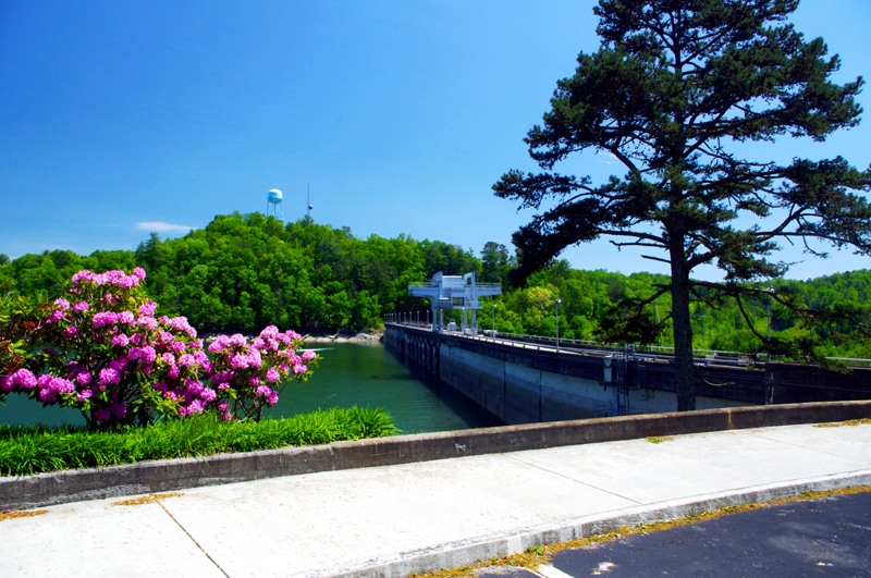
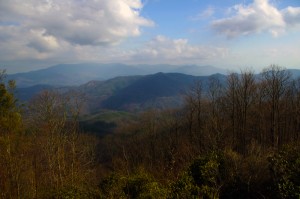
Photo - View from Hiawassee Dam Overlook

There are nice spots for a break both atop and below the Hiawassee Dam. The road runs across it then continues around the lake.

_______________________________________________________________________________

Wayne Busch
Wayne Busch – Cartographer
– Wayne Busch lives in Waynesville, NC, where he produces the most detailed and comprehensive and up-to-date motorcycle pocket maps of the Blue Ridge and Smoky Mountains to help you get the most of your vacation experience. See them here – AmericaRidesMaps.com 
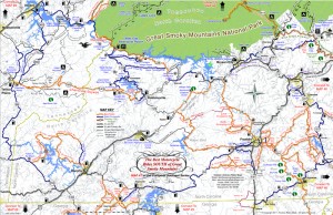
New Map – The Best Motorcycle Rides SOUTH of Great Smoky Mountains National Park

Image - View of Map

Map #7 - The Best Motorcycle Rides South of Great Smoky Mountains National Park

I’m proud to announce the release of America Rides Maps latest compilation of great motorcycle rides in the Blue Ridge Mountains and the final map to complete a series of three maps which detail close to 200 good motorcycle roads surrounding Great Smoky Mountains National Park.

Map #7, The Best Roads South of Great Smoky Mountains National Park, covers the region west from Maggie Valley, North Carolina, to Tellico Plains, Tennessee, extending south to cross the borders into South Carolina and Georgia. More than 30 of the roads rate being listed as outstanding rides highlighted in red, and another 20 are shown as great connecting roads highlighted in blue to link them all together.  The Best Roads South of Great Smoky Mountains National Park includes a guide to 9 roadside waterfalls, numerous out-of-the-way gas stations, sights and attractions, and motorcycle friendly locations.

dragon-motorcycles

Motorcycles flock to ride the Dragon at Deals Gap

This is THE MAP for motorcycle riders making a trip down the Blue Ridge Parkway then on to the Dragon at Deals Gap.

It includes the final sections of the Blue Ridge Parkway into Cherokee, North Carolina, the popular 125 mile long Dragon /  Cherohala Skyway loop ride, the Nantahala River Gorge, Wayah Bald, the Cullasaja River Gorge, a surprising wealth of hidden back roads near Franklin, NC, and variations on rides surrounding the Dragon at Deals Gap few ever discover.

The Smoky Park Motorcycle Map Series includes –

Nearly 200 roads are described in this map package which weave through some of the highest mountains in the east, cross extensive scenic national forests and park lands, see dozens of roadside waterfalls, including every ride within Great Smoky Mountains National Park, it’s the most extensive and comprehensive collection of great motorcycle rides in this area ever assembled.


Photo by Jim Miller Photography

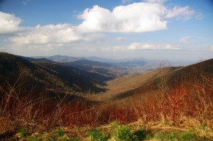
Photo by Jim Miller Photography - This area is so remote and wild you'll find hundred mile views with no evidence of human occupation to be seen.


“This map takes my best selling map, combines it with another, and adds new roads I’ve discovered to make the ultimate map for visitors to the Dragon at Deals Gap, it’s all you need!”

_______________________________________________________________________________

Wayne Busch
Wayne Busch – Cartographer
– Wayne Busch lives in Waynesville, NC, where he produces the most detailed and comprehensive and up-to-date motorcycle pocket maps of the Blue Ridge and Smoky Mountains to help you get the most of your vacation experience. See them here – AmericaRidesMaps.com 
The Birthplace of Tennessee – Best Seen on a Motorcycle

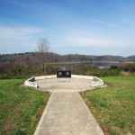
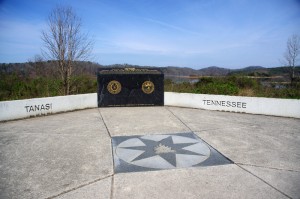
Photo - marble campfire

Who knows where this is?

It was the middle of nowhere yet it was the center of everything. I’d stumbled upon the birthplace of Tennessee.

I had low expectations. My research told me most of the roads I’d be riding today would hold little interest to the typical motorcycle rider who had come to ride The Dragon at Deals Gap and the Cherohala Skyway. None of the roads I’d ride on my 450+ mile travels would come anywhere close to those legends. Still, the morning held a surprise I never expected and made the efforts worthwhile.

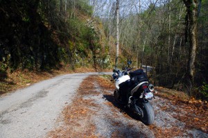
Photo - Cherokee National Forest Road

Parked along Pleasant Mountain Road. It's typical of other roads nearby - of little interest to most. Still I check them all.

Arriving in Tellico Plains, Tennessee, after an early morning motorcycle ride where I’d had the whole of the Cherohala Skyway to myself, I pointed my wheel north onto TN 360 and my workday began. Within a few miles I’d reach the point where I’d previously abandoned my search for great motorcycle rides and the explorations would resume. Rounding a curve a green street sign flashed past with a name I recognized and I clamped on the brakes to swing around.

I could rule this road out as soon as I saw it, it was doubtful it would be of any interest. Consulting my map, I saw it connected to another I wanted to investigate, so I snicked into first gear determined to make quick work of White Plains Road and move on.

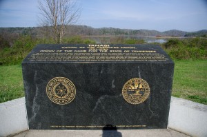
Photo - Tanasi Monument

The Tansi Monument - Tennessee gets it's name from here

It met Smoky Branch Road in a few miles where they both intersected Citico Road. I’d eventually loop back through Smoky Branch Road, also of little interest. Obviously Citico Road was the daddy in this area, the main thoroughfare of better quality, decent pavement, and sporting a faded double yellow line, a proper road.

I expected it would quickly peter out, but after several miles it continued to wind and snake through the mostly bland countryside and I started to wonder if it actually went somewhere in the big empty white space on the map. Curiosity aroused, I couldn’t resist investigating the Tanasi Memorial Site when the sign appeared.

Photo - Tanasi Monument

The empty and isolated setting quickly fills with visions of what must have been

Never heard of it. Turning the motorcycle onto Bacon Ferry Road I ventured out into the nothingness on the barely paved bumpy and potholed  single lane that led out onto a low finger of land surrounded by Tellico Lake. I rode past the pull-off, but a quick glance towards the lake had me circling back when I saw the shoreside monument.

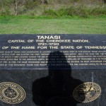
Photo - Tanasi inscription

Inscription transcribed below

Tanasi

Capital of the Cherokee Nation

1721-1730

Origin of the Name for the State of Tennessee

The site of the former town of Tanasi, now underwater, is located about 300 yards west of this marker. Tanasi attained political prominence in 1721 when its civil chief was elected the first “Emperor of the Cherokee Nation”. About the same time, the town name was also applied to the river on which it was located. During the mid 18th century, Tansi became overshadowed and eventually absorbed by the adjacent town of Chota, which was to the immediate north. The first recorded spelling of Tennessee as it is today occured on Henry Timberlakes map of 1762. In 1796, the name Tennessee was selected from among several as most appropriate for the nation’s 16th state. Therfore, symbolized by this monument, those who reside in this beautiful state are forever linked to its Cherokee heritage.

Pho

Cherokee Tanasi to Tennessee - State. A heritage preserved and honored.

I don’t much adhere to theories of “vortexes” or spirituality, but there’s something about this site that is powerful enough to make it worth a visit, it will be on the new map. It’s worth the ride out to it. See it if you have the chance.

_______________________________________________________________________________

Wayne Busch
Wayne Busch – Cartographer
– Wayne Busch lives in Waynesville, NC, where he produces the most detailed and comprehensive and up-to-date motorcycle pocket maps of the Blue Ridge and Smoky Mountains to help you get the most of your vacation experience. See them here – AmericaRidesMaps.com 
Motorcycle the Dragon, the Cherohala Skyway, the Blue Ridge Parkway in one day

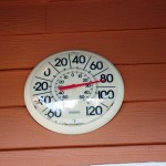
Photo - Thermometer at Deals Gap Motorcycle Resort

Thermometer at Deals Gap Motorcycle Resort

It was 80 degrees when I pulled up at the Deals Gap Motorcycle Resort yesterday at 5 PM with over 400 miles of Smoky Mountain motorcycle rides already behind me. 8 hours ago I was on the Cherohala Skyway as the soft morning glow and gusty winds made the lonely road seem like it was in another world.  I decided to make the day a trifecta and go home via the Blue Ridge Parkway. It’s hard to believe it’s still March, early spring has arrived!

Photo - morning on the Cherohala Skway

Morning on the Cherohala Skyway. I'm parked on the state line between North Carolina and Tennessee.

I had reservations about going out today, I’d been putting it off. I knew I would not find many good motorcycle rides in the areas I was searching. It was either too far out of the mountains or too far to into them. I was hitting the single lane back roads in the National Forests near The Dragon at Deals Gap and the Cherohala Skyway,  as well as the best ways to pass through the semi-urban areas to the north.

Photo - marble campfire

Who knows where this is?

I found something cool out in the Cherokee National Forest that will get it’s own motorcycle blog post shortly. One of the more useful things I discovered is one of the most direct ways to connect The Dragon at Deals Gap to I-75 south of Lenoir City.

Photo - Cherohala Skyway View

A long view of the Cherohala Skyway as it winds into Tennessee

I suspect many riders follow US 129 to Maryville, then take US 321 north when headed for the Interstate. There is  a way to minimize the traffic and avoid more than half of the four lane US 321.

Take TN 72 north from The Dragon at Punkin Center. When you reach US 411, cross it onto the East Coast Tellico Parkway and follow it along the lake area. It will become Axely Chapel Road at the north end and will intersect US 321. These are not outstanding motorcycle rides, but they are a heck of a lot better than the alternatives and get you off the four lane on some scenic and curvy motorcycle roads.

Photo - Calderwood Lake

Calderwood Lake is one of several along US 129

I don’t really care much for riding in this area, but it’s only because there are so many really great motorcycle rides once you get in close to Great Smoky Mountains National Park. It’s hard to shine when pitted against them.

I’ve been mostly focusing on find the connections between the better rides so you can link them together. If you have the time when passing through, they are the most enjoyable motorcycle rides I can find for those who would rather stay on the back roads and savor them. The views are certainly more entertaining. Watch out for turkeys in the road.

Photo - Chillowhee Dam

How many of you have seen the Chillowhee Dam from this side?

My “wake up and dream” cruise on the smooth and sweeping curves of the Cherohala Skyway was the highlight of the morning.  The rest of it was on a web of roads which weave through the more remote and rugged sections of the national forest. A few of them start out as decent paved roads, but quickly diminish to single lane unmarked trails that become more potholed and full of gravel as you go. On most, the pavement ends long before the road does.

Photo - motorcycles at Delas Gap Motorcycle Resort

5 PM on a Tuesday evening in late March at the Deals Gap Motorcycle Resort

I’ll need at least one more good day to cover this area as thoroughly as I’d like. I’ve hit almost all the roads. The challenge now is how they work together to become the best motorcycle rides through the area, how well do the linked roads flow, can I find ways to make the good motorcycle rides last longer?

I know I can!

(Click on photos for larger views)
_______________________________________________________________________________

_______________________________________________________________________________

Wayne Busch
Wayne Busch – Cartographer
– Wayne Busch lives in Waynesville, NC, where he produces the most detailed and comprehensive and up-to-date motorcycle pocket maps of the Blue Ridge and Smoky Mountains to help you get the most of your vacation experience. See them here – AmericaRidesMaps.com 

My Search for the Best Mountain Motorcycle Rides Never Ends

Photo - Maple Springs Observation Point

The Maple Springs Observation Point - accessed from Santeetlah Rd

Friday’s search for great Smoky Mountain motorcycle rides, which culminated with a spirited cruise on the Cherohala Skyway, was one of those days that might be looked on as not so productive. It’s not that I didn’t catalogue some good mountain motorcycle riding roads, I added several which will appear on my new map of the area. In my quest to leave no stone unturned, much of the 400 miles I covered was spent on roads which only the most adventurous would bother to travel. Still, there are sights and places some may wish to see, and I’m determined to find as many of them as I can.

Photo - Cherokee National Forest View

View from the Maple Springs Observation Point. I was told you can see 5 states from this spot.

Considering the number of motorcycle riders who are drawn to the area by such notable roads as The Dragon at Deals Gap, the Cherohala Skyway, The Tennessee Foothills Parkway, NC 28 (now renamed “the Moonshiner 28“), finding others that compare in quality is pretty much futile. These are some of the best motorcycle rides in the world. I’m not holding my breath thinking I’m going to discover the next great classic motorcycle ride. So why go to all this effort?

Photo - Santeetlah Dam

Quiet morning at the Santeetlah Dam

There are probably millions of motorcycles that pass through here each year. In most cases, they come, they ride the famous roads, get the t-shirt, then they’re gone to other places following the crowds. It’s the notable roads that get all the attention. Once experienced, it’s back on the four lane or the congested tourist arteries to reach the next great spot. You can rack up a lot of miles playing connect-the-dots, though those droning plods on the connections are the price you pay to reach those popular motorcycle rides.

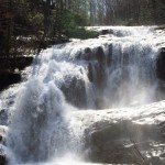
Photo - Bald River Falls

Bald River Falls

It doesn’t have to be that way. I’m filling in the gaps between the famous motorcycle rides with the best quality rides I can find so connecting the dots is as much of an adventure as the roads you’re trying to reach. Where others might show you one good way to get from point A to point B, I look for all the best ways.

Photo - Cherohala Skyway View

View from the Cherohala Skyway. The Smoky Mountains were especially smoky today and I'll get more photos another time.

Who want’s to spend their time on the 4 lane or in bumper to bumper tourist traffic when there are so many empty two lane scenic and challenging mountain roads that get bypassed? It’s often as simple as crossing over to the next valley to escape the congestion. One little turn can make the difference between cruising along with the wind in your face or cursing the throngs of dawdling codgers, gawking sightseers, lumbering RV’s, and belching commercial trucks struggling up the grades to deliver their wares.

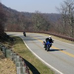
Photo - Motorcycles on the Cherohala Skyway

Bikes on the Cherohala Skyway

I’ve catalogued more than 100 good motorcycle roads so far surrounding Great Smoky Mountains National Park. I’m not done yet. Some of these are outstanding rides. Others will satisfy those looking for adventure. All of them avoid most everyone else who’s come to enjoy the Smoky Mountains just like you and take you to the places they’ll never see while getting you where you want to be.

Keeping you going is what keeps me going. I’m closing in on finishing the map of the Best Motorcycle Rides North of Great Smoky Mountains National Park. Stay tuned and see what I discover. It’s all for you. (Click on the photos for the large versions)


http://www.youtube.com/watch?v=xBbQfR2GqMc

_______________________________________________________________________________

Wayne Busch
Wayne Busch – Cartographer
– Wayne Busch lives in Waynesville, NC, where he produces the most detailed and comprehensive and up-to-date motorcycle pocket maps of the Blue Ridge and Smoky Mountains to help you get the most of your vacation experience. See them here – AmericaRidesMaps.com 
 

New Rock Slide Affects Motorcycle Vacation Plans to Smokies

Add yet another rock slide to the long list of road closures in the mountains of western North Carolina and eastern Tennessee. This one in particular will affect many motorcycle vacation plans to visit one of the most popular and well known rides in the region, the infamous Tail of the Dragon on US 129 at Deals Gap. Located along the western border of Great Smoky Mountains National Park, the 13 mile stretch of US 129 with it’s 311 curves draws hundreds of thousands of motorcycle and sports car enthusiasts each year who come to experience the challenging stretch of road.

It’s been an exceptional year for rock slides in the Smokies, the most notable being the massive slide along the eastern edge of Great Smoky Mountains National Park which has closed Interstate 40 for months. With both the east and west routes around the park closed, the only route allowing north-south travel from Tennessee to North Carolina is US 411 which cuts through the heart of the park and it too has been the scene of slides. US 441 is presently open, though cleanup continues on the northern spur road.

The Tail of the Dragon is still accessible from the North Carolina side. From Tennessee, the best route is through Tellico Plains and onto the Cherohala Skyway. Expect increased traffic loads on TN 68 approaching Tellico Plains due to yet another rock slide on US 64-74 in the Ocoee River Gorge which has shifted traffic onto it. As far as I can tell, it is still possible to reach Pumpkin Center from Vonure on the north end of the Dragon via the popular Dragon – Cherohala loop ride. Still, even more traffic will now be using these roads and you may want to reconsider visiting the area until things improve.

I’ve been reporting on the status of all the rock slides and road closures in my newsletter which you’ll find archived here – http://budurl.com/3smm. As there are so many, so widely scattered, it may be the easiest place to find all the information without bouncing around to various DOT sites (they are rarely as up to date). With so much going on, I’ll probably post an extra edition or two to keep you apprised of the situation and help with your motorcycle vacation plans. There is a lot going on you need to be aware of including the progress on the clean up to the Blue Ridge Parkway after severe winter storm damage, the closed section there, and all the roads which have been closed in Great Smoky Mountains National Park for paving.

If you have early year travel plans to Robbinsville, Townsend, Gatlinburg, Pigeon Forge, Great Smoky Mountains National Park, or Franklin, I suggest you consider them carefully. Better alternative destinations for motorcycle touring would include Maggie Valley and Asheville. I’m am working with local lodgers to find you the best deals and affordable as well as luxury motorcycle friendly accommodations. I’ll be stepping up those efforts. Please email me for help. The changes in traffic patterns have severely impacted their business and there are some deals to be had. Watch the blog as I review them.

Finally, for America Rides Maps patrons, I want you to be aware these rock slides have impacted 3 of the 4 loop rides on the most popular map “Maggie Valley to Deals Gap and the Cherohala Skyway”. I strongly urge you to look at the “Waterfall Package” for the best alternative. These two maps will lead you into some of my favorite areas unaffected by the changing traffic patterns and open up a wealth of fantastic rides which are too often overlooked. These roads are the first place I head when looking for great riding, the first place I take tour groups, and hold everything you’ve come to expect from a motorcycle vacation in the Smokies.

Looking For Motorcycle Adventure? See The Wild Smoky Mountains With GSM Moto Rent

http://www.youtube.com/watch?v=GcAgqmGpiZk

Remember all that fun you had as a kid learning to ride on that dirt bike? Maybe you’ve dreamed of challenging the wilds like Charlie and Ewan, taking the Long Way Round ? Already riding a dual sport bike and looking for motorcycle adventure? Whether you prefer just tooling along on the pavement, groomed fire roads, or gnarly single track trails, you can find them near Townsend, Tennessee.

GSMmotoRent offers dual sport motorcycle rentals, guided & self guided tours and cabin rental on the Little River: All within a half mile of the Great Smoky Mountains National Park.

We invite you to ride some of the greatest paved and gravel roads around! Everyone knows about our great roads in East TN and Western NC, such as the Tail of the Dragon, Blue Ridge Parkway, and Cherohala Skyway, all within an hour or less from our base in Townsend, TN.

But if you want to really avoid the crowds and get in some great motorcycle riding off the beaten path– let GSMmotoRent help. Our fleet includes Kawasaki KLR 650’s, Suzuki DR 650 and 200’s. We can provide the equipment, and with our knowledge of the area provide you with the best routes that fit your needs. On-site river front cabin rental is available as well as transportation to and from the Knoxville, TN regional airport. We also offer secure storage for your bike: short or long term.

The bikes were in great shape and well maintained. We had an unbelievable day riding 180 miles of excellent paved and unpaved roads in and around Smoky Mountain National Park. We arrived back at GSM in the late afternoon very happily tired. We all agreed it was one of the most enjoyable motorcycling days we’ve ever had. This was our first experience with GSM MotoRent and it could not have been better. Dan and Debbie are wonderful people and run a top-notch outfit. Thanks,
Joe Nardy

http://www.youtube.com/watch?v=1Tb1CIolSOw

Visit http://gsmmotorent.com
CALL US AT 865-448-6090