100 Best Motorcycle Rides in the Smoky Mountains

Motorcycle Map – Best Motorcycle Rides in the Smoky Mountains

America Rides Maps announces its first large format motorcycle ride map. Available in 24 x 36 inch and 31 x 48 sizes.

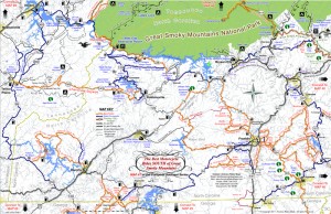
Image of map the Best Motorcycle Rides in the Smoky Mountains

Image of map the Best Motorcycle Rides in the Smoky Mountains - B&W version. Click for a closer look at all the detail!

The only map of its kind, The Best Motorcycle Rides in the Smoky Mountains highlights more than 100 of the best motorcycle rides and more than 50 good connecting roads to tie them all together into endless loops and touring routes.

This map is produced in Black & White  so YOU CAN CUSTOMIZE IT to fit your needs. Use colored markers to highlight where you’ve been or lay out where you want to go.

Santa - great gift ideaPlaning your motorcycle vacation trip has never been easier!

Hang it on the wall to show all the places you’ve been on your motorcycle vacation tours.

Got a favorite place to stay in the Smokies? Discover all the hidden riding nearby. Make the best use of your riding time, ride on on all the best roads,  avoid traffic and congestion.

$24.99 price includes free shipping and handling – First Class US Mail – average 2-3 day delivery. Ships unfolded.

Read more and order here: 

 The Best Motorcycle Rides in the Smoky Mountains

http://shop.americaridesmaps.com/The-Great-Motorcycle-Rides-of-the-Smoky-Mountains-BW-NC023BW.htm

Curious? Need more info? Email info@americaridesmaps.com

_______________________________________________________________________________

Wayne Busch

Wayne Busch - Cartographer

– Wayne Busch lives in Waynesville, NC, where he produces the most detailed and comprehensive and up-to-date motorcycle pocket maps of the Blue Ridge and Smoky Mountains to help you get the most of your vacation experience. See them here – AmericaRidesMaps.com
 

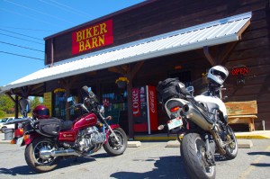
Georgia’s Premier Motorcycle Ride & The Biker Barn

photo-The-Biker-Barn

The Biker Barn - The Gauntlet Headquarters

I’ve long had an affection for the motorcycle rides of north Georgia and now some of the best of them have been linked into a 133 mile long loop ride known as “The Gauntlet“. As it has gained notoriety, visitors from across the nation, even around the world have begun to flock to enjoy this serpentine romp through the hills and mountains of the Peach State.

Conceived and promoted by The Lodge at Copperhead and The Biker Barn near Blairsville, The Gauntlet strings together such notable rides as GA 60, GA 180, US 19 / 129, and others, routing you near or through Suches, Helen, Hiawasee, and Blairsville on roads which have long been favorite destinations for the two wheeled tourist.

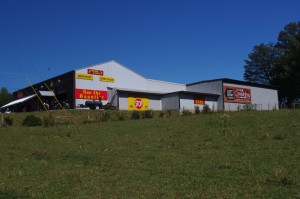
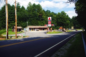
Photo-The-Biker-Barn-road-view

The Biker Barn is easy to find with gas nearby

For those approaching the Blue ridge Mountains from the south on their way to such legendary rides as the Cherohala Skyway and the Dragon at Deals Gap in Tennessee and North Carolina, The Gauntlet adds another classic and outstanding adventure to their touring itinerary. For those who come to play in the Smoky Mountains from the north, the Gauntlet gives them ample reason to make the quick hop across the southern border into Georgia’s motorcycle playground.

Yesterday, I took a ride down meet Lori and Brad Betters at The Biker Barn near Blairsville, the headquarters for your Gauntlet memorabilia and and souvenirs and purveyors of motorcycle gear and supplies. Located at one of the junctions on The Gauntlet loop marked by a traffic light with a convenient gas station nearby, The Biker Barn is one of those must-do pit stops on the challenging ride.

Photo-The-Biker-Barn-inside

The Biker Barn has what you need and what you want

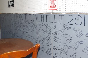
This popular rest stop at The Biker Barn is one of several gathering spots along the ride. There’s a “hang out” for bikers around the back side of the store where you can write your name on the wall with those who have come before you and leave your mark along with others from as far away as Alaska and beyond.

The well equipped store includes several versions of some very nice Gauntlet T-shirts, as well as leather wear, helmets, gear, and supplies. They also have an assortment of quality motorcycle trailers on hand if you’re looking for options to haul your bikes.

Photo-The-Biker-Barn-wall

Ride the Gauntlet and add your name to the wall at the Biker Barn

Of course they have maps and other info, and work in partnership with The Lodge at Copperhead which offers outstanding accommodations in the area.


The Biker Barn

The Lodge at Copperhead


Download a map of The Gauntlet here – http://www.gauntletga.com/downloads/Gauntlet_printable_map.pdf

_______________________________________________________________________________

Wayne Busch

Wayne Busch - Cartographer

Total Rider Tech Logo

Learn Total Control

– Wayne Busch lives in Waynesville, NC, where he produces the most detailed and comprehensive and up-to-date motorcycle pocket maps of the Blue Ridge and Smoky Mountains to help you get the most of your vacation experience. See them here – AmericaRidesMaps.com

Wayne is an advanced motorcycle instructor for Total Rider Tech teaching Lee Parks Total Control Advanced Rider Courses. It’s time you looked into advanced rider training to ride more confidently and safely, it will change your mountain riding experience. It worked so well for me I became an instructor! Total Rider Tech

_______________________________________________________________________________

You’ll find the roads of The Gauntlet and many more of north Georgia’s finest rides on America Rides Maps #9 – The Best Rides in the North Georgia Mountains


Another Great Smoky Mountain Motorcycle Ride

photo-silversteen-rd-meets US-64

The junction with US 64 is marked by a Citgo Station

Silversteen Road is one of those roads  you want to keep in your pocket – it’s almost so good I’ve been tempted to keep it to myself. But after riding it again this week, I’ve just got to share it so you can enjoy it too.

Silversteen Road intersects US 64 between Rosman and Sapphire, NC. The junction is well marked by a convenient landmark gas station. About half way through Silversteen Road, it makes a turn so sharp it doubles back on itself where it meets Macendonia Church Road. If you don’t make the turn to stay on Silversteen Road, Macendonia Church Road will lead you out to NC 215, another outsanding ride which crosses the Blue Ridge Parkway.

Photo-curve-on-Silversteen-Rd

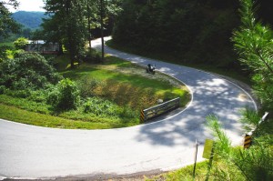
Imagine miles and miles of curves like this one - a.k.a. Silversteen Road

If you stay on Silversteen Road it runs into NC 281, another fabulous Smoky Mountain Motorcycle Ride and another of my favorites. I typically follow NC 281 north to Tuckaseegee or use it to connect to Charlies Creek Road to reach NC 215 (so many good choices in the area).

I’m attracted to Silversteen Road for it’s challenge – it’s every bit as twisty as the infamous Dragon at Deals Gap. In fact, it’s more difficult as the road seems a bit narrower and the pavement is not up to the quality you find at the Dragon. It sees very little traffic, but the trade off is you’ll find a few potholes and some gravel in the road where unpaved side roads and driveways connect to it. It also has some very sneaky descending radius turns you’ll want to be prepared for so you don’t get in over your head.

Photo-motorcycle-curves-on Sliversteen-Rd-NC

The curves on Silversteen Road never let up.

The ride holds a few scenic areas, particularly where it runs along the bank of what could be the Horsepasture River, but your eyes had better be on the road, not the scenery. It will give you all the challenge you want, maybe more.

You’ll find Silversteen Road on America Rides Maps Map #6 – The Best Motorcycle Rides EAST of Great Smoky Mountains National Park along with all the other great rides in the area, more than 50 great motorcycle rides in this small but beautiful area of the “Land of the Waterfalls”.

_______________________________________________________________________________

Wayne Busch

Wayne Busch - Cartographer

Total Rider Tech Logo

Learn Total Control

– Wayne Busch lives in Waynesville, NC, where he produces the most detailed and comprehensive and up-to-date motorcycle pocket maps of the Blue Ridge and Smoky Mountains to help you get the most of your vacation experience. See them here – AmericaRidesMaps.com

Wayne is an advanced motorcycle instructor for Total Rider Tech teaching Lee Parks Total Control Advanced Rider Courses. It’s time you looked into advanced rider training to ride more confidently and safely, it will change your mountain riding experience. It worked so well for me I became an instructor! Total Rider Tech

_______________________________________________________________________________

Motorcycle Friendly – Skyline Village Inn, Little Switzerland

photo-skyline-inn

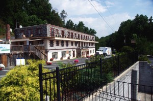
The Skyline Inn, Little Switzerland, NC

Located right at the start of the Diamondback Motorcycle Ride, the Skyline Village Inn offers a scenic stay, good food, a nice selection of beer and wine, and one of the most unique and historic places to stay on the Blue Ridge Parkway.

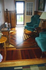
First of all, the Skyline Village Inn has a story and it’s a great one. (If you want all the details click here and go the their site in a minute). In a nutshell, the Skyline Village Inn was built as a front to cover up a huge moonshine operation which operated out of secret caverns beneath it. When not brewing corn, they used their free time to do intricate stone and woodwork throughout the building and grounds. Some of the wood inlay work on the tables in the lounge belongs in a museum. They give tours of the moonshiners caverns. I didn’t ask if they still sell “shine”, but the beer and wine on hand is diverse and high quality.

photo-skline-inn-woodwork

Those moonshiners used 17 kinds of local wood

The building was constructed in the 1930’s and 40’s, before small roadside motels came into vogue, so it has an authentic historic atmosphere that permeates the entire place. Those moonshiners built with quality and it endures.

The Skyline Village Inn sits high atop the ridge with commanding views. You can see the beautiful stone arch where the Blue Ridge Parkway passes over NC 226 down the road at the Spruce Pine exit at milepost 331 from out front of the Inn. The rooms open onto a porch where you can sit to enjoy the view.

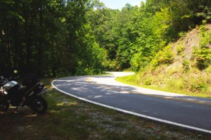
Best of all for the motorcycle rider, the  Skyline Village Inn sits at the head of the Diamondback Motorcycle Ride, one of North Carolina’s most popular rides. Just roll out  of the covered motorcycle parking and you’re on the ride.

photo-motorcycle-NC-226

Rider nears the top of NC 226. Shot from the overlook across from the Skyline Inn


While the Diamondback is popular, the ride they like to send you on from the Skyline Village Inn is the Murder Mountain Ride. You can do the short version of the Diamondback Loop down 226A then back up 226 in about 45 minutes. The Murder Mountain Ride is much more of a commitment, about 3 1/2 hours minimum, but it includes a traverse of spectacular Roan Mountain and some of the twistiest and most enjoyable roads in North Carolina and a bit of Tennessee. (See Murder Mountain Ride Description / Map here)

photo-room-at-skyline-inn

A room at the Skyline Inn

If you want to stay somewhere you’ll remember and can tell (good) stories about, consider the Skyline Village Inn on your Blue Ridge Parkway motorcycle ride.

Skyline Village Inn

Murder Mountain Ride

Diamondback Motorcycle Ride


_______________________________________________________________________________

Wayne Busch

Wayne Busch – Cartographer

Total Rider Tech Logo

Learn Total Control

– Wayne Busch lives in Waynesville, NC, where he produces the most detailed and comprehensive and up-to-date motorcycle pocket maps of the Blue Ridge and Smoky Mountains to help you get the most of your vacation experience. See them here – AmericaRidesMaps.com

Wayne is an advanced motorcycle instructor for Total Rider Tech teaching Lee Parks Total Control Advanced Rider Courses. It’s time you looked into advanced rider training to ride more confidently and safely, it will change your mountain riding experience. It worked so well for me I became an instructor! Total Rider Tech

_______________________________________________________________________________

Updates to Blue Ridge Motorcycle Ride Maps

America-Rides-Maps-Logo

www.AmericaRidesMaps.com

First of all, none of the recent updates are significant enough for you to order fresh versions of your America Rides Maps Blue Ridge and Smoky Mountain motorcycle maps if you’ve recently purchased them. The major updates were completed over the last 18 months, and only if your maps are more than a year old will you see the benefit of looking to the newer expanded versions.

However, there have been some more recent changes I’d like to share with you so you don’t miss out on the best motorcycle rides in the Blue Ridge and Smoky Mountians.


image-Georgia-motorcycle-map-cover

#9 - The Best Rides in the North Georgia Mountains

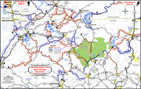
Map #9 – The Best Rides in the North Georgia Mountains was the last completed so it’s most up to date. I’ve just added the new Wolfpen Gap Country Store which will open Saturday in Suches, Georgia (the offical opening is Oct. 1). This is a significant development in Georgia as the convenience store and gas station has long been a popular gathering and rest stop at the intersection of some of the best motorcycle rides in Georgia.


image-motorcycle-ride-map-cover

#6 - The Best Motorcycle Rides EAST of Great Smoky Mountains National Park

Map #6 – The Best Motorcycle Rides EAST of Great Smoky Mountains National Park – This is one of the best of all the maps and were I forced to choose it would be probably be my favorite. It includes the best section of the Blue Ridge Parkway. The gas station and convenience store closest to the Blue Ridge Motorcycle Campground has closed and has been removed from the map. Just a few miles further down the road there are 3 gas stations in Bethel, 2 popular restaurants, so it’s no big deal. I’ve added Max Thompson Rd as a good connector as it’s a way to divert around tiny Bethel and a nice connecting road, and it also intersects the short section of NC 215 (Sonoma Rd) at NC 110. Rather than wait at the traffic light, you can just pass by it on Max Thompson Rd and enjoy this short but twisty ride to reach US 276.


Image-motorcycle-ride-map-cover

#4 Great Roads Near Boone, Banner Elk, and Blowing Rock

Map #4 – Great Roads Near Boone, Banner Elk, and Blowing Rock – I’ve added Shulls Farm / Shull’s Mill Rd which connect NC 105 to the Blue Ridge Parkway in Julian Prince State Park near the Moses Cone House. While I’ve known about this wonderfully twisty ride previously, it somehow got left off the last update. That’s been corrected. I also added the BP station near 7 Devils on NC 105. Again, don’t know why it got missed, I stop there all the time.


image-virigina-motorcycle-ride-map

#1 The Best Rides near the Start of the Blue Ridge Parkway in Virginia

Map #1 – Great Rides Near the Start of the Blue Ridge Parkway in Virginia – I’ve added Red Hill Rd, Plank Rd, and Padgett Hill Rd as good connectors. These make the ride from Natural Bridge to Lexington much more enjoyable then the alternative – Interstate 81. They are not lined with outstanding scenery, and a little remote, but they do the job and throw in a few nice curves along the way.


People have often told me my maps are more up-to-date than their GPS, and I can concur as I use GPS while out mapping – the little lady often gets confused when it comes to the twisty two lane back roads we love so much. I’m constantly updating the maps to keep them as accurate and useful as possible and unlike other maps, I produce them in small batches as they change so often. I want to insure you always get the most recent and up-to-date versions. I hope these changes help you have the best motorcycle rides and get the most out of your precious motorcycle vacation adventures.


Map #1 – Great Rides Near the Start of the Blue Ridge Parkway in Virginia
Map #4 – Great Roads Near Boone, Banner Elk, and Blowing Rock
Map #6 – The Best Motorcycle Rides EAST of Great Smoky Mountains National Park
Map #9 – The Best Rides in the North Georgia Mountains

Wayne Busch

Wayne Busch - Cartographer

Thanks,

Wayne

www.AmericaRidesMaps.com

Why so many great motorcycles rides in the Blue Ridge & Smoky Mountains?

Why are there so many great motorcycle rides in the mountains of the southeast? It’s a combination of geography, history and climate.
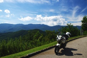
photo-black-mountains

One of my favorite Blue Ridge Parkway overlooks of the Black Mountain Range - highest in the east.

Geographically, the Blue Ridge and Smoky Mountains are very, very, old. Over the eons of time mountains once taller than Everest have weathered, eroded, and subsided to where their heights never much exceed 6000 feet in elevation. Compared to the lofty Rocky mountains in the midwest and the great Sierra Range on the far coast, those in the east are half the size.

While those western mountains soar to dramatic heights, it’s not without a cost. The lower elevations of the Blue Ridge Mountains make them accessible in every season. The softer, gentler topography of the mountains of the east makes building and maintaining roads to connect the valleys and towns more feasible.

photo-penland-post-office

Post office, Penland, NC - the Blue Ridge Mountains are rich with historic sights waiting to be discovered on your rides

History favors the mountains of the east as well. Settlement of our country began on the east coast and gradually moved inward as the population grew. Hill by hill, valley by valley, one small settlement at a time, the trails leading to them became the roads we now enjoy. More people, more time, more roads to connect them all together.

Finally there’s the climate, which is heavily influenced by altitude. The mild wet climate of the east promotes the growth of the dense forests and makes growing crops and farming much easier. The high dry desert climate of the west holds sparse vegetation, harsh conditions, and long cold winters.
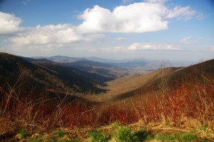
Photo - morning on the Cherohala Skway

View from the Cherohala Skyway in early March - mild climate means year round riding in the Blue Ridge Mountains

Life gets even tougher as you go up into the high mountains of the west. Crops can’t grow at the extreme elevations, and were it not for mining and timber, those vast western mountains would be even less populated than they are now. Fewer people means fewer roads in general, and building and maintaing those that pass through the high places is much more difficult and costly.

Finally, the development of the Interstate Highway system works to favor of the high quality of the motorcycle rides in the east.  As more people used them to move into the west, the fewer local roads and passes there became more crowded. More people on fewer roads, many of which open for only part of the year, means more congestion and traffic in the west.
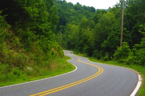
Photo-Charlies-Creek-Rd

Charlie's Creek Rd - typical of the wonderfully empty and inviting rides that abound in the Smokies

In the Blue Ridge and Smoky Mountains, when the traffic moved to the Interstate Highways, it relieved the pressure on the back roads. One of the greatest pleasures of riding a motorcycle in the Blue Ridge Mountains is the absence of traffic. The selection of two lane, empty, winding roads through beautifully scenic and historic places just never seems to end.

Recently back from my motorcycle touring in the mountains of California, then Colorado, my appreciation for the bounty of great motorcycle rides in the Smoky and Blue Ridge Mountains is refreshed. While I loved the dramatic change of scenery, the vast distances and scale of things to the west, one thing became crystal clear –
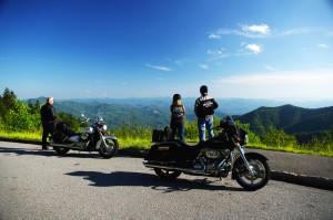
Photo-motorcycles-on-parkway

Bikers pause to admire the stunning views in the Smoky Mountains

Out west, you are on a mountain. It’s a harsher, more extreme landscape, you are a temporary interloper. In the Blue Ridge and Smoky Mountains, you are in the mountains. They cradle and surround you, it’s a comfortable and welcoming environment.

I enjoy my travels and motorcycle rides in other places, but there is simply nothing which comes close to the quality and quantity of outstanding motorcycle rides right in my back yard. While lots of bikers pay a visit, I doubt they much scratch the surface of the gold mine of motorcycle riding that exists here. I know, I’ve mapped hundreds of these great motorcycle rides, thousands of miles of two lane twisties, it’s what I do for a living.
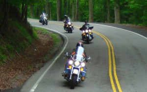
Photo-motorcycles-on-the-dragon

Some roads, like the Dragon at Deals Gap are well known - a wealth of others await your discovery!

Half the population of the US lives within a days ride of the Blue Ridge and Smoky Mountains. It’s an easy trip to get here. It’s affordable and convenient. The motorcycle rides are beautiful, scenic, challenging, and the mountains are full of roads that thrill the motorcycle rider, more than can be visited in a season, let alone a single motorcycle vacation tour.

I’ve said it before, and continue to preach – “There are more great motorcycle rides in the Blue Ridge and Smoky Mountains than anywhere else”.  

Why not start planning your motorcycle trip right now?

Still need convincing? Visit www.AmericaRidesMaps.com to see just how many great roads there are waiting for you!

_______________________________________________________________________________

Wayne Busch

Wayne Busch - Cartographer

Total Rider Tech Logo

Learn Total Control

– Wayne Busch lives in Waynesville, NC, where he produces the most detailed and comprehensive and up-to-date motorcycle pocket maps of the Blue Ridge and Smoky Mountains to help you get the most of your vacation experience. See them here – AmericaRidesMaps.com

Wayne is an advanced motorcycle instructor for Total Rider Tech teaching Lee Parks Total Control Advanced Rider Courses. It’s time you looked into advanced rider training to ride more confidently and safely, it will change your mountain riding experience. It worked so well for me I became an instructor! Total Rider Tech

_______________________________________________________________________________

Best Motorcycle Rides in North Georgia – digital soon?

Wow! It’s taken me 18 months to completely revise and update all my Smoky Mountain / Blue Ridge motorcycle ride maps, but the last of them is done – Map #9 “The Best Rides in the North Georgia Mountains” has been released.

image-best-rides-in-the-north-georgia-mountains

Roads are really bold, map is easy to and quick to read. Road descriptions on back of map.

If you have one of my Georgia motorcycle maps you honestly don’t need to replace the map you have. I had almost all of the really outstanding Georgia motorcycle rides on the earlier version. I did find a couple more really nice north Georgia motorcycle rides on the periphery of the main area of the map as you make your way to the classic rides  – you’ve got to ride GA 60,  Blood Mountain area, and I love to play back and forth across the North Carolina state line.

image-georgia-motorcycle-map

Map #9 - The Best Rides in the North Georgia Mountains

So what’s the big deal? The reason this revision took so long was prepare the maps for digital use! I’ve looked at phone apps but decided the limiting factor in the mountains is reception. Live GPS positioning via phone just isn’t there yet for this region.

A solution I’ve been testing instead is map downloads which can be scaled and used from an ipad, ipod, iphone, or any other smart phone provided you’ve got a decent sized memory card. Got your phone? You’ve got your maps. It worked well on the ipad. I’ll be testing ipod, iphone, etc. next. If it goes well, you can expect to see them available in about 2-3 weeks.

So what about GPS? Next project. I have the software. I need the time.

See more about the new map here – goo.gl/ifTNr

_______________________________________________________________________________

Wayne Busch
Wayne Busch – Cartographer
– Wayne Busch lives in Waynesville, NC, where he produces the most detailed and comprehensive and up-to-date motorcycle pocket maps of the Blue Ridge and Smoky Mountains to help you get the most of your vacation experience. See them here – AmericaRidesMaps.com 

How to Make a good Deals Gap Motorcycle Ride Better –

Adding these two roads to one of the four most popular Smoky Mountain motorcycle loop rides near the The Dragon at Deals Gap makes the least of them measure up to the others.

Photo - morning on the Cherohala Skway

Morning on the Cherohala Skyway. I'm parked on the state line between North Carolina and Tennessee.

Smoky Mountain / Blue Ridge motorcycle riders who flock to ride The Dragon at Deals Gap typically take in other rides when in the area. One of the best Smoky Mountain motorcycle rides is a loop through Vonore and Tellico Plains, TN to take in the Cherohala Skyway. Another popular circuit is to loop around Great Smoky Mountains National Park crossing through the heart of the Smoky Mountains on US 441. A third great loop ride links NC 28 at Franklin, NC to Nantahala Gorge via Wayah Road. All of these are great loop rides in the Blue Ridge with unique characters.

The fourth most popular ride is to take the Cherohala Skyway west to Tellico Plains, then go south on TN 68. You then use TN 123 / NC 294 to head east, and follow US 74 / 129 north through the Nantahala Gorge to return to The Dragon at Deals Gap. This loop ride starts out with the outstanding scenery and enjoyable sweeping curves of the 50 mile long Cherohala Skyway as it crosses the Snowbird Mountain Range of the Blue Ridge. It gets nice again once you enter the curvy sections a few miles south of Tellico Plains on NC 68. It’s gets better and better the further south you go, though NC 68 can carry a bit of traffic on weekends.

Photo - Field of the Woods

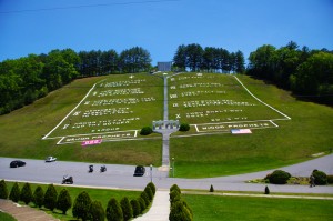
The 10 Commandments at Fields of the Wood - big enough God can read them

Once you turn east on TN 123 / NC 294, the ride is still pretty good, but the road opens up and the ride is not as scenic and challenging as you progress. Here’s how to punch it back up to outstanding.

Watch for Fields of the Wood, it’s the closest landmark to the turn off onto Hiawassee Dam Access Road. Fields of the Wood is worth a stop to see and a nice place for a break. Those with devout religious leanings will be inspired by the hillside with the ten commandments written out in stone, as well as numerous other Biblical icons and monuments. For those inspired more by hellacious and challenging roads, Hiawassee Dam Access Road is next leading to devilish twists and curves.

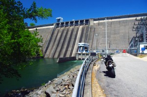
Photo - Hiawassee Dam

The Hiawassee Dam is a nice spot for a break.

Turn onto Hiawassee Dam Access Road to start the fun. You may encounter a little traffic approaching the dam on weekends as many come for boat access to the lake and river. Once past the dam, the excellent and challenging road continues a course around the west side of the lake. Turn right onto Joe Brown Highway when you reach the end of Hiawassee Dam Access Road.

Joe Brown Highway is hardly what any of us think of when the word “highway” comes to mind. This isolated and remote twisty two lane back road is packed with curve after curve and some pretty decent Smoky Mountain scenery, though you’ll be paying more attention to the road than the horizons. It’s a whole lot of fun, usually carries very little traffic, and may be the best section of the entire loop, a nice contrast to the sweeping curves of the Cherohala Skyway.

Photo - Nantahala Outdoor Center

The Nantahala Outdoor Center on the river is another great break spot with bathrooms, good food, nice views, and the place to arrange a river trip.

Joe Brown Highway runs you right through downtown Murphy, NC to intersect US 129 / 74 at the junction with US 64 East. Turn north to follow the four lane to Andrews where it funnels down to two lanes again for the ride through scenic Nantahala Gorge. You’re bound to run into traffic in Nantahala Gorge, but the scenery along the popular whitewater river makes up for it. Avoid the gorge on weekends when possible as the buses hauling rafters and kayakers tend to bottle things up.

Once through Nantahala Gorge, turn left onto NC 28 and back into the twists and curves to return to The Dragon at Deals Gap.

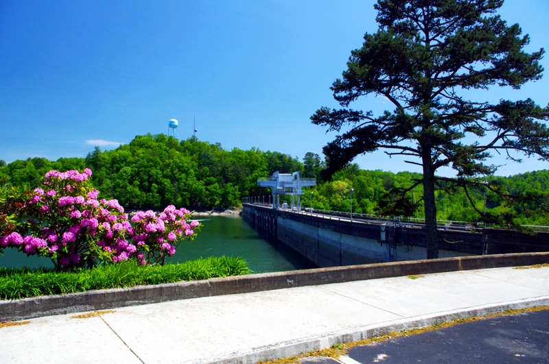
Photo - View from Hiawassee Dam Overlook

There are nice spots for a break both atop and below the Hiawassee Dam. The road runs across it then continues around the lake.

_______________________________________________________________________________

Wayne Busch
Wayne Busch – Cartographer
– Wayne Busch lives in Waynesville, NC, where he produces the most detailed and comprehensive and up-to-date motorcycle pocket maps of the Blue Ridge and Smoky Mountains to help you get the most of your vacation experience. See them here – AmericaRidesMaps.com 

New Map – The Best Motorcycle Rides SOUTH of Great Smoky Mountains National Park

Image - View of Map

Map #7 - The Best Motorcycle Rides South of Great Smoky Mountains National Park

I’m proud to announce the release of America Rides Maps latest compilation of great motorcycle rides in the Blue Ridge Mountains and the final map to complete a series of three maps which detail close to 200 good motorcycle roads surrounding Great Smoky Mountains National Park.

Map #7, The Best Roads South of Great Smoky Mountains National Park, covers the region west from Maggie Valley, North Carolina, to Tellico Plains, Tennessee, extending south to cross the borders into South Carolina and Georgia. More than 30 of the roads rate being listed as outstanding rides highlighted in red, and another 20 are shown as great connecting roads highlighted in blue to link them all together.  The Best Roads South of Great Smoky Mountains National Park includes a guide to 9 roadside waterfalls, numerous out-of-the-way gas stations, sights and attractions, and motorcycle friendly locations.

dragon-motorcycles

Motorcycles flock to ride the Dragon at Deals Gap

This is THE MAP for motorcycle riders making a trip down the Blue Ridge Parkway then on to the Dragon at Deals Gap.

It includes the final sections of the Blue Ridge Parkway into Cherokee, North Carolina, the popular 125 mile long Dragon /  Cherohala Skyway loop ride, the Nantahala River Gorge, Wayah Bald, the Cullasaja River Gorge, a surprising wealth of hidden back roads near Franklin, NC, and variations on rides surrounding the Dragon at Deals Gap few ever discover.

The Smoky Park Motorcycle Map Series includes –

Nearly 200 roads are described in this map package which weave through some of the highest mountains in the east, cross extensive scenic national forests and park lands, see dozens of roadside waterfalls, including every ride within Great Smoky Mountains National Park, it’s the most extensive and comprehensive collection of great motorcycle rides in this area ever assembled.


Photo by Jim Miller Photography

Photo by Jim Miller Photography - This area is so remote and wild you'll find hundred mile views with no evidence of human occupation to be seen.


“This map takes my best selling map, combines it with another, and adds new roads I’ve discovered to make the ultimate map for visitors to the Dragon at Deals Gap, it’s all you need!”

_______________________________________________________________________________

Wayne Busch
Wayne Busch – Cartographer
– Wayne Busch lives in Waynesville, NC, where he produces the most detailed and comprehensive and up-to-date motorcycle pocket maps of the Blue Ridge and Smoky Mountains to help you get the most of your vacation experience. See them here – AmericaRidesMaps.com 

Motorcycling in the Land of the Waterfalls – Shouldn’t You be in these Photos?

Photo - Soco Road Exit Blue Ridge Parkway

We started from the Soco Rd Exit (US 19) on the Blue Ridge Parkway @ MP 455.7

Absolutely gorgeous weather over the holiday weekend did not go to waste. We took advantage of the opportunity to enjoy riding a “tourist” loop we typically avoid. While the good folks were in church, we knew the traffic would be light and the timing would be right to get out for a Smoky Mountain motorcycle ride that would take us by some of the best scenery the area has to offer and a trip through the Land of the Waterfalls.

Photo - Museum of the Cherokee Indian

Museum of the Cherokee Indian

We made our way to Maggie Valley and started the loop from the Soco Gap exit on the Blue Ridge Parkway at MP 455.7. Careening down through the curves towards Cherokee, we had the road to ourselves and got the rare chance to enjoy this twisty section of two lane which is normally crowded with travelers and commuters.

Photo - Bear in Cherokee

Cherokee is full of these bears

Cherokee was quiet as we sneaked into town for a quick photo then continued on US 19 into Bryson City on the south side of Great Smoky Mountains National Park.  On Easter Sunday, the trains of the Great Smoky Mountain Railroad sat in reverence as we passed through the back side of town to check out a road I’d been curious about – (I never stop looking for new roads for America Rides Maps).

Photo - Great Smoky Mountains Railway Train

Great Smoky Mountains Railroad train in Bryson City

After 10 minutes on the Great Smoky Mountains Expressway (US 74 /19/23/28), we forked south into the Nantahala Gorge and paused for a break at the Nantahala Outdoor Center on the river.  From now on, this beautiful road which follows the course of one of the most popular whitewater rivers in the east will be filled with lumbering buses hauling rafters and kayakers upstream for the chilly and thrilly ride through the rapids. Thanks to the holiday, there was no commercial traffic, though plenty of others were here to enjoy the hiking, biking, and other pursuits in this hub of outdoor activity.

Photo - Rivers End Restaurant

The Rivers End Restaurant sits on the Natahala River at NOC.

Enduring 10 miles of relatively light traffic, we turned off for the climb over Wayah Bald. Snaking up along the cascading river, we passed fishermen gracefully floating their flies in the quiet pools beneath the numerous falls, then paused for a picnic lunch on the shore of crystal clear alpine Nantahala Lake.

Photo - motorcycle on Wayah Road

Jackie cruises Wayah Road

The ride across the top of the mountain is more challenging than it is scenic filled with curves and twists that attract riders to this favorite motorcycle route. Easing down through the hairpin curves on the back side of the hump, the road traces the course of another stream which builds to flow into the Little Tennessee River once you reach Franklin.  We passed through town then headed south again on US 64 / NC 28 to enter the Cullasaja River Gorge.

Waterfall along Wayah Road

The ride along the river on Wayah Road is spectacular!
It looked like our luck was changing as we found ourselves behind several cars, but each peeled off on side roads before we reached the outstanding curves that carve through the rugged canyon and we actually got to enjoy the ride at speed. That is a rare treat and we appreciated it. Good rains this spring have the waterfalls roaring and they were spectacular.

Photo - motorcycles at Nantahala Lake

Picnic lunch at alpine Nantahala Lake

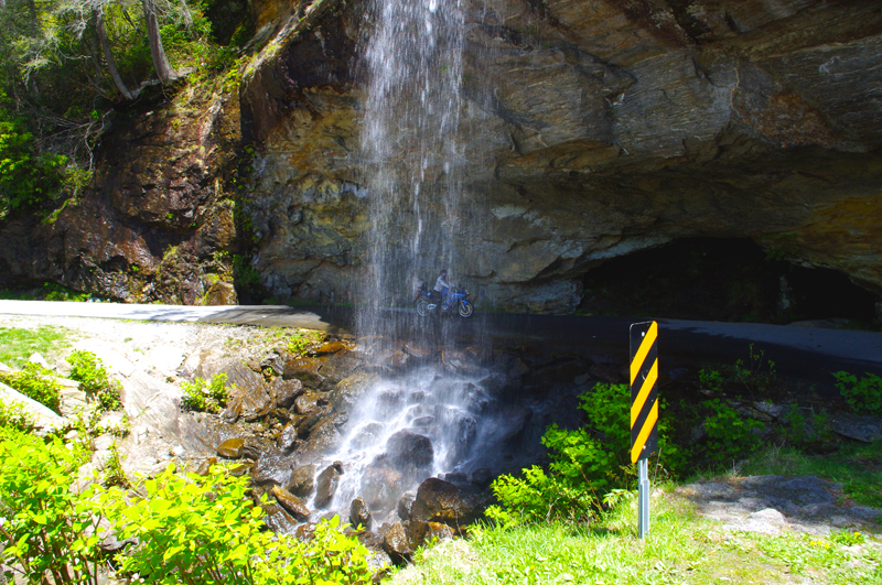
There are four easy to spot major waterfalls along this stretch of US 64 leading into Highlands, Cullasaja Falls (the largest), Dry Falls, Quarry Falls, and delicate Bridal Veil Falls. We stopped for a unique photo at Bridal Veil Falls where a small paved loop runs behind the cascade.

Photo - Cullasaja Falls

Cullasaja Falls on US 64 / NC 28

The remainder of the ride on US 64 is outstanding for scenery but by mid afternoon the tourist traffic was picking up and we did not always get to exploit the wonderful curves as much as we would have liked. The horizons are flanked with glimpses of the highest naked cliffs in North Carolina, some more than 1000 feet tall, and you cruise through some of the most expensive real estate in the country.

We completed the loop by heading north again on US 215 from Rosman climbing to reach the highest section of the Blue Ridge Parkway on a freshly paved road that snakes through outstanding turns and scenery that make it one of the locals favorite rides.

Photo - Motorcycle behind Bridal Veil Falls

Jackie poses for a photo on her motorcycle behind Bridal Veil Falls just outside Highlands, NC on US 64 / NC 28. How cool is that?

Click on photos for larger view

_______________________________________________________________________________

Wayne Busch
Wayne Busch – Cartographer
– Wayne Busch lives in Waynesville, NC, where he produces the most detailed and comprehensive and up-to-date motorcycle pocket maps of the Blue Ridge and Smoky Mountains to help you get the most of your vacation experience. See them here – AmericaRidesMaps.com