Motorcycle Touring the Blue Ridge Parkway in One Day – What was it Like?

On Thursday I rode the Blue Ridge Parkway on my motorcycle from the start at Waynesboro, Virginia, 469 miles to the southern end at Great Smoky Mountains National Park in North Carolina. As I progressed I paused to snap photos and posted them on Facebook and Twitter. Here’s a recap of the experience;

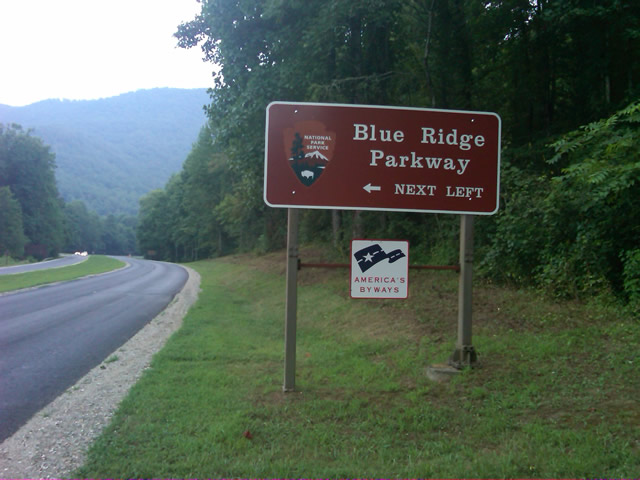
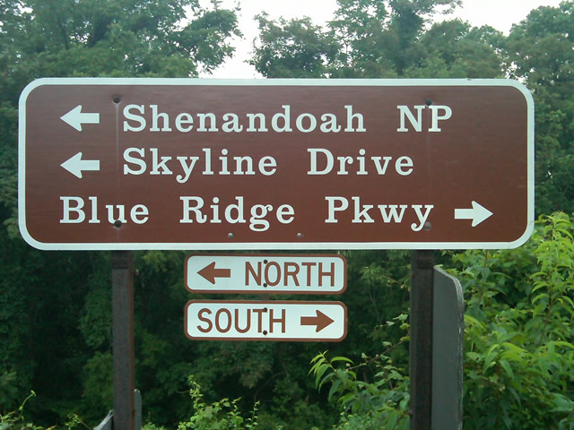
Photo - sign at start of Blue Ridge Parkway

The Blue Ridge Parkway starts where the Skyline Drive ends near Waynesboro, Virginia.

I chose to start at the north end as I knew I’d need to leave at daybreak. The morning fog has been so heavy at the southern end I didn’t want to chance it slowing me down or making for pictures of nothing but white mist. I spent the previous night in Richmond and left before 5 AM to make the 1 1/2 hour ride to Waynesboro in the darkness.
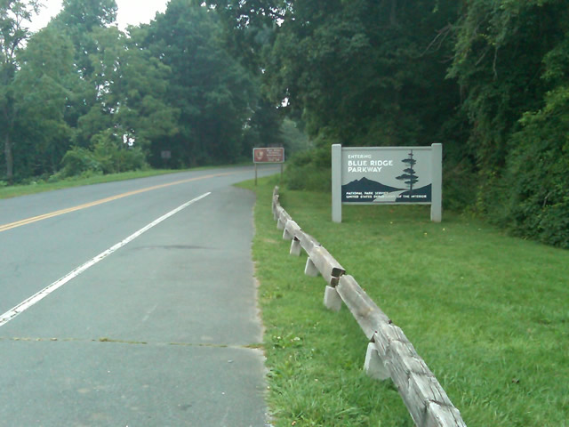
Photo - sign at the start of the Blue Ridge Parkway in Virginia

I took these photos the previous day as I expected it would be too dark to take them on the actual trip. I was right.

I fueled up in Waynesboro, grabbed a cup of coffee and a pack of doughnuts to sustain me, and headed on my way. It would be the last time I stopped to eat or drink. 469 miles is a long way at the 45 mph speed limit. I had no time to waste. At least that was my attitude early on.

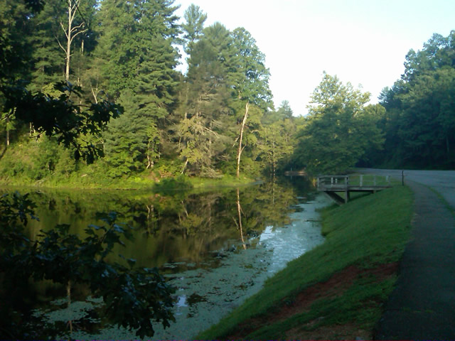
Photo - morning at the lake on Otter Creek

The sun comes up at the lake on Otter Creek. Easy ride so far.

I had the road to myself in the early morning twilight. Within a few minutes I’d seen both deer and turkey. The road starts a gradual climb to elevation here though nothing like the heights reached further south. With no other traffic on the road, my speed crept up a bit, something I’d fight the remainder of the trip. As you get comfortable and into the rhythm of the road, the temptation to take things at your more comfortable pace is always there taunting you. Knowing how far I had left to go didn’t help.
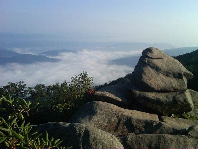
Photo - Above the clouds approaching Roanoke

I paused at this overlook to top up on oil, lube what was left of the chain, and take a few moments to savor the views I was rushing by.

I was also facing the challenge of not knowing if my chain would last the trip. It was already shot before I left, adjusted to the end of the swingarm, far beyond the normal limit. It now sagged precariously and was making noises that had me wondering when it would snap. I’d never seen a chain smoke when lubed before, and I took advantage of opportunities to slather it with lubricant whenever my concerns peaked. I prayed it would not jump the sprockets when carving through a turn and catapult me into a rock face or over a precipice.
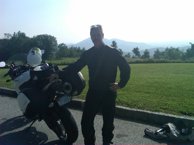
Photo - me and my bike along the Blue Ridge Parkway

A fellow biker snapped this photo of me at a rest stop. Riding from Florida to Maine and back, he and his wife were enjoying the parkway on their return.

Traffic remained surprisingly light through the morning with few holdups to pass slower vehicles. I watched the parkway wake up, the rangers and maintenance crews come to work and start their labors. Finding cell phone coverage to post my photos was always a challenge. You never know when it will be available, sometimes there in what looks like the most unlikely spots, other times absent where you think it should be a strong signal.
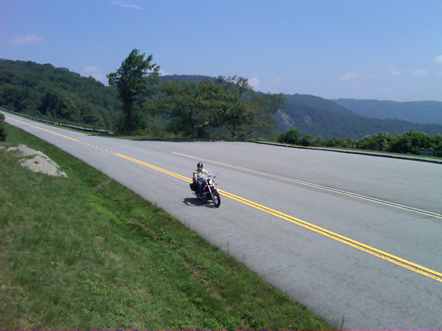
Photo - near Doughton Park

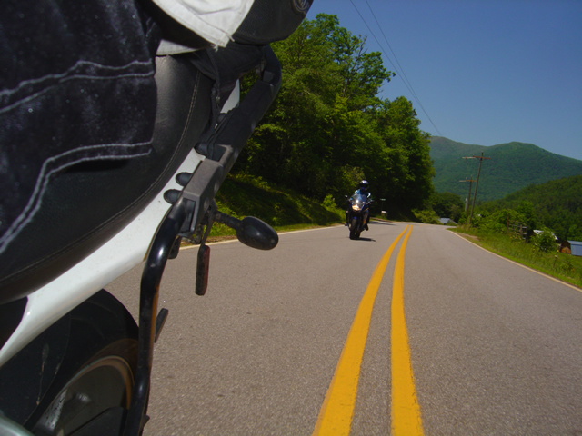
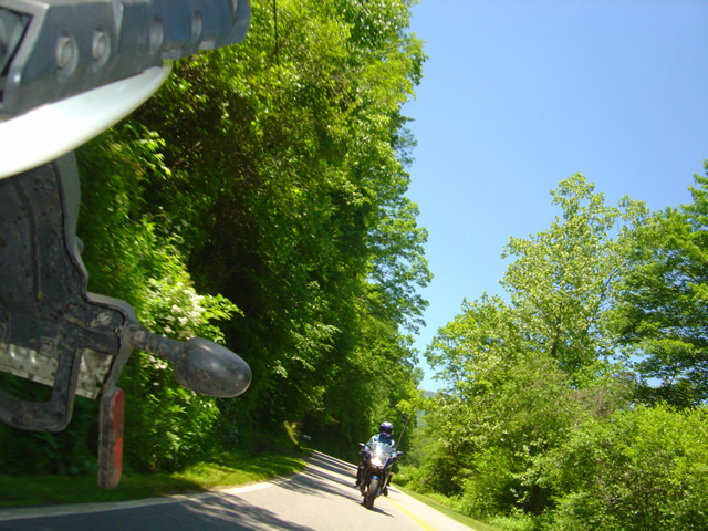
By mid morning there were plenty of other motorcycles on the road. This photo was taken somewhere near Doughton Park.

My first stop for gas necessitated a detour into Floyd, VA. Knowing where the nearest gas stations are is one reason I map the area so throughly. You can waste a lot of time looking for them if you don’t know which way to go. While in Floyd I popped in for a minute to see Derek at the Hotel Floyd, one of my favorite places to stay.

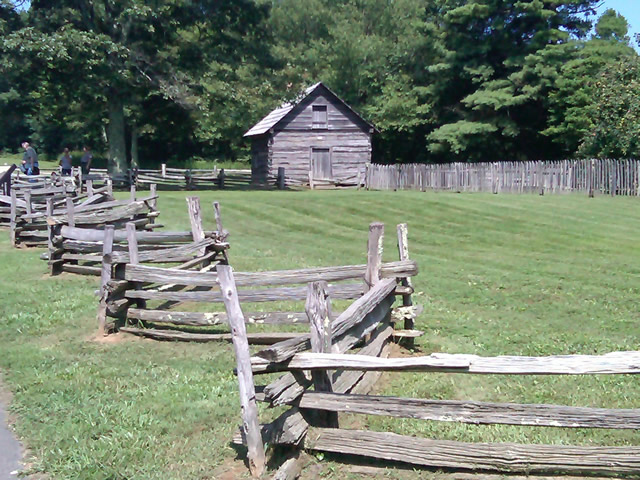
Photo - Historic cabin on the Blue Ridge Parkway

There are a few historic cabins along the road in southern Virginia.

As I crossed into North Carolina and entered the high mountains I knew cell phone coverage would be much more limited. The curves tightened up bit and the road was often wet from spotty showers. It would be another day with temps approaching near 100 in the valleys, but at elevation things remained tolerable so long as I was moving. I somehow avoided all but a slight peppering of rain which felt wonderful at the time.

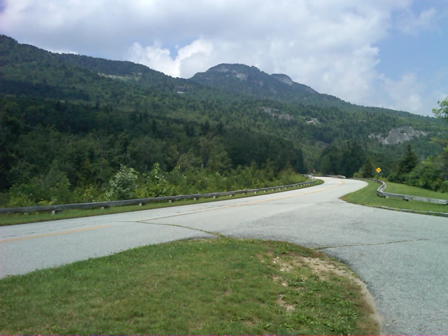
Photo - Grandfather Mountain

Passing Grandfather Mountain I felt I was back on home turf though still a long, long way to go.

Delays had been brief so far, and I planned my next fuel stop to coincide with a quick stop to say hello at the Switzerland Inn in Little Switzerland, one of my favorite places to eat or overnight. I fueled up in Spruce Pine. It was tempting to get a good meal, but I forced myself to press on. The real hold ups came as I approached Asheville. Tree crews and road construction caused significant delays and I hit the “commuter section” during evening rush hour.
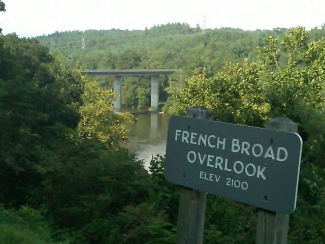
Photo - French Broad River Overlook

It was a great relief to finally cross the French Broad River southwest of Asheville and begin the climb to the highest and most scenic section of the Blue Ridge Parkway.

The sun was drawing near the horizon as I carved my way along the high ridge tops of the section of the Blue Ridge Parkway I consider my back yard. Thunderheads lurked and the road was wet in places, but my luck continued.
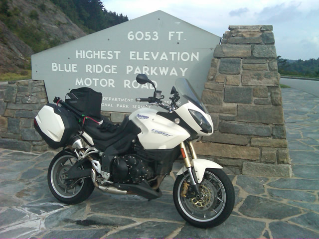
Photo - at the highest point on the Blue Ridge Parkway

Reaching the highest point on the Blue Ridge Parkway, I knew there was less than 40 miles to go to reach my goal.

I reached the southern end of the 469 mile ride with daylight to spare and took a pause at the Oconoluftee Visitor Center in Great Smoky Mountains National Park. I grabbed a few photos but found the battery was now dead on my cell phone. Here they are now –

Photo - start of the Blue Ridge Parkway in North Carolina

The Southern end of the Blue Ridge Parkway near the Oconoluftee Visitor Center.

While my Blue Ridge Parkway in a day adventure was completed, I still needed to get home. Noting the evening traffic, I chose to avoid going into Cherokee and got back on the Blue Ridge Parkway now headed in the opposite direction. I rode through to Soco Gap, then passed through Maggie Valley to finally get to my home in Waynesville.
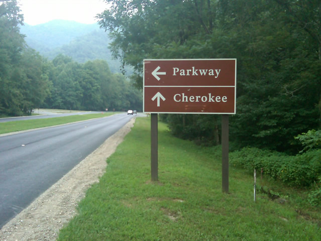
Photo - sign at the southern end of the Blue Ridge Parkway

Go through Cherokee or back the way I'd come? I chose to return home via the Blue Ridge Parkway of course.

My chain lasted the trip. My rear tire is bald. It’s time for some service on the engine. New parts are on order and it will take this week to get the bike roadworthy again. Next week? I might just poke into east Tennessee. I’ve too long ignored the area between Great Smoky Mountains National Park and Knoxville. If I can locate at least a dozen good rides there it will warrant a new motorcycle pocket map. I discovered some great roads along the Virginia / West Virginia border on this trip, several of which will be added to existing America Rides Maps. It will take a few more trips north to determine how the map of that region will lay out but it will come. For now, it’s catch up on the work I left, update the existing maps with the new rides I discovered, and make preparations for the roads ahead.

America Rides Maps on Facebook

America Rides Maps on Twitter

America Rides Maps – the best motorcycle pocket maps money can buy

_______________________________________________________________________________

Wayne Busch

Wayne Busch - Cartographer


– Wayne Busch lives in Waynesville, NC, where he produces the most detailed and comprehensive and up-to-date motorcycle pocket maps of the Blue Ridge and Smoky Mountains to help you get the most of your vacation experience. See them here – AmericaRidesMaps.com


Follow Me Thursday as I ride the Blue Ridge Parkway end-to-end in One Day

Image - Join Us on the Road to Adventure!

Follow my progress with hourly photo updates on Twitter and Facebook

To continue my celebration of mid-summer motorcycle madness, on Thursday I will get on the Blue Ridge Parkway in Waynesboro, Virginia, and ride it 469 miles through to the southern end at Great Smoky Mountains National Park near Cherokee, North Carolina.

As I go I will make hourly stops to tweet a photo and report on my progress so long as I have cell phone service.

Why not check my progress from time to time on Twitter – americaridesmap

and Facebook – facebook.com/americaridesmaps

I’m not trying to set a record or even establish a benchmark for someone to beat. The hourly stops will insure there is no record to speak of. Admittedly, it’s the worst way to experience the Blue Ridge Parkway, which should be done as slowly as possible with as many side trips as you can afford.

Still, curiosity has got the best of me, and I’ve never done it before nor heard of anyone doing it, so why not?

Follow along with me Thursday!

_______________________________________________________________________________

Wayne Busch

Wayne Busch - Cartographer


– Wayne Busch lives in Waynesville, NC, where he produces the most detailed and comprehensive and up-to-date motorcycle pocket maps of the Blue Ridge and Smoky Mountains to help you get the most of your vacation experience. See them here – AmericaRidesMaps.com
 

Dumb Things to Do on Your Motorcycle – Cades Cove Bears on a Saturday

I don’t know what possessed me to ride through Great Smoky Mountains National Park on a warm, sunny, Saturday, but then I’m kinda getting in the spirit to do more dumb things on my motorcycle this week – more on that plan later. Nonetheless, I had a new tire to scrub in so I took off for the Dragon at Deals Gap to do the deed. Arriving early in the afternoon, I found it pleasantly low in traffic. Most everyone had already made their passes and headed out to explore the surroundings and I had a good run through it thanks to my brother riders who waved me to slow down when approaching the police stationed along the route. I arrived at the overlook with the new front tire looking like someone had taken a cheese grater to the shoulders and satisfied with the performance of the new Michelin Pure rubber which now adorned both ends of my ride.

I stopped in to see Jody at the Punkin Center Motorcycle Campground who was deeply engaged in a mid afternoons relaxation on the porch, and had to pass on the cool one offered as I had miles to before I reached home. We talked briefly of roads and riding, then I set out for the Foothills Parkway which runs along the Northwest border of Great Smoky Mountains National Park .

Photo - Cades Cove, Gear Smoky Mountains National Park

A view from the Cades Cove Loop Road which rings the valley in Great Smoky Mountains National Park

The Foothills Parkway has never impressed me much, but then my standards of comparison are skewed from all the time I spend on the Blue Ridge Parkway. I passed through Townsend, then fell in line with the cattle herd that staggers it’s way through the park. Regardless of the speed limit, there is always some plod who thinks the posted speed is at least 10 mph too fast and there are a dozen cars in front of you. Oblivious to the landslide of perturbed drivers riding up his bumper, he motors right past pull off after pull off where he could let the traffic pass. It’s all part of the experience.

Photo - the Cades Cove Loop Road in Great Smoky Mountains National Park

Freshly paved, the scenic loop road around Cade's Cove is a great place to see the wildlife that is so plentiful here

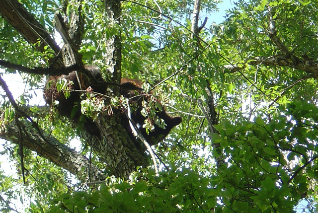
The purpose of my visit was to lay eyes on the newly paved sections of road so I made a detour out to Cades Cove to see the Loop Road. I started, stopped, started, stopped, started (you get the idea) out the freshly paved single lane but quickly realized at this pace I could throw away my watch and use a calendar to figure when I’d get home. I took the first opportunity to shortcut the loop with Sparks Road, an unpaved cut more or less straight across the valley. Nearing the South end of it, I saw the first bear up in a cherry tree gorging on the summer fruit and stopped to snap a photo.

Photo - bear in tree in Great Smoky Mountains National Park

One of several bears I saw on my short visit. They were high in the cherry trees gorging on the summer fruit.

Reaching the south side of the loop road, I fell back into the herd which was held up by another bear spied in another cherry tree at which point people just abandon their cars in the road and walk out to stand beneath the bruin for a telephoto of the bears ass. It’s all part of the experience.

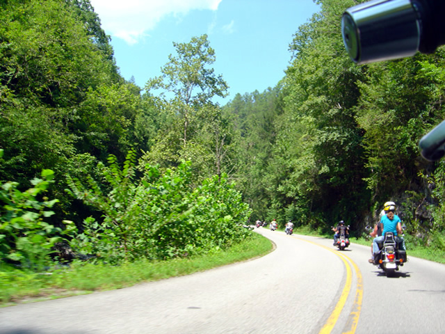
Photo - riding with the herd on River Road

Just one of a long like of bikers on River Road in Great Smoky Mountains National Park

The ride back from Cades Cove, along River Road, then across the park on 441 need not be detailed, it was as was already described. All the way. All the time. I finally escaped onto the Blue Ridge Parkway scooting around the next plodder who was doing 20 mph in the 45 mph section with a quick twist and flick, then fell in with another bike that was obviously not a tourist. I felt it my duty to ride along at a matching pace as a safety backup just in case his enthusiasm wasn’t matched by the talent it took to lay a bike through the turns like he was and someone had to make a 911 call. I’m always there for you bro.

Which brings us back to more dumb things to do on your motorcycle. One day this week I’m going to ride the 469 mile long Blue Ridge Parkway from end to end. In one day. That’s really dumb, like seeing how fast you can have sex. The goal is not to see how fast I can do it, though my competitive nature would naturally lead to that extreme.  Nor do I want to establish a benchmark which will invite challenge by setting a time. I’m building in a safeguard to prevent me from giving in to that temptation. I’m going to force myself to stop once every hour, take a photo, and tweet my location and situation when I have cell phone reception.

I was hoping to go south to north on Tuesday, but the morning fog has been so heavy lately it might not only delay me, but the photos I take will show nothing but white for the first couple hours. It looks like I’ll come from the North end south on Thursday instead. Don’t ask why, it’s something to do with the summer heat no doubt.

Plan on following me on my Parkway-in-a-day tour this Thursday.

_______________________________________________________________________________

Wayne Busch

Wayne Busch - Cartographer


– Wayne Busch lives in Waynesville, NC, where he produces the most detailed and comprehensive and up-to-date motorcycle pocket maps of the Blue Ridge and Smoky Mountains to help you get the most of your vacation experience. See them here – AmericaRidesMaps.com
 

Good News / Bad News at Onion Mountain Road Near Franklin

Photo - work on Onion Mountain road

For a road that is going nowhere, they are doing a nice job of getting you there. Lets hope they find the funds to finish it this year.

On my way back from Georgia I decided to make a detour to investigate the progress on Onion Mountain Road east of Franklin, NC. This is one of my “pet” roads, one I’ve been watching ever since they started paving it last year. The work completed prior to the winter shut down really got my hopes up that this ridge top two lane would eventually be completely paved once warmer weather returned. The good news is the crews are back at it.

The bad news though, puts a damper on the whole situation. I was excited to follow a dump truck up the winding road, though a little dismayed to see the weight of the passing trucks was already damaging what had been an excellent paving job. Proceeding out onto the gravel section (no change from where  it had begun last year), I soon ran into the work crew. They have no expectation to complete the paving all the way through this year, funding has been cut. Why they are bothering with what they are doing is a mystery to me, it will be just another road to nowhere.

I’ll keep watching. Once paved, Onion Mountain Road will link a number a great motorcycle roads and allow you to avoid pretty but heavily trafficked US 64. I went ahead and added more of the surrounding roads to my America Rides Maps motorcycle pocket map “The Best Roads South of Great Smoky Mountains National Park – WEST” and am considering adding a few more once I give them another look. We’ll see how things develop.

_______________________________________________________________________________

Wayne Busch

Wayne Busch - Cartographer


– Wayne Busch lives in Waynesville, NC, where he produces the most detailed and comprehensive and up-to-date motorcycle pocket maps of the Blue Ridge and Smoky Mountains to help you get the most of your vacation experience. See them here – AmericaRidesMaps.com
 

Motorcycles in the Fog at Fontana Lake Near Deals Gap

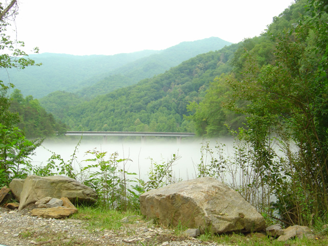
Photo - Fontana Lake draped with fog

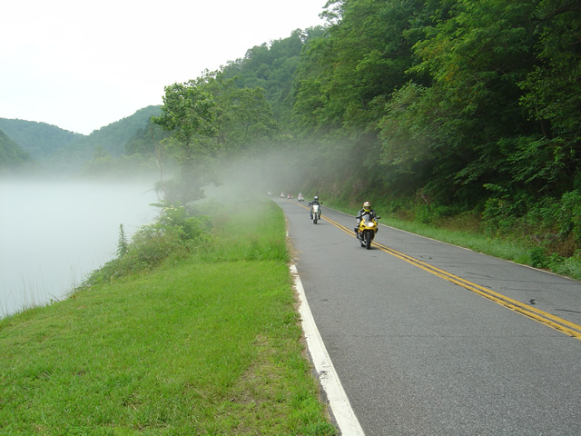
The bridge across Fontana Lake on NC 28 floats above a cloud of fog over the chilly water on a hot day.

Hot, overcast, occasional spits of rain, it was still a nice day to hop on the motorcycles and cruise over to Deals Gap at the southwest corner of Great Smoky Mountains National Park. When the summer heat comes on it’s not unusual for a fog to form over the chilly waters of Fontana Lake as you near the Dragon.

Photo - Fog on Lake Fontana

The fog hugs the waters on hot days.

I shot a few photos on NC 28 to capture the phenomenon. Maybe the clouds put off some of the usual weekend crowds, there were relatively few motorcycles out for a Saturday. There were times the Dragon was quiet for a minute or more, a good day to pay a visit.

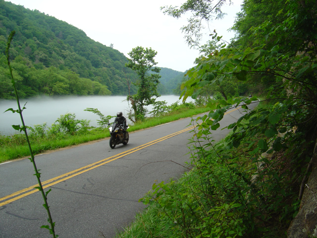
Photo - Motorcycle on NC 28 at Lake Fontana

A motorcycle cruises the lake shore on NC 28

Maybe the sportier riders stayed closer to home today. The Harleys, Gold Wings, Beemers, and other dressers  were out in force on the twisty roads at Deals Gap. It was a good  day for motorcycle touring.

Photo - Motorcycles along foggy Fontana Lake

Rarely does the mist rise high enough to have much effect on the roadway, at least in the middle of the day.

The lake section of NC 28 bordering Great Smoky Mountains National Park is one of the most beautiful, but it’s the curvy and twisty parts that make it one of the best rides in the Smoky Mountains. I hope you get to see sights like these on your next motorcycle vacation.

For the best maps of motorcycle rides the area look no further than America Rides Maps .

http://americaridesmaps.com

Motorcycle Friendly – The Shady Valley Country Store at The Snake

There’s a reason my wife rarely tags along with me while I’m out working from my motorcycle – I only stop for two things, one is fuel. The other can be remedied at any clump of shrubbery. Rarely do I ever stop to eat, drink, or grab photos. It’s all about covering the miles. Those creature comforts can wait until I retire for the evening when darkness makes any further progress futile. I think that’s about to change and one of the first places I’m going to visit is the Shady Valley Country Store the home of “The Snake”.

Photo - Shady Valley Country store

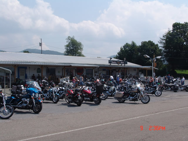
Shady Valley Country Store serves thousands of motorcycles weekly who come to ride "The Snake" and surrounding roads.

Located at the junction of NC 133, NC 91 and US 421 (a.k.a. “The Snake”), the Shady Valley Country Store is at the hub of some of the best motorcycle rides found in the Smoky Mountains where North Carolina, Virginia and Tennessee meet. Serving thousands of motorcycles every week, it provides a convenient fuel stop with regular as well as premium “Snake Venom” for your thirsty motorcycle. I’m told the 1/2 lb. black angus burgers, the thick bologna sandwiches and great chili dogs will keep you going full speed as well.

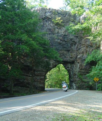
Backbone Rock on TN/NC 133

Backbone Rock on TN/NC 133 not far from the Shady Valley Country Store

I’ve blasted past the Shady Valley Country Store enough times. Next time I’m up there I’m stopping in to check it out, maybe get me a T-shirt or some other Snake memorabilia. Expect to get a first hand report ASAP.

The Shady Valley Country Store

New Deals Gap Motorcycle Map Nears Completion – Your Chance For Input

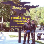
Photo - Smoky Mountain Rider and BMW Girl at the Tail of the Dragon

Smoky Mountain Rider and BMW Girl at the Dragon

Having completed a series of motorcycle ride maps covering the full scope of the Blue Ridge Parkway from end to end describing more than 3000 miles of the most outstanding motorcycle rides along its entire length, I’ve now been commissioned to produce the ultimate and best map available for the motorcycle rider planning a motorcycle vacation trip to Deals Gap, home of the infamous “Dragon” motorcycle ride.

Due to the success of the Blue Ridge Parkway motorcycle ride maps as well as others which expand the areas covered into Georgia and South Carolina, I invested in new hardware and software to take America Rides Maps to the next level. This new Deals Gap map will be the first to take full advantage of the improvements and I am impressed with the output to date.

Maintaining the handy pocket map size which makes the maps easy to use and conveniently accessible, as well as the most affordable motorcycle ride maps available at the ridiculously low price of $5 each, this latest America Rides map will guide the Dragon rider to a dozen or more additional great motorcycle rides in the surrounding area including the best section of the Blue Ridge Parkway, as well as the most notable rides in the Smoky Mountains of Tennessee and North Carolina and touching on north Georgia and South Carolina.

The scope of the map covers the largest area yet tackled to include approach routes to Deals Gap from all points of the compass making navigation to reach the Dragon easy. Once there, it leads you to enough additional good motorcycle rides to fill a week of vacation time or more. The back side of the map will describe the various routes as well as give details about riding them.

image-raw-map

The Ultimate Deals Gap Map Nears Completion

As I wrap this project up, now is the time for your input as to which features are most important to you. I typically include out of the way reliable gas stations, notable attractions, and a handful of selected eateries, campgrounds, and motorcycle dealers and repair shops. Unlike my other maps which are only available online, this Deals Gap map will be provided by vendors in the area. As such, the frequent updates I normally provide to the maps will not be as easy to accomplish and I want to get this first edition as complete as possible as once maps are distributed they will not be updated as frequently.

Send your suggestions to info@americaridesmaps.com . If your suggestion is incorporated into this new map, I’ll send you a copy in appreciation. It should be wrapped up in about a week, so if you’ve got a great idea shoot it to me immediately. I’ve got to get this done, the open road beckons and I’m itching to get away from my office and ride.

A Good Tip Leads to More Great Motorcycle Rides Near the Dragon

Droning west on the Great Smoky Mountains Expressway this morning, my mind tends to wander. The greatest challenge of the highway is simply maintaining the legal limit leaving plenty of brain cells free to engage in other things. My wife rides alongside on her Beemer so I have something to look at every once and a while and count my blessings of how fortunate I am to have someone like her to come along with me today. The thought that comes to the forefront is “Just how many motorcycles are there on the road?”

It was far easier to snap a photo on the rare straight stretches - overall the roads were wonderfully curvy.

As the main artery between the Blue Ridge Parkway and the Dragon at Deals Gap, it’s no wonder there are a lot of motorcycle riders on this stretch of highway 23 / 74. Both the Parkway and the Dragon draw millions of two wheeled vacationers to the area every year. Still, we’re a good bit east of Cherokee, the southern endpoint of the Blue Ridge Parkway, and within minutes we’ve passed scores of bikes headed in the opposite direction.

Photo-motorcycle-follows-nice-views

The roads we explored followed winding streams and creeks through rolling farm lands in a broad mountain valley. Plenty of great long range views.

We’re only going as far as NC 28 south today, about 45 minutes ride time to reach Lauada, and early on I wonder if we’ll pass 100 riders. I start to keep a loose count, but within 20 minutes or so it’s obvious the number will easily exceed that, and question answered, my mind drifts to other things. Turning off the highway onto two lane NC 28 we plunge south into the twisties and the bikes keep sweeping past us in the other direction.

Photo - Jackie rounds a curve

The pavement is generally excellent for back roads, and you can enjoy the ride with gusto. Just be wary for a little gravel now and then.

I’m following up on a tip from Brad at the Deals Gap Motorcycle Resort. I spent some time with him Friday and he suggested I revisit an area I’d previously sketched over. I knew there were a couple of nice rides hidden away around Franklin, but he hinted they could be linked together to make a nice route. I’d done some scouting on the way home that day, and I saw promise. Today was the day we’d put it all together and see if it added up to getting a place on my America Rides Maps.

Photo - Jackie leads

The only traffic we found was when we approached the main road. If you stick to the perimeter route you'll see very little if any and it's more curvy and fun.

It took about four hours for a thorough assessment. We checked out every one of the roads in the area, confirmed the unpaved areas remained so (I only focus on paved roads), the dead ends were still dead, and the links that joined the roads together followed a more or less natural flow or the turn points were easy enough to locate. When we completed our task, I had assembled an outstanding ride that will certainly be the next addition to America Rides Maps. I’ll add it tomorrow morning.

Photo - a day meant for riding a motorcycle

I highly recommend NC 28. These roads make it even better. Great to know when there's traffic. You can jump off and enjoy the ride again.

I make a claim to know almost every great motorcycle ride from North Georgia to North Virginia. While I can’t claim I know them all, I’ve just learned another, and we saw only one other bike the whole time we were exploring the area. Now that’s what I’m looking for.

America Rides Maps

Another Great Motorcycle Ride to be Added to the List – My Secret

It’s not all that frequently I miss a great motorcycle ride in my explorations. I really try to be thorough as well as intuitive, so few slip by. Still, I can’t claim to know ALL the great roads in the southern Appalachians, just the vast majority of them. I continue to find more, and quite embarrassingly, they are too often close to home. Everyone believes they know ALL the great roads right in their back yard. Time and again I am proven wrong, and that’s not such a bad thing.

Stop reading now if you think I am giving this one away. No photos, no road names, nada. I just gave away 30 routes at the Asheville Bikefest for free and people gobbled them up. Nor is this a post about the Asheville Bikefest, I think you may be getting sick of hearing about that, but be cautioned, there will be more to come. The event was far more successful than expected and stuff is flooding in. The only reason I mention the event is because I found this great road because of it.

As Route Master for the Asheville Bikefest (there I go again, last time) I spoke with countless people helping them find the best rides in the area and getting them to see the most in the time they had. When you’re passionate about something, even work becomes fun. I went almost non-stop for four days and I had a great time. That’s why I founded America Rides Maps.

So anyway, this guy wants me to direct him to one of the two dozen local roadside waterfalls, which I do, so he can get of picture of his bike behind it. Yeah, you can actually drive behind this waterfall right off the road. He didn’t find it. Why, I don’t know, it’s one of the most obvious roadside waterfalls there is but that doesn’t matter. What matters is this guy doesn’t give up. He gets directions which lead him off into the forest. He rides and rides everything in sight, exploring places I know better than to go. He never finds it.

The next day he comes back to me and tells me he couldn’t find the waterfall. I’m a bit incredulous, it’s so easy. I redirect him. He relates his adventures and tells me he found this awesome motorcycle ride. I’m dubious. If he couldn’t find the easy waterfall do I believe him now? I made a mental note of it nonetheless. About an hour later I’m talking to a couple of women. They’re buying maps of the areas closest to them (we all think we know our own back yard), right down the street from the “event which will not be named again in this post. Out of curiosity, I ask if they know of this road the guy mentioned. “I live on that road, it’s great!”

So I can’t resist. Today I have to check it out. It rocks. Who cares how or why I missed it.   I’ll add it to the “The Best Roads South of Great Smoky Mountains State Park – EAST” map tomorrow. The other routes in the area I’d previously identified were detours around a congested town and a four lane section of road which formed one leg of a 100 mile+ triangle of superb riding. Now I think I’m looking forward to the detour more than the great rides that lead to it.

I have some more leads to follow up. I know some will be disappointing. I think I’ve done at least one and rejected it, my standards are high, but you never know. I’d be very pleased to find another jewel.

The Snake – A Motorcycle Ride and More

Image-Sanke-web-header

http://www.421thesnake.com

While the Smoky Mountains are laced with great motorcycle rides, only a few get known well enough to get a name attached to them. The Snake is one such road. Tucked away in the corner where the states of North Carolina, Tennessee, and Virginia come together, this stretch of US 421 north of Mountain City boast 489 curves within a 33 mile stretch. Sections of this road are tighter than the infamous Dragon at Deals Gap and it deserves more attention than it gets. The Iron Mountain Inn B&B is seeking to change that.

Phot0-bridge-watauga-lake

Scenes nearby - Watauga Lake

The Snake does not stand alone. When you see references to Shady Valley, the junction where TN 133 and 91 junction with US 421, it characterizes a surrounding area ripe with great roads, nice scenery, and miles and miles of fun. As you traverse the borders of the three states, then continue on up into Virginia, you enter a region full of so many good motorcycle roads it will fill days and days of riding. Surprisingly undiscovered, dotted with small rural towns and cities, the majority of the roads are empty of all but local traffic.

To the south lies Boone, Banner Elk, and Blowing Rock, the convenient jumping off point from the Blue Ridge Parkway and home to Grandfather Mountain and its mile high swinging bridge, and Watauga Lake. Bristol Motor Speedway and the city from which it is named is  at  the west end of US 421. North brings you to Damascus with the Virginia Creeper Trail and the Mt. Rogers National Recreation Area. To the east miles and miles of largely undiscovered two lane roads wind and twist through the hillsides waiting for your motorcycle tour.

Photo- Iron Mountain Inn B&B Creekside Chalet

Iron Mountain Inn B&B Creekside Chalet

Based out of Butler, Tennessee, the Iron Mountain Inn B&B offers a variety of settings in addition to the Inn itself – a lake house, a chalet, and a cottage. Choose your level of privacy, amenities, and setting. Wether you’re looking for the convenience of meals served on sight, a private hot tub under the stars, or a house pre-stocked with you dining choices, they will cater to your needs. Should you choose to have someone show you the area on your motorcycle vacation, day tours are available highlighting both the roads and nearby attractions which can include:

  • A visit to the Ashe County Cheese Factory
  • Visit Grandfather Mountain, a globally recognized nature preserve with the famous Mile High Swinging Bridge
  • A trip back in time at the Todd General Store
  • A picnic beside Watauga Lake
  • The Butler Museum to learn the story of “the town that wouldn’t drown
  • Festivals throughout the spring, summer and fall throughout the region
  • Taking a pontoon boat for an afternoon or  evening spin around Watauga Lake
  • A hike to Laurel Falls – part of the Appalachian Trail
  • Depending on the season a visit to the Rhododendrons at Roan Mountain State Park
  • Visit the Grey Fossil site to learn about rhinoceros which once roamed these hills
  • Visit Bristol Motor Speedway – take the tour and see what the banked track is really like!
  • A side trip to Mt. Jefferson where you can hike to the top for a magnificent view!
Photo- View from the deck

The view from the deck.

Come, share the magic of the mountains where every season has a reason to visit us at either:

www.ironmountainINN.com (a luxury B&B)

www.creeksidechalet.net (a very secluded log cabin in the woods)

www.cottageonwataugalake.com (a 3 bedroom/3 bath home right on the edge of Watauga Lake)

www.lodgeonironmountain.com (a 4 bedroom 4 bath luxury log home atop the mountain)

www.mountainlakevacation.com (lots of things to do and see in the area)

Host and Owner: Vikki Woods 423-768-2446 for reservations or book online 24 hours a day!

Email: stay@ironmountainINN.com