The Blue Ridge Parkway – Old World Craftsmanship Endures

Photo--Blue-Ridge-Parkway-Sign

Blue Ridge Parkway - History preserved

As you make that Blue Ridge Parkway motorcycle ride this year you will encounter one major detour near Doughton Park just south of the Virginia border in North Carolina. Within this stretch of road, the beautifully crafted stone walls which line the shoulders of the Blue Ridge Parkway are being restored and foundations added to insure they endure long into the future.  Originally built by master stone masons brought from Europe, descendants of the original craftsmen now labor to re-craft the work done by their grandfathers.  This video shows the care being taken to preserve the historic legacy of the national park insuring each stone is returned to its original position.

While the park service has routed traffic north on a detour which takes you through Sparta, I’ve identified another more challenging and scenic detour route that will take you on a ride that gets you away from all the other traffic and takes you to sights those others miss seeing. This video shows you the details of what I believe is a better detour route for motorcycle travelers –

Use this link to download a map of this detour route you can print at home and take with you on your journey. goo.gl/pCRdP

This section of the Blue Ridge Parkway is detailed on America Rides Maps Map #3 – North Carolina / Virginia Border Rides, part of the 6 map Blue Ridge Parkway set.

_______________________________________________________________________________

Wayne Busch
Wayne Busch – Cartographer
– Wayne Busch lives in Waynesville, NC, where he produces the most detailed and comprehensive and up-to-date motorcycle pocket maps of the Blue Ridge and Smoky Mountains to help you get the most of your vacation experience. See them here – AmericaRidesMaps.com 

Popular Blue Ridge Parkway feature destroyed

photo-sign-at-the-highest-point-on-the-Blue-Ridge-Parkway

The sign at the highest point on the Blue Ridge Parkway

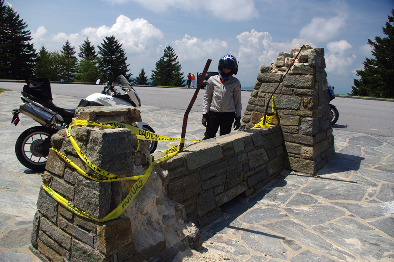
What a surprise as our motorcycles rounded the bend on my favorite section of the Blue Ridge Parkway July 4 to find a familiar and highly visited overlook feature missing. We had to stop for a closer look.

It’s one of those classic photo opportunities on your Blue Ridge Parkway motorcycle ride – the highest point of the 469 mile roadway is prominently marked with a large sign at the popular overlook. You can pull your bikes right in front of it and get that great picture to commemorate your visit – until now. That sign is missing.

Photo-sign-destroyed-on-Blue-Ridge-Parkway

It used to be a classic photo spot - pull your bikes in front of the sign and get the picture for your scrapbook

My first though was it had been struck by a car. It would have had to be a big car though, at least an SUV, maybe even a small truck, but the evidence did not show signs of a collision.

Photo-sign-destoryed-on-Blue-Rdige-Parkway

Surveying the damage we speculate the sign was pushed over. Look at the bent steel supports, and the damage to the rock pillars up high.

The damage was too high, and it appeared more as if it had occurred from the top down. The twisted steel and fractured rock indicated the sign had probably been forced down by high wind, though it must have been one heck of a blow. Perhaps it was a tornado or one of those micro-burst events. At over 6000 feet elevation you can experience some pretty severe weather.

Photo-view-from-highest-point-on-the-Blue-Ridge-Parkway

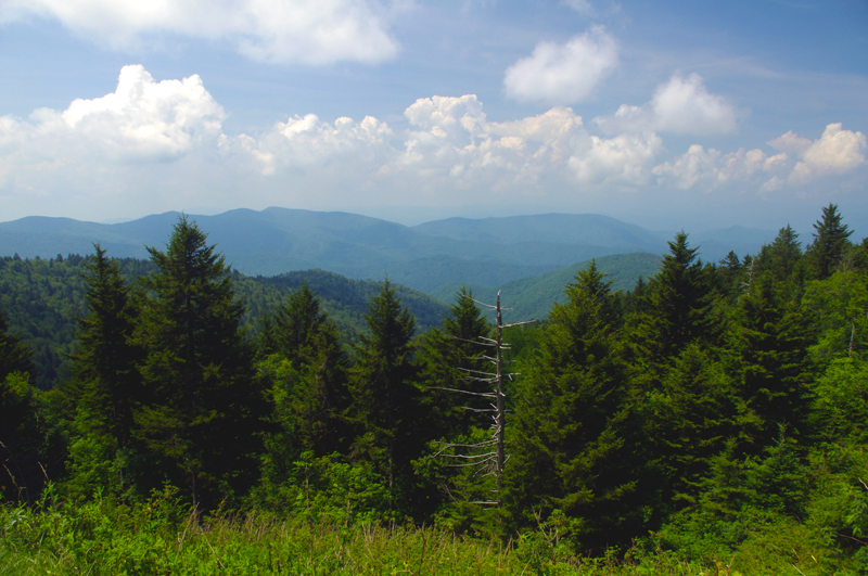
The view from the highest point on the Blue Ridge Parkway.

Still, this sign has stood through harsh conditions for many years. I’m glad I wasn’t up high when this damage occurred. We’ve had extraordinarily unusual weather in the Smoky Mountains this year. Until now, I would have told you tornados don’t happen in the mountains. Great Smoky Mountains National Park has experienced a couple, you can still see the twisted steel tower in the middle of the lake at Deals Gap left when that cyclone blew through, and  I no longer know what to expect. Times are changing and the southeast has been pummeled with twisters this year.

If it’s the end-of-times, I’m going out riding my motorcycle. Watch me flash by in the twister like the wicked witch in the Wizard of Oz. See you on the yellow brick road.

You’ll find this outstanding motorcycle riding area featured on America Rides Maps “The Best Motorcycle Rides South of Great Smoky Mountains National Park

_______________________________________________________________________________

Wayne Busch
Wayne Busch – Cartographer
– Wayne Busch lives in Waynesville, NC, where he produces the most detailed and comprehensive and up-to-date motorcycle pocket maps of the Blue Ridge and Smoky Mountains to help you get the most of your vacation experience. See them here – AmericaRidesMaps.com 

What is a Blue Ridge Parkway Milepost?

AWMXDX9J8QT9

photo-blue-ridge-parkway-milepost

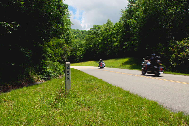
Blue Ridge Parkway milepost 455 not far from Waynesville, NC

When planning your Blue Ridge Parkway motorcycle ride you’ll find references to mileposts handy. Every mile along the Blue Ridge Parkway, you’ll find a concrete post with the mileage of the 469.1 mile long motorcycle ride displayed. Miles run from north to south, the further south you go, the higher they get. The milepost shown here, #455, is near the southern end not far from Waynesville.

Mileposts make navigation much easier and better allow you to track your progress on your Blue Ridge Parkway motorcycle vacation tour.

_______________________________________________________________________________

Wayne Busch
Wayne Busch – Cartographer
– Wayne Busch lives in Waynesville, NC, where he produces the most detailed and comprehensive and up-to-date motorcycle pocket maps of the Blue Ridge and Smoky Mountains to help you get the most of your vacation experience. See them here – AmericaRidesMaps.com 

2SearchBlogs Web

Ever seen the Dragon’s Breath on your Deals Gap motorcycle ride?

NC-28-motorcycle

The Dragons breath envelopes riders on NC 28 near Deals Gap

OK, so I made the Dragon‘s Breath thing up – at least the name. The phenomenon is real though, something you may encounter when riding NC 28 along Cheoah Lake on your way to or from The Dragon at Deals Gap.

NC-28-Fontana-lake

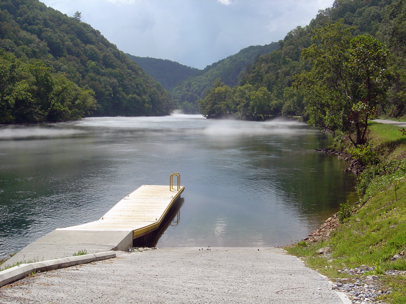
NC 28 - Cheoah Lake fog (or is it?) - Remember, there's a Dragon nearby.

The fog, which can be pretty thick at times, is a common occurrence on warm summer days. The water which drives the turbines at nearby Fontana Dam is drawn from the deepest coldest depths of Fontana Lake. When there is enough moisture in the warm air, it condenses when it comes near the cold water of Cheoah Lake.

NC-28-fontana-lake-

NC 28 - Sometimes the NC 28 bridge below the dam sits on a cloud

Fontana-Dam

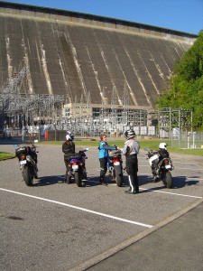
Below the Fontana Dam

A nice side trip when you are in the area is a stop at the Fontana Dam. You can access the bottom of the dam once you cross the bridge over Cheoah Lake. Turn right and follow the paved road to the power station. To see the dam from the top, and you should it’s one of the highest in the east, use the road which intersects NC 28 just beyond Fontana Village. It’s easy to find, it’s the only stop sign on NC 28.

You find NC 28, the Fontana Dam, The Dragon, the Cherohala Skyway, other nearby attractions and scores of two lane twisty back roads which make for great Smoky Mountain motorcycle rides on America Rides Maps;

_______________________________________________________________________________

Wayne Busch
Wayne Busch – Cartographer
– Wayne Busch lives in Waynesville, NC, where he produces the most detailed and comprehensive and up-to-date motorcycle pocket maps of the Blue Ridge and Smoky Mountains to help you get the most of your vacation experience. See them here – AmericaRidesMaps.com 


Blue Ridge Motorcycle Touring – Natural Bridge, Virginia

In general, I avoid the touristy sights on my motorcycle travels as I get my kicks from the road. It’s the hundreds of great motorcycle rides in the Blue Ridge and Smoky Mountains I most enjoy, and that is best done with the kickstand up and the throttle open. I need a pretty good reason to park the motorcycle and go for a walk, and Natural Bridge, Virginia, is worth time the time to stop and see.

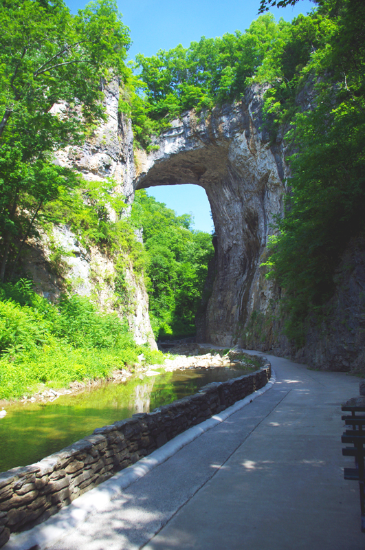
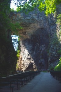
Photo-Natural-Bridge-view

The Natural Bridge, a Viriginia landmark worth seeing.

Photo-Natural-Bridge-Hotel

The Natural Bridge Hotel, a historic landmark

Natural Bridge has been around for a long time. It was already a tourist destination when Thomas Jefferson visited. This 200 foot high natural arch started as a cavern millennia ago. Over the eons erosion collapsed the majority of it leaving only the dramatic and inspiring rock formation that has drawn thousands of spectators over the last few centuries.

Photo-Natural-Bridge-Entrance-and-Gift-Shop

Natural Bridge Entrance and Gift Shop

This long history was part of the attraction for me. There are many early sketches and historic reports of the landmark displayed in the museum, it is part of our national heritage. This legacy though has come at the cost of commercialization of the natural attraction with manufactured ones added to woo the crowds and entice them to part with their dollars.

Photo-Cowboy-on-a-dinosaur

I managed to escape the Dinosaur Kingdom

We passed on the wax museum, the butterfly room, and most all the other man-made enhancements designed to lure the tourist. I was particularly amused by the hook for the “Escape from the Dinosaur Kingdom” with a statue of a cowboy riding a dinosaur. Easy to pass on that one, I’m quite satisfied with the Flintsone’s version of pre-history. Yabba-dabba dumb, but I’ll bet the kids like it as well as the Haunted Monster Museum.

Photo-Indian-village

The Indian Village re-creation.

We did walk the trail to view the re-created native indian village, but it pales in comparison to the main attraction.

We paid $18 a piece for a ticket that gave us partial access to all the attractions. All we really wanted to see was the Natural Bridge. It’s a short walk and worth the time, and while I we could have seen all the other kitschy stuff, I felt my money well spent avoiding it.

A side trip to Natural Bridge, Virginia is an easy and pleasant ride from the Blue Ridge Parkway. Exit near the James River Visitor Center on US 501 (milepost 63.7) or VA 130  a couple miles north (milepost 61.6, and the better ride). Follow Us 501 / VA 130 to Glasgow, turning right on VA 130 to pass through the small town for another 4 miles or so. Don’t worry, you can’t miss it when you arrive.

Photo-Natural-Bridge-view

View of the other side of the Natural Bridge

Natural Bridge, Virginia

The Natural Bridge and other scenic attractions nearby are found on Map #1 of the 6 map Blue Ridge Parkway series of motorcycle pocket maps by America Rides Maps. Don’t miss all the great motorcycle rides in this area.

Image-map-cover

Great rides Near the Start of the Blue Ridge Parkway in Virginia

_______________________________________________________________________________

Wayne Busch
Wayne Busch – Cartographer
– Wayne Busch lives in Waynesville, NC, where he produces the most detailed and comprehensive and up-to-date motorcycle pocket maps of the Blue Ridge and Smoky Mountains to help you get the most of your vacation experience. See them here – AmericaRidesMaps.com 

Motorcycle Touring – Sights: Spectacular Roadside Waterfall in VA

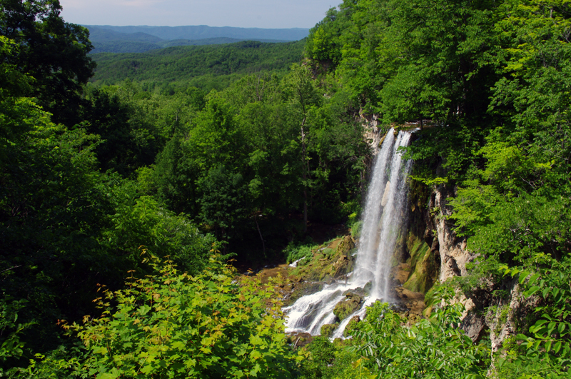
Photo-Falling_spring-VA

Falling Spring on US 220 north of Covington, VA

Located about 4 miles north of Covington, Virginia, Falling Spring has been an attraction referenced as far back as Thomas Jefferson. It’s an easy to locate, well marked pull off on this curvy section of US 220 (a.k.a Sam Snead Highway).

Jackie and I passed through here Sunday on our motorcycle ride as we explored the wealth of great motorcycle roads west of the north end of the Blue Ridge Parkway. It’s a popular rest stop for bikers who flock to ride this great section of US 220 north of Covington. After revisiting Sam Snead Highway I’ve decided it should be upgraded on my America Rides Maps. I currently show only the portion south from the falls as being a great ride, while in truth the entire section from VA 39 south is outstanding. As much as I’d like to give it my top rating, due to the traffic load I can only feel right listing it as a “Good Connector” road.

For the casual cruiser who’s just out to enjoy the ride through the spectacular scenic countryside it’s a superb motorcycle ride. For those looking for a more spirited approach to the twisty sections, of which there are plenty, you’ll want to ride this one during the off hours and preferably during the week.

This roadside waterfall and the surrounding great motorcycle rides in the area are found on map #1 of The Complete Blue Ridge Parkway 6 Map Series from America Rides Maps.

_______________________________________________________________________________

Wayne Busch
Wayne Busch – Cartographer
– Wayne Busch lives in Waynesville, NC, where he produces the most detailed and comprehensive and up-to-date motorcycle pocket maps of the Blue Ridge and Smoky Mountains to help you get the most of your vacation experience. See them here – AmericaRidesMaps.com 

The Birthplace of Tennessee – Best Seen on a Motorcycle

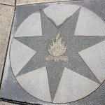
Photo - marble campfire

Who knows where this is?

It was the middle of nowhere yet it was the center of everything. I’d stumbled upon the birthplace of Tennessee.

I had low expectations. My research told me most of the roads I’d be riding today would hold little interest to the typical motorcycle rider who had come to ride The Dragon at Deals Gap and the Cherohala Skyway. None of the roads I’d ride on my 450+ mile travels would come anywhere close to those legends. Still, the morning held a surprise I never expected and made the efforts worthwhile.
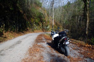
Photo - Cherokee National Forest Road

Parked along Pleasant Mountain Road. It's typical of other roads nearby - of little interest to most. Still I check them all.

Arriving in Tellico Plains, Tennessee, after an early morning motorcycle ride where I’d had the whole of the Cherohala Skyway to myself, I pointed my wheel north onto TN 360 and my workday began. Within a few miles I’d reach the point where I’d previously abandoned my search for great motorcycle rides and the explorations would resume. Rounding a curve a green street sign flashed past with a name I recognized and I clamped on the brakes to swing around.

I could rule this road out as soon as I saw it, it was doubtful it would be of any interest. Consulting my map, I saw it connected to another I wanted to investigate, so I snicked into first gear determined to make quick work of White Plains Road and move on.
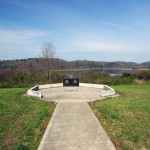
Photo - Tanasi Monument

The Tansi Monument - Tennessee gets it's name from here

It met Smoky Branch Road in a few miles where they both intersected Citico Road. I’d eventually loop back through Smoky Branch Road, also of little interest. Obviously Citico Road was the daddy in this area, the main thoroughfare of better quality, decent pavement, and sporting a faded double yellow line, a proper road.

I expected it would quickly peter out, but after several miles it continued to wind and snake through the mostly bland countryside and I started to wonder if it actually went somewhere in the big empty white space on the map. Curiosity aroused, I couldn’t resist investigating the Tanasi Memorial Site when the sign appeared.
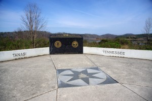
Photo - Tanasi Monument

The empty and isolated setting quickly fills with visions of what must have been

Never heard of it. Turning the motorcycle onto Bacon Ferry Road I ventured out into the nothingness on the barely paved bumpy and potholed  single lane that led out onto a low finger of land surrounded by Tellico Lake. I rode past the pull-off, but a quick glance towards the lake had me circling back when I saw the shoreside monument.
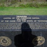
Photo - Tanasi inscription

Inscription transcribed below

Tanasi

Capital of the Cherokee Nation

1721-1730

Origin of the Name for the State of Tennessee

The site of the former town of Tanasi, now underwater, is located about 300 yards west of this marker. Tanasi attained political prominence in 1721 when its civil chief was elected the first “Emperor of the Cherokee Nation”. About the same time, the town name was also applied to the river on which it was located. During the mid 18th century, Tansi became overshadowed and eventually absorbed by the adjacent town of Chota, which was to the immediate north. The first recorded spelling of Tennessee as it is today occured on Henry Timberlakes map of 1762. In 1796, the name Tennessee was selected from among several as most appropriate for the nation’s 16th state. Therfore, symbolized by this monument, those who reside in this beautiful state are forever linked to its Cherokee heritage.
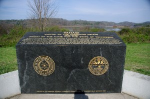
Pho

Cherokee Tanasi to Tennessee - State. A heritage preserved and honored.

I don’t much adhere to theories of “vortexes” or spirituality, but there’s something about this site that is powerful enough to make it worth a visit, it will be on the new map. It’s worth the ride out to it. See it if you have the chance.

_______________________________________________________________________________

Wayne Busch
Wayne Busch – Cartographer
– Wayne Busch lives in Waynesville, NC, where he produces the most detailed and comprehensive and up-to-date motorcycle pocket maps of the Blue Ridge and Smoky Mountains to help you get the most of your vacation experience. See them here – AmericaRidesMaps.com 

My Search for the Best Mountain Motorcycle Rides Never Ends

Photo - Maple Springs Observation Point

The Maple Springs Observation Point - accessed from Santeetlah Rd

Friday’s search for great Smoky Mountain motorcycle rides, which culminated with a spirited cruise on the Cherohala Skyway, was one of those days that might be looked on as not so productive. It’s not that I didn’t catalogue some good mountain motorcycle riding roads, I added several which will appear on my new map of the area. In my quest to leave no stone unturned, much of the 400 miles I covered was spent on roads which only the most adventurous would bother to travel. Still, there are sights and places some may wish to see, and I’m determined to find as many of them as I can.

Photo - Cherokee National Forest View

View from the Maple Springs Observation Point. I was told you can see 5 states from this spot.

Considering the number of motorcycle riders who are drawn to the area by such notable roads as The Dragon at Deals Gap, the Cherohala Skyway, The Tennessee Foothills Parkway, NC 28 (now renamed “the Moonshiner 28“), finding others that compare in quality is pretty much futile. These are some of the best motorcycle rides in the world. I’m not holding my breath thinking I’m going to discover the next great classic motorcycle ride. So why go to all this effort?

Photo - Santeetlah Dam

Quiet morning at the Santeetlah Dam

There are probably millions of motorcycles that pass through here each year. In most cases, they come, they ride the famous roads, get the t-shirt, then they’re gone to other places following the crowds. It’s the notable roads that get all the attention. Once experienced, it’s back on the four lane or the congested tourist arteries to reach the next great spot. You can rack up a lot of miles playing connect-the-dots, though those droning plods on the connections are the price you pay to reach those popular motorcycle rides.

Photo - Bald River Falls

Bald River Falls

It doesn’t have to be that way. I’m filling in the gaps between the famous motorcycle rides with the best quality rides I can find so connecting the dots is as much of an adventure as the roads you’re trying to reach. Where others might show you one good way to get from point A to point B, I look for all the best ways.

Photo - Cherohala Skyway View

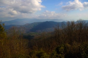
View from the Cherohala Skyway. The Smoky Mountains were especially smoky today and I'll get more photos another time.

Who want’s to spend their time on the 4 lane or in bumper to bumper tourist traffic when there are so many empty two lane scenic and challenging mountain roads that get bypassed? It’s often as simple as crossing over to the next valley to escape the congestion. One little turn can make the difference between cruising along with the wind in your face or cursing the throngs of dawdling codgers, gawking sightseers, lumbering RV’s, and belching commercial trucks struggling up the grades to deliver their wares.

Photo - Motorcycles on the Cherohala Skyway

Bikes on the Cherohala Skyway

I’ve catalogued more than 100 good motorcycle roads so far surrounding Great Smoky Mountains National Park. I’m not done yet. Some of these are outstanding rides. Others will satisfy those looking for adventure. All of them avoid most everyone else who’s come to enjoy the Smoky Mountains just like you and take you to the places they’ll never see while getting you where you want to be.

Keeping you going is what keeps me going. I’m closing in on finishing the map of the Best Motorcycle Rides North of Great Smoky Mountains National Park. Stay tuned and see what I discover. It’s all for you. (Click on the photos for the large versions)


http://www.youtube.com/watch?v=xBbQfR2GqMc

_______________________________________________________________________________

Wayne Busch
Wayne Busch – Cartographer
– Wayne Busch lives in Waynesville, NC, where he produces the most detailed and comprehensive and up-to-date motorcycle pocket maps of the Blue Ridge and Smoky Mountains to help you get the most of your vacation experience. See them here – AmericaRidesMaps.com 
 

Great Food in a Gas Station? Hello, Caffe Rel!

Photo - Hot Spot Gas Station in Franklin

You can't miss the huge Hot Spot gas station in Franklin, home to the Caffe Rel.

I’ve been hearing tales of Caffe Rel for quite a while but a good restaurant in a gas station? It was just a bit hard to believe. Nor does Franklin, NC come to mind when I’m thinking of great places to eat. It does now.

Let’s say I had my doubts when I pulled into the Hot Spot gas station in downtown Franklin. It is a very nice gas station. Big, new, clean. You can’t miss it. We arrived around 5:30 and there were already cars in all the spaces outside.

I had heard the place was small. It wasn’t as small as I supposed, but seating is limited. Get there early. It’s really nice on the inside. It’s not well set up for large parties – tables seat 4, there are a couple that will hold 6, but room is limited and if you come in with a huge group don’t expect to share a table.

Photo - Caffe Rel sign

Still seems odd - a decent restaurant connected to the Hot Spot convenience store.

The menu is extensive and I was surprised at some of the offerings. It’s got a French theme, but also covers a variety of cuisines. One of the specials of the evening was “snails and tails“,  the tails being crawfish. I chose another crawfish dish. We also tried the mountain trout (great), the french style roast beef (excellent), shrimp and grits (not the typical southern recipe, but a nice twist), and assorted ravioli. Everybody got a great meal and we had very good service. What more can you ask for?

So what has this got to do with Smoky Mountain motorcycle riding? A lot of motorcycle riders find their way to Franklin. It’s nice to know those good places to stop when you come to a decent sized town.

Photo - inside Caffe Rel

It's surprisingly nice inside. The food will surprise you as well.

Franklin, NC is one of those towns located at the crossroads of several great motorcycle rides. US 64 passes on the south side of town. Go east to see 4 great roadside waterfalls on the way to Highlands. Wayah Road lies just 5 miles to the west. The great motorcycle ride over Wayah Bald into the Nantahlala River gorge is a classic. The Moonshiner 28 runs north to lead you to the Dragon at Deals Gap. US 441 takes you to Cherokee and the start of the Blue Ridge Parkway. You’re only half an hour from some of the great motorcycle rides in north Georgia. Those are just the well known motorcycle rides in Franklin. There are plenty more on my America Rides Maps.

Photo - inside Caffe Rel

The next time you're near Franklin, remember the Caffe Rel and try to stop during the off hours.

I didn’t find a web site for Caffe Rel, but then, they don’t have a bathroom either. Use the one in the gas station. Maybe it has a web site. Don’t much care.

We’ll be revisiting the Caffe Rel, looking for opportunities to stop during the off hours. By normal meal times, the place is packed. Hope you get a chance to try it.

_______________________________________________________________________________

Wayne Busch
Wayne Busch – Cartographer
– Wayne Busch lives in Waynesville, NC, where he produces the most detailed and comprehensive and up-to-date motorcycle pocket maps of the Blue Ridge and Smoky Mountains to help you get the most of your vacation experience. See them here – AmericaRidesMaps.com 

Sights From the Motorcycle Road – Penland Post Office

Yesterday’s explorations north of Asheville brought me back to many familiar roads, several good new ones, and far too many unpaved and unsuitable trails that had to be investigated regardless. With leaf season past its peak thanks to some windy storms, I followed the Blue Ridge Parkway north and paused along the way to see what remains. There’s still some good color down low, but it’s mostly yellows, browns, and gold that hold fast to the branches for another week or so.

Photo - view from the Blue Ridge Parkway

The Black Mountains viewed from the Blue Ridge Parkway between Crabtree Falls and Little Switzerland. Still some leaves giving a last show of color.

Northeast of Spruce Pine, NC, an excellent motorcycle ride can be enjoyed on Penland Road. It diagonals between the the too heavily trafficked US 226 and US19E and is a welcome relief from the four lane bustle. Near the midpoint sits the tiny hamlet of Penland and the ancient Penland Post Office.

Photo - Penland Post Office

The flag was the giveaway the Penland Post Office was still in business. I've passed by many times, today I stopped to visit.

I’d passed by it many times, noting it’s location, but never paying it much attention as it appeared to be abandoned. Yesterday, seeking a spot to stop and consult my map, I found it’s very much alive and functional despite its antique appearance.

Photo - Penland Post Office

A place preserved in time, I had wondered if the Penland Post Office was just another abandoned relic of the past. Hardly the case.

The female postmaster seemed to welcome the intrusion of me poking about, snapping a few photos, and inquiring about the location. She tells it’s slated for restoration thanks to the efforts of the nearby Penland School of Crafts.

Photo - Penland Post Office

I suspect many of these boxes are tended only by ghosts, though it's hardly an isolated area. Generations have lived back in these mountains and continue to do so.

Discovering sights like these is one of the best reasons to get off the Blue Ridge Parkway and explore the wealth of back roads that weave throughout the Smoky Mountains. Were I to photograph and visit all of them I’d get little mapping done. Trust me, there are plenty more awaiting your discovery and the roads and motorcycle rides that lead to them are what keep me going.

Photo - Penland Post Office

While I did see a computer in the back room, I suspect this typewriter and brass scale got just as much use.

The Blue Ridge Parkway projects an image of isolated mountain wilderness that doesn’t truly reflect just how many people have lived adjacent to it since times before there were cars and motorcycles. Think about it – something like popular Mabry Mill on the parkway could never have existed were there not a community that needed and supported it. Many of those communities persist and the roads which connect to and lie nearby the Blue Ridge Parkway are the gateways to discovering them. Discover America Rides Maps and find this wealth of hidden treasures.

_______________________________________________________________________________

Wayne Busch
Wayne Busch – Cartographer
– Wayne Busch lives in Waynesville, NC, where he produces the most detailed and comprehensive and up-to-date motorcycle pocket maps of the Blue Ridge and Smoky Mountains to help you get the most of your vacation experience. See them here – AmericaRidesMaps.com