The Blue Ridge Parkway’s Best Kept Secret Waterfall

The Mount Lyn Lowry overlook is  a large and welcoming pull-off on the Blue Ridge Parkway that holds more than appears on a drive-by.

Motorcycle the Blue Ridge Parkway in the early spring and you’ll be rewarded with sights unseen by those who visit later in the year. One of them is Woodfin Cascades at the Mt Lyn Lowry overlook (MP 446.7). Once leaves cover the trees when summer arrives, most of this waterfall disappears from view.

Photo-woodfin-cascades-on-the-blue-ridge-parkway

Woodfin Cascades are viewed from the Mt. Lyn Lowry overlook on the Blue Ridge Parkway

Another secret revealed to those who spend a little time observing at this Blue Ridge Parkway overlook is the 60 foot high illuminated cross atop Mt. Lyn Lowry. You can use the cross as a reference to fid the falls, they are located beneath it on the mountainside.
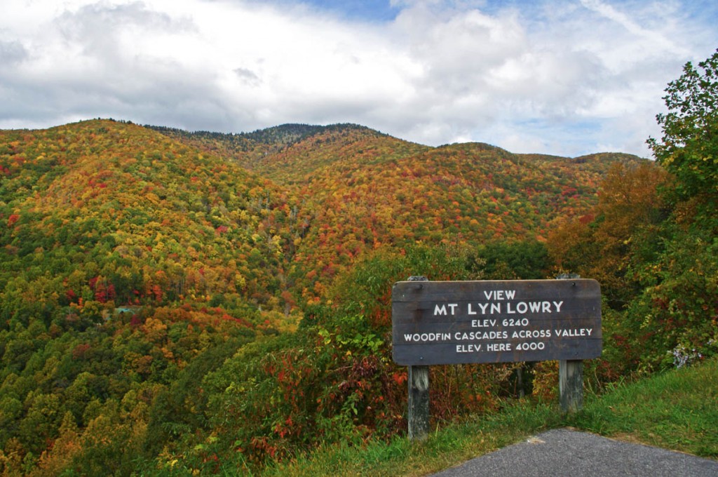
Photo-mt-lyn-lowry-fall

The cross is located atop the mountain. Even though it's 60 ft tall, on a 6240 mountain it's just a speck! The falls are hiding behind the leaves.

Mt Lyn Lowry overlook is located on the section of the Blue Ridge Parkway between Waynesville at US 74 and Maggie Valley at US 19. This is one of the most scenic stretches of the national park as it climbs to the heights of Waterrock Knob, then descends to Soco Gap and Maggie Valley. There are numerous long range overlooks.  Be sure to bring your camera for some of the best views you’ll find.
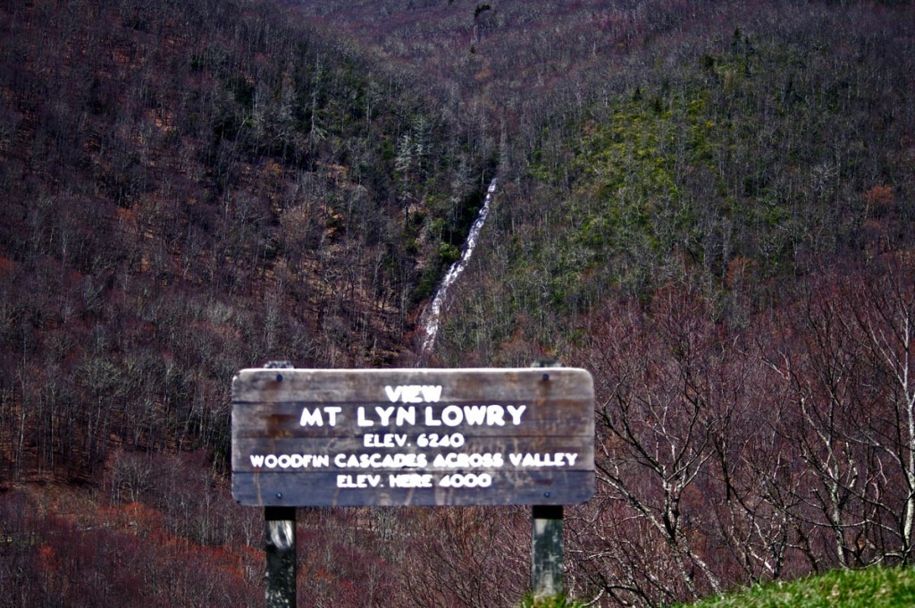
photo-woodfin-cascades

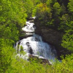
In spring, the entire 235 foot run of Woodfin Cascades can be admired. It dissapears when things green up.

Here’s a 2 min video closeup of Woodfin Cascades –

__________________________________________________________________

Wayne Busch

Wayne Busch - Cartographer

Total Rider Tech Logo

Learn Total Control

– Wayne Busch lives in Waynesville, NC, where he produces the most detailed and comprehensive and up-to-date motorcycle pocket maps of the Blue Ridge and Smoky Mountains to help you get the most of your vacation experience. See them here – AmericaRidesMaps.com

Wayne is an advanced motorcycle instructor for Total Rider Tech teaching Lee Parks Total Control Advanced Rider Courses. Isn’t it time you looked into advanced rider training to ride more confidently and safely? It can transform your mountain riding experience.  Total Rider Tech

____________________________________________________________________

Scenic Motorcycle Rides – Dry Falls, NC

The beautiful region south of Great Smoky Mountains National Park is often called “The Land of the Waterfalls” and is one of the most popular areas to ride on a motorcycle.  More than 20 nice waterfalls are located close to the roadside, another 40 or so require more serious hiking than most bikers are willing or equipped to tackle.

photo-Dry-Falls

A path leads behind Dry Falls so you can pass beneath it without getting wet.

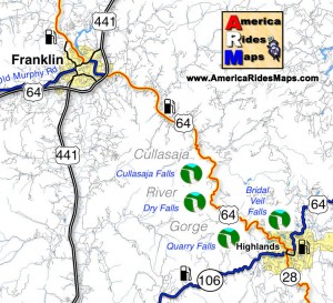
Dry Falls is one of the most unique though it’s an easy one to miss on your motorcycle ride despite being well marked. It’s easy to miss as it’s not directly visible from the road so you’re not tempted off the wonderfully curvy section of US 64 as it snakes through the spectacular Cullasaja Gorge between Franklin and Highlands.

This section of US 64 can be a very enjoyable ride on a motorcycle, though it’s too often hampered by other traffic drawn to see the sights and wonders. On those typical days when there is a good amount on traffic on the road, it’s definitely worth the time to stop for a break and make the short walk from the parking area to admire Dry Falls.

image-map-of-waterfalls

Dry Falls got it’s name because you can walk beneath the falls without getting wet. A large cavern beneath the rock ledge at the top of the falls has a path where you can pass behind the cascade to emerge on the other side. It has the largest and best improved parking area of all the falls in the area, so it’s an easy place to stop and enjoy.


image Great Smokies south map coverFind more than a dozen roadside waterfalls on America Rides Maps map #7The Best Roads SOUTH of Great Smoky Mountain National Park

__________________________________________________________________

Wayne Busch

Wayne Busch - Cartographer

Total Rider Tech Logo

Learn Total Control

– Wayne Busch lives in Waynesville, NC, where he produces the most detailed and comprehensive and up-to-date motorcycle pocket maps of the Blue Ridge and Smoky Mountains to help you get the most of your vacation experience. See them here – AmericaRidesMaps.com

Wayne is an advanced motorcycle instructor for Total Rider Tech teaching Lee Parks Total Control Advanced Rider Courses. It’s time you looked into advanced rider training to ride more confidently and safely, it will change your mountain riding experience. It worked so well for me I became an instructor! Total Rider Tech

____________________________________________________________________

North Carolina + Motorcycle + Camera + Rain = Waterfalls!

Photo-clouds-move-in-on-the-Blue-ridge-Parkway

As the clouds moved in, I left the Blue Ridge Parkway color behind.

I’ve been taking every opportunity to get out on the motorcycle on the Blue Ridge Parkway and photograph one of the best years for fall leaf color in a long time. I’ve captured some great shots so far. Yesterday though, the weather changed and the high places were quickly enveloped in cloudy wetness so thick I could barely see. Resigned to give up the day to the weather, I stowed the camera and left the Blue Ridge Parkway at Beech Gap (map) to return home to Waynesville via NC 215.

photo-Flat-Laurel-Creek-on-NC 215

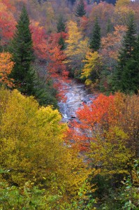
Easy to miss, Flat Laurel Creek cascades down the rock faces - 3rd pull out on right, first long straight section of road from top

Currently, a ride on NC 215 is a Jekyll & Hyde experience.  South of the Blue Ridge Parkway, this popular motorcycle ride is an exquisite pleasure as it plunges down from the heights to reach US 64 near Rosman. Recently paved, this southern section of  the road courses through the  Pisgah National Forest, with stunning views from the high parts and challenging curves and bends that thrill.

Photo-Bubbling-Springs-Branch-on-NC 215

Easy to find Bubbling Springs Branch is on a sharp curve where it flows under NC 215.

In contrast, the north end of NC 215 is a nightmare for the motorcyclist and I’ve heard many bikers cursing the experience of surviving the twisty descent on a road now strewn with loose gravel after recent road “improvements”.  It got a “tar & chip” repair job a few weeks back which addressed the breaks in the pavement, but left a slippery legacy to negotiate turns that are a handful on a road with ideal conditions. Riding it on a motorcycle now is an experience that brings dread to the minds of most.

Coming down in the rain, already wet, I took my time and paused along the route to capture some shots of the scenery most motorcyclists will miss as all their attention is focused on staying upright on this challenging road.

Photo-East-Fork-Pigeon-River

The river calms briefly near the Sunburst Campground with an easy to find pull off along this section.

There are many hidden secrets along this stretch of NC 215 as it traces the course of the Little East Fork of the Pigeon River though most blast right by them. It’s worth taking a little time to pause and explore.

The river is never far from the road, and several small streams add to the torrent along the way. For those who enjoy hiking, the trails through this area are ripe with outstanding scenery.

The Little East Fork eventually reaches Lake Logan where it is captured by a dam. It then continues on to join the Big East Fork before it continues it’s run on through Canton, NC then on into Tennessee where I-40 cuts through a dramatic gorge at the state lines. Eventually it flows through Pigeon Forge, TN, then on to join the great rivers beyond.

Photo-Lake-Logan-North-Carolina

The river pools behind the dam at Lake Logan, then continues on.

Forced to slow down by the road, the rain, and the rocks, I enjoyed a ride most others despise. NC 215 will always be one of our favorite local North Carolina motorcycle rides. I’m hopeful it will see a proper paving in the future, but if not, it will still be a road I visit often and recommend to others. The gravel will eventually be cast along the roadside by traffic.

Don’t be put off by the condition of NC 215. Take your time, go easy, and you’ll be rewarded with some outstanding sights along this classic North Carolina motorcycle ride. It will only get better with time.

_______________________________________________________________________________

Wayne Busch

Wayne Busch - Cartographer

Total Rider Tech Logo

Learn Total Control

– Wayne Busch lives in Waynesville, NC, where he produces the most detailed and comprehensive and up-to-date motorcycle pocket maps of the Blue Ridge and Smoky Mountains to help you get the most of your vacation experience. See them here – AmericaRidesMaps.com

Wayne is an advanced motorcycle instructor for Total Rider Tech teaching Lee Parks Total Control Advanced Rider Courses. It’s time you looked into advanced rider training to ride more confidently and safely, it will change your mountain riding experience. It worked so well for me I became an instructor! Total Rider Tech

_______________________________________________________________________________
You’ll find NC 215 and some of the best motorcycle rides in this outstanding area along with a guide to more than a dozen roadside waterfalls on America Rides Maps “The Best Motorcycle Rides EAST of Great Smoky Mountains National Park

Motorcycle Friendly Lodging – Gear Head Inn near Bryson City, NC

photo-blue-ridge-parkway-view-big-witch

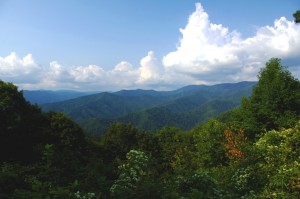
View form the Blue Ridge Parkway this afternoon - Big Witch Overlook near Cherokee

Another great motorcycle friendly place to stay in the Smokies and I got you another discount! Read on…

A gorgeous afternoon on the Blue Ridge Parkway with clear blue skies, amazing long range views, and those wonderful, wonderful curves, provided a stark contrast to the touristy mess that is Cherokee as I came off the parkway, passed through town, then pointed my wheel west on US 19 towards Bryson City, NC.

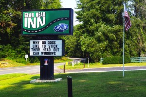
As soon as you’re out of town the pleasant green returns and two lane US 19 winds its way along the pretty Oconoluftee River for several miles as you leave the Reservation. It was easy to spot the Gear Head Inn sign and I pulled into the quiet spot cradled in the hillside along the road.

photo-sign-gear-head-inn

The Gear Head in Near Bryson City, NC

The first thing that struck me was how fresh everything looked. The green metal roofs looked new, as did the paint, in fact everything showed it had been resurrected and restored to a standard that exceeds anything I’d seen in the surrounding properties. The lawns were well tended, the pool sparkled, and the first impression is that the owners have put a lot of time and effort into this making this motel a labor of love. It shows.

Jim was finishing up the last of the renovations to the spacious lobby and the room was both inviting and welcoming. Mary met me at the door and invited me in.

photo-room-gear-head-inn

The rooms are huge at the Gear Head Inn

The cold glass of spring water she brought me was welcome on this hot late summer afternoon, and I spent some time getting to know them and finding out what they had to offer the motorcycle vacationer.

The motif reflects Jim’s passion for performance automobiles, and while he’s primarily a car guy at heart, I think any performance vehicle gets his motor running and he loves the motorcycle visitors. They’ve designed this place for people who love their rides, two wheels or four, and want a place where car and motorcycle enthusiasts feel at home. It’s a great place for people who frequent the numerous custom car and motorcycle shows in the area.

photo-pool-gear-head-inn

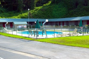
The pool - note the lights

Was I surprised when Mary showed me a room! Jeez, they are huge! Totally out of character from what you typically find in these smaller roadside motels. Must say I’m impressed.

They’ve got a bike cleaning station waiting, a nice fire pit centrally located for sharing those stories about the days ride in the evening, and nice level paved parking set well back from the road. Mary even knew of a roadside waterfall I’d yet to discover and she shared its secret location with me – sorry Mary, that was a mistake, I’m a blabbermouth and I’ll be checking it out ASAP (ask her about it).

They’ve got a few motorcycle groups coming in over the next couple weeks, but would love to see a few more. As an incentive, they’re offering a 10% discount through December if you tell them I sent you or bring in one of their cards I’ll be sending out with all America Rides Maps orders this fall.

PS – take a look at the lights by the pool – (They’re giant gear shift levers – how cool!)

Gear Head Inn


_______________________________________________________________________________
_______________________________________________________________________________
Wayne Busch

Wayne Busch - Cartographer

Total Rider Tech Logo

Learn Total Control

– Wayne Busch lives in Waynesville, NC, where he produces the most detailed and comprehensive and up-to-date motorcycle pocket maps of the Blue Ridge and Smoky Mountains to help you get the most of your vacation experience. See them here – AmericaRidesMaps.com

Wayne is an advanced motorcycle instructor for Total Rider Tech teaching Lee Parks Total Control Advanced Rider Courses. It’s time you looked into advanced rider training to ride more confidently and safely, it will change your mountain riding experience. It worked so well for me I became an instructor! Total Rider Tech

_______________________________________________________________________________
Motorcycle Touring – Sights: Spectacular Roadside Waterfall in VA

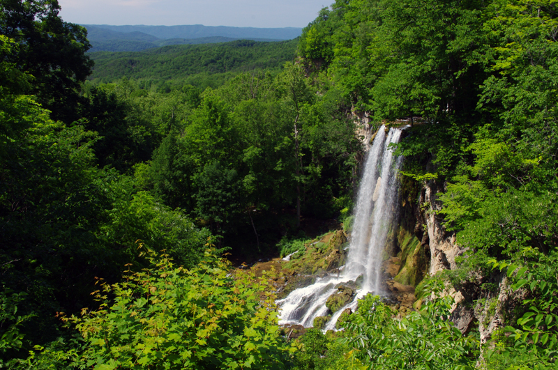
Photo-Falling_spring-VA

Falling Spring on US 220 north of Covington, VA

Located about 4 miles north of Covington, Virginia, Falling Spring has been an attraction referenced as far back as Thomas Jefferson. It’s an easy to locate, well marked pull off on this curvy section of US 220 (a.k.a Sam Snead Highway).

Jackie and I passed through here Sunday on our motorcycle ride as we explored the wealth of great motorcycle roads west of the north end of the Blue Ridge Parkway. It’s a popular rest stop for bikers who flock to ride this great section of US 220 north of Covington. After revisiting Sam Snead Highway I’ve decided it should be upgraded on my America Rides Maps. I currently show only the portion south from the falls as being a great ride, while in truth the entire section from VA 39 south is outstanding. As much as I’d like to give it my top rating, due to the traffic load I can only feel right listing it as a “Good Connector” road.

For the casual cruiser who’s just out to enjoy the ride through the spectacular scenic countryside it’s a superb motorcycle ride. For those looking for a more spirited approach to the twisty sections, of which there are plenty, you’ll want to ride this one during the off hours and preferably during the week.

This roadside waterfall and the surrounding great motorcycle rides in the area are found on map #1 of The Complete Blue Ridge Parkway 6 Map Series from America Rides Maps.

_______________________________________________________________________________
Wayne Busch
Wayne Busch – Cartographer
– Wayne Busch lives in Waynesville, NC, where he produces the most detailed and comprehensive and up-to-date motorcycle pocket maps of the Blue Ridge and Smoky Mountains to help you get the most of your vacation experience. See them here – AmericaRidesMaps.com 

Motorcycling in the Land of the Waterfalls – Shouldn’t You be in these Photos?

Photo - Soco Road Exit Blue Ridge Parkway

We started from the Soco Rd Exit (US 19) on the Blue Ridge Parkway @ MP 455.7

Absolutely gorgeous weather over the holiday weekend did not go to waste. We took advantage of the opportunity to enjoy riding a “tourist” loop we typically avoid. While the good folks were in church, we knew the traffic would be light and the timing would be right to get out for a Smoky Mountain motorcycle ride that would take us by some of the best scenery the area has to offer and a trip through the Land of the Waterfalls.

Photo - Museum of the Cherokee Indian

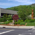
Museum of the Cherokee Indian

We made our way to Maggie Valley and started the loop from the Soco Gap exit on the Blue Ridge Parkway at MP 455.7. Careening down through the curves towards Cherokee, we had the road to ourselves and got the rare chance to enjoy this twisty section of two lane which is normally crowded with travelers and commuters.

Photo - Bear in Cherokee

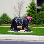
Cherokee is full of these bears

Cherokee was quiet as we sneaked into town for a quick photo then continued on US 19 into Bryson City on the south side of Great Smoky Mountains National Park.  On Easter Sunday, the trains of the Great Smoky Mountain Railroad sat in reverence as we passed through the back side of town to check out a road I’d been curious about – (I never stop looking for new roads for America Rides Maps).

Photo - Great Smoky Mountains Railway Train

Great Smoky Mountains Railroad train in Bryson City

After 10 minutes on the Great Smoky Mountains Expressway (US 74 /19/23/28), we forked south into the Nantahala Gorge and paused for a break at the Nantahala Outdoor Center on the river.  From now on, this beautiful road which follows the course of one of the most popular whitewater rivers in the east will be filled with lumbering buses hauling rafters and kayakers upstream for the chilly and thrilly ride through the rapids. Thanks to the holiday, there was no commercial traffic, though plenty of others were here to enjoy the hiking, biking, and other pursuits in this hub of outdoor activity.

Photo - Rivers End Restaurant

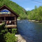
The Rivers End Restaurant sits on the Natahala River at NOC.

Enduring 10 miles of relatively light traffic, we turned off for the climb over Wayah Bald. Snaking up along the cascading river, we passed fishermen gracefully floating their flies in the quiet pools beneath the numerous falls, then paused for a picnic lunch on the shore of crystal clear alpine Nantahala Lake.

Photo - motorcycle on Wayah Road

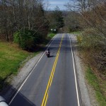
Jackie cruises Wayah Road

The ride across the top of the mountain is more challenging than it is scenic filled with curves and twists that attract riders to this favorite motorcycle route. Easing down through the hairpin curves on the back side of the hump, the road traces the course of another stream which builds to flow into the Little Tennessee River once you reach Franklin.  We passed through town then headed south again on US 64 / NC 28 to enter the Cullasaja River Gorge.

Waterfall along Wayah Road

The ride along the river on Wayah Road is spectacular!

It looked like our luck was changing as we found ourselves behind several cars, but each peeled off on side roads before we reached the outstanding curves that carve through the rugged canyon and we actually got to enjoy the ride at speed. That is a rare treat and we appreciated it. Good rains this spring have the waterfalls roaring and they were spectacular.

Photo - motorcycles at Nantahala Lake

Picnic lunch at alpine Nantahala Lake

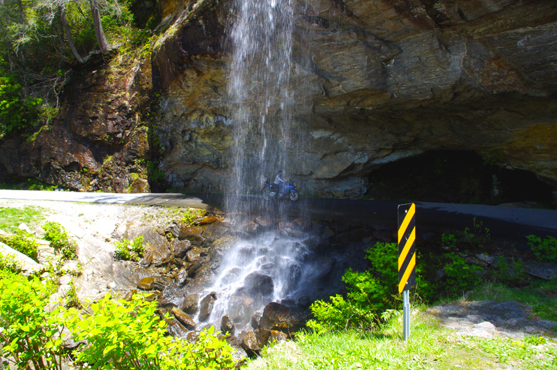
There are four easy to spot major waterfalls along this stretch of US 64 leading into Highlands, Cullasaja Falls (the largest), Dry Falls, Quarry Falls, and delicate Bridal Veil Falls. We stopped for a unique photo at Bridal Veil Falls where a small paved loop runs behind the cascade.

Photo - Cullasaja Falls

Cullasaja Falls on US 64 / NC 28

The remainder of the ride on US 64 is outstanding for scenery but by mid afternoon the tourist traffic was picking up and we did not always get to exploit the wonderful curves as much as we would have liked. The horizons are flanked with glimpses of the highest naked cliffs in North Carolina, some more than 1000 feet tall, and you cruise through some of the most expensive real estate in the country.

We completed the loop by heading north again on US 215 from Rosman climbing to reach the highest section of the Blue Ridge Parkway on a freshly paved road that snakes through outstanding turns and scenery that make it one of the locals favorite rides.

Photo - Motorcycle behind Bridal Veil Falls

Jackie poses for a photo on her motorcycle behind Bridal Veil Falls just outside Highlands, NC on US 64 / NC 28. How cool is that?

Click on photos for larger view

_______________________________________________________________________________
Wayne Busch
Wayne Busch – Cartographer
– Wayne Busch lives in Waynesville, NC, where he produces the most detailed and comprehensive and up-to-date motorcycle pocket maps of the Blue Ridge and Smoky Mountains to help you get the most of your vacation experience. See them here – AmericaRidesMaps.com 

Motorcycle Touring the Blue Ridge Parkway – Crabtree Falls Visitor Center – Is it worth the stop?

So what does the Crabtree Falls Visitor Center offer those on a motorcycle tour of the Blue Ridge Parkway and is it worth a stop?

Image located at http://www.ncwaterfalls.com/crabtree1.htm

Image from NC Waterfalls site -http://www.ncwaterfalls.com/crabtree1.htm. For detailed info and more photos use the link.

http://www.ncwaterfalls.com/crabtree1.htm

If you pull into the Crabtree Falls Visitor Center near milepost 339.5 on the Blue Ridge Parkway expecting to see a dramatic and breathtaking cascade you’ll be disappointed. The waterfall is a mile hike distant down a rough trail, not the ideal venue for riding boots and gear. Should you want to see the falls, come prepared to change into something more appropriate for the hike to reach it. Of course, if you’re spending a night at the campground (71 tent and 22 RV sites, May – October, $14) it’s a must do.

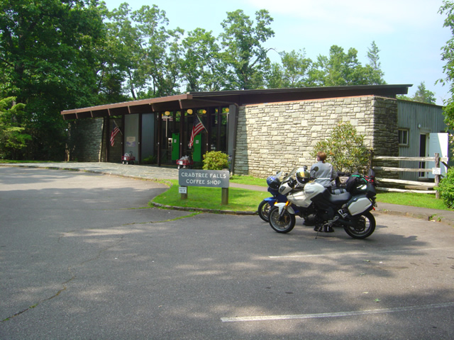
Photo - Visitor Center at Crabtree Falls

The Visitor Center at Crabtree Falls on the Blue Ridge Parkway

The Visitor Center serves as a convenience store for the campground and parkway traffic. You can get snacks and sandwiches, drinks, and limited supplies.

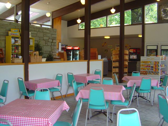
Photo - seating area at the Crabtree Falls Visitor Center

Seating area at the Crabtree Falls Visitor Center where you can savor your snacks

There’s an indoor seating area as well as a porch, though I would consider the views of a small clearing surrounded by trees all that inspiring. Still, it’s a nice and quiet place to spend a break.

Photo - Gift Shop at Crabtree Falls Visitor Center

One section of the Gift Shop at Crabtree Falls Visitor Center

The Visitor Center at Crabtree Falls is as much a gift shop as it is a convenience store with the usual craft and parkway related items.

Photo - Inside the visitor center at Crabtree Falls

Supplies are limited, but you won't starve if you come in off the road looking to camp.

So is it worth a stop on your motorcycle vacation? If you’re making your motorcycle trip by camping along the way it might just be the nice quiet campground that you’re looking for. It’s certainly a good pit stop for those passing through who need break, a bathroom, and a little something to sustain them on their way.

For info about other waterfalls on or near the Blue Ridge Parkway look at Virtual Blue Ridge -Parkway Waterfalls.

If you’re really into seeing roadside waterfalls, check out America Rides Maps 2 map bundle – The Carolina Waterfall Tour with nearly 2 dozen roadside cascades to enjoy with little if any walking.

http://www.youtube.com/watch?v=eBrB5lrtZ9I

_______________________________________________________________________________

Wayne Busch

Wayne Busch - Cartographer


– Wayne Busch lives in Waynesville, NC, where he produces the most detailed and comprehensive and up-to-date motorcycle pocket maps of the Blue Ridge and Smoky Mountains to help you get the most of your vacation experience. See them here – AmericaRidesMaps.com


Another Great Motorcycle Ride to be Added to the List – My Secret

It’s not all that frequently I miss a great motorcycle ride in my explorations. I really try to be thorough as well as intuitive, so few slip by. Still, I can’t claim to know ALL the great roads in the southern Appalachians, just the vast majority of them. I continue to find more, and quite embarrassingly, they are too often close to home. Everyone believes they know ALL the great roads right in their back yard. Time and again I am proven wrong, and that’s not such a bad thing.

Stop reading now if you think I am giving this one away. No photos, no road names, nada. I just gave away 30 routes at the Asheville Bikefest for free and people gobbled them up. Nor is this a post about the Asheville Bikefest, I think you may be getting sick of hearing about that, but be cautioned, there will be more to come. The event was far more successful than expected and stuff is flooding in. The only reason I mention the event is because I found this great road because of it.

As Route Master for the Asheville Bikefest (there I go again, last time) I spoke with countless people helping them find the best rides in the area and getting them to see the most in the time they had. When you’re passionate about something, even work becomes fun. I went almost non-stop for four days and I had a great time. That’s why I founded America Rides Maps.

So anyway, this guy wants me to direct him to one of the two dozen local roadside waterfalls, which I do, so he can get of picture of his bike behind it. Yeah, you can actually drive behind this waterfall right off the road. He didn’t find it. Why, I don’t know, it’s one of the most obvious roadside waterfalls there is but that doesn’t matter. What matters is this guy doesn’t give up. He gets directions which lead him off into the forest. He rides and rides everything in sight, exploring places I know better than to go. He never finds it.

The next day he comes back to me and tells me he couldn’t find the waterfall. I’m a bit incredulous, it’s so easy. I redirect him. He relates his adventures and tells me he found this awesome motorcycle ride. I’m dubious. If he couldn’t find the easy waterfall do I believe him now? I made a mental note of it nonetheless. About an hour later I’m talking to a couple of women. They’re buying maps of the areas closest to them (we all think we know our own back yard), right down the street from the “event which will not be named again in this post. Out of curiosity, I ask if they know of this road the guy mentioned. “I live on that road, it’s great!”

So I can’t resist. Today I have to check it out. It rocks. Who cares how or why I missed it.   I’ll add it to the “The Best Roads South of Great Smoky Mountains State Park – EAST” map tomorrow. The other routes in the area I’d previously identified were detours around a congested town and a four lane section of road which formed one leg of a 100 mile+ triangle of superb riding. Now I think I’m looking forward to the detour more than the great rides that lead to it.

I have some more leads to follow up. I know some will be disappointing. I think I’ve done at least one and rejected it, my standards are high, but you never know. I’d be very pleased to find another jewel.

50 Great Motorcycle Roads Near the Tail of the Dragon

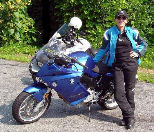
Photo - Jackie and her BMW

Even #1 Riding Partner, my wife Jackie (a.k.a. BMW Girl), has not ridden all the roads - yet!

I was wondering this morning just how many great motorcycle rides I’d discovered in the areas I’ve suggested as alternatives since the Tail of the Dragon at Deals Gap closed due to the recent rock slide.

So far, I’ve posted info about several areas;

Photo - Jackie rides

Does this bike make my butt look FAST?

I pulled out my America Rides Maps and starting counting. I hit 50 long before I got to the last maps that covered the great motorcycle riding areas I’d been describing. Closer to 70, probably more. I tried not to count rides where the road changes names along it’s course twice or even three times. It gets a little confusing, there are just so many.

Don’t let the rock slide at the Tail of the Dragon obstruct your motorcycle vacation planning. It could be a blessing in disguise. After all, Deals Gap is not known for it’s scenery, mountain views, waterfalls, or picturesque countryside. Imagine what waits just over the hill.

Visit  or contact http://americaridesmaps.com for more info.

Motorcycle Vacation Planning – Great Ride Alternatives

SEE SOME WATERFALLS!

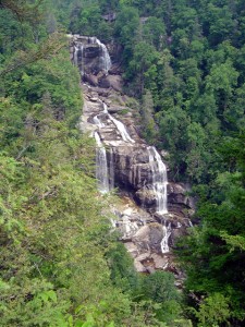
Photo - Whitewater Falls Highest in the east

Whitewater Falls - Highest in the east

With the Tail of the Dragon at Deals Gap on the North Carolina / Tennessee state line now closed due to a rock slide, many who have made reservations in advance may be wondering what to do. Before you cancel those reservations, consider there are plenty of alternatives to discover great motorcycle rides in the area within easy reach.

The Cherohala Skyway, Tennessee’s version of the Blue Ridge Parkway, remains open and is a fine ride, though be aware much of the regional traffic will be shifting onto it. It’s not quite the challenge to ride, but it makes up the deficiency with great scenery as it climbs to over 5000 feet before entering North Carolina.

Of course, NC 28 which intersects US 129 in North Carolina at the southern end of the Tail of the Dragon will be there for those looking for a more challenging motorcycle route. With the Dragon closed, I suspect traffic on it will be light. Don’t let this road fool you, it “bites” more riders than the Dragon in that it is not as predictable. Where the Dragon has one turn after another, you know what to expect,  NC 28 has some more open stretches where you can pick up speed only to find the upcoming 10 mph corner is far sharper than you are ready for.

Many motorcycle tourers who ride this section of NC 28 don’t realize it continues further south into South Carolina and miss out on a great section of road. It grows to 4 lanes as it reaches the intersection with the Great Smoky Mountains Expressway, continues a few miles on the highway, then diverts south again to become a wonderful two lane road again. All in all, it’s more than 100 miles of truly great motorcycle riding with but a few interruptions where it passes through Franklin and Highlands.

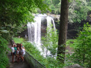
Photo - Dry Falls

Dry Falls - You can walk behind them

The first area I highly recommend you spend some time motorcycle riding is often called the “Land of the Waterfalls”. Comprised primarily of the wild mountains of the Nantahala and Pisgah National Forests, this area south of Great Smoky Mountains National Park hosts one of the greatest collections of easy to view roadside waterfalls in the nation including the highest waterfall east of the Rockies.

This rugged area is laced with challenging and scenic motorcycle roads including the highest and most beautiful section of the Blue Ridge Parkway. Springtime is the best season to see them before the summer leaves obscure the views.

Here’s a video sample of them from America Rides Maps;

http://www.youtube.com/watch?v=eBrB5lrtZ9I

Don’t let the closure of the Tail of the Dragon ruin your motorcycle vacation. There are plenty of great rides just over the hill. These are some of the best, more to come.

Contact http://americaridesmaps.com for more suggestions and advice.