Just Completed – Update to Blue Ridge Parkway Motorcycle Pocket Map #1

Image - Map Side

Map Side

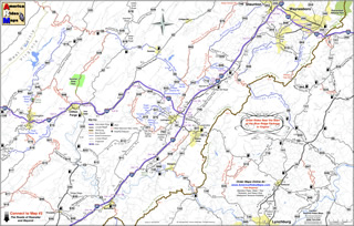
I am proud to announce the release of the most recently updated America Rides Maps Motorcycle Pocket Map in the Blue Ridge Parkway Series – VA016; “Great Rides Near the Start of the Blue Ridge Parkway in Virginia“. It’s taken more than a month of working on it every spare minute to bring it into the new and improved format and incorporate more than 50 additional miles of great motorcycle rides in this region. It contains more than 40 roads which either cross, connect, or lie adjacent to the north end of the Blue Ridge Parkway with detailed info, descriptions of the rides, locations of gas stations and points of interest, and more.

While I’d hoped new cartographic software would speed production times, the process of conversion from simple graphic images to fully digital representations is as laborious and meticulous as before. The benefits are recognized in the ease of future updates as well as the improved clarity that is gained. As I’m constantly updating and improving all the maps, more than a dozen which cover the Smoky Mountains from north Georgia to north Virginia, the effort is worth it. There is nothing else like America Rides Maps motorcycle pocket maps, and best of all I’ve been able to improve the maps without increasing the price, already the lowest on the market.

Image - Description of rides

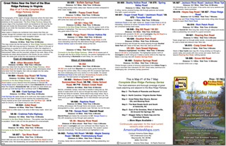
Description of the rides on the back of each map

I’ve sold thousands of maps and get lots of thankful emails from customers. You love them. Here’s an email I got from a professional motorcycle tour guide, someone who covers thousand of miles in the region and knows it well –

“Your maps are truly awesome.  As you know I have also ridden many miles in NC and surrounding areas laying out our Tours for Blue Strada.  Just yesterday, I was studying your “Best Roads South of GSMNP East.”  You have done riders and drivers a huge service by pointing out all the important little details along the way… I love the Red & Blue definitions of Great and Good roads..  but just looking at gas stations.. and the waterfalls locations make these maps fantastic.  (In fact, I need to get the whole set for NC and GA).  Anyone coming here to ride without a guide could do no better than to get a set of your maps and just start studying the options… of which there are so many… and making their own Tour.  I’m going to send my motorcycle renters your direction in the future… they will be better off than trying to use my Tour maps… “

Bill Kniegge
www.bluestradatours.com
www.wheeljockey.com
POB 1336
Waxhaw, NC 28173
704 292 8801

Get the most out of your motorcycle vacation. Expand the horizons of your motorcycle tour. Discover the roads and sights others will never see. Whether you’re looking for the best shortcut or would prefer to take the long way around, these inexpensive, easy to use, fit in your pocket maps are the best thing going and I can get them to you in just a few days.

Wayne@americaridesmaps.com

http://americaridesmaps.comsee videos of the maps in use

www.bluestradatours.comexpert tours and motorcycle rentals

www.wheeljockey.comI love this gadget. It makes maintenance on the road a breeze.

_______________________________________________________________________________

Wayne Busch

Wayne Busch - Cartographer


– Wayne Busch lives in Waynesville, NC, where he produces the most detailed and comprehensive and up-to-date motorcycle pocket maps of the Blue Ridge and Smoky Mountains to help you get the most of your vacation experience. See them here – AmericaRidesMaps.com


A Motorcycle Ride You Should Know About – A stop at Wolf Creek Dam

If you were in the Smoky Mountains this weekend you already know what perfect motorcycle riding we enjoyed. Cool mornings, warm afternoons, bright sunshine and unusually clear skies meant you were in for enjoyment regardless of where you rode while motorcycle touring. Bikes were everywhere. Riding the Blue Ridge Parkway was outstanding, but no more so than anywhere else.

Photo - wolf Creek Dam

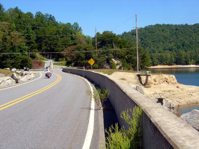
Wolf Creek Dam near the midpoint of NC 281, one of the scenic points on this great motorcycle ride.

As it was a holiday weekend, we chose to avoid the more popular venues and when Labor Day came around I celebrated by – going to work. It was the good kind of work though, out on the motorcycle exploring and discovering more new roads to add to my America Rides Maps. I found a couple more, and today will be an office day as I update the maps. Along the way we took a ride on NC 281 (which I’ve written about previously) a road you should know about.

Photo - wolf Creek Dam

NC 281 is a great motorcycle ride - even the dam is curved and you can see the road leading on to it rarely lets up.

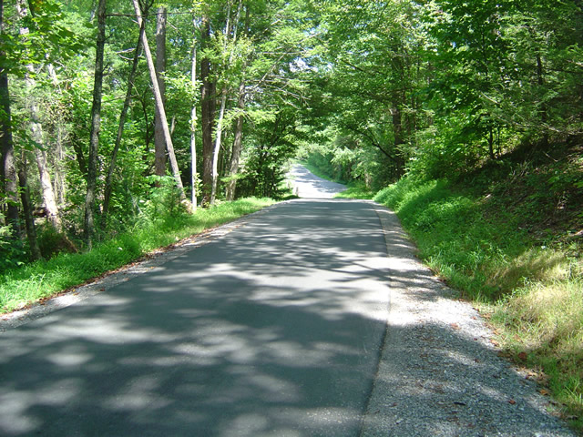
NC 281, a.k.a. Canada Road, is well marked at both ends. The north end is accessed from NC 107 south of Sylva and Cullowhee. The south end is accessed from Us 64 near Toxaway. The road takes you through sections of the Pisgah Forest climbing and rolling gently up and down the mountains with generally nice pavement, some decent views, and excellent curves. It a great road for viewing fall colors.

Photo - view from the Wolf Creek Dam

NC 281 is surrounded by the rugged mountains of the Pisgah Forest with scenic vistas of the craggy rocks and valleys, mountain lakes, and streams.s

We stopped for a break at the Wolf Creek Dam near the midpoint. To the north, NC 281 climbs over a pass then descends through a series of fast sweepers to reach NC 107 at Tuckaseegee. There’s a convenient (though expensive) gas station near the junction. To the south, the road is tighter and more technical as it claws it’s way through the rugged hills on the most recently paved portion. It’s certainly worth your time to take a ride on this great motorcycle road and this weekend many chose to do so.

Photo - stopped near the Wolf Creek Dam

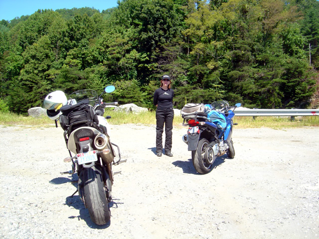
Jackie enjoys a break in the warm sunshine from our nearby explorations of great motorcycle rides.

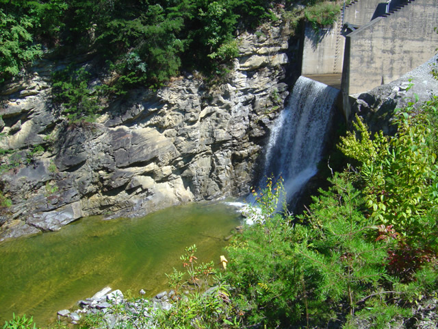
With the dry weather, the dam was spilling water from the lake to keep the popular trout fishing rivers below flowing. It an earthen dam and riding across it’s arcing top is a thrill for some. While there is a concrete K-barrier on the lake side, the drop off on the boulder strewn face is posted only by a series of large rocks widely spaced.

Photo - Spillway at the Wolf Creek Dam

The lake provides water for the popular trout streams below.

Add NC 281 to your list of rides to do this fall. This is just one section of it, it continues south after it joins with US 64 for a few miles. It’s a far better ride than nearby NC 107 which carries most of the local traffic. There are lots of other great motorcycle roads nearby with outstanding scenery, roadside waterfalls, and challenging and fun curves. You could spend your whole motorcycle vacation exploring them. It’s a road you will return to.

America Rides Maps – Dozens of roads in the surrounding area make it one of my favorites.

_______________________________________________________________________________

Wayne Busch

Wayne Busch - Cartographer


– Wayne Busch lives in Waynesville, NC, where he produces the most detailed and comprehensive and up-to-date motorcycle pocket maps of the Blue Ridge and Smoky Mountains to help you get the most of your vacation experience. See them here – AmericaRidesMaps.com


The Most Challenging Motorcycle Ride Found? A day with the map guy.

I am either;

  1. Getting too old and out of shape
  2. Coming down with the flu
  3. Rode harder than I have in a long time

It’s probably a combination of the first point and the last. I awoke last night sore from the chest down due to throwing my bike around all day in my never ending quest to discover the best motorcycle rides in the Smoky Mountains. It was not planned to be such a day but it turned out to be quite an adventure.

I set out around 8AM for Shady Valley, Tennessee, home of “the Snake” motorcycle ride to make a delivery of motorcycle maps to the Shady Valley Country Store. Plan was to ride up, enjoy the Snake, make the delivery, then check out half a dozen roads nearby in hopes to add some to my motorcycle pocket maps. I knew one would just be a connector route. I didn’t have high hopes for many of the others, though a couple held promise.

It was beautiful and cool up on the Blue Ridge Parkway in the morning. Skies were clear and bright. Even the half hour on Interstate 40 to Asheville was pleasant. There’s little traffic before 10AM once you leave the highway and I pretty much had the road to myself. I watched hopefully for bears north of the city, then enjoyed the run up the wonderful new sections of pavement to pass Mt. Mitchell. Looks like they’ve pretty much wrapped that job up. Saw one grouse, a few hawks, but no bruins.
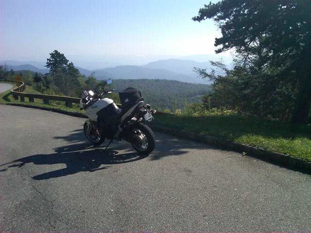
Photo - on the Blue Ridge Parkway

Clear, cool, breezy morning on the Blue Ridge Parkway near Altapass.

I stopped to tweet my first photo at an overlook where I could count on cell phone reception. Though hurricane Earl was approaching the coast, here in the mountains no impact was expected. Even so it was noticeably breezy.

I hit one brief delay for tree work, and another for guardrail replacement. I surprised a flock of turkeys as I came near Little Switzerland. Passing Linville, I left the Blue Ridge Parkway at Roseborugh Road, one of those handy unmarked crossroads that descends through a series of tight turns to NC 105 at Grandfather Mountain. NC 105 took me north through the congestion of Banner Elk. Broadstone Road led me west of Boone to Valle Crucis. NC 194 led to US 421 which I followed through Mountain City and into Tennessee to reach Shady Valley.

A brief pit stop turned into a decent delay as I took time to chat with several riders, mostly locals, and return phone calls when the intermittent cell reception cooperated. I figured it would take a couple hours to see the roads I wanted, then I’d zip back home as I came.

Photo - Shady Valley Country Store

The sun was still shining at the Shady Valley Country Store though the winds were getting gusty. Things would change as the afternoon wore on.

The first few roads proved less than expected. They were a decent ride for a cruiser maybe, though it was not type of rural scenery that makes a road interesting. I explored another after a couple bikes passed in the opposite direction to find it intersected the fourth road at an unknown point. Still nothing special. I turned to backtrack on the fourth road so I would be sure to ride it end to end and was thrilled to find the short leg wonderful. Nice sweeping turns through pretty countryside. Hopeful, I spun about at the intersection with 197 and headed back. The remainder disappointed. Too much straight and only mildly interesting. It was worth adding to the map but not recommending highly. The natural flow dictated I bypass the next on the list meaning another backtrack to explore the better alternative.

The last of the most promising roads was accessed from US 321 near Watauga Lake. It was tight, it was twisty, but it didn’t appeal. It was then that serendipity  struck. Rather than continue on my planned path, instinct told me to detour onto another road. I followed it through turn after turn after turn and it went on and on and on. All the while I expected it would peter out  into a goat trail but it just kept going without letting up. Mile after mile on narrow, sometimes poor, blacktop it climbed through the mountains finally dumping me out at Banner Elk Highway. I pulled into an abandoned gas station to take my notes and decide how to describe it.

I kept asking myself, “But was it fun?” There was no doubt it was challenging, very challenging. It kept you on the edge the whole time. It never let up. I ride the Dragon routinely and this road is much more difficult and sustained. I’d come up on some traffic and had to simply ride behind it, no room to pass, so I didn’t feel I could give it an accurate evaluation. Nor was I sure what lay at the other end. Only choice was to ride it back and see where it came out.

As I turned about my heart sank. A school bus turned onto the road ahead of me. While it looked empty, this would still be an exercise in pain as it could only crawl through the narrow serpentine climb ahead. What a relief when it pulled off within a few hundred feet. It wasn’t long before I had my answer. This road WAS fun.

Unimpeded I rode it enthusiastically back as I’d come. A few miles in I remember thinking, “If you get out of second gear on this road, look down – you’re riding a moped”. I reached the point where I’d first turned on to it and continued past. The road name changed, but its character did not. I continued mile after mile carving through the exquisitely tight turns, dodging gravel patches, potholes, and debris now falling on the road from the increasing wind. I was so happy when US 321 appeared at the margin of the screen on the GPS. I’d found a new way to link a couple major roads. Awesome.

That ride was worth the trip. I stopped and entered the notes in my Blackberry. From there I turned onto US 321 to head on to check out the last couple roads. The weather was deteriorating. Skies dark, winds gusting, it didn’t bother me a bit. Shortly, I came up on another biker who suddenly veered off on another road back in the area where I’d just been riding. I circled back out of curiosity to see what business this cruiser guy had in such a rugged area. The road he chose was a superb cruiser road and I caught up to him just as he pulled into his yard at the junction with the first great road. Bonus! Instinct paid off again.

I returned to US 321 via the cruiser road to make time. It was getting late and the weather would soon add more to the challenge of these tight roads. After a short ride on US 321, I started down the last of them which turned out to be a disappointment. A few miles in I spied a road connecting to it I felt needed exploring and eventually found a better approach though I did waste a good bit of time on dead ends and gravel lanes. Plan was to take this road a few miles, then turn onto another to make my way back towards Mountain City. As I approached the turn, instinct took over again and I purposefully rode past it.

The GPS showed the road I was on getting tighter and twistier and it was climbing higher into the mountains. Thats usually a pretty good indication it’s going to deteriorate to nothing once it nears the top and the road grew narrower and more challenging as it went on. I considered just giving up on it, but something made me go on. The smell of fresh rain on a dry road filled the air and I started hitting dark patches of pavement. I was really questioning myself when I emerged  atop a pass with a rugged valley stretched below and signs warning of a steep descent and switchbacks appeared. It would have been beautiful in nicer weather, but the dark and angry clouds only hastened my urgency to continue on, dreading the thought of having to retrace my steps.

I’ve ridden a lot of miles in the mountains yet never seen switchbacks as tight as these. I plunged down through the valley wondering where I’d end up, hoping I’d find some landmark to steer me back to something familiar. When the road ended, I looked at the sign ahead to see I was on the road I’d meant to explore next. Another great ride found, and I was ready to wrap things up after this last road.

It was longer then I thought and I reached US 421 south of Mountain City. It was now 5 PM. Rain was coming down in sheets. I turned south towards Boone. The Friday evening traffic before the holiday weekend crawled and stalled in the rain. I dreaded the idea of going into Boone and  veered off on 194 to bypass it. More traffic. I stopped near Banner Elk to top off the tank and called home to let my wife know I wouldn’t be there for dinner. We discussed the weather, the traffic, and decided I’d prefer the exposure to the elements on the Blue Ridge Parkway over the hazards of this crazy traffic. It was the right choice. The rain let up once I got up high.

I coursed through the mountains in the twilight relatively unimpeded. It got cold but I made good time. Reaching Asheville, I merged into the traffic jam that clogged Interstate 40 all the way home. Arriving in my driveway as darkness fell, I’d had a successful day. I’d discovered some great roads. I had reason to go back with hopes of more. I had money in my pocket. Sometimes, a cartographers life is to be envied. I wish I had more photos, but I got swept up in the riding. Maybe next time.

wayne@americaridesmaps.com

America Rides Maps – from north Georgia to north Virginia, the best motorcycle rides

_______________________________________________________________________________

Wayne Busch

Wayne Busch - Cartographer


– Wayne Busch lives in Waynesville, NC, where he produces the most detailed and comprehensive and up-to-date motorcycle pocket maps of the Blue Ridge and Smoky Mountains to help you get the most of your vacation experience. See them here – AmericaRidesMaps.com


Dumb Things to Do on Your Motorcycle – Cades Cove Bears on a Saturday

I don’t know what possessed me to ride through Great Smoky Mountains National Park on a warm, sunny, Saturday, but then I’m kinda getting in the spirit to do more dumb things on my motorcycle this week – more on that plan later. Nonetheless, I had a new tire to scrub in so I took off for the Dragon at Deals Gap to do the deed. Arriving early in the afternoon, I found it pleasantly low in traffic. Most everyone had already made their passes and headed out to explore the surroundings and I had a good run through it thanks to my brother riders who waved me to slow down when approaching the police stationed along the route. I arrived at the overlook with the new front tire looking like someone had taken a cheese grater to the shoulders and satisfied with the performance of the new Michelin Pure rubber which now adorned both ends of my ride.

I stopped in to see Jody at the Punkin Center Motorcycle Campground who was deeply engaged in a mid afternoons relaxation on the porch, and had to pass on the cool one offered as I had miles to before I reached home. We talked briefly of roads and riding, then I set out for the Foothills Parkway which runs along the Northwest border of Great Smoky Mountains National Park .

Photo - Cades Cove, Gear Smoky Mountains National Park

A view from the Cades Cove Loop Road which rings the valley in Great Smoky Mountains National Park

The Foothills Parkway has never impressed me much, but then my standards of comparison are skewed from all the time I spend on the Blue Ridge Parkway. I passed through Townsend, then fell in line with the cattle herd that staggers it’s way through the park. Regardless of the speed limit, there is always some plod who thinks the posted speed is at least 10 mph too fast and there are a dozen cars in front of you. Oblivious to the landslide of perturbed drivers riding up his bumper, he motors right past pull off after pull off where he could let the traffic pass. It’s all part of the experience.

Photo - the Cades Cove Loop Road in Great Smoky Mountains National Park

Freshly paved, the scenic loop road around Cade's Cove is a great place to see the wildlife that is so plentiful here

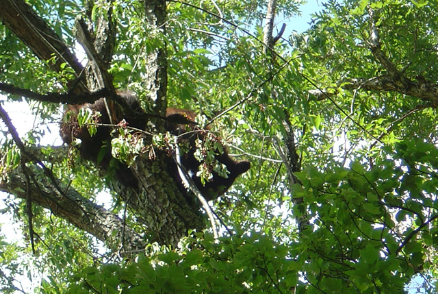
The purpose of my visit was to lay eyes on the newly paved sections of road so I made a detour out to Cades Cove to see the Loop Road. I started, stopped, started, stopped, started (you get the idea) out the freshly paved single lane but quickly realized at this pace I could throw away my watch and use a calendar to figure when I’d get home. I took the first opportunity to shortcut the loop with Sparks Road, an unpaved cut more or less straight across the valley. Nearing the South end of it, I saw the first bear up in a cherry tree gorging on the summer fruit and stopped to snap a photo.

Photo - bear in tree in Great Smoky Mountains National Park

One of several bears I saw on my short visit. They were high in the cherry trees gorging on the summer fruit.

Reaching the south side of the loop road, I fell back into the herd which was held up by another bear spied in another cherry tree at which point people just abandon their cars in the road and walk out to stand beneath the bruin for a telephoto of the bears ass. It’s all part of the experience.

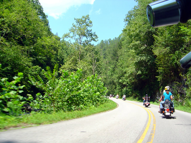
Photo - riding with the herd on River Road

Just one of a long like of bikers on River Road in Great Smoky Mountains National Park

The ride back from Cades Cove, along River Road, then across the park on 441 need not be detailed, it was as was already described. All the way. All the time. I finally escaped onto the Blue Ridge Parkway scooting around the next plodder who was doing 20 mph in the 45 mph section with a quick twist and flick, then fell in with another bike that was obviously not a tourist. I felt it my duty to ride along at a matching pace as a safety backup just in case his enthusiasm wasn’t matched by the talent it took to lay a bike through the turns like he was and someone had to make a 911 call. I’m always there for you bro.

Which brings us back to more dumb things to do on your motorcycle. One day this week I’m going to ride the 469 mile long Blue Ridge Parkway from end to end. In one day. That’s really dumb, like seeing how fast you can have sex. The goal is not to see how fast I can do it, though my competitive nature would naturally lead to that extreme.  Nor do I want to establish a benchmark which will invite challenge by setting a time. I’m building in a safeguard to prevent me from giving in to that temptation. I’m going to force myself to stop once every hour, take a photo, and tweet my location and situation when I have cell phone reception.

I was hoping to go south to north on Tuesday, but the morning fog has been so heavy lately it might not only delay me, but the photos I take will show nothing but white for the first couple hours. It looks like I’ll come from the North end south on Thursday instead. Don’t ask why, it’s something to do with the summer heat no doubt.

Plan on following me on my Parkway-in-a-day tour this Thursday.

_______________________________________________________________________________

Wayne Busch

Wayne Busch - Cartographer


– Wayne Busch lives in Waynesville, NC, where he produces the most detailed and comprehensive and up-to-date motorcycle pocket maps of the Blue Ridge and Smoky Mountains to help you get the most of your vacation experience. See them here – AmericaRidesMaps.com
 

Alcohol Vote Great News For The Lodge at Copperhead Motorcycle Resort

Photo - Vote Yes Sign worked

They Voted YES! Alcohol sales are now legal in Union County, Georgia

Emerging from the transition to new ownership, Tuesdays vote to allow alcohol sales in Union County, Georgia, may be just the shot in the arm needed to get The Lodge at Copperhead Motorcycle Resort back up to speed. Located a few miles west of Blairsville just off US 515 / 76, The Lodge at Copperhead couldn’t be better located to serve as a base camp for those looking to ride the best motorcycle roads in north Georgia and I know of no other motorcycle resort in the region which offers the level of service and quality of accommodations found here – it’s simply outstanding.

Easy to reach for motorcycle riders in Atlanta, Charlotte, Columbia, and Chattanooga, and an already popular destination with the throngs of motorcycle touring enthusiasts in Florida, The Lodge at Copperhead sits in the heart of the best motorcycle riding in the Peach State and is within a convenient distance to the Dragon at Deals Gap and the wealth of great motorcycle rides across the border in Tennessee, North and South Carolina.

Photo - The Lodge at Copperhead

The Lodge at Copperhead Motorcycle Resort is under new ownership and ready for your visit.

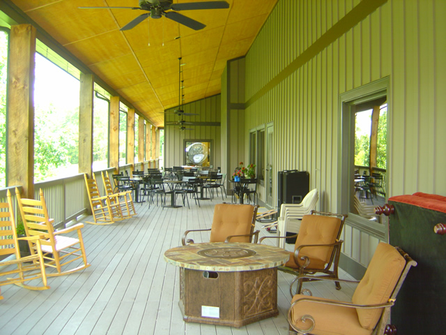
Both lodge rooms and cabins are available. Specifically designed to serve the needs and desires of those on a motorcycle vacation, The Lodge at Copperhead offers the traveler a comfortable and luxurious setting to relax in after a day of enjoying the fantastic roads through the surrounding hills and mountains.

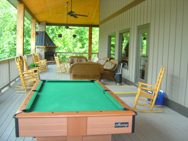
Look at those porches with the comfortable chairs, the pool table, and the outdoor fireplace, and imagine you and your friends enjoying a relaxing beverage from the bar as you talk of the days adventures and plan for more tomorrow. Take a dip in the pool during the summer heat, or cozy up to the fireplace inside the lodge on the cooler evenings in the big comfortable furnishings. Enjoy a great meal at the restaurant in the evening or stock up at breakfast for a full day of riding fun.

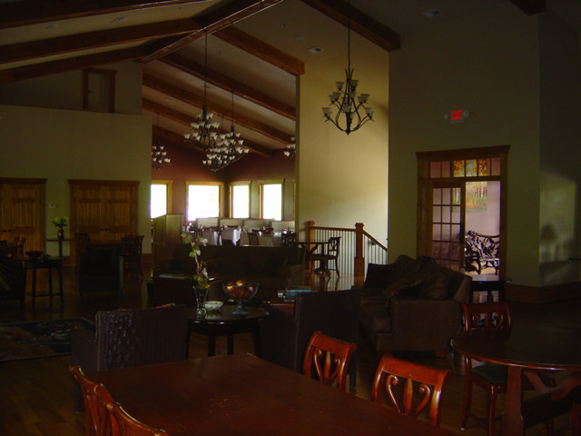
Photo - inside the Lodge at Copperhead

Comfortable, luxurious, and welcoming, relax in the lodge. Dining Room in the background.

Peaceful, relaxing, away from the crowds, traffic, and congestion found elsewhere, The Lodge at Copperhead is located almost square in the center of America Rides MapsThe Best Rides in the North Georgia Mountains“, the most complete map of more than 25 of the best mountain motorcycle rides in the state. Choose any direction and within minutes you’re cruising along the sweeping curves or carving your way through the winding back roads.

Photo - view of the porch at the Lodge at Copperhead

This is the mountains, so count on spending a lot of time enjoying the fresh air and good conversation on the porches. Note the fireplace in the corner.

Photo - porch at the Lodge at Copperhead

Plenty of room on the porches to find just the right spot.

Photo - the bar at the Lodge at Copperhead

The well equipped bar offers yet another cozy refuge.

The Lodge at Copperhead Motorcycle Resort is destined to become the premier motorcycle resort at the gateway to the Smoky Mountains and the thousands and thousands of miles of great two lane mountain roads which begin in the northern corner of Georgia.

Photo - view of the cabins at the Copperhead Motorycle Resort

If you're looking for more privacy ask about a cabin - close enough to walk to the facilities but distant enough to be apart from the activity.

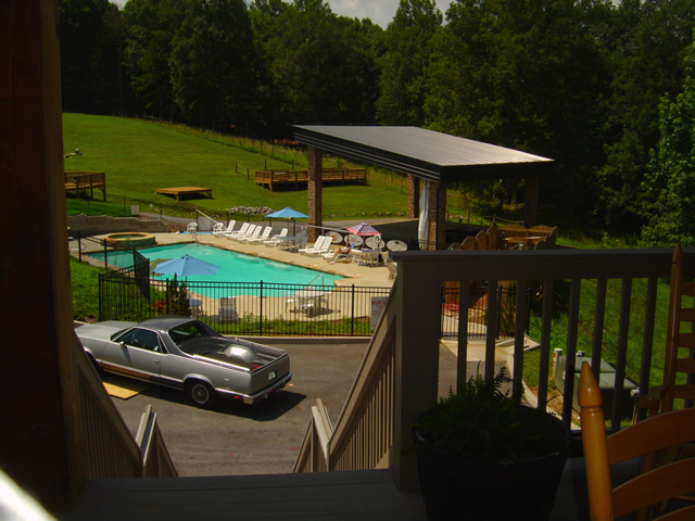
Photo - the pool and stage at the Lodge at Copperhead

Enjoy the pool during the day and entertainment on some evenings. Notice the stage, the decks, and the grassy hill to view and enjoy the shows.

The Lodge at Copperheadhttp://TheLodgeAtCopperhead.com

_______________________________________________________________________________

Wayne Busch

Wayne Busch - Cartographer


– Wayne Busch lives in Waynesville, NC, where he produces the most detailed and comprehensive and up-to-date motorcycle pocket maps of the Blue Ridge and Smoky Mountains to help you get the most of your vacation experience. See them here – AmericaRidesMaps.com
 

Motorcycles in the Fog at Fontana Lake Near Deals Gap

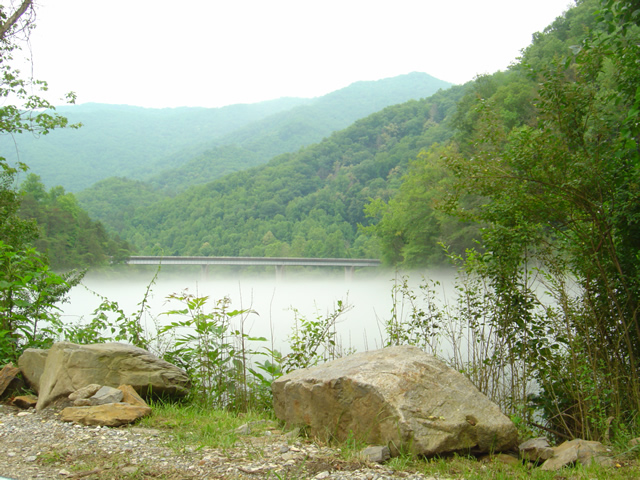
Photo - Fontana Lake draped with fog

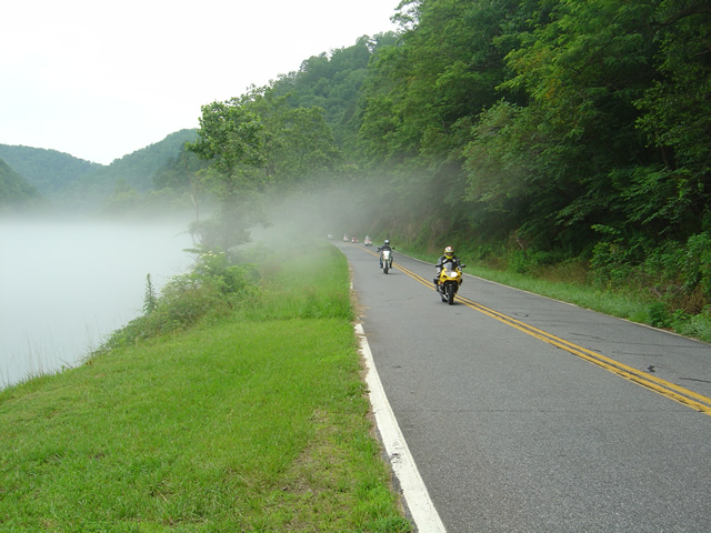
The bridge across Fontana Lake on NC 28 floats above a cloud of fog over the chilly water on a hot day.

Hot, overcast, occasional spits of rain, it was still a nice day to hop on the motorcycles and cruise over to Deals Gap at the southwest corner of Great Smoky Mountains National Park. When the summer heat comes on it’s not unusual for a fog to form over the chilly waters of Fontana Lake as you near the Dragon.

Photo - Fog on Lake Fontana

The fog hugs the waters on hot days.

I shot a few photos on NC 28 to capture the phenomenon. Maybe the clouds put off some of the usual weekend crowds, there were relatively few motorcycles out for a Saturday. There were times the Dragon was quiet for a minute or more, a good day to pay a visit.

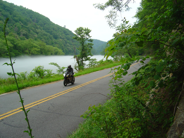
Photo - Motorcycle on NC 28 at Lake Fontana

A motorcycle cruises the lake shore on NC 28

Maybe the sportier riders stayed closer to home today. The Harleys, Gold Wings, Beemers, and other dressers  were out in force on the twisty roads at Deals Gap. It was a good  day for motorcycle touring.

Photo - Motorcycles along foggy Fontana Lake

Rarely does the mist rise high enough to have much effect on the roadway, at least in the middle of the day.

The lake section of NC 28 bordering Great Smoky Mountains National Park is one of the most beautiful, but it’s the curvy and twisty parts that make it one of the best rides in the Smoky Mountains. I hope you get to see sights like these on your next motorcycle vacation.

For the best maps of motorcycle rides the area look no further than America Rides Maps .

http://americaridesmaps.com

Motorcycle Friendly – The Shady Valley Country Store at The Snake

There’s a reason my wife rarely tags along with me while I’m out working from my motorcycle – I only stop for two things, one is fuel. The other can be remedied at any clump of shrubbery. Rarely do I ever stop to eat, drink, or grab photos. It’s all about covering the miles. Those creature comforts can wait until I retire for the evening when darkness makes any further progress futile. I think that’s about to change and one of the first places I’m going to visit is the Shady Valley Country Store the home of “The Snake”.

Photo - Shady Valley Country store

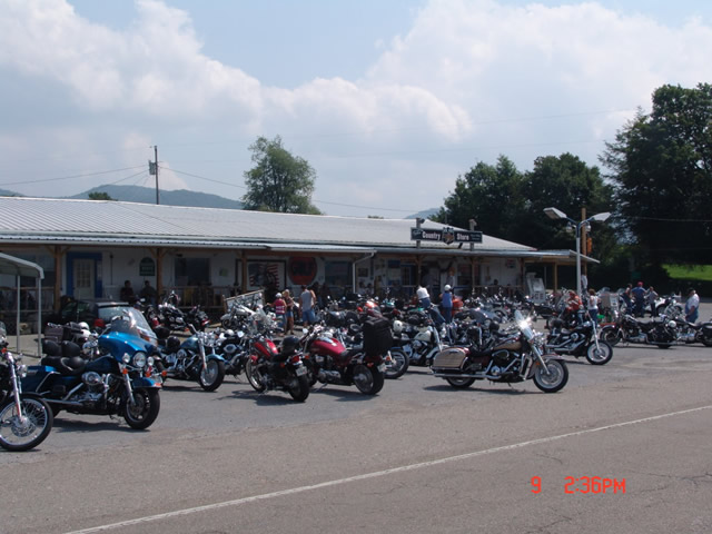
Shady Valley Country Store serves thousands of motorcycles weekly who come to ride "The Snake" and surrounding roads.

Located at the junction of NC 133, NC 91 and US 421 (a.k.a. “The Snake”), the Shady Valley Country Store is at the hub of some of the best motorcycle rides found in the Smoky Mountains where North Carolina, Virginia and Tennessee meet. Serving thousands of motorcycles every week, it provides a convenient fuel stop with regular as well as premium “Snake Venom” for your thirsty motorcycle. I’m told the 1/2 lb. black angus burgers, the thick bologna sandwiches and great chili dogs will keep you going full speed as well.

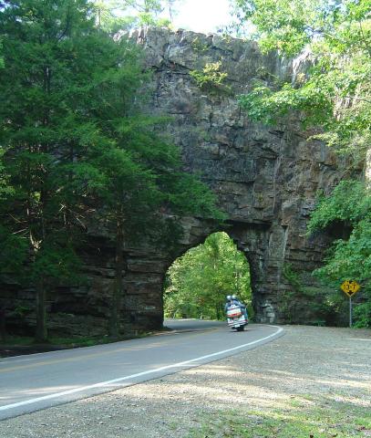
Backbone Rock on TN/NC 133

Backbone Rock on TN/NC 133 not far from the Shady Valley Country Store

I’ve blasted past the Shady Valley Country Store enough times. Next time I’m up there I’m stopping in to check it out, maybe get me a T-shirt or some other Snake memorabilia. Expect to get a first hand report ASAP.

The Shady Valley Country Store

New Deals Gap Motorcycle Map Nears Completion – Your Chance For Input

Photo - Smoky Mountain Rider and BMW Girl at the Tail of the Dragon

Smoky Mountain Rider and BMW Girl at the Dragon

Having completed a series of motorcycle ride maps covering the full scope of the Blue Ridge Parkway from end to end describing more than 3000 miles of the most outstanding motorcycle rides along its entire length, I’ve now been commissioned to produce the ultimate and best map available for the motorcycle rider planning a motorcycle vacation trip to Deals Gap, home of the infamous “Dragon” motorcycle ride.

Due to the success of the Blue Ridge Parkway motorcycle ride maps as well as others which expand the areas covered into Georgia and South Carolina, I invested in new hardware and software to take America Rides Maps to the next level. This new Deals Gap map will be the first to take full advantage of the improvements and I am impressed with the output to date.

Maintaining the handy pocket map size which makes the maps easy to use and conveniently accessible, as well as the most affordable motorcycle ride maps available at the ridiculously low price of $5 each, this latest America Rides map will guide the Dragon rider to a dozen or more additional great motorcycle rides in the surrounding area including the best section of the Blue Ridge Parkway, as well as the most notable rides in the Smoky Mountains of Tennessee and North Carolina and touching on north Georgia and South Carolina.

The scope of the map covers the largest area yet tackled to include approach routes to Deals Gap from all points of the compass making navigation to reach the Dragon easy. Once there, it leads you to enough additional good motorcycle rides to fill a week of vacation time or more. The back side of the map will describe the various routes as well as give details about riding them.

image-raw-map

The Ultimate Deals Gap Map Nears Completion

As I wrap this project up, now is the time for your input as to which features are most important to you. I typically include out of the way reliable gas stations, notable attractions, and a handful of selected eateries, campgrounds, and motorcycle dealers and repair shops. Unlike my other maps which are only available online, this Deals Gap map will be provided by vendors in the area. As such, the frequent updates I normally provide to the maps will not be as easy to accomplish and I want to get this first edition as complete as possible as once maps are distributed they will not be updated as frequently.

Send your suggestions to info@americaridesmaps.com . If your suggestion is incorporated into this new map, I’ll send you a copy in appreciation. It should be wrapped up in about a week, so if you’ve got a great idea shoot it to me immediately. I’ve got to get this done, the open road beckons and I’m itching to get away from my office and ride.

Motorcycle Gear Review – Fieldsheer Mercury 2.0 Pants – I’m Liking Them in the Mountains

A sunny day, blue skies, balmy temps, what a great day for a spin on the motorcycle. We all revel in such opportunities, but when it comes to motorcycle vacation plans, your schedule does not always fall on those perfect days. All too often the weather is questionable, and with limited time you set off to make the most of it come what may.

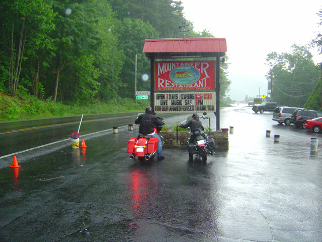
Photo-rain-happens

Don't let a rain storm ruin your travels. With the right gear, you just keep on going.

I’ve given up on counting on the predictions. There are days when I must ride regardless. With most of my time spent in the Smoky Mountains, you can rarely trust a forecast or plan with certainty on what’s happening over the next hill or ridge top. Best to adapt the Boy Scout attitude of “Always be prepared”. Leathers and chaps have long been retired. Nor can I be burdened with always packing a decent rain suit. A good one is not only bulky but costly. You have to stop and put it on, stow it when wet, I can’t be bothered. I have embraced synthetics and come to value the gear produced by Fieldsheer.

Case in point, a situation I see repeated all too often. I got a call last week that some magazine writers from Florida were in town and wanted someone to show them some great rides. I knocked off for the day, and headed over to meet them. Who can’t use a little more publicity.  The storm clouds were gathering and there was obvious rain to the southwest. No problem, we’ll head for the blue skies to the northeast and skirt around it.

By the time we saddled up and got ready to leave, the first wave of rain had hit up high near the Blue Ridge Parkway where they were waiting. It was still sunny a few miles down the road and I knew we could pass through the shower and get ahead of the storm which would hang to the south. Dressed in blue jeans, T-shirts, and skid lids, they were not only saturated by the time we reached the bottom of the hill but couldn’t see where they were going with their open faced helmets. I lost them at the first gas station as they sought shelter. I circled back, and we waited for the shower to let up to return them to the motel. Their day was ruined. I headed out, rode for a bit, and returned home bone dry in my synthetic gear. How many have wasted their valuable motorcycle vacation time waiting in shelter or cutting things short when they become wet, cold, and miserable from a brief shower? Don’t let it happen to you, plan ahead and be prepared.

Photo-motorcycles-shelter-from-rain-at-gas-station

An hour wasted at a gas station that could have been better spent for proper gear.

I’m long acquainted with Fieldsheer motorcycle gear. It’s my everyday year-round riding apparel. My jacket, now 4 years old or more is still waterproof, and the ballistic cloth has survived going down at highway speeds without significant damage, the protective armor built in insuring I walk away from spills with little more than my ego impacted. After three years I’d done enough to my old pants to warrant a replacement. The occasional knee down and a spill or two had loosened the stitching in the crotch and I had a minor leak. Santa blessed me with a new pair of Mercury 2.0 pants, and after six months, I can give them a preliminary rating – stellar.

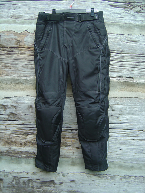
The quilted lining served me well through the winter. Comfortable and warm, it has been removed now that the summer heat is here. I really appreciate the small zipper controlled thigh vents that are easily opened while riding. Full side zippers insure that should the temps really climb, I can add even more ventilation. With repeated forays through some heavy downpours I can attest to their being waterproof. Sizing runs a bit large, though that probably contributes to comfort – plenty of room to move around without restriction. The velcro waist bands make for quick cinching when I make those trips into the weeds to commune with nature. The fly is so well gusseted as to be useless as an avenue for quick relief, but in exchange water tight.

photo-filedsheer-mercury-pants

Available in black or silver, Fieldsheer Mercury 2.0 pants are versatile and practically indestructible while offering comfort and function..

You can find FIELDSHEER MERCURY 2.0 PANTS online for under $150.00. They’ll serve my purpose for 95% of the riding I do, with a set of mesh pants as back up should I decide to head for more tropical climes (not likely). I no longer plan around weather, waste time parked under overpasses or sit out storms slurping endless cups of bitter truck stop coffee. They also come in silver, and womens versions.

Rain is temporary. Good gear endures and keeps you riding and should be part of your motorcycle touring kit. If that’s important to you, I highly recommend these pants.

Video:

http://www.youtube.com/watch?v=27f3Uq49PcU

Fieldsheer Site: http://www.fieldsheer.com/site2009/IE/product/mercurypant.htm

Other Reviews:

http://www.stromtrooper.com/showthread.php?t=27272

http://www.motorcyclistonline.com/gearbox/122_0901_fieldsheer_adventure_jacket_mercury_pants/index.html

_______________________________________________________________________________

Wayne Busch

Wayne Busch - Cartographer


– Wayne Busch lives in Waynesville, NC, where he produces the most detailed and comprehensive and up-to-date motorcycle pocket maps of the Blue Ridge and Smoky Mountains to help you get the most of your vacation experience. See them here – AmericaRidesMaps.com


Full Service Motorcycle Tour Company in Charlotte Area – Blue Strada Tours

Bill-Kniegge-Blue-Strada-Tours

Bill Kneigge

Isn’t it great when you come across those people in life whom everyone can’t help but like? Happy, enthusiastic, uplifting, and full of passion, they not only make your day but you can’t help but want to spend more time with them. I had the privilege and pleasure of meeting Bill Kniegge through the Asheville Bikefest when he provided exemplary service as one of the tour guides for that inaugural four day event. You may count on hearing more of him in the future, he’s one of those people you WANT to do business with.
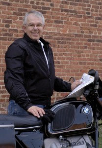
Photo-Bill-at-Backbone-Rock-Tennessee

A photo from Backbone Rock, Tennessee, in one of the premier riding areas in the Smoky Mountains

With 30 years in the motorcycle and motorsports industry and involvement with brands like Bell Helmets, Husqvarna and ATK Motorcycles, Ford Motorsports, and his love of riding and competing since the age of 12, Bill Kniegge, brings his knowledge, desire, and passion to Blue Strada Motorcycle Tours putting together premier two-wheel experiences for the motorcycle vacationer.

Blue Strada Motorcycle Tours & Rentals is a Motorcycle Touring company based in the Charlotte area.  The company provides motorcycle riders with all-inclusive 5-8 Day tours of the Appalachian mountains, including the Blue Ridge and the Smokys.  Tour guests can ride their own motorcycles if they desire or pick from a series of Suzuki V Strom, BMW and Yamaha Touring bikes. Tour leaders are experienced with the roads and Tour guests arrive at their lodging to find their luggage already in their rooms… Kniegge is a self admitted “Foodie” and thus provides great choices for dinners and lunches along the way.

Photo and the Fiddling Pig

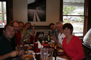
An admitted "foodie", Bill and company enjoy the dining as much as the riding.

Blue Strada Motorcycle Rentals are a important part of their business.  Riders that want to ride their own pace in the mountains can do so very easily.  Blue Strada provides help in searching for great roads to ride, a variety of lodging based on price points and will also deliver and pick up bikes from Charlotte area hotels and airport if needed.

Photo-Bill-Kniegge-Blue-Strada-Tours

Quality endures - Bill and a classic Beemer

Look to the Blue Strada web site as a trusted source for motorcycle rentals and high quality touring experiences and consider working them into your motorcycle vacation plan. Whether it’s the Blue Ridge Parkway or any of the thousands of miles of superb back roads in the Smoky Mountains you seek to enjoy,  Bill and his team will do you well. Experience excellence in motion with Bill Kniegge.

http://bluestradatours.com