Best Motorcycle Rides in North Georgia – digital soon?

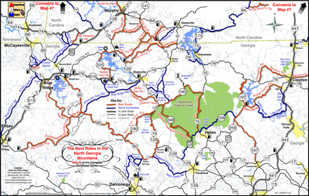
Wow! It’s taken me 18 months to completely revise and update all my Smoky Mountain / Blue Ridge motorcycle ride maps, but the last of them is done – Map #9 “The Best Rides in the North Georgia Mountains” has been released.

image-best-rides-in-the-north-georgia-mountains

Roads are really bold, map is easy to and quick to read. Road descriptions on back of map.

If you have one of my Georgia motorcycle maps you honestly don’t need to replace the map you have. I had almost all of the really outstanding Georgia motorcycle rides on the earlier version. I did find a couple more really nice north Georgia motorcycle rides on the periphery of the main area of the map as you make your way to the classic rides  – you’ve got to ride GA 60,  Blood Mountain area, and I love to play back and forth across the North Carolina state line.

image-georgia-motorcycle-map

Map #9 - The Best Rides in the North Georgia Mountains

So what’s the big deal? The reason this revision took so long was prepare the maps for digital use! I’ve looked at phone apps but decided the limiting factor in the mountains is reception. Live GPS positioning via phone just isn’t there yet for this region.

A solution I’ve been testing instead is map downloads which can be scaled and used from an ipad, ipod, iphone, or any other smart phone provided you’ve got a decent sized memory card. Got your phone? You’ve got your maps. It worked well on the ipad. I’ll be testing ipod, iphone, etc. next. If it goes well, you can expect to see them available in about 2-3 weeks.

So what about GPS? Next project. I have the software. I need the time.

See more about the new map here – goo.gl/ifTNr

_______________________________________________________________________________

Wayne Busch
Wayne Busch – Cartographer
– Wayne Busch lives in Waynesville, NC, where he produces the most detailed and comprehensive and up-to-date motorcycle pocket maps of the Blue Ridge and Smoky Mountains to help you get the most of your vacation experience. See them here – AmericaRidesMaps.com 
Motorcycle Friendly Places – Paint Bank General Store, VA

Photo-Paint-Bank-General-Store

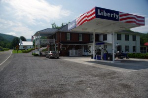
Morning at the Paint Bank General Store, Paint Bank, VA

Though it’s only 1/2 hour west of Roanoke, the tiny hamlet of Paint Bank on Highway 311 sits like a jewel surrounded by rolling green hills and pastoral country that makes the busy city seem a million miles away. This is spectacular motorcycle riding country and bikers flock here to enjoy the long winding rides through narrow valleys which lead south towards Blacksburg, Christiansburg, and Pembroke. The beautiful wilds of West Virginia lie just over the western horizon, and the roads north twist and turn through forests teaming with wildlife.

Photo-Paint-Bank-General-Store

A for-real General Store! Cool!

Jackie and I came in from the north on VA 615, a ride through woods so wild we had to cruise with care to avoid all the critters in the roadway. Deer and turkey were abundant, a slew of painted turtles awaited their doom on the pavement, a fox, hawks, and all sorts of other animals either watched us pass or darted off into the greenery as we approached.  We paused in Newcastle for a rest, then pointed our wheels west on 311 to make the curvy fabulous climb and descent over Potts Mountain into the valley to arrive at scenic Paint Bank.

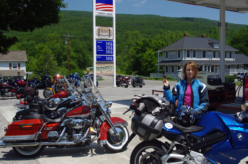
Photo-Paint-Bank-General-Store-motorcycles

The lunch crowd has arrived!

Eager to get on to the next curvy climb we stopped at the Paint Bank General Store for a potty break and to top off our tanks, but as the noon hour approached we soon abandoned our ride into West Virginia to return to the Paint Bank General Store, lured back by the promise of tasty locally raised buffalo burgers in the inviting and charming rustic setting of the Swinging Bridge Restaurant.

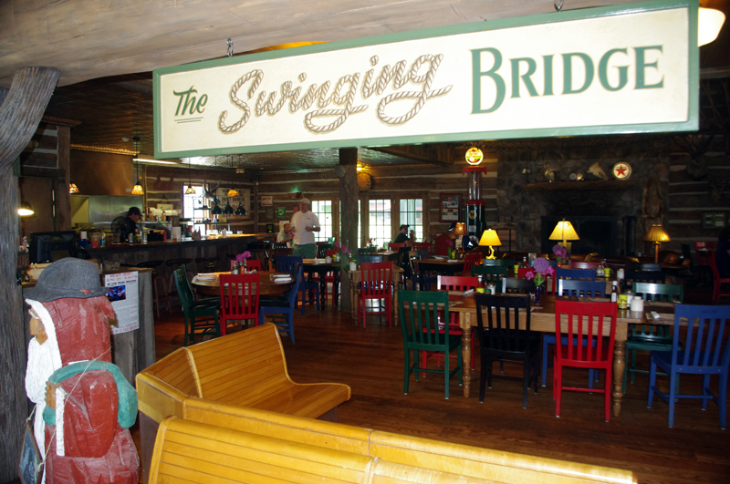
Photo-Swinging-Bridge-restaurant

The buffalo burgers were great!

In the short time we’d been gone the parking lot at the Paint Bank General Store had been taken over by motorcycles with the same ambitions as us and more arrived every few minutes. “Motorcycle parking only” signs lined the periphery of the  lot and the crowd of bikes spilled over to fill the remaining space. Some milled about on the porch, others hosed the bugs off their chrome with the convenient hose, but most found their way to the restaurant to enjoy the food and comfortable atmosphere.

Photo-Paint-Bank-General-Store

Bikers flock here for lunch

The Paint Bank General Store – A unique place in a beautiful setting with gas and good food surrounding by outstanding motorcycle rides and biker friendly. What more do you need?

Paint Bank General Store

Swinging Bridge Restaurant

Paint Bank info

Photo-Paint-Bank-General-Store

Great food, wonderful riding, the Paint Bank General Store and Swinging Bridge Restaurant was one of the highlights of our Virginia motorcycle riding

Photo-Swinging-Bridge-Restaurant

Great food in a fun and relaxing atmosphere at the Swinging Bridge Restaurant located in the back of the Paint Bank General Store.

_______________________________________________________________________________

Wayne Busch
Wayne Busch – Cartographer
– Wayne Busch lives in Waynesville, NC, where he produces the most detailed and comprehensive and up-to-date motorcycle pocket maps of the Blue Ridge and Smoky Mountains to help you get the most of your vacation experience. See them here – AmericaRidesMaps.com 
Motorcycle Touring – Sights: Spectacular Roadside Waterfall in VA

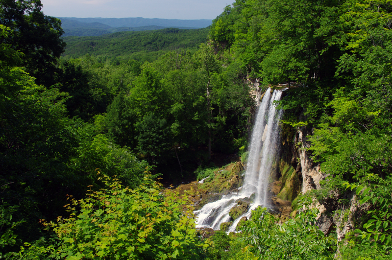
Photo-Falling_spring-VA

Falling Spring on US 220 north of Covington, VA

Located about 4 miles north of Covington, Virginia, Falling Spring has been an attraction referenced as far back as Thomas Jefferson. It’s an easy to locate, well marked pull off on this curvy section of US 220 (a.k.a Sam Snead Highway).

Jackie and I passed through here Sunday on our motorcycle ride as we explored the wealth of great motorcycle roads west of the north end of the Blue Ridge Parkway. It’s a popular rest stop for bikers who flock to ride this great section of US 220 north of Covington. After revisiting Sam Snead Highway I’ve decided it should be upgraded on my America Rides Maps. I currently show only the portion south from the falls as being a great ride, while in truth the entire section from VA 39 south is outstanding. As much as I’d like to give it my top rating, due to the traffic load I can only feel right listing it as a “Good Connector” road.

For the casual cruiser who’s just out to enjoy the ride through the spectacular scenic countryside it’s a superb motorcycle ride. For those looking for a more spirited approach to the twisty sections, of which there are plenty, you’ll want to ride this one during the off hours and preferably during the week.

This roadside waterfall and the surrounding great motorcycle rides in the area are found on map #1 of The Complete Blue Ridge Parkway 6 Map Series from America Rides Maps.

_______________________________________________________________________________

Wayne Busch
Wayne Busch – Cartographer
– Wayne Busch lives in Waynesville, NC, where he produces the most detailed and comprehensive and up-to-date motorcycle pocket maps of the Blue Ridge and Smoky Mountains to help you get the most of your vacation experience. See them here – AmericaRidesMaps.com 

My Search for the Best Mountain Motorcycle Rides Never Ends

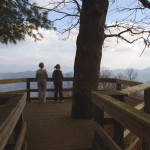
Photo - Maple Springs Observation Point

The Maple Springs Observation Point - accessed from Santeetlah Rd

Friday’s search for great Smoky Mountain motorcycle rides, which culminated with a spirited cruise on the Cherohala Skyway, was one of those days that might be looked on as not so productive. It’s not that I didn’t catalogue some good mountain motorcycle riding roads, I added several which will appear on my new map of the area. In my quest to leave no stone unturned, much of the 400 miles I covered was spent on roads which only the most adventurous would bother to travel. Still, there are sights and places some may wish to see, and I’m determined to find as many of them as I can.

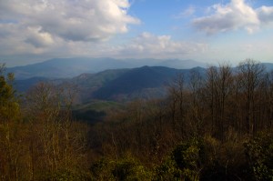
Photo - Cherokee National Forest View

View from the Maple Springs Observation Point. I was told you can see 5 states from this spot.

Considering the number of motorcycle riders who are drawn to the area by such notable roads as The Dragon at Deals Gap, the Cherohala Skyway, The Tennessee Foothills Parkway, NC 28 (now renamed “the Moonshiner 28“), finding others that compare in quality is pretty much futile. These are some of the best motorcycle rides in the world. I’m not holding my breath thinking I’m going to discover the next great classic motorcycle ride. So why go to all this effort?

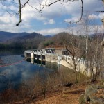
Photo - Santeetlah Dam

Quiet morning at the Santeetlah Dam

There are probably millions of motorcycles that pass through here each year. In most cases, they come, they ride the famous roads, get the t-shirt, then they’re gone to other places following the crowds. It’s the notable roads that get all the attention. Once experienced, it’s back on the four lane or the congested tourist arteries to reach the next great spot. You can rack up a lot of miles playing connect-the-dots, though those droning plods on the connections are the price you pay to reach those popular motorcycle rides.

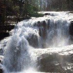
Photo - Bald River Falls

Bald River Falls

It doesn’t have to be that way. I’m filling in the gaps between the famous motorcycle rides with the best quality rides I can find so connecting the dots is as much of an adventure as the roads you’re trying to reach. Where others might show you one good way to get from point A to point B, I look for all the best ways.

Photo - Cherohala Skyway View

View from the Cherohala Skyway. The Smoky Mountains were especially smoky today and I'll get more photos another time.

Who want’s to spend their time on the 4 lane or in bumper to bumper tourist traffic when there are so many empty two lane scenic and challenging mountain roads that get bypassed? It’s often as simple as crossing over to the next valley to escape the congestion. One little turn can make the difference between cruising along with the wind in your face or cursing the throngs of dawdling codgers, gawking sightseers, lumbering RV’s, and belching commercial trucks struggling up the grades to deliver their wares.

Photo - Motorcycles on the Cherohala Skyway

Bikes on the Cherohala Skyway

I’ve catalogued more than 100 good motorcycle roads so far surrounding Great Smoky Mountains National Park. I’m not done yet. Some of these are outstanding rides. Others will satisfy those looking for adventure. All of them avoid most everyone else who’s come to enjoy the Smoky Mountains just like you and take you to the places they’ll never see while getting you where you want to be.

Keeping you going is what keeps me going. I’m closing in on finishing the map of the Best Motorcycle Rides North of Great Smoky Mountains National Park. Stay tuned and see what I discover. It’s all for you. (Click on the photos for the large versions)


http://www.youtube.com/watch?v=xBbQfR2GqMc

_______________________________________________________________________________

Wayne Busch
Wayne Busch – Cartographer
– Wayne Busch lives in Waynesville, NC, where he produces the most detailed and comprehensive and up-to-date motorcycle pocket maps of the Blue Ridge and Smoky Mountains to help you get the most of your vacation experience. See them here – AmericaRidesMaps.com 
 

Motorcycle Vacation Planning – Great Ride Alternatives

SEE SOME WATERFALLS!

Photo - Whitewater Falls Highest in the east

Whitewater Falls - Highest in the east

With the Tail of the Dragon at Deals Gap on the North Carolina / Tennessee state line now closed due to a rock slide, many who have made reservations in advance may be wondering what to do. Before you cancel those reservations, consider there are plenty of alternatives to discover great motorcycle rides in the area within easy reach.

The Cherohala Skyway, Tennessee’s version of the Blue Ridge Parkway, remains open and is a fine ride, though be aware much of the regional traffic will be shifting onto it. It’s not quite the challenge to ride, but it makes up the deficiency with great scenery as it climbs to over 5000 feet before entering North Carolina.

Of course, NC 28 which intersects US 129 in North Carolina at the southern end of the Tail of the Dragon will be there for those looking for a more challenging motorcycle route. With the Dragon closed, I suspect traffic on it will be light. Don’t let this road fool you, it “bites” more riders than the Dragon in that it is not as predictable. Where the Dragon has one turn after another, you know what to expect,  NC 28 has some more open stretches where you can pick up speed only to find the upcoming 10 mph corner is far sharper than you are ready for.

Many motorcycle tourers who ride this section of NC 28 don’t realize it continues further south into South Carolina and miss out on a great section of road. It grows to 4 lanes as it reaches the intersection with the Great Smoky Mountains Expressway, continues a few miles on the highway, then diverts south again to become a wonderful two lane road again. All in all, it’s more than 100 miles of truly great motorcycle riding with but a few interruptions where it passes through Franklin and Highlands.

Photo - Dry Falls

Dry Falls - You can walk behind them

The first area I highly recommend you spend some time motorcycle riding is often called the “Land of the Waterfalls”. Comprised primarily of the wild mountains of the Nantahala and Pisgah National Forests, this area south of Great Smoky Mountains National Park hosts one of the greatest collections of easy to view roadside waterfalls in the nation including the highest waterfall east of the Rockies.

This rugged area is laced with challenging and scenic motorcycle roads including the highest and most beautiful section of the Blue Ridge Parkway. Springtime is the best season to see them before the summer leaves obscure the views.

Here’s a video sample of them from America Rides Maps;

http://www.youtube.com/watch?v=eBrB5lrtZ9I

Don’t let the closure of the Tail of the Dragon ruin your motorcycle vacation. There are plenty of great rides just over the hill. These are some of the best, more to come.

Contact http://americaridesmaps.com for more suggestions and advice.

What’s The Best Section of the Blue Ridge Parkway?

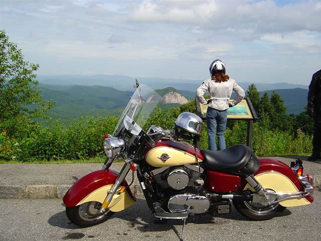
Photo - Admiring the view from the Looking Glass Rock overlook

Photo - Admiring the view from the Looking Glass Rock overlook

Easy question. It’s in North Carolina. I can almost see it from my window. I moved here to be close to it and enjoy it on my motorcycle. I know every twist and bump. The best section of the Blue Ridge Parkway with the best ride runs south from Asheville to Soco Gap near motorcycle friendly Maggie Valley.

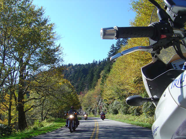
Photo - As falls comes so do the bikes

Photo - As falls comes so do the bikes on the Blue Ridge Parkway

Why is it the best? It’s the highest and most scenic section. There are more great pull-outs here than any other stretch. Most of it is above 5000 feet. It has everything motorcycle riders come for. Waterfalls, impressive rock formations, winding tunnels, pristine wilderness, vast stretches of rolling mountains on every horizon, and one of the best places to eat on the parkway, the Pisgah Inn. When I used to run  motorcycle tours through this section I‘d always figure about 4 hours to hit the highlights and sometimes it was a tight schedule. If you see only one section of the Blue Ridge Parkway, this should be it.

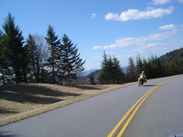
Photo - Early in the spring traffic is light and skies are clear

Early in the spring traffic is light and skies are clear on the Blue Ridge Parkway

Make this one of your prime destinations on your motorcycle vacation, but don’t limit yourself to the parkway while you’re here. You could spend weeks riding the fabulous roads which snake through the Smoky Mountains you see from those overlooks. They are packed with more waterfalls, scenery that will fill your camera, and some of the most challenging motorcycle roads you’ll ever ride.

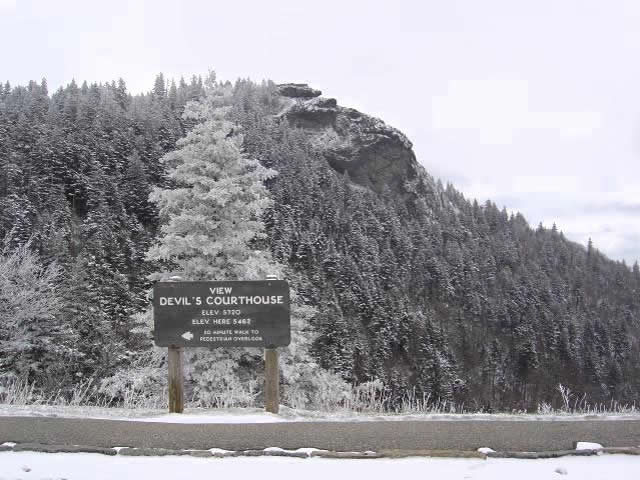
Photo - Devil's Courthouse snow covered in Winter

Spectacular Devil's Courthouse snow covered in winter

Impressive any time of year, I never take this section of the Blue Ridge Parkway for granted and visit almost every week. It never disappoints. It one of the most scenic motorcycle rides anywhere.

Scenic Motorcycle Rides – Backbone Rock, TN

photo - motorcycle cruises through Backbone RockI went back to Virginia this weekend to revisit and explore some of the sights I’d passed while mapping the area

I’m pretty much all business when mapping – I only stop for three things; gas, to take notes, and when “nature” forces me to do so. Eating is a luxury typically left for the evening to make the most of the time on the road. This trip was to go back and savor some of the gems I’d just blown by previously.

One of my favorite loop rides is found near the point where North Carolina, Virginia, and Tennessee meet, a 103 mile jaunt that takes you on some of the twistiest and most scenic roads. It’s listed on America Rides Map #4 – “Great Roads Near Boone, Banner Elk, and Blowing Rock.

Heading south from Damascus, Virginia, on SR 133, you soon enter the National Forest in Tennessee and signs for Backbone Rock Park start appearing along the road. Round a curve and you find yourself zipping through the quick yet dramatic tunnel through Backbone Rock.

I stopped in to investigate.

The Empire Mining Company blasted through Backbone Rock in 1901 to lay train tracks for the Tennessee Lumber Company. Long gone, the rail bed became the roadbed which continues on towards Mountain City.

The ridge is about 75 feet high and 20 feet thick, though it narrows near the top. There is a steep trail from the parking area on the right just after you pass through the rock, though if you have any aversion to heights and walking near the edge of a cliff, you’ll never make it to the section of rock which straddles the road.

There are several hiking trails, picnic tables and campsites, a waterfall is about 0.4 miles on a foot trail. The area is popular for fishing and kayaking.

_______________________________________________________________________________

Wayne Busch

Wayne Busch - Cartographer

Total Rider Tech Logo

Learn Total Control

– Wayne Busch lives in Waynesville, NC, where he produces the most detailed and comprehensive and up-to-date motorcycle pocket maps of the Blue Ridge and Smoky Mountains to help you get the most of your vacation experience. See them here – AmericaRidesMaps.com

Wayne is an advanced motorcycle instructor for Total Rider Tech teaching Lee Parks Total Control Advanced Rider Courses. It’s time you looked into advanced rider training to ride more confidently and safely, it will change your mountain riding experience. It worked so well for me I became an instructor! Total Rider Tech

America Rides Map #4 – “Great Roads Near Boone, Banner Elk, and Blowing Rock

_______________________________________________________________________________

The Most Dangerous Road for Motorcycles?

Charlies Creek Road

Charlies Creek Road - even the sign is crooked


“That’s the most dangerous road we ride” my wife commented after a recent morning outing.

It’s my favorite road!”, I responded.

“I know, but it’s still dangerous” she reiterated.

We talked a bit more about it and the things she finds most dangerous are the things I enjoy as an added challenge.

“I still like it, it’s just a dangerous road” says Jackie.

Jackie’s no lightweight. We rode dual-purpose bikes all over the country years ago, she can throw a motorcycle around. Now, astride her Beemer, she often gives the boys a run for their money on the twisty roads. She can handle herself and I enjoy watching her flow through the curves. And no, we’re not talking about the infamous “Tail of the Dragon“. That’s just another ride for us compared to this.

riding Charlies Creek Road

Be ready to get some lean on when riding Charlies Creek Road

Photo – Wayne prepares to get some lean on in a curve on Charlie’s Creek Road

What makes Charlies Creek Road a challenge is it’s unpredictability. You just never know what it’s going to throw at you next, and it throws everything in the book along it’s 10.1 mile length making it seem a whole lot longer. Mixed pavement, potholes, bumpy repairs, loose gravel, climbs, descents, first gear hairpins interspersed with sections of relatively straight road that lure you to roll on the throttle then snare unsuspecting riders with turns which shut down on them the deeper in you get. Cresting a rise you never know what lies on the other side, which way it will dive. Is there a patch of loose gravel in the next corner, a flock of turkeys in the road, will the tires maintain their grip on that concrete bridge littered with sand and rocks, what’s with this freakin turn, it’s getting tighter? How many seasons before some bear hunter discovers my rusted bike and bleached bones if I lose it out here in the middle of nowhere?

It’s a handful it you approach it cautiously. Come at it with vigor, and it will test everything you’ve got. My kind of road. Beware of Charlies Creek Road, it’s the most dangerous road we ride. It’s also my favorite and I do it as often as I can. Just don’t try to keep up with me. I know it pretty darn well. Respect it or it will eat you.

Note – Charlies Creek Road runs between NC 215 and NC 281. It’s found on America Rides Maps “#6 – The Best Motorcycle Roads EAST of Great Smoky Mountains National Park”.

>> Go To America Rides Maps.comhttp://americaridesmaps.com

_______________________________________________________________________________

Wayne Busch

Wayne Busch - Cartographer

– Wayne Busch lives in Waynesville, NC, where he produces the most detailed and comprehensive and up-to-date motorcycle pocket maps of the Blue Ridge and Smoky Mountains to help you get the most of your vacation experience. See them here – AmericaRidesMaps.com
 
See “Map #6 – The Best Motorcycle Roads EAST of Great Smoky Mountains National Park”