North Carolina + Motorcycle + Camera + Rain = Waterfalls!

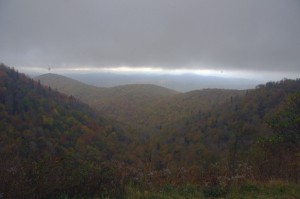
Photo-clouds-move-in-on-the-Blue-ridge-Parkway

As the clouds moved in, I left the Blue Ridge Parkway color behind.

I’ve been taking every opportunity to get out on the motorcycle on the Blue Ridge Parkway and photograph one of the best years for fall leaf color in a long time. I’ve captured some great shots so far. Yesterday though, the weather changed and the high places were quickly enveloped in cloudy wetness so thick I could barely see. Resigned to give up the day to the weather, I stowed the camera and left the Blue Ridge Parkway at Beech Gap (map) to return home to Waynesville via NC 215.
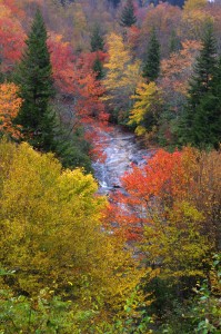
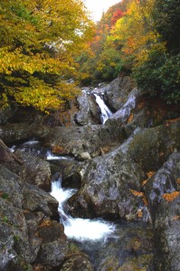
photo-Flat-Laurel-Creek-on-NC 215

Easy to miss, Flat Laurel Creek cascades down the rock faces - 3rd pull out on right, first long straight section of road from top

Currently, a ride on NC 215 is a Jekyll & Hyde experience.  South of the Blue Ridge Parkway, this popular motorcycle ride is an exquisite pleasure as it plunges down from the heights to reach US 64 near Rosman. Recently paved, this southern section of  the road courses through the  Pisgah National Forest, with stunning views from the high parts and challenging curves and bends that thrill.

Photo-Bubbling-Springs-Branch-on-NC 215

Easy to find Bubbling Springs Branch is on a sharp curve where it flows under NC 215.

In contrast, the north end of NC 215 is a nightmare for the motorcyclist and I’ve heard many bikers cursing the experience of surviving the twisty descent on a road now strewn with loose gravel after recent road “improvements”.  It got a “tar & chip” repair job a few weeks back which addressed the breaks in the pavement, but left a slippery legacy to negotiate turns that are a handful on a road with ideal conditions. Riding it on a motorcycle now is an experience that brings dread to the minds of most.

Coming down in the rain, already wet, I took my time and paused along the route to capture some shots of the scenery most motorcyclists will miss as all their attention is focused on staying upright on this challenging road.
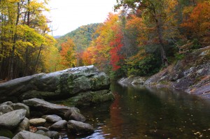
Photo-East-Fork-Pigeon-River

The river calms briefly near the Sunburst Campground with an easy to find pull off along this section.

There are many hidden secrets along this stretch of NC 215 as it traces the course of the Little East Fork of the Pigeon River though most blast right by them. It’s worth taking a little time to pause and explore.

The river is never far from the road, and several small streams add to the torrent along the way. For those who enjoy hiking, the trails through this area are ripe with outstanding scenery.

The Little East Fork eventually reaches Lake Logan where it is captured by a dam. It then continues on to join the Big East Fork before it continues it’s run on through Canton, NC then on into Tennessee where I-40 cuts through a dramatic gorge at the state lines. Eventually it flows through Pigeon Forge, TN, then on to join the great rivers beyond.

Photo-Lake-Logan-North-Carolina

The river pools behind the dam at Lake Logan, then continues on.

Forced to slow down by the road, the rain, and the rocks, I enjoyed a ride most others despise. NC 215 will always be one of our favorite local North Carolina motorcycle rides. I’m hopeful it will see a proper paving in the future, but if not, it will still be a road I visit often and recommend to others. The gravel will eventually be cast along the roadside by traffic.

Don’t be put off by the condition of NC 215. Take your time, go easy, and you’ll be rewarded with some outstanding sights along this classic North Carolina motorcycle ride. It will only get better with time.

_______________________________________________________________________________

Wayne Busch

Wayne Busch - Cartographer

Total Rider Tech Logo

Learn Total Control

– Wayne Busch lives in Waynesville, NC, where he produces the most detailed and comprehensive and up-to-date motorcycle pocket maps of the Blue Ridge and Smoky Mountains to help you get the most of your vacation experience. See them here – AmericaRidesMaps.com

Wayne is an advanced motorcycle instructor for Total Rider Tech teaching Lee Parks Total Control Advanced Rider Courses. It’s time you looked into advanced rider training to ride more confidently and safely, it will change your mountain riding experience. It worked so well for me I became an instructor! Total Rider Tech

_______________________________________________________________________________

You’ll find NC 215 and some of the best motorcycle rides in this outstanding area along with a guide to more than a dozen roadside waterfalls on America Rides Maps “The Best Motorcycle Rides EAST of Great Smoky Mountains National Park

Blue Ridge Parkway Detour 2011 – the BETTER way

Photo - At the parkway detour

Which way to go? Let me help!

All things considered, the Blue Ridge Parkway is in the best shape it has been in for quite some time. It received a lot of attention with the 75th anniversary of the nations most popular motor park last year. Still, there is always work going on to maintain this 469 mile long road.

There is one section which is closed for 2011 near the North Carolina / Virginia border as historic rock walls are reconstructed and stabilized near the Doughton Park area. Because of this, the Bluffs Lodge did not open this year.

The official detour routes traffic north through Sparta, NC. There is a much more enjoyable route for motorcycle travelers.

Choosing this southern detour will allow you to avoid the bulk of the traffic which is directed north and avoid going through the town of Sparta. There is a gas station along this alternate route. While it is a bit longer, it is also quite twisty and scenic as it plunges down from the heights of the parkway, traverses a valley south of Stone Mountain State Park, then climbs again to return to the parkway to continue on your way.

You can download and print your own map of it by using this link:

http://americaridesmaps.com/downloads/Parkway_Detour_2011.pdf

You may also encounter some brief delays here and there, particularly between Boone, NC and Linville, NC as spot paving is done, roadside drainage is improved, and wooden guardrails are replaced.

_______________________________________________________________________________

Wayne Busch
Wayne Busch – Cartographer
– Wayne Busch lives in Waynesville, NC, where he produces the most detailed and comprehensive and up-to-date motorcycle pocket maps of the Blue Ridge and Smoky Mountains to help you get the most of your vacation experience. See them here – AmericaRidesMaps.com 

Another Great Smoky Mountain Motorcycle Ride

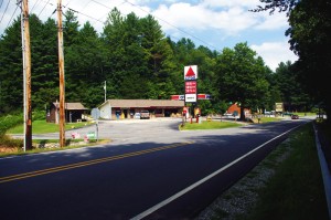
photo-silversteen-rd-meets US-64

The junction with US 64 is marked by a Citgo Station

Silversteen Road is one of those roads  you want to keep in your pocket – it’s almost so good I’ve been tempted to keep it to myself. But after riding it again this week, I’ve just got to share it so you can enjoy it too.

Silversteen Road intersects US 64 between Rosman and Sapphire, NC. The junction is well marked by a convenient landmark gas station. About half way through Silversteen Road, it makes a turn so sharp it doubles back on itself where it meets Macendonia Church Road. If you don’t make the turn to stay on Silversteen Road, Macendonia Church Road will lead you out to NC 215, another outsanding ride which crosses the Blue Ridge Parkway.

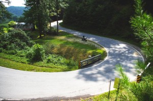
Photo-curve-on-Silversteen-Rd

Imagine miles and miles of curves like this one - a.k.a. Silversteen Road

If you stay on Silversteen Road it runs into NC 281, another fabulous Smoky Mountain Motorcycle Ride and another of my favorites. I typically follow NC 281 north to Tuckaseegee or use it to connect to Charlies Creek Road to reach NC 215 (so many good choices in the area).

I’m attracted to Silversteen Road for it’s challenge – it’s every bit as twisty as the infamous Dragon at Deals Gap. In fact, it’s more difficult as the road seems a bit narrower and the pavement is not up to the quality you find at the Dragon. It sees very little traffic, but the trade off is you’ll find a few potholes and some gravel in the road where unpaved side roads and driveways connect to it. It also has some very sneaky descending radius turns you’ll want to be prepared for so you don’t get in over your head.

Photo-motorcycle-curves-on Sliversteen-Rd-NC

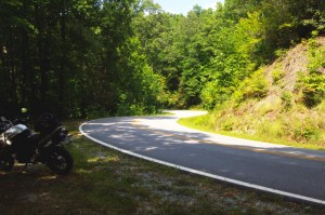
The curves on Silversteen Road never let up.

The ride holds a few scenic areas, particularly where it runs along the bank of what could be the Horsepasture River, but your eyes had better be on the road, not the scenery. It will give you all the challenge you want, maybe more.

You’ll find Silversteen Road on America Rides Maps Map #6 – The Best Motorcycle Rides EAST of Great Smoky Mountains National Park along with all the other great rides in the area, more than 50 great motorcycle rides in this small but beautiful area of the “Land of the Waterfalls”.

_______________________________________________________________________________

Wayne Busch

Wayne Busch - Cartographer

Total Rider Tech Logo

Learn Total Control

– Wayne Busch lives in Waynesville, NC, where he produces the most detailed and comprehensive and up-to-date motorcycle pocket maps of the Blue Ridge and Smoky Mountains to help you get the most of your vacation experience. See them here – AmericaRidesMaps.com

Wayne is an advanced motorcycle instructor for Total Rider Tech teaching Lee Parks Total Control Advanced Rider Courses. It’s time you looked into advanced rider training to ride more confidently and safely, it will change your mountain riding experience. It worked so well for me I became an instructor! Total Rider Tech

_______________________________________________________________________________

Motorcycle Friendly – The Shady Valley Country Store at The Snake

There’s a reason my wife rarely tags along with me while I’m out working from my motorcycle – I only stop for two things, one is fuel. The other can be remedied at any clump of shrubbery. Rarely do I ever stop to eat, drink, or grab photos. It’s all about covering the miles. Those creature comforts can wait until I retire for the evening when darkness makes any further progress futile. I think that’s about to change and one of the first places I’m going to visit is the Shady Valley Country Store the home of “The Snake”.

Photo - Shady Valley Country store

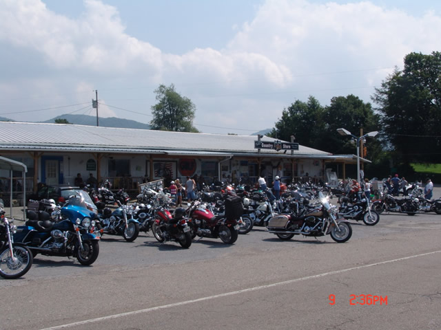
Shady Valley Country Store serves thousands of motorcycles weekly who come to ride "The Snake" and surrounding roads.

Located at the junction of NC 133, NC 91 and US 421 (a.k.a. “The Snake”), the Shady Valley Country Store is at the hub of some of the best motorcycle rides found in the Smoky Mountains where North Carolina, Virginia and Tennessee meet. Serving thousands of motorcycles every week, it provides a convenient fuel stop with regular as well as premium “Snake Venom” for your thirsty motorcycle. I’m told the 1/2 lb. black angus burgers, the thick bologna sandwiches and great chili dogs will keep you going full speed as well.

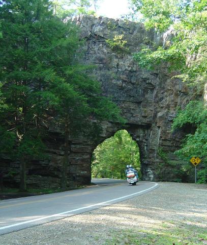
Backbone Rock on TN/NC 133

Backbone Rock on TN/NC 133 not far from the Shady Valley Country Store

I’ve blasted past the Shady Valley Country Store enough times. Next time I’m up there I’m stopping in to check it out, maybe get me a T-shirt or some other Snake memorabilia. Expect to get a first hand report ASAP.

The Shady Valley Country Store

The Most Dangerous Road for Motorcycles?

Charlies Creek Road

Charlies Creek Road - even the sign is crooked


“That’s the most dangerous road we ride” my wife commented after a recent morning outing.

It’s my favorite road!”, I responded.

“I know, but it’s still dangerous” she reiterated.

We talked a bit more about it and the things she finds most dangerous are the things I enjoy as an added challenge.

“I still like it, it’s just a dangerous road” says Jackie.

Jackie’s no lightweight. We rode dual-purpose bikes all over the country years ago, she can throw a motorcycle around. Now, astride her Beemer, she often gives the boys a run for their money on the twisty roads. She can handle herself and I enjoy watching her flow through the curves. And no, we’re not talking about the infamous “Tail of the Dragon“. That’s just another ride for us compared to this.

riding Charlies Creek Road

Be ready to get some lean on when riding Charlies Creek Road

Photo – Wayne prepares to get some lean on in a curve on Charlie’s Creek Road

What makes Charlies Creek Road a challenge is it’s unpredictability. You just never know what it’s going to throw at you next, and it throws everything in the book along it’s 10.1 mile length making it seem a whole lot longer. Mixed pavement, potholes, bumpy repairs, loose gravel, climbs, descents, first gear hairpins interspersed with sections of relatively straight road that lure you to roll on the throttle then snare unsuspecting riders with turns which shut down on them the deeper in you get. Cresting a rise you never know what lies on the other side, which way it will dive. Is there a patch of loose gravel in the next corner, a flock of turkeys in the road, will the tires maintain their grip on that concrete bridge littered with sand and rocks, what’s with this freakin turn, it’s getting tighter? How many seasons before some bear hunter discovers my rusted bike and bleached bones if I lose it out here in the middle of nowhere?

It’s a handful it you approach it cautiously. Come at it with vigor, and it will test everything you’ve got. My kind of road. Beware of Charlies Creek Road, it’s the most dangerous road we ride. It’s also my favorite and I do it as often as I can. Just don’t try to keep up with me. I know it pretty darn well. Respect it or it will eat you.

Note – Charlies Creek Road runs between NC 215 and NC 281. It’s found on America Rides Maps “#6 – The Best Motorcycle Roads EAST of Great Smoky Mountains National Park”.

>> Go To America Rides Maps.comhttp://americaridesmaps.com

_______________________________________________________________________________

Wayne Busch

Wayne Busch - Cartographer

– Wayne Busch lives in Waynesville, NC, where he produces the most detailed and comprehensive and up-to-date motorcycle pocket maps of the Blue Ridge and Smoky Mountains to help you get the most of your vacation experience. See them here – AmericaRidesMaps.com
 
See “Map #6 – The Best Motorcycle Roads EAST of Great Smoky Mountains National Park”