Updates to Blue Ridge Motorcycle Ride Maps

America-Rides-Maps-Logo

www.AmericaRidesMaps.com

First of all, none of the recent updates are significant enough for you to order fresh versions of your America Rides Maps Blue Ridge and Smoky Mountain motorcycle maps if you’ve recently purchased them. The major updates were completed over the last 18 months, and only if your maps are more than a year old will you see the benefit of looking to the newer expanded versions.

However, there have been some more recent changes I’d like to share with you so you don’t miss out on the best motorcycle rides in the Blue Ridge and Smoky Mountians.


image-Georgia-motorcycle-map-cover

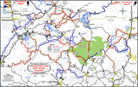
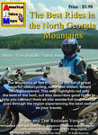
#9 - The Best Rides in the North Georgia Mountains

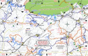
Map #9 – The Best Rides in the North Georgia Mountains was the last completed so it’s most up to date. I’ve just added the new Wolfpen Gap Country Store which will open Saturday in Suches, Georgia (the offical opening is Oct. 1). This is a significant development in Georgia as the convenience store and gas station has long been a popular gathering and rest stop at the intersection of some of the best motorcycle rides in Georgia.


image-motorcycle-ride-map-cover

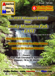
#6 - The Best Motorcycle Rides EAST of Great Smoky Mountains National Park

Map #6 – The Best Motorcycle Rides EAST of Great Smoky Mountains National Park – This is one of the best of all the maps and were I forced to choose it would be probably be my favorite. It includes the best section of the Blue Ridge Parkway. The gas station and convenience store closest to the Blue Ridge Motorcycle Campground has closed and has been removed from the map. Just a few miles further down the road there are 3 gas stations in Bethel, 2 popular restaurants, so it’s no big deal. I’ve added Max Thompson Rd as a good connector as it’s a way to divert around tiny Bethel and a nice connecting road, and it also intersects the short section of NC 215 (Sonoma Rd) at NC 110. Rather than wait at the traffic light, you can just pass by it on Max Thompson Rd and enjoy this short but twisty ride to reach US 276.


Image-motorcycle-ride-map-cover

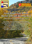
#4 Great Roads Near Boone, Banner Elk, and Blowing Rock

Map #4 – Great Roads Near Boone, Banner Elk, and Blowing Rock – I’ve added Shulls Farm / Shull’s Mill Rd which connect NC 105 to the Blue Ridge Parkway in Julian Prince State Park near the Moses Cone House. While I’ve known about this wonderfully twisty ride previously, it somehow got left off the last update. That’s been corrected. I also added the BP station near 7 Devils on NC 105. Again, don’t know why it got missed, I stop there all the time.


image-virigina-motorcycle-ride-map

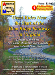
#1 The Best Rides near the Start of the Blue Ridge Parkway in Virginia

Map #1 – Great Rides Near the Start of the Blue Ridge Parkway in Virginia – I’ve added Red Hill Rd, Plank Rd, and Padgett Hill Rd as good connectors. These make the ride from Natural Bridge to Lexington much more enjoyable then the alternative – Interstate 81. They are not lined with outstanding scenery, and a little remote, but they do the job and throw in a few nice curves along the way.


People have often told me my maps are more up-to-date than their GPS, and I can concur as I use GPS while out mapping – the little lady often gets confused when it comes to the twisty two lane back roads we love so much. I’m constantly updating the maps to keep them as accurate and useful as possible and unlike other maps, I produce them in small batches as they change so often. I want to insure you always get the most recent and up-to-date versions. I hope these changes help you have the best motorcycle rides and get the most out of your precious motorcycle vacation adventures.


Map #1 – Great Rides Near the Start of the Blue Ridge Parkway in Virginia
Map #4 – Great Roads Near Boone, Banner Elk, and Blowing Rock
Map #6 – The Best Motorcycle Rides EAST of Great Smoky Mountains National Park
Map #9 – The Best Rides in the North Georgia Mountains

Wayne Busch

Wayne Busch - Cartographer

Thanks,

Wayne

www.AmericaRidesMaps.com

Best Motorcycle Rides in North Georgia – digital soon?

Wow! It’s taken me 18 months to completely revise and update all my Smoky Mountain / Blue Ridge motorcycle ride maps, but the last of them is done – Map #9 “The Best Rides in the North Georgia Mountains” has been released.

image-best-rides-in-the-north-georgia-mountains

Roads are really bold, map is easy to and quick to read. Road descriptions on back of map.

If you have one of my Georgia motorcycle maps you honestly don’t need to replace the map you have. I had almost all of the really outstanding Georgia motorcycle rides on the earlier version. I did find a couple more really nice north Georgia motorcycle rides on the periphery of the main area of the map as you make your way to the classic rides  – you’ve got to ride GA 60,  Blood Mountain area, and I love to play back and forth across the North Carolina state line.

image-georgia-motorcycle-map

Map #9 - The Best Rides in the North Georgia Mountains

So what’s the big deal? The reason this revision took so long was prepare the maps for digital use! I’ve looked at phone apps but decided the limiting factor in the mountains is reception. Live GPS positioning via phone just isn’t there yet for this region.

A solution I’ve been testing instead is map downloads which can be scaled and used from an ipad, ipod, iphone, or any other smart phone provided you’ve got a decent sized memory card. Got your phone? You’ve got your maps. It worked well on the ipad. I’ll be testing ipod, iphone, etc. next. If it goes well, you can expect to see them available in about 2-3 weeks.

So what about GPS? Next project. I have the software. I need the time.

See more about the new map here – goo.gl/ifTNr

_______________________________________________________________________________

Wayne Busch
Wayne Busch – Cartographer
– Wayne Busch lives in Waynesville, NC, where he produces the most detailed and comprehensive and up-to-date motorcycle pocket maps of the Blue Ridge and Smoky Mountains to help you get the most of your vacation experience. See them here – AmericaRidesMaps.com 

New Map – The Best Motorcycle Rides SOUTH of Great Smoky Mountains National Park

Image - View of Map

Map #7 - The Best Motorcycle Rides South of Great Smoky Mountains National Park

I’m proud to announce the release of America Rides Maps latest compilation of great motorcycle rides in the Blue Ridge Mountains and the final map to complete a series of three maps which detail close to 200 good motorcycle roads surrounding Great Smoky Mountains National Park.

Map #7, The Best Roads South of Great Smoky Mountains National Park, covers the region west from Maggie Valley, North Carolina, to Tellico Plains, Tennessee, extending south to cross the borders into South Carolina and Georgia. More than 30 of the roads rate being listed as outstanding rides highlighted in red, and another 20 are shown as great connecting roads highlighted in blue to link them all together.  The Best Roads South of Great Smoky Mountains National Park includes a guide to 9 roadside waterfalls, numerous out-of-the-way gas stations, sights and attractions, and motorcycle friendly locations.

dragon-motorcycles

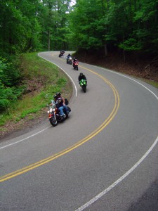
Motorcycles flock to ride the Dragon at Deals Gap

This is THE MAP for motorcycle riders making a trip down the Blue Ridge Parkway then on to the Dragon at Deals Gap.

It includes the final sections of the Blue Ridge Parkway into Cherokee, North Carolina, the popular 125 mile long Dragon /  Cherohala Skyway loop ride, the Nantahala River Gorge, Wayah Bald, the Cullasaja River Gorge, a surprising wealth of hidden back roads near Franklin, NC, and variations on rides surrounding the Dragon at Deals Gap few ever discover.

The Smoky Park Motorcycle Map Series includes –

Nearly 200 roads are described in this map package which weave through some of the highest mountains in the east, cross extensive scenic national forests and park lands, see dozens of roadside waterfalls, including every ride within Great Smoky Mountains National Park, it’s the most extensive and comprehensive collection of great motorcycle rides in this area ever assembled.


Photo by Jim Miller Photography

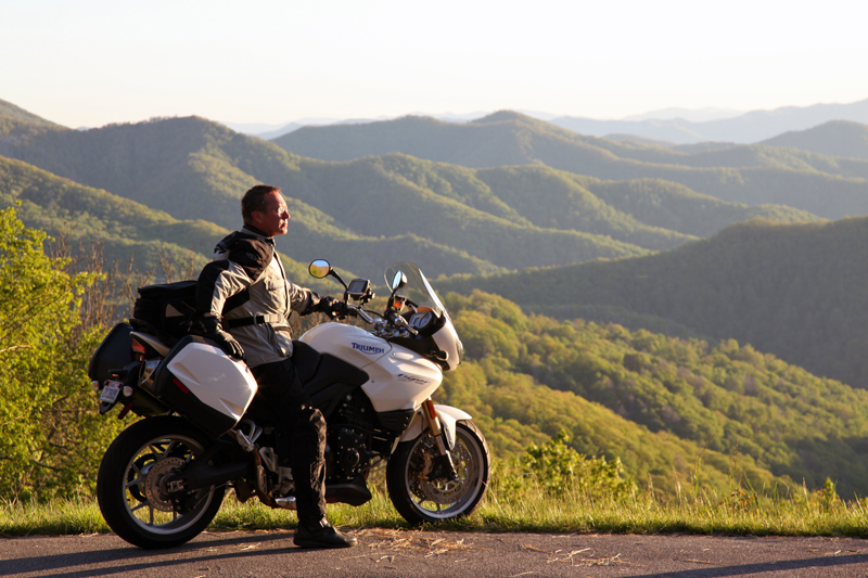
Photo by Jim Miller Photography - This area is so remote and wild you'll find hundred mile views with no evidence of human occupation to be seen.


“This map takes my best selling map, combines it with another, and adds new roads I’ve discovered to make the ultimate map for visitors to the Dragon at Deals Gap, it’s all you need!”

_______________________________________________________________________________

Wayne Busch
Wayne Busch – Cartographer
– Wayne Busch lives in Waynesville, NC, where he produces the most detailed and comprehensive and up-to-date motorcycle pocket maps of the Blue Ridge and Smoky Mountains to help you get the most of your vacation experience. See them here – AmericaRidesMaps.com 

Fall leaves – Photos from The Snake Motorcycle Ride

With such a beautiful day I was itching for an excuse to get out of the office, onto my motorcycle, and enjoy it when an email came in from David at the Shady Valley Country Store at The Snake Motorcycle Ride in Tennessee. He needed to be restocked on maps, and I was curious about a recommended road in the area – Denton Valley Road. Thats all it took.

Photo - Fall leaves on the Snake - US 421

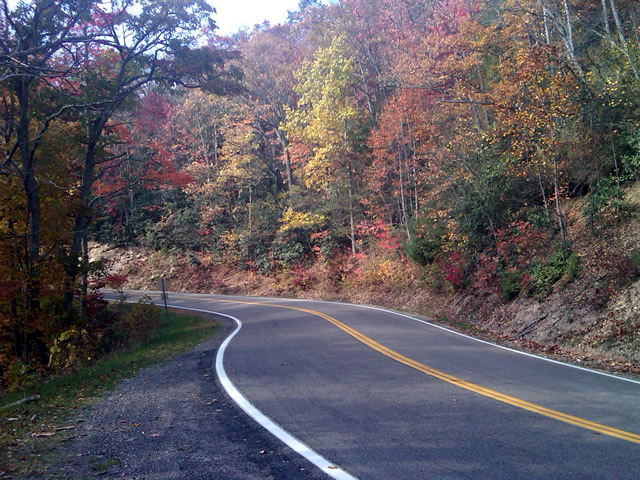
The were some nice spots of fall color on US 421 a.k.a. "The Snake" yesterday. I was delivering a load of maps to the Shady Valley Country Store.

The big question was “How to get there?” Normally I’d take the Blue Ridge Parkway north to Linville, then jump on the back roads to skirt around the traffic in Boone. Knowing the Blue Ridge Parkway would be heavy with leaf peeping traffic, I considered going east to take the most common routes, but I also knew US 321 would be clogged with traffic and I’d get held up going through Boone. That left a western approach, so I went to Asheville, then up I-26 to US 19E from which I could jump on the back roads once I neared Elk Park. Looking back, I should have just followed the back roads all the way. I got held up in the construction on US 19E and could probably have made the trip in the same amount of time and had a lot more fun. Time was an issue as it was after noon before I left the house.

Photo - Fall leaves on The Snake - US 421

I snapped this photo just before I started down Denton Valley Road from US 421. The sun hit just right, the colors are real, not enhanced. I tried to tone them down, but decided to go with what the camera captured.

It was nearing 4 PM when I concluded my business at the Shady Valley Country Store and continued west on US 421 enjoying the twists and curves of The Snake to reach Denton Valley Road. It was a decent ride, though I hadn’t researched it well enough and ended up spending the next hour and a half exploring it and the roads which connect to it to determine the best and most natural routes. I rolled into Bristol, Virginia, around 6 to refuel and resigned to taking the Interstates back home as it was the most efficient course. It’s not the first time I’ve made that trip in the dark, and unprepared to be out so late I once again suffered the chills of going through the high pass on I-26 at Buckner Gap at night – it ‘s always cold there.

I pulled into the driveway at 8PM, shivering but happy after a decent 350 miles and a collection of new roads to add to America Rides Maps collection.

_______________________________________________________________________________

Wayne Busch
Wayne Busch – Cartographer
– Wayne Busch lives in Waynesville, NC, where he produces the most detailed and comprehensive and up-to-date motorcycle pocket maps of the Blue Ridge and Smoky Mountains to help you get the most of your vacation experience. See them here – AmericaRidesMaps.com