The Blue Ridge Parkway’s Best Kept Secret Waterfall

The Mount Lyn Lowry overlook is  a large and welcoming pull-off on the Blue Ridge Parkway that holds more than appears on a drive-by.

Motorcycle the Blue Ridge Parkway in the early spring and you’ll be rewarded with sights unseen by those who visit later in the year. One of them is Woodfin Cascades at the Mt Lyn Lowry overlook (MP 446.7). Once leaves cover the trees when summer arrives, most of this waterfall disappears from view.

Photo-woodfin-cascades-on-the-blue-ridge-parkway

Woodfin Cascades are viewed from the Mt. Lyn Lowry overlook on the Blue Ridge Parkway

Another secret revealed to those who spend a little time observing at this Blue Ridge Parkway overlook is the 60 foot high illuminated cross atop Mt. Lyn Lowry. You can use the cross as a reference to fid the falls, they are located beneath it on the mountainside.
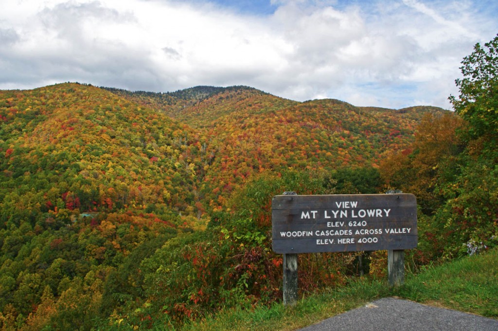
Photo-mt-lyn-lowry-fall

The cross is located atop the mountain. Even though it's 60 ft tall, on a 6240 mountain it's just a speck! The falls are hiding behind the leaves.

Mt Lyn Lowry overlook is located on the section of the Blue Ridge Parkway between Waynesville at US 74 and Maggie Valley at US 19. This is one of the most scenic stretches of the national park as it climbs to the heights of Waterrock Knob, then descends to Soco Gap and Maggie Valley. There are numerous long range overlooks.  Be sure to bring your camera for some of the best views you’ll find.
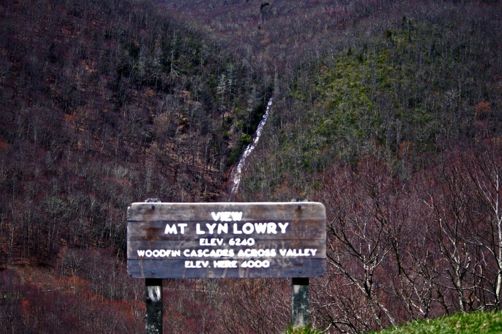
photo-woodfin-cascades

In spring, the entire 235 foot run of Woodfin Cascades can be admired. It dissapears when things green up.

Here’s a 2 min video closeup of Woodfin Cascades –

__________________________________________________________________

Wayne Busch

Wayne Busch - Cartographer

Total Rider Tech Logo

Learn Total Control

– Wayne Busch lives in Waynesville, NC, where he produces the most detailed and comprehensive and up-to-date motorcycle pocket maps of the Blue Ridge and Smoky Mountains to help you get the most of your vacation experience. See them here – AmericaRidesMaps.com

Wayne is an advanced motorcycle instructor for Total Rider Tech teaching Lee Parks Total Control Advanced Rider Courses. Isn’t it time you looked into advanced rider training to ride more confidently and safely? It can transform your mountain riding experience.  Total Rider Tech

____________________________________________________________________

Another Great Motorcycle Ride to be Added to the List – My Secret

It’s not all that frequently I miss a great motorcycle ride in my explorations. I really try to be thorough as well as intuitive, so few slip by. Still, I can’t claim to know ALL the great roads in the southern Appalachians, just the vast majority of them. I continue to find more, and quite embarrassingly, they are too often close to home. Everyone believes they know ALL the great roads right in their back yard. Time and again I am proven wrong, and that’s not such a bad thing.

Stop reading now if you think I am giving this one away. No photos, no road names, nada. I just gave away 30 routes at the Asheville Bikefest for free and people gobbled them up. Nor is this a post about the Asheville Bikefest, I think you may be getting sick of hearing about that, but be cautioned, there will be more to come. The event was far more successful than expected and stuff is flooding in. The only reason I mention the event is because I found this great road because of it.

As Route Master for the Asheville Bikefest (there I go again, last time) I spoke with countless people helping them find the best rides in the area and getting them to see the most in the time they had. When you’re passionate about something, even work becomes fun. I went almost non-stop for four days and I had a great time. That’s why I founded America Rides Maps.

So anyway, this guy wants me to direct him to one of the two dozen local roadside waterfalls, which I do, so he can get of picture of his bike behind it. Yeah, you can actually drive behind this waterfall right off the road. He didn’t find it. Why, I don’t know, it’s one of the most obvious roadside waterfalls there is but that doesn’t matter. What matters is this guy doesn’t give up. He gets directions which lead him off into the forest. He rides and rides everything in sight, exploring places I know better than to go. He never finds it.

The next day he comes back to me and tells me he couldn’t find the waterfall. I’m a bit incredulous, it’s so easy. I redirect him. He relates his adventures and tells me he found this awesome motorcycle ride. I’m dubious. If he couldn’t find the easy waterfall do I believe him now? I made a mental note of it nonetheless. About an hour later I’m talking to a couple of women. They’re buying maps of the areas closest to them (we all think we know our own back yard), right down the street from the “event which will not be named again in this post. Out of curiosity, I ask if they know of this road the guy mentioned. “I live on that road, it’s great!”

So I can’t resist. Today I have to check it out. It rocks. Who cares how or why I missed it.   I’ll add it to the “The Best Roads South of Great Smoky Mountains State Park – EAST” map tomorrow. The other routes in the area I’d previously identified were detours around a congested town and a four lane section of road which formed one leg of a 100 mile+ triangle of superb riding. Now I think I’m looking forward to the detour more than the great rides that lead to it.

I have some more leads to follow up. I know some will be disappointing. I think I’ve done at least one and rejected it, my standards are high, but you never know. I’d be very pleased to find another jewel.

Deals Gap, NC -Tail of the Dragon Reopening April 12

PRESS RELEASE
April 9, 2010
For Immediate Release
Contact:
Ron or Nancy Johnson
800-768-7129 or 828-479-8400
Tail of the Dragon, LLC

Tail of the Dragon Reopening

April 12, 2010

ROCK SLIDE UPDATE April 9, 2010:

The rock slide on US 129 is located between the Dragon and Happy Valley Road/Foothills Parkway.

TDOT has announced in a press release that the 11 mile section known as the Tail of the Dragon will be open from 8 am to 8 pm beginning Monday April 12, 2010. The only access is from North Carolina US 129. THP announced that there will be zero tolerance for traffic violations, so I’d travel the Tail with extreme caution. Please obey the traffic laws and report any undue harassment to us. We will forward all complaints to the Tennessee and North Carolina senators and representatives who worked so hard to get the road open.

We will continue to post the latest information here so keep in touch. The only alternatives from 8 pm to 8 am are the Cherohala Skyway and US 441 through the Great Smoky Mountains. There are many great roads in North Carolina and the Cherohala Skyway is clean.

http://tailofthedragon.com

Tail of the Dragon Closed – Great Rides Nearby – Hot Springs

No new info on the rock slide which has closed the Tail of the Dragon at Deals Gap. In a previous post I suggested some great rides nearby in the “Land of the Waterfalls” and provided a video sample. It’s just one great spot near the Tail of the Dragon with great motorcycle rides nearby, here’s another.

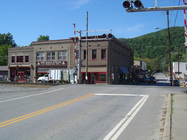
Photo - View of Hot Springs, NC

Hot Springs, NC - A town so small it fits on one photo.

This time I’m going to direct you to an area which sees little traffic, yet contains some fabulous and challenging motorcycle rides with some enjoyable sights and scenery. It’s an area most motorcycle tourists either drive right past on their way into the region or sample only the most notable road. Trust me, there is a lot there to explore and enjoy.

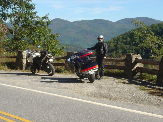
Photo - A roadside view near Hot Springs

Pausing to admire the view near Hot Springs, NC

I urge you to spend some time riding the great roads found in the mountains east of Great Smoky Mountains National Park. The Smoky Mountains do not end at the border of the park, in fact they continue their long run northward reaching their greatest heights north of Asheville, North Carolina at Mt. Mitchell, highest peak in the east just off the Blue Ridge Parkway. The mountains between the park and Mt. Mitchell are spectacular and beautiful, the valleys dotted with rural farms and tiny hamlets, sections of wild national forest, and roads which trace the serpentine courses of rushing mountain streams.

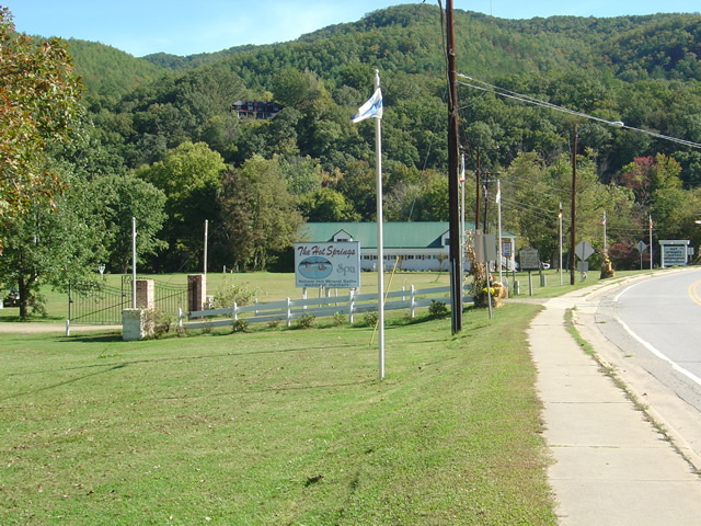
Photo - entrance to the Hot Springs Spa

Entrance to the Hot Springs Spa - Natural Mineral Baths and Massage

The hub of this great motorcycle riding area is the small and historic town of Hot Springs. It’s a good place to pause for lunch, do a little sightseeing, and maybe pay a visit to the natural hot springs which give the town its name. Long popular with hikers (the Appalachian Trail passes through town), fly fisherman, and whitewater rafters and kayakers on the French Broad River, it’s also a popular local motorcycle watering hole as it’s a convenient ride from Asheville.

Photo - French Broad River at Hot Springs

The French Broad River flows through Hot Springs

Honestly, there’s not a lot to the town. No traffic light. One gas station. A few shops and restaurants, a campground, and of course the Hot Springs Spa. You can capture the whole thing in a photo. It’s the roads and the beautiful countryside which surrounds that makes it worth the visit.

Photo - Iron Horse Station, Hot Springs

Iron Horse Station - One of several places to grab a bite and quench your thirst in Hot Springs.

If you take but one ride into the area, do the classic section of NC 209 which runs from Lake Junaluska to the heart of town. It’s such a nice ride. It takes about an hour one way. It’s a local classic. Be aware there is plenty more out there if you know where to look for it.

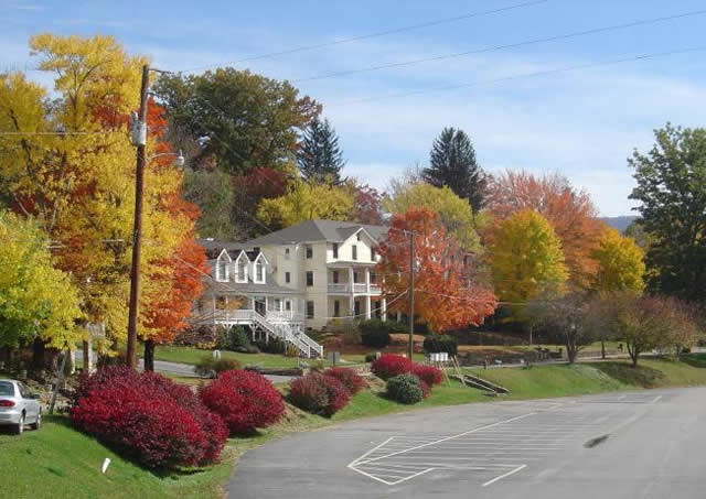
Photo - Fall Color at Lake Junaluska

One of the best rides, NC 209, starts near Lake Junaluska

I’ve been working on a video to showcase the area, though the severe winter pretty much closed the door on that for a long while. I’ll be getting back to it ASAP. Here’s the sample that gives you a good idea of what to expect:

http://www.youtube.com/watch?v=3hsCLMCIUOo

For more detail on the area look to America Rides Maps ” East of the Smokies, West of Asheville, All Around Hot Springs” map which catalogues about 400 miles of the best roads in this small area.

Don’t worry, there’s still more great riding alternatives to come in future posts. Closing the Tail of the Dragon opens the door to you discovering just how much you’ve been missing.

How Long Does It Take To Ride The Blue Ridge Parkway?

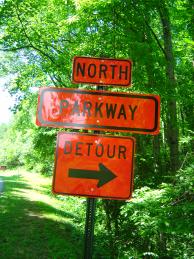
Photo - Detour sign on the Blue Ridge Parkway

It’s not a detour, it’s an opportunity to explore!

10 Hours, 47 minutes, and 27 seconds, so long as you get at least 469 miles from one tank of gas, don’t eat, wear a diaper, and they miraculously resolve all the Blue Ridge Parkway closures and detours. Obviously, that’s not the answer you are looking for.

Riding the Blue Ridge Parkway end-to-end on a motorcycle is a goal for many. It’s our nations classic motorcycle ride. But in planning your motorcycle trip, it is a goal that should be approached like sex – you don’t try to see how fast you can get it done and really enjoy it. Realistically, you could do this great ride in two long days, just to say you’ve done it, but the “I’m an idiot award” would be waiting for you at the end of your scenic ride.

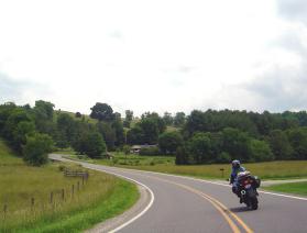
Photo - motorcycle on a Virginia section with caption "Never rush the Parkway - it's meant to be savored".

Never rush the Parkway, it’s meant to be savored.

The more time you put into it, the more pleasure you will get out of your motorcycle vacation. It would be better to focus on exploring small sections of the Blue Ridge Parkway and truly enjoying them. It’s not going anywhere. You can always come back to it. The same spot in the morning is a new experience in the evening, another view with a change of seasons.”

Look at those detours as opportunities to explore the thousands of miles of great roads that surround the Blue Ridge Parkway. The mountains are full of good rides which are devoid of traffic, chock full of scenery, and often more challenging and rewarding to explore.

If you must hurry through, or cover the distance for whatever reason, note those places that were special to you and plan on coming back. The Blue Ridge Parkway is best when you’re not moving at all.

For info about Blue Ridge Parkway Road Closures,
go to http://www.nps.gov/blri/planyourvisit/roadclosures.htm


Wayne Busch - AMERICA RIDES MAPS

Wayne Busch – AMERICA RIDES MAPS

America Rides Maps