The Birthplace of Tennessee – Best Seen on a Motorcycle

Photo - marble campfire

Who knows where this is?

It was the middle of nowhere yet it was the center of everything. I’d stumbled upon the birthplace of Tennessee.

I had low expectations. My research told me most of the roads I’d be riding today would hold little interest to the typical motorcycle rider who had come to ride The Dragon at Deals Gap and the Cherohala Skyway. None of the roads I’d ride on my 450+ mile travels would come anywhere close to those legends. Still, the morning held a surprise I never expected and made the efforts worthwhile.
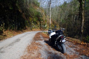
Photo - Cherokee National Forest Road

Parked along Pleasant Mountain Road. It's typical of other roads nearby - of little interest to most. Still I check them all.

Arriving in Tellico Plains, Tennessee, after an early morning motorcycle ride where I’d had the whole of the Cherohala Skyway to myself, I pointed my wheel north onto TN 360 and my workday began. Within a few miles I’d reach the point where I’d previously abandoned my search for great motorcycle rides and the explorations would resume. Rounding a curve a green street sign flashed past with a name I recognized and I clamped on the brakes to swing around.

I could rule this road out as soon as I saw it, it was doubtful it would be of any interest. Consulting my map, I saw it connected to another I wanted to investigate, so I snicked into first gear determined to make quick work of White Plains Road and move on.

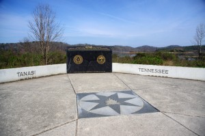
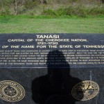
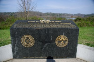
Photo - Tanasi Monument

The Tansi Monument - Tennessee gets it's name from here

It met Smoky Branch Road in a few miles where they both intersected Citico Road. I’d eventually loop back through Smoky Branch Road, also of little interest. Obviously Citico Road was the daddy in this area, the main thoroughfare of better quality, decent pavement, and sporting a faded double yellow line, a proper road.

I expected it would quickly peter out, but after several miles it continued to wind and snake through the mostly bland countryside and I started to wonder if it actually went somewhere in the big empty white space on the map. Curiosity aroused, I couldn’t resist investigating the Tanasi Memorial Site when the sign appeared.

Photo - Tanasi Monument

The empty and isolated setting quickly fills with visions of what must have been

Never heard of it. Turning the motorcycle onto Bacon Ferry Road I ventured out into the nothingness on the barely paved bumpy and potholed  single lane that led out onto a low finger of land surrounded by Tellico Lake. I rode past the pull-off, but a quick glance towards the lake had me circling back when I saw the shoreside monument.

Photo - Tanasi inscription

Inscription transcribed below

Tanasi

Capital of the Cherokee Nation

1721-1730

Origin of the Name for the State of Tennessee

The site of the former town of Tanasi, now underwater, is located about 300 yards west of this marker. Tanasi attained political prominence in 1721 when its civil chief was elected the first “Emperor of the Cherokee Nation”. About the same time, the town name was also applied to the river on which it was located. During the mid 18th century, Tansi became overshadowed and eventually absorbed by the adjacent town of Chota, which was to the immediate north. The first recorded spelling of Tennessee as it is today occured on Henry Timberlakes map of 1762. In 1796, the name Tennessee was selected from among several as most appropriate for the nation’s 16th state. Therfore, symbolized by this monument, those who reside in this beautiful state are forever linked to its Cherokee heritage.

Pho

Cherokee Tanasi to Tennessee - State. A heritage preserved and honored.

I don’t much adhere to theories of “vortexes” or spirituality, but there’s something about this site that is powerful enough to make it worth a visit, it will be on the new map. It’s worth the ride out to it. See it if you have the chance.

_______________________________________________________________________________

Wayne Busch
Wayne Busch – Cartographer
– Wayne Busch lives in Waynesville, NC, where he produces the most detailed and comprehensive and up-to-date motorcycle pocket maps of the Blue Ridge and Smoky Mountains to help you get the most of your vacation experience. See them here – AmericaRidesMaps.com 
Motorcycle the Dragon, the Cherohala Skyway, the Blue Ridge Parkway in one day

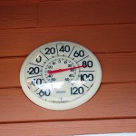
Photo - Thermometer at Deals Gap Motorcycle Resort

Thermometer at Deals Gap Motorcycle Resort

It was 80 degrees when I pulled up at the Deals Gap Motorcycle Resort yesterday at 5 PM with over 400 miles of Smoky Mountain motorcycle rides already behind me. 8 hours ago I was on the Cherohala Skyway as the soft morning glow and gusty winds made the lonely road seem like it was in another world.  I decided to make the day a trifecta and go home via the Blue Ridge Parkway. It’s hard to believe it’s still March, early spring has arrived!

Photo - morning on the Cherohala Skway

Morning on the Cherohala Skyway. I'm parked on the state line between North Carolina and Tennessee.

I had reservations about going out today, I’d been putting it off. I knew I would not find many good motorcycle rides in the areas I was searching. It was either too far out of the mountains or too far to into them. I was hitting the single lane back roads in the National Forests near The Dragon at Deals Gap and the Cherohala Skyway,  as well as the best ways to pass through the semi-urban areas to the north.

Photo - marble campfire

Who knows where this is?

I found something cool out in the Cherokee National Forest that will get it’s own motorcycle blog post shortly. One of the more useful things I discovered is one of the most direct ways to connect The Dragon at Deals Gap to I-75 south of Lenoir City.

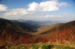
Photo - Cherohala Skyway View

A long view of the Cherohala Skyway as it winds into Tennessee

I suspect many riders follow US 129 to Maryville, then take US 321 north when headed for the Interstate. There is  a way to minimize the traffic and avoid more than half of the four lane US 321.

Take TN 72 north from The Dragon at Punkin Center. When you reach US 411, cross it onto the East Coast Tellico Parkway and follow it along the lake area. It will become Axely Chapel Road at the north end and will intersect US 321. These are not outstanding motorcycle rides, but they are a heck of a lot better than the alternatives and get you off the four lane on some scenic and curvy motorcycle roads.

Photo - Calderwood Lake

Calderwood Lake is one of several along US 129

I don’t really care much for riding in this area, but it’s only because there are so many really great motorcycle rides once you get in close to Great Smoky Mountains National Park. It’s hard to shine when pitted against them.

I’ve been mostly focusing on find the connections between the better rides so you can link them together. If you have the time when passing through, they are the most enjoyable motorcycle rides I can find for those who would rather stay on the back roads and savor them. The views are certainly more entertaining. Watch out for turkeys in the road.

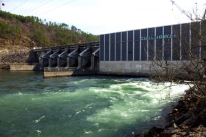
Photo - Chillowhee Dam

How many of you have seen the Chillowhee Dam from this side?

My “wake up and dream” cruise on the smooth and sweeping curves of the Cherohala Skyway was the highlight of the morning.  The rest of it was on a web of roads which weave through the more remote and rugged sections of the national forest. A few of them start out as decent paved roads, but quickly diminish to single lane unmarked trails that become more potholed and full of gravel as you go. On most, the pavement ends long before the road does.

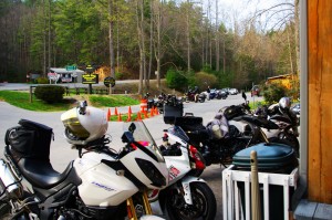
Photo - motorcycles at Delas Gap Motorcycle Resort

5 PM on a Tuesday evening in late March at the Deals Gap Motorcycle Resort

I’ll need at least one more good day to cover this area as thoroughly as I’d like. I’ve hit almost all the roads. The challenge now is how they work together to become the best motorcycle rides through the area, how well do the linked roads flow, can I find ways to make the good motorcycle rides last longer?

I know I can!

(Click on photos for larger views)
_______________________________________________________________________________

_______________________________________________________________________________

Wayne Busch
Wayne Busch – Cartographer
– Wayne Busch lives in Waynesville, NC, where he produces the most detailed and comprehensive and up-to-date motorcycle pocket maps of the Blue Ridge and Smoky Mountains to help you get the most of your vacation experience. See them here – AmericaRidesMaps.com 
My Search for the Best Mountain Motorcycle Rides Never Ends

Photo - Maple Springs Observation Point

The Maple Springs Observation Point - accessed from Santeetlah Rd

Friday’s search for great Smoky Mountain motorcycle rides, which culminated with a spirited cruise on the Cherohala Skyway, was one of those days that might be looked on as not so productive. It’s not that I didn’t catalogue some good mountain motorcycle riding roads, I added several which will appear on my new map of the area. In my quest to leave no stone unturned, much of the 400 miles I covered was spent on roads which only the most adventurous would bother to travel. Still, there are sights and places some may wish to see, and I’m determined to find as many of them as I can.

Photo - Cherokee National Forest View

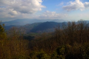
View from the Maple Springs Observation Point. I was told you can see 5 states from this spot.

Considering the number of motorcycle riders who are drawn to the area by such notable roads as The Dragon at Deals Gap, the Cherohala Skyway, The Tennessee Foothills Parkway, NC 28 (now renamed “the Moonshiner 28“), finding others that compare in quality is pretty much futile. These are some of the best motorcycle rides in the world. I’m not holding my breath thinking I’m going to discover the next great classic motorcycle ride. So why go to all this effort?

Photo - Santeetlah Dam

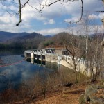
Quiet morning at the Santeetlah Dam

There are probably millions of motorcycles that pass through here each year. In most cases, they come, they ride the famous roads, get the t-shirt, then they’re gone to other places following the crowds. It’s the notable roads that get all the attention. Once experienced, it’s back on the four lane or the congested tourist arteries to reach the next great spot. You can rack up a lot of miles playing connect-the-dots, though those droning plods on the connections are the price you pay to reach those popular motorcycle rides.

Photo - Bald River Falls

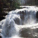
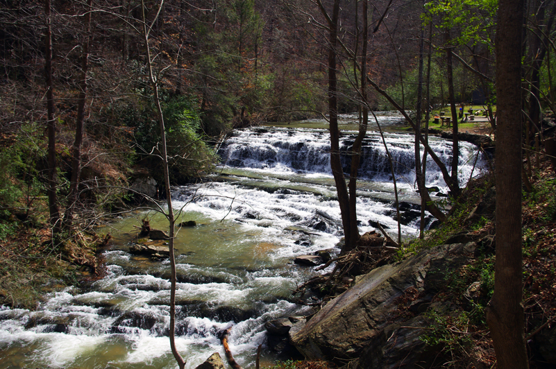
Bald River Falls

It doesn’t have to be that way. I’m filling in the gaps between the famous motorcycle rides with the best quality rides I can find so connecting the dots is as much of an adventure as the roads you’re trying to reach. Where others might show you one good way to get from point A to point B, I look for all the best ways.

Photo - Cherohala Skyway View

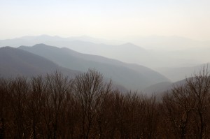
View from the Cherohala Skyway. The Smoky Mountains were especially smoky today and I'll get more photos another time.

Who want’s to spend their time on the 4 lane or in bumper to bumper tourist traffic when there are so many empty two lane scenic and challenging mountain roads that get bypassed? It’s often as simple as crossing over to the next valley to escape the congestion. One little turn can make the difference between cruising along with the wind in your face or cursing the throngs of dawdling codgers, gawking sightseers, lumbering RV’s, and belching commercial trucks struggling up the grades to deliver their wares.

Photo - Motorcycles on the Cherohala Skyway

Bikes on the Cherohala Skyway

I’ve catalogued more than 100 good motorcycle roads so far surrounding Great Smoky Mountains National Park. I’m not done yet. Some of these are outstanding rides. Others will satisfy those looking for adventure. All of them avoid most everyone else who’s come to enjoy the Smoky Mountains just like you and take you to the places they’ll never see while getting you where you want to be.

Keeping you going is what keeps me going. I’m closing in on finishing the map of the Best Motorcycle Rides North of Great Smoky Mountains National Park. Stay tuned and see what I discover. It’s all for you. (Click on the photos for the large versions)


http://www.youtube.com/watch?v=xBbQfR2GqMc

_______________________________________________________________________________

Wayne Busch
Wayne Busch – Cartographer
– Wayne Busch lives in Waynesville, NC, where he produces the most detailed and comprehensive and up-to-date motorcycle pocket maps of the Blue Ridge and Smoky Mountains to help you get the most of your vacation experience. See them here – AmericaRidesMaps.com 
 

Finding Great Motorcycle Rides North of Smoky Mountains National Park

Another long day on the road, another loop of Great Smoky Mountains National Park, in search of the best motorcycle rides north of the big forest. The wonderfully warm weather we’ve been enjoying has slipped back into the winter norms, though it was still nice to be out riding. The day ended with a long ride home in the rain with temps in the 40’s but it was well worth it.

Photo - roadside waterfall near Wears Valley

Waterfall along US 321 near Wears Valley, TN. While it's pretty to look at, US 321 is one of the last roads you want to be caught on if you're looking for enjoyable riding. Even mid-winter, the traffic takes all the fun out of the ride.

While I’ve pretty much scoured the mountains from north Georgia to north Virginia looking for the best motorcycle rides for America Rides Maps, this area north of Great Smoky Mountains National Park is one I’ve shunned until now. I know the tourist routes through it – and avoided it because of them. The traffic and congestion that is drawn to Gatlinburg, Sevierville, and the surrounding cities chokes the major roads so much it takes all the enjoyment out of riding a motorcycle. With Knoxville, Oak Ridge, and Maryville all growing and expanding, the winding mountain roads bare a heavy burden of local and commercial traffic. Add to that the millions of tourists drawn by the nations most visited National Park, the Smokies, and things can grind to a miserable crawl.

Photo - tree in roadway

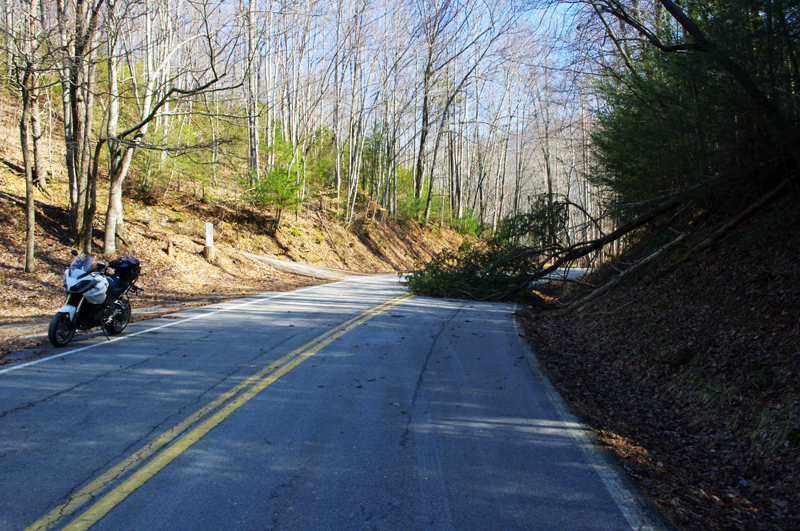
High winds recently, including today, keep you on your toes on the back roads. If you're not skirting around trees, you're dodging rocks loosened by rains. Some of these roads still have a good deal of gravel and sand left from the last snow. You come to expect this of winter riding in the mountains.

It’s a tangled web of roads along the north side of the smokies, but I’m already happy with what I’ve found. Sorting through them has been full of surprises. As always, if you really look for them, great motorcycle rides are there to be found. I’ve already got some real gems, roads I ride over and over in my travels. I can duck in and out of Gatlinburg with little care for the traffic on some great hidden roads. I’ve already found ways to cruise right through all the chaos like it didn’t exist. Now I’m seeking the roads that link all these gems together, and I found a bunch more today.

At this rate, the new motorcycle ride map will be finished soon. I’ve found great rides near The Dragon at Deals Gap few know about. I’ve discovered some that play with the Foothills Scenic Parkway. A few go into Great Smoky Mountains National Park. The best ones though, are those that are just the roads less traveled. If you’re in a car, there are faster or more direct ways to reach your destination. On a motorcycle, destination doesn’t matter so much – it’s all about the ride, and these are some great rides!

_______________________________________________________________________________

Wayne Busch
Wayne Busch – Cartographer
– Wayne Busch lives in Waynesville, NC, where he produces the most detailed and comprehensive and up-to-date motorcycle pocket maps of the Blue Ridge and Smoky Mountains to help you get the most of your vacation experience. See them here – AmericaRidesMaps.com 
Photos From Another Great Smoky Mountain Motorcycle Riding Day

Photo - 15 mph road sign

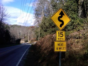
15 MPH NEXT 6 MILES - You've probably discovered a good ride when you see signs like this.

So I’m wrapping up this new motorcycle ride map which covers best motorcycle rides in the eastern half of Great Smoky Mountains National Park and I’m finally to the “get out and ride” stage. Most of the really tedious work is done, the stuff that keeps me in front of the computer. Today I took the afternoon to go out and ride some of the closer roads and it was superb.

When I do a map revision, I typically re-ride almost all the roads from the existing map to re-familiarize myself with them.  I think it’s the best way to judge newly discovered roads against the others I already know by making a fresh comparison. As some of my maps now have more than 50 featured roads I’ve got a lot of miles to cover. Sometimes a road I once considered top-notch pales a bit when new and better ones are discovered. When I do find a new road, I then seek out the best routes to connect them all together. All-in-all it adds up to a lot of mileage.

With a good frost this morning and temperatures that never creeped out of the 40’s, I saw only a few other motorcycles out on the road.  It was warm enough to leave the heated gear on the coat rack. Mid-week traffic was light and it was a great day to be out on the bike. Recent rains had helped clear the roads of the de-icing coating and gravel that had been laid down during the last cold snap.

Photo - Mountain view from one of the roads

I snapped this photo atop the climb one of the great new roads made over a mountain. Views are sometimes better once the leaves are off the trees.

As is usual only a few of the new roads were really good rides though the two I found were so outstanding either would have made for a successful day. I routed my commute between them to include NC 215 so I could shoot some more video along the way for the upcoming production. Damn, that road is fun now that the south end has been repaved. The fresh asphalt has been exposed long enough that the oily surface has aged and the grip on the baby bottom smooth tarmac is outstanding. It’s a Jeckyl and Hyde experience though – as soon as you pass under the Blue Ridge Parkway the new pavement ends and the road quality becomes dangerous in places. Be on your toes where they started patching and paving the north side. I wonder if it didn’t get compacted enough as the gravel in the asphalt is loose. It’s really hard to see how bad it is until you’re in it and by then you’re slipping and sliding just as you enter the hairpin curves.

Photo - NC 215 winter view

Winter riding has it's own beauty - I enjoy the contrast to summers lush growth. This is NC 215 south of the parkway, one of the better sections.

The first road I added was one surprisingly close to home – Crabtree Mountain Road. The last time I explored it there was a long section that wasn’t paved. That’s not unusual in the mountains. The easy sections along the valley floors get paved. The steep sections that climb up and over the mountain passes don’t as it requires so much effort and expense to prepare and then maintain a decent roadbed in the steep and rocky terrain.

Photo - View from Crabtree Mountain Rd

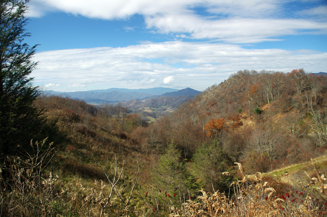
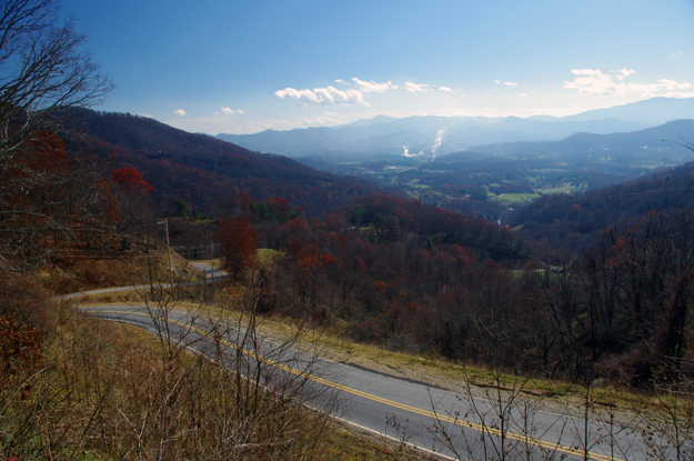
Outstanding views from atop the pass on Crabtree Mountain Road. The smoke plume from paper mill in Canton is easy to spot

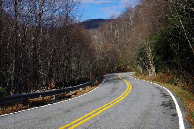
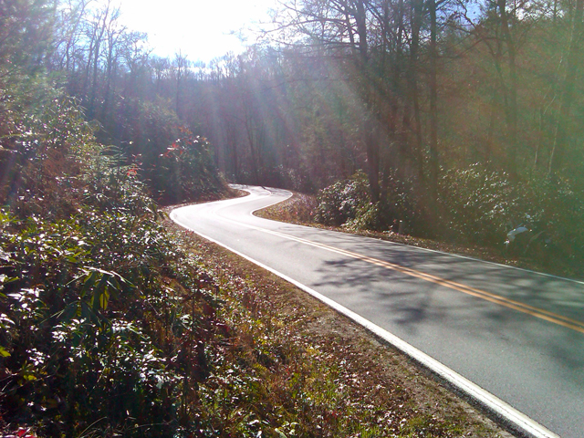
Crabtree Mountain Road connects NC 209 (now known as “The Rattler” video here) to NC 215 at the town of Canton. It not only makes a connection between two already great rides, but is a great motorcycle ride on it’s own merits. The scenery in the valley is picturesque as the road winds along with the course of a stream through a collection of nice curves, then darts south to start the steep climb over a high pass. Two of the photos included were from the high point on the road. It then plunges down the mountainside through a series of hairpin turns and switchbacks before it runs into Thickety Road and connects to NC 215 near I-40. Watch for gravel near the top of the pass, but otherwise the road is in good condition and a nice ride.

Photo - Silversteen Road

High quality pavement on Silversteen Road gives you the confidence to exploit the unending series of curves.

The second road I added was near Lake Toxaway and I suspect it may become one of my new favorites. Silversteen Road connects the fabulous riding on NC 281 to one of the twistiest sections of US 64. This road had me thinking of The Dragon at Deals Gap. Though a third shorter than the Dragon at at 8.1 miles in length, the tight curves are relentless throughout the ride. Also, like the Dragon, while it doesn’t offer much in the way of scenery, you’re too engaged in just maintaining control to let your eyes wander to the horizon. It’s easy to find from NC 281 as it intersects on a hairpin curve, and the southern end at at US 64 is marked by a gas station.

Progress is going to have to wait a week as I’m taking a short vacation. I be back in the saddle after Thanksgiving. I posted some of the video I shot today at my Youtube Channel – http://youtube.com/americaridesmaps. Until then, enjoy the ride.

http://www.youtube.com/watch?v=t1HbSTAk7C4

_______________________________________________________________________________

Wayne Busch
Wayne Busch – Cartographer
– Wayne Busch lives in Waynesville, NC, where he produces the most detailed and comprehensive and up-to-date motorcycle pocket maps of the Blue Ridge and Smoky Mountains to help you get the most of your vacation experience. See them here – AmericaRidesMaps.com 
 

Fire at The Dragon no Hazard to Motorcycles

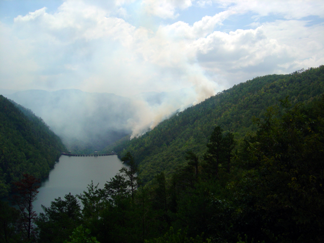
Photo - forest fire near the Calderwood Dam at Deals Gap

View of the forest fire from the Calderwood Dam Overlook at Deals Gap

As I passed through Deals Gap yesterday (scrubbing in my new tires) I paused at the Calderwood Dam overlook at the north end of The Dragon to see what all the activity was about. On Tuesday a lightning strike started a forest fire on the steep slope near the dam. It has been smoldering since.

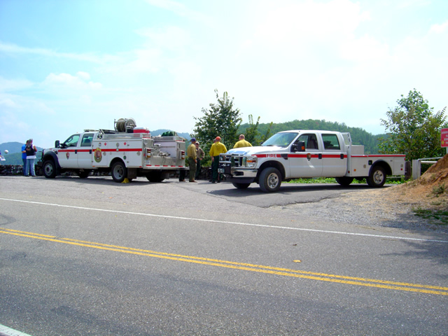
Photo - fire crews at Deals Gap

The fire crews are monitoring and managing the natural burn - "Right now, the information officer is busier than us"

About 35 acres have been involved so far so it’s not a significant fire in size. Fire crews are on the scene and have been managing the burn since, mostly monitoring it to insure it doesn’t affect the dam buildings and at times helping nature do it’s work by setting backfires and encouraging burning along the roadway while keeping it from going out of control.

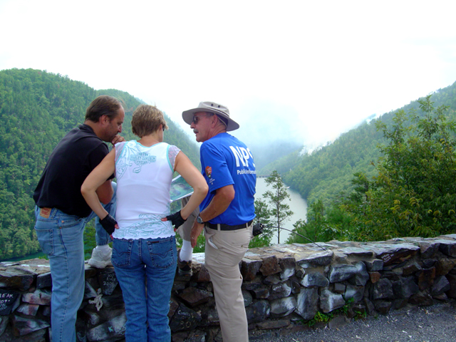
Photo - Information officer at the site

The National Park Service has stationed an information officer at the overlook to explain what's going on.

As the burn is on property recently acquired by Great Smoky Mountains National Park, the park has posted an information officer to inform the public of what is going on and educate them as to how it fits into the park management process. He’s great, knowledgable, has photos, topos, and I enjoyed talking with him.

The fire has had no effect on riding the Dragon, you can still enjoy your visit.

_______________________________________________________________________________

Wayne Busch

Wayne Busch - Cartographer


– Wayne Busch lives in Waynesville, NC, where he produces the most detailed and comprehensive and up-to-date motorcycle pocket maps of the Blue Ridge and Smoky Mountains to help you get the most of your vacation experience. See them here – AmericaRidesMaps.com


Dumb Things to Do on Your Motorcycle – Cades Cove Bears on a Saturday

I don’t know what possessed me to ride through Great Smoky Mountains National Park on a warm, sunny, Saturday, but then I’m kinda getting in the spirit to do more dumb things on my motorcycle this week – more on that plan later. Nonetheless, I had a new tire to scrub in so I took off for the Dragon at Deals Gap to do the deed. Arriving early in the afternoon, I found it pleasantly low in traffic. Most everyone had already made their passes and headed out to explore the surroundings and I had a good run through it thanks to my brother riders who waved me to slow down when approaching the police stationed along the route. I arrived at the overlook with the new front tire looking like someone had taken a cheese grater to the shoulders and satisfied with the performance of the new Michelin Pure rubber which now adorned both ends of my ride.

I stopped in to see Jody at the Punkin Center Motorcycle Campground who was deeply engaged in a mid afternoons relaxation on the porch, and had to pass on the cool one offered as I had miles to before I reached home. We talked briefly of roads and riding, then I set out for the Foothills Parkway which runs along the Northwest border of Great Smoky Mountains National Park .

Photo - Cades Cove, Gear Smoky Mountains National Park

A view from the Cades Cove Loop Road which rings the valley in Great Smoky Mountains National Park

The Foothills Parkway has never impressed me much, but then my standards of comparison are skewed from all the time I spend on the Blue Ridge Parkway. I passed through Townsend, then fell in line with the cattle herd that staggers it’s way through the park. Regardless of the speed limit, there is always some plod who thinks the posted speed is at least 10 mph too fast and there are a dozen cars in front of you. Oblivious to the landslide of perturbed drivers riding up his bumper, he motors right past pull off after pull off where he could let the traffic pass. It’s all part of the experience.

Photo - the Cades Cove Loop Road in Great Smoky Mountains National Park

Freshly paved, the scenic loop road around Cade's Cove is a great place to see the wildlife that is so plentiful here

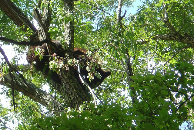
The purpose of my visit was to lay eyes on the newly paved sections of road so I made a detour out to Cades Cove to see the Loop Road. I started, stopped, started, stopped, started (you get the idea) out the freshly paved single lane but quickly realized at this pace I could throw away my watch and use a calendar to figure when I’d get home. I took the first opportunity to shortcut the loop with Sparks Road, an unpaved cut more or less straight across the valley. Nearing the South end of it, I saw the first bear up in a cherry tree gorging on the summer fruit and stopped to snap a photo.

Photo - bear in tree in Great Smoky Mountains National Park

One of several bears I saw on my short visit. They were high in the cherry trees gorging on the summer fruit.

Reaching the south side of the loop road, I fell back into the herd which was held up by another bear spied in another cherry tree at which point people just abandon their cars in the road and walk out to stand beneath the bruin for a telephoto of the bears ass. It’s all part of the experience.

Photo - riding with the herd on River Road

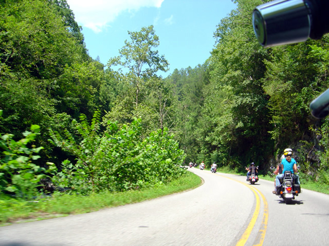
Just one of a long like of bikers on River Road in Great Smoky Mountains National Park

The ride back from Cades Cove, along River Road, then across the park on 441 need not be detailed, it was as was already described. All the way. All the time. I finally escaped onto the Blue Ridge Parkway scooting around the next plodder who was doing 20 mph in the 45 mph section with a quick twist and flick, then fell in with another bike that was obviously not a tourist. I felt it my duty to ride along at a matching pace as a safety backup just in case his enthusiasm wasn’t matched by the talent it took to lay a bike through the turns like he was and someone had to make a 911 call. I’m always there for you bro.

Which brings us back to more dumb things to do on your motorcycle. One day this week I’m going to ride the 469 mile long Blue Ridge Parkway from end to end. In one day. That’s really dumb, like seeing how fast you can have sex. The goal is not to see how fast I can do it, though my competitive nature would naturally lead to that extreme.  Nor do I want to establish a benchmark which will invite challenge by setting a time. I’m building in a safeguard to prevent me from giving in to that temptation. I’m going to force myself to stop once every hour, take a photo, and tweet my location and situation when I have cell phone reception.

I was hoping to go south to north on Tuesday, but the morning fog has been so heavy lately it might not only delay me, but the photos I take will show nothing but white for the first couple hours. It looks like I’ll come from the North end south on Thursday instead. Don’t ask why, it’s something to do with the summer heat no doubt.

Plan on following me on my Parkway-in-a-day tour this Thursday.

_______________________________________________________________________________

Wayne Busch

Wayne Busch - Cartographer


– Wayne Busch lives in Waynesville, NC, where he produces the most detailed and comprehensive and up-to-date motorcycle pocket maps of the Blue Ridge and Smoky Mountains to help you get the most of your vacation experience. See them here – AmericaRidesMaps.com
 

Alcohol Vote Great News For The Lodge at Copperhead Motorcycle Resort

Photo - Vote Yes Sign worked

They Voted YES! Alcohol sales are now legal in Union County, Georgia

Emerging from the transition to new ownership, Tuesdays vote to allow alcohol sales in Union County, Georgia, may be just the shot in the arm needed to get The Lodge at Copperhead Motorcycle Resort back up to speed. Located a few miles west of Blairsville just off US 515 / 76, The Lodge at Copperhead couldn’t be better located to serve as a base camp for those looking to ride the best motorcycle roads in north Georgia and I know of no other motorcycle resort in the region which offers the level of service and quality of accommodations found here – it’s simply outstanding.

Easy to reach for motorcycle riders in Atlanta, Charlotte, Columbia, and Chattanooga, and an already popular destination with the throngs of motorcycle touring enthusiasts in Florida, The Lodge at Copperhead sits in the heart of the best motorcycle riding in the Peach State and is within a convenient distance to the Dragon at Deals Gap and the wealth of great motorcycle rides across the border in Tennessee, North and South Carolina.

Photo - The Lodge at Copperhead

The Lodge at Copperhead Motorcycle Resort is under new ownership and ready for your visit.

Both lodge rooms and cabins are available. Specifically designed to serve the needs and desires of those on a motorcycle vacation, The Lodge at Copperhead offers the traveler a comfortable and luxurious setting to relax in after a day of enjoying the fantastic roads through the surrounding hills and mountains.

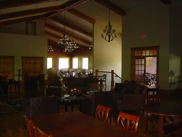
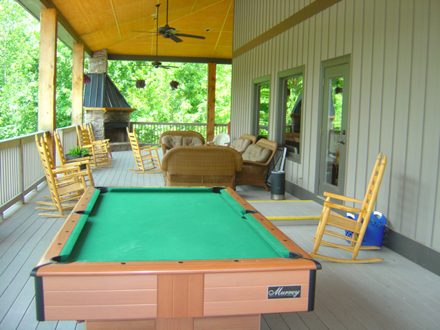
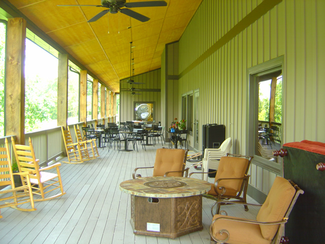
Look at those porches with the comfortable chairs, the pool table, and the outdoor fireplace, and imagine you and your friends enjoying a relaxing beverage from the bar as you talk of the days adventures and plan for more tomorrow. Take a dip in the pool during the summer heat, or cozy up to the fireplace inside the lodge on the cooler evenings in the big comfortable furnishings. Enjoy a great meal at the restaurant in the evening or stock up at breakfast for a full day of riding fun.

Photo - inside the Lodge at Copperhead

Comfortable, luxurious, and welcoming, relax in the lodge. Dining Room in the background.

Peaceful, relaxing, away from the crowds, traffic, and congestion found elsewhere, The Lodge at Copperhead is located almost square in the center of America Rides MapsThe Best Rides in the North Georgia Mountains“, the most complete map of more than 25 of the best mountain motorcycle rides in the state. Choose any direction and within minutes you’re cruising along the sweeping curves or carving your way through the winding back roads.

Photo - view of the porch at the Lodge at Copperhead

This is the mountains, so count on spending a lot of time enjoying the fresh air and good conversation on the porches. Note the fireplace in the corner.

Photo - porch at the Lodge at Copperhead

Plenty of room on the porches to find just the right spot.

Photo - the bar at the Lodge at Copperhead

The well equipped bar offers yet another cozy refuge.

The Lodge at Copperhead Motorcycle Resort is destined to become the premier motorcycle resort at the gateway to the Smoky Mountains and the thousands and thousands of miles of great two lane mountain roads which begin in the northern corner of Georgia.

Photo - view of the cabins at the Copperhead Motorycle Resort

If you're looking for more privacy ask about a cabin - close enough to walk to the facilities but distant enough to be apart from the activity.

Photo - the pool and stage at the Lodge at Copperhead

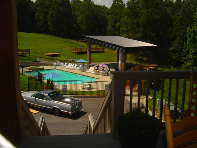
Enjoy the pool during the day and entertainment on some evenings. Notice the stage, the decks, and the grassy hill to view and enjoy the shows.

The Lodge at Copperheadhttp://TheLodgeAtCopperhead.com

_______________________________________________________________________________

Wayne Busch

Wayne Busch - Cartographer


– Wayne Busch lives in Waynesville, NC, where he produces the most detailed and comprehensive and up-to-date motorcycle pocket maps of the Blue Ridge and Smoky Mountains to help you get the most of your vacation experience. See them here – AmericaRidesMaps.com
 

Visit the Punkin Center Motorcycle Resort at the Dragon – a bunch of photos and info

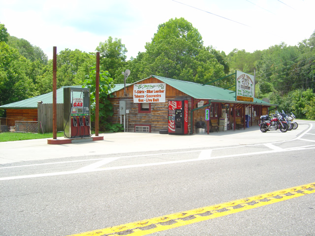
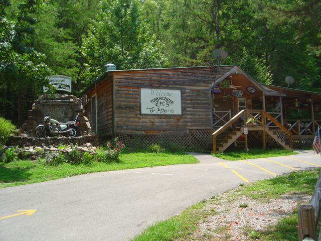
Photo - Punkin Center Motorcycle Resort

Store and gas at the Punkin Center Motorcycle Resort - there's so much more here.

I made a stop at the Punkin Center Motorcycle Resort yesterday located at the Tennessee end of the Dragon at Deals Gap and came away impressed with all it has to offer.

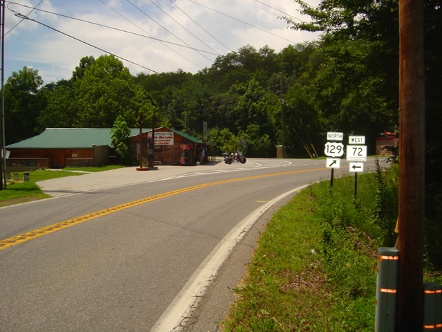
Photo - street view of Punkin Cneter Motorcycle Resort

It's more than just a convenient navigation marker at the junction of US 129 and TN 72, the trun to make the Cherohala Loop Ride

Located at the junction of US 129 and Tn 72, the turn to make the loop ride with the Cherohala Skyway, and just of the road from the Foothills Parkway,  it’s a very convenient landmark for navigation, but there are good reasons to stop in.

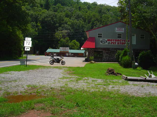
Photo - Punkin Center Motorcycle Resort and the PitStop

You can't miss it when approaching from the north, the Punkin Center Pit Stop is just across the street.

There’s the store of course with souveniers, gear, and accessories. Then there’s the new motel. Next to that is the BBQ restaurant. They have gas outside the store. Jody’s a great source of information. Still, there’s more.

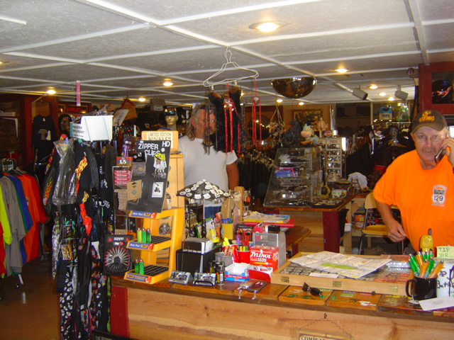
Photo - Inside the sore at the Punkin Center Motorcycle Resort

The store at the Punkin Center Motorcycle Resort is packed with goodies.

Just up the road is the campground and cabins. There’s a deli here and they serve beer. There’s a stage for entertainment.

Photo - the Campground at the Punkin Center Motorcycle Resort

In the middle of the afternoon the campground was deserted - everyone was out riding

There’s not much the Punkin Center Motorcycle Resort doesn’t offer.

Photo - one of the cabins at the Punkin Cneter Motorcycle Resort

One of the cabins at the campground up the street

Did I mention there’s a bunkhouse behind the store for groups? It’s all here.

Photo - the Punkin Center Campground Hub

The office and Deli at the Punkin Center Motorcycle Resort Campground - good food and beer available

I came on a Tuesday and the restaurant was closed for the day – shame as I came hungry. Maybe next time. It was the middle of the afternoon and while the campground was full, everyone was out riding. Great day for it, hot sunny, and so many good rides nearby.

Photo - the Punkin Center Motel

The closest motel to the Dragon - new, nice, and clean, the Punkin Center Motel

I’ll be returning to sample the food and learn more about this great spot for the motorcycle touring enthusiast. Friendly people, everything you need, everything clean and spotless, it’s well run and I can recommend it from what I’ve seen.

You should check into the Punkin Center Motorcycle Resort. http://punkincentermotorcycleresort.com

_______________________________________________________________________________

Wayne Busch

Wayne Busch - Cartographer


– Wayne Busch lives in Waynesville, NC, where he produces the most detailed and comprehensive and up-to-date motorcycle pocket maps of the Blue Ridge and Smoky Mountains to help you get the most of your vacation experience. See them here – AmericaRidesMaps.com
 

12 Classic Deals Gap Motorcycle Rides now at Thunder Mountain

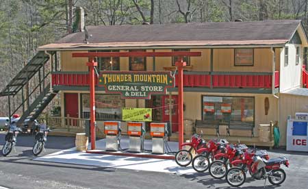
Photo - Thunder Mountain Country Store and Deli

Photo from Thunder Mountain Country Store and Deli - http://thundermountainnc.com/

America Rides Maps newest map, 12 Classic Deals Gap Motorcycle Rides, is now available at the Thunder Mountain Country Store and Deli located at the Robbinsville end of the Cherohala Skyway. You can’t miss it as you carve through the tight curves at the start of the the Cherohala. Say hello to Paul and Tina when you stop in for gas or refreshments on your motorcycle ride.

Now that the rock slide has been resolved on the Dragon at Deals Gap, the motorcycle traffic is really picking up again and riding the Cherohala loop is one of the prime attractions for motorcycle touring. Tennessee’s version of the Blue Ridge Parkway, it’s a very similar motorcycle ride with it’s high vantage points and overlooks, paved pull-outs, and quality pavement. After the Dragon, it’s the most popular motorcycle ride in the area and well worth the time.

Be aware enforcement is heavy right now with 8 troopers in the Dragon yesterday. Don’t be silly or you WILL pay the price. With a heavy weekend predicted, I’d suspect they’ll be out in force. Also be careful – I regret to relate there was a motorcycle fatality on the Cherohala yesterday, and the passenger was airlifted to Knoxville. I don’t know the details, it was unfolding while I was there.