Riding the Blue Ridge Parkway – Fall leaves can be deadly!

Motorcycle riding tips – Wet leaves in the road can be slick as ice! Watch out for them.

The fall leaf color show is nearing it’s end. With every good breeze a shower of tree trash rains down to blanket the ground for winter’s slumber. Usually those winds blow it clear from the road and it’s no big deal for the motorcycle rider flying along with trails of floating color swirling romantically in your wake.

There is still plenty of fall color to enjoy in the Blue Ridge, but those leaves can become a hazard!

There is still plenty of fall color to enjoy in the Blue Ridge, but those leaves can become a hazard!

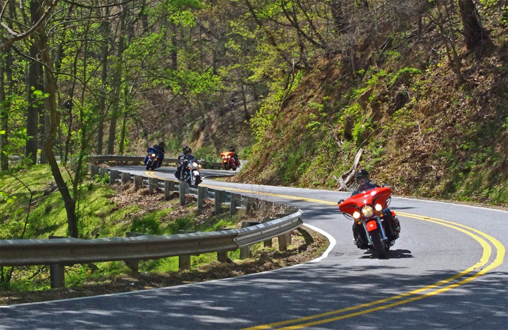
But add water to the mix and those leaves get heavy and stick to the road piling up between the two tire tracks cleared by passing autos. The water acts as a lubricant. Stray out of those tire tracks cleared by the cars, especially in a curve, and you’ll find your traction goes from hero to zero in an instant.

We all know the painted lines are slick when wet -

We all know the painted lines are slick when wet – it can be deadly when you add wet leaves on top of them. Watch out and hold your line in the curves!

Be especially alert and cautious when riding now after it rains. The problem goes away pretty quickly with sunshine, but don’t be fooled. Many areas of our mountain roads are perpetually shady and those leaves remain wet and slippery even on the brightest of days.

If you enjoy photos of motorcycle riding in the Blue Ridge and Smoky Mountains, like MY BLUE RIDGE MOTORCYCLING FACEBOOK PAGE.
____________________________________________________________________

wayne busch - Smoky Mountain Motorcycle Rider.com

Wayne Busch

– Wayne Busch lives in Waynesville, NC, where he produces the most detailed and comprehensive and up-to-date motorcycle pocket maps of the Blue Ridge and Smoky Mountains to help you get the most of your vacation experience. See them here – AmericaRidesMaps.com

____________________________________________________________________

Classic Motorcycle Roads Closed – a blessing?

Classic Motorcycle Roads Closed – a blessing?

Extreme rain causes flooding and washes out many favorite motorcycle rides – here’s an update and what it means for your motorcycle tour plans;

Note: we are hardly out of the woods – all this moisture in the soil could lead to more slides over time, and now with some hard freezes coming in, the freeze/thaw cycles could contribute to more problems as more rock is cracked, split, and loosened.

US 441 – Newfound Gap Road, Great Smoky Mountains National Park

Seems this road is always under construction, over the past year or two, to repair a slide near the top on the Tennessee side of the border. As the only road which crosses the park, right through the heart of it, it carries heavy traffic loads. Now, a large section has washed out about 9 miles north of Cherokee, and it will require a substantial and costly repair.

photo - slide closes park

photo source: Great Smoky Mountains National Park – Newfound Road US 441 hit by slide, park closes

Of all the damage from the recent weather, this is the most significant. While I do show this as a great motorcycle ride on my America Rides motorcycle pocket maps, it’s one of those “if you haven’t done it, you should ride it”, but it’s not one of my favorites due to the traffic, and I typically avoid it.

If you are planning to base a motorcycle vacation out of Gatlinburg / Pigeon Forge, you will now be forced to ride completely around the park to reach many of the best motorcycle rides. While there are some great motorcycle rides on the north side of Great Smoky Mountains National Park, you will also be dealing the the tourist traffic that  floods into this area. I suggest you look at options on the south side of the park instead. Map #8 details the best motorcycle rides free of traffic on the north side of GSMNP, but there are so many more on the south side you will get in more riding by basing your motorcycle trip on the quiet side of the park.

The Cherohala Skyway – NC 143/ TN 165

A significant slide on the North Carolina side of the border, about 1 mile from the state line has taken out one lane of the road and it has been closed. This is one of the nicest rides in the area, and the only road that crosses through this remote area of high mountains, a favorite scenic motorcycle ride often done as a loop ride with the infamous Dragon at Deals Gap.

Photo Source - Graham Star - Slide on Cherohala Skyway takes out 1 lane

Photo Source – Graham Star – Slide on Cherohala Skyway takes out 1 lane

This is a “wait and watch” situation right now to determine how stable the slope is over time. The good news is there is likely enough room for a temporary detour, though the work required to fix the problem will be extensive. I am hopeful, it will reopen before the riding season cranks up.

This road is featured on Map #7,  Map #8, and 12 Classic Deals Gap motorcycle rides.

US 19 – Near Burnsville

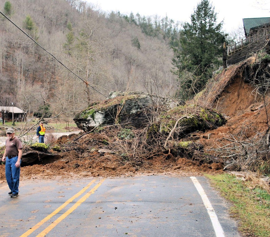
This is not a large slide in scope, but the issue is a “house sized boulder” which now sits blocking the road. Complicating the cleanup is a nearby house which is too close to permit blasting of the rock. Plan is to drill in to it and use expanding materials to break it up. I expect this problem will be cleared up relatively quickly.

yancey county slide

Photo source – Yancey County News – Large boulder blocking road

Detours use Jack’s Creek Road and Coxes Creek roads, this area is detailed on Map #5

Blue Ridge Parkway (near MP 455) Soco Gap area, near Maggie Valley

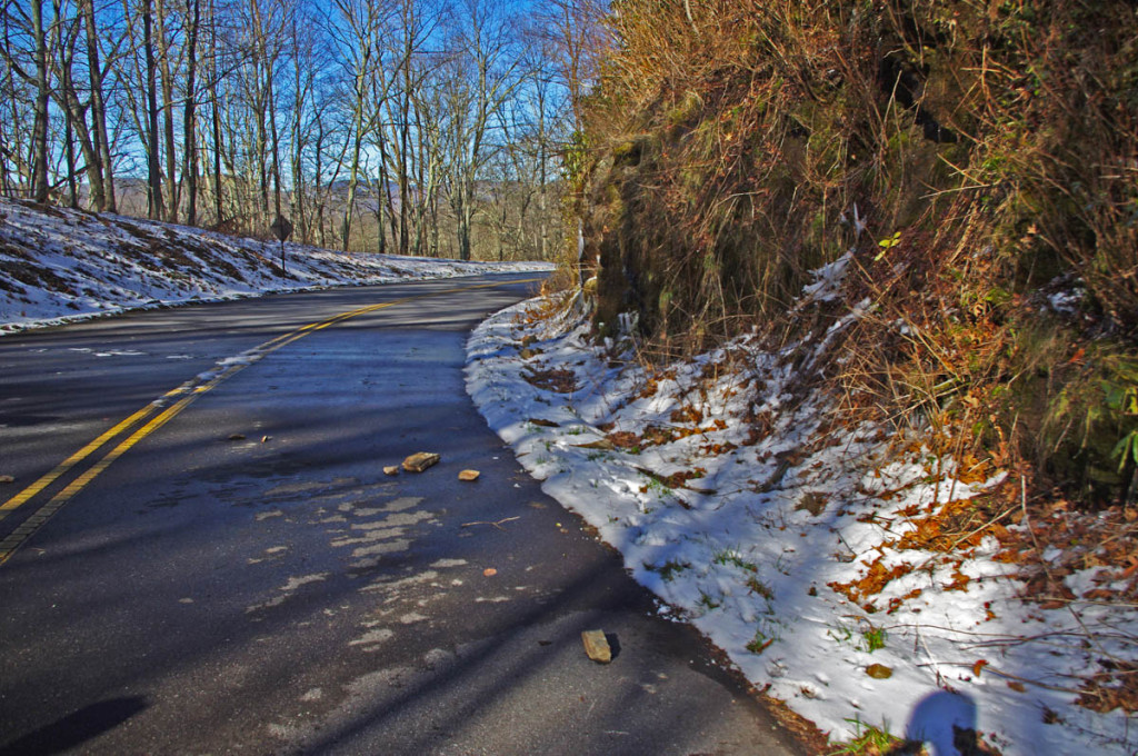
Reports of a small slide in this area seem to be over-hyped. I have hiked to it for inspection, and found a few rocks in the road which I could have cleared with one hand. No worries here.

photo - small slide on Blue Ridge PArkway

The rock slide reported near MP 455 is nothing to worry about. I could have taken care of it myself.

The most significant Blue Ridge Parkway closure in North Carolina is for slope stabilization near Mt. Mitchell. The road is closed here at least through April. You can download a free printable map of my suggested detours for motorcycles that give you other options here – http://smokymountainrider.com/Downloads/parkway-closure-2013.pdf

NC 63 – Leicester Road

I have not had personally investigated this slide, it is reported one lane has been affected. This is a popular motorcycle ride connecting to NC 209 (The Rattler), often used to make loop rides or access Asheville. The slide occurred in the best section of the road, the steep switchbacks that climb over the mountain. No further info on this one right now.

Great Motorcycle Rides in North Carolina - NC 209, a.k.a. "The Rattler" This is some of the best motorcycle riding you'll find in the world. These riders are looping back to NC 209 on NC 63.This is some of the best motorcycle riding you'll find in the world. These riders are looping back to NC 209 on NC 63.

Great Motorcycle Rides in North Carolina – These riders are looping back to NC 209 on NC 63.

Fortunately, there are many other options to make loop rides through this area, you’ll find them them extensively detailed on Map #6

So where are the blessings in all this bad news?

Most of the mess will be tended to by the time the real motorcycle riding season gets going. While 5 important roads are closed, some of them consistently on the “top 10 motorcycle rides” lists, it is only 5. I show nearly 200 other great motorcycle rides in this area, the blessing is you now have the opportunity to get away from the tourist traffic that flocks to these biker roads and discover some of little know and best scenic motorcycle rides detailed on my maps.

____________________________________________________________________

wayne busch - Smoky Mountain Motorcycle Rider.com

Wayne Busch

– Wayne Busch lives in Waynesville, NC, where he produces the most detailed and comprehensive and up-to-date motorcycle pocket maps of the Blue Ridge and Smoky Mountains to help you get the most of your vacation experience. See them here – AmericaRidesMaps.com

Total Rider Tech Logo

Learn Total Control

Wayne is an advanced motorcycle instructor for Total Rider Tech teaching Lee Parks Total Control Advanced Rider Courses. Isn’t it time you looked into advanced rider training to ride more confidently and safely? It can transform your mountain riding experience.  Total Rider Tech

____________________________________________________________________

Misleading Blue Ridge Parkway Sign should come down

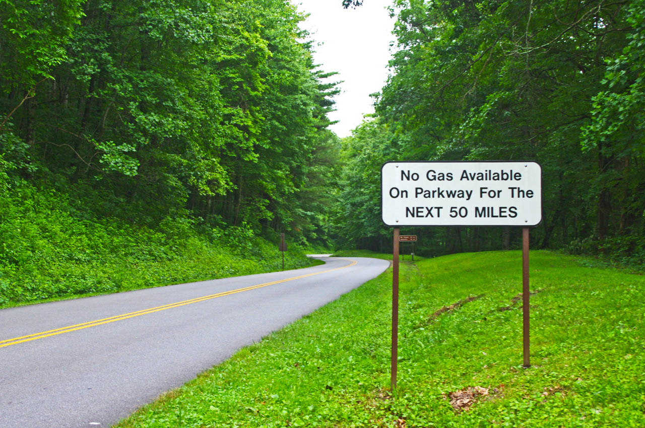
There was a time when the “No Gas for Next 50 Miles” sign at the US 74 exit on the Blue Ridge Parkway (MP 443.1) was an accurate warning, but it no longer serves the purpose.

photo-no-gas-sign-on-blue-ridge-parkway

This sign is a legacy to when gas was available on the Blue Ridge Parkway. It should now read "No gas next 400 miles". There is no gas on the Blue Ridge Parkway.

Years ago, there were gas stations on the Blue Ridge Parkway. This sign warns next gas was once available at the Pisgah Inn after a long lonely stretch with no convenient access to fuel. That’s no longer the case.

You’ll also see the remnants of a gas station at the Crabtree Meadows Visitor Center (MP 339.5).

Country-Store-at-Pisgah-Inn

The Country Store at the Pisgah Inn was once a gas station. Now it's just a break spot and service for the campground.

The Park Service removed the gas stations yeas ago. There is no longer gas available on the Blue Ridge Parkway nor are there any signs directing you to the location of the nearest gas at an exit.

The only place you’ll find a gas station visible from the Blue Ridge Parkway is at Raps’ Deli at Orchard Gap (MP 193.8) in southern Virginia.

With the limited range of motorcycles and long stretches of isolated road, knowing where the gas stations are is one of those things that takes a lot of the worry out of a Blue Ridge Parkway trip.

image-section-of-map

You'll find the closest gas to each Parkway exit listed on each of my Blue Ridge Parkway maps and descriptions of the best roads nearby.

It’s one of the most useful features I’ve included on my maps – closest gas to each exit along the 469 mile ride. Sometimes it’s just a few miles, other times it can be quite a distance. Knowing which way to go can keep you from getting stranded and help you make the best use of your time.

In keeping with the park service’s ethic of minimal signage, this legacy warning sign should be removed.

__________________________________________________________________

Wayne Busch

Wayne Busch - Cartographer

Total Rider Tech Logo

Learn Total Control

– Wayne Busch lives in Waynesville, NC, where he produces the most detailed and comprehensive and up-to-date motorcycle pocket maps of the Blue Ridge and Smoky Mountains to help you get the most of your vacation experience. See them here – AmericaRidesMaps.com

Wayne is an advanced motorcycle instructor for Total Rider Tech teaching Lee Parks Total Control Advanced Rider Courses. Isn’t it time you looked into advanced rider training to ride more confidently and safely? It can transform your mountain riding experience.  Total Rider Tech

____________________________________________________________________

Georgia’s Premier Motorcycle Ride & The Biker Barn

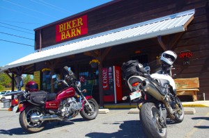
photo-The-Biker-Barn

The Biker Barn - The Gauntlet Headquarters

I’ve long had an affection for the motorcycle rides of north Georgia and now some of the best of them have been linked into a 133 mile long loop ride known as “The Gauntlet“. As it has gained notoriety, visitors from across the nation, even around the world have begun to flock to enjoy this serpentine romp through the hills and mountains of the Peach State.

Conceived and promoted by The Lodge at Copperhead and The Biker Barn near Blairsville, The Gauntlet strings together such notable rides as GA 60, GA 180, US 19 / 129, and others, routing you near or through Suches, Helen, Hiawasee, and Blairsville on roads which have long been favorite destinations for the two wheeled tourist.

Photo-The-Biker-Barn-road-view

The Biker Barn is easy to find with gas nearby

For those approaching the Blue ridge Mountains from the south on their way to such legendary rides as the Cherohala Skyway and the Dragon at Deals Gap in Tennessee and North Carolina, The Gauntlet adds another classic and outstanding adventure to their touring itinerary. For those who come to play in the Smoky Mountains from the north, the Gauntlet gives them ample reason to make the quick hop across the southern border into Georgia’s motorcycle playground.

Yesterday, I took a ride down meet Lori and Brad Betters at The Biker Barn near Blairsville, the headquarters for your Gauntlet memorabilia and and souvenirs and purveyors of motorcycle gear and supplies. Located at one of the junctions on The Gauntlet loop marked by a traffic light with a convenient gas station nearby, The Biker Barn is one of those must-do pit stops on the challenging ride.

Photo-The-Biker-Barn-inside

The Biker Barn has what you need and what you want

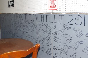
This popular rest stop at The Biker Barn is one of several gathering spots along the ride. There’s a “hang out” for bikers around the back side of the store where you can write your name on the wall with those who have come before you and leave your mark along with others from as far away as Alaska and beyond.

The well equipped store includes several versions of some very nice Gauntlet T-shirts, as well as leather wear, helmets, gear, and supplies. They also have an assortment of quality motorcycle trailers on hand if you’re looking for options to haul your bikes.

Photo-The-Biker-Barn-wall

Ride the Gauntlet and add your name to the wall at the Biker Barn

Of course they have maps and other info, and work in partnership with The Lodge at Copperhead which offers outstanding accommodations in the area.


The Biker Barn

The Lodge at Copperhead


Download a map of The Gauntlet here – http://www.gauntletga.com/downloads/Gauntlet_printable_map.pdf

_______________________________________________________________________________

Wayne Busch

Wayne Busch - Cartographer

Total Rider Tech Logo

Learn Total Control

– Wayne Busch lives in Waynesville, NC, where he produces the most detailed and comprehensive and up-to-date motorcycle pocket maps of the Blue Ridge and Smoky Mountains to help you get the most of your vacation experience. See them here – AmericaRidesMaps.com

Wayne is an advanced motorcycle instructor for Total Rider Tech teaching Lee Parks Total Control Advanced Rider Courses. It’s time you looked into advanced rider training to ride more confidently and safely, it will change your mountain riding experience. It worked so well for me I became an instructor! Total Rider Tech

_______________________________________________________________________________

You’ll find the roads of The Gauntlet and many more of north Georgia’s finest rides on America Rides Maps #9 – The Best Rides in the North Georgia Mountains


Central California vs. Smoky Mountain Motorcycle Rides

Photo-Santa-Barbara-view

Santa Barbara - coast & mountains

Earlier this year some magazine came out with a list of top 10 motorcycle rides. The Blue Ridge Parkway made the list. The Dragon at Deals Gap made the list. Others had me wondering what criteria they used to judge them.

I’ve been all across the US and I’m convinced the best motorcycle riding is in the Blue Ridge / Smoky Mountains, but I’m trying to keep an open mind. When the opportunity came to visit Santa Barbara on the California coast,  I made arrangements to insure I’d explore central California by motorcycle to see how west coast mountain riding compared to home sweet home.
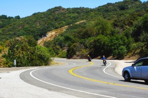
Photo-CA-150

Nice section of CA 150 near Ojai

I’ve previously been on sections of the Pacific Coast Highway. It’s fabulously scenic, but there’s not a whole lot about it that drives me to want to carve through it on a motorcycle to get the most out of the ride. I remember too much time plodding along behind duffers with lines of cars behind them, not rolling on the throttle to course through the curves and drop a knee towards the pavement. I did ride the Ventura Highway several times, and that Eagle’s song jumps into your mind as soon as you see the sign.

My explorations this trip would be through central California, leaving the congestion of the coastal roads behind for the more challenging mountain passes. Unfortunately, this required time-wasting commutes on the expressway to reach them.
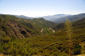
Photo-view-from-CA-33

You can see the Channel Islands from atop CA 33

The highlight of all that highway riding was experiencing lane sharing when traffic backed up, which it frequently did. Not for the meek, the skinny Ducati sport bike I was on was perfectly suited for darting between the lines of slower cars, flitting into every hole that opened, and filtering through the traffic.  Surprisingly, the cars and trucks made room for you to pass. I guess it beats having a speeding bike scrape along your car. It was fun and I felt like I was given a free pass to cheat at the game.  I think we need more lane sharing in the US.
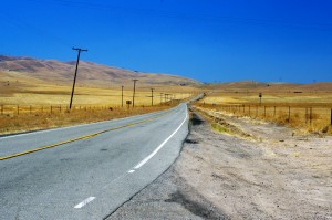
Photo-Ca-58

CA 58 a long, lonely ride to reach the twisties

I was a little disappointed to find the rides out to reach the mountain passes long and quite tame. While there was less traffic, it’s still far busier then you’ll find secondary roads in my Blue Ridge Mountains back home.

I first went south from Santa Barabara to Carpenteria, then headed inland to Ojai. Most of the towns are pretty cool, they look like great places to visit, but not what I’d come to do.

Leaving Ojai, my first run across the mountains on CA 33 had me feeling more at home. CA 33 is a good long run with curves that reminded me more of the Cherohala Skyway then the Dragon– a little more open and sweeping in comparison to the tight and technical curves I so enjoy back home.

The Ducati 848 made enjoying the canyon rides at a spirited pace easy. While the suspension was set up way to stiff for my liking, it always provided as much traction as I asked for, the bike ran the curves like it was on a rial. It was a challenge to keep from hitting triple digits when the road opened up, a challenge I failed many times.
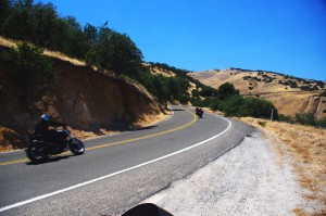
Photo-bikes-on-CA-58

A long twisty section makes CA 58 so great

Once over the mountains I came down into the oil fields and farmlands near Maricopa. I then headed north through the desert where temps were just shy of 100 degrees to pick up the next great ride near McKittrick, CA 58. Fortunately, I’d topped up the tank as the “No services next 70 miles” signs appeared. CA 58 was another outstanding ride through high open mountain passes, great curves, and  a whole of of fun. Lot’s of bikes on this ride, it’s a great one so long as you’re up in the mountains. Once you come down, things straighten out again. I was reminded of the midwest where you ride a road that runs like an arrow to the horizon for miles and miles until you come to a 20 mph right angle turn to do it all over again and again.
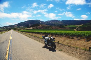
photo-wine-country

Cruising through wine country on Foxen Canyon and Santa Rosa Rds

I got bored on these long straight runs and after a while the speed crept up and up until I was playing a game to see if I could launch the bike off the hilltops as a the Ducati stretched it’s legs out and sang at the top of it’s booming baritone voice. I looped back through Santa Margarita then limped into San Luis Obispo with the reserve light crying out for a drink of fresh petrol. I wasted a bit of time looking for gas as every station was flagged off with yellow tape. They were all getting some kind of service done and I was running on fumes when I finally found one that had one bank of pumps in operation. I waited my turn in the long lines that had formed, then headed south on the freeway to return home.
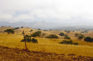
Photo-coastal-fog

The coastal fog travels well inland and persists till after noon - Foxen Canyon Rd

The next day I headed north this time, taking CA 154 through the dense morning fog that rolls in off the ocean. My destination was Foxen Canyon Rd, a decent ride, but not as challenging as those I’d previously been on. Most of this day was in wine country and it was more scenic then I’d seen on the east side of the mountains. I worked my way from Santa Maria to Lompoc, then found a nice ride on Santa Rosa Rd. Passing through Solvang, I returned to Santa Barbara on CA 154, then got on the freeway and went back south to Carpenteria to make a few more runs on CA 33.

So how do the California motorcycle rides I was on compare to the Blue Ridge & Smoky Mountain motorcycle rides I know so well?
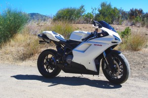
Photo-Ducati-848

The Ducati 848 - a precision guided missile - too much for all but the best riders

While the California rides were longer, so were the distances between them – they stood in isolation. Here in the Smokies, you finish one great road to continue your motorcycle ride on the next. You spend far more time in the nice sections and finding a long straight stretch of road means you made a wrong turn and left the mountains. I missed the green trees, the rushing mountain streams, the little waterfalls around the bends. The California countryside is dry, if not desert, close to it. Towns are much further apart, and you’ve got to pay attention to gas stations – when in doubt, top it out. You may have a long ride before you find another.
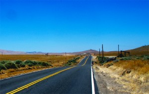
Photo-oil-derricks

Sometimes there are more oil derricks than trees

Many of the California roads were rough and bumpy – a patchwork of asphalt and concrete layer upon layer. I thought we had some rough rods, but I’m beginning to think we don’t have it so bad after all.

In the same amount of area I covered to reach just a few great motorcycle rides in California, there would have been a hundred or so in the Smokies and never  a 4 lane road or highway needed. I continue to believe there are more great motorcycle rides in the Blue Ridge and Smoky Mountains than any other area of the country.

To quote the now ex-governator, “I’ll be back”. Admittedly, I’ve barely touched the huge state of California. It’s a nice contrast to the motorcycle rides we have back home in the Smoky Mountains and makes me appreciate how great we’ve got it back east.

_______________________________________________________________________________

Wayne Busch
Wayne Busch – Cartographer
– Wayne Busch lives in Waynesville, NC, where he produces the most detailed and comprehensive and up-to-date motorcycle pocket maps of the Blue Ridge and Smoky Mountains to help you get the most of your vacation experience. See them here – AmericaRidesMaps.com