Motorcycle the Dragon, the Cherohala Skyway, the Blue Ridge Parkway in one day

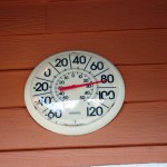
Photo - Thermometer at Deals Gap Motorcycle Resort

Thermometer at Deals Gap Motorcycle Resort

It was 80 degrees when I pulled up at the Deals Gap Motorcycle Resort yesterday at 5 PM with over 400 miles of Smoky Mountain motorcycle rides already behind me. 8 hours ago I was on the Cherohala Skyway as the soft morning glow and gusty winds made the lonely road seem like it was in another world.  I decided to make the day a trifecta and go home via the Blue Ridge Parkway. It’s hard to believe it’s still March, early spring has arrived!

Photo - morning on the Cherohala Skway

Morning on the Cherohala Skyway. I'm parked on the state line between North Carolina and Tennessee.

I had reservations about going out today, I’d been putting it off. I knew I would not find many good motorcycle rides in the areas I was searching. It was either too far out of the mountains or too far to into them. I was hitting the single lane back roads in the National Forests near The Dragon at Deals Gap and the Cherohala Skyway,  as well as the best ways to pass through the semi-urban areas to the north.

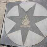
Photo - marble campfire

Who knows where this is?

I found something cool out in the Cherokee National Forest that will get it’s own motorcycle blog post shortly. One of the more useful things I discovered is one of the most direct ways to connect The Dragon at Deals Gap to I-75 south of Lenoir City.

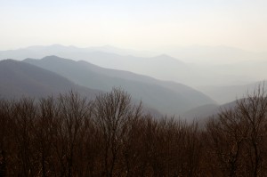
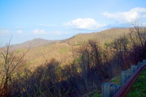
Photo - Cherohala Skyway View

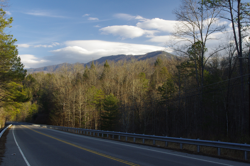
A long view of the Cherohala Skyway as it winds into Tennessee

I suspect many riders follow US 129 to Maryville, then take US 321 north when headed for the Interstate. There is  a way to minimize the traffic and avoid more than half of the four lane US 321.

Take TN 72 north from The Dragon at Punkin Center. When you reach US 411, cross it onto the East Coast Tellico Parkway and follow it along the lake area. It will become Axely Chapel Road at the north end and will intersect US 321. These are not outstanding motorcycle rides, but they are a heck of a lot better than the alternatives and get you off the four lane on some scenic and curvy motorcycle roads.

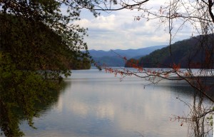
Photo - Calderwood Lake

Calderwood Lake is one of several along US 129

I don’t really care much for riding in this area, but it’s only because there are so many really great motorcycle rides once you get in close to Great Smoky Mountains National Park. It’s hard to shine when pitted against them.

I’ve been mostly focusing on find the connections between the better rides so you can link them together. If you have the time when passing through, they are the most enjoyable motorcycle rides I can find for those who would rather stay on the back roads and savor them. The views are certainly more entertaining. Watch out for turkeys in the road.

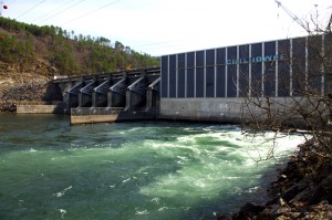
Photo - Chillowhee Dam

How many of you have seen the Chillowhee Dam from this side?

My “wake up and dream” cruise on the smooth and sweeping curves of the Cherohala Skyway was the highlight of the morning.  The rest of it was on a web of roads which weave through the more remote and rugged sections of the national forest. A few of them start out as decent paved roads, but quickly diminish to single lane unmarked trails that become more potholed and full of gravel as you go. On most, the pavement ends long before the road does.

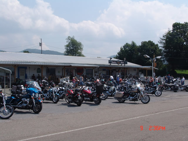
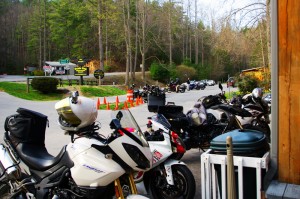
Photo - motorcycles at Delas Gap Motorcycle Resort

5 PM on a Tuesday evening in late March at the Deals Gap Motorcycle Resort

I’ll need at least one more good day to cover this area as thoroughly as I’d like. I’ve hit almost all the roads. The challenge now is how they work together to become the best motorcycle rides through the area, how well do the linked roads flow, can I find ways to make the good motorcycle rides last longer?

I know I can!

(Click on photos for larger views)
_______________________________________________________________________________

_______________________________________________________________________________

Wayne Busch
Wayne Busch – Cartographer
– Wayne Busch lives in Waynesville, NC, where he produces the most detailed and comprehensive and up-to-date motorcycle pocket maps of the Blue Ridge and Smoky Mountains to help you get the most of your vacation experience. See them here – AmericaRidesMaps.com 
My Search for the Best Mountain Motorcycle Rides Never Ends

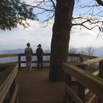
Photo - Maple Springs Observation Point

The Maple Springs Observation Point - accessed from Santeetlah Rd

Friday’s search for great Smoky Mountain motorcycle rides, which culminated with a spirited cruise on the Cherohala Skyway, was one of those days that might be looked on as not so productive. It’s not that I didn’t catalogue some good mountain motorcycle riding roads, I added several which will appear on my new map of the area. In my quest to leave no stone unturned, much of the 400 miles I covered was spent on roads which only the most adventurous would bother to travel. Still, there are sights and places some may wish to see, and I’m determined to find as many of them as I can.

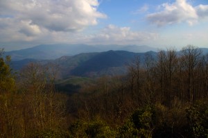
Photo - Cherokee National Forest View

View from the Maple Springs Observation Point. I was told you can see 5 states from this spot.

Considering the number of motorcycle riders who are drawn to the area by such notable roads as The Dragon at Deals Gap, the Cherohala Skyway, The Tennessee Foothills Parkway, NC 28 (now renamed “the Moonshiner 28“), finding others that compare in quality is pretty much futile. These are some of the best motorcycle rides in the world. I’m not holding my breath thinking I’m going to discover the next great classic motorcycle ride. So why go to all this effort?

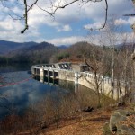
Photo - Santeetlah Dam

Quiet morning at the Santeetlah Dam

There are probably millions of motorcycles that pass through here each year. In most cases, they come, they ride the famous roads, get the t-shirt, then they’re gone to other places following the crowds. It’s the notable roads that get all the attention. Once experienced, it’s back on the four lane or the congested tourist arteries to reach the next great spot. You can rack up a lot of miles playing connect-the-dots, though those droning plods on the connections are the price you pay to reach those popular motorcycle rides.

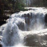
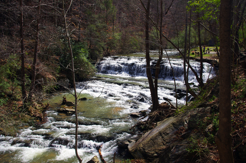
Photo - Bald River Falls

Bald River Falls

It doesn’t have to be that way. I’m filling in the gaps between the famous motorcycle rides with the best quality rides I can find so connecting the dots is as much of an adventure as the roads you’re trying to reach. Where others might show you one good way to get from point A to point B, I look for all the best ways.

Photo - Cherohala Skyway View

View from the Cherohala Skyway. The Smoky Mountains were especially smoky today and I'll get more photos another time.

Who want’s to spend their time on the 4 lane or in bumper to bumper tourist traffic when there are so many empty two lane scenic and challenging mountain roads that get bypassed? It’s often as simple as crossing over to the next valley to escape the congestion. One little turn can make the difference between cruising along with the wind in your face or cursing the throngs of dawdling codgers, gawking sightseers, lumbering RV’s, and belching commercial trucks struggling up the grades to deliver their wares.

Photo - Motorcycles on the Cherohala Skyway

Bikes on the Cherohala Skyway

I’ve catalogued more than 100 good motorcycle roads so far surrounding Great Smoky Mountains National Park. I’m not done yet. Some of these are outstanding rides. Others will satisfy those looking for adventure. All of them avoid most everyone else who’s come to enjoy the Smoky Mountains just like you and take you to the places they’ll never see while getting you where you want to be.

Keeping you going is what keeps me going. I’m closing in on finishing the map of the Best Motorcycle Rides North of Great Smoky Mountains National Park. Stay tuned and see what I discover. It’s all for you. (Click on the photos for the large versions)


http://www.youtube.com/watch?v=xBbQfR2GqMc

_______________________________________________________________________________

Wayne Busch
Wayne Busch – Cartographer
– Wayne Busch lives in Waynesville, NC, where he produces the most detailed and comprehensive and up-to-date motorcycle pocket maps of the Blue Ridge and Smoky Mountains to help you get the most of your vacation experience. See them here – AmericaRidesMaps.com 
 

Finding Great Motorcycle Rides North of Smoky Mountains National Park

Another long day on the road, another loop of Great Smoky Mountains National Park, in search of the best motorcycle rides north of the big forest. The wonderfully warm weather we’ve been enjoying has slipped back into the winter norms, though it was still nice to be out riding. The day ended with a long ride home in the rain with temps in the 40’s but it was well worth it.

Photo - roadside waterfall near Wears Valley

Waterfall along US 321 near Wears Valley, TN. While it's pretty to look at, US 321 is one of the last roads you want to be caught on if you're looking for enjoyable riding. Even mid-winter, the traffic takes all the fun out of the ride.

While I’ve pretty much scoured the mountains from north Georgia to north Virginia looking for the best motorcycle rides for America Rides Maps, this area north of Great Smoky Mountains National Park is one I’ve shunned until now. I know the tourist routes through it – and avoided it because of them. The traffic and congestion that is drawn to Gatlinburg, Sevierville, and the surrounding cities chokes the major roads so much it takes all the enjoyment out of riding a motorcycle. With Knoxville, Oak Ridge, and Maryville all growing and expanding, the winding mountain roads bare a heavy burden of local and commercial traffic. Add to that the millions of tourists drawn by the nations most visited National Park, the Smokies, and things can grind to a miserable crawl.

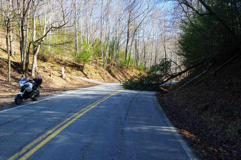
Photo - tree in roadway

High winds recently, including today, keep you on your toes on the back roads. If you're not skirting around trees, you're dodging rocks loosened by rains. Some of these roads still have a good deal of gravel and sand left from the last snow. You come to expect this of winter riding in the mountains.

It’s a tangled web of roads along the north side of the smokies, but I’m already happy with what I’ve found. Sorting through them has been full of surprises. As always, if you really look for them, great motorcycle rides are there to be found. I’ve already got some real gems, roads I ride over and over in my travels. I can duck in and out of Gatlinburg with little care for the traffic on some great hidden roads. I’ve already found ways to cruise right through all the chaos like it didn’t exist. Now I’m seeking the roads that link all these gems together, and I found a bunch more today.

At this rate, the new motorcycle ride map will be finished soon. I’ve found great rides near The Dragon at Deals Gap few know about. I’ve discovered some that play with the Foothills Scenic Parkway. A few go into Great Smoky Mountains National Park. The best ones though, are those that are just the roads less traveled. If you’re in a car, there are faster or more direct ways to reach your destination. On a motorcycle, destination doesn’t matter so much – it’s all about the ride, and these are some great rides!

_______________________________________________________________________________

Wayne Busch
Wayne Busch – Cartographer
– Wayne Busch lives in Waynesville, NC, where he produces the most detailed and comprehensive and up-to-date motorcycle pocket maps of the Blue Ridge and Smoky Mountains to help you get the most of your vacation experience. See them here – AmericaRidesMaps.com 
Making Gatlinburg Tolerable for Motorcycles (1 photo)

Gatlinburg. I cringe just thinking about the traffic, congestion, and development.  It’s one of the last places I consider when thinking of good motorcycle riding. Today, my outlook may be changing.

Photo-US-321-north-of-great-smoky-mountains-national-park

US 321 north of Great Smoky Mountains National Park. 90% of the east-west traffic between I-40 and Gatlinburg will be on this road.

I’m closing in on the GatlinburgPigeon ForgeSevierville area, mapping west from I-40 in search of the best motorcycle rides. I’ve already found my best route to reach the city limits avoiding the traffic on US 321 along the north edge of Great Smoky Mountains National Park. A few back roads linked together turn the chore of crossing the foothills downright enjoyable but now I’m getting into the towns.

Even so, I found a couple nice shortcuts today to skirt around the tourists, and there are number of promising roads waiting. The short winter days and roads strewn with road salt, grit, and lingering icy patches limit the miles I can cover efficiently before I turn tail and head home.

I shouldn’t complain about the traffic as it’s the dead of winter. Dollywood is closed. Much of Great Smoky Mountains National Park is closed. The memories of what happens once things warm up give me chills. I won’t quit until I find the best ways to go.

_______________________________________________________________________________

Wayne Busch
Wayne Busch – Cartographer
– Wayne Busch lives in Waynesville, NC, where he produces the most detailed and comprehensive and up-to-date motorcycle pocket maps of the Blue Ridge and Smoky Mountains to help you get the most of your vacation experience. See them here – AmericaRidesMaps.com 
Great Motorcycle Rides North of Asheville Discovered

It’s not often I have such a successful day when out exploring for new motorcycle rides to add to my maps but Friday was one of the best. Most of the roads I evaluate don’t measure up against my strict standards – low traffic, engaging scenery, and a challenging and fun motorcycle ride. Nearly every road I explored turned out to be good enough to add to my map of “The Best Motorcycle Rides North and South of Asheville, NC”.

Photo - river north of asheville

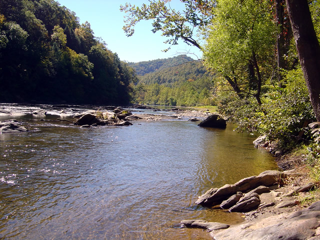
Most of todays rides were through the valleys near rivers. The twisty roads hug the banks.

The weather was ideal – atypically warm, sunny, and clear. The first hints of fall color were starting to emerge in places. Most of that is concentrated in the highest elevations right now, see the post to follow for some photos of the best color. The bulk of todays riding was searching out roads to link and connect to the already outstanding rides previously discovered.

Photo - river north of Asheville

I stopped here for a break along NC 197. It's a great ride as are the roads which connect to it.

I had been avoiding the area around US 19W due to the construction to widen the road to 4 lanes. Part of the mission was to discover the side roads which skirt around it. That construction will be going on for quite some time. I found a bunch of them.

Photo - The lake at roaring Creek, TN

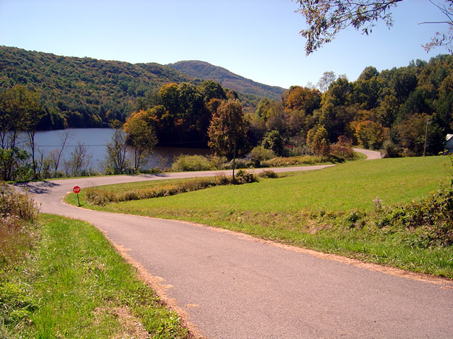
You can see a hint of fall color near this lake along Roaring Creek Road in Tennessee.

I also located a nice loop ride south of Johnson City, Tennessee, a good road to make loops near Roan Mountain, and quite surprising, still more great rides near Little Switzerland and the Diamondback. Much of the riding this trip was down low, through the valleys and along the rivers which are rides you can do pretty much all year round, places to go  after the Blue Ridge Parkway has closed for the winter season.

Photo - Stopped near Roan Mountain

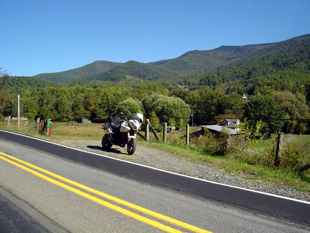
This road turned out to be a great way to make a loop ride when doing the popular ride over Roan Mountain. There is one very short but well maintained unpaved section.

I’ll be adding these new motorcycle rides to the map  The Best Motorcycle Rides North and South of Asheville, NC” this week. It’s almost done with the upgrade to the new and improved format slow but sure.

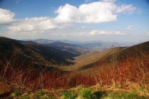
Photo - mountain view

The skies have been unusually clear lately and the long range views are outstanding.

I got some great photos of the start of the fall color in the higher elevations on the Blue Ridge Parkway. You’ll find some nice stuff starting near Boone and Banner Elk, in the area around Mt. Mitchell and the Black Mountains, not so much near Craggy Gardens, and then some north and south of Asheville. It’s still a little early, the peak will come next weekend, though it will continue through the lower elevations for a while. Next post will show you some color.

America Rides Mapshttp://americaridesmaps.com 

_______________________________________________________________________________

Wayne Busch

Wayne Busch - Cartographer


– Wayne Busch lives in Waynesville, NC, where he produces the most detailed and comprehensive and up-to-date motorcycle pocket maps of the Blue Ridge and Smoky Mountains to help you get the most of your vacation experience. See them here – AmericaRidesMaps.com
 

Alcohol Vote Great News For The Lodge at Copperhead Motorcycle Resort

Photo - Vote Yes Sign worked

They Voted YES! Alcohol sales are now legal in Union County, Georgia

Emerging from the transition to new ownership, Tuesdays vote to allow alcohol sales in Union County, Georgia, may be just the shot in the arm needed to get The Lodge at Copperhead Motorcycle Resort back up to speed. Located a few miles west of Blairsville just off US 515 / 76, The Lodge at Copperhead couldn’t be better located to serve as a base camp for those looking to ride the best motorcycle roads in north Georgia and I know of no other motorcycle resort in the region which offers the level of service and quality of accommodations found here – it’s simply outstanding.

Easy to reach for motorcycle riders in Atlanta, Charlotte, Columbia, and Chattanooga, and an already popular destination with the throngs of motorcycle touring enthusiasts in Florida, The Lodge at Copperhead sits in the heart of the best motorcycle riding in the Peach State and is within a convenient distance to the Dragon at Deals Gap and the wealth of great motorcycle rides across the border in Tennessee, North and South Carolina.

Photo - The Lodge at Copperhead

The Lodge at Copperhead Motorcycle Resort is under new ownership and ready for your visit.

Both lodge rooms and cabins are available. Specifically designed to serve the needs and desires of those on a motorcycle vacation, The Lodge at Copperhead offers the traveler a comfortable and luxurious setting to relax in after a day of enjoying the fantastic roads through the surrounding hills and mountains.

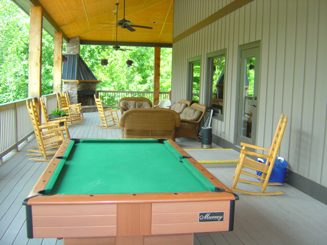
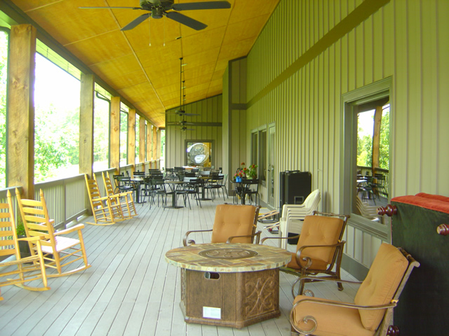
Look at those porches with the comfortable chairs, the pool table, and the outdoor fireplace, and imagine you and your friends enjoying a relaxing beverage from the bar as you talk of the days adventures and plan for more tomorrow. Take a dip in the pool during the summer heat, or cozy up to the fireplace inside the lodge on the cooler evenings in the big comfortable furnishings. Enjoy a great meal at the restaurant in the evening or stock up at breakfast for a full day of riding fun.

Photo - inside the Lodge at Copperhead

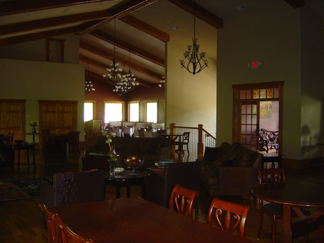
Comfortable, luxurious, and welcoming, relax in the lodge. Dining Room in the background.

Peaceful, relaxing, away from the crowds, traffic, and congestion found elsewhere, The Lodge at Copperhead is located almost square in the center of America Rides MapsThe Best Rides in the North Georgia Mountains“, the most complete map of more than 25 of the best mountain motorcycle rides in the state. Choose any direction and within minutes you’re cruising along the sweeping curves or carving your way through the winding back roads.

Photo - view of the porch at the Lodge at Copperhead

This is the mountains, so count on spending a lot of time enjoying the fresh air and good conversation on the porches. Note the fireplace in the corner.

Photo - porch at the Lodge at Copperhead

Plenty of room on the porches to find just the right spot.

Photo - the bar at the Lodge at Copperhead

The well equipped bar offers yet another cozy refuge.

The Lodge at Copperhead Motorcycle Resort is destined to become the premier motorcycle resort at the gateway to the Smoky Mountains and the thousands and thousands of miles of great two lane mountain roads which begin in the northern corner of Georgia.

Photo - view of the cabins at the Copperhead Motorycle Resort

If you're looking for more privacy ask about a cabin - close enough to walk to the facilities but distant enough to be apart from the activity.

Photo - the pool and stage at the Lodge at Copperhead

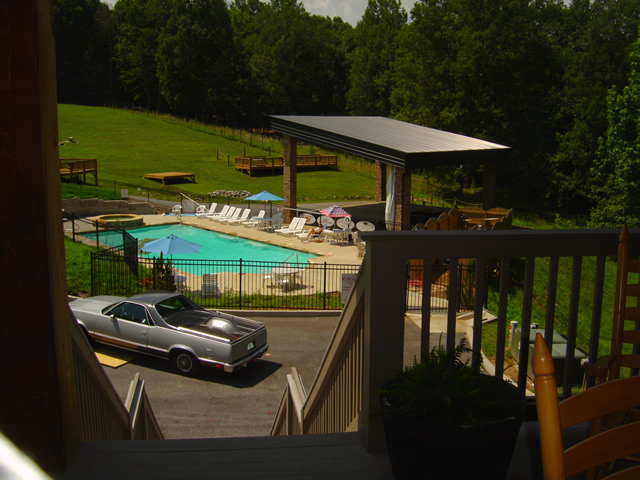
Enjoy the pool during the day and entertainment on some evenings. Notice the stage, the decks, and the grassy hill to view and enjoy the shows.

The Lodge at Copperheadhttp://TheLodgeAtCopperhead.com

_______________________________________________________________________________

Wayne Busch

Wayne Busch - Cartographer


– Wayne Busch lives in Waynesville, NC, where he produces the most detailed and comprehensive and up-to-date motorcycle pocket maps of the Blue Ridge and Smoky Mountains to help you get the most of your vacation experience. See them here – AmericaRidesMaps.com
 

Motorcycle Friendly – The Shady Valley Country Store at The Snake

There’s a reason my wife rarely tags along with me while I’m out working from my motorcycle – I only stop for two things, one is fuel. The other can be remedied at any clump of shrubbery. Rarely do I ever stop to eat, drink, or grab photos. It’s all about covering the miles. Those creature comforts can wait until I retire for the evening when darkness makes any further progress futile. I think that’s about to change and one of the first places I’m going to visit is the Shady Valley Country Store the home of “The Snake”.

Photo - Shady Valley Country store

Shady Valley Country Store serves thousands of motorcycles weekly who come to ride "The Snake" and surrounding roads.

Located at the junction of NC 133, NC 91 and US 421 (a.k.a. “The Snake”), the Shady Valley Country Store is at the hub of some of the best motorcycle rides found in the Smoky Mountains where North Carolina, Virginia and Tennessee meet. Serving thousands of motorcycles every week, it provides a convenient fuel stop with regular as well as premium “Snake Venom” for your thirsty motorcycle. I’m told the 1/2 lb. black angus burgers, the thick bologna sandwiches and great chili dogs will keep you going full speed as well.

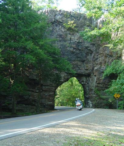
Backbone Rock on TN/NC 133

Backbone Rock on TN/NC 133 not far from the Shady Valley Country Store

I’ve blasted past the Shady Valley Country Store enough times. Next time I’m up there I’m stopping in to check it out, maybe get me a T-shirt or some other Snake memorabilia. Expect to get a first hand report ASAP.

The Shady Valley Country Store

Scenic Motorcycle Rides – Backbone Rock, TN

photo - motorcycle cruises through Backbone RockI went back to Virginia this weekend to revisit and explore some of the sights I’d passed while mapping the area

I’m pretty much all business when mapping – I only stop for three things; gas, to take notes, and when “nature” forces me to do so. Eating is a luxury typically left for the evening to make the most of the time on the road. This trip was to go back and savor some of the gems I’d just blown by previously.

One of my favorite loop rides is found near the point where North Carolina, Virginia, and Tennessee meet, a 103 mile jaunt that takes you on some of the twistiest and most scenic roads. It’s listed on America Rides Map #4 – “Great Roads Near Boone, Banner Elk, and Blowing Rock.

Heading south from Damascus, Virginia, on SR 133, you soon enter the National Forest in Tennessee and signs for Backbone Rock Park start appearing along the road. Round a curve and you find yourself zipping through the quick yet dramatic tunnel through Backbone Rock.

I stopped in to investigate.

The Empire Mining Company blasted through Backbone Rock in 1901 to lay train tracks for the Tennessee Lumber Company. Long gone, the rail bed became the roadbed which continues on towards Mountain City.

The ridge is about 75 feet high and 20 feet thick, though it narrows near the top. There is a steep trail from the parking area on the right just after you pass through the rock, though if you have any aversion to heights and walking near the edge of a cliff, you’ll never make it to the section of rock which straddles the road.

There are several hiking trails, picnic tables and campsites, a waterfall is about 0.4 miles on a foot trail. The area is popular for fishing and kayaking.

_______________________________________________________________________________

Wayne Busch

Wayne Busch - Cartographer

Total Rider Tech Logo

Learn Total Control

– Wayne Busch lives in Waynesville, NC, where he produces the most detailed and comprehensive and up-to-date motorcycle pocket maps of the Blue Ridge and Smoky Mountains to help you get the most of your vacation experience. See them here – AmericaRidesMaps.com
Wayne is an advanced motorcycle instructor for Total Rider Tech teaching Lee Parks Total Control Advanced Rider Courses. It’s time you looked into advanced rider training to ride more confidently and safely, it will change your mountain riding experience. It worked so well for me I became an instructor! Total Rider Tech

America Rides Map #4 – “Great Roads Near Boone, Banner Elk, and Blowing Rock

_______________________________________________________________________________

The Most Dangerous Road for Motorcycles?

Charlies Creek Road

Charlies Creek Road - even the sign is crooked


“That’s the most dangerous road we ride” my wife commented after a recent morning outing.

It’s my favorite road!”, I responded.

“I know, but it’s still dangerous” she reiterated.

We talked a bit more about it and the things she finds most dangerous are the things I enjoy as an added challenge.

“I still like it, it’s just a dangerous road” says Jackie.

Jackie’s no lightweight. We rode dual-purpose bikes all over the country years ago, she can throw a motorcycle around. Now, astride her Beemer, she often gives the boys a run for their money on the twisty roads. She can handle herself and I enjoy watching her flow through the curves. And no, we’re not talking about the infamous “Tail of the Dragon“. That’s just another ride for us compared to this.

riding Charlies Creek Road

Be ready to get some lean on when riding Charlies Creek Road

Photo – Wayne prepares to get some lean on in a curve on Charlie’s Creek Road

What makes Charlies Creek Road a challenge is it’s unpredictability. You just never know what it’s going to throw at you next, and it throws everything in the book along it’s 10.1 mile length making it seem a whole lot longer. Mixed pavement, potholes, bumpy repairs, loose gravel, climbs, descents, first gear hairpins interspersed with sections of relatively straight road that lure you to roll on the throttle then snare unsuspecting riders with turns which shut down on them the deeper in you get. Cresting a rise you never know what lies on the other side, which way it will dive. Is there a patch of loose gravel in the next corner, a flock of turkeys in the road, will the tires maintain their grip on that concrete bridge littered with sand and rocks, what’s with this freakin turn, it’s getting tighter? How many seasons before some bear hunter discovers my rusted bike and bleached bones if I lose it out here in the middle of nowhere?

It’s a handful it you approach it cautiously. Come at it with vigor, and it will test everything you’ve got. My kind of road. Beware of Charlies Creek Road, it’s the most dangerous road we ride. It’s also my favorite and I do it as often as I can. Just don’t try to keep up with me. I know it pretty darn well. Respect it or it will eat you.

Note – Charlies Creek Road runs between NC 215 and NC 281. It’s found on America Rides Maps “#6 – The Best Motorcycle Roads EAST of Great Smoky Mountains National Park”.

>> Go To America Rides Maps.comhttp://americaridesmaps.com

_______________________________________________________________________________

Wayne Busch

Wayne Busch - Cartographer

– Wayne Busch lives in Waynesville, NC, where he produces the most detailed and comprehensive and up-to-date motorcycle pocket maps of the Blue Ridge and Smoky Mountains to help you get the most of your vacation experience. See them here – AmericaRidesMaps.com
 
See “Map #6 – The Best Motorcycle Roads EAST of Great Smoky Mountains National Park”