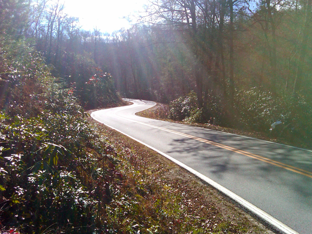
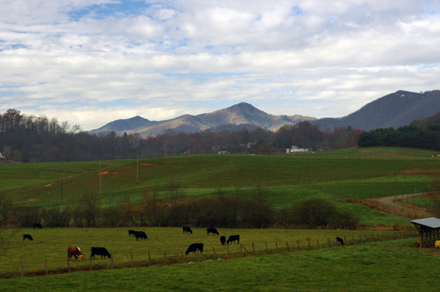
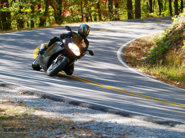
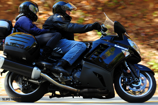
Photos from Todays Motorcycle Ride in the NC Mountains 12-9-10

It was noon before the temperature finally crested freezing, though I’m not sure it ever reached the predicted high of 35.  The sky was blue, the sun was shining, and the roads were dry. I couldn’t stand it any longer and had to get out on the bike.
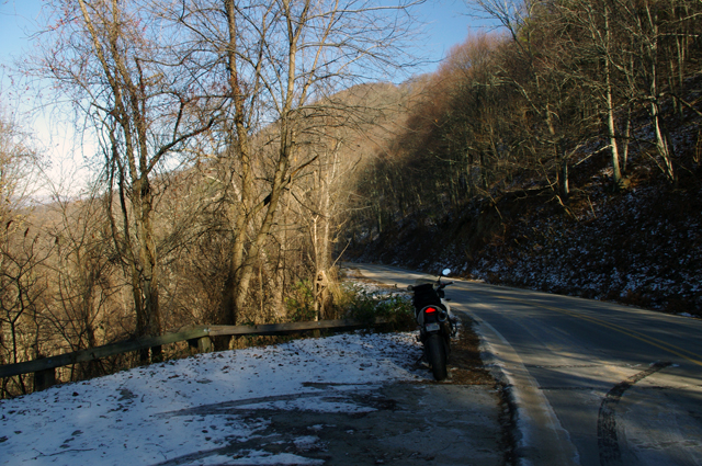
Photo - motorcycle and snow in NC

Shady spots on the north side of the mountains still held snow, but mostly it was gone. Roads were in pretty good shape. This is at Hookers Gap. Saw a Post-lady but no hookers. Probably too cold.

I ended up covering about 200 miles today, most of it riding back and forth on the roads which run between Liecester and Marshall, North Carolina. The majority of the key roads have already been discovered for this motorcycle ride map I’m working on. What I’m seeking now are  the best ways to link them together and show you how to make connected rides that keep you cruising along without hitting traffic or four lanes or the interstate.
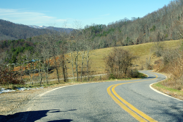
Photo - Potato Branch Rd near Liecester, NC

I think this is a section of Potato Branch Rd. It's one of my new favorites. You can link-ride it all the way back to the Blue Ridge Parkway or out to Hot Springs and beyond.

This area is only minutes from downtown Asheville. It doesn’t take long to “get lost” in the mountains surrounding the city. Outside of paving, these old roads have changed little in more than 200 years. They twist and wind through older neighborhoods, farmlands, homesteads and old barns, following the path of least resistance over mountain passes and along rushing streams and rivers.
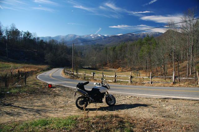
Photo - A winter scene near Liecester, NC

Winter riding may not be as frequent as during the warmer months, but it has it's rewards. I enjoy it as much as the rest of the year. This might be Early Mountain Road.

I also took a ride over by Cherokee to investigate a road which I thought I’d overlooked. As is too often the case, there was a good reason to ignore it – it was another one of those half-paved roads that lead up into mountain coves. They start out nice enough but once the grade gets steep the pavement ends. Rarely does one go through and you can waste a lot of time riding up dead end roads. I’m out discovering those roads which DO go through and are worth the ride. It was a very successful day.

_______________________________________________________________________________

Wayne Busch
Wayne Busch – Cartographer
– Wayne Busch lives in Waynesville, NC, where he produces the most detailed and comprehensive and up-to-date motorcycle pocket maps of the Blue Ridge and Smoky Mountains to help you get the most of your vacation experience. See them here – AmericaRidesMaps.com 

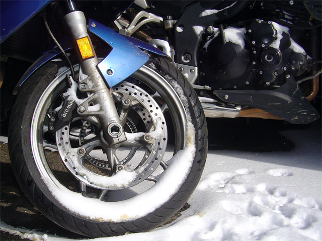
Another Cold Winter Day – Photo – Snow on motorcycles

Photo - Snow on motorcycles

Still too cold to ride. It will be better near the end of the week.

Blue Ridge Mountain skies are blue, but it’s barely in the 20’s. I’m going to wait for the weather to get above freezing before I go back out so it has a chance to melt any ice. The roads are salted, but up in the high parts there  can be spots where it’s too wet and shady to work well.

I’m making good progress on this new map revision, it’s almost done. I’ll still need a few more days to finish re-riding all the roads and catalog the new ones. In the mean time I’m getting it as close to done as possible.

Stay warm!

_______________________________________________________________________________

Wayne Busch
Wayne Busch – Cartographer
– Wayne Busch lives in Waynesville, NC, where he produces the most detailed and comprehensive and up-to-date motorcycle pocket maps of the Blue Ridge and Smoky Mountains to help you get the most of your vacation experience. See them here – AmericaRidesMaps.com 
Blue Ridge Parkway Snow Photos – 12-5-10 Soco Gap, NC

Riding was out of the question today – too icy. Instead, we took a hike on the Blue Ridge Parkway to enjoy the recent snow fall.

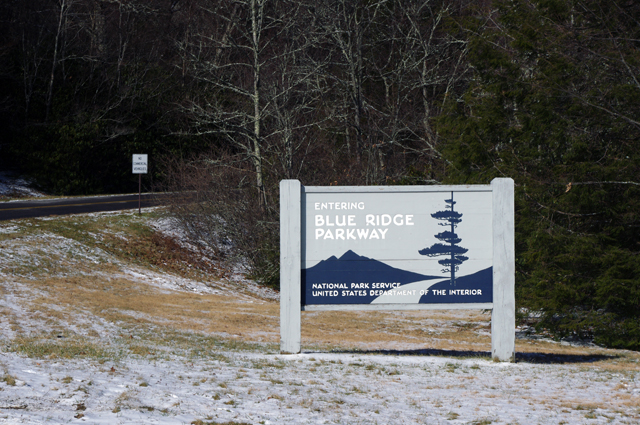
Photo - Parkway entrance at Soco Gap

The Blue Ridge Parkway access at Soco Gap on US 19 just west of Maggie Valley, NC

Soco Gap is the last (paved) Blue Ridge Parkway exit before you reach the south end of the parkway at Great Smoky Mountains National Park just north of Cherokee (13.3 miles).

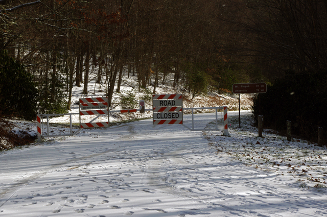
Photo - Parkway gates

Don't think the parkway goes unused when it's closed to traffic for the winter. Look at all those footprints. For the next few months it's a playground for hiking, biking, and skiing.

So far, it’s not much of a snow. There was a bit over an inch accumulated with a layer of ice underneath. If we get a couple more inches tonight, there’s a chance the Blue Ridge Parkway may be decent for cross country skiing tomorrow.  It’s just as likely to melt away.

Photo - snow on the Blue Ridge Parkway

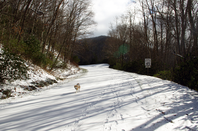
That's not a fox, it's one of my dogs - Sophie. I was surprised to see so much snow had stuck at just 4500 feet elevation.

It doesn’t feel cold enough for a significant amount of snow to accumulate. 1000 feet lower in elevation most of it is already gone. I wonder what it’s like up high? If we get more snow tonight, maybe I’ll go up higher tomorrow.

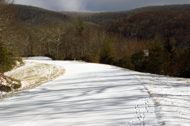
Photo - Snow on Blue Ridge Parkway

This section of the Blue Ridge Parkway makes a steady climb to reach the Waterrock Knob overlook in about 6 miles. That's a bit more than we wanted to walk today. The first overlook hasn't been cleared and there's no view.

We were fortunate to be out of the wind on this side of the mountain. We dressed expecting it, so we were quite comfortable when the extra protection wasn’t needed.

Photo - Blue Ridge Parkway Snow

The snow is like a ghost - you can see the yellow lines on the road. Rumor has it drunken ghosts wander the parkway at times - just look at those footprints!

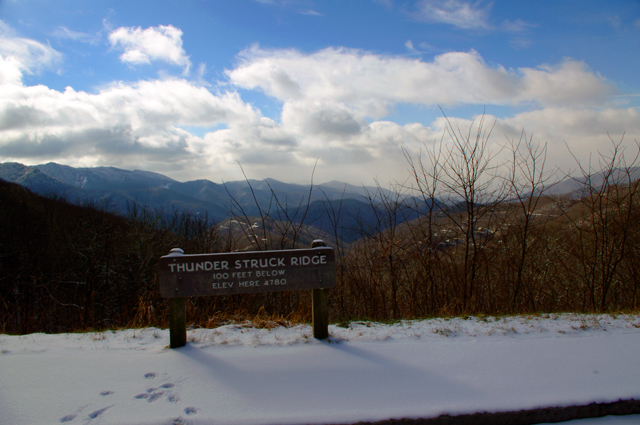
We walked as far as the Thunder Struck Ridge overlook at Milepost 455, about 1 mile.

Photo - Blue Ridge Parkway Snow

Thunder Struck Ridge is a great place for sunset photos.

It’s a faster walk going back – all down hill. The dogs love the Blue Ridge Parkway in the winter and so do Jackie and I.

Photo - dog with snow beard

That's my other dog Ajax wearing a snow beard. The parkway is their playground in the winter too.

_______________________________________________________________________________

Wayne Busch
Wayne Busch – Cartographer
– Wayne Busch lives in Waynesville, NC, where he produces the most detailed and comprehensive and up-to-date motorcycle pocket maps of the Blue Ridge and Smoky Mountains to help you get the most of your vacation experience. See them here – AmericaRidesMaps.com 
A Winter Day Searching for Great Smoky Mountain Motorcycle Rides

The Smoky Mountains of the Blue Ridge aren’t waiting for the official arrival of the solstice – winter time is pretty much here and now. Last week was messy, wrapping up with a deluge of rain.  When the weather broke a little yesterday, I finally got out to do some motorcycle riding. I waited for the sun to get high enough to minimize any icy patches on the road, then set out on a cold and mostly overcast day. It’s good that I did. It looks like we’re in for a cold wet stretch of dismal gray skies and the constant threat of rain or snow over the next few days. It’s hardly the kind of winter weather that inspires one to go dashing over the river and through the woods on your motorcycle no matter how much Grandma wants to see you. When the skies clear, you shouldn’t chance missing the opportunity to get out and ride. The good riding days will be more and more rare.

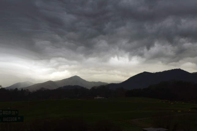
Photo - morning clouds bring us snow

After yesterdays break in the weather, clouds are moving back in this morning. Rain will turn to snow tonight, but not a significant amount. Blustery for the next few days.

I spent the afternoon prospecting for great motorcycle rides near Hendersonville, Mountain Home, Pisgah Forest, and Mills River. I’d not paid this area much attention before as it was not a piece of real estate previously included in one of my motorcycle maps.  There’s relatively high traffic and congestion around here and I tend to avoid going through, but I’m already thinking about the Asheville Bikefest in the spring and I want to become more knowledgable of this nearby area. It turns out there are a number of nice roads passing through it and I managed to locate and explore several good new ones I can now recommend as more enjoyable alternatives to the main roads.

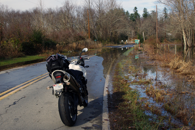
Photo - flooded road near Mills River

This area got hammered by recent heavy rains and I forded a few flooded roads this afternoon. While some were several feet deep yesterday and some cars got stranded, the water was only inches deep today.

Located south and slightly west of Asheville, the mountains in this area are not as high as those to the north in the Pisgah Forest. There are a number of rivers which flow through here, some farmland, a few high end neighborhoods, and some rugged and forested areas like the Dupont Forest with it’s many waterfalls. I -26 runs north-south just a few miles east and the border with South Carolina in only minutes away. It’s a pretty area, but the mountains of the Pisgah Forest and the Blue Ridge Parkway to the north overshadow it.

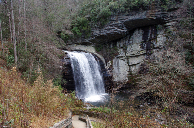
Photo - Looking Glass Falls

I commuted via US 276 from Waynesville to Brevard to reach the area. No ride on US 276 is complete without a stop at Looking Glass Falls.

The areas I have left to scout for this map revision (in progress) are scattered across 4 states. I’ve still got to press a little further into South Carolina then sweep west into the corner of Georgia to look at one potentially good road. The bulk of the remaining riding is in Tennessee, just north of Great Smoky Mountains National Park. I’ll need two really good days to thoroughly re-explore that area.

If the weather doesn’t break soon, I’ll start working on the next map, the companion to this one. I’ve got plenty to occupy my time. Still, I’d rather be out riding.

_______________________________________________________________________________

Wayne Busch
Wayne Busch – Cartographer
– Wayne Busch lives in Waynesville, NC, where he produces the most detailed and comprehensive and up-to-date motorcycle pocket maps of the Blue Ridge and Smoky Mountains to help you get the most of your vacation experience. See them here – AmericaRidesMaps.com 
My Quick Visit to Paris – A City Full of Motorcycles

Obligatory Eiffel Tower Photo

Obligatory Eiffel Tower Photo

I was gone all last week. To celebrate one of my wife’s milestone birthdays I gave her the gift of a trip to Paris. Her birthday was in August. As she’d recently started new employment, we delayed leaving until she had some time at the job accumulated.

We flew into London, then took the high speed rail Eurostar train beneath the English channel crossing the rolling farmlands of France into the heart of the city of lights.

* This blog is supposed to have at least some relationship to motorcycling, – don’t worry I’m getting there.

We spent 3 days in the heart of the city. We had no set plan or itinerary. Each day we woke up, enjoyed a wonderful european breakfast spread, and walked out the door of our hotel. Afterwards the day just happened.

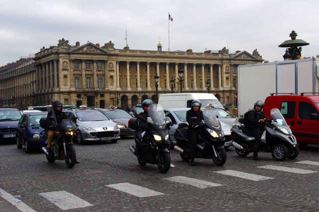
So what has Paris got to do with motorcycling? Apparently a lot! The city is awash in all sorts of 2 wheeled travel.

Photo - motorcycles in Paris

Paris is abuzz with motorcycle traffic. It may be one of the best ways to get around.

Photo - Arc de Triomphe

Arc de Triomphe

When you ride a motorcycle, you’re more aware of them. You have a deeper appreciation and your eye is drawn to anything with two wheels. Walking the streets of Paris you can’t help but be impressed with how many motorcycles tangle with the chaotic flow of city traffic.

At first take it appears the vulnerability of being on a motorcycle would make riding in this turmoil more risk than it’s worth. Streets are narrow, lined with cars, I don’t think they even bother with posting speed limit signs – it would be futile in any case.

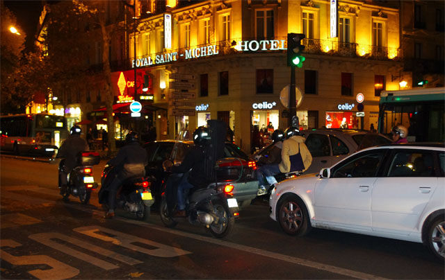
Photos - motorcycles at night in Paris

Night, day, it doesn't make much difference. When a light turns red, the motorcycles filter to the front.

Photo-Wayne-in-Paris

French food deserves its reputation.

The more I watched, the more I became convinced a motorcycle was the ideal means to take advantage of the opportunities the traffic held. Rapid acceleration, quick handling, and the capability to squeeze through most any gap make tackling the Paris traffic on a motorcycle look like a video game. It think it might be fun in some strange way.

Mopeds, Vespas, and scooters, you might expect.  They do make up a decent fraction of the two-wheeled traffic, but are not the bulk of it. There are bikes of all makes and sizes. I was surprised so many dual-sport bikes were present. A good number of big bikes, particularly BMWs, were fairly common. Most of the sport bikes I saw were moving. I even saw several Harley-Davidsons.

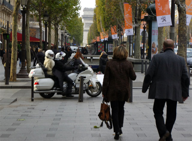
Photo - Motorcycle Champs Elysees

The Setting - the Champs Elyees. Arc de Triomphe in background. Motorcycle passenger on white Goldwing. White helmet. White fur coat. Motorcycling is not done exclusively for economic reasons.

Image-Mona-Lisa

Mona Lisa at Louvre

What a contrast to what I’m familiar with. It’s a whole different environment. Urban vs. rural. It’s almost a combat environment when it comes to driving.  Still, it wasn’t long before I was wishing I had access to a bike. Heck, I’ll give it a try. I’m confident I’ll survive.

It turns out Paris is a pretty easy place to be when you’re off the motorcycle. We walked a lot. We also took the Metro. We managed to do the whirlwind tour hitting many of the tourist spots without even trying. As expected, you can get by without knowing much french. Another day to explore more would have been nice. I think saying that is a sign of a successful vacation.

photo - motorcycle parked along a Paris Street

An assortment of motorcycles crowds any small open street corner. Parking is a treasured commodity.

Photo - Eiffel Tower

The Eiffel Tower viewed from atop the Arc D Triomphe

One day I’m going to make that motorcycle trip across Europe searching for the best rides. I’m convinced the Appalachian Mountains of the US have more to offer the motorcycle adventure tourer than all the Alps of Europe. This trip gives me more confidence about passing through the city of Paris on that future journey, though I’m not sure it will be needed. I may stay further south. It’s good to know I will enjoy revisiting Paris if needed. I may just make a detour.

The short vacation was a nice break from America Rides Maps. With Christmas coming orders pick up, then really start to grow once the new year comes. I’m playing the weather day by day, choosing the best days to get out. I need three good days out on the road to finish up the Hot Springs map revision. With luck, I’ll have the companion map done by the start of the new year.

The break did us both good. Now it’s back to work.

_______________________________________________________________________________

Wayne Busch
Wayne Busch – Cartographer
– Wayne Busch lives in Waynesville, NC, where he produces the most detailed and comprehensive and up-to-date motorcycle pocket maps of the Blue Ridge and Smoky Mountains to help you get the most of your vacation experience. See them here – AmericaRidesMaps.com 
Photos From Another Great Smoky Mountain Motorcycle Riding Day

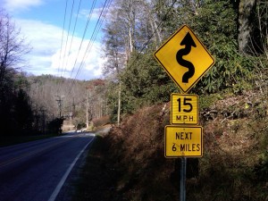
Photo - 15 mph road sign

15 MPH NEXT 6 MILES - You've probably discovered a good ride when you see signs like this.

So I’m wrapping up this new motorcycle ride map which covers best motorcycle rides in the eastern half of Great Smoky Mountains National Park and I’m finally to the “get out and ride” stage. Most of the really tedious work is done, the stuff that keeps me in front of the computer. Today I took the afternoon to go out and ride some of the closer roads and it was superb.

When I do a map revision, I typically re-ride almost all the roads from the existing map to re-familiarize myself with them.  I think it’s the best way to judge newly discovered roads against the others I already know by making a fresh comparison. As some of my maps now have more than 50 featured roads I’ve got a lot of miles to cover. Sometimes a road I once considered top-notch pales a bit when new and better ones are discovered. When I do find a new road, I then seek out the best routes to connect them all together. All-in-all it adds up to a lot of mileage.

With a good frost this morning and temperatures that never creeped out of the 40’s, I saw only a few other motorcycles out on the road.  It was warm enough to leave the heated gear on the coat rack. Mid-week traffic was light and it was a great day to be out on the bike. Recent rains had helped clear the roads of the de-icing coating and gravel that had been laid down during the last cold snap.

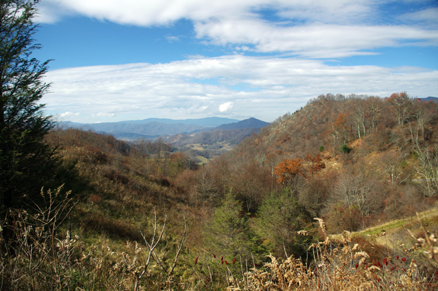
Photo - Mountain view from one of the roads

I snapped this photo atop the climb one of the great new roads made over a mountain. Views are sometimes better once the leaves are off the trees.

As is usual only a few of the new roads were really good rides though the two I found were so outstanding either would have made for a successful day. I routed my commute between them to include NC 215 so I could shoot some more video along the way for the upcoming production. Damn, that road is fun now that the south end has been repaved. The fresh asphalt has been exposed long enough that the oily surface has aged and the grip on the baby bottom smooth tarmac is outstanding. It’s a Jeckyl and Hyde experience though – as soon as you pass under the Blue Ridge Parkway the new pavement ends and the road quality becomes dangerous in places. Be on your toes where they started patching and paving the north side. I wonder if it didn’t get compacted enough as the gravel in the asphalt is loose. It’s really hard to see how bad it is until you’re in it and by then you’re slipping and sliding just as you enter the hairpin curves.

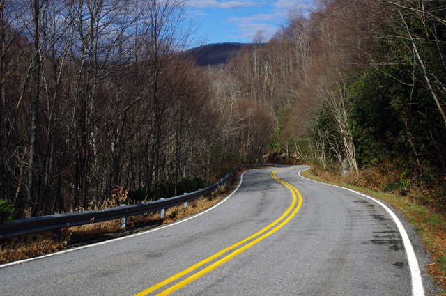
Photo - NC 215 winter view

Winter riding has it's own beauty - I enjoy the contrast to summers lush growth. This is NC 215 south of the parkway, one of the better sections.

The first road I added was one surprisingly close to home – Crabtree Mountain Road. The last time I explored it there was a long section that wasn’t paved. That’s not unusual in the mountains. The easy sections along the valley floors get paved. The steep sections that climb up and over the mountain passes don’t as it requires so much effort and expense to prepare and then maintain a decent roadbed in the steep and rocky terrain.

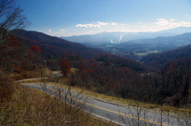
Photo - View from Crabtree Mountain Rd

Outstanding views from atop the pass on Crabtree Mountain Road. The smoke plume from paper mill in Canton is easy to spot

Crabtree Mountain Road connects NC 209 (now known as “The Rattler” video here) to NC 215 at the town of Canton. It not only makes a connection between two already great rides, but is a great motorcycle ride on it’s own merits. The scenery in the valley is picturesque as the road winds along with the course of a stream through a collection of nice curves, then darts south to start the steep climb over a high pass. Two of the photos included were from the high point on the road. It then plunges down the mountainside through a series of hairpin turns and switchbacks before it runs into Thickety Road and connects to NC 215 near I-40. Watch for gravel near the top of the pass, but otherwise the road is in good condition and a nice ride.

Photo - Silversteen Road

High quality pavement on Silversteen Road gives you the confidence to exploit the unending series of curves.

The second road I added was near Lake Toxaway and I suspect it may become one of my new favorites. Silversteen Road connects the fabulous riding on NC 281 to one of the twistiest sections of US 64. This road had me thinking of The Dragon at Deals Gap. Though a third shorter than the Dragon at at 8.1 miles in length, the tight curves are relentless throughout the ride. Also, like the Dragon, while it doesn’t offer much in the way of scenery, you’re too engaged in just maintaining control to let your eyes wander to the horizon. It’s easy to find from NC 281 as it intersects on a hairpin curve, and the southern end at at US 64 is marked by a gas station.

Progress is going to have to wait a week as I’m taking a short vacation. I be back in the saddle after Thanksgiving. I posted some of the video I shot today at my Youtube Channel – http://youtube.com/americaridesmaps. Until then, enjoy the ride.

http://www.youtube.com/watch?v=t1HbSTAk7C4

_______________________________________________________________________________

Wayne Busch
Wayne Busch – Cartographer
– Wayne Busch lives in Waynesville, NC, where he produces the most detailed and comprehensive and up-to-date motorcycle pocket maps of the Blue Ridge and Smoky Mountains to help you get the most of your vacation experience. See them here – AmericaRidesMaps.com 
 

Practicing for Motorcycling in Paris – I’m not ready (videos)

On Sunday I’m flying ‘cross the pond for a much needed vacation in Paris, France. I’m a little disappointed to miss the Paris Motorcycle show, but I’ll try to make up for it as I can. I’ve been looking for info so I can be prepared for the experience, but after reviewing these videos I’m not quite sure I’m ready;

Obviously, I’m going to need to brush up on my traffic skills to fit in. From the looks of this next video, tires must be really expensive – they tend to use just one at a time in the French City.

Maybe its time to rethink this. I only know a couple French words – gendarme and bastille come to mind.  It’s my first visit. Maybe I’ll just stick to the motorcycle taxis for now, but then I’ve still got a couple days to practice up.

PS – you might want to stay off the roads this week or at least pull over if you see a crazy biker approaching with a beret taped his the helmet.

Rain Welcome Following Nice Motorcycle Riding in the Smoky Mountains

You’ve got to appreciate the great weather we had this past week in the Smoky Mountains. It was a good time to be out motorcycle riding and most riders seem to have taken advantage of the opportunity. I’m not complaining now that a couple days of rain have moved in.

Photo - clouds in the Smokies

When the clear blue skies went to cloudy Sunday morning, it was the end to a really nice spell of weather.

It’s was hard to spend time in the office while the sky was so blue, the sun was shining, and the air warm and still. I managed to squeeze in a few days of motorcycle riding including some time up on the Blue Ridge Parkway . With this rain, maybe I’ll get a little more work done now that I’m not so often glancing out the window and stepping outside to insure the motorcycle is still ready and waiting. A few good days of inside work should do it.

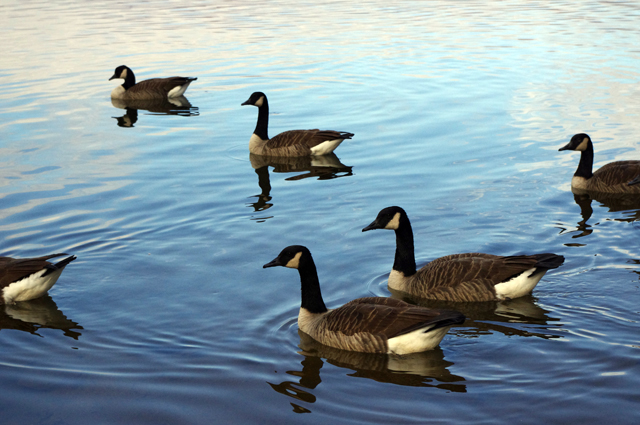
Photo - Canada Geese

A still warm morning at Lake Junaluska soon clouded up and now is nothing but wet and gray today.

Here’s a couple photos from this weekend that I’ll be looking at over the next week to remind me of those good times, and inspire me to get the business done so I can get out and enjoy some more. Hope you like.

_______________________________________________________________________________

Wayne Busch
Wayne Busch – Cartographer
– Wayne Busch lives in Waynesville, NC, where he produces the most detailed and comprehensive and up-to-date motorcycle pocket maps of the Blue Ridge and Smoky Mountains to help you get the most of your vacation experience. See them here – AmericaRidesMaps.com 


Motorcycles Flock to Blue Ridge Parkway with Warm Fall Weather

The weather in the Smoky Mountains lately has been stellar. While there may be a nip of frost in the mornings, by the afternoon the temps are in the high 60’s, the wind is still and dry, and the summer haze that gives the Smokies their name has taken a holiday. It’s been hard not to get out and ride your motorcycle.

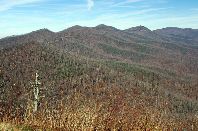
Photo - November view from the Blue Ridge Parkway

This is what the views from the Blue Ridge Parkway look like in mid-November. While almost all the leaves are down, it's still inspiring. Look close (click the picture for a larger view) and you can see the Parkway.

Jackie is in off the road for the weekend (like me, she travels with her work), and with the afternoon free we hopped on the bikes for a “La La” ride. In other words, no agenda, just cruising along, enjoying the  scenery, going wherever the whim takes you, “La la la”. You shouldn’t be surprised we ended up spending a little time on the Blue Ridge Parkway. It’s the epitome of “la la” rides.

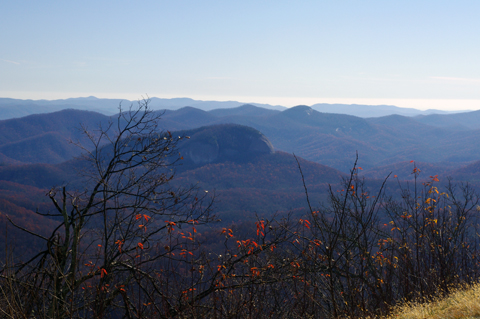
Photo - November view from the Blue Ridge Parkway

Cool and clear weather makes for great long range views. The feature in the center of the photo is Looking Glass Rock. The mountains on the horizon are in South Carolina and Georgia. Summer haze and green leaves hide so much which winter reveals.

I’m often surprised by the number of motorcycles on the Blue Ridge Parkway, but I didn’t expect to see so many today this late in the season. While I didn’t do an official count, I can confidently say motorcycles outnumbered cars while we were there.  We stopped at a couple overlooks and talked with a few people from Florida and South Carolina who had come north to enjoy the views.

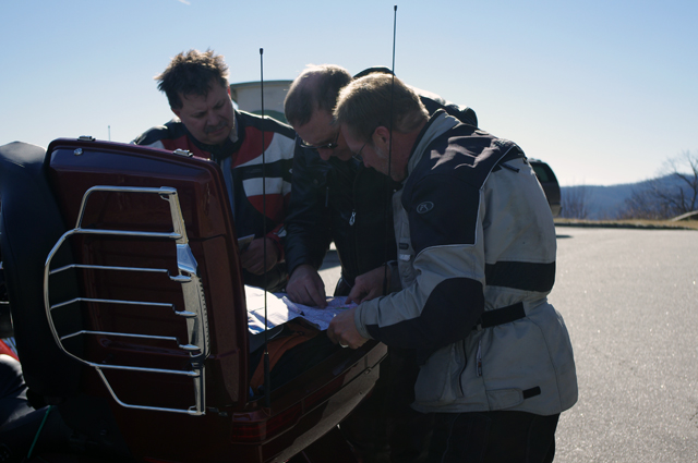
Photo - Looking at a map on the Blue Ridge Parkway

These guys from Florida really needed the help. The map they had was of such a large scale it didn't show many of the local roads. I hope the maps I gave them made the rest of their afternoon enjoyable.

I can’t help myself when I come across motorcyclists looking at a map, it’s the cartographers curse. We ended up spending almost half an hour at one overlook talking with other motorcyclists who pulled in, suggesting alternative rides, and handing out old versions of my maps. I usually carry an assortment in my bag to give away as promotional material and I parted with a bunch this afternoon.

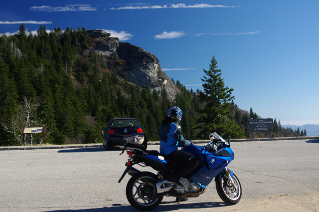
Photo - Devils Courthouse

Jackie pauses to admire the view of Devil's Courthouse on the Blue Ridge Parkway.

I shot a little video on the ride home to use later. It looks like our winter video ride project will be NC 215. It’s not only close to home so I can get a good collection of shots to choose from, but amongst locals it’s the most favorite ride and one you should know about.

Just because winter is coming it doesn’t mean an end to riding in the Smoky Mountains and it appears as many as possible are making the best of what warm weather remains.

_______________________________________________________________________________

Wayne Busch
Wayne Busch – Cartographer
– Wayne Busch lives in Waynesville, NC, where he produces the most detailed and comprehensive and up-to-date motorcycle pocket maps of the Blue Ridge and Smoky Mountains to help you get the most of your vacation experience. See them here – AmericaRidesMaps.com 
Did Blind Kenny See Your Motorcycle on the Diamondback?

Blind Kenny is the official Diamondback and Diamondback Loop photographers. The powersports photography business is owned and operated by Ken and Donna Behm of Marion, NC.

Photo by Blind Kenny

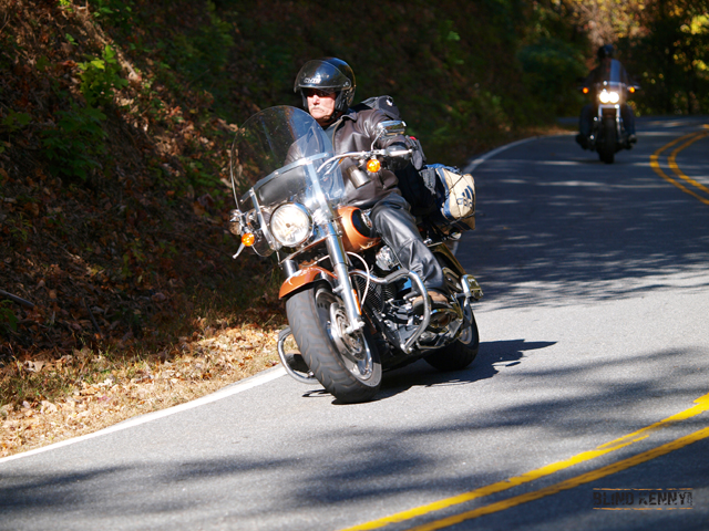
Photo by Blind Kenny - Cruiser on The Diamondback - www.BlindKenny.com

Blind Kenny photographs motorcycle riders and sportscar drivers out enjoying the ride on 226A and NC 80.  Their photography captures a unique moment in time from a perspective most riders and drivers never get to see – themselves and their machines performing as a unit and having fun.

Photo by Blind Kenny

Photo by Blind Kenny - Sport Bike on The Diamondback - www.blindkenny.com

You’ll usually find Blind Kenny‘s yellow and black signs on the road one half mile south of Wildacres Retreat on The Diamondback and a mile south of Buck Creek Gap on NC 80.  On warmer days in late winter/early spring, they’re’ out rain or shine from about 9:00 AM until dark and after.  Even when the forecast is for showers, they’ll be under the black and white checkered canopy taking pictures!

Photo by Blind Kenny

Photo by Blind Kenny - A Sports/Touring Bike on The Diamondback - www.BlindKenny.com

When you get back from your ride, go to www.BlindKenny.com to find and purchase your photos.  It may take up to 5 days before the photos are proofed and available, so send them an email and they’ll alert you when they’re ready.  If you contact them in advance, they’ll look for you out on the road.

Image - Blind Kenny Logo

www.BlindKenny.com

Blind Kenny offers all standard print sizes, gift items including gift cards, and high resolution digital downloads at very reasonable prices. Unique multiple shots posters are coming soon.

Blind Kenny – powersports photography

Diamondback and Diamondback Loop

America Rides Maps – Get the most up to date ride maps of the Diamondback

_______________________________________________________________________________

Wayne Busch
Wayne Busch – Cartographer
– Wayne Busch lives in Waynesville, NC, where he produces the most detailed and comprehensive and up-to-date motorcycle pocket maps of the Blue Ridge and Smoky Mountains to help you get the most of your vacation experience. See them here – AmericaRidesMaps.com