Wayne’s 2012 Blue Ridge Parkway Alternative Detours for Motorcycles

map-brp-detour-2012

Don’t get caught up in the traffic on the Park Service Detour Route 

These roads allow you to take the shortcuts (or the long way round) that will keep you riding!

Get your free copy! Instructions at bottom of page.

photo-parkway-closed-signs-nc18

30+ miles of the Blue Ridge Parkway is closed for most of 2012 near the NC / VA border. Detour via NC 18.


There is one significant detour on the Blue Ridge Parkway for 2012. To my surprise, it’s an extension of the detour that closed this middle section of the road near the North Carolina / Virginia border last year. While I found a much better detour route for motorcycle touring in 2011, 2012 is a real challenge in this very rural area where a paved road is a rarity.
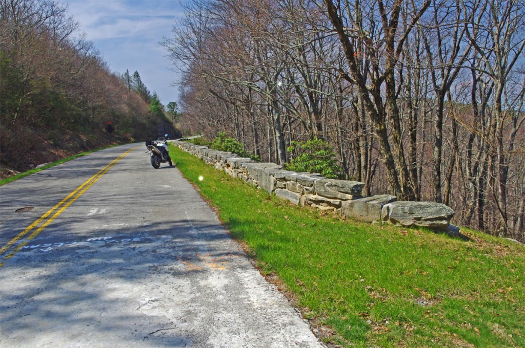
photo-stone-walls-on-brp

The Blue Ridge Parkway is closed for maintenance, repair, and rebuilding of the historic stone walls found in this 30+ mile section.

The Blue Ridge Parkway will be closed to traffic (including bicycles) in 2012 from Milepost 216.5 near Cumberland Knob to Milepost 248.1 for repair of historic stone walls (see photo). While the wall shown may not seem impressive, this is where the Blue Ridge Parkway was born back in 1930-40. The early masonry work you see on the overpasses, bridges, and walls was done by master masons brought over from Europe. A few third generation descendants continue this restoration work today.

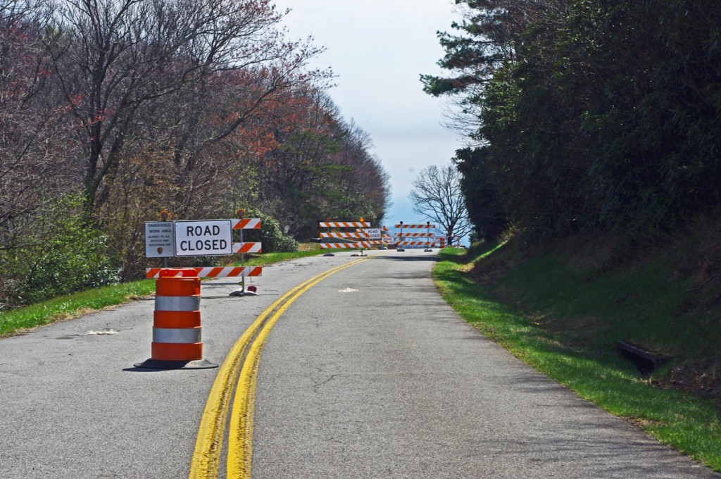
photo-brp-barricade

4 Road Closed signs, barrels, barricades, flashing lights, locked gate, - seriously closed!

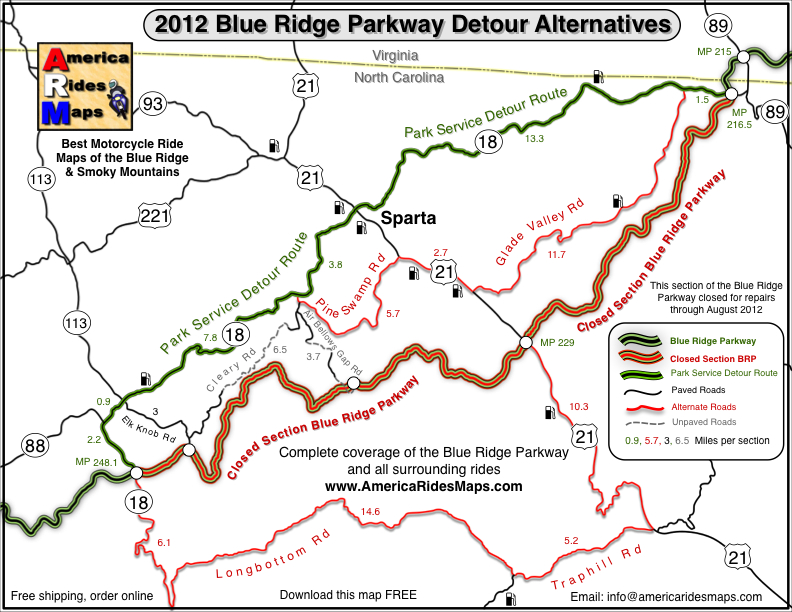
Last year’s detour was north of the Blue Ridge Parkway through Sparta. I knew of a longer though much better route on the south side and produced a free downloadable map of it. It was fun. That route is included on the map. This years extension of the closure means there is no good way to bypass it completely on the south side of the Blue Ridge Parkway.
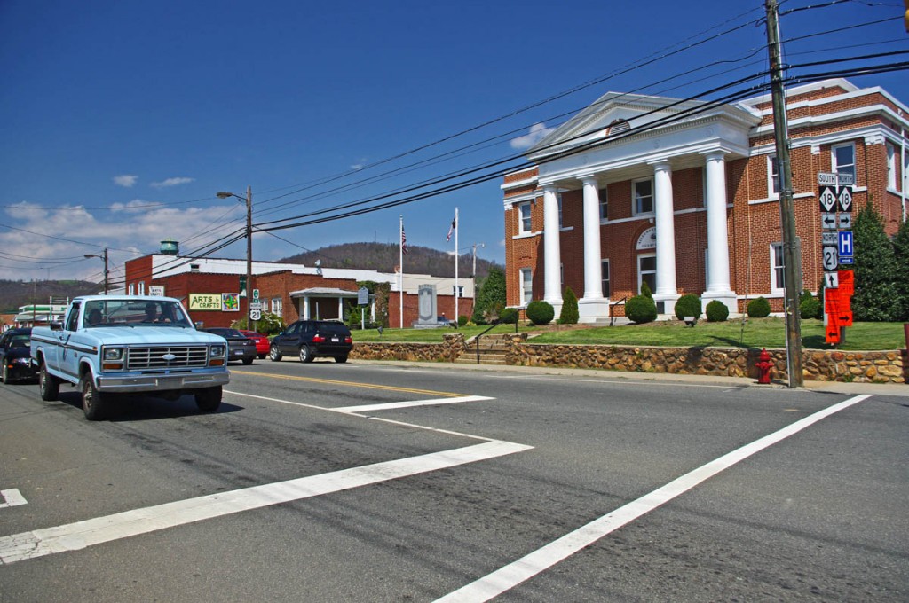
photo-sparta

The Allegheny County Courthouse is the cornerstone of downtown Sparta. It's a small crossroads town, little of interest to me.

The 2012 Park Service detour route is simple, just one road – NC 18 which intersects the Blue Ridge Parkway at two points. It’s the easy, elegant solution passing through Sparta. While NC 18 could be a decent motorcycle ride, it’s curvy and rolling, the lack of paved roads in the area means it also carries all the traffic. Few cars and trucks are able to maintain the 55 mph speed limit and there’s always that one or two that can’t seem to get much above 40 mph and the lines back up behind them. It can be frustrating to ride when you can’t enjoy the curves at a proper motorcycle pace.

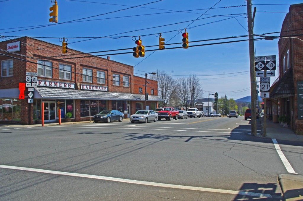
photo-sparta

There - now you've seen Sparta. Don't feel like you've missed much if you bypass it.

Nor is there a compelling reason to go into Sparta. It’s a historic town at the crossroads of NC 18 / US 21, but I saw no places which looked enticing to eat at (one coffee shop), and the 2 gas stations require you to leave NC 18 and go a short distance on US 21. There’s a little museum, but miss Sparta and you won’t miss much.

map-brp-detour-2012

Download this map and print your copy or save it in your phone!

The roads show on the map offer alternatives to avoid most of the standard route and should save you some time. They will at least help you avoid getting caught up in any traffic that could get backed up on the official detour. For those on adventure bikes I’ve included a couple non-paved options that will let you get your wheels dirty on gravel roads.

Downloads:
Use http://americaridesmaps.com/downloads/BRP-detour-2012.pdf for a map you can print on a standard sheet of paper.

Use http://americaridesmaps.com/downloads/BRP-detour-2012.jpg for an image file you can store in your cell phone, iPad, or GPS.

__________________________________________________________________

Wayne Busch

Wayne Busch - Cartographer

Total Rider Tech Logo

Learn Total Control

– Wayne Busch lives in Waynesville, NC, where he produces the most detailed and comprehensive and up-to-date motorcycle pocket maps of the Blue Ridge and Smoky Mountains to help you get the most of your vacation experience. See them here – AmericaRidesMaps.com

Wayne is an advanced motorcycle instructor for Total Rider Tech teaching Lee Parks Total Control Advanced Rider Courses. Isn’t it time you looked into advanced rider training to ride more confidently and safely? It can transform your mountain riding experience.  Total Rider Tech

____________________________________________________________________

The Blue Ridge Parkway’s Best Kept Secret Waterfall

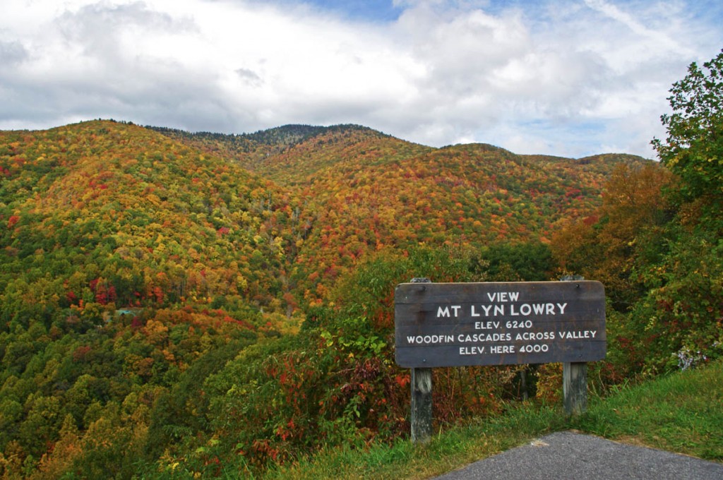
The Mount Lyn Lowry overlook is  a large and welcoming pull-off on the Blue Ridge Parkway that holds more than appears on a drive-by.

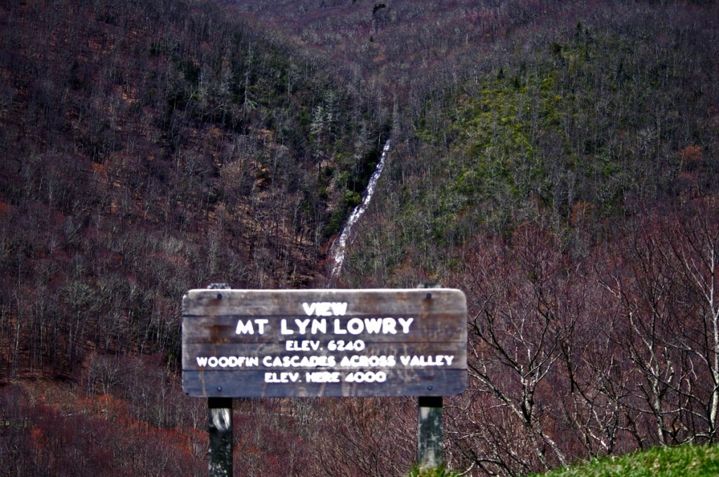
Motorcycle the Blue Ridge Parkway in the early spring and you’ll be rewarded with sights unseen by those who visit later in the year. One of them is Woodfin Cascades at the Mt Lyn Lowry overlook (MP 446.7). Once leaves cover the trees when summer arrives, most of this waterfall disappears from view.

Photo-woodfin-cascades-on-the-blue-ridge-parkway

Woodfin Cascades are viewed from the Mt. Lyn Lowry overlook on the Blue Ridge Parkway

Another secret revealed to those who spend a little time observing at this Blue Ridge Parkway overlook is the 60 foot high illuminated cross atop Mt. Lyn Lowry. You can use the cross as a reference to fid the falls, they are located beneath it on the mountainside.

Photo-mt-lyn-lowry-fall

The cross is located atop the mountain. Even though it's 60 ft tall, on a 6240 mountain it's just a speck! The falls are hiding behind the leaves.

Mt Lyn Lowry overlook is located on the section of the Blue Ridge Parkway between Waynesville at US 74 and Maggie Valley at US 19. This is one of the most scenic stretches of the national park as it climbs to the heights of Waterrock Knob, then descends to Soco Gap and Maggie Valley. There are numerous long range overlooks.  Be sure to bring your camera for some of the best views you’ll find.

photo-woodfin-cascades

In spring, the entire 235 foot run of Woodfin Cascades can be admired. It dissapears when things green up.

Here’s a 2 min video closeup of Woodfin Cascades –

__________________________________________________________________

Wayne Busch

Wayne Busch - Cartographer

Total Rider Tech Logo

Learn Total Control

– Wayne Busch lives in Waynesville, NC, where he produces the most detailed and comprehensive and up-to-date motorcycle pocket maps of the Blue Ridge and Smoky Mountains to help you get the most of your vacation experience. See them here – AmericaRidesMaps.com

Wayne is an advanced motorcycle instructor for Total Rider Tech teaching Lee Parks Total Control Advanced Rider Courses. Isn’t it time you looked into advanced rider training to ride more confidently and safely? It can transform your mountain riding experience.  Total Rider Tech

____________________________________________________________________

Motorcycles use caution – Rocks and Ice on the Blue Ridge Parkway

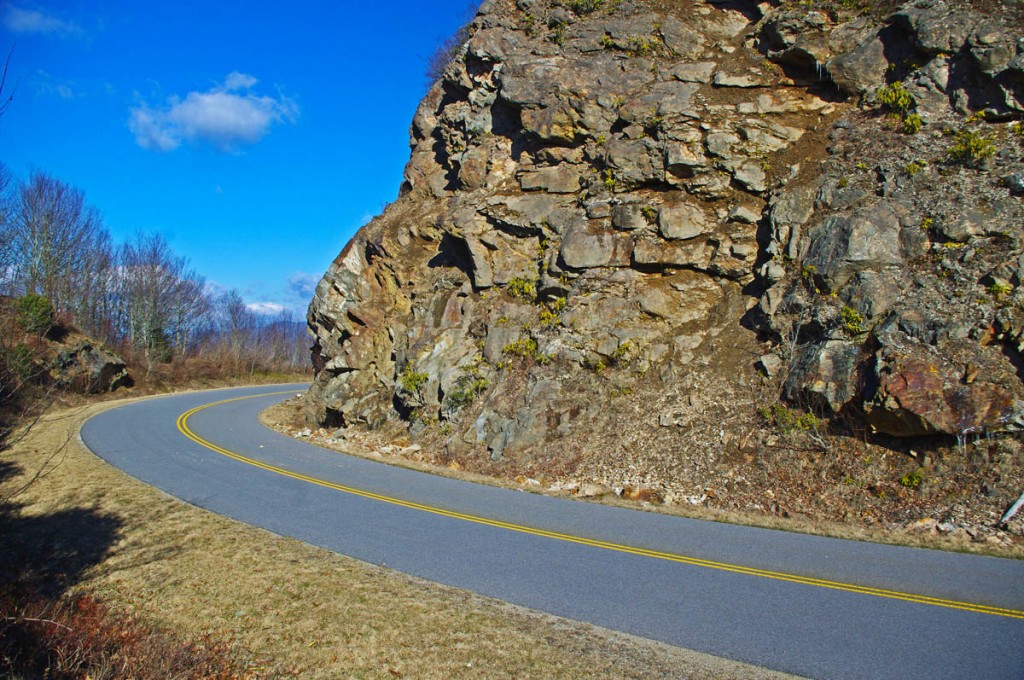
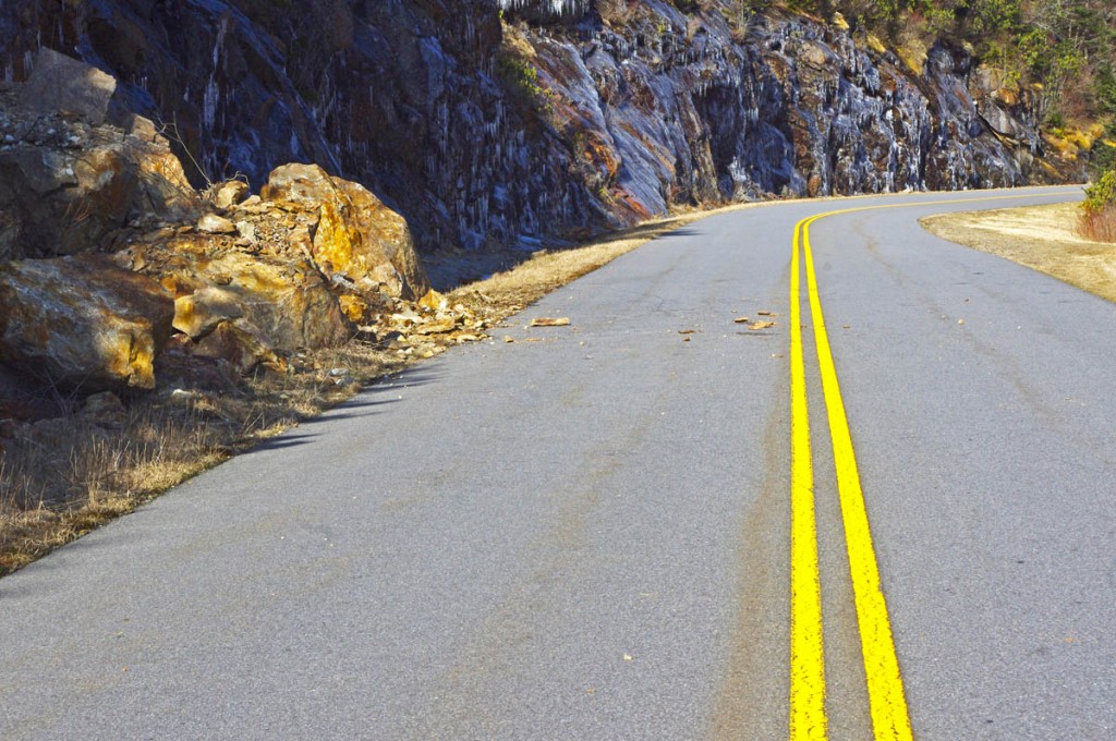
Early spring means early season motorcycle riding on the Blue Ridge Parkway, but nightly freezes cause lots of small rock slides.

photo-rocky-section-along-blue-ridge-parkway

Rocky sections along the parkway are prone to slides

The National Park Service has done an outstanding job keeping the Blue Ridge Parkway open through the winter season as much as possible. I can’t remember spending as much time up there on my motorcycle, usually I’m on skis this time of year.

photo-rocky-section-along-blue-ridge-parkway

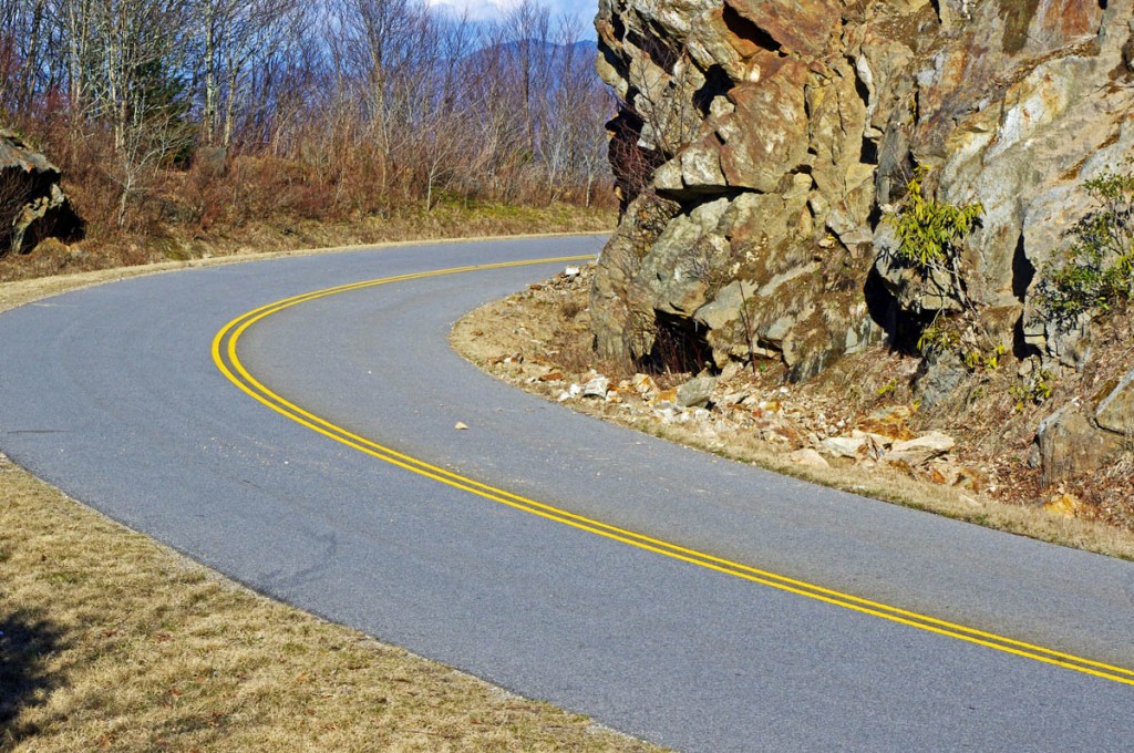
Rocks in the road are a common hazard

Warm and sunny days through this mild winter often find me pointing my wheels to the high country to take advantage of the nearly empty scenic road as it carves along the high ridge tops more than 5000 ft in elevation. Clear winter skies mean you can see into the surrounding states on the horizon, and the naked trees reveal what is hidden in the forested valleys spread out below.

photo-rocky-section-along-blue-ridge-parkway

If you see evidence of a large slide, be alert for the smaller ones which often follow.

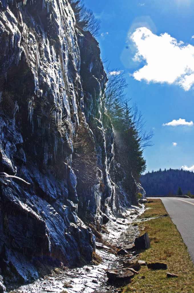
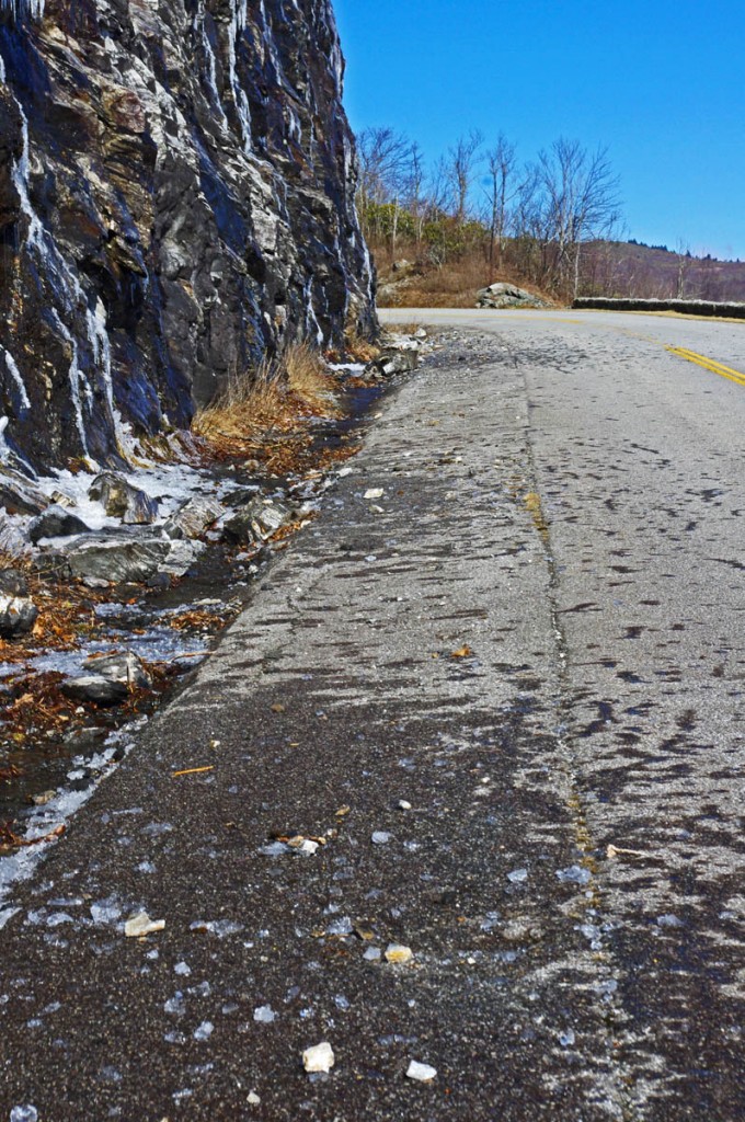
Once darkness comes, the temperatures dive below freezing and sheets of ice build on the wet rock faces that line the roadway. As the sun warms them the next day, the ice melts and rains down along the roadside, and the repetitive freezing and melting cracks and loosens the rocks above causing small slides.

photo-rocky-section-along-blue-ridge-parkway

When the sun hits the rocks, the ice quickly melts and falls.

The park service is quick to remove the bigger slides as they occur and you’ll see the piles of rock pushed to the roadside. Throughout the day the process continues and it’s not uncommon to find rocks in the road when the road carves along the rocky cliffs.

photo-rocky-section-along-blue-ridge-parkway

Rocks, ice, and water litter this section of the road

Be alert whenever you see exposed rock along the roadside, particularly when rounding shady curves. The road may be clear where the sun rarely reaches, but as you come into the sunny side there may be surprises in the road.

1 minute video shows how noisy and active the melting and falling ice can be. It’s worth a stop to watch the spectacle.

__________________________________________________________________

Wayne Busch

Wayne Busch - Cartographer

Total Rider Tech Logo

Learn Total Control

– Wayne Busch lives in Waynesville, NC, where he produces the most detailed and comprehensive and up-to-date motorcycle pocket maps of the Blue Ridge and Smoky Mountains to help you get the most of your vacation experience. See them here – AmericaRidesMaps.com

Wayne is an advanced motorcycle instructor for Total Rider Tech teaching Lee Parks Total Control Advanced Rider Courses. Isn’t it time you looked into advanced rider training to ride more confidently and safely? It can transform your mountain riding experience.  Total Rider Tech

____________________________________________________________________
Good Motorcycle Rides near Waynesville and Maggie Valley, NC

The last place I want to be riding a motorcycle is the 4-lane highway when there are so many good 2 lane back roads in North Carolina.

photo-turn-onto-candlestick-lane

Turn off the highway onto Candlestick Lane

For most motorcycle riders, covering the distance between Waynesville and Sylva means a relatively pleasant ride on four lane divided NC Highway 74 (The Great Smoky Mountains Expressway). As far as highways go, it is a nice ride winding down from Balsam Mountain and it rarely gets enough traffic to be annoying.

Lately though, I’ve been covering the relatively short distance on a few nice little back roads which I’ve grown very fond of. Since so many motorcycle touring riders pass through and stay in this area, I think they should know about them. If you’re riding near Cherokee, Maggie Valley, Waynesville, or Sylva, these roads may come in handy.

photo-turn-onto-cabin-flats

Next turn onto Cabin Flats Road.

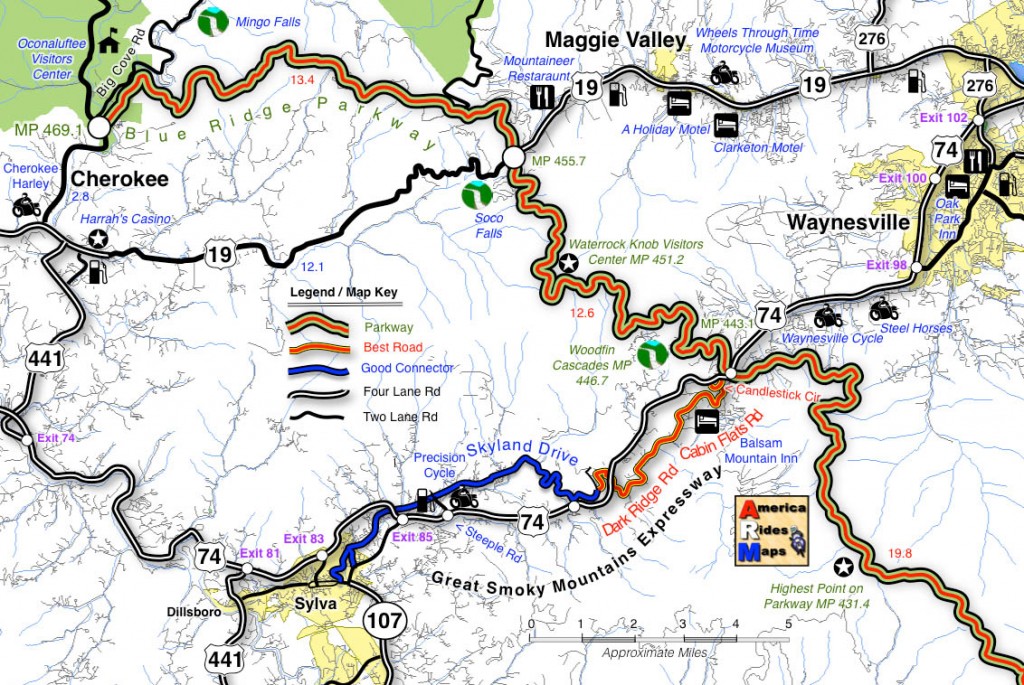
Both ends meet the Highway (US 74). The Waynesville end starts near the Blue Ridge Parkway Exit for Waynesville (MP 443.1) where it intersects US 74. Pass under the parkway then exit left onto Candlestick Lane. It’s an obvious intersection, well marked, look for the signs to Balsam, Balsam Mountain Inn, Moonshine Creek Campground.

Candlestick Circle is just a short loop off the highway, turn right onto Cabin Flats Rd. Cabin Flats Road winds along the railroad tracks a short distance, then makes a hairpin turn across them.  Balsam Mountain Inn sits on the hill above.

photo-balsam-mountain-inn

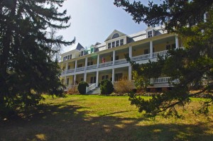
The Balsam Mountain Inn – historic, good food

It’s been a long while side I last visited, but the historic inn (1905) is both scenic and the food used to be very, very, good. You can imagine it’s heyday when it was a stop on the tracks in the middle of nowhere.

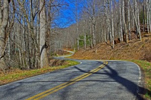
Cabin Flats Road will morph into Dark Ridge Road and start a twisting course alongside a stream through the mountain passes. The railroad also follows this narrow valley and you’ll often see it off in the woods crossing the stream on bridges and trestles.

photo-Dark-Ridge-Rd

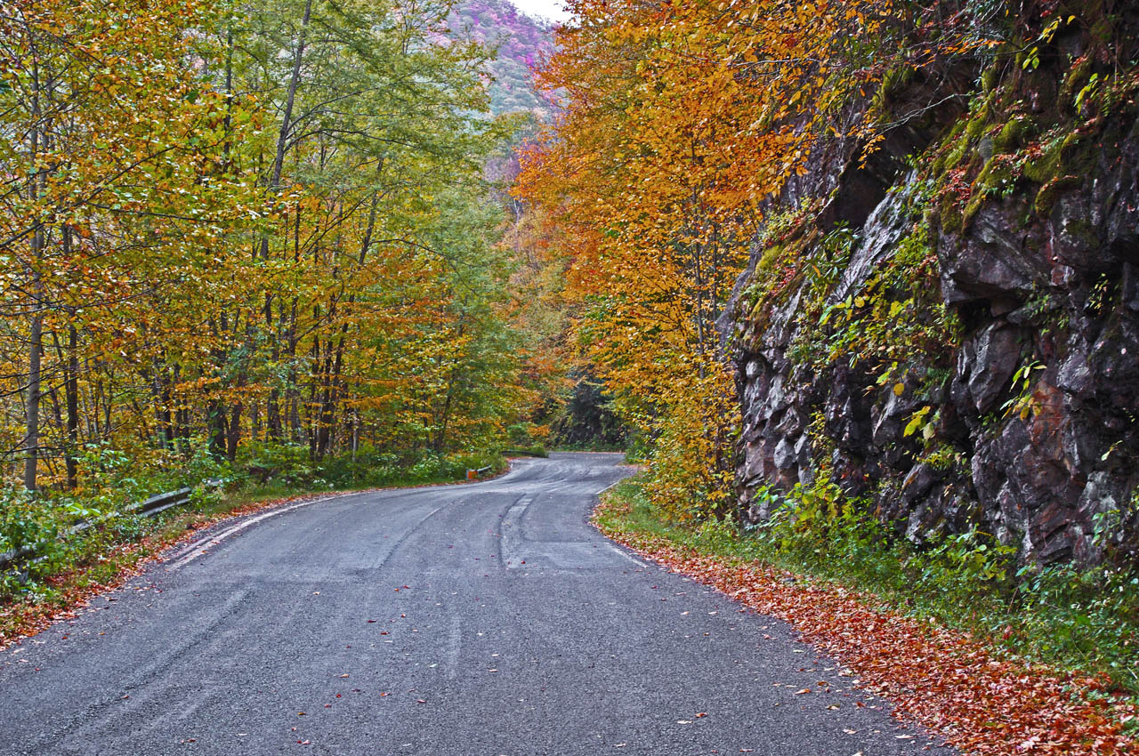
Dark Ridge Road – more fun than the 4 lane

Dark Ridge Road, the railroad, the highway, and the stream cross each other several times on the way to Sylva in a twisted mountain mess. You go under the highway, under the railroad, over the stream several times on the ride.

Dark Ridge Road meets Skyland Road at a stop sign just after you cross the railroad tracks. Turn left (the road quickly peters out if you go right).

photo-trestle-on-skyland-rd

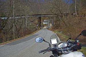
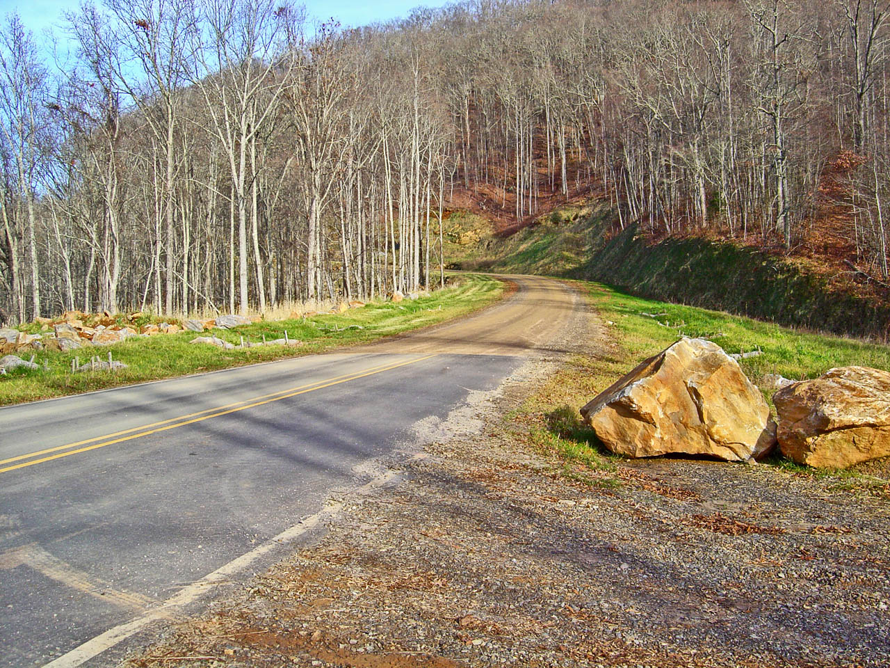
Under the tracks on Skyland Rd

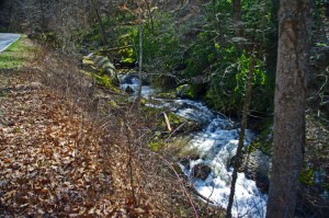
The first part of Skyland Road is nice and there are several good spots to stop and get a look at the now rushing whitewater stream.

The second half looses it’s appeal as it draws near Sylva and the suburbs of the town. You can follow the road all the way into Sylva. You may note the prominent fork right onto Chipper Curve Rd – it will bring you closer to downtown.

photo-creek

Whitewater Creek along Skyland Rd

You can hop on-off this ride at 2 points and get back on the highway. One of them is obvious, a mile or so after you get on Skyland Rd. The other, Steeple Road, is closer to Sylva and is the best way to get back on the highway without going into town. Precision Cycles and a BP station mark it at the highway.

map

Click on photos and map for larger views

__________________________________________________________________

Wayne Busch

Wayne Busch – Cartographer

Total Rider Tech Logo

Learn Total Control

– Wayne Busch lives in Waynesville, NC, where he produces the most detailed and comprehensive and up-to-date motorcycle pocket maps of the Blue Ridge and Smoky Mountains to help you get the most of your vacation experience. See them here – AmericaRidesMaps.com

Wayne is an advanced motorcycle instructor for Total Rider Tech teaching Lee Parks Total Control Advanced Rider Courses. Isn’t it time you looked into advanced rider training to ride more confidently and safely? It can transform your mountain riding experience.  Total Rider Tech

____________________________________________________________________
Motorcycles and Gravel on the Road – Relax

If you clench your teeth and death-grip the bars at the sight of gravel in the road, you’re asking for trouble.

Yesterday, Jackie and I took a winter motorcycle ride to the Blue Ridge Parkway via NC 215. I’ve been riding NC 215 about every 2 weeks through the winter to monitor the road condition. Since it was paved with a ‘tar and chip” coating this fall, the surface of this outstanding climb through the national forest has been strewn with loose gravel. (See Map of this section)

photo-nc215

The loose surface of NC 215 can make you a better rider if you relax.

It’s certainly not as much fun to ride this classic motorcycle ride in this condition, but it shouldn’t be an exercise in terror either. One of the worst things you can do when riding a road like this on a motorcycle is to tense up, fight it, and over-react to slips.

Face up to it – on a loose surface, the bike is going to slip a bit now and then. Expect it. Accept it. You can’t prevent it. You just need to manage it smoothly as it happens and allow the bike to do what it needs to do. Almost every instinctive reaction we have makes the situation worse – hitting the brakes, cutting the throttle, and aggressive or stiff inputs at the bars only reduce traction further. Relax. Use the lightest touch you can and maintain your throttle so there are no abrupt weight changes on the tires.

Motorcycles function very well in loose conditions if you let them move about as they need to do to maintain stability. The wheels will come back into alignment when they find traction and the bike will self correct. Anyone who’s ridden a dirt bike knows the wheels are moving all over the place, the harder you fight it, the less control you have. You just keep it guided in the general direction and let what happens happen as you go.

It’s a delicate situation when a tire slips. You need smooth and gentle input on the controls but if you are all tensed up, you can’t react quickly and smoothly. If you panic, you’ll apply your controls too harshly or change them too quickly and buy a ticket to crash-land. Chop the throttle and you get an express ticket to trouble. Practice being relaxed and accepting whatever is happening.  Respond softly, gently, and maintain your throttle application through turns.

Photo-road-unpaved

Practice getting a little out of your comfort zone when conditions change. The skills you learn may save your butt on the pavement when you least expect it.

As you gain more riding experience, you’ll learn many techniques to help you manage traction better while riding your motorcycle. None of them will be effective if you don’t relax and perform them smoothly.

The next time you find yourself on a road with a loose surface, remember to relax and accept it. Recognize what it has to teach you –

  • You’ll learn how to gauge the limits of your traction and how to react when you exceed them.
  • Because you’re more familiar with riding at the edge of traction, you’ll have a better feel for knowing when you’re getting close to the limit.
  • You may not intend to ride at the limit of your traction on a nice clean road, but when the unexpected happens and a wheel slips on a slick spot, the reactions you’ve learned will be old habits.

NC 215 will improve with time. Rumors are it may get more paving in the spring, but I wouldn’t count on it. The next time you find yourself riding a road with a loose surface, appreciate the opportunity to hone your skills and learn how to deal with things when they get a little out of your comfort zone.

photo-bikes on gravel

Occasional rides on gravel are a learning experience. Just take it easy and avoid a crash course. You'll gain skills that will help you react better and be more comfortable when things get loose.

Tip – Where are your elbows? If your elbows are above your wrists, you’re not relaxed.

Read what other riders have to say about NC 215

__________________________________________________________________

Wayne Busch

Wayne Busch - Cartographer

Total Rider Tech Logo

Learn Total Control

– Wayne Busch lives in Waynesville, NC, where he produces the most detailed and comprehensive and up-to-date motorcycle pocket maps of the Blue Ridge and Smoky Mountains to help you get the most of your vacation experience. See them here – AmericaRidesMaps.com

Wayne is an advanced motorcycle instructor for Total Rider Tech teaching Lee Parks Total Control Advanced Rider Courses. Isn’t it time you looked into advanced rider training to ride more confidently and safely? It can transform your mountain riding experience.  Total Rider Tech

____________________________________________________________________
Scenic Motorcycle Rides – Dry Falls, NC

The beautiful region south of Great Smoky Mountains National Park is often called “The Land of the Waterfalls” and is one of the most popular areas to ride on a motorcycle.  More than 20 nice waterfalls are located close to the roadside, another 40 or so require more serious hiking than most bikers are willing or equipped to tackle.

photo-Dry-Falls

A path leads behind Dry Falls so you can pass beneath it without getting wet.

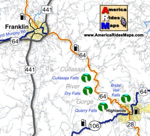
Dry Falls is one of the most unique though it’s an easy one to miss on your motorcycle ride despite being well marked. It’s easy to miss as it’s not directly visible from the road so you’re not tempted off the wonderfully curvy section of US 64 as it snakes through the spectacular Cullasaja Gorge between Franklin and Highlands.

This section of US 64 can be a very enjoyable ride on a motorcycle, though it’s too often hampered by other traffic drawn to see the sights and wonders. On those typical days when there is a good amount on traffic on the road, it’s definitely worth the time to stop for a break and make the short walk from the parking area to admire Dry Falls.

image-map-of-waterfalls

Dry Falls got it’s name because you can walk beneath the falls without getting wet. A large cavern beneath the rock ledge at the top of the falls has a path where you can pass behind the cascade to emerge on the other side. It has the largest and best improved parking area of all the falls in the area, so it’s an easy place to stop and enjoy.


image Great Smokies south map coverFind more than a dozen roadside waterfalls on America Rides Maps map #7The Best Roads SOUTH of Great Smoky Mountain National Park

__________________________________________________________________

Wayne Busch

Wayne Busch - Cartographer

Total Rider Tech Logo

Learn Total Control

– Wayne Busch lives in Waynesville, NC, where he produces the most detailed and comprehensive and up-to-date motorcycle pocket maps of the Blue Ridge and Smoky Mountains to help you get the most of your vacation experience. See them here – AmericaRidesMaps.com

Wayne is an advanced motorcycle instructor for Total Rider Tech teaching Lee Parks Total Control Advanced Rider Courses. It’s time you looked into advanced rider training to ride more confidently and safely, it will change your mountain riding experience. It worked so well for me I became an instructor! Total Rider Tech

____________________________________________________________________

Motorcycle Riding on the Blue Ridge Parkway – in January?

I should be in Vegas – luck is with me today. Although the weather has been unseasonably warm here in the Smoky Mountains this week, it’s also been wet. Not that “Old Testament” deluge kind of wet, but a wintery wet with light but persistent rains.

photo-winter-view-of-cold-mountain

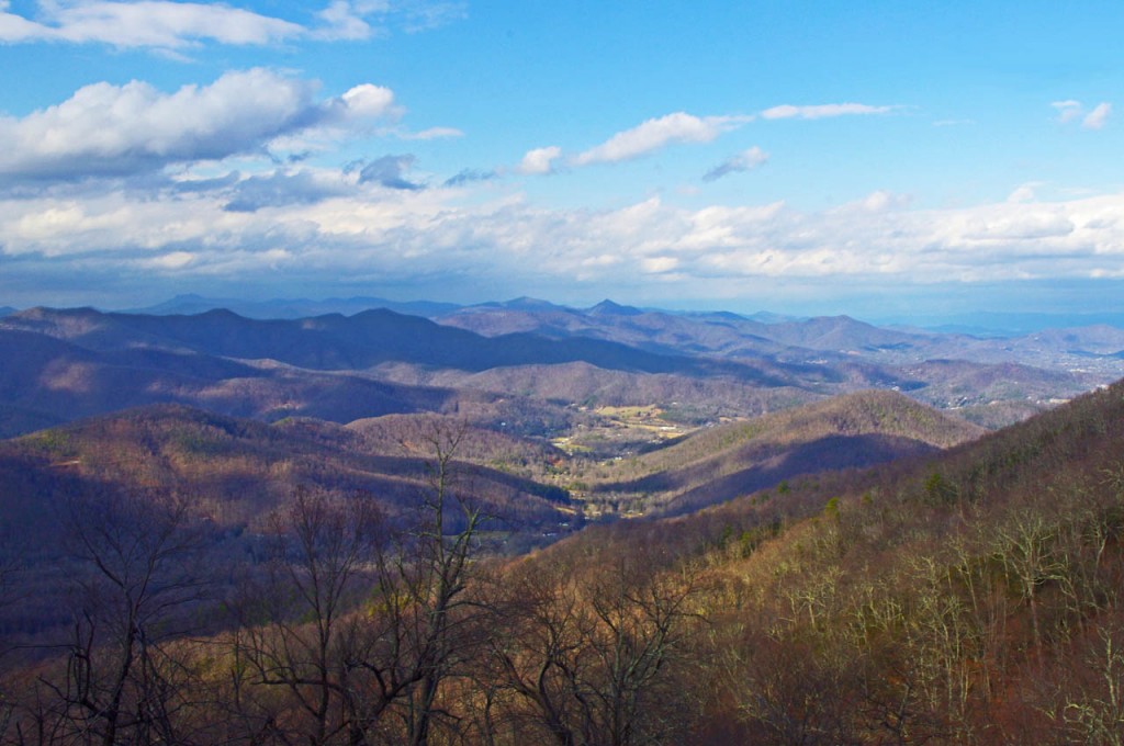
A winter view of Cold Mountain from the Blue Ridge Parkway near Mt. Pisgah.

In a normal year we’d have a bit of white on the ground, and I did see a rare patch or two today. It’s not the ideal season for motorcycling the Blue Ridge Parkway. In fact, the Blue Ridge Parkway is normally closed to traffic through this season due to the frigid conditions.

When I saw the sun this morning I knew a motorcycle ride was in order. There’s a weather front passing over with a few hours of blue sky before the snow moves in tonight. I wrapped up the mornings work and fired up the bike.

Photo-wayne-on-parkway

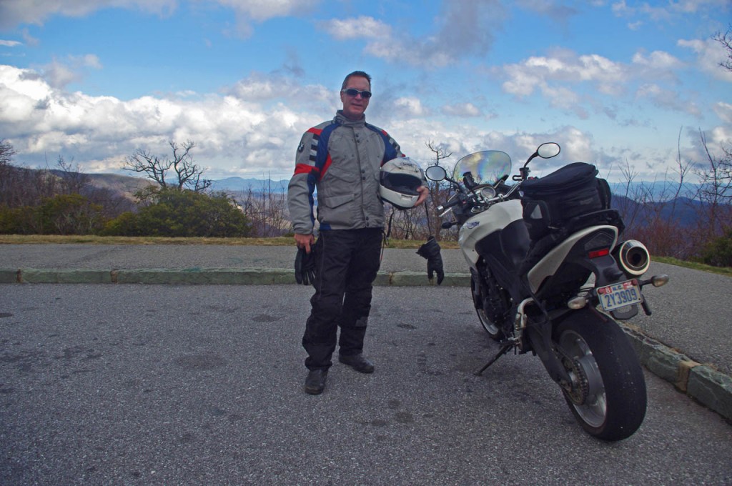
The weather looked great to the south, what a difference the other direction.

I just wanted a nice little ride. The threatening clouds on the northern horizon foretold this break in the weather was temporary, so I chose to just head south from Waynesville on US 276 and ride up to the Blue Ridge Parkway and back after running a few errands in town.

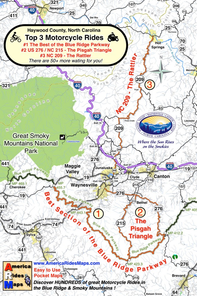
US 276 is a well know road to motorcycle riders and part of a classic loop called the “Pisgah Triangle” south of Waynesville. US 276 forms one leg of the triangle, the Blue Ridge Parkway the second, and NC 215 the third. It’s a “must do” fun ride if you’re in the Waynesville / Maggie Valley area.

photo-winter-view-blue-ridge-parkway

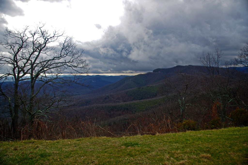
Winter riding in the Smoky Mountains can be as beautiful as the summer, just in a different way.

It takes about 25 minutes to ride out across Bethel Valley then follow the Big East Fork of the Pigeon River in the Pisgah National Forest and make the steep and twisting climb to the heights of the Blue Ridge Parkway at the Wagon Road Gap. The ramp to the Blue Ridge Parkway leads to the large parking area  overlooking Cold Mountain  (MP 412.2).

The overlook is accessible year-round. The parkway is gated on either side. The south gate (towards Cherokee) was closed, but the north gate to Mt. Pisgah was open so I took advantage of the opportunity to snap a few photos.

photo-clouds-on-the-blue-ridge-parkway

By the time I turned back, those clouds had swallowed up everything.

The blue skies didn’t last long, and by the time I had turned around nearing Asheville, the clouds were swallowing the views. The wind was gusting and I started to hit some wet stuff on the way back. Some of it was white.

It was a rare treat this time of year. Next time you’re passing through, take a motorcycle ride on the Pisgah Triangle. I had a great time on just one leg of it, and the other two are better!

haywood-county-postcard

A postcard from Haywood County, North Carolina shows the Pisgah Triangle

__________________________________________________________________
Wayne Busch

Wayne Busch - Cartographer

Total Rider Tech Logo

Learn Total Control

– Wayne Busch lives in Waynesville, NC, where he produces the most detailed and comprehensive and up-to-date motorcycle pocket maps of the Blue Ridge and Smoky Mountains to help you get the most of your vacation experience. See them here – AmericaRidesMaps.com

Wayne is an advanced motorcycle instructor for Total Rider Tech teaching Lee Parks Total Control Advanced Rider Courses. It’s time you looked into advanced rider training to ride more confidently and safely, it will change your mountain riding experience. It worked so well for me I became an instructor! Total Rider Tech

____________________________________________________________________
Great Motorcycle Ride Rivals the Tail of the Dragon

You hear a lot of folks say “I know of roads better than the Tail of the Dragon, but I, like you, am often doubtful of such claims.

The Dragon at Deals Gap is pretty much the benchmark motorcycle ride to measure and compare to. There are darned good reasons the Tail of the Dragon is legendary. But what about those other roads?

Photo - Start of ride on south end

This abandoned gas station/store on Banner Elk Highway (SR 194) alerts you to the start of the ride. The road is just beyond it.

Here’s one I really enjoy, Beech Mountain / Flat Springs Road. I won’t claim it’s better than the Dragon, but it ranks right up there.

The pavement is not as good in places. There are connecting roads and driveways so you’ve got to ride alert, watch for gravel and sand at those connections and in tight turns. There are no motorcycle resorts at either end. Still, Beech Mountain Road is an excellent, challenging , and fun ride.

Photo - view from road

View of what I think is Roan Mountain. It's not the rare views that make Beech Mountain / Flat Springs Roads good, it's the ride.

This great motorcycle ride is labeled as Beech Mountain Road on the south side of Beech Mountain, then becomes Flat Springs Road once you start descending the north side of the mountain.

Grades are steeper than the Dragon but generally mild. It’s a bit longer. Best of all it’s a road I use to bypass traffic and avoid going through large towns and the city of Boone.

I use it often when I’m headed up to Tennessee and Virginia to ride The Snake and the great roads nearby, and it’s also in the neighborhood of Roan Mountain and the Murder Mountain Ride. It’s a good one to know about and add to your list of great back roads.

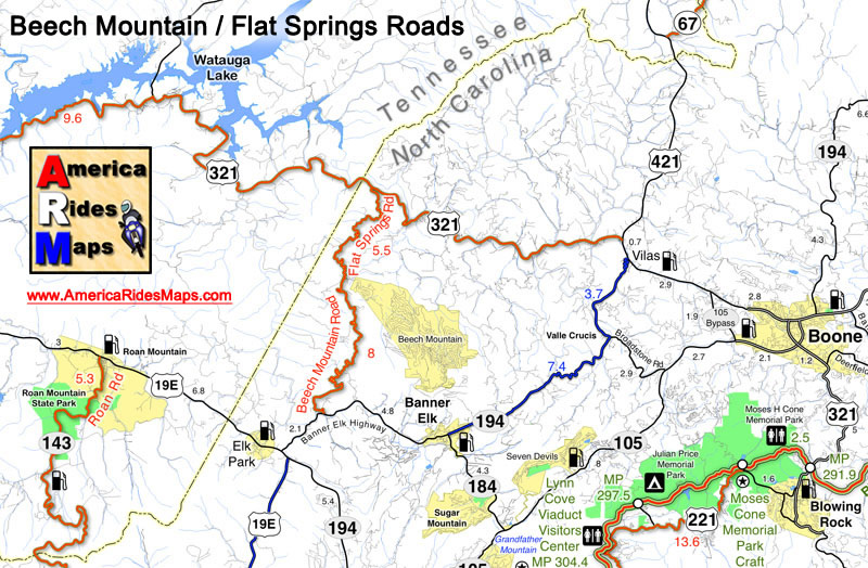
Image - Map shows location of Beech Mountain Road

Beech Mountain / Flat Springs Road help you avoid all the traffic to the east.

So how does it stack up?

I was going through my video files one day and found two that were nearly identical. Same camera angle. Same bike. A complete ride through both roads. So I matched them up side by side to see how the roads compare in a contest. The outcome was surprising!


_______________________________________________________________________________
Wayne Busch

Wayne Busch - Cartographer

Total Rider Tech Logo

Learn Total Control

– Wayne Busch lives in Waynesville, NC, where he produces the most detailed and comprehensive and up-to-date motorcycle pocket maps of the Blue Ridge and Smoky Mountains to help you get the most of your vacation experience. See them here – AmericaRidesMaps.com

Wayne is an advanced motorcycle instructor for Total Rider Tech teaching Lee Parks Total Control Advanced Rider Courses. It’s time you looked into advanced rider training to ride more confidently and safely, it will change your mountain riding experience. It worked so well for me I became an instructor! Total Rider Tech

_______________________________________________________________________________
Nice Motorcycle Ride Near Maggie Valley, North Carolina

The locals know this good biker road well. Shouldn’t you?

Hard to believe Jan 1, 2012, and we’re out for a spin on the bikes. Unusually warm, the day also brought some showers so we kept our ride short and local. As we’re pretty much surrounded by great motorcycle rides here in the Waynesville / Maggie Valley area, even those short rides can be a lot of fun.

photo-jackie-on-rabbit-skin-road

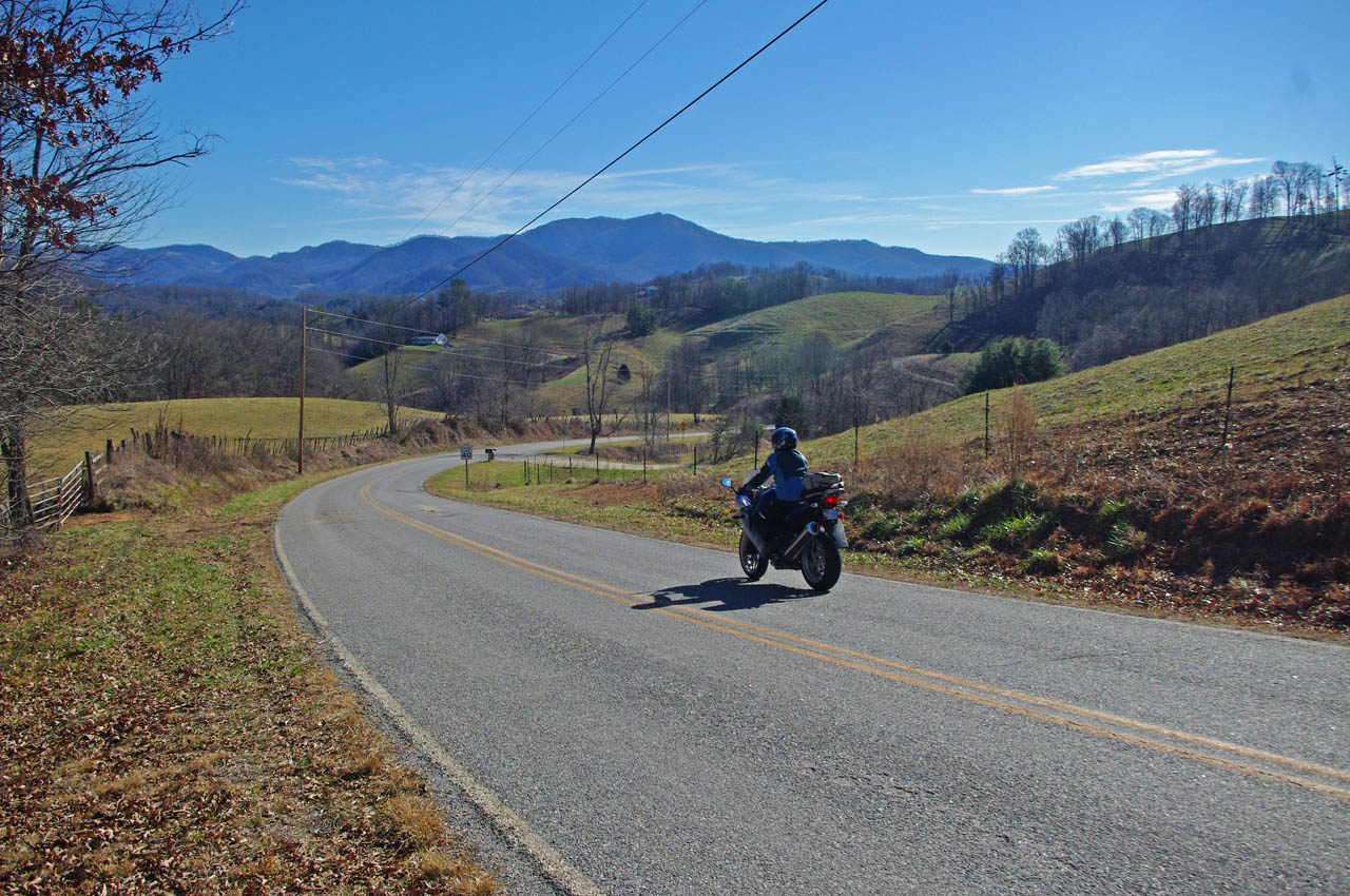
Jackie welcomes the New Year with a ride on Rabbit Skin Road. Nice curves, nice views, it’s a local favorite.

Rabbit Skin Road is easy to find. From Waynesville / Maggie Valley, head north on US 276 across the broad expanse of Jonathan Valley as it skirts the edge of Great Smoky Mountains National Park. The top of the ridge line to the west is the park border. To the north you’ll see more impressive mountains including 6000 Max Patch Bald. Even though it’s a long straight stretch of 4 lane, US 276 is a scenic and relaxing ride and a good chance to get settled on the bike before the challenge that is soon to come.

US 276 ends at the intersection with Interstate 40 at Exit 20. Pass under the Interstate as if you are continuing north to Tennessee and look for Rabbit Skin Road on the right before you head up the ramp to the highway.

This video includes some shots of the bridge where the roads meet

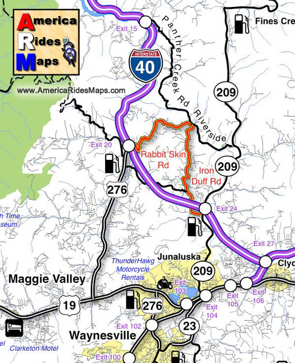
Rabbit Skin Road is one of several very challenging and scenic motorcycle rides through the mountains which lie north of Waynesville / Lake Junaluska / and Maggie Valley. It’s only 3.5 miles in length, but it doesn’t really end, it just continues on as Iron Duff Road for another 4.1 miles before it connects to NC 209 (a.k.a. The Rattler) near Exit 24 on Interstate 40.

The junction of Rabbit Skin Road and Iron Duff Road occurs at a bridge which crosses the Pigeon River. Across the river, are two more good motorcycle rides, Riverside Road and Panther Creek Road. Still more good motorcycle rides link to them.

While none of these roads is very long, all of them are scenic and fun to ride, and they interconnect. They are good toknow about when you have only a short time available to get in a motorcycle ride or are darting out for a cruise between rainy spells. If you know where they are, you can just keep linking roads together and spend a couple hours looping through the mountains and never leave the county nor ride the same one twice.

Image-map-shows-the-motorcycle-ride

Rabbit Skin Road and Iron Duff Road – Local Favorites


All Roads Lead to Maggie

The Rattler

America Rides Maps Map #6 – The Best Motorcycle Rides EAST of Great Smoky Mountains National Park

_______________________________________________________________________________
Wayne Busch

Wayne Busch – Cartographer

Total Rider Tech Logo

Learn Total Control

– Wayne Busch lives in Waynesville, NC, where he produces the most detailed and comprehensive and up-to-date motorcycle pocket maps of the Blue Ridge and Smoky Mountains to help you get the most of your vacation experience. See them here – AmericaRidesMaps.com

Wayne is an advanced motorcycle instructor for Total Rider Tech teaching Lee Parks Total Control Advanced Rider Courses. It’s time you looked into advanced rider training to ride more confidently and safely, it will change your mountain riding experience. It worked so well for me I became an instructor! Total Rider Tech

_______________________________________________________________________________
A Great North Carolina Motorcycle Ride near Franklin

Here’s a nice motorcycle ride west of Franklin, NC most riders never see. It’s easy to ride right past it onUS 64 between Franklin and Hayesville.

photo-view-west-from-us-64

West view from US 64 looking towards Hayesville, North Carolina.

US 64 has long been a favorite motorcycle ride as it makes a lazy climb through the mountains of the Nantahala National Forest. It’s a popular way to travel from Franklin to Murphy, or approach the great rides found just across the border in north Georgia.

Scenic US 64 is an easy motorcycle ride with gentle climbs and descents, the curves are broad and sweeping, the road wide and well maintained, and there are a couple nice overlooks.

photo-fall-view-us-64

US 64 is an easy ride, well maintained, wide and sweeping, but it can carry a good amount of traffic at times.


Near the middle of this section of US 64 you’ll find West Old Murphy Road winding into a mountain pass to the east. It’s a nice motorcycle ride that loops back to connect with US 64 closer to Franklin in 8.6 miles.

As much as I enjoy riding US 64, I don’t give it a top rating on my maps. US 64 is the primary east-west connector across the southern border of western North Carolina. Because of this, you’ll rarely have the road to yourself to enjoy. Local, commercial and tourist traffic use US 64 and chances are you’ll run in to at least a little of it.

West Old Murphy Road let’s you escape if you do get caught behind a string of slow traffic crawling up the grade.  If you’re looking for something more challenging and entertaining, you’ll find it on West Old Murphy Road.

photo-cemetary-w-old-murphy-rd

One of my favorite break spots, a small cemetery on W Old Murphy Rd.

This great motorcycle ride circles around the south side of the mountain US 64 skirts to the north. It’s devilishly twisty in places, the pavement is decent, and there are a few nice views though it’s another one of those roads you’ll be watching the  twisty pavement more than the pretty scenery.

West Old Murphy Road is easy to find at either end. Nearest Franklin, it’s near the point US 64 goes from two lanes to the four lane section  which circles south of the town. Near the mid point of US 64 look for signage on the east side of the road for Standing Indian campground in the National Forest.

Not far in from the mid point is one of my favorite spots for a quick break. You’ll see a pull-off near a small embankment. Atop the rise is an old graveyard. There are some good places to sit and enjoy the reverent solitude.

image-map-of-w-old-murphy-rd

You can see W Old Murphy Road is a twisty little bugger, but a lot of fun to ride.

_______________________________________________________________________________
Wayne Busch

Wayne Busch – Cartographer

Total Rider Tech Logo

Learn Total Control

– Wayne Busch lives in Waynesville, NC, where he produces the most detailed and comprehensive and up-to-date motorcycle pocket maps of the Blue Ridge and Smoky Mountains to help you get the most of your vacation experience. See them here – AmericaRidesMaps.com

Wayne is an advanced motorcycle instructor for Total Rider Tech teaching Lee Parks Total Control Advanced Rider Courses. It’s time you looked into advanced rider training to ride more confidently and safely, it will change your mountain riding experience. It worked so well for me I became an instructor! Total Rider Tech

_______________________________________________________________________________
West Old Murphy Road and many other roads in the surrounding area is found on America Rides Maps #7 – The Best Motorcycle Rides SOUTH of GSMNP
The start of it is also shown on America Rides Maps  – Map #9 – The Best Rides in the North Georgia Mountains