New Rock Slide Affects Motorcycle Vacation Plans to Smokies

Add yet another rock slide to the long list of road closures in the mountains of western North Carolina and eastern Tennessee. This one in particular will affect many motorcycle vacation plans to visit one of the most popular and well known rides in the region, the infamous Tail of the Dragon on US 129 at Deals Gap. Located along the western border of Great Smoky Mountains National Park, the 13 mile stretch of US 129 with it’s 311 curves draws hundreds of thousands of motorcycle and sports car enthusiasts each year who come to experience the challenging stretch of road.

It’s been an exceptional year for rock slides in the Smokies, the most notable being the massive slide along the eastern edge of Great Smoky Mountains National Park which has closed Interstate 40 for months. With both the east and west routes around the park closed, the only route allowing north-south travel from Tennessee to North Carolina is US 411 which cuts through the heart of the park and it too has been the scene of slides. US 441 is presently open, though cleanup continues on the northern spur road.

The Tail of the Dragon is still accessible from the North Carolina side. From Tennessee, the best route is through Tellico Plains and onto the Cherohala Skyway. Expect increased traffic loads on TN 68 approaching Tellico Plains due to yet another rock slide on US 64-74 in the Ocoee River Gorge which has shifted traffic onto it. As far as I can tell, it is still possible to reach Pumpkin Center from Vonure on the north end of the Dragon via the popular Dragon – Cherohala loop ride. Still, even more traffic will now be using these roads and you may want to reconsider visiting the area until things improve.

I’ve been reporting on the status of all the rock slides and road closures in my newsletter which you’ll find archived here – http://budurl.com/3smm. As there are so many, so widely scattered, it may be the easiest place to find all the information without bouncing around to various DOT sites (they are rarely as up to date). With so much going on, I’ll probably post an extra edition or two to keep you apprised of the situation and help with your motorcycle vacation plans. There is a lot going on you need to be aware of including the progress on the clean up to the Blue Ridge Parkway after severe winter storm damage, the closed section there, and all the roads which have been closed in Great Smoky Mountains National Park for paving.

If you have early year travel plans to Robbinsville, Townsend, Gatlinburg, Pigeon Forge, Great Smoky Mountains National Park, or Franklin, I suggest you consider them carefully. Better alternative destinations for motorcycle touring would include Maggie Valley and Asheville. I’m am working with local lodgers to find you the best deals and affordable as well as luxury motorcycle friendly accommodations. I’ll be stepping up those efforts. Please email me for help. The changes in traffic patterns have severely impacted their business and there are some deals to be had. Watch the blog as I review them.

Finally, for America Rides Maps patrons, I want you to be aware these rock slides have impacted 3 of the 4 loop rides on the most popular map “Maggie Valley to Deals Gap and the Cherohala Skyway”. I strongly urge you to look at the “Waterfall Package” for the best alternative. These two maps will lead you into some of my favorite areas unaffected by the changing traffic patterns and open up a wealth of fantastic rides which are too often overlooked. These roads are the first place I head when looking for great riding, the first place I take tour groups, and hold everything you’ve come to expect from a motorcycle vacation in the Smokies.

Motorcycle Friendly Lodging – Blue Ridge Parkway – The Switzerland Inn


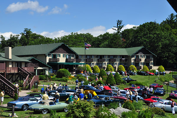
Photo - View of the grounds at the Switzerland Inn

The Switzerland Inn - A beautiful Resort on the Blue Ridge Parkway

The Switzerland Inn, located directly on the Blue Ridge Parkway at milepost 334  between North Carolina’s Mt. Mitchell (tallest peak east of the Rockies) and Grandfather Mountain with it’s mile high swinging bridge, is perfect for overnight stops while traveling the entire parkway, or a good multi day stop if motorcycle riders want to get off the Blue Ridge Parkway and ride some great local roads on your motorcycle vacation.

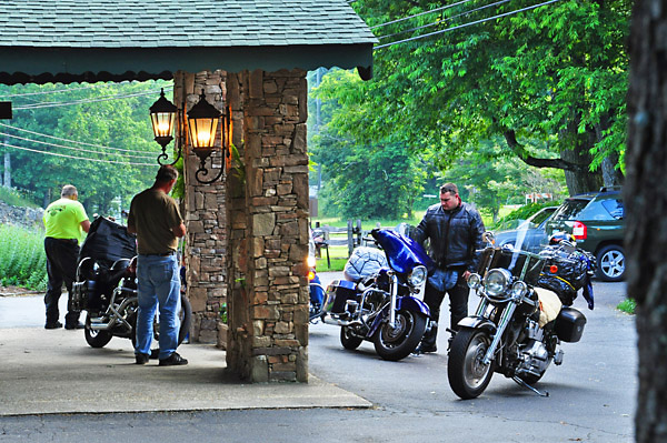
Photo - Always popular with motorcyclists.

Always popular with motorcyclists, the Switzerland Inn aims to please.

The Switzerland Inn provides a variety of accommodations, dining, and amenities as you plan your motorcycle vacation. If you’re traveling through and want a clean low cost room, the Diamondback motorcycle lodge is perfect ($65.00). If on the other hand a couple are traveling and want a comfortable suite with great mountain views, private balconies, etc. and wish to explore and enjoy the many relaxing and beautiful sights in the area, a luxury suite can be reserved ($180.00).

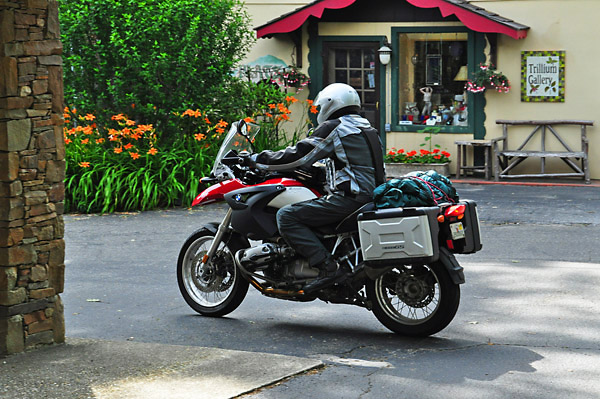
Photo - A rider heads out for a day of scenic riding

Ride hard all day, rest easy each night. Beauty surrounds wherever you are.

The Switzerland Inn is a full service resort with two restaurants, two bars, hot tubs, pool, concierge service for fishing, horseback riding, golf, whatever a guest needs or wants while on vacation in the mountains.  They have covered bike parking, motorcycle rentals, airport service, and motorcycle tour guides if needed.

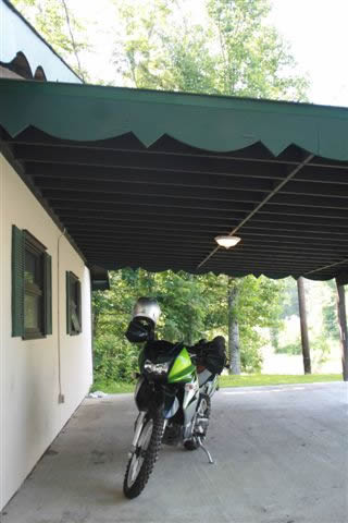
Photo - Covered Parking for your bike

Of course, there is covered parking for your bike.

Gary and his wife are both avid riders with a garage full of toys, so they know just how to cater to the motorcyclist traveling through the region. Popular over the years with both sports cars and motorcycles who come to enjoy such unique and challenging roads as “The Diamondback” (NC 226A), the Blue Ridge Parkway, and other notable and challenging roads nearby, The Switzerland Inn has something to offer everyone.

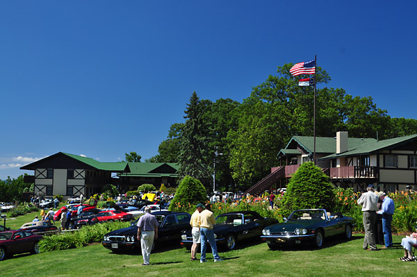
Photo - View of the Switzerland Inn

A spectacular setting popular with car clubs and motorcyclists

Learn more and make your travel arrangements at: http://www.switzerlandinn.com

Smoky Mountain Motorcycle Vacation Touring – Rider’s Roost

Rider’s Roost Motorcycle Resort & Campground is located not far from Boone, NC, near the midpoint of the Blue Ridge Parkway. It offers the motorcycle touring rider an affordable and comfortable place to bed down for the night, whether it’s in a tent or rental cabin. It’s an exclusively motorcycle resort so you won’t be dealing with blaring RV generators or throngs of kids running through your camp, and it could make a great place to spend part of your motorcycle vacation.

It’s more than just another motorcycle campground, for some it’s a must stop touring destination. Comedy nights, pig roasts, live entertainment, a central pavilion with a game room offer lots of ways to shake the kinks out after a day on the great roads in the surrounding area. Take a dip in the river or just settle down to watch the sunset, get into touch with home via wifi.

It just off NC221, and while I haven’t stayed there yet, it’s been highly recommended. I’m planning to visit next time I’m staying up that way on my motorcycle tours. Texas Ron has a nice testimonial in one of his blog posts –

“Riders Roost was a great Bike Campground, No cages, no kids, no hassles. Uncle Roy and Mary really know how to take care of “motorcycle pilots”. “The Road goes on forever and the party never ends.” I think that’s the Roosts motto or it should be. There’s a perfect little river that runs through the camp ground and in the rocks is a place that is like natures recliners, complete with moss to scratch the back. The water temperature is cool but after riding all day in the sun and heat….man what a refreshing way to relax and wash the road off ya. Most gather at the party headquarters located under the pavilion/game room. There is a pool table and darts to keep one entertained. This is also where the midnight auction is held too. What a way to start an adventure.”
http://texasron.u.yuku.com/blog/post/id/185

Get more info at the Riders Roost web site at http://www.ridersroost.com/


Wayne Busch - AMERICA RIDES MAPS

Wayne Busch – AMERICA RIDES MAPS

For the most detailed motorcycle ride maps of the area see http://americaridesmaps.com

It Doesn’t Get More Motorcycle Friendly Than This!

A lot of motels and lodgers CLAIM they are motorcycle friendly, even hang out a cute little sign. Few will show you hospitality like this and at a price that will have you inviting your buddies along! A Holiday Motel in Maggie Valley, North Carolina, only 5 miles from the best section of the Blue Ridge Parkway, stands out. Check out this video from last summer;


http://www.youtube.com/watch?v=zvUaArTyhOo

They are located in the heart of town, walking distance to restaurants and bars, have a restaurant on site for breakfast, offer covered parking for your bike right in front of your room and rocking chairs to sit and enjoy the view of the sunset reflecting off your chrome.

Add to that a bike wash area, grills and picnic tables, a fire pit, a pool, a horse shoe pit, clean rooms at surprisingly low prices, and personal attention and hospitality that goes beyond what you expect, nestled in the friendly mountains which line every horizon.

Don’t come alone! They’ll set up a tent for groups and cater your party, even bring out the big projection screen to watch your favorite movies.

Here’s what one visitor had to say –


http://www.youtube.com/watch?v=yGgsBURxBv4

I know Gabi and Rob personally and you’ve got my promise they’ll show you a great time and help you have one of the best motorcycle vacations ever. I wouldn’t be recommending them otherwise.

Rob & Gabi Edwards
A Holiday Motel – Your Preferred Lodging
828-926-1186
877-686-4386
www.holidaymotel.net

What’s The Best Section of the Blue Ridge Parkway?

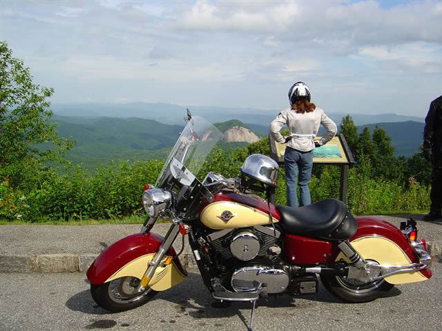
Photo - Admiring the view from the Looking Glass Rock overlook

Photo - Admiring the view from the Looking Glass Rock overlook

Easy question. It’s in North Carolina. I can almost see it from my window. I moved here to be close to it and enjoy it on my motorcycle. I know every twist and bump. The best section of the Blue Ridge Parkway with the best ride runs south from Asheville to Soco Gap near motorcycle friendly Maggie Valley.

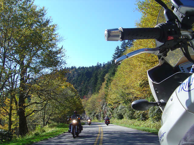
Photo - As falls comes so do the bikes

Photo - As falls comes so do the bikes on the Blue Ridge Parkway

Why is it the best? It’s the highest and most scenic section. There are more great pull-outs here than any other stretch. Most of it is above 5000 feet. It has everything motorcycle riders come for. Waterfalls, impressive rock formations, winding tunnels, pristine wilderness, vast stretches of rolling mountains on every horizon, and one of the best places to eat on the parkway, the Pisgah Inn. When I used to run  motorcycle tours through this section I‘d always figure about 4 hours to hit the highlights and sometimes it was a tight schedule. If you see only one section of the Blue Ridge Parkway, this should be it.

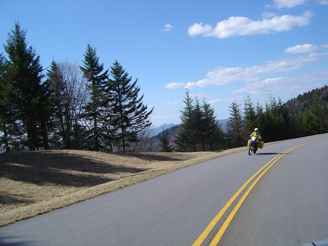
Photo - Early in the spring traffic is light and skies are clear

Early in the spring traffic is light and skies are clear on the Blue Ridge Parkway

Make this one of your prime destinations on your motorcycle vacation, but don’t limit yourself to the parkway while you’re here. You could spend weeks riding the fabulous roads which snake through the Smoky Mountains you see from those overlooks. They are packed with more waterfalls, scenery that will fill your camera, and some of the most challenging motorcycle roads you’ll ever ride.

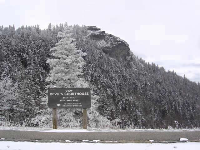
Photo - Devil's Courthouse snow covered in Winter

Spectacular Devil's Courthouse snow covered in winter

Impressive any time of year, I never take this section of the Blue Ridge Parkway for granted and visit almost every week. It never disappoints. It one of the most scenic motorcycle rides anywhere.

Blue Ridge Parkway On Ice – Photos / Video

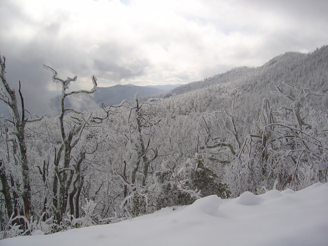
With all the snow and cold weather we’ve had this winter, riding the motorcycle has been only a dream. This afternoon, we headed up to the Blue Ridge Parkway to enjoy it in full winter glory.

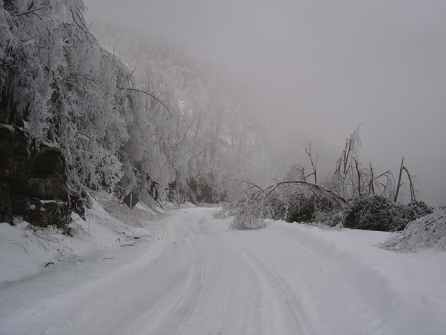
An ice storm hit last night. Damage was extensive.

While “Snowmageddon” hit Washington we were largely spared it’s fury in the high mountains of western North Carolina. We picked up a few more inches here and there to what was already a significant accumulation. What we did get with this storm was ice. You can see the trees bent over from the weight of it.

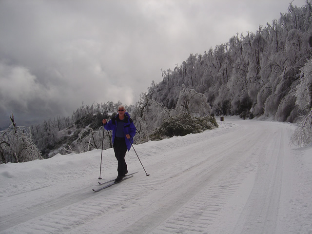
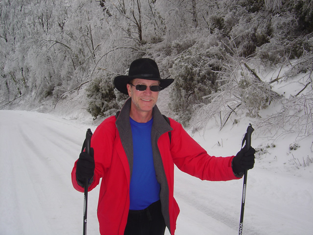
Photo - skiing the parkway

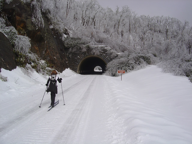
Cross country skiing on the highest sections of the Blue Ridge Parkway

For those of us who live here, the Blue Ridge Parkway becomes our winter playground when it closes for the colder season. This section has seen park service traffic to maintain a communications tower. It made for nice skiing.

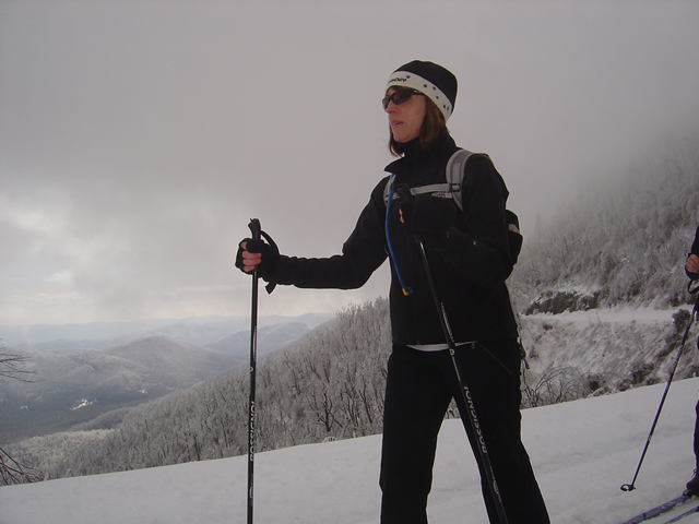
Jackie Skiing

When the snow is good, the skiing here is great

We started at Wagon Road Gap where US 276 and the Parkway meet at on of the highest crossings. From there, we headed east towards Asheville.

Ice was bringing down trees the whole time we were out.

The coating of rhyme ice, while beautiful, was causing extensive damage. The surroundings were filled with the almost constant sound of limbs and even entire trees breaking from the weight of the ice. Large branches lay everywhere. In places, every tree had been snapped and I saw none higher than about 12 feet, their tops broken off. A hike in the woods would be deadly.

Heavy ice coats and brings down surrounding trees.

We skied as far as the Pisgah Inn near Mount Pisgah passing through the Frying Pan Tunnel. Along the way we ran into a convoy of rangers hauling in equipment to repair the communications tower which must have been damaged by the storm or its aftermath.

Jackie approaches the Frying Pan Tunnel.

Being one of the highest and most rugged sections of the Blue Ridge Parkway, there are more tunnels in this area than any other. Most are not very long, like this one, though the majority are curved. This is a spectacular scenic area in summer. What a contrast and compliment in winter.

The group pauses to take off skis to walk through the tunnel.

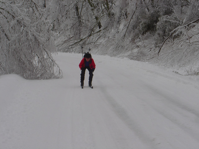
The nice thing about this route is it’s a very gentle climb from Wagon Road Gap to Mount Pisgah. Up hill on the way out, but downhill on the way back. Skiing takes on a whole new aspect when you change from uphill to downhill.

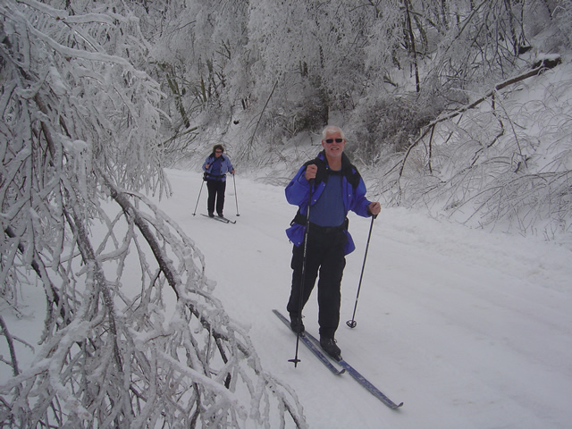
Wayne makes up some time on the downhill sections.

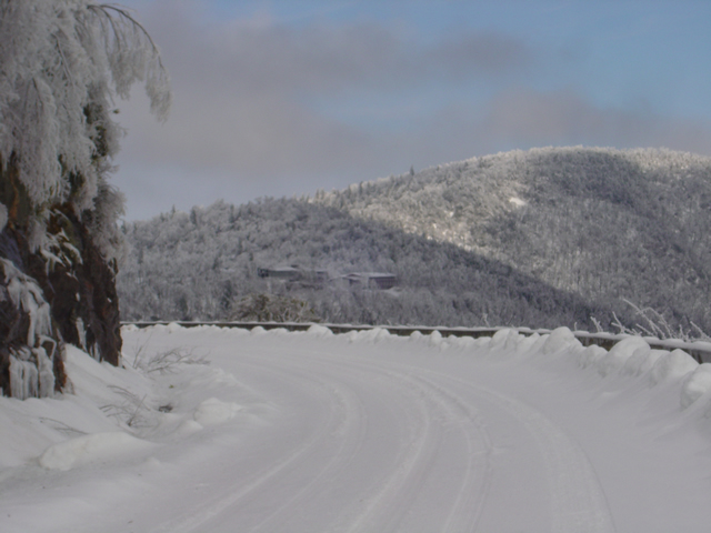
By the time we reached the Pisgah Inn it was shrouded in thick cloud and I couldn’t get any close up photos of it or Mt.Pisgah. The inn is closed of course, though the joke of the day was getting a beer and a meal once we reached it.

The Pisgah Inn seen from distance.

Few people ever see the Blue Ridge Parkway like this. It is admittedly a rare occurrence in recent times, at least until this year. Now it’s to the point we look at this a realize just how much snow has already melted and remember how deep it once was. We’ve not had ice like this though, and it will be spring before we realize just how much impact it had.

Wayne, the author,makes the most of a snowy winter

My wife shot some video of our excursion and posted it on You Tube. It really captures the scenery and the experience, and shows just how bad a skier I really am. Enjoy.

Planning Your Motorcycle Vacation Trip – What Will The Weather Be Like?

Photo - Rain clouds swirl over Waynesville, North Carolina

Rain clouds swirl over Waynesville, North Carolina

The weather on your motorcycle vacation trip will probably be better than you think or what the weatherman says, – or not. I swear that guy drinks. I know I would be hitting the old mason jar if I had his job. Predicting the weather in the Smoky Mountains is tough. Sometimes, there’s little question about taking that great ride. When there’s a massive front coming through or some system stalls for a while, you can pretty much go with what’s obvious.

In the Smoky Mountains each little valley has its own weather. It can pour down rain all day in one spot, ride your motorcycle over the hill, and the sun is shining. If I had a dollar for every time they’ve predicted rain and I’ve spent a dry day riding the great roads…

My advice – if there’s any question, get on the bike and go for it and always have some rain gear and a warm jacket or fleece in the bags. The highest elevations, like the Blue Ridge Parkway, see the most intense weather. If something’s going to happen it’s going to happen up high first. Coming down, or staying low when planning your motorcycle rides on the iffy days will often do the trick.

Weather also stalls when it hits the mountains and can’t quite make the climb over them. Try heading in the opposite direction and you can often avoid it. Bottom line, when planning your motorcycle vacation, be ready for anything.

Useful Web Resource:

One of the best resources for weather in North Carolina is Ray’s Weather site -http://www.raysweather.com/

True History – How The Blue Ridge Parkway Was Stolen

photo - view from Waterrock Knob, one of the highest sections in North Carolina

Morning clouds blanket the valleys in this view from Waterrock Knob in North Carolina

The concept of the Blue Ridge Parkway was to build a scenic connection between Shenandoah National Park in Virginia and Great Smoky Mountains National Park in North Carolina. Even before it was approved by Congress, controversy reigned over the route and clouded the possibility the nations favorite ride would ever be built.

There were strong proponents for building the scenic highway from three states – Virginia, North Carolina, and Tennessee. Originally, they more or less worked together to get the idea launched. Virginia’s route was fairly clear. It would course south from Shenandoah National Park following the highest ridges of the Smoky Mountains. The problem came on which way to go once the border with North Carolina was reached. Great Smoky Mountains National Park is divided right down the middle between Tennessee and North Carolina sharing equal portions in each state. In which state would the parkways southern end of this now classic ride reach Great Smoky Park?

Photo - a view of the Blue Ridge Parkway

Nothing in Tennessee can compare to the views from the North Carolina section of the Blue Ridge Parkway

Tennessee argued the route should be shared between the three states arriving on the north side of Great Smoky Mountains National Park about 40 miles south of Knoxville. North Carolina had different ideas, and a powerful lobby arose from the city of Asheville who wanted the road to pass near it. Reeling from the depression, Asheville felt it’s future relied on tourism and without the parkway, it would would not survive.

Two routes were laid out. North Carolina proposed following the highest passages through the tallest mountains in the east, a route which would not only maximize the views, but come right by Asheville. Tennessee chose a route further north which included both mountains and scenic valleys highlighting various features along the way. It would leave Asheville, the only city of size in the Carolina mountains, in isolation.

Right up to the last minute, it appeared the three state route would prevail. In the end though, it was the powerful and well connected proponents from Asheville who convinced the legislature to favor the route which avoided Tennessee entirely thereby stealing the road from Tennessee.

Riding the parkway it’s easy to see the right choice was made. The highest, most scenic and breathtaking views are found in the North Carolina sections both north and south of Asheville. What a different park we would have now had it been otherwise.

Great New Motorcycle Road Still Waits Completion

Ahh, fresh tarmac. I wasn’t long into the serpentine climb up the mountain I realized this road was better than I’d expected. It had taken an hour to get here, but then I didn’t take the fastest route. Instead, I took the fun route, revisiting some of my favorite and most enjoyable rides on the southeast course towards Franklin, North Carolina. Taking the highway doesn’t save that much time anyway. There is no direct route from Waynesville to Franklin through the mountains of western North Carolina. There are no direct routes anywhere. That’s what makes it motorcycle heaven. You’re not going to save much time taking the four lane, might as well take the back roads and enjoy the ride.

Photo - A view of Onion Mountain Road

A section of Onion Mountain Road which has been paved.

I’d already accepted the disappointment that Onion Mountain Road was not yet completed having passed the eastern end of it on my way down. I could only afford a quick glance at the junction while keeping focus through the screaming tight descending hairpin curve, but even a brief view was enough to reveal this end was not yet paved. Knee down, bike laid over on the edge of the tires, it was far more important to concentrate on just how much throttle to roll on coming out of the turn before I  jumped to the other side of the motorcycle and laid it into the next curve. I was having way too much fun to circle back, I’d check it out from the other end.

Photo - Where the pavement ends and the road beyond

2.1 miles in the pavement ends but the roadbed has been laid. The remaining portion should see asphalt with warmer spring weather.

Every time I ride through here I find myself thinking I don’t come this way often enough. These roads are stellar in quality,  some of the most challenging found anywhere. There’s rarely anything you could call traffic. Most travelers choose the “main” roads to pass through this rugged area of high peaks and forests leaving the back roads delightfully empty and welcome to enjoy at your own comfortable pace.

I turned west when I reached US 64 the principle east-west route through the area and headed towards Franklin, then turned north on 441 to make my approach to Onion Mountain Road and select the best connections. The detour and construction signs were still up, though obscured by black plastic now that the road was open to traffic again. Another hint the project was still in the works. While I’d hoped to find it completed, the road reports were cryptic in saying the road would be closed for paving until December.  Once the cold weather sets in, the asphalt plants shut down. Come spring, they’ll pull the plastic off the signs and resume work (I hope).

I assume the situation will be similar to the section of NC 281 which was paved last year and is now part of one of my favorite loop rides. They get as much done as they can preparing the roadbed before winter. When things warm enough, it’s fairly quick work to come back and lay down the asphalt. Judging by what they’ve done so far, it’s going to be eagerly awaited. It’s the prep work that takes the time, cutting into the embankments and filling the road, adding culverts and bridges where needed.

Photo - A view from the roadside.

The panoramic views are some of the best found in the area. They should get even better higher up.

Only 6.2 miles long, you might wonder why I’m so excited about this road. It’s isolated from any towns, just a remote section going from nowhere to nowhere else. Once fully paved, it will make a strategic connection between other great rides that will allow you to avoid the traffic on US 64 and open options to link them together, more ways to bypass the four lane highway and town traffic. There’s that, and then there’s the road itself. Making the climb up Onion Mountain is one beautiful arc after another. As you gain altitude the road frequently follows a narrow ridge dropping precipitously on both sides. The views, especially with the leaves off the trees are some of the best panoramic sights in the region.  It will be one of those roads where you pull over and take out the camera to remember it. When coupled with the other fabulous rides in the  surroundings,  it will be one you not only treasure but want to come back to and ride again.

2.1 miles of it are paved, then it abruptly turns to gravel. I didn’t ride it through, though I could see the 4.1 mile section remaining had been prepped. From the end of the paved section it continues to climb up the mountain and I expect the views will get even better. I’ll keep watching it for progress and make another visit in the spring. As soon as it’s ready, I’ll add it to the map of this area with the best connecting roads, probably another 15 miles of great riding for you to enjoy. With luck, it will be climbing the list of classic rides by summer and I’ll be frequenting the area more often.


Wayne Busch - AMERICA RIDES MAPS

Wayne Busch – AMERICA RIDES MAPS

Wayne@americaridesmaps.com

>> Go to America Rides Maps.comhttp://americaridesmaps.com

While Mapping Motorcycle Roads I Found the Andrews Geyser

I was passing through Old Fort, North Carolina the other day hoping to find a road I might have missed on one of my motorcycle mapping trips, when I came across the man-made Andrews Geyser. The wading pond was frozen, the spout encased in heavy ice, and the grass surrounding the pool was a huge sheet of bumpy rhyme.

Photo - Andrews Geyser encased in ice near Old Fort, NC

Andrews Geyser encased in ice near Old Fort, NC

The Geyser was built in 1880 as a tourist attraction and to commemorate those whole lost their lives building the railroad that climbed from Old fort to Swannanoa, then on to Asheville. Until that time, Old Fort was as far west as the railroad went. The 3 mile climb through the mountains required more than 12 miles of serpentine track and seven tunnels. More details at  (http://www.romanticasheville.com/old_fort.htm)

My explorations take me to the most unusual and scenic locations as I search out the best roads for my motorcycle maps. I’d passed the sign that directs you to the Geyser on the west end of town many times, but never ventured out to see it as the paved road does not make it all the way through the mountains. It’s a nice ride, but it doesn’t lead you anywhere else so it’s not on my motorcycle map of the area. Still, you won’t miss the signs.

If you’re passing through Old Fort on your way to reach those great two lane mountain roads nearby and have a little extra time, you might want to ride out and see the 80 ft. high plume. I got there late on the day when the temperatures never went much above freezing. Next time I visit, I hope it will be a little warmer.


Wayne Busch - AMERICA RIDES MAPS

Wayne Busch – AMERICA RIDES MAPS