Motorcycle Touring the Blue Ridge Parkway in One Day – What was it Like?

On Thursday I rode the Blue Ridge Parkway on my motorcycle from the start at Waynesboro, Virginia, 469 miles to the southern end at Great Smoky Mountains National Park in North Carolina. As I progressed I paused to snap photos and posted them on Facebook and Twitter. Here’s a recap of the experience;

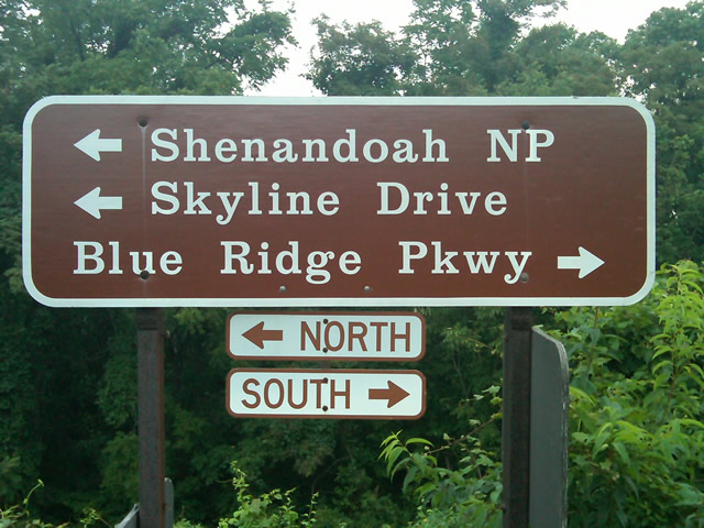
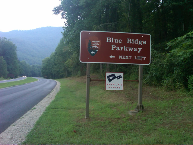
Photo - sign at start of Blue Ridge Parkway

The Blue Ridge Parkway starts where the Skyline Drive ends near Waynesboro, Virginia.

I chose to start at the north end as I knew I’d need to leave at daybreak. The morning fog has been so heavy at the southern end I didn’t want to chance it slowing me down or making for pictures of nothing but white mist. I spent the previous night in Richmond and left before 5 AM to make the 1 1/2 hour ride to Waynesboro in the darkness.
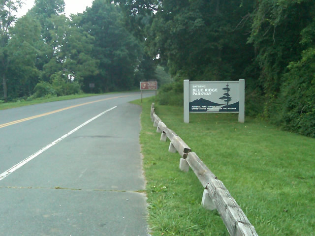
Photo - sign at the start of the Blue Ridge Parkway in Virginia

I took these photos the previous day as I expected it would be too dark to take them on the actual trip. I was right.

I fueled up in Waynesboro, grabbed a cup of coffee and a pack of doughnuts to sustain me, and headed on my way. It would be the last time I stopped to eat or drink. 469 miles is a long way at the 45 mph speed limit. I had no time to waste. At least that was my attitude early on.

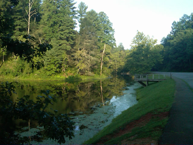
Photo - morning at the lake on Otter Creek

The sun comes up at the lake on Otter Creek. Easy ride so far.

I had the road to myself in the early morning twilight. Within a few minutes I’d seen both deer and turkey. The road starts a gradual climb to elevation here though nothing like the heights reached further south. With no other traffic on the road, my speed crept up a bit, something I’d fight the remainder of the trip. As you get comfortable and into the rhythm of the road, the temptation to take things at your more comfortable pace is always there taunting you. Knowing how far I had left to go didn’t help.
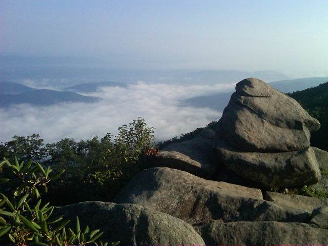
Photo - Above the clouds approaching Roanoke

I paused at this overlook to top up on oil, lube what was left of the chain, and take a few moments to savor the views I was rushing by.

I was also facing the challenge of not knowing if my chain would last the trip. It was already shot before I left, adjusted to the end of the swingarm, far beyond the normal limit. It now sagged precariously and was making noises that had me wondering when it would snap. I’d never seen a chain smoke when lubed before, and I took advantage of opportunities to slather it with lubricant whenever my concerns peaked. I prayed it would not jump the sprockets when carving through a turn and catapult me into a rock face or over a precipice.
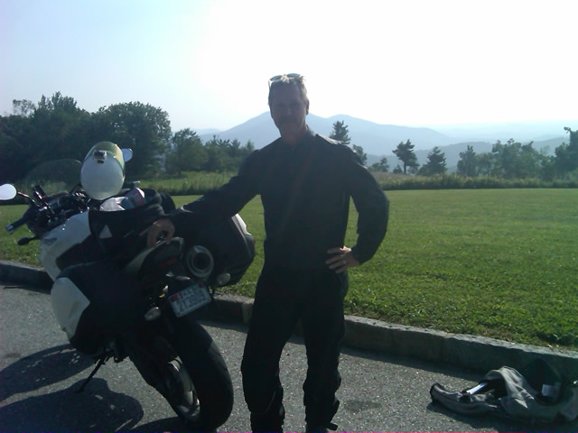
Photo - me and my bike along the Blue Ridge Parkway

A fellow biker snapped this photo of me at a rest stop. Riding from Florida to Maine and back, he and his wife were enjoying the parkway on their return.

Traffic remained surprisingly light through the morning with few holdups to pass slower vehicles. I watched the parkway wake up, the rangers and maintenance crews come to work and start their labors. Finding cell phone coverage to post my photos was always a challenge. You never know when it will be available, sometimes there in what looks like the most unlikely spots, other times absent where you think it should be a strong signal.
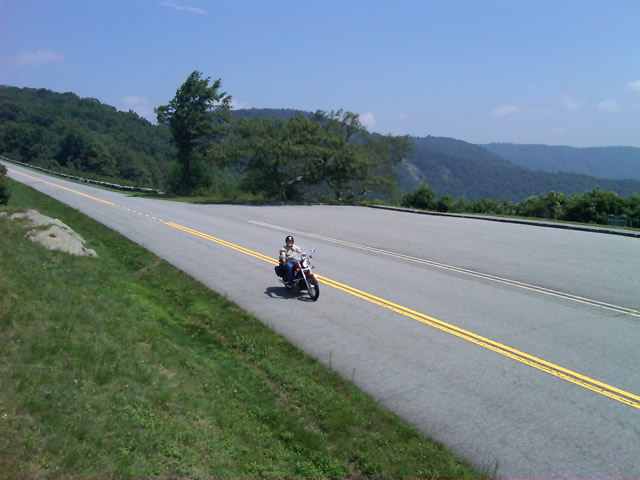
Photo - near Doughton Park

By mid morning there were plenty of other motorcycles on the road. This photo was taken somewhere near Doughton Park.

My first stop for gas necessitated a detour into Floyd, VA. Knowing where the nearest gas stations are is one reason I map the area so throughly. You can waste a lot of time looking for them if you don’t know which way to go. While in Floyd I popped in for a minute to see Derek at the Hotel Floyd, one of my favorite places to stay.

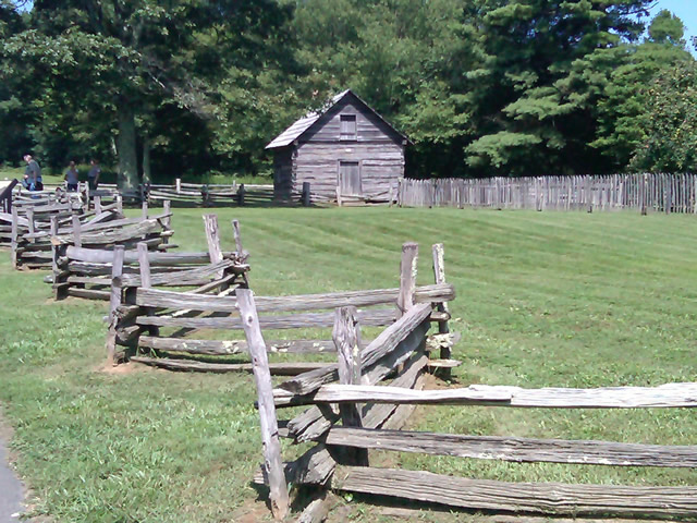
Photo - Historic cabin on the Blue Ridge Parkway

There are a few historic cabins along the road in southern Virginia.

As I crossed into North Carolina and entered the high mountains I knew cell phone coverage would be much more limited. The curves tightened up bit and the road was often wet from spotty showers. It would be another day with temps approaching near 100 in the valleys, but at elevation things remained tolerable so long as I was moving. I somehow avoided all but a slight peppering of rain which felt wonderful at the time.

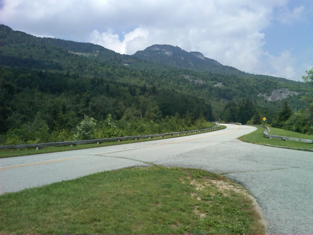
Photo - Grandfather Mountain

Passing Grandfather Mountain I felt I was back on home turf though still a long, long way to go.

Delays had been brief so far, and I planned my next fuel stop to coincide with a quick stop to say hello at the Switzerland Inn in Little Switzerland, one of my favorite places to eat or overnight. I fueled up in Spruce Pine. It was tempting to get a good meal, but I forced myself to press on. The real hold ups came as I approached Asheville. Tree crews and road construction caused significant delays and I hit the “commuter section” during evening rush hour.
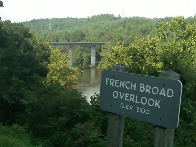
Photo - French Broad River Overlook

It was a great relief to finally cross the French Broad River southwest of Asheville and begin the climb to the highest and most scenic section of the Blue Ridge Parkway.

The sun was drawing near the horizon as I carved my way along the high ridge tops of the section of the Blue Ridge Parkway I consider my back yard. Thunderheads lurked and the road was wet in places, but my luck continued.
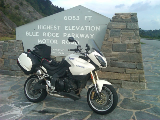
Photo - at the highest point on the Blue Ridge Parkway

Reaching the highest point on the Blue Ridge Parkway, I knew there was less than 40 miles to go to reach my goal.

I reached the southern end of the 469 mile ride with daylight to spare and took a pause at the Oconoluftee Visitor Center in Great Smoky Mountains National Park. I grabbed a few photos but found the battery was now dead on my cell phone. Here they are now –

Photo - start of the Blue Ridge Parkway in North Carolina

The Southern end of the Blue Ridge Parkway near the Oconoluftee Visitor Center.

While my Blue Ridge Parkway in a day adventure was completed, I still needed to get home. Noting the evening traffic, I chose to avoid going into Cherokee and got back on the Blue Ridge Parkway now headed in the opposite direction. I rode through to Soco Gap, then passed through Maggie Valley to finally get to my home in Waynesville.
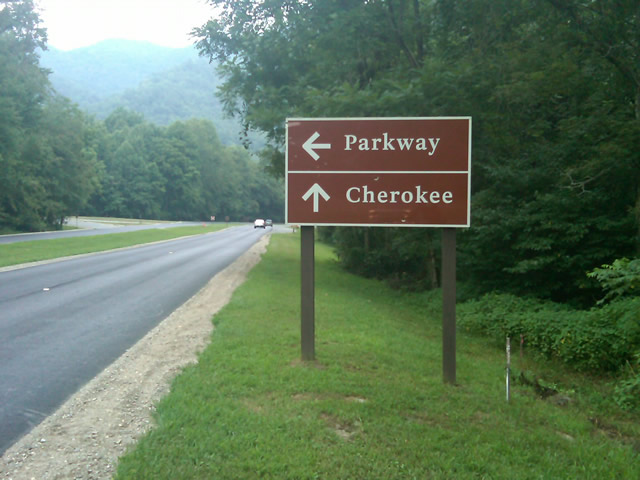
Photo - sign at the southern end of the Blue Ridge Parkway

Go through Cherokee or back the way I'd come? I chose to return home via the Blue Ridge Parkway of course.

My chain lasted the trip. My rear tire is bald. It’s time for some service on the engine. New parts are on order and it will take this week to get the bike roadworthy again. Next week? I might just poke into east Tennessee. I’ve too long ignored the area between Great Smoky Mountains National Park and Knoxville. If I can locate at least a dozen good rides there it will warrant a new motorcycle pocket map. I discovered some great roads along the Virginia / West Virginia border on this trip, several of which will be added to existing America Rides Maps. It will take a few more trips north to determine how the map of that region will lay out but it will come. For now, it’s catch up on the work I left, update the existing maps with the new rides I discovered, and make preparations for the roads ahead.

America Rides Maps on Facebook

America Rides Maps on Twitter

America Rides Maps – the best motorcycle pocket maps money can buy

_______________________________________________________________________________

Wayne Busch

Wayne Busch - Cartographer


– Wayne Busch lives in Waynesville, NC, where he produces the most detailed and comprehensive and up-to-date motorcycle pocket maps of the Blue Ridge and Smoky Mountains to help you get the most of your vacation experience. See them here – AmericaRidesMaps.com


Follow Me Thursday as I ride the Blue Ridge Parkway end-to-end in One Day

Image - Join Us on the Road to Adventure!

Follow my progress with hourly photo updates on Twitter and Facebook

To continue my celebration of mid-summer motorcycle madness, on Thursday I will get on the Blue Ridge Parkway in Waynesboro, Virginia, and ride it 469 miles through to the southern end at Great Smoky Mountains National Park near Cherokee, North Carolina.

As I go I will make hourly stops to tweet a photo and report on my progress so long as I have cell phone service.

Why not check my progress from time to time on Twitter – americaridesmap

and Facebook – facebook.com/americaridesmaps

I’m not trying to set a record or even establish a benchmark for someone to beat. The hourly stops will insure there is no record to speak of. Admittedly, it’s the worst way to experience the Blue Ridge Parkway, which should be done as slowly as possible with as many side trips as you can afford.

Still, curiosity has got the best of me, and I’ve never done it before nor heard of anyone doing it, so why not?

Follow along with me Thursday!

_______________________________________________________________________________

Wayne Busch

Wayne Busch - Cartographer


– Wayne Busch lives in Waynesville, NC, where he produces the most detailed and comprehensive and up-to-date motorcycle pocket maps of the Blue Ridge and Smoky Mountains to help you get the most of your vacation experience. See them here – AmericaRidesMaps.com
 

Blue Ridge Parkway Construction – Plan on Letting the Motorcycle Cool for a While

With the new paving done, I’ve been using the Blue Ridge Parkway more often for my motorcycle touring rides north. It’s actually about as quick as taking any other route if you’re heading for areas between Asheville and Boone, NC, and even if it takes a tad longer, it’s usually so much nicer to go that way. Today though, I hit it at the wrong time.

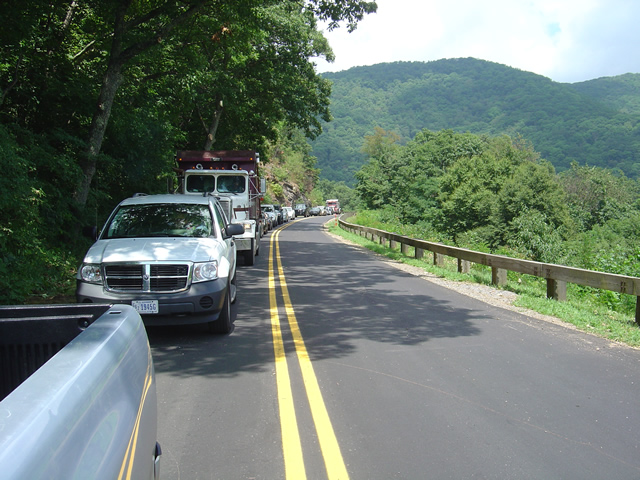
Photo - line of cars on the Blue Ridge Parkway

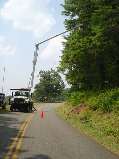
This line of cars much have stretched for a mile waiting on the tree clearing crews to let us pass.

I needed to make a run up to Craggy Gardens for a photo. If you’ve been to Craggy Gardens on your motorcycle vacation you know why it makes a good photo spot, if not, I can be confident you’ll stop there if you pass that way and take your own. It’s the first Visitor Center location north of Asheville, though it’s the views people come for, not the facilities.

I had expected the traffic from the work crews would be tapering off. I was proven wrong today and I’ll need to explore a bit further to find out why.  I just plain didn’t have the time this morning.  As soon as I got on the Blue Ridge Parkway in Asheville I found myself behind a dump truck. I was shortly joined by a string of motorcycle riders as we putted along behind said truck for creeping uphill mile after mile. Just as the truck managed to pick up speed it caught up to another.

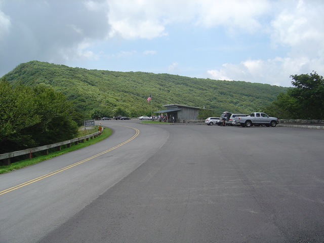
Photo - the Craggy Gardens Visitor Center on the Blue Ridge Parkway. Lots of parking, it's a popular stop.

The Craggy Gardens Visitor Center on the Blue Ridge Parkway

I don’t know where the trucks were headed, the last work I saw was near Mt. Mitchell State Park. If they are working on the stretch of road north of there, more power to them and I have no complaints. It needs some attention, though not as severely as that south of Craggy Gardens. The hold up today was the tree clearing crews. I waited for 1/2 and hour to pass. Must be the same slow crews which worked through Asheville last week.

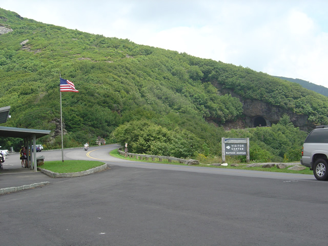
Photo - The Craggy Pinnacle Tunnel

I was looking for and got a nice photo at the Craggy Pinnacle Tunnel for a new "The Best Rides North and South of Asheville, NC" map cover.

Anyway, be aware there are still delays through this section and take it in stride on your motorcycle vacation plans. Spend a little more time at the overlooks, appreciate the improvements to the road, and remember there are  few places better to have to pause and wait. I’ll be at the north end of the Parkway in Virginia next week to update what’s going on there.

_______________________________________________________________________________

Wayne Busch

Wayne Busch - Cartographer


– Wayne Busch lives in Waynesville, NC, where he produces the most detailed and comprehensive and up-to-date motorcycle pocket maps of the Blue Ridge and Smoky Mountains to help you get the most of your vacation experience. See them here – AmericaRidesMaps.com
 

Good News / Bad News at Onion Mountain Road Near Franklin

Photo - work on Onion Mountain road

For a road that is going nowhere, they are doing a nice job of getting you there. Lets hope they find the funds to finish it this year.

On my way back from Georgia I decided to make a detour to investigate the progress on Onion Mountain Road east of Franklin, NC. This is one of my “pet” roads, one I’ve been watching ever since they started paving it last year. The work completed prior to the winter shut down really got my hopes up that this ridge top two lane would eventually be completely paved once warmer weather returned. The good news is the crews are back at it.

The bad news though, puts a damper on the whole situation. I was excited to follow a dump truck up the winding road, though a little dismayed to see the weight of the passing trucks was already damaging what had been an excellent paving job. Proceeding out onto the gravel section (no change from where  it had begun last year), I soon ran into the work crew. They have no expectation to complete the paving all the way through this year, funding has been cut. Why they are bothering with what they are doing is a mystery to me, it will be just another road to nowhere.

I’ll keep watching. Once paved, Onion Mountain Road will link a number a great motorcycle roads and allow you to avoid pretty but heavily trafficked US 64. I went ahead and added more of the surrounding roads to my America Rides Maps motorcycle pocket map “The Best Roads South of Great Smoky Mountains National Park – WEST” and am considering adding a few more once I give them another look. We’ll see how things develop.

_______________________________________________________________________________

Wayne Busch

Wayne Busch - Cartographer


– Wayne Busch lives in Waynesville, NC, where he produces the most detailed and comprehensive and up-to-date motorcycle pocket maps of the Blue Ridge and Smoky Mountains to help you get the most of your vacation experience. See them here – AmericaRidesMaps.com
 

Motorcycle Touring on the Blue Ridge Parkway – Doughton Park

Photo - Doughton Park facilities

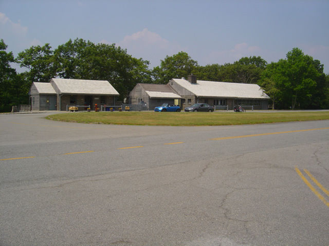
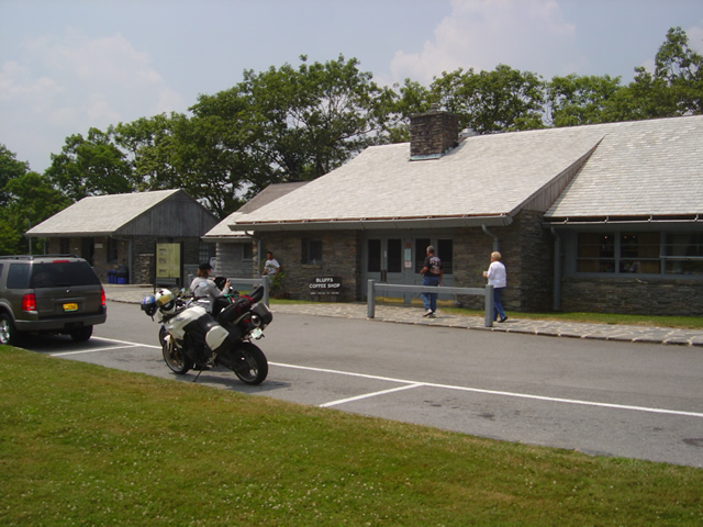
View of the Bluffs Restaurant and facilities on the Parkway

There are numerous places to stop as you cruise along the Blue Ridge Parkway from overlooks to attractions and places which offer concessions and lodging. I usually blow right past them preferring to find places off the Blue Ridge Parkway when I’m in need of something. On a recent pass through, Jackie’s lunch alarm was in the red zone so it was convenient to stop and check out Doughton Park. So what does it offer the motorcycle traveler?

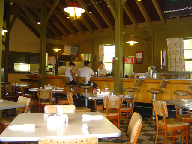
Photo - dining at Doughton Park

Simple and homestyle, the accommodations at the restaurant match the fare.

Doughton Park is located on the Blue Ridge Parkway between mileposts 238.5 and 244.7 as the scenic roadway gets ready to enter Virgina. It’s a 6000 acre tract of parkland featuring open meadows good for seeing critters in the early and late hours. Doughton Park also offers a lodge, a restaurant, picnic areas, a campground, trailer sites, and comfort stations. There are 30 miles or so of hiking trails here and some nice views of the surroundings, a couple historic cabins (pioneer cabins include the Brinegar Cabin (ca. 1885) and the one-room Caudill Cabin (ca. 1895)), and a few overlooks. Views are nice, but not as dramatic as found elsewhere. The facilities are located and milepost 241.1.

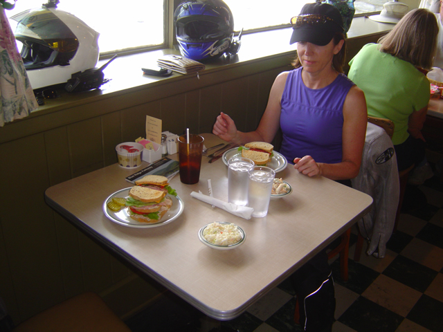
Photo - the sandwiches

Sandwiches reminded me of a visit to Grandma's. They were both good and ample.

We stopped for lunch so the Bluffs Restaurant was the focus of our visit. Food is served “family style” and reported to be “home style cooking”. With just one meal here, I can’t provide a review of the main meals. We ordered a couple sandwiches which were reminiscent of a visit to grandmas.  Nothing exotic, plain American yellow cheese, maybe it was our white haired server, but it sure dug up memories of what I remember from those childhood visits. I suppose it lands squarely in the “comfort food” category, and  honestly, I enjoyed the experience and it filled the hole quite well.

Photo of the Doughton Park Lodge buildings

A quick look at the Lodge then back on the road.

We rode over to look at the Lodge but I have not stayed there. From my experiences with stays at Parkway facilities, they are vintage, but well maintained. For the price, I prefer to look off the Parkway as I can usually stay some place nicer (like the Switzerland Inn at milepost 334). For a more rustic experience, Rocky Knob Cabins are located a milepost 174.

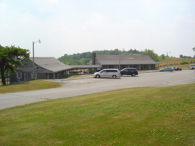
Photo of the restaurant at Doughton Park

Mid afternoon, we missed the lunch crowds. It's a good pit stop if you're trying to make time.

For your motorcycle vacation I’d categorize Doughton Park as a good pit stop. Use the facilities, get a quick meal, take a break. To really enjoy and get the full experience, the Lodge fits the bill though I’m not impressed enough at this point to label this a “must see” location on your motorcycle tour.

Blue Ridge Parkway
Doughton Park

Bluffs Lodge & Restaurant
Milepost 241
(336) 372-4499

Doughton Park is located on America Rides MapsNorth Carolina / Virginia Border Rides

_______________________________________________________________________________

Wayne Busch

Wayne Busch - Cartographer


– Wayne Busch lives in Waynesville, NC, where he produces the most detailed and comprehensive and up-to-date motorcycle pocket maps of the Blue Ridge and Smoky Mountains to help you get the most of your vacation experience. See them here – AmericaRidesMaps.com
 

Temporary Blue Ridge Parkway Closures in Asheville This Week – Suggestions

Photo - Detour sign on the Blue Ridge Parkway

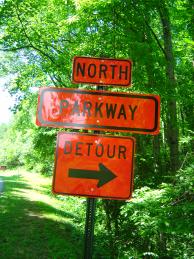
It's not a detour, it's an opportunity to explore!

Was it too good to be true? Finally, the Blue Ridge Parkway opens from end to end after 18 months of problems and here we go again – more closures to add spice to your motorcycle vacation. Parts of the “commuter section” of the Blue Ridge Parkway in Asheville will be closed this week as a tree trimming crew works it’s way north through the area from 8:30 AM to 3:30 PM each day. You’re not missing much in the way of motorcycle touring or scenery in this closed section. The Parkway is reaching its low point near the city to cross the French Broad River and there is little to see, though the park headquarters and visitor center are located here. It’s referred to as the “commuter section” as so many locals use the Parkway to skirt around the southeast side of the city and avoid the traffic.

The section where the closures will occur is between the NC 191 exit at MP 393 near the Arboretum on the southwest side of  Asheville to the US 70 Exit (a.k.a. Tunnel Road / Oteen) at milepost 383. The crew will start near 191 and work north. I’m not sure why they need to completely close down the road – I went through some pretty heavy tree work in Virginia and they were only holding up traffic as needed to do the trimming and clear the debris, nor are the trees in this section particularly close to or overhanging the road. Maybe they are planning to drop some of the big ones.

As for alternative routes, it’s going to be nearly impossible to avoid going through the city. I suggest you make the most of it and see what’s makes Asheville so much fun and unique. Of course you can just follow the detours and take I-40 as directed, though I try to avoid the US 70 exit and Tunnel Road – it’s congested and there are a lot of accidents in that area, though getting on the Interstate is not difficult. Nor is the 191 end of things all that attractive, but you gotta get through it. Consider taking a little extra time and getting off the Blue Ridge Parkway at the next exit north at Town Mountain Road.

Town Mountain Road is one of my suggested good rides. It’s nice and twisty, passes by the Grove Park Inn and Spa (drinks on the veranda anyone? Oh, so nice), then dumps you right in the heart of downtown. Passing through the city on your motorcycle tour gives you the opportunity to find some outstanding dining and discover why it won the “Beer City” award again this year at one of the numerous microbreweries. As there’s really so little to see on the closed section of the Blue Ridge Parkway, and so much to discover in Asheville, why not make the most of it? That way you’ll be ahead of the game for next years Asheville Bikefest and Blue Ridge Run and already know some of the hot spots.

Discover the thousands of miles of great motorcycle touring roads in the surrounding mountainsAmerica Rides Maps

Blue Ridge Parkway Motorcycle Road Construction Report / photos 7-14-10

Photo - stopped on the Blue Ridge Parkway

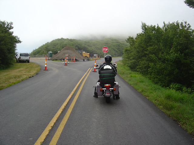
A short delay between Mt. Mitchell and Craggy Gardens near the roadwork.

I took a motorcycle ride through the North Carolina section of the Blue Ridge Parkway to confirm my suspicions this morning. Even with the heavy fog up high it was clear that the bulk of the Blue Ridge Parkway paving work in North Carolina has been completed. While work continues, the major roadwork between Asheville and Mt. Mitchell is done and you may expect smooth new pavement on your next motorcycle ride.

Photo - section of new Blue Ridge Parkway guardrail

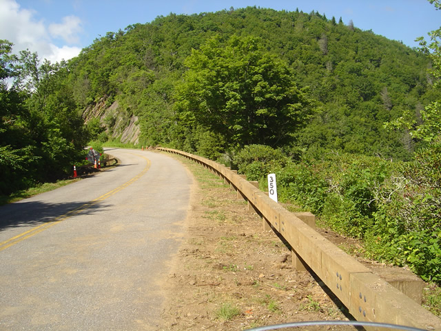
The new wooden guardrails are much heavier and a little higher than the ones they replace

The focus has now shifted to the margins of the road as the drainage is being cleaned and groomed, trees are being trimmed, and most significantly, new wooded guardrails are being installed. You will hit short delays when you come upon this work. North of Mt. Mitchell State Park you’ll still hit some bumpy areas of road. The worst of the pot holes are being filled and patched.

Photo - tree trimming on the Blue Ridge Parkway

The most extensive tree work is on the Virginia side of the border where much of the winter damage is yet to be removed.

Further north on the sections of the Blue Ridge Parkway near the North Carolina and Virginia border, you’ll still run into sections being paved, though nothing as extensive as what was done to the south.  On the Virginia side of the border, the paving is in short sections and along the edges of the road. I’m hoping this is just laying down a base for a fresh coat of pavement over the top as some of the patched areas dip lower than the untouched sections of road and you’ll notice the drop. I’m impressed with the stone work being done to construct the drains.

Photo - Clouds hug the tops of the black Mountains this morning

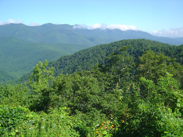
Take time to pause and look at the Black Mountains, some of the most rugged and beautiful peaks in the south. Clouds hugged the tops this morning.

Overall, delays are brief, you’ll hit more in Virginia right now, but the work that has been done was needed and welcome. No major changes at the rock slide area south of Asheville – one lane remains open controlled by a traffic signal.

Wayne from America Rides Maps

Home from Motorcycle Adventures in Virginia

Photo - Me at the pub at the Switzerland Inn

A cool brew at the pub at the Switzerland Inn last night. It was not the last of them.

We’re back from our brief three day trip north on the Blue Ridge Parkway. It was a semi-working trip in that Jackie tagged along. That changes the focus and the daily plans dramatically from my usual road-warrior approach. Even so, we accomplished a lot and I have a ton of new information to pass along.

I’ll get to it little by little as I now must catch up on the things left unattended. We added almost 50 miles of new roads to one of the maps (and I still have a few new motorcycle rides to go back and check into). I got a firsthand look at the construction and cleanup work on the Blue Ridge Parkway through North Carolina and Virginia and there’s some great news to relate. We found a wonderful place to stay in Virginia, the Hotel Floyd. I picked up a lot of new info to add to the maps. We found ourselves at the Switzerland Inn more than once and loved every minute of it. I shot a load of video to go through.

We braved the heat, wore out a tire, fought with the electronics, lost a headlight, dealt with a minor crisis at home, and generally had a great adventure. It will be the last with Jackie for a while as she returns to start a new job. I returned home to find the new printer on a pallet in the back of my truck (thanks Mom). It’s larger than expected and I’m not sure I can lift it. Office redesign and build new furniture ASAP.

So many things to do I’m making a list to prioritize. #1, take a few hours down time.

_______________________________________________________________________________

Wayne Busch

Wayne Busch - Cartographer


– Wayne Busch lives in Waynesville, NC, where he produces the most detailed and comprehensive and up-to-date motorcycle pocket maps of the Blue Ridge and Smoky Mountains to help you get the most of your vacation experience. See them here – AmericaRidesMaps.com
 

Blue Ridge Parkway Rockslide – Photos / Info – July 4, 2010

Photo - view of the rock slide

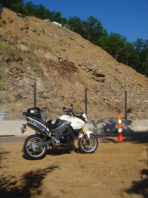
Once a steep hillside giving way, the rock slide is now being reshaped into a more gradual slope near milepost 400 on the Blue Ridge Parkway.

My July 4th holiday was one of those exquisite weekends with ideal weather, clear skies, and lots of time on the motorcycles. I managed to hit four states, rode several of the most notable routes, discovered some new rides, and treated my riding partners to at least one America Rides Maps road they’d never seen before that they will surely remember. While I touched the Blue Ridge Parkway several times, the holiday traffic took much of the fun out of it for me and I stuck mostly the little known hidden two lane mountain back roads I know so well. Finally, Monday evening, I rode up to view the newly opened section at the rock slide south of Asheville.

Photo - traffic waits on the parkway

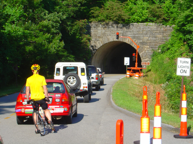
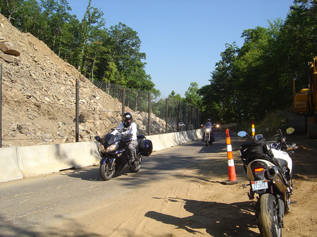
Waiting to go at Ferrin Knob Tunnel #1 south of the work area - A set of temporary traffic lights control passage through the single lane open at the site of the rock slide cleanup.

One lane is open at the Blue Ridge Parkway section near milepost 400 between Asheville and Mt. Pisgah. Passage is controlled by a set of temporary traffic lights on either side of the work area. They are programed to change about every 5 minutes so delays are tolerable though I’m sure the lines got pretty long during the peak of the weekend. Concrete barriers and a chain fence separate the tourists from the workers and prevent too many boulders from tumbling down onto the road.

Photo - the single open lane on the parkway

A concrete barrier and high fence help protect from boulders and debris which might come down from above. It's a short ride past.

They’ve removed one heck of a lot of rock from up high on what was previously a pretty vertical section of hillside. It now slopes more gradually, though there’s enough loose rock and soil above to make one hesitant to linger below. There’s still quite a bit to haul out and stabilize before the second lane is opened in September, but it will come.

photo- work zone near Buck Spring Tunnel

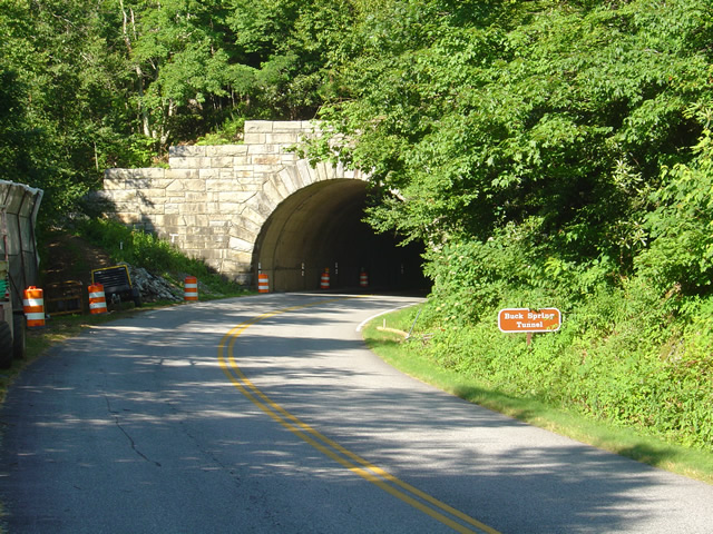
Another set of traffic lights is being used near work on the Buck Springs Tunnel just north of the Pisgah Inn.

There is a second work area at the Spring Gap Tunnel near milepost 408 just north of the Pisgah Inn. A set of temporary traffic lights also does duty here as the tunnel work progresses. It doesn’t appear to be too extensive and I wouldn’t think it will last long, but count on another delay.

This is great news, and I’m glad to see it finally come to pass. For the first time in more than 18 months the Parkway is open from end to 469 mile long end. Enjoy!

wayne@americaridesmaps.com

Last Blue Ridge Parkway Section Opens Friday – Personal Road Report

Photo - Blue Ridge Parkway barricade at NC 151

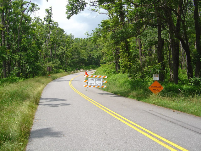
Blue Ridge Parkway barricade at NC 151 on the south side of the closed area.

For the first time in 18 months or more the entire 469 miles length of America’s favorite motorcycle ride, the Blue Ridge Parkway, will be open for travel. I’ve patiently watched and waited for this day, trying to sneak peeks at the progress on clearing the slide area near milepost 400 without success. Despite a grueling bicycle ride to make first hand observations, I was put off by the high fence and $5000 fine for trespassing, and have had to simply wait for the announcement. Work is still being done and there will be temporary traffic lights to manage traffic at a nearby tunnel.

Photo - fence near closed section of the Blue Ridge Parkway

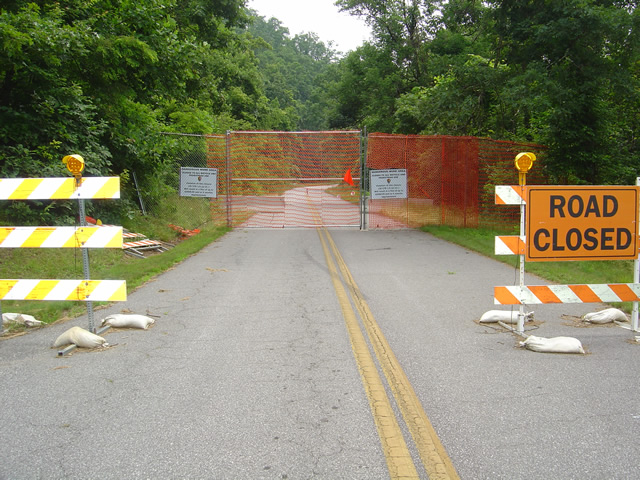
I was put off by the high fence and $5000 trespassing fine from getting a first hand look at the progress.

Work continues elsewhere on the Blue Ridge Parkway clearing the damage from one of the most severe winters on record. One of the worst hit areas near Linnville is now pristine again, an amazing job considering how badly it was affected. Ice and wind storms had covered the road with fallen trees and debris. Riding through now, you’d have to know what to look for to see evidence of the devastation now hidden by fresh summer greenery.

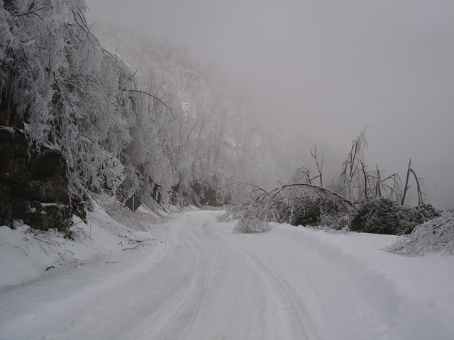
Photo - View of Blue Ridge Parkway with trees down from ice in February

View of Blue Ridge Parkway with trees down from ice in February

Paving continues between Mt. Mitchell State Park and Asheville, most concentrated near the Craggy Gardens area. The southbound lane is nearly completed and the quality of the new roadway is outstanding. You’ll hit a few delays and a mile or so of road that has been top-scraped in preparation for new asphalt. There are some rough sections and pot holes. The north bound lane still has a way to go and while the killer pot holes have been filled, the road is rough for many miles. It has also been prepped, but the pot holes are more numerous and it’s a bumpy ride.

Photo-section-of-the-Blue-Ridge-Parkway-damage-near-Linnville

The volume of trees down on the section of the Blue Ridge Parkway near Linnville was amazing. You wouldn't know it looked like this riding through now.

A recent hazard to be aware of is near Mt. Mitchell State Park where guardrail replacement is being done. A very slick sand is found in places near this work and motorcyclists should be vigilant and exercise caution. This video shows what to watch out for.

http://americaridesmaps.com The best Blue Ridge Parkway maps