Motorcycle Friendly Lodging – Maggie Valley, NC – The Chalet

Photo - Maggie-Valley-Chalet

Motorcycle Friendly Lodging at the Chalet

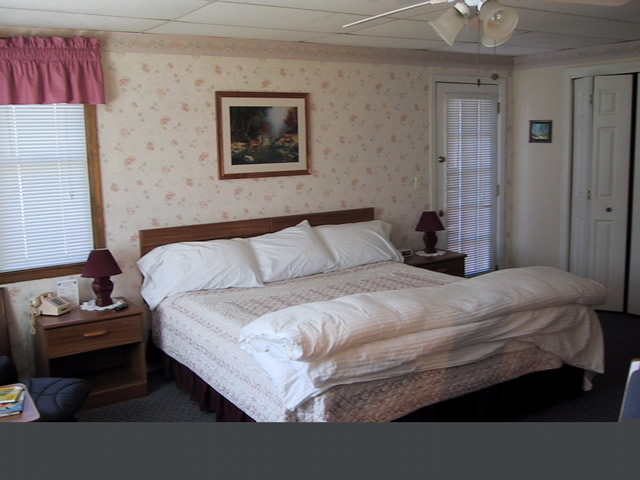
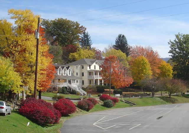
The Chalet in Maggie Valley offers a quiet off highway setting for all individuals, no matter the number of wheels, that desire spotless accommodations.

Photo-Maggie-Valley-Chalet

Private, secluded, secure, peaceful, and friendly - What more could you ask for?

We offer all paved easy access, plenty of trailer parking,  bike/car washing area, rag bucket,  and even some garage parking.Our location is secure and bikes are not visible to traveling public.

Photo-View-of-room-at-Maggie-Valley-Chalet

Now that's what I'm looking for at the end of a good day of riding!

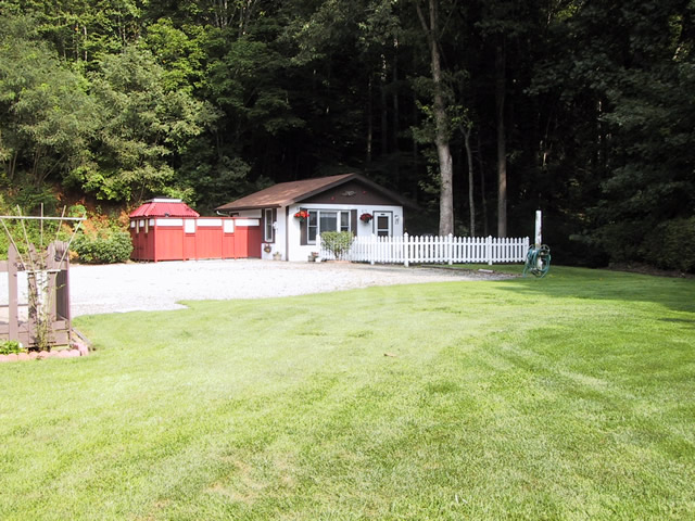
The vast lawn area with gas grills, horseshoe pit and enclosed hot tub is ideal for socializing.

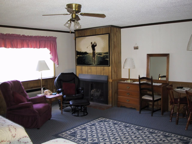
Photo-View-of-room-at-Maggie-Valley-Chalet

Comfortable, relaxing, all you need to feel at home

Our units are all studios or suites with kitchens excellent for small groups of up to 30. Most of our guest come back yearly to enjoy the comfortable accommodations we offer.

Photo-Facilities-at-Maggie-Valley-Chalet

They have all you need to make sure your bike has a nice stay too!

For more info contact http://www.mvchalet.com

50 Great Motorcycle Roads Near the Tail of the Dragon

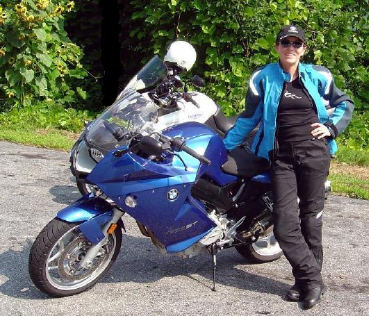
Photo - Jackie and her BMW

Even #1 Riding Partner, my wife Jackie (a.k.a. BMW Girl), has not ridden all the roads - yet!

I was wondering this morning just how many great motorcycle rides I’d discovered in the areas I’ve suggested as alternatives since the Tail of the Dragon at Deals Gap closed due to the recent rock slide.

So far, I’ve posted info about several areas;

Photo - Jackie rides

Does this bike make my butt look FAST?

I pulled out my America Rides Maps and starting counting. I hit 50 long before I got to the last maps that covered the great motorcycle riding areas I’d been describing. Closer to 70, probably more. I tried not to count rides where the road changes names along it’s course twice or even three times. It gets a little confusing, there are just so many.

Don’t let the rock slide at the Tail of the Dragon obstruct your motorcycle vacation planning. It could be a blessing in disguise. After all, Deals Gap is not known for it’s scenery, mountain views, waterfalls, or picturesque countryside. Imagine what waits just over the hill.

Visit  or contact http://americaridesmaps.com for more info.

Tail of the Dragon Closed – Great Rides Nearby – Hot Springs

No new info on the rock slide which has closed the Tail of the Dragon at Deals Gap. In a previous post I suggested some great rides nearby in the “Land of the Waterfalls” and provided a video sample. It’s just one great spot near the Tail of the Dragon with great motorcycle rides nearby, here’s another.

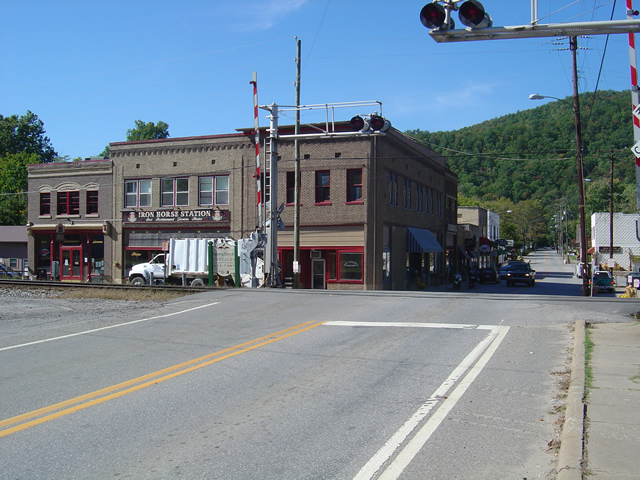
Photo - View of Hot Springs, NC

Hot Springs, NC - A town so small it fits on one photo.

This time I’m going to direct you to an area which sees little traffic, yet contains some fabulous and challenging motorcycle rides with some enjoyable sights and scenery. It’s an area most motorcycle tourists either drive right past on their way into the region or sample only the most notable road. Trust me, there is a lot there to explore and enjoy.

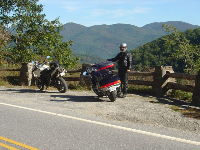
Photo - A roadside view near Hot Springs

Pausing to admire the view near Hot Springs, NC

I urge you to spend some time riding the great roads found in the mountains east of Great Smoky Mountains National Park. The Smoky Mountains do not end at the border of the park, in fact they continue their long run northward reaching their greatest heights north of Asheville, North Carolina at Mt. Mitchell, highest peak in the east just off the Blue Ridge Parkway. The mountains between the park and Mt. Mitchell are spectacular and beautiful, the valleys dotted with rural farms and tiny hamlets, sections of wild national forest, and roads which trace the serpentine courses of rushing mountain streams.

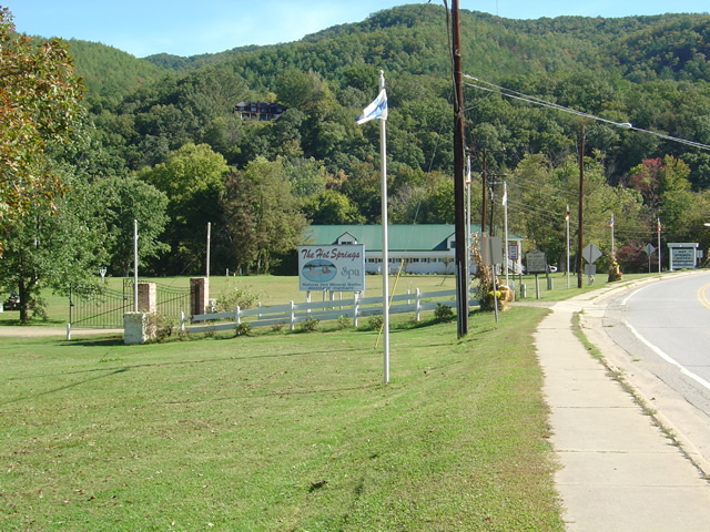
Photo - entrance to the Hot Springs Spa

Entrance to the Hot Springs Spa - Natural Mineral Baths and Massage

The hub of this great motorcycle riding area is the small and historic town of Hot Springs. It’s a good place to pause for lunch, do a little sightseeing, and maybe pay a visit to the natural hot springs which give the town its name. Long popular with hikers (the Appalachian Trail passes through town), fly fisherman, and whitewater rafters and kayakers on the French Broad River, it’s also a popular local motorcycle watering hole as it’s a convenient ride from Asheville.

Photo - French Broad River at Hot Springs

The French Broad River flows through Hot Springs

Honestly, there’s not a lot to the town. No traffic light. One gas station. A few shops and restaurants, a campground, and of course the Hot Springs Spa. You can capture the whole thing in a photo. It’s the roads and the beautiful countryside which surrounds that makes it worth the visit.

Photo - Iron Horse Station, Hot Springs

Iron Horse Station - One of several places to grab a bite and quench your thirst in Hot Springs.

If you take but one ride into the area, do the classic section of NC 209 which runs from Lake Junaluska to the heart of town. It’s such a nice ride. It takes about an hour one way. It’s a local classic. Be aware there is plenty more out there if you know where to look for it.

Photo - Fall Color at Lake Junaluska

One of the best rides, NC 209, starts near Lake Junaluska

I’ve been working on a video to showcase the area, though the severe winter pretty much closed the door on that for a long while. I’ll be getting back to it ASAP. Here’s the sample that gives you a good idea of what to expect:

http://www.youtube.com/watch?v=3hsCLMCIUOo

For more detail on the area look to America Rides Maps ” East of the Smokies, West of Asheville, All Around Hot Springs” map which catalogues about 400 miles of the best roads in this small area.

Don’t worry, there’s still more great riding alternatives to come in future posts. Closing the Tail of the Dragon opens the door to you discovering just how much you’ve been missing.

What’s The Best Section of the Blue Ridge Parkway?

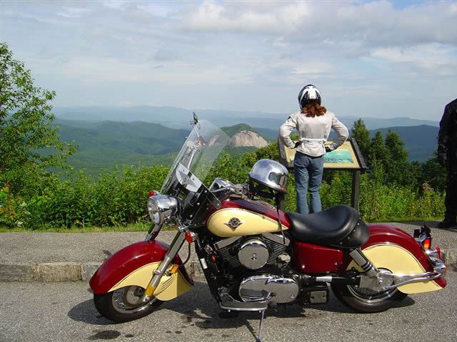
Photo - Admiring the view from the Looking Glass Rock overlook

Photo - Admiring the view from the Looking Glass Rock overlook

Easy question. It’s in North Carolina. I can almost see it from my window. I moved here to be close to it and enjoy it on my motorcycle. I know every twist and bump. The best section of the Blue Ridge Parkway with the best ride runs south from Asheville to Soco Gap near motorcycle friendly Maggie Valley.

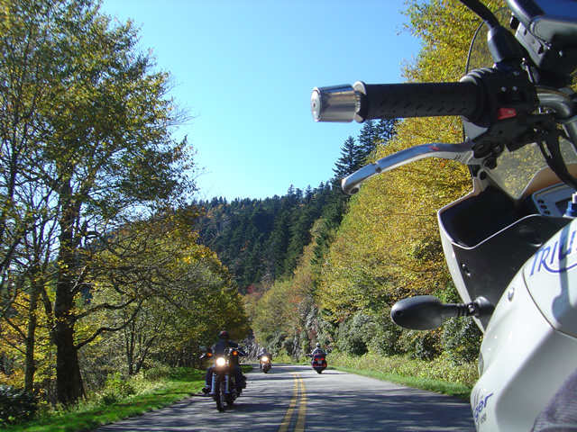
Photo - As falls comes so do the bikes

Photo - As falls comes so do the bikes on the Blue Ridge Parkway

Why is it the best? It’s the highest and most scenic section. There are more great pull-outs here than any other stretch. Most of it is above 5000 feet. It has everything motorcycle riders come for. Waterfalls, impressive rock formations, winding tunnels, pristine wilderness, vast stretches of rolling mountains on every horizon, and one of the best places to eat on the parkway, the Pisgah Inn. When I used to run  motorcycle tours through this section I‘d always figure about 4 hours to hit the highlights and sometimes it was a tight schedule. If you see only one section of the Blue Ridge Parkway, this should be it.

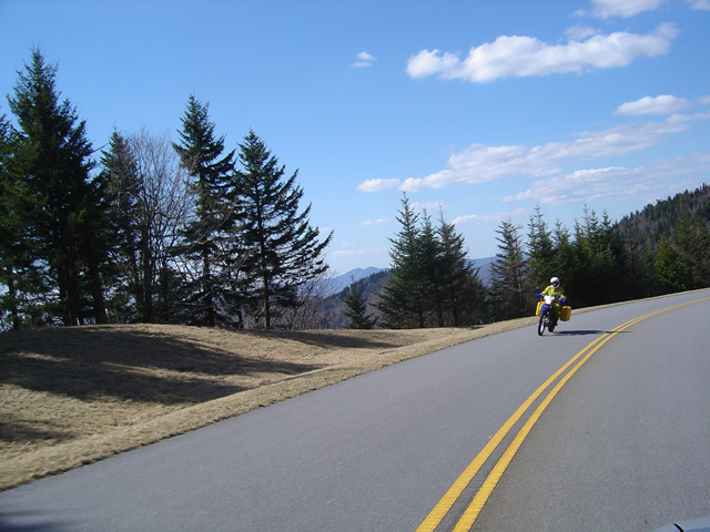
Photo - Early in the spring traffic is light and skies are clear

Early in the spring traffic is light and skies are clear on the Blue Ridge Parkway

Make this one of your prime destinations on your motorcycle vacation, but don’t limit yourself to the parkway while you’re here. You could spend weeks riding the fabulous roads which snake through the Smoky Mountains you see from those overlooks. They are packed with more waterfalls, scenery that will fill your camera, and some of the most challenging motorcycle roads you’ll ever ride.

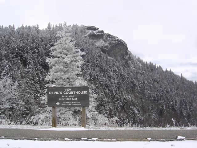
Photo - Devil's Courthouse snow covered in Winter

Spectacular Devil's Courthouse snow covered in winter

Impressive any time of year, I never take this section of the Blue Ridge Parkway for granted and visit almost every week. It never disappoints. It one of the most scenic motorcycle rides anywhere.

Can You Pass This Motorcycle Traffic Test?

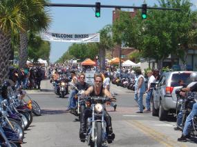
Photo - riding the crowds at the Leesburg, FL rally

Urban Warfare - Riding the Crowds at the Leesburg Rally in Florida

I grabbed this out of a post on the Motorcycle Enthusiasts Group on LinkedIn as it caught my eye. It’s an excerpt from the book “Sport Riding Techniques” by Nick Ienatsch which you can find on Amazon here . I own a coy of this book, it’s one of my favorite resources and one that will benefit any rider.

Traffic is rarely a problem on the great motorcycle roads in the Smoky Mountains, at least  the roads I favor. It’s hardly urban warfare, in fact it’s rare to see more than a handful of other vehicles. Still, the test is a pretty good judge of whether you will survive very long on a motorcycle.

How do you score on the test?

Title: Sport Riding Techniques
Author: Nick Ienatsch
Chapter 9: Urban Survival
Page: 105

Section: Should everyone ride a bike? No!

== START QUOTE ==

Frankly, some car drivers should never ride a motorcycle in traffic. I’m frequently asked by concerned parents/spouses if their loved one would be safe riding a bike in traffic, and judging a driver’s habits in a car helps to gauge his or her risk on a bike. Apply this test to any driver who wants to become a rider:

1. Are you always being encroached upon by other drivers? If so, you’re driving in too many blind spots and are unaware of how to drive in someone’s mirrors.

2. Do you honk your horn daily just to survive? Your horn should be your last line of evense. If you constantly rely on it to get through traffic safely, you aren’t reading traffic patterns well, and you’re in the wrong place – – probably in someone else’s blind spot.

3. Is every other driver on the road out to get you? It’s okay to think they’re out to get you, but drivers who really believe it drive in a timid manner. They don’t maintain their place in the flow of traffic, and are constantly taken advantage of by more aggressive drivers.

4. Does stopped traffic frequently surprise you, forcing you to brake hard every time you drive? If so, your eyes are too low and you aren’t looking far enough ahead of your car.

5. Do you have trouble accelerating onto a freeway to merge smoothly with traffic? You won’t survive on a motorcycle without a good deal of aggression and an ability to fit into traffic smoothly.

6. Are you honked at often? Drivers who get honked at usually aren’t paying attention, are daydreaming at traffic lights, or are changing lanes without looking or signaling. If you can’t stay totally focused on your driving, don’t try riding.

7. Are you constantly the recipient of road rage? Drivers get angry when their safety is threatened, and recipients of road rage are often doing something that distorts the normal flow of traffic badly enough to endanger lives.

8. Do you drive below the posted speed limit for safety? Those who do have no idea of how traffic really flows and are confusing speed with safety, a mistake that will have tough consequences on a motorcycle.

9. Do you neglect your turn signal switch? Communicating with other drivers reduces surprises, and your turn signal is a primary source of communication. If you don’t use it in your car, you aren’t truly working with traffic around you.

10. Do you believe everyone on the road is crazy and that it’s only a matter of time before one of these crazy drivers hits you? If you feel accidents are inevitable and your turn is coming, stay in that Volvo station wagon.

If you answered yes to one or two questions, you might be trainable. If you answered yes to more than a few, you may not enjoy or survive a motorcycle in traffic. It’s okay to be paranoid and believe that everyone on the road is poorly trained, but if that outlook distracts you from what you’re doing at the handlebar, then you must realign your priorities to quit worrying about aspects you can’t control and totally master those you can.

== END QUOTE ==

Posted by Chris Hultberg
Re -Posted by Tony (C. Anthony) Ladt

Thanks for posting this guys. I’m going to pull out the book this weekend and enjoy it again.

Planning Your Motorcycle Vacation Trip – What Will The Weather Be Like?

Photo - Rain clouds swirl over Waynesville, North Carolina

Rain clouds swirl over Waynesville, North Carolina

The weather on your motorcycle vacation trip will probably be better than you think or what the weatherman says, – or not. I swear that guy drinks. I know I would be hitting the old mason jar if I had his job. Predicting the weather in the Smoky Mountains is tough. Sometimes, there’s little question about taking that great ride. When there’s a massive front coming through or some system stalls for a while, you can pretty much go with what’s obvious.

In the Smoky Mountains each little valley has its own weather. It can pour down rain all day in one spot, ride your motorcycle over the hill, and the sun is shining. If I had a dollar for every time they’ve predicted rain and I’ve spent a dry day riding the great roads…

My advice – if there’s any question, get on the bike and go for it and always have some rain gear and a warm jacket or fleece in the bags. The highest elevations, like the Blue Ridge Parkway, see the most intense weather. If something’s going to happen it’s going to happen up high first. Coming down, or staying low when planning your motorcycle rides on the iffy days will often do the trick.

Weather also stalls when it hits the mountains and can’t quite make the climb over them. Try heading in the opposite direction and you can often avoid it. Bottom line, when planning your motorcycle vacation, be ready for anything.

Useful Web Resource:

One of the best resources for weather in North Carolina is Ray’s Weather site -http://www.raysweather.com/

Press Release: New Blue Ridge Parkway Series of Maps Released

FOR IMMEDIATE RELEASE:

New Blue Ridge Parkway Series of Maps Released

America Rides Maps has just released a new series of motorcycle pocket maps based on the Blue Ridge Parkway which expand the great mountain riding to more than 3000 miles.

Waynesville, North Carolina, USA – October 30, 2009

America Rides Maps now has complete end-to-end coverage of the 469 mile long Blue Ridge Parkway and every great mountain ride in the surroundings! More than 3 years of research and exploration and tens of thousands of miles spent on the motorcycle personally riding, selecting, judging, and cataloging every paved road which connects to and is adjacent to the nations favorite scenic ride are now available in a 7 map package. Designed and created for and by motorcyclists, field tested and proven, these pocket maps are unlike anything else available and are an unparalleled bargain at the $30.00 package price.

Each year millions make the ride down the scenic Blue Ridge Parkway which traces the highest mountain ridges in Virginia and North Carolina from it’s starting point near Shenandoah National Park just outside Waynesboro, Virginia, to it’s southern end at Great Smoky Mountains National Park near Cherokee, North Carolina. Along the way are spectacular views from high mountain overlooks, historic sites, and rugged natural beauty that has endeared the Blue Ridge Parkway as a national treasure.

America Rides Maps expands this 469 mile park ride to encompass the surrounding mountains highlighting more than 3000 miles of the most enjoyable paved two lane mountain back roads in the country. Designed to be accessible and easy to read, the maps fold simply, fit in a pocket, and highlight the kinds of information motorcyclists desire which other parkway-specific maps lack. They overlap and connect, are numbered in sequence from north to south, and provide such important features as the locations of reliable gas stations, distances between roads and exits, locations of significant attractions as well as all other connecting roads, cities, parks, and items of note to the traveling motorcyclist.

As nice as the ride on the Blue Ridge Parkway is, it provides only a fraction of the wealth of scenic, historic, and rewarding sights found in the surrounding rural mountains. With at least a dozen additional roads on each of the 7 maps selected for their challenge, beauty, and enjoyment, America Rides Maps reveals one of the best kept secrets – there is no greater concentration of fabulous motorcycle rides anywhere else in the nation.

I’d been coming here for more than 20 years and thought I knew of the best roads. It was only after I moved here and spent a few years in the area I realized how little I had discovered” says Wayne Busch, owner and creator of America Rides Maps.

Wayne lives only minutes from one of the most scenic sections of the parkway in Waynesville, North Carolina. A lifelong motorcyclist, he was always enamored with the great ride through the linear park and made frequent trips north from Florida to enjoy it and the surrounding mountains. Once he relocated to the mountains of western North Carolina, he discovered the parkway barely scratched the surface of the depth of great two lane mountain back roads found in the Smoky Mountains.

I met too many people, like me, who thought they knew the area. I’d mention my favorite roads only to find they’d never heard of them or had been driving right past them for years” he reports. In response, heI began making local maps to help people find them.

“I’d take the occasional job leading tours to help make ends meet, and they always went well – I knew the roads so I could tailor the rides as we went to just what my clients were looking for. It confirmed I knew what people liked”. Eventually, he decided to focus all his efforts on producing maps.

“I know what I don’t like about maps, and I am determined to make mine useful” says Busch. I tried a bunch of sizes before settling on pocket maps. Bigger maps are too hard to fold, tough to use in wind, it seems what you want is always on the other side, and they are never handy. They end up in the saddlebag which means you rarely use them. I designed my maps so you can whip them out at a stop sign, quickly find what you need, slip them back in your pocket, and keep moving. That’s the way I ride.”

It seems America Rides Maps is onto something. With a dozen maps in production and thousands sold through their on line store, business is growing while other map makers struggle in an age of GPS and the Internet. They don’t just show you where the roads are, any map does that. America Rides Maps shows you where the RIGHT roads are and highlights them from all the others. Just because it’s a squiggly line on a map doesn’t mean it’s a great ride. You never know until you actually ride it, and that’s what they do. There’s nothing else like them.

America Rides Maps
http://americaridesmaps.com/
706 Underwood Cove Road
Waynesville, North Carolina 28786
(828) 734-2164
Fax: 828-456-5243

Contact:
Wayne Busch / America Rides Maps
America Rides Maps
http://americaridesmaps.com/

wayne@americaridesmaps.com
706 Underwood Cove Road
Waynesville, North Carolina 28786
(828) 734-2164
Fax: 828-456-5243
###

Paving – Great Smoky Mountains National Park

The National Park Service is beginning an 18 month long project to repave 6.5 miles of Newfound Gap Road (US 441), the only road which crosses through Great Smoky Mountains National Park. The section to be repaved starts at the south boundary near Cherokee and climbs to the Collins Creek Picnic Area intersection. Last paved in 1983, the road is in sore need of attention.

Road closures on Newfound Gap Road are nothing new. Sections have required maintenance resulting in lane closures for years. It’s been a rare day when you can make an uninterrupted transit from Cherokee, NC to Gatlinburg, TN. While this is one of those “must do” rides to see the park, it’s never been one of my first choices for a days ride. If you’re not pausing for road maintenance, you’re crawling along behind some lumbering RV straining to make the climb or smoking his brakes on the way down. Considering the thousands of miles of fabulous empty mountain roads in the surrounding area I prefer to go elsewhere.

Still, to see the park you gotta do the ride. If you haven’t done it, it’s worth the time and effort. Fill up, pack a snack and some water, bring the camera, don’t have a deadline, and take the time to enjoy the views. There’s a reason it’s the most visited national park in the nation and it is the Park’s 75th anniversary this year.

Lane closures will be staggered to reduce the impact on traffic. The contractor may close up to four areas at a time with delays at each closure which may not exceed 10 minutes. The park has a toll free recording providing details on lane closures at (888) 355-1849.

If you haven’t done this ride, you should. It’s included in one of the four loop rides on America Rides Maps “Maggie Valley to Deals Gap and the Cherohala Skyway“. However, if you crave more deserted roads that not only give you wonderful scenery but a challenging ride, there are another 600 miles or so of routes on that map that will keep you carving through the curves and rolling along the back roads where RV’s, Grandpa, and van loads of kids never tread.