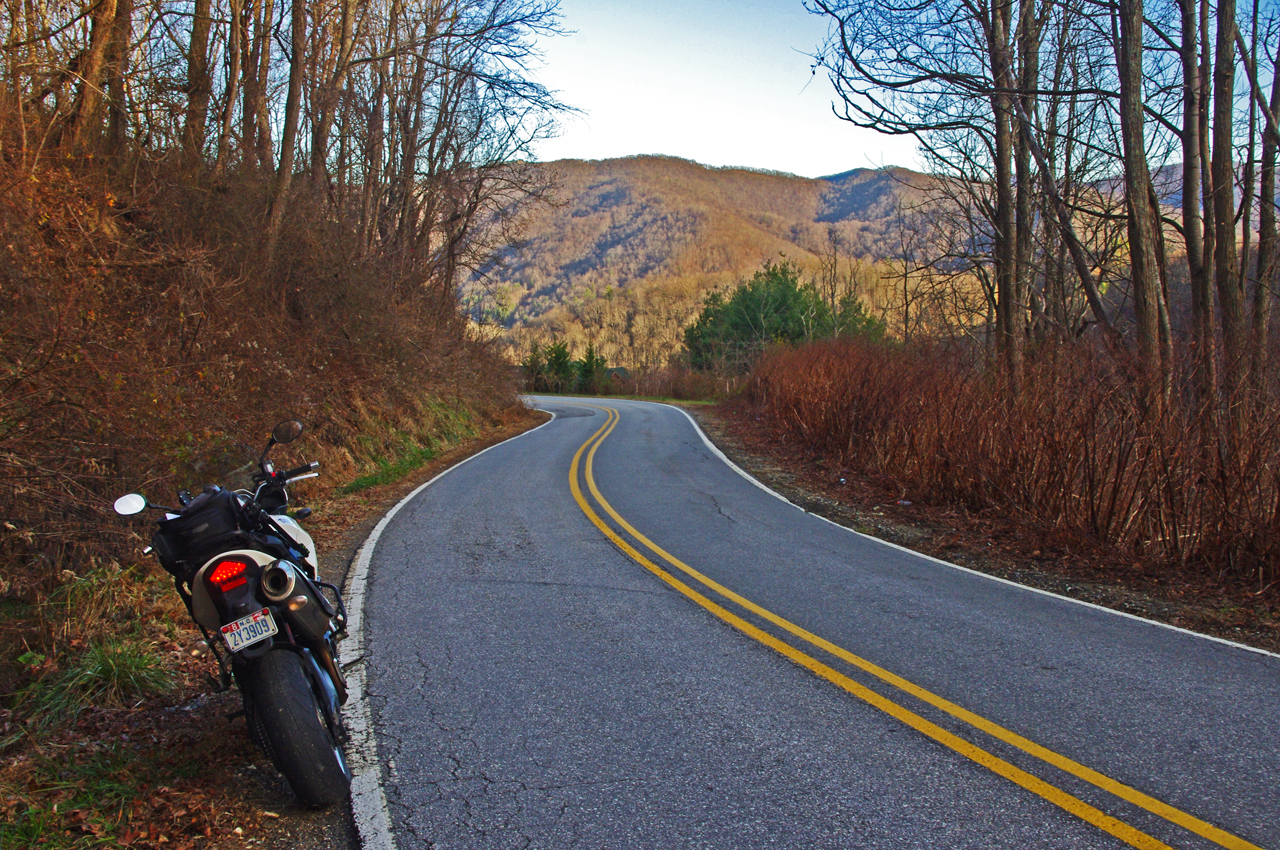
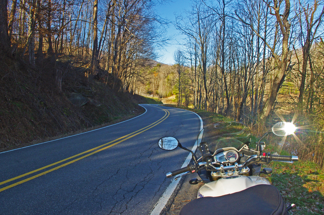
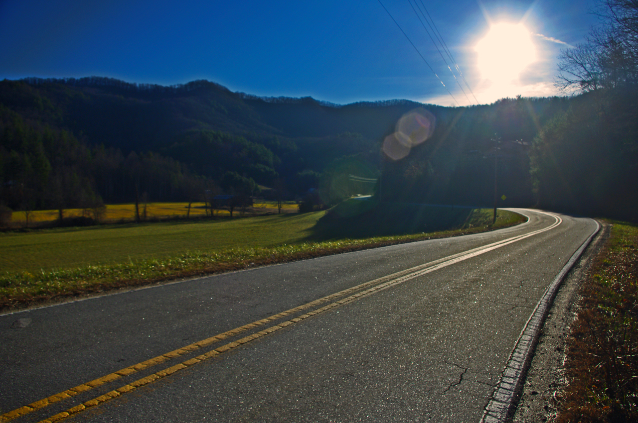
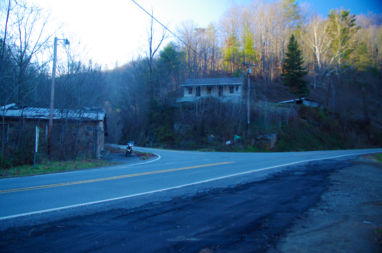
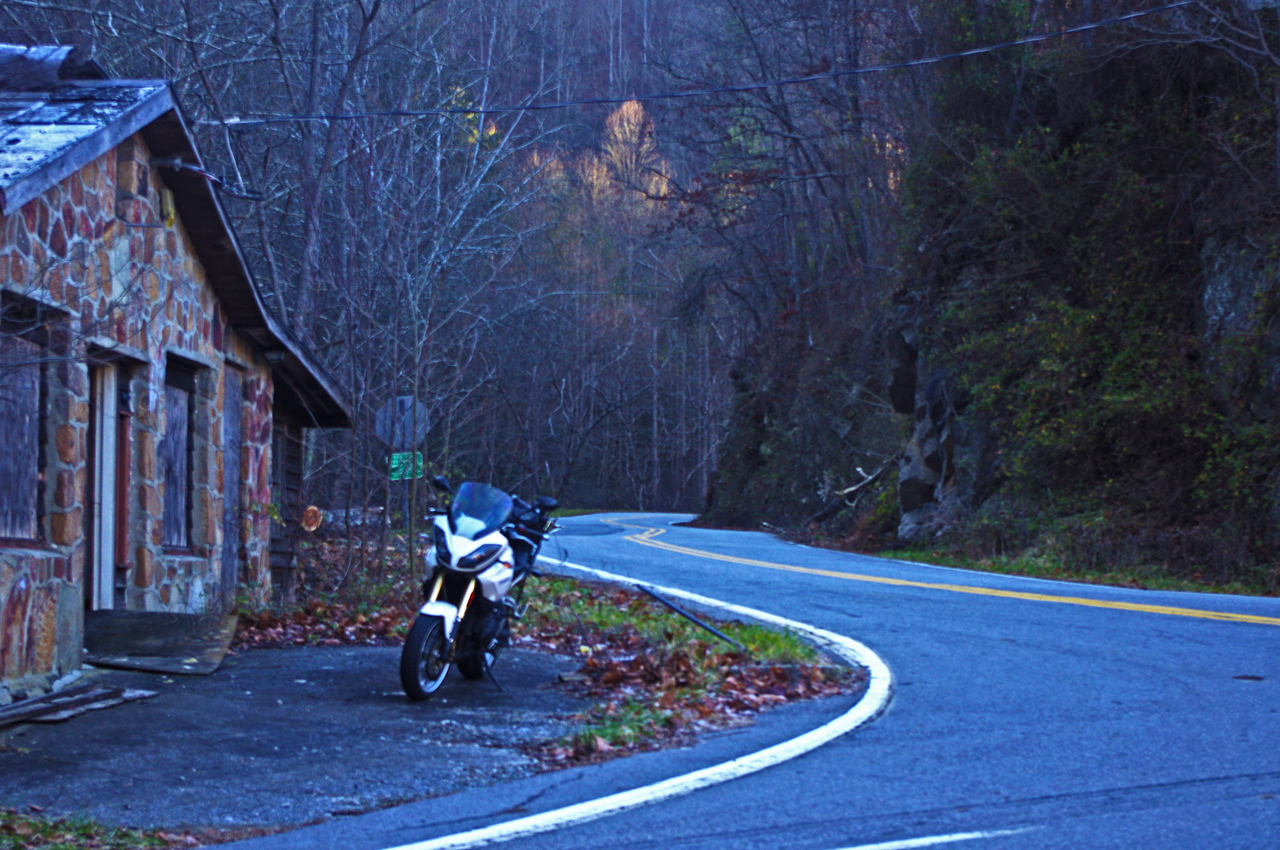
Wolf Creek Bridge TN US 25/74 Closure – Motorcycle Rides

Wayne’s Alternative Detour Rides for Motorcycles – a better biker road  that is shorter and more scenic than the TN DOT route  – with map

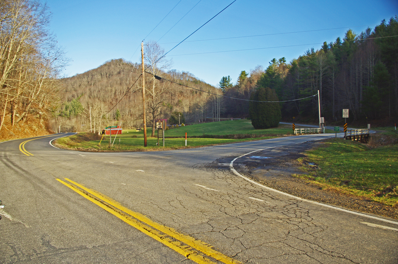
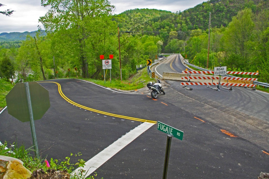
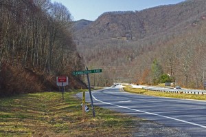
Photo-Wolf-Creek-Bridge-Junction

Ignore the signs and ride to the bridge. It's an easy detour and brand new pavement!.

It came out of the blue. Not one hour after I’d sent out my monthly road report of the best motorcycle rides in the Blue Ridge Mountains, I got an alert of the announcement – a 2 year long closure of the Wolf Creek Bridge near the Tennessee / North Carolina state line.
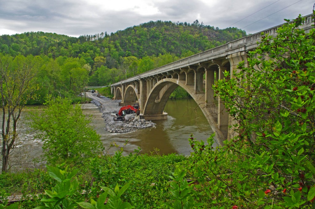
photo-wolf-creek-bridge

They don't make 'em like that anymore! Look at that beautiful 1928 architecture. The best thing about the detour is you get to see the bridge!

Honestly, US 25/70 ( TN Route 9 ) is not a road the majority of Blue Ridge motorcycle riders ever see unless you’re from Tennessee. It is a good way to get to some great motorcycle rides along the NC border. The bulk of the traffic now keeps to Interstate 40 to the west, so it doesn’t carry heavy traffic.

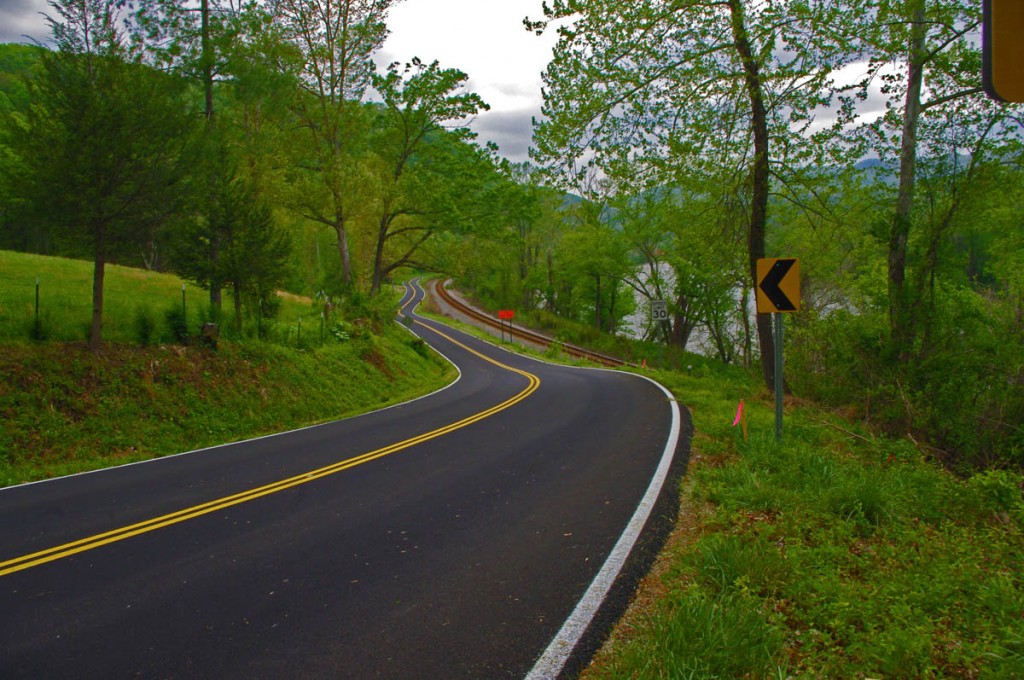
Photo-Fugate-Road

Fugate Road is freshly paved, winding, and narrow, squeezed between the river and the railroad.

Directions:

From Hot Springs –  Ignore the signs that tell of the road being closed ahead as you follow US 25/70 north of town and ride all the way to the closed bridge. Fugate Road is on the left. Follow it 4.8 miles until you reach TN 107. Turn right and follow to reconnect with US 25/70.

From Newport: Turn south on TN 107. Fugate Road will be on the left, turn left and follow it until you arrive at the Wolf Creek Bridge. Follow US 25/70 into Hot Springs, NC.
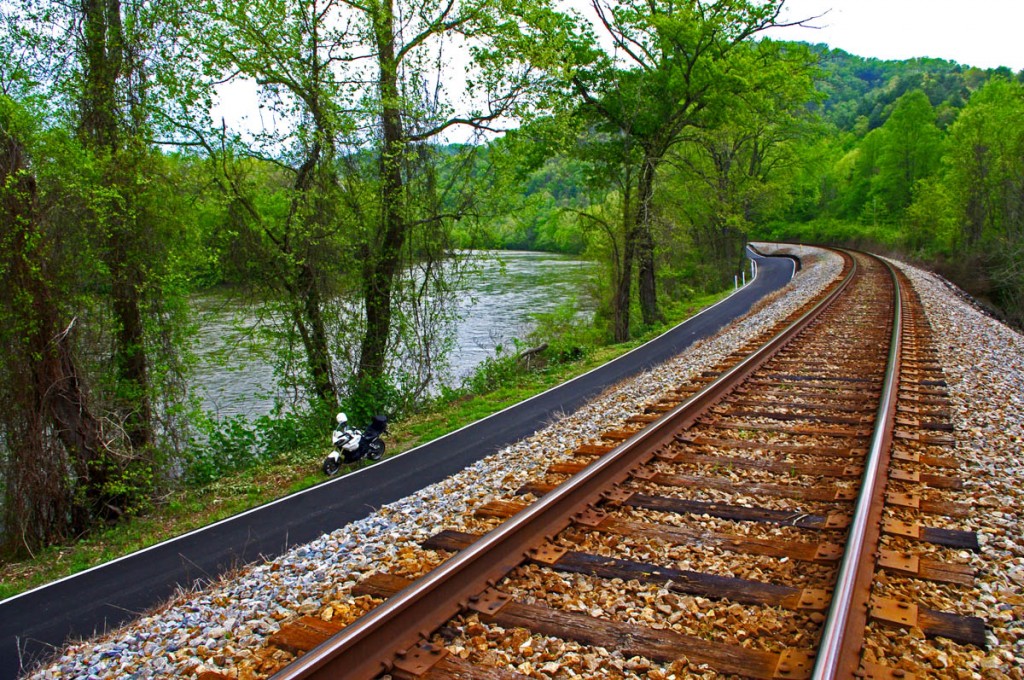
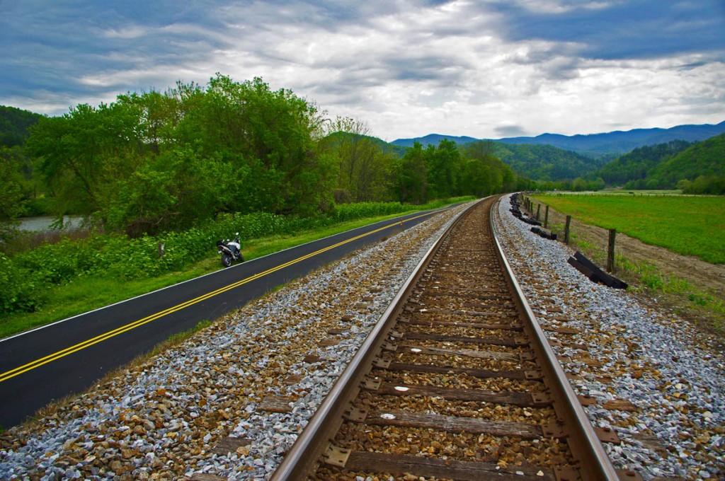
photo-Fugate-road

Squeezed between the river and the rail, Fugate Road gets too narrow for a painted line in a few places.

Fugate Road follows the railroad tracks along the French Broad River. Recently paved, half of Fugate Road is squeezed on an narrow strip between the water and the railroad tracks. At times it gets too narrow for a painted line and cars slow to sneak past one another. You cross the tracks in the middle of the ride and spend the rest of it married to the other side of the rails.

photo-fugate-road

River, road, and rail. Fugate Road makes a nice alternative detour for motorcycle riders.

Because it’s too narrow, big trucks can’t use this detour. Local and commuter traffic will quickly discover it, though most of the commercial and tourist traffic will be led to the longer official DOT detour route to the north. Fugate road should cut your detour time in half.

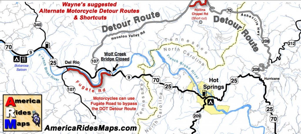
image-map-of-wolf-creek-bridge-detour

Click for larger view

If you do take the DOT recommend detour, you can use Rollins Chapel Road to take a short cut and save yourself a few miles.

__________________________________________________________________

Wayne Busch

Wayne Busch - Cartographer

Total Rider Tech Logo

Learn Total Control

– Wayne Busch lives in Waynesville, NC, where he produces the most detailed and comprehensive and up-to-date motorcycle pocket maps of the Blue Ridge and Smoky Mountains to help you get the most of your vacation experience. See them here – AmericaRidesMaps.com

Wayne is an advanced motorcycle instructor for Total Rider Tech teaching Lee Parks Total Control Advanced Rider Courses. Isn’t it time you looked into advanced rider training to ride more confidently and safely? It can transform your mountain riding experience.  Total Rider Tech

____________________________________________________________________

Good Motorcycle Rides near Waynesville and Maggie Valley, NC

The last place I want to be riding a motorcycle is the 4-lane highway when there are so many good 2 lane back roads in North Carolina.

photo-turn-onto-candlestick-lane

Turn off the highway onto Candlestick Lane

For most motorcycle riders, covering the distance between Waynesville and Sylva means a relatively pleasant ride on four lane divided NC Highway 74 (The Great Smoky Mountains Expressway). As far as highways go, it is a nice ride winding down from Balsam Mountain and it rarely gets enough traffic to be annoying.

Lately though, I’ve been covering the relatively short distance on a few nice little back roads which I’ve grown very fond of. Since so many motorcycle touring riders pass through and stay in this area, I think they should know about them. If you’re riding near Cherokee, Maggie Valley, Waynesville, or Sylva, these roads may come in handy.

photo-turn-onto-cabin-flats

Next turn onto Cabin Flats Road.

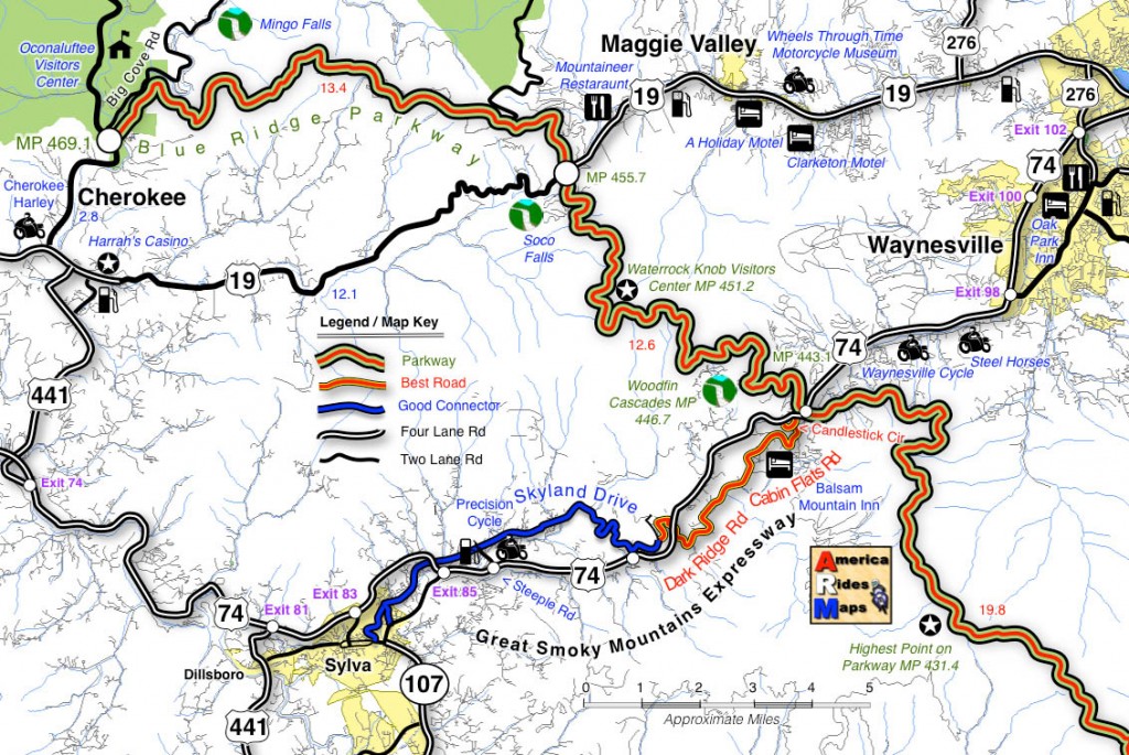
Both ends meet the Highway (US 74). The Waynesville end starts near the Blue Ridge Parkway Exit for Waynesville (MP 443.1) where it intersects US 74. Pass under the parkway then exit left onto Candlestick Lane. It’s an obvious intersection, well marked, look for the signs to Balsam, Balsam Mountain Inn, Moonshine Creek Campground.

Candlestick Circle is just a short loop off the highway, turn right onto Cabin Flats Rd. Cabin Flats Road winds along the railroad tracks a short distance, then makes a hairpin turn across them.  Balsam Mountain Inn sits on the hill above.

photo-balsam-mountain-inn

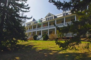
The Balsam Mountain Inn – historic, good food

It’s been a long while side I last visited, but the historic inn (1905) is both scenic and the food used to be very, very, good. You can imagine it’s heyday when it was a stop on the tracks in the middle of nowhere.

Cabin Flats Road will morph into Dark Ridge Road and start a twisting course alongside a stream through the mountain passes. The railroad also follows this narrow valley and you’ll often see it off in the woods crossing the stream on bridges and trestles.

photo-Dark-Ridge-Rd

Dark Ridge Road – more fun than the 4 lane

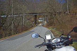
Dark Ridge Road, the railroad, the highway, and the stream cross each other several times on the way to Sylva in a twisted mountain mess. You go under the highway, under the railroad, over the stream several times on the ride.

Dark Ridge Road meets Skyland Road at a stop sign just after you cross the railroad tracks. Turn left (the road quickly peters out if you go right).

photo-trestle-on-skyland-rd

Under the tracks on Skyland Rd

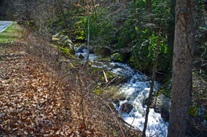
The first part of Skyland Road is nice and there are several good spots to stop and get a look at the now rushing whitewater stream.

The second half looses it’s appeal as it draws near Sylva and the suburbs of the town. You can follow the road all the way into Sylva. You may note the prominent fork right onto Chipper Curve Rd – it will bring you closer to downtown.

photo-creek

Whitewater Creek along Skyland Rd

You can hop on-off this ride at 2 points and get back on the highway. One of them is obvious, a mile or so after you get on Skyland Rd. The other, Steeple Road, is closer to Sylva and is the best way to get back on the highway without going into town. Precision Cycles and a BP station mark it at the highway.

map

Click on photos and map for larger views

__________________________________________________________________

Wayne Busch

Wayne Busch – Cartographer

Total Rider Tech Logo

Learn Total Control

– Wayne Busch lives in Waynesville, NC, where he produces the most detailed and comprehensive and up-to-date motorcycle pocket maps of the Blue Ridge and Smoky Mountains to help you get the most of your vacation experience. See them here – AmericaRidesMaps.com

Wayne is an advanced motorcycle instructor for Total Rider Tech teaching Lee Parks Total Control Advanced Rider Courses. Isn’t it time you looked into advanced rider training to ride more confidently and safely? It can transform your mountain riding experience.  Total Rider Tech

____________________________________________________________________
Motorcycle Riding on the Blue Ridge Parkway – in January?

I should be in Vegas – luck is with me today. Although the weather has been unseasonably warm here in the Smoky Mountains this week, it’s also been wet. Not that “Old Testament” deluge kind of wet, but a wintery wet with light but persistent rains.

photo-winter-view-of-cold-mountain

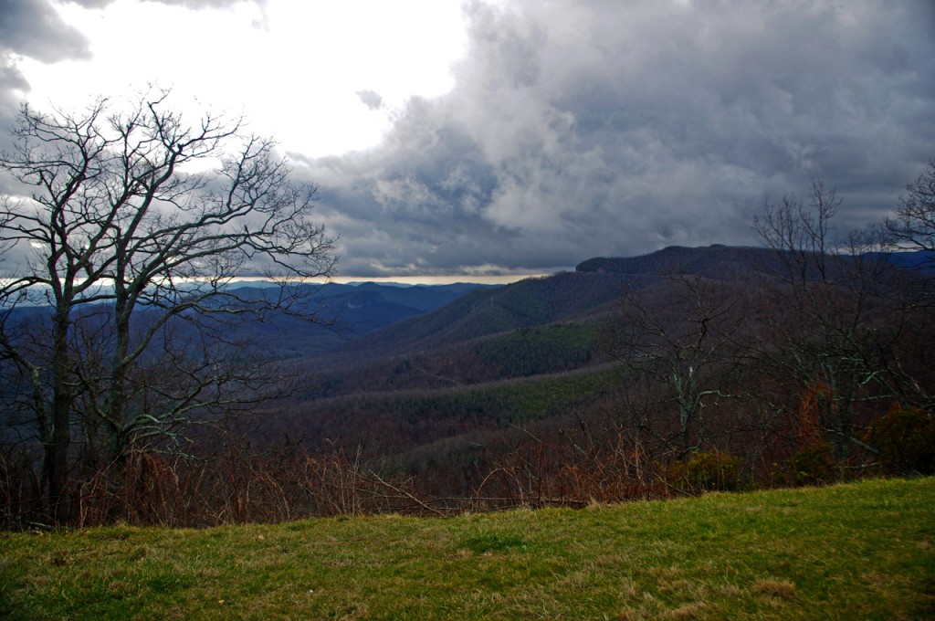
A winter view of Cold Mountain from the Blue Ridge Parkway near Mt. Pisgah.

In a normal year we’d have a bit of white on the ground, and I did see a rare patch or two today. It’s not the ideal season for motorcycling the Blue Ridge Parkway. In fact, the Blue Ridge Parkway is normally closed to traffic through this season due to the frigid conditions.

When I saw the sun this morning I knew a motorcycle ride was in order. There’s a weather front passing over with a few hours of blue sky before the snow moves in tonight. I wrapped up the mornings work and fired up the bike.

Photo-wayne-on-parkway

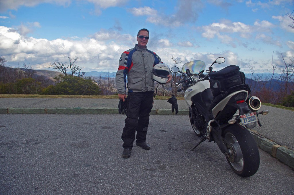
The weather looked great to the south, what a difference the other direction.

I just wanted a nice little ride. The threatening clouds on the northern horizon foretold this break in the weather was temporary, so I chose to just head south from Waynesville on US 276 and ride up to the Blue Ridge Parkway and back after running a few errands in town.

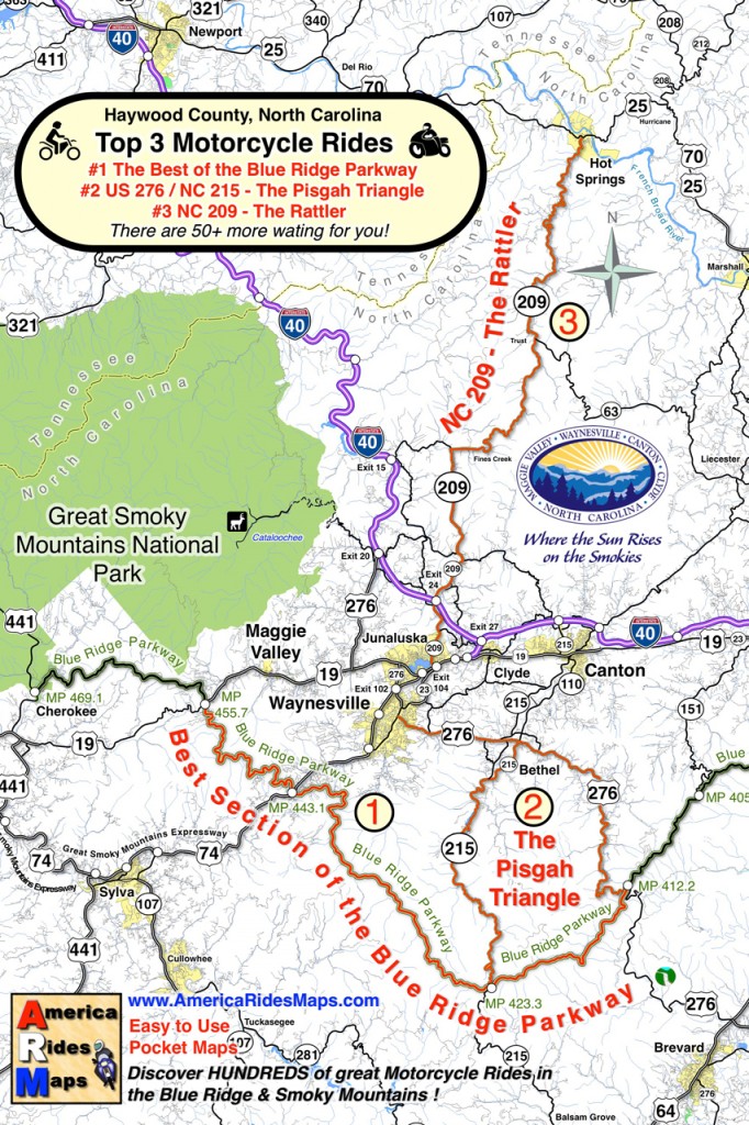
US 276 is a well know road to motorcycle riders and part of a classic loop called the “Pisgah Triangle” south of Waynesville. US 276 forms one leg of the triangle, the Blue Ridge Parkway the second, and NC 215 the third. It’s a “must do” fun ride if you’re in the Waynesville / Maggie Valley area.

photo-winter-view-blue-ridge-parkway

Winter riding in the Smoky Mountains can be as beautiful as the summer, just in a different way.

It takes about 25 minutes to ride out across Bethel Valley then follow the Big East Fork of the Pigeon River in the Pisgah National Forest and make the steep and twisting climb to the heights of the Blue Ridge Parkway at the Wagon Road Gap. The ramp to the Blue Ridge Parkway leads to the large parking area  overlooking Cold Mountain  (MP 412.2).

The overlook is accessible year-round. The parkway is gated on either side. The south gate (towards Cherokee) was closed, but the north gate to Mt. Pisgah was open so I took advantage of the opportunity to snap a few photos.

photo-clouds-on-the-blue-ridge-parkway

By the time I turned back, those clouds had swallowed up everything.

The blue skies didn’t last long, and by the time I had turned around nearing Asheville, the clouds were swallowing the views. The wind was gusting and I started to hit some wet stuff on the way back. Some of it was white.

It was a rare treat this time of year. Next time you’re passing through, take a motorcycle ride on the Pisgah Triangle. I had a great time on just one leg of it, and the other two are better!

haywood-county-postcard

A postcard from Haywood County, North Carolina shows the Pisgah Triangle

__________________________________________________________________
Wayne Busch

Wayne Busch - Cartographer

Total Rider Tech Logo

Learn Total Control

– Wayne Busch lives in Waynesville, NC, where he produces the most detailed and comprehensive and up-to-date motorcycle pocket maps of the Blue Ridge and Smoky Mountains to help you get the most of your vacation experience. See them here – AmericaRidesMaps.com

Wayne is an advanced motorcycle instructor for Total Rider Tech teaching Lee Parks Total Control Advanced Rider Courses. It’s time you looked into advanced rider training to ride more confidently and safely, it will change your mountain riding experience. It worked so well for me I became an instructor! Total Rider Tech

____________________________________________________________________
First Day of Winter – Let’s Ride the Blue Ridge Parkway!

So here it is, winter is officially upon us today and I spent the best of it on my motorcycle on the Blue Ridge Parkway.

I couldn’t stand it any longer. It was so warm when I took the dog out this morning I knew I was going to HAVE to get on the bike. The weatherman says rain is coming to the Smoky Mountains so I knew I’d need an early start.

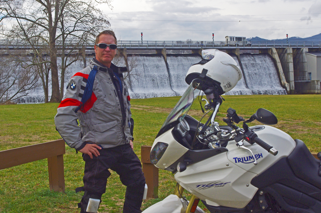
photo-wayne-at-lake-junaluska-dam

I would have settled for a nice short ride - (if you believe that, you don't know me very well)

“Just a short ride” I told my wife.

If nothing else I’d top up the near-empty tank and make a short spin of it. Thinking of someplace close I could get a photo, I headed to the dam at Lake Junaluska. Sure looked like rain was coming. Got my photo, then where?

It’s been so unusually warm lately, I decided to ride over to Maggie Valley and see if the Blue Ridge Parkway was open. Slim chance of it, but just maybe….

Photo-Wayne-celebrates-at Waterrock-Knob

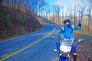
Made it to Waterrock Knob! Enveloped in clouds, raining, but totally unexpected at this time of year. That would have been enough for most riders - it just goaded me to push on.

Passing the man made snow at Tony’s Tube World as I left the valley, I started to consider alternatives. If snow could linger down low, it would sure be too cold up high for the parkway to be open. If it wasn’t, I could always cruise over to Cherokee.

I turned onto the ramp to the Blue Ridge Parkway at Soco Gap, and sure enough, the gates towards Cherokee were closed when I reached the top. Oh well.

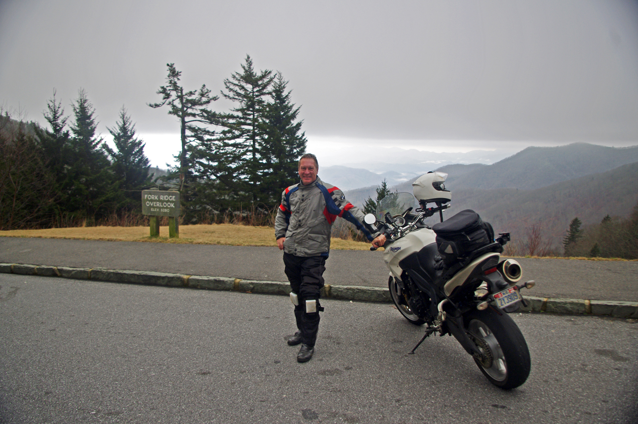
motorcycle-at-fork-ridge-overlook-1st-day-of-winter

I stopped for a photo when I came down to the mile-high Fork Ridge overlook. You can see the cloud ceiling a few hundred feet above me and the clouds in the valleys below.

As long as I was here, might as well ride over to see if the gates were closed heading south though the chances were even slimmer as the parkway climbs to some of the highest parts in that direction.

Surprise, surprise, the gates were open and I rolled on the throttle!

I didn’t think I’d get far, but I might at least get a photo from one of the lower overlooks. As I climbed, I came nearer and nearer to the cloud bank that socked in the mountain tops. Still, the road was clear.

Photo-first-day-of-winter-on-blue-ridge-parkway

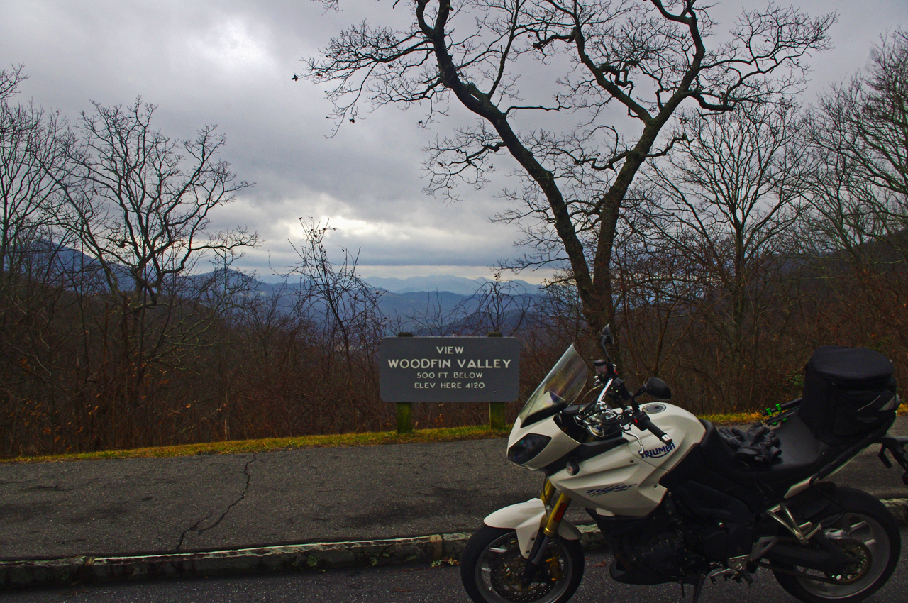
It was a good day for riding so long as you stayed down low. At 4000 feet, the Woodfin Valley overlook shows it's fine at the lower elevations. I couldn't resist going higher.

I was stoked when I reached Waterrock Knob. Totally enveloped in thick clouds and peppering light rain, I stopped for another photo. This was awesome and a rare occasion this far into the cold season.

I was happy as I continued towards the next exit at US 74 in Waynesville, dropping back below the ceiling of clouds and out of the rain.

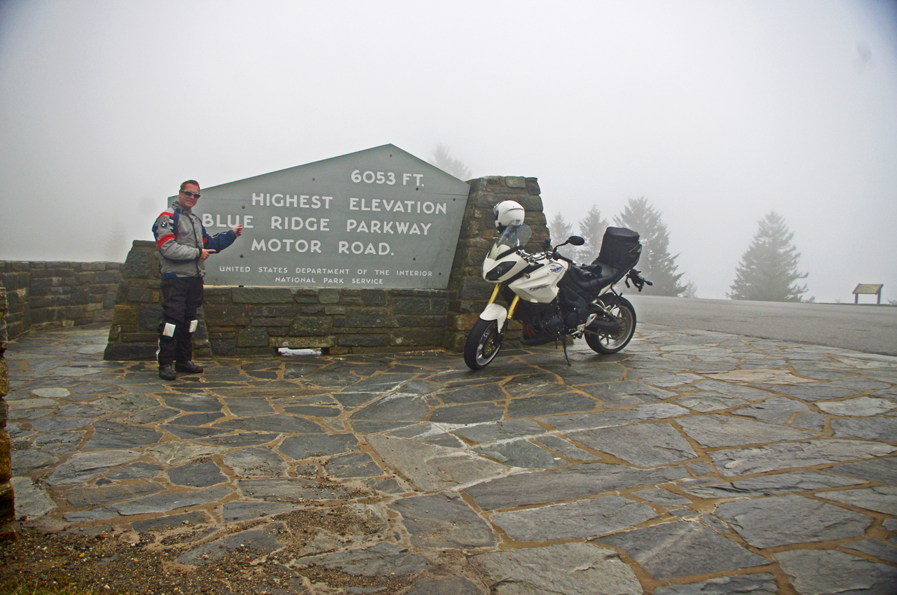
I almost left the parkway at Waynesville (see my video of Waynesville), as the next section of the Blue Ridge Parkway leads to the highest point on the road. No way it would be open. Still, I was curious as to how far I would get and amazed to find the gates open as I crossed over the highway.

photo-wayne-rides-his-motorcycle-to-the highest-point-on-the-parkway

Can't believe it! I rode to the highest point on the Blue Ridge Parkway on the first day of winter. Same day last year we got a snow that covered the yard until well into march.

I began climbing again, and before long was back in the wet cloud bank. Except for a few stray cars, I had the road to myself and enjoyed it with enthusiasm.

It was windy and poor visibility when I reached the high point, but it was another unexpected treat. Took another photo to remember it by.

I rode the rest of the way to Beech Gap and NC 215 in heavy wet fog (here’s a wicked ride nearby). No views to speak of, and lots of rocks and debris from the small slides that occur where rocky faces run close to the road. Winter thaws and freezes cause a lot of little slides during this season but it’s not much of a problem as no one is there to be affected by them.

photo-fall-on-nc215-great-motorcycle-ride

Road condition has improved marginally since this fall photo of NC 215 following the resurfacing. Still plenty of loose gravel and slippery corners to negotiate. Not for the faint-of-heart. It will improve, but how much?

The ride home via NC 215 (see my video of NC 215)is unchanged from my last visit – the road is till a mess. If riding sharp turns on loose gravel isn’t your thing, you will want to avoid it a while longer until things clean up.

Same day last year, we got snow so deep it laid in my yard for 3 months. This year I’m riding. I think I like this year better!

_______________________________________________________________________________
Wayne Busch

Wayne Busch - Cartographer

Total Rider Tech Logo

Learn Total Control

– Wayne Busch lives in Waynesville, NC, where he produces the most detailed and comprehensive and up-to-date motorcycle pocket maps of the Blue Ridge and Smoky Mountains to help you get the most of your vacation experience. See them here – AmericaRidesMaps.com

Wayne is an advanced motorcycle instructor for Total Rider Tech teaching Lee Parks Total Control Advanced Rider Courses. It’s time you looked into advanced rider training to ride more confidently and safely, it will change your mountain riding experience. It worked so well for me I became an instructor! Total Rider Tech

_______________________________________________________________________________

Smoky Mountain Motorcycle Rides – Meadow Fork Rd

Two good motorcycle roads are found along NC 209, a.k.a. “The Rattler“. They make a nice side loop on the popular motorcycle ride from Junaluska to Hot Springs in North Carolina. 

Photo-Meadow-Fork-Rd-View

A section of Meadow Fork Road which demonstrates the character of the curves through much of the ride.

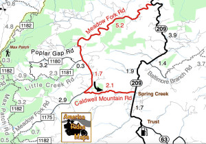
Meadow Fork Road Map

Meadow Fork Road spurs off NC 209 about 7 miles south of Hot Springs. The road follows the twisty banks of a whitewater creek for quite a while climbing gently on the challenging and scenic run. It  leads into the Pisgah National Forest where it becomes one of many unpaved forest roads high in the mountains.

Photo-The-Rattler-Motorcycle-Ride

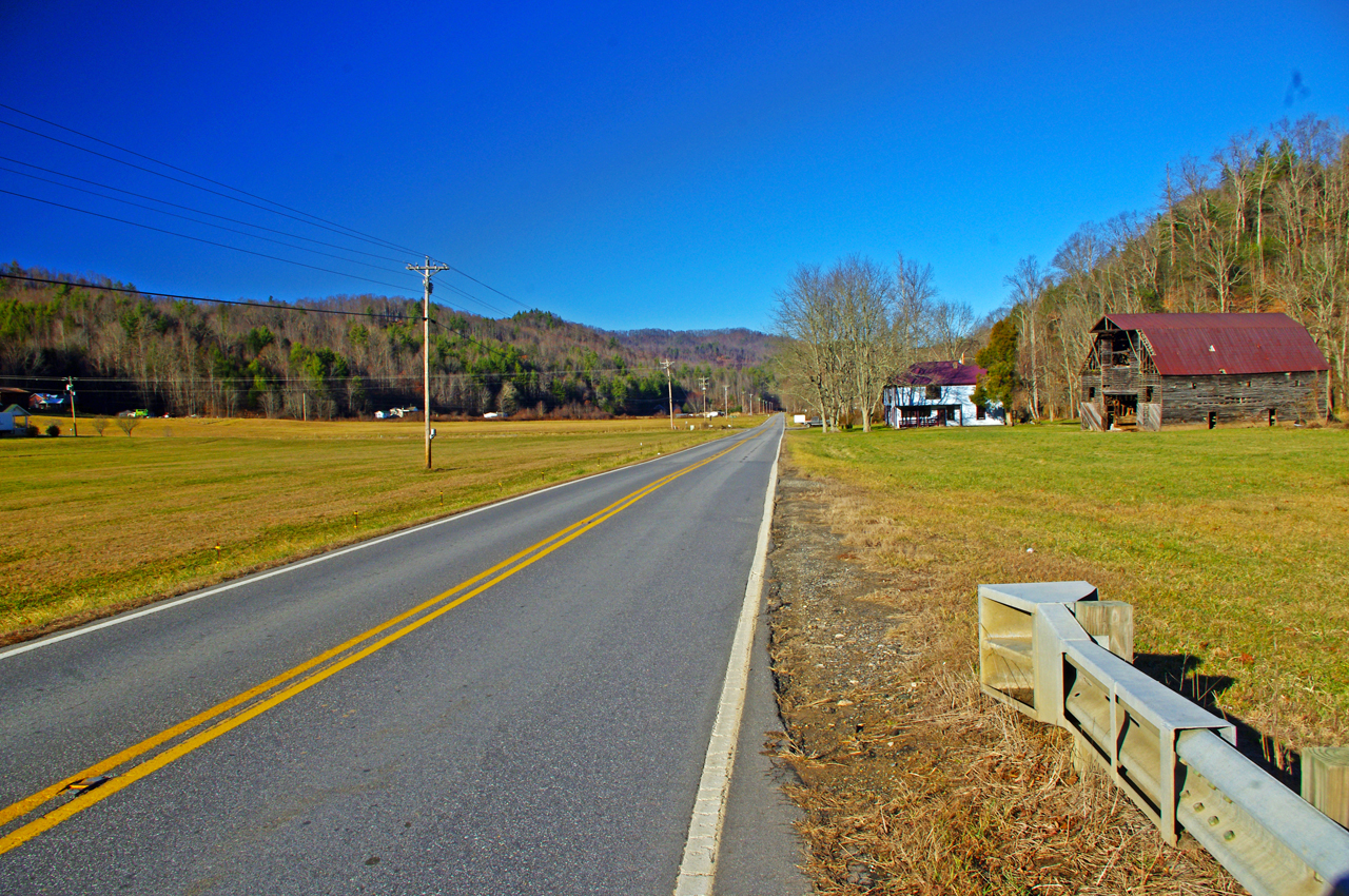
The 1.7 mile section of NC 209 which crosses the Spring Creek valley is the straightest road I can think of in western North Carolina. View approaching Caldwell Mountain Road

Caldwell Mountain Road meets Meadow Fork Road in 6.9 miles. 2.1 mile long Caldwell Mountain Road will take you over the mountain and down to meet NC 209 near the middle of the long straight stretch across the Spring Creek Valley.

photo-NC209-The-Rattler-motorcycle-ride-campground-sign

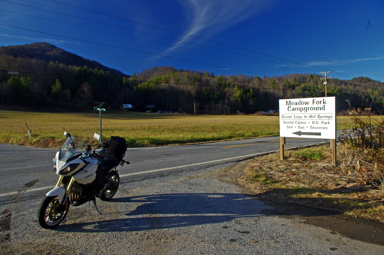
Caldwell Mountain Rd is easy to find. Ride to the middle of the long straight stretch of NC 209 in Spring Creek. Look for the sign for Meadow Fork Campground.

Caldwell Mountain Road and Meadow Fork Road form a nice loop on the west side of NC 209 when joined together. It’s a good way to vary the ride to and from Hot Springs and  see a few different sights.

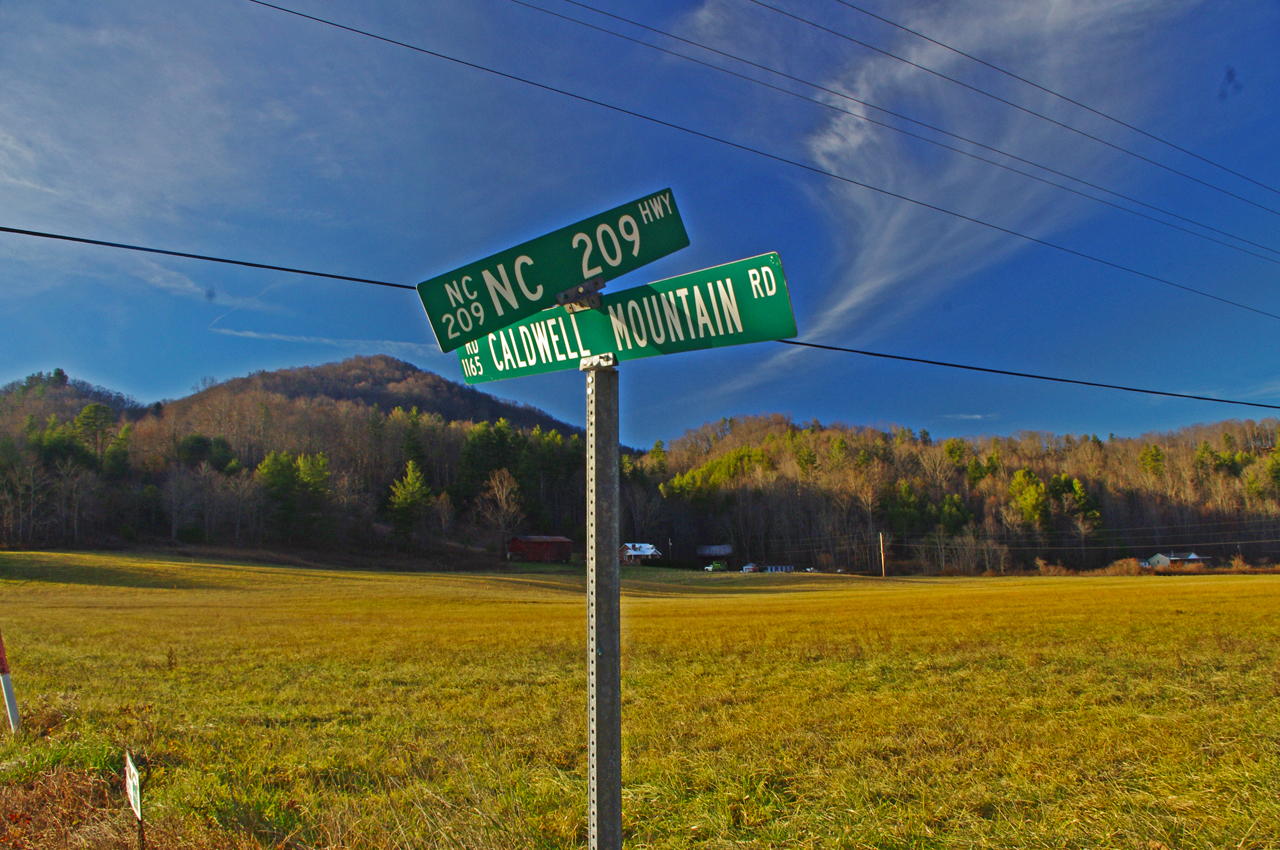
Photo-road-sign

The sign may be a little crooked, but so is Caldwell Mountain Rd .

Both Meadow Fork and Caldwell Mountains Roads are paved, though if you miss turning at their junction you will run out of pavement before long when Meadow Fork Road reaches the National Forest. If you are on a dual-sport or adventure bike, this is one way to access the great unpaved roads that lead up to Max Patch bald and wind into Tennessee and the eastern edge of Great Smoky Mountains National Park. (See map OR-1)

Photo-Caldwell-Mountain_rd-motorcycle-ride

One of the few long range views on Caldwell Mountain Rd. You’ll probably be looking at the road instead.

Both of these roads are easy to find from NC 209. Their junctions are well marked. There is a prominent sign for the Meadow Fork Campground which marks the junction and it’s easy to spot Caldwell Mountain Road cutting across the felids in the valley as you approach.

Photo-Motorcycle-Ride-Meadow-Fork

Never far from the edge of the roaring creek, Meadow Fork Road twists through steep rocky hill sides and small valleys and coves.

Caldwell Mountain Road has some nice curves on the climbs and a few brief long range views. The pavement is a little bumpy in places, but generally is pretty good overall.

Photo-motorcycle -ride-meadow-fork-rd

There are some very pleasant views along Meadow Fork Road and lots of places to pause and enjoy it.

Meadow Fork Road follows the Roaring Fork River from NC 209 as it carves through the mountains for 7 miles to reach the junction with Caldwell Mountain Road. The road  traces the bank of the river  making it a nice curvy motorcycle ride for the most part. The pavement is in good shape – a long section near the river washed out and was replaced a few years ago with nice new pavement.

Photo-junction-NC-209-Meadow-fork-rd

The junction of Meadow Fork Rd and NC 209 is easy to spot though it may come up on you quickly as you come around a curve on either side.

Neither road has scenery you’ll be framing on the wall, though in general it’s pretty nice with small remote and isolated coves and valleys, the whitewater river along the road, and lots of hundred year old barns and the like.

Photo-start-of-Meadow-Fork-Rd

Just a peek down Meadow Fork Road shows what lies ahead.

This side loop off NC 209 adds a nice diversion, a little something different, without adding a significant amount of time to the longer motorcycle ride on classic NC 209 – The Rattler.

photo-junction-meadow-fork-caldwell-mountain

The junction of Meadow Fork Rd and Caldwell Mountain Rd is easy to spot, so navigation of this ride is easy and you can focus on enjoying the roads.

Related – Map and info about NC 209 – a.k.a “The Rattler”

America Rides Maps Map #6 – The Best Motorcycle Rides EAST of Great Smoky Mountains National Park

_______________________________________________________________________________
Wayne Busch

Wayne Busch – Cartographer

Total Rider Tech Logo

Learn Total Control

– Wayne Busch lives in Waynesville, NC, where he produces the most detailed and comprehensive and up-to-date motorcycle pocket maps of the Blue Ridge and Smoky Mountains to help you get the most of your vacation experience. See them here – AmericaRidesMaps.com

Wayne is an advanced motorcycle instructor for Total Rider Tech teaching Lee Parks Total Control Advanced Rider Courses. It’s time you looked into advanced rider training to ride more confidently and safely, it will change your mountain riding experience. It worked so well for me I became an instructor! Total Rider Tech

_______________________________________________________________________________
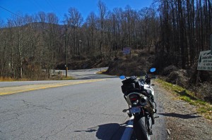
Not Good Enough for 100 Smoky Mountain Motorcycle Rides

I’ve just released a map of the Smoky Mountains which shows nearly 200 motorcycle rides highlighted on it. Here’s one that won’t be on it, not good enough.

Photo-Grapevine-rd

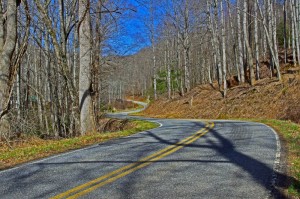
A long section of bad pavement gives way to some great curves.

Yesterday, Jackie and I hopped on the bikes to follow up on a rumor of yet another good motorcycle ride tucked away in the mountains. Possibilities were high as the area northeast of Hot Springs, NC, is ripe with some of the most challenging and technical motorcycle rides you’ll find anywhere. The two lane roads that wind through these Tennessee mountains hug the edges of rushing creeks which snake the bottoms of shady valleys or carve steep steps through gaps and passes.

This is no place for the faint of heart nor the inexperienced motorcycle rider, though by the time you reach it those riders who won’t accept the challenge have already turned tail and run. Roads like NC 209, NC 208 probably give most riders as much thrill as they want. Only the adventurous consider these approaching roads just a warm-up and look to kick the ride up a notch with more challenging pavement.

photo-grapevine-rd

There are some very nice sections of Grapevine Rd, but overall, NOT GOOD ENOUGH!

I remembered Grapevine Road as soon as I turned on it. I’d been told by a couple people they thought it was a great motorcycle ride, but for some reason I couldn’t remember I’d not put it on one of my maps. I quickly figured out why.

The pavement was in such bad shape. Broken and potholed, sunken, bumpy, strewn with gravel, rocks, and loose asphalt. Add to that steep grades, devilish tight switchbacks, unforgiving drop-offs, and you’ve got a real handful, especially on a big bike.

The reason I’d come back to Grapevine Road is the last time, I made a quick judgment and turned around. Not having gone all the way through, I didn’t know how far until the pavement improved. I knew it had to get better as it approached more civilized areas to the south.

photo-jackie-thumbs-down

Jackie votes "thumbs down" on Grapevine Rd.

It was a long ride until the pavement smoothed out. Once it did, there was a decent section with some nice curves which become more sweeping and open, but little of scenic appeal.

Some may like this road, but there are so many better ones nearby, it’s the least appealing. Jackie gave it the “thumbs down”. No reason to recommend Grapevine Road.

_______________________________________________________________________________
Wayne Busch

Wayne Busch - Cartographer

Total Rider Tech Logo

Learn Total Control

– Wayne Busch lives in Waynesville, NC, where he produces the most detailed and comprehensive and up-to-date motorcycle pocket maps of the Blue Ridge and Smoky Mountains to help you get the most of your vacation experience. See them here – AmericaRidesMaps.com

Wayne is an advanced motorcycle instructor for Total Rider Tech teaching Lee Parks Total Control Advanced Rider Courses. It’s time you looked into advanced rider training to ride more confidently and safely, it will change your mountain riding experience. It worked so well for me I became an instructor! Total Rider Tech

_______________________________________________________________________________
See the map “Best Motorcycle Rides of the Smoky Mountains

100 Best Motorcycle Rides in the Smoky Mountains

Motorcycle Map – Best Motorcycle Rides in the Smoky Mountains

America Rides Maps announces its first large format motorcycle ride map. Available in 24 x 36 inch and 31 x 48 sizes.

Image of map the Best Motorcycle Rides in the Smoky Mountains

Image of map the Best Motorcycle Rides in the Smoky Mountains - B&W version. Click for a closer look at all the detail!

The only map of its kind, The Best Motorcycle Rides in the Smoky Mountains highlights more than 100 of the best motorcycle rides and more than 50 good connecting roads to tie them all together into endless loops and touring routes.

This map is produced in Black & White  so YOU CAN CUSTOMIZE IT to fit your needs. Use colored markers to highlight where you’ve been or lay out where you want to go.

Santa - great gift ideaPlaning your motorcycle vacation trip has never been easier!

Hang it on the wall to show all the places you’ve been on your motorcycle vacation tours.

Got a favorite place to stay in the Smokies? Discover all the hidden riding nearby. Make the best use of your riding time, ride on on all the best roads,  avoid traffic and congestion.

$24.99 price includes free shipping and handling – First Class US Mail – average 2-3 day delivery. Ships unfolded.

Read more and order here: 

 The Best Motorcycle Rides in the Smoky Mountains

http://shop.americaridesmaps.com/The-Great-Motorcycle-Rides-of-the-Smoky-Mountains-BW-NC023BW.htm

Curious? Need more info? Email info@americaridesmaps.com

_______________________________________________________________________________
Wayne Busch

Wayne Busch - Cartographer

– Wayne Busch lives in Waynesville, NC, where he produces the most detailed and comprehensive and up-to-date motorcycle pocket maps of the Blue Ridge and Smoky Mountains to help you get the most of your vacation experience. See them here – AmericaRidesMaps.com
 

Motorcycle Friendly – Tapoco Lodge @ The Tail of the Dragon

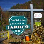
Photo-Tapoco Lodge Sign

The Tapoco Lodge

The most luxurious and convenient motorcycle friendly lodging nearest the Tail of the Dragon at Deals Gap, the Tapoco Lodge is historic, unique, classy, and about as close to The Dragon as you can stay.

Greg McCoy from SportBikes4Hire.com had often mentioned the fine dining at the Tapoco Lodge near the Dragon at Deals Gap, but I’d never stopped in to check it out. Honestly, it’s so close to the Tail of the Dragon, I usually blast right past it enjoying the curves on this section of US 129. This week I had the chance to pay a visit and I was impressed with what I found.

Photo-Tapoco-Dam

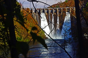
The Cheoah Dam - a.k.a. "The Fugitive" Dam, where Harrison Ford's character takes the big leap in the movie "The Fugitive".

The Tapoco Lodge was built in the 1930’s by the Alcoa Corporation which was subsequently involved in building the many power generating dams along the Tennessee River to provide power for the aluminum plants in Maryville and Knoxville, Tennessee. At one time as many as 2000 people lived in the area working both in construction of the many dams nearby and substantial timber operations in the surrounding mountains. What is now the Tapoco Lodge saw service as a hospital, theater, residential and operations headquarters for the company, and you’ll find the lodge filled and adorned with historic artifacts from this era.

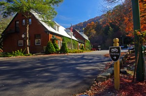
Photo-The-Tapoco-Lodge

The Tapoco Lodge - exclusive, luxurious, AND motorcycle friendly

Visting today, there is little evidence of the thousands of people who lived and worked here in those times past. As the many dams were completed the lakes which formed behind them submerged the roads, railroads, and small communities, and the area seems remote and isolated, pristine and natural, as if it all never happened save the dams which and lakes which remain as a legacy and still generate power.

Riding through the area you may come across the Chillowhee Dam on US 129 north of The Dragon, the Santeetlah Dam just north of Robbinsville, the Calderwood Dam viewed from the popular overlook at the Tennessee end of The Dragon, but the most impressive and notable are the Fontana Dam on NC 28 (a.k.a. The Moonshiner 28) and the Cheoah Dam just up the road from the lodge.

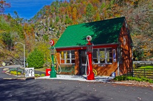
Photo-historic-gas-station-at-Tapoco-Lodge

Visiting the historic Tapoco Lodge is like visiting a living museum!

The Fontana Dam is one of the highest and most impressive, and is a popular stop for riders in the area. The Cheoah Dam is commonly referred to as “the Fugitive Dam” as it was the structure Harrison Ford’s character in the movie “The Fugitive” jumped from (the movie was shot in the surrounding area).

As operations in the area wound down, the Tapoco Lodge property transferred to private ownership and for many years after was used as a corporate retreat center for the company and others. In 2010, it was sold to the current owners who have renovated, upgraded, and restored  the property to a glorious and historic lodge with outstanding accommodations and fine dining in an exclusive setting.

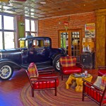
photo-tapoco-lodge-interior view

History surrounds you at the Tapoco Lodge

Unfortunately my untimely visit happened just as the Tapoco Lodge was shutting down operations for the year. I’ve not yet had the opportunity to sample the sumptuous 5 course dinner at Jasper’s Restaraunt ($44 per plate, reservations required) nor the more casual fare in served in the Slickrock Riverside Grill. I trust Greg’s recommendations the food matches the quality of the rest of the establishment.

Photo-Jaspers-Restaraunt-at-Tapoco-Lodge

A quick peek at Jasper's Restaurant

Nor have I had the opportunity to enjoy the luxurious rooms, though I did get the quick tour of the lodge and they are outstanding. I passed on the opportunity to see the cabins this time.

Photo-the-bar-at-the-Tapoco-Lodge

A treat in a dry county! Save me a seat.

I’m particularly interested in the very comfortable looking bar, a unique feature in the last dry county in the State of North Carolina. It looked well stocked and I noted a good variety of wines. I love having a comfy place to enjoy a libation after a hard days riding and this bar will serve the purpose well.

Photo-room-at-Tapoco-Lodge

Spacious and comfortable rooms

I’m really looking forward to a stay at the Tapoco Lodge as it’s the ideal location for riding some of the best motorcycle rides in North Carolina and Tennessee. it’s on the popular Cherohala Skyway / Tail of the Dragon loop ride. Roll out the driveway, and you’re on the ride.

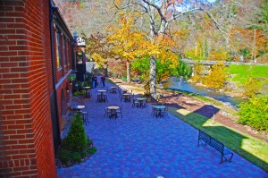
photo-Tapoco-Lodge-view-of-river

Enjoy sitting along the Cheoah River which flows beside the Tapoco Lodge

They are already booking groups for next year, it’s an ideal location for gatherings and they can accommodate a lot of people. Initially, the price of a stay seems high, but once you factor in the cost  of the 5 course dinner and cooked to order all-you-can-eat breakfast, which are included in your room cost, it works out to be an affordable way to enjoy a luxurious, convenient, and comfortable stay in the area.

You won’t find better food, you won’t find anything like it for accommodations, and you don’t have to ride to the next county to enjoy a cold brew at the end of the day.

 The Tapoco Lodge

_______________________________________________________________________________
Wayne Busch

Wayne Busch - Cartographer

Total Rider Tech Logo

Learn Total Control

– Wayne Busch lives in Waynesville, NC, where he produces the most detailed and comprehensive and up-to-date motorcycle pocket maps of the Blue Ridge and Smoky Mountains to help you get the most of your vacation experience. See them here – AmericaRidesMaps.com

Wayne is an advanced motorcycle instructor for Total Rider Tech teaching Lee Parks Total Control Advanced Rider Courses. It’s time you looked into advanced rider training to ride more confidently and safely, it will change your mountain riding experience. It worked so well for me I became an instructor! Total Rider Tech

_______________________________________________________________________________
 I’ll be adding The Tapoco Lodge to America Rides Maps Map #7 – Best Motorcycle Rides SOUTH of GSMNPMap #8 – Best Motorcycle Rides NORTH of GSMNP and map – 12 Classic Deals Gap Motorcycle Rides

Another Great Smoky Mountain Motorcycle Ride

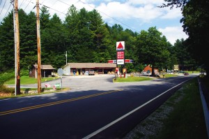
photo-silversteen-rd-meets US-64

The junction with US 64 is marked by a Citgo Station

Silversteen Road is one of those roads  you want to keep in your pocket – it’s almost so good I’ve been tempted to keep it to myself. But after riding it again this week, I’ve just got to share it so you can enjoy it too.

Silversteen Road intersects US 64 between Rosman and Sapphire, NC. The junction is well marked by a convenient landmark gas station. About half way through Silversteen Road, it makes a turn so sharp it doubles back on itself where it meets Macendonia Church Road. If you don’t make the turn to stay on Silversteen Road, Macendonia Church Road will lead you out to NC 215, another outsanding ride which crosses the Blue Ridge Parkway.

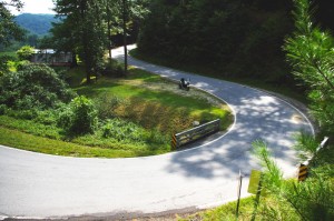
Photo-curve-on-Silversteen-Rd

Imagine miles and miles of curves like this one - a.k.a. Silversteen Road

If you stay on Silversteen Road it runs into NC 281, another fabulous Smoky Mountain Motorcycle Ride and another of my favorites. I typically follow NC 281 north to Tuckaseegee or use it to connect to Charlies Creek Road to reach NC 215 (so many good choices in the area).

I’m attracted to Silversteen Road for it’s challenge – it’s every bit as twisty as the infamous Dragon at Deals Gap. In fact, it’s more difficult as the road seems a bit narrower and the pavement is not up to the quality you find at the Dragon. It sees very little traffic, but the trade off is you’ll find a few potholes and some gravel in the road where unpaved side roads and driveways connect to it. It also has some very sneaky descending radius turns you’ll want to be prepared for so you don’t get in over your head.

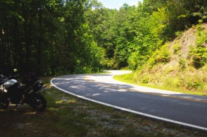
Photo-motorcycle-curves-on Sliversteen-Rd-NC

The curves on Silversteen Road never let up.

The ride holds a few scenic areas, particularly where it runs along the bank of what could be the Horsepasture River, but your eyes had better be on the road, not the scenery. It will give you all the challenge you want, maybe more.

You’ll find Silversteen Road on America Rides Maps Map #6 – The Best Motorcycle Rides EAST of Great Smoky Mountains National Park along with all the other great rides in the area, more than 50 great motorcycle rides in this small but beautiful area of the “Land of the Waterfalls”.

_______________________________________________________________________________

Wayne Busch

Wayne Busch - Cartographer

Total Rider Tech Logo

Learn Total Control

– Wayne Busch lives in Waynesville, NC, where he produces the most detailed and comprehensive and up-to-date motorcycle pocket maps of the Blue Ridge and Smoky Mountains to help you get the most of your vacation experience. See them here – AmericaRidesMaps.com

Wayne is an advanced motorcycle instructor for Total Rider Tech teaching Lee Parks Total Control Advanced Rider Courses. It’s time you looked into advanced rider training to ride more confidently and safely, it will change your mountain riding experience. It worked so well for me I became an instructor! Total Rider Tech

_______________________________________________________________________________
Hurricane Weekend in Maggie Valley on my Motorcycle

Photo-mt-mitchell-highest-in-east

A little cloudy and rainy was as bad as it got atop Mt. Mitchell

While curiousity got the best of me and I did cruise up to Mt. Mitchell to get a close look at the hurricane, the Smoky Mountain weather was beautiful for motorcycle rides and I took advantage of it with a bunch of local favorites. Judging from all the other bikes out on the road, a lot of coastal folks hopped on the hog and ran for the hills. It was a good decision.

Photo-Thunderhawg-motorcycle-rentals

Thunderhawg Motorcycle Rentals, Maggie Valley

Friday found me visiting my friends at ThunderHawg motorcycle rental which just opened at the corner of US 276 and US 19 after my ride north on the Blue Ridge Parkway to Mt. Mitchell. Peggy and Mark rent Harleys and it’s nice to have a local rental place again in Maggie Valley. They’ve got tons of info, maps, and they love to meet and greet motorcycle vacationers to the Smoky Mountains. Stop in and see them when you pass through.

photo-aholiday-motel

A Holiday Motel - Saturday night

Saturday, I rode the Blue Ridge Parkway the other way to Cherokee and Bryson City to stop in at The Gear Head Inn, then hopped on some of the great roads south of there. I ended up at A Holiday Motel in Maggie Valley to pass the time while my wife ran in the 8K Maggie Valley Moonlight race.  Always popular with motorcycle vacationers, the A Holiday Motel was full of bikers who came to enjoy the splendid weather. The bonfire was going out front and I was able to cheer Jackie on and spend a little time with the riders. Dale from Wheels Through Time Motorcycle Museum came by with a couple of Australian visitors who had borrowed a couple of his antique Harleys.

The view from Riders Roost Restaurant is awesome

The view from Riders Roost Restaurant is awesome

Sunday, I cruised NC 215 and US 276, then followed the Blue Ridge Parkway back to Maggie Valley to stop in at Riders Roost Restaurant in before we headed back up on the Blue Ridge Parkway to enjoy the crystal clear evening skies that came in after the storm.

No matter which way you point your wheels from Maggie Valley, you’ll find outstanding riding. The Best section of the Blue Ridge Parkway is right up the hill. It’s a great place to base out of for your motorcycle trip to the Smoky Mountains as so many great rides are within easy reach.

Check out AllRoadsLeadToMaggie.com when planning your visit. Maggie Valley is the heart of good motorcycle riding in the Smoky Mountains.

_______________________________________________________________________________
Wayne Busch

Wayne Busch - Cartographer

Total Rider Tech Logo

Learn Total Control

– Wayne Busch lives in Waynesville, NC, where he produces the most detailed and comprehensive and up-to-date motorcycle pocket maps of the Blue Ridge and Smoky Mountains to help you get the most of your vacation experience. See them here – AmericaRidesMaps.com

Wayne is an advanced motorcycle instructor for Total Rider Tech teaching Lee Parks Total Control Advanced Rider Courses. It’s time you looked into advanced rider training to ride more confidently and safely, it will change your mountain riding experience. It worked so well for me I became an instructor! Total Rider Tech

_______________________________________________________________________________