Fall leaves – Photos from The Snake Motorcycle Ride

With such a beautiful day I was itching for an excuse to get out of the office, onto my motorcycle, and enjoy it when an email came in from David at the Shady Valley Country Store at The Snake Motorcycle Ride in Tennessee. He needed to be restocked on maps, and I was curious about a recommended road in the area – Denton Valley Road. Thats all it took.
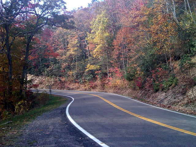
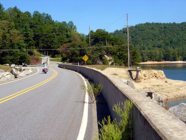
Photo - Fall leaves on the Snake - US 421

The were some nice spots of fall color on US 421 a.k.a. "The Snake" yesterday. I was delivering a load of maps to the Shady Valley Country Store.

The big question was “How to get there?” Normally I’d take the Blue Ridge Parkway north to Linville, then jump on the back roads to skirt around the traffic in Boone. Knowing the Blue Ridge Parkway would be heavy with leaf peeping traffic, I considered going east to take the most common routes, but I also knew US 321 would be clogged with traffic and I’d get held up going through Boone. That left a western approach, so I went to Asheville, then up I-26 to US 19E from which I could jump on the back roads once I neared Elk Park. Looking back, I should have just followed the back roads all the way. I got held up in the construction on US 19E and could probably have made the trip in the same amount of time and had a lot more fun. Time was an issue as it was after noon before I left the house.

Photo - Fall leaves on The Snake - US 421

I snapped this photo just before I started down Denton Valley Road from US 421. The sun hit just right, the colors are real, not enhanced. I tried to tone them down, but decided to go with what the camera captured.

It was nearing 4 PM when I concluded my business at the Shady Valley Country Store and continued west on US 421 enjoying the twists and curves of The Snake to reach Denton Valley Road. It was a decent ride, though I hadn’t researched it well enough and ended up spending the next hour and a half exploring it and the roads which connect to it to determine the best and most natural routes. I rolled into Bristol, Virginia, around 6 to refuel and resigned to taking the Interstates back home as it was the most efficient course. It’s not the first time I’ve made that trip in the dark, and unprepared to be out so late I once again suffered the chills of going through the high pass on I-26 at Buckner Gap at night – it ‘s always cold there.

I pulled into the driveway at 8PM, shivering but happy after a decent 350 miles and a collection of new roads to add to America Rides Maps collection.

_______________________________________________________________________________

Wayne Busch
Wayne Busch – Cartographer
– Wayne Busch lives in Waynesville, NC, where he produces the most detailed and comprehensive and up-to-date motorcycle pocket maps of the Blue Ridge and Smoky Mountains to help you get the most of your vacation experience. See them here – AmericaRidesMaps.com

Video – Fall Leaf Status – a Motorcycle Ride on NC 209

http://www.youtube.com/watch?v=en5xcyY_kcc

A compilation of video clips from a weekend motorcycle ride to Hot Springs, North Carolina to show the current status of the fall leaf color in the Smoky Mountains.

Jackie and I have been out enjoying the fall colors at every chance. I shot this video on an afternoon ride out to Hot Springs to see what the leaves looked at in the lower altitudes. Some of the leaves have already dropped at the higher elevations on the Blue Ridge Parkway. We saw some nice color near Linville and also near Soco Gap and the lower areas of the Blue Ridge Parkway near Waynesville.

There’s still a surprising amount of green on the trees so this show will go on for a while longer. It’s not as dramatic as when everything comes in at once, rather, you stumble across pockets of it here and their that are really nice. I hope the mild weather continues as I have more roads to explore for America Rides Maps before the winter starts to limit my rides.

_______________________________________________________________________________

Wayne Busch
Wayne Busch – Cartographer
– Wayne Busch lives in Waynesville, NC, where he produces the most detailed and comprehensive and up-to-date motorcycle pocket maps of the Blue Ridge and Smoky Mountains to help you get the most of your vacation experience. See them here – AmericaRidesMaps.com 

Blue Ridge Parkway Rockslide Update for Motorcycles – photos

It has been the year for rock slides. There were 6 major ones in southern region of the Smoky Mountains. Interstate 40 near the North Carolina – Tennessee state line is still being worked on with one lane closed. Be aware traffic backs up there on Fridays and weekends, 30 minute delays are advertised. If you’re planning on staying on the north side of Great Smoky Mountains National Park (link to map – .pdf) factor the delays into your travel time, or better yet, stay on the south side of the park.

Photo from Blue Ridge Parkway this morning

I was out on the BMW this foggy morning. Traffic is increasing on the Blue Ridge Parkway, especially motorcycles.

The fence and gates are still visible at the Dragon near Deals Gap even though the rock slide there has long been resolved. It’s a reminder of when the road was first closed, then open only from 8 Am to 8 PM. It’s been open since August and you can plainly see where the rock slide happened along the lake. I still stop at the pull off to take photos occasionally.

Photo - rock slide site on the Blue Ridge Parkway

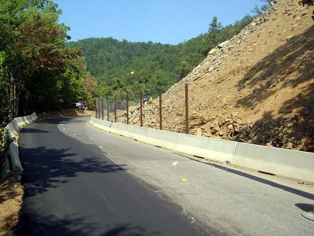
Little change is evident from the road. Most of the work is going on above, terracing and stabilizing the slope.

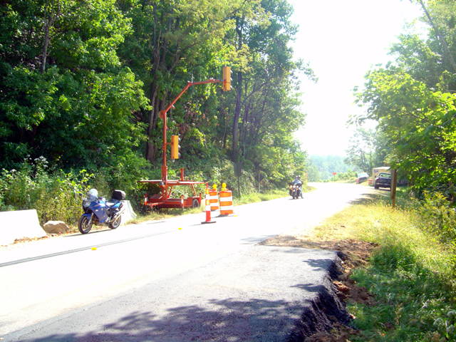
The rock slide on the Blue Ridge Parkway near Mt. Pisgah is yet to be resolved completely. It was supposed to be done by the start of September. The road is open for travel, but only one lane. Timed temporary traffic lights are positioned on each side of the work area to regulate traffic, and the duration of the delays seems to have been decreased. It used to 5 minutes, but now it feels like less. Maybe I’m used to it.

Photo - traffic lights on the Blue Ridge Parkway

Temporary timed traffic lights manage the traffic through the work area. It seems like they've decreased the wait times.

Looking at the photos I took today and comparing them to the last set, there is little visible difference at the rock slide site. As I’m up there often, I can see subtle signs of progress. While it looks pretty devastated along the road, it’s comparatively minor in contrast to the amount of work that has been done to terrace and stabilize the slope above. They were still drilling rock today so there’s work yet to be finished.

Photo - motorcycles pass the rock slide on the Blue Ridge Parkway

The delays are short, there's nothing challenging, motorcycles of which there are plenty have nothing to worry about.

Also be aware there is another delay for tunnel work as you reach Mt. Pisgah. Another set of temporary traffic lights controls traffic there as well. The scaffolding came down weeks ago, the road bed has been freshly paved, and when I passed today they were raking the edges of the road. It appears this delay is nearly over.

So long as I’m relating Blue Ridge Parkway road conditions, there is still paving going on north of Asheville. I thought they were done here when I passed through a couple weeks ago and raved about how nice the pavement was. When I went through a couple days ago they were putting another layer of fresh asphalt on top of the already wonderful road that was there. It’s SO nice! I hit two delays, one near Craggy Gardens and another further south, but they were not long waits. This second coat is going down fast so it won’t be long before they move out of there.

I’ll sum all this up in the somewhat monthly newsletter I put out (subscribe bottom right of page). There are a few paving projects I need to ride out and check on. If you have any info to add, please send it to me.

_______________________________________________________________________________

Wayne Busch

Wayne Busch - Cartographer


– Wayne Busch lives in Waynesville, NC, where he produces the most detailed and comprehensive and up-to-date motorcycle pocket maps of the Blue Ridge and Smoky Mountains to help you get the most of your vacation experience. See them here – AmericaRidesMaps.com
 

Pre 1916 Coast to Coast Motorcycle Race Going On? Here are the photos!

http://www.motorcyclecannonball.com/ – here are some of the photos I took this morning.

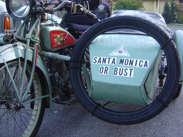
Photo - Cannonball motorcycle run

Bust? Highly likely

I can’t adequately describe this event so I’m just going to give you the link right off the bat. See for yourself, follow them as they progress, it’s just hard to believe it’s actually happening.

Photo - Cannonball Motorcycle run

7:30 AM and getting ready

For those of us in western North Carolina, it’s not all that unusual to see vintage motorcycles from time to time thanks to Dale Walksler’s Wheels Through Time Motorcycle Museum in Maggie Valley.  Not only does he have one of the most extensive collections of early motorcycles, and a historical representation of the Harley Davidson line, but they all run and he races them. More than once I’ve been cruising through Maggie Valley when he pulls up alongside on one of the vintage motorcycles out for a spin.

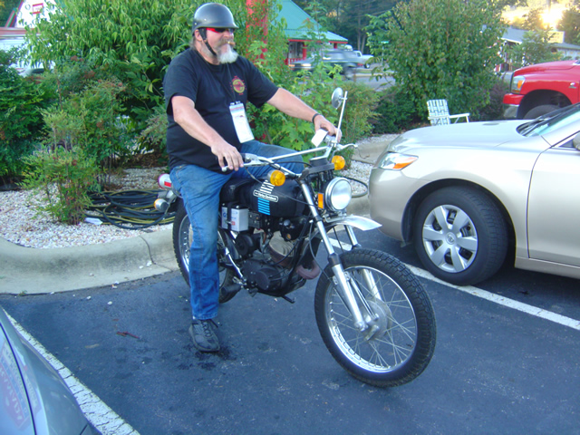
Photo - Cannonball Motorcycle run

Not all the bikes were vintage - THIS WAS MY FIRST ROAD BIKE! 1974 Harley Davidson 90cc

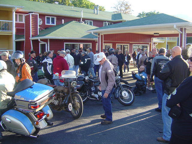
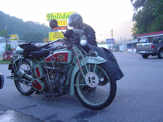
I watched the bikes straggle in last night. They filled the A Holiday Motel in Maggie Valley as well as 2 others. I got to talk with the support crews and some of the riders.

Photo - Cannonball Motorcycle Run

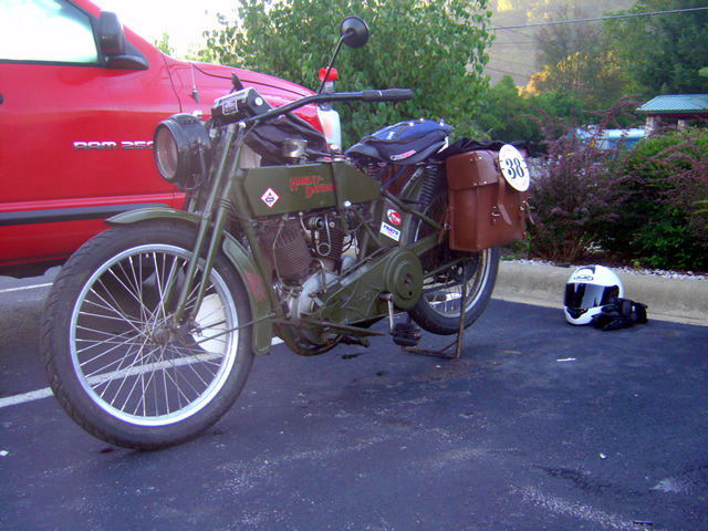
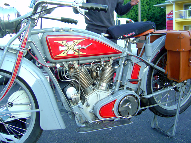
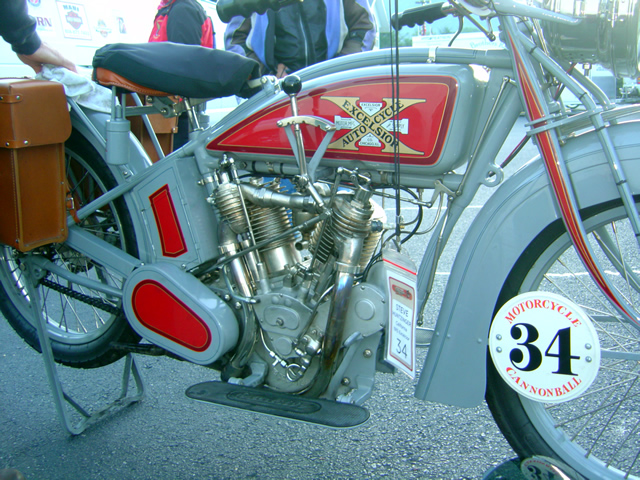
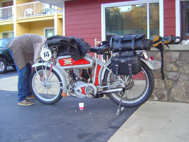
Excelsior Motorcycles were well represented

What’s it like riding one of these? They’re lucky to hit 50 mph so you don’t get windblown. The seats are fairly springy. It’s not all that bad – so they say.

Photo - Cannonball Motorcycle Run

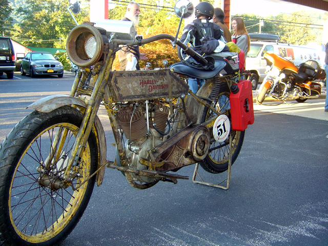
Plenty of early Harleys

On the other hand, going up hills is a challenge. I think those pedals get used. Things fall off – like brakes.

Photo - Cannonball Motorcycle Run

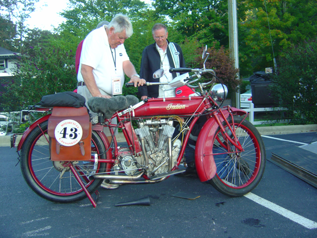
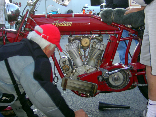
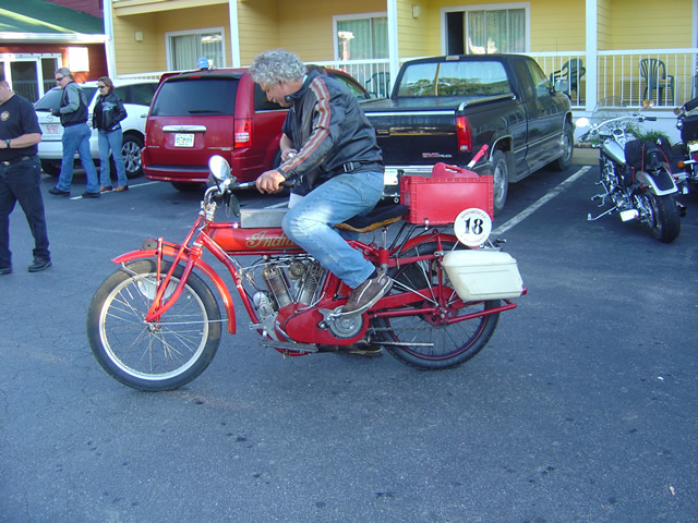
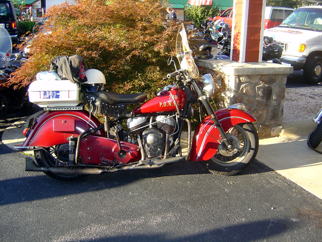
Lots of Indian Motorcycles

Electrical problems, particularly magnetos, are a problem that can stop you dead and tough to resolve.

Photo - Cannonball Motorcycle Run

Somehow they got the magneto repaired on this Indian.

A lot of these guys were up till the early morning hours in Wheels Through Time repairing the bikes to keep them running.

Photo - Cannonball Motorcycle Run

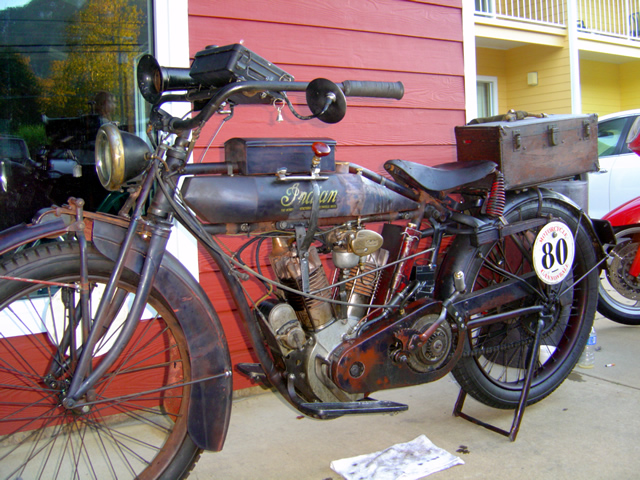
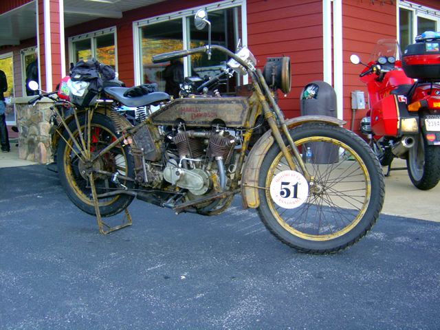
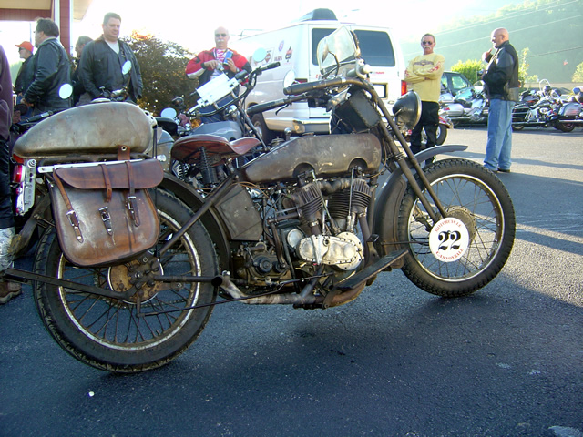
Not all the bikes were restored to original condition

It was interesting to see what it took to make these bikes run. The right fuel mix, careful coaxing and monitoring, and a lot of attention.

Photo - Cannonball Motorcycle Run

Some bikes were in mint condition

Photo - Cannonball Motorcycle Run

Would you race this baby across the country?

48 bikes started the race. Some had already dropped by this 3rd day. Will any make the west coast?

Photo - Cannonball Motorcycle Run

Getting them started is a challenge

They average about 200 miles per day. The longest day is 300 miles. No interstates. Only one rest day. Holy cow.

Photo - Cannonball Motorcycle Run

I wouldn't know where to start to work the controls

I hope they make it. I’d like to see it become an annual event, though I don’t know how long the bikes could make repeated trips.

Photo - Cannonball Motorcycle Run

You couldn't pay enough to duplicate the finish on this machine.

Photo - Cannonball Motorcycle Run

The detailing on this machine attests to its authenticity

It’s something to see motorcycles nearly 100 years old not only running, but racing.

Photo - Cannonball Motorcycle Run

Best to get an assistant to do the starting

Photo - Cannonball Motorcycle Run

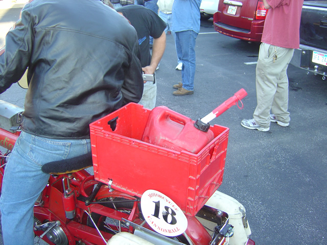
Is that a "cheater tank" on this Harley?

Some of these guys were stopping to fill up every 20 miles.

Photo - Cannonball Motorcycle Run

With VERY limited range, this was the way to go.

Photo - Cannonball Motorcycle Run

A police escort helps

it’s pretty cool to see these old bikes. It’s even cooler to see them run. But when you see them take off down the road to race, it just defies coolness and becomes something beyond.

Photo - Cannonball Motorcycle Run

People came from surrounding states to see the event.

Follow the progress, read the trails and tribulations of the riders a thttp://www.motorcyclecannonball.com/


Photo - Cannonball Motorcycle Run

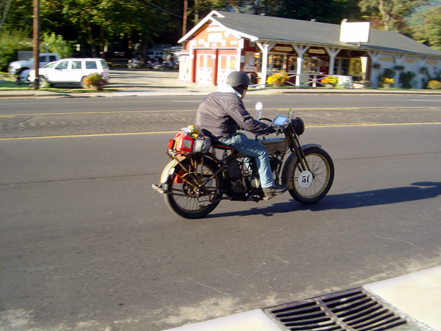
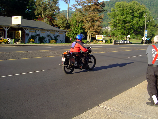
The race is on!

Photo - Cannonball Motorcycle Run

Another racer hits the road

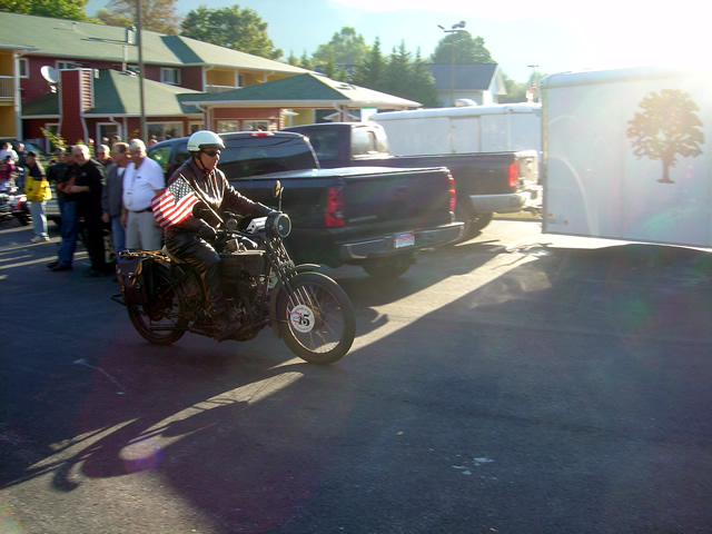
Photo - Cannonball Motorcycle Run

Dude, that flag is gonna slow you down!

Photo - Cannonball Motorcycle Run

Horsepower Ok. Dog power - disqualified.

If you like this you need to pay a visit to Wheels Through Time Motorcycle Museum in Maggie Valley, NC.

_______________________________________________________________________________

Wayne Busch

Wayne Busch - Cartographer


– Wayne Busch lives in Waynesville, NC, where he produces the most detailed and comprehensive and up-to-date motorcycle pocket maps of the Blue Ridge and Smoky Mountains to help you get the most of your vacation experience. See them here – AmericaRidesMaps.com
 

A Motorcycle Ride You Should Know About – A stop at Wolf Creek Dam

If you were in the Smoky Mountains this weekend you already know what perfect motorcycle riding we enjoyed. Cool mornings, warm afternoons, bright sunshine and unusually clear skies meant you were in for enjoyment regardless of where you rode while motorcycle touring. Bikes were everywhere. Riding the Blue Ridge Parkway was outstanding, but no more so than anywhere else.

Photo - wolf Creek Dam

Wolf Creek Dam near the midpoint of NC 281, one of the scenic points on this great motorcycle ride.

As it was a holiday weekend, we chose to avoid the more popular venues and when Labor Day came around I celebrated by – going to work. It was the good kind of work though, out on the motorcycle exploring and discovering more new roads to add to my America Rides Maps. I found a couple more, and today will be an office day as I update the maps. Along the way we took a ride on NC 281 (which I’ve written about previously) a road you should know about.

Photo - wolf Creek Dam

NC 281 is a great motorcycle ride - even the dam is curved and you can see the road leading on to it rarely lets up.

NC 281, a.k.a. Canada Road, is well marked at both ends. The north end is accessed from NC 107 south of Sylva and Cullowhee. The south end is accessed from Us 64 near Toxaway. The road takes you through sections of the Pisgah Forest climbing and rolling gently up and down the mountains with generally nice pavement, some decent views, and excellent curves. It a great road for viewing fall colors.

Photo - view from the Wolf Creek Dam

NC 281 is surrounded by the rugged mountains of the Pisgah Forest with scenic vistas of the craggy rocks and valleys, mountain lakes, and streams.s

We stopped for a break at the Wolf Creek Dam near the midpoint. To the north, NC 281 climbs over a pass then descends through a series of fast sweepers to reach NC 107 at Tuckaseegee. There’s a convenient (though expensive) gas station near the junction. To the south, the road is tighter and more technical as it claws it’s way through the rugged hills on the most recently paved portion. It’s certainly worth your time to take a ride on this great motorcycle road and this weekend many chose to do so.

Photo - stopped near the Wolf Creek Dam

Jackie enjoys a break in the warm sunshine from our nearby explorations of great motorcycle rides.

With the dry weather, the dam was spilling water from the lake to keep the popular trout fishing rivers below flowing. It an earthen dam and riding across it’s arcing top is a thrill for some. While there is a concrete K-barrier on the lake side, the drop off on the boulder strewn face is posted only by a series of large rocks widely spaced.

Photo - Spillway at the Wolf Creek Dam

The lake provides water for the popular trout streams below.

Add NC 281 to your list of rides to do this fall. This is just one section of it, it continues south after it joins with US 64 for a few miles. It’s a far better ride than nearby NC 107 which carries most of the local traffic. There are lots of other great motorcycle roads nearby with outstanding scenery, roadside waterfalls, and challenging and fun curves. You could spend your whole motorcycle vacation exploring them. It’s a road you will return to.

America Rides Maps – Dozens of roads in the surrounding area make it one of my favorites.

_______________________________________________________________________________

Wayne Busch

Wayne Busch - Cartographer


– Wayne Busch lives in Waynesville, NC, where he produces the most detailed and comprehensive and up-to-date motorcycle pocket maps of the Blue Ridge and Smoky Mountains to help you get the most of your vacation experience. See them here – AmericaRidesMaps.com


Fire at The Dragon no Hazard to Motorcycles

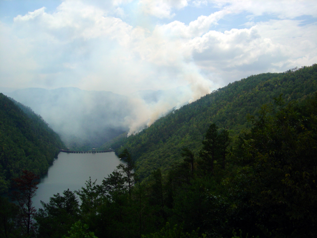
Photo - forest fire near the Calderwood Dam at Deals Gap

View of the forest fire from the Calderwood Dam Overlook at Deals Gap

As I passed through Deals Gap yesterday (scrubbing in my new tires) I paused at the Calderwood Dam overlook at the north end of The Dragon to see what all the activity was about. On Tuesday a lightning strike started a forest fire on the steep slope near the dam. It has been smoldering since.

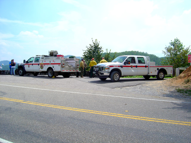
Photo - fire crews at Deals Gap

The fire crews are monitoring and managing the natural burn - "Right now, the information officer is busier than us"

About 35 acres have been involved so far so it’s not a significant fire in size. Fire crews are on the scene and have been managing the burn since, mostly monitoring it to insure it doesn’t affect the dam buildings and at times helping nature do it’s work by setting backfires and encouraging burning along the roadway while keeping it from going out of control.

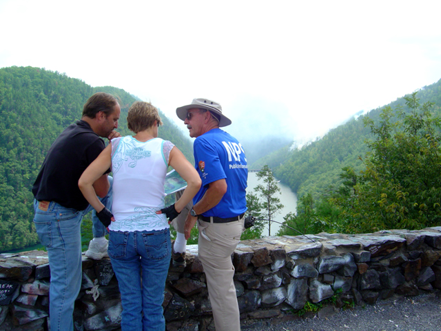
Photo - Information officer at the site

The National Park Service has stationed an information officer at the overlook to explain what's going on.

As the burn is on property recently acquired by Great Smoky Mountains National Park, the park has posted an information officer to inform the public of what is going on and educate them as to how it fits into the park management process. He’s great, knowledgable, has photos, topos, and I enjoyed talking with him.

The fire has had no effect on riding the Dragon, you can still enjoy your visit.

_______________________________________________________________________________

Wayne Busch

Wayne Busch - Cartographer


– Wayne Busch lives in Waynesville, NC, where he produces the most detailed and comprehensive and up-to-date motorcycle pocket maps of the Blue Ridge and Smoky Mountains to help you get the most of your vacation experience. See them here – AmericaRidesMaps.com
 

Follow Me Thursday as I ride the Blue Ridge Parkway end-to-end in One Day

Image - Join Us on the Road to Adventure!

Follow my progress with hourly photo updates on Twitter and Facebook

To continue my celebration of mid-summer motorcycle madness, on Thursday I will get on the Blue Ridge Parkway in Waynesboro, Virginia, and ride it 469 miles through to the southern end at Great Smoky Mountains National Park near Cherokee, North Carolina.

As I go I will make hourly stops to tweet a photo and report on my progress so long as I have cell phone service.

Why not check my progress from time to time on Twitter – americaridesmap

and Facebook – facebook.com/americaridesmaps

I’m not trying to set a record or even establish a benchmark for someone to beat. The hourly stops will insure there is no record to speak of. Admittedly, it’s the worst way to experience the Blue Ridge Parkway, which should be done as slowly as possible with as many side trips as you can afford.

Still, curiosity has got the best of me, and I’ve never done it before nor heard of anyone doing it, so why not?

Follow along with me Thursday!

_______________________________________________________________________________

Wayne Busch

Wayne Busch - Cartographer


– Wayne Busch lives in Waynesville, NC, where he produces the most detailed and comprehensive and up-to-date motorcycle pocket maps of the Blue Ridge and Smoky Mountains to help you get the most of your vacation experience. See them here – AmericaRidesMaps.com
 

Motorcycle Touring the Blue Ridge Parkway – Crabtree Falls Visitor Center – Is it worth the stop?

So what does the Crabtree Falls Visitor Center offer those on a motorcycle tour of the Blue Ridge Parkway and is it worth a stop?

Image located at http://www.ncwaterfalls.com/crabtree1.htm

Image from NC Waterfalls site -http://www.ncwaterfalls.com/crabtree1.htm. For detailed info and more photos use the link.

http://www.ncwaterfalls.com/crabtree1.htm

If you pull into the Crabtree Falls Visitor Center near milepost 339.5 on the Blue Ridge Parkway expecting to see a dramatic and breathtaking cascade you’ll be disappointed. The waterfall is a mile hike distant down a rough trail, not the ideal venue for riding boots and gear. Should you want to see the falls, come prepared to change into something more appropriate for the hike to reach it. Of course, if you’re spending a night at the campground (71 tent and 22 RV sites, May – October, $14) it’s a must do.

Photo - Visitor Center at Crabtree Falls

The Visitor Center at Crabtree Falls on the Blue Ridge Parkway

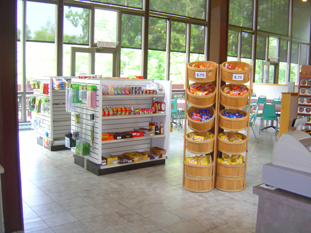
The Visitor Center serves as a convenience store for the campground and parkway traffic. You can get snacks and sandwiches, drinks, and limited supplies.

Photo - seating area at the Crabtree Falls Visitor Center

Seating area at the Crabtree Falls Visitor Center where you can savor your snacks

There’s an indoor seating area as well as a porch, though I would consider the views of a small clearing surrounded by trees all that inspiring. Still, it’s a nice and quiet place to spend a break.

Photo - Gift Shop at Crabtree Falls Visitor Center

One section of the Gift Shop at Crabtree Falls Visitor Center

The Visitor Center at Crabtree Falls is as much a gift shop as it is a convenience store with the usual craft and parkway related items.

Photo - Inside the visitor center at Crabtree Falls

Supplies are limited, but you won't starve if you come in off the road looking to camp.

So is it worth a stop on your motorcycle vacation? If you’re making your motorcycle trip by camping along the way it might just be the nice quiet campground that you’re looking for. It’s certainly a good pit stop for those passing through who need break, a bathroom, and a little something to sustain them on their way.

For info about other waterfalls on or near the Blue Ridge Parkway look at Virtual Blue Ridge -Parkway Waterfalls.

If you’re really into seeing roadside waterfalls, check out America Rides Maps 2 map bundle – The Carolina Waterfall Tour with nearly 2 dozen roadside cascades to enjoy with little if any walking.

http://www.youtube.com/watch?v=eBrB5lrtZ9I

_______________________________________________________________________________

Wayne Busch

Wayne Busch - Cartographer


– Wayne Busch lives in Waynesville, NC, where he produces the most detailed and comprehensive and up-to-date motorcycle pocket maps of the Blue Ridge and Smoky Mountains to help you get the most of your vacation experience. See them here – AmericaRidesMaps.com
 

Good News / Bad News at Onion Mountain Road Near Franklin

Photo - work on Onion Mountain road

For a road that is going nowhere, they are doing a nice job of getting you there. Lets hope they find the funds to finish it this year.

On my way back from Georgia I decided to make a detour to investigate the progress on Onion Mountain Road east of Franklin, NC. This is one of my “pet” roads, one I’ve been watching ever since they started paving it last year. The work completed prior to the winter shut down really got my hopes up that this ridge top two lane would eventually be completely paved once warmer weather returned. The good news is the crews are back at it.

The bad news though, puts a damper on the whole situation. I was excited to follow a dump truck up the winding road, though a little dismayed to see the weight of the passing trucks was already damaging what had been an excellent paving job. Proceeding out onto the gravel section (no change from where  it had begun last year), I soon ran into the work crew. They have no expectation to complete the paving all the way through this year, funding has been cut. Why they are bothering with what they are doing is a mystery to me, it will be just another road to nowhere.

I’ll keep watching. Once paved, Onion Mountain Road will link a number a great motorcycle roads and allow you to avoid pretty but heavily trafficked US 64. I went ahead and added more of the surrounding roads to my America Rides Maps motorcycle pocket map “The Best Roads South of Great Smoky Mountains National Park – WEST” and am considering adding a few more once I give them another look. We’ll see how things develop.

_______________________________________________________________________________

Wayne Busch

Wayne Busch - Cartographer


– Wayne Busch lives in Waynesville, NC, where he produces the most detailed and comprehensive and up-to-date motorcycle pocket maps of the Blue Ridge and Smoky Mountains to help you get the most of your vacation experience. See them here – AmericaRidesMaps.com
 

Motorcycle Touring on the Blue Ridge Parkway – Doughton Park

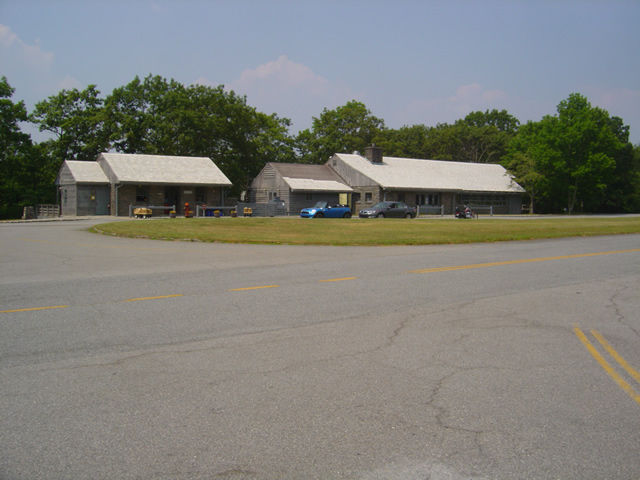
Photo - Doughton Park facilities

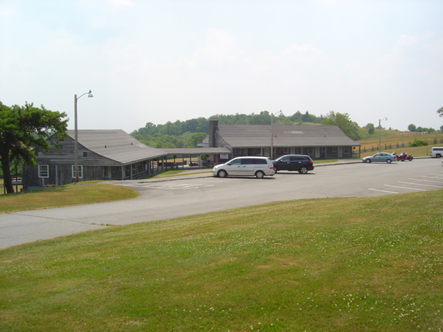
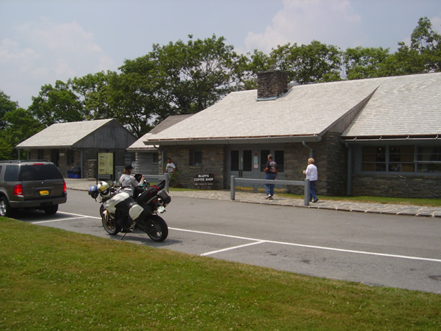
View of the Bluffs Restaurant and facilities on the Parkway

There are numerous places to stop as you cruise along the Blue Ridge Parkway from overlooks to attractions and places which offer concessions and lodging. I usually blow right past them preferring to find places off the Blue Ridge Parkway when I’m in need of something. On a recent pass through, Jackie’s lunch alarm was in the red zone so it was convenient to stop and check out Doughton Park. So what does it offer the motorcycle traveler?
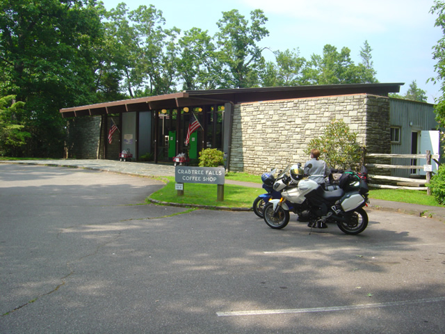
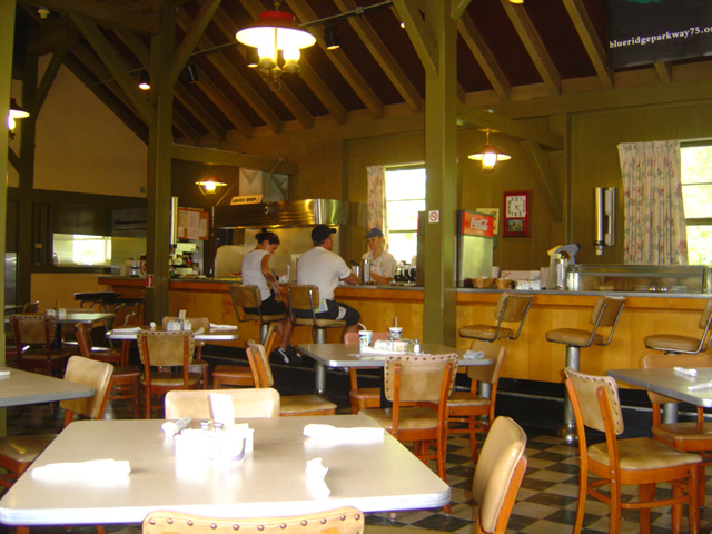
Photo - dining at Doughton Park

Simple and homestyle, the accommodations at the restaurant match the fare.

Doughton Park is located on the Blue Ridge Parkway between mileposts 238.5 and 244.7 as the scenic roadway gets ready to enter Virgina. It’s a 6000 acre tract of parkland featuring open meadows good for seeing critters in the early and late hours. Doughton Park also offers a lodge, a restaurant, picnic areas, a campground, trailer sites, and comfort stations. There are 30 miles or so of hiking trails here and some nice views of the surroundings, a couple historic cabins (pioneer cabins include the Brinegar Cabin (ca. 1885) and the one-room Caudill Cabin (ca. 1895)), and a few overlooks. Views are nice, but not as dramatic as found elsewhere. The facilities are located and milepost 241.1.

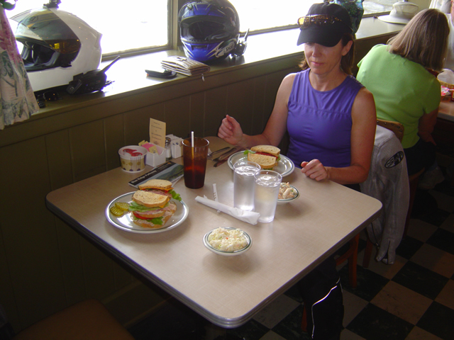
Photo - the sandwiches

Sandwiches reminded me of a visit to Grandma's. They were both good and ample.

We stopped for lunch so the Bluffs Restaurant was the focus of our visit. Food is served “family style” and reported to be “home style cooking”. With just one meal here, I can’t provide a review of the main meals. We ordered a couple sandwiches which were reminiscent of a visit to grandmas.  Nothing exotic, plain American yellow cheese, maybe it was our white haired server, but it sure dug up memories of what I remember from those childhood visits. I suppose it lands squarely in the “comfort food” category, and  honestly, I enjoyed the experience and it filled the hole quite well.

Photo of the Doughton Park Lodge buildings

A quick look at the Lodge then back on the road.

We rode over to look at the Lodge but I have not stayed there. From my experiences with stays at Parkway facilities, they are vintage, but well maintained. For the price, I prefer to look off the Parkway as I can usually stay some place nicer (like the Switzerland Inn at milepost 334). For a more rustic experience, Rocky Knob Cabins are located a milepost 174.

Photo of the restaurant at Doughton Park

Mid afternoon, we missed the lunch crowds. It's a good pit stop if you're trying to make time.

For your motorcycle vacation I’d categorize Doughton Park as a good pit stop. Use the facilities, get a quick meal, take a break. To really enjoy and get the full experience, the Lodge fits the bill though I’m not impressed enough at this point to label this a “must see” location on your motorcycle tour.

Blue Ridge Parkway
Doughton Park

Bluffs Lodge & Restaurant
Milepost 241
(336) 372-4499

Doughton Park is located on America Rides MapsNorth Carolina / Virginia Border Rides

_______________________________________________________________________________

Wayne Busch

Wayne Busch - Cartographer


– Wayne Busch lives in Waynesville, NC, where he produces the most detailed and comprehensive and up-to-date motorcycle pocket maps of the Blue Ridge and Smoky Mountains to help you get the most of your vacation experience. See them here – AmericaRidesMaps.com