Fire at The Dragon no Hazard to Motorcycles

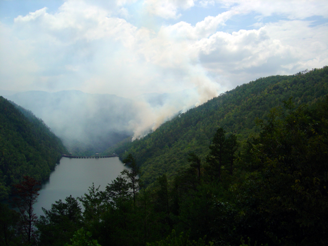
Photo - forest fire near the Calderwood Dam at Deals Gap

View of the forest fire from the Calderwood Dam Overlook at Deals Gap

As I passed through Deals Gap yesterday (scrubbing in my new tires) I paused at the Calderwood Dam overlook at the north end of The Dragon to see what all the activity was about. On Tuesday a lightning strike started a forest fire on the steep slope near the dam. It has been smoldering since.

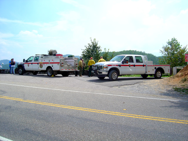
Photo - fire crews at Deals Gap

The fire crews are monitoring and managing the natural burn - "Right now, the information officer is busier than us"

About 35 acres have been involved so far so it’s not a significant fire in size. Fire crews are on the scene and have been managing the burn since, mostly monitoring it to insure it doesn’t affect the dam buildings and at times helping nature do it’s work by setting backfires and encouraging burning along the roadway while keeping it from going out of control.

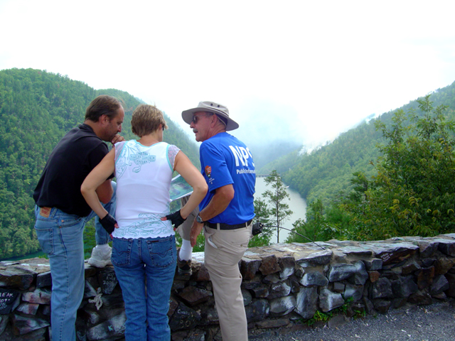
Photo - Information officer at the site

The National Park Service has stationed an information officer at the overlook to explain what's going on.

As the burn is on property recently acquired by Great Smoky Mountains National Park, the park has posted an information officer to inform the public of what is going on and educate them as to how it fits into the park management process. He’s great, knowledgable, has photos, topos, and I enjoyed talking with him.

The fire has had no effect on riding the Dragon, you can still enjoy your visit.

_______________________________________________________________________________

Wayne Busch

Wayne Busch - Cartographer


– Wayne Busch lives in Waynesville, NC, where he produces the most detailed and comprehensive and up-to-date motorcycle pocket maps of the Blue Ridge and Smoky Mountains to help you get the most of your vacation experience. See them here – AmericaRidesMaps.com


Motorcycle Touring the Blue Ridge Parkway in One Day – What was it Like?

On Thursday I rode the Blue Ridge Parkway on my motorcycle from the start at Waynesboro, Virginia, 469 miles to the southern end at Great Smoky Mountains National Park in North Carolina. As I progressed I paused to snap photos and posted them on Facebook and Twitter. Here’s a recap of the experience;
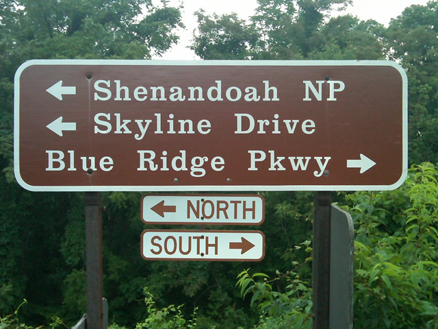
Photo - sign at start of Blue Ridge Parkway

The Blue Ridge Parkway starts where the Skyline Drive ends near Waynesboro, Virginia.

I chose to start at the north end as I knew I’d need to leave at daybreak. The morning fog has been so heavy at the southern end I didn’t want to chance it slowing me down or making for pictures of nothing but white mist. I spent the previous night in Richmond and left before 5 AM to make the 1 1/2 hour ride to Waynesboro in the darkness.
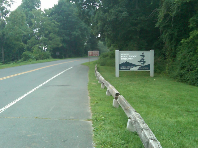
Photo - sign at the start of the Blue Ridge Parkway in Virginia

I took these photos the previous day as I expected it would be too dark to take them on the actual trip. I was right.

I fueled up in Waynesboro, grabbed a cup of coffee and a pack of doughnuts to sustain me, and headed on my way. It would be the last time I stopped to eat or drink. 469 miles is a long way at the 45 mph speed limit. I had no time to waste. At least that was my attitude early on.
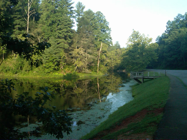
Photo - morning at the lake on Otter Creek

The sun comes up at the lake on Otter Creek. Easy ride so far.

I had the road to myself in the early morning twilight. Within a few minutes I’d seen both deer and turkey. The road starts a gradual climb to elevation here though nothing like the heights reached further south. With no other traffic on the road, my speed crept up a bit, something I’d fight the remainder of the trip. As you get comfortable and into the rhythm of the road, the temptation to take things at your more comfortable pace is always there taunting you. Knowing how far I had left to go didn’t help.
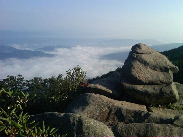
Photo - Above the clouds approaching Roanoke

I paused at this overlook to top up on oil, lube what was left of the chain, and take a few moments to savor the views I was rushing by.

I was also facing the challenge of not knowing if my chain would last the trip. It was already shot before I left, adjusted to the end of the swingarm, far beyond the normal limit. It now sagged precariously and was making noises that had me wondering when it would snap. I’d never seen a chain smoke when lubed before, and I took advantage of opportunities to slather it with lubricant whenever my concerns peaked. I prayed it would not jump the sprockets when carving through a turn and catapult me into a rock face or over a precipice.
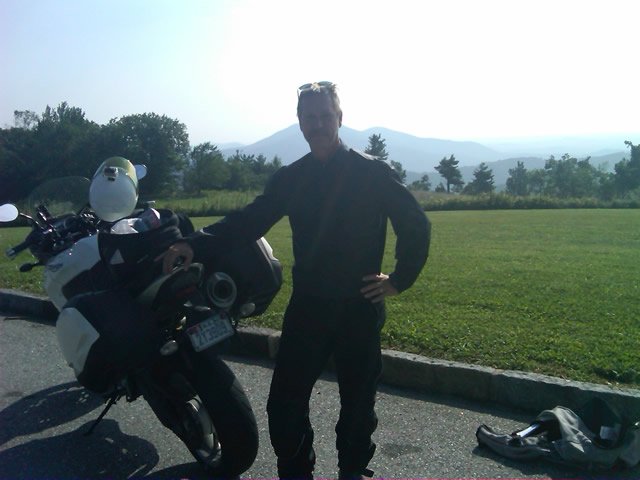
Photo - me and my bike along the Blue Ridge Parkway

A fellow biker snapped this photo of me at a rest stop. Riding from Florida to Maine and back, he and his wife were enjoying the parkway on their return.

Traffic remained surprisingly light through the morning with few holdups to pass slower vehicles. I watched the parkway wake up, the rangers and maintenance crews come to work and start their labors. Finding cell phone coverage to post my photos was always a challenge. You never know when it will be available, sometimes there in what looks like the most unlikely spots, other times absent where you think it should be a strong signal.
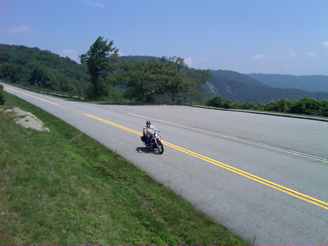
Photo - near Doughton Park

By mid morning there were plenty of other motorcycles on the road. This photo was taken somewhere near Doughton Park.

My first stop for gas necessitated a detour into Floyd, VA. Knowing where the nearest gas stations are is one reason I map the area so throughly. You can waste a lot of time looking for them if you don’t know which way to go. While in Floyd I popped in for a minute to see Derek at the Hotel Floyd, one of my favorite places to stay.
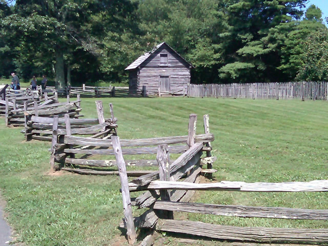
Photo - Historic cabin on the Blue Ridge Parkway

There are a few historic cabins along the road in southern Virginia.

As I crossed into North Carolina and entered the high mountains I knew cell phone coverage would be much more limited. The curves tightened up bit and the road was often wet from spotty showers. It would be another day with temps approaching near 100 in the valleys, but at elevation things remained tolerable so long as I was moving. I somehow avoided all but a slight peppering of rain which felt wonderful at the time.
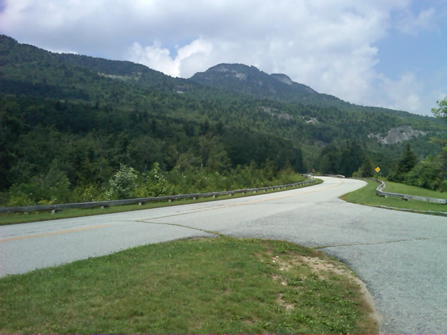
Photo - Grandfather Mountain

Passing Grandfather Mountain I felt I was back on home turf though still a long, long way to go.

Delays had been brief so far, and I planned my next fuel stop to coincide with a quick stop to say hello at the Switzerland Inn in Little Switzerland, one of my favorite places to eat or overnight. I fueled up in Spruce Pine. It was tempting to get a good meal, but I forced myself to press on. The real hold ups came as I approached Asheville. Tree crews and road construction caused significant delays and I hit the “commuter section” during evening rush hour.
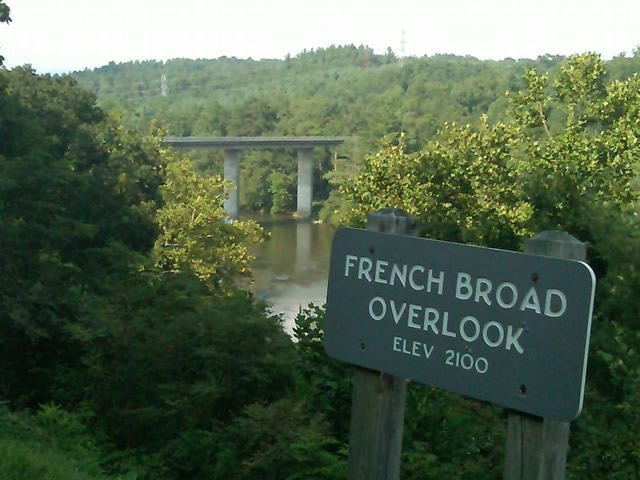
Photo - French Broad River Overlook

It was a great relief to finally cross the French Broad River southwest of Asheville and begin the climb to the highest and most scenic section of the Blue Ridge Parkway.

The sun was drawing near the horizon as I carved my way along the high ridge tops of the section of the Blue Ridge Parkway I consider my back yard. Thunderheads lurked and the road was wet in places, but my luck continued.
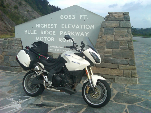
Photo - at the highest point on the Blue Ridge Parkway

Reaching the highest point on the Blue Ridge Parkway, I knew there was less than 40 miles to go to reach my goal.

I reached the southern end of the 469 mile ride with daylight to spare and took a pause at the Oconoluftee Visitor Center in Great Smoky Mountains National Park. I grabbed a few photos but found the battery was now dead on my cell phone. Here they are now –
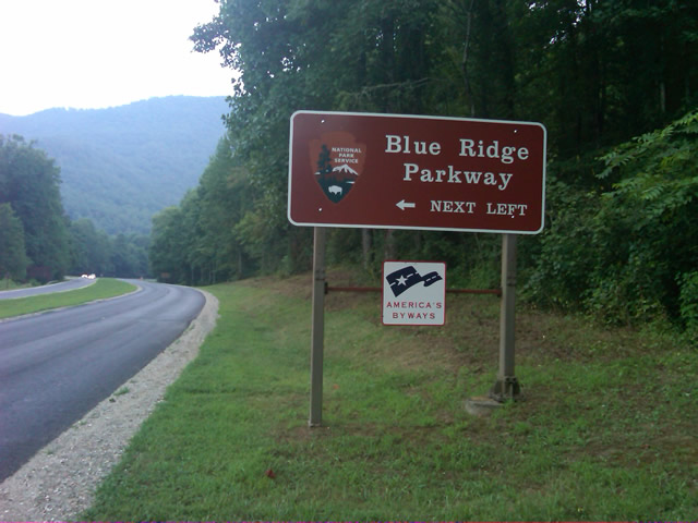
Photo - start of the Blue Ridge Parkway in North Carolina

The Southern end of the Blue Ridge Parkway near the Oconoluftee Visitor Center.

While my Blue Ridge Parkway in a day adventure was completed, I still needed to get home. Noting the evening traffic, I chose to avoid going into Cherokee and got back on the Blue Ridge Parkway now headed in the opposite direction. I rode through to Soco Gap, then passed through Maggie Valley to finally get to my home in Waynesville.
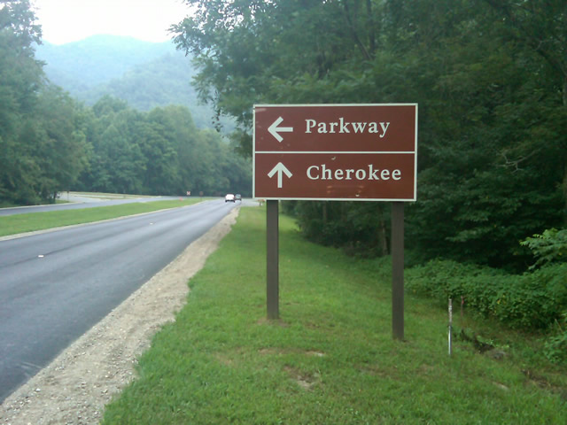
Photo - sign at the southern end of the Blue Ridge Parkway

Go through Cherokee or back the way I'd come? I chose to return home via the Blue Ridge Parkway of course.

My chain lasted the trip. My rear tire is bald. It’s time for some service on the engine. New parts are on order and it will take this week to get the bike roadworthy again. Next week? I might just poke into east Tennessee. I’ve too long ignored the area between Great Smoky Mountains National Park and Knoxville. If I can locate at least a dozen good rides there it will warrant a new motorcycle pocket map. I discovered some great roads along the Virginia / West Virginia border on this trip, several of which will be added to existing America Rides Maps. It will take a few more trips north to determine how the map of that region will lay out but it will come. For now, it’s catch up on the work I left, update the existing maps with the new rides I discovered, and make preparations for the roads ahead.

America Rides Maps on Facebook

America Rides Maps on Twitter

America Rides Maps – the best motorcycle pocket maps money can buy

_______________________________________________________________________________

Wayne Busch

Wayne Busch - Cartographer


– Wayne Busch lives in Waynesville, NC, where he produces the most detailed and comprehensive and up-to-date motorcycle pocket maps of the Blue Ridge and Smoky Mountains to help you get the most of your vacation experience. See them here – AmericaRidesMaps.com
 

Follow Me Thursday as I ride the Blue Ridge Parkway end-to-end in One Day

Image - Join Us on the Road to Adventure!

Follow my progress with hourly photo updates on Twitter and Facebook

To continue my celebration of mid-summer motorcycle madness, on Thursday I will get on the Blue Ridge Parkway in Waynesboro, Virginia, and ride it 469 miles through to the southern end at Great Smoky Mountains National Park near Cherokee, North Carolina.

As I go I will make hourly stops to tweet a photo and report on my progress so long as I have cell phone service.

Why not check my progress from time to time on Twitter – americaridesmap

and Facebook – facebook.com/americaridesmaps

I’m not trying to set a record or even establish a benchmark for someone to beat. The hourly stops will insure there is no record to speak of. Admittedly, it’s the worst way to experience the Blue Ridge Parkway, which should be done as slowly as possible with as many side trips as you can afford.

Still, curiosity has got the best of me, and I’ve never done it before nor heard of anyone doing it, so why not?

Follow along with me Thursday!

_______________________________________________________________________________

Wayne Busch

Wayne Busch - Cartographer


– Wayne Busch lives in Waynesville, NC, where he produces the most detailed and comprehensive and up-to-date motorcycle pocket maps of the Blue Ridge and Smoky Mountains to help you get the most of your vacation experience. See them here – AmericaRidesMaps.com
 

Dumb Things to Do on Your Motorcycle – Cades Cove Bears on a Saturday

I don’t know what possessed me to ride through Great Smoky Mountains National Park on a warm, sunny, Saturday, but then I’m kinda getting in the spirit to do more dumb things on my motorcycle this week – more on that plan later. Nonetheless, I had a new tire to scrub in so I took off for the Dragon at Deals Gap to do the deed. Arriving early in the afternoon, I found it pleasantly low in traffic. Most everyone had already made their passes and headed out to explore the surroundings and I had a good run through it thanks to my brother riders who waved me to slow down when approaching the police stationed along the route. I arrived at the overlook with the new front tire looking like someone had taken a cheese grater to the shoulders and satisfied with the performance of the new Michelin Pure rubber which now adorned both ends of my ride.

I stopped in to see Jody at the Punkin Center Motorcycle Campground who was deeply engaged in a mid afternoons relaxation on the porch, and had to pass on the cool one offered as I had miles to before I reached home. We talked briefly of roads and riding, then I set out for the Foothills Parkway which runs along the Northwest border of Great Smoky Mountains National Park .

Photo - Cades Cove, Gear Smoky Mountains National Park

A view from the Cades Cove Loop Road which rings the valley in Great Smoky Mountains National Park

The Foothills Parkway has never impressed me much, but then my standards of comparison are skewed from all the time I spend on the Blue Ridge Parkway. I passed through Townsend, then fell in line with the cattle herd that staggers it’s way through the park. Regardless of the speed limit, there is always some plod who thinks the posted speed is at least 10 mph too fast and there are a dozen cars in front of you. Oblivious to the landslide of perturbed drivers riding up his bumper, he motors right past pull off after pull off where he could let the traffic pass. It’s all part of the experience.

Photo - the Cades Cove Loop Road in Great Smoky Mountains National Park

Freshly paved, the scenic loop road around Cade's Cove is a great place to see the wildlife that is so plentiful here

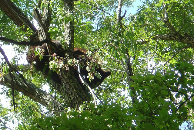
The purpose of my visit was to lay eyes on the newly paved sections of road so I made a detour out to Cades Cove to see the Loop Road. I started, stopped, started, stopped, started (you get the idea) out the freshly paved single lane but quickly realized at this pace I could throw away my watch and use a calendar to figure when I’d get home. I took the first opportunity to shortcut the loop with Sparks Road, an unpaved cut more or less straight across the valley. Nearing the South end of it, I saw the first bear up in a cherry tree gorging on the summer fruit and stopped to snap a photo.

Photo - bear in tree in Great Smoky Mountains National Park

One of several bears I saw on my short visit. They were high in the cherry trees gorging on the summer fruit.

Reaching the south side of the loop road, I fell back into the herd which was held up by another bear spied in another cherry tree at which point people just abandon their cars in the road and walk out to stand beneath the bruin for a telephoto of the bears ass. It’s all part of the experience.

Photo - riding with the herd on River Road

Just one of a long like of bikers on River Road in Great Smoky Mountains National Park

The ride back from Cades Cove, along River Road, then across the park on 441 need not be detailed, it was as was already described. All the way. All the time. I finally escaped onto the Blue Ridge Parkway scooting around the next plodder who was doing 20 mph in the 45 mph section with a quick twist and flick, then fell in with another bike that was obviously not a tourist. I felt it my duty to ride along at a matching pace as a safety backup just in case his enthusiasm wasn’t matched by the talent it took to lay a bike through the turns like he was and someone had to make a 911 call. I’m always there for you bro.

Which brings us back to more dumb things to do on your motorcycle. One day this week I’m going to ride the 469 mile long Blue Ridge Parkway from end to end. In one day. That’s really dumb, like seeing how fast you can have sex. The goal is not to see how fast I can do it, though my competitive nature would naturally lead to that extreme.  Nor do I want to establish a benchmark which will invite challenge by setting a time. I’m building in a safeguard to prevent me from giving in to that temptation. I’m going to force myself to stop once every hour, take a photo, and tweet my location and situation when I have cell phone reception.

I was hoping to go south to north on Tuesday, but the morning fog has been so heavy lately it might not only delay me, but the photos I take will show nothing but white for the first couple hours. It looks like I’ll come from the North end south on Thursday instead. Don’t ask why, it’s something to do with the summer heat no doubt.

Plan on following me on my Parkway-in-a-day tour this Thursday.

_______________________________________________________________________________

Wayne Busch

Wayne Busch - Cartographer


– Wayne Busch lives in Waynesville, NC, where he produces the most detailed and comprehensive and up-to-date motorcycle pocket maps of the Blue Ridge and Smoky Mountains to help you get the most of your vacation experience. See them here – AmericaRidesMaps.com


Motorcycles in the Fog at Fontana Lake Near Deals Gap

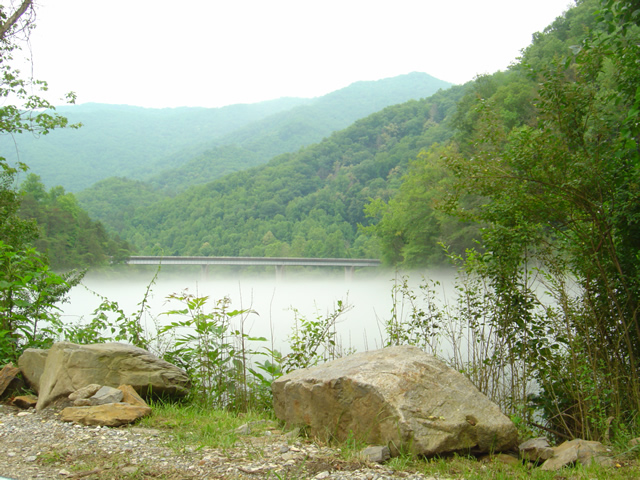
Photo - Fontana Lake draped with fog

The bridge across Fontana Lake on NC 28 floats above a cloud of fog over the chilly water on a hot day.

Hot, overcast, occasional spits of rain, it was still a nice day to hop on the motorcycles and cruise over to Deals Gap at the southwest corner of Great Smoky Mountains National Park. When the summer heat comes on it’s not unusual for a fog to form over the chilly waters of Fontana Lake as you near the Dragon.

Photo - Fog on Lake Fontana

The fog hugs the waters on hot days.

I shot a few photos on NC 28 to capture the phenomenon. Maybe the clouds put off some of the usual weekend crowds, there were relatively few motorcycles out for a Saturday. There were times the Dragon was quiet for a minute or more, a good day to pay a visit.

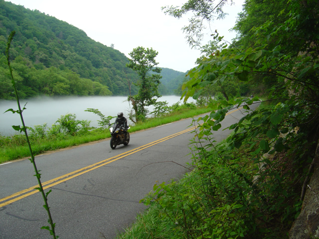
Photo - Motorcycle on NC 28 at Lake Fontana

A motorcycle cruises the lake shore on NC 28

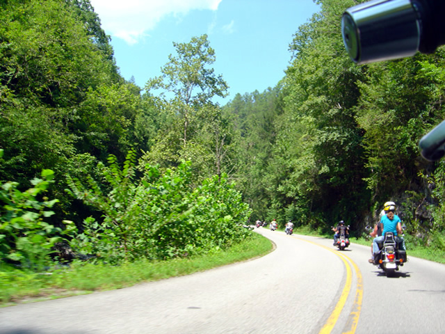
Maybe the sportier riders stayed closer to home today. The Harleys, Gold Wings, Beemers, and other dressers  were out in force on the twisty roads at Deals Gap. It was a good  day for motorcycle touring.

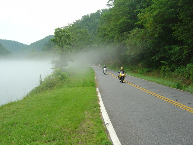
Photo - Motorcycles along foggy Fontana Lake

Rarely does the mist rise high enough to have much effect on the roadway, at least in the middle of the day.

The lake section of NC 28 bordering Great Smoky Mountains National Park is one of the most beautiful, but it’s the curvy and twisty parts that make it one of the best rides in the Smoky Mountains. I hope you get to see sights like these on your next motorcycle vacation.

For the best maps of motorcycle rides the area look no further than America Rides Maps .

http://americaridesmaps.com
Another Great Motorcycle Ride to be Added to the List – My Secret

It’s not all that frequently I miss a great motorcycle ride in my explorations. I really try to be thorough as well as intuitive, so few slip by. Still, I can’t claim to know ALL the great roads in the southern Appalachians, just the vast majority of them. I continue to find more, and quite embarrassingly, they are too often close to home. Everyone believes they know ALL the great roads right in their back yard. Time and again I am proven wrong, and that’s not such a bad thing.

Stop reading now if you think I am giving this one away. No photos, no road names, nada. I just gave away 30 routes at the Asheville Bikefest for free and people gobbled them up. Nor is this a post about the Asheville Bikefest, I think you may be getting sick of hearing about that, but be cautioned, there will be more to come. The event was far more successful than expected and stuff is flooding in. The only reason I mention the event is because I found this great road because of it.

As Route Master for the Asheville Bikefest (there I go again, last time) I spoke with countless people helping them find the best rides in the area and getting them to see the most in the time they had. When you’re passionate about something, even work becomes fun. I went almost non-stop for four days and I had a great time. That’s why I founded America Rides Maps.

So anyway, this guy wants me to direct him to one of the two dozen local roadside waterfalls, which I do, so he can get of picture of his bike behind it. Yeah, you can actually drive behind this waterfall right off the road. He didn’t find it. Why, I don’t know, it’s one of the most obvious roadside waterfalls there is but that doesn’t matter. What matters is this guy doesn’t give up. He gets directions which lead him off into the forest. He rides and rides everything in sight, exploring places I know better than to go. He never finds it.

The next day he comes back to me and tells me he couldn’t find the waterfall. I’m a bit incredulous, it’s so easy. I redirect him. He relates his adventures and tells me he found this awesome motorcycle ride. I’m dubious. If he couldn’t find the easy waterfall do I believe him now? I made a mental note of it nonetheless. About an hour later I’m talking to a couple of women. They’re buying maps of the areas closest to them (we all think we know our own back yard), right down the street from the “event which will not be named again in this post. Out of curiosity, I ask if they know of this road the guy mentioned. “I live on that road, it’s great!”

So I can’t resist. Today I have to check it out. It rocks. Who cares how or why I missed it.   I’ll add it to the “The Best Roads South of Great Smoky Mountains State Park – EAST” map tomorrow. The other routes in the area I’d previously identified were detours around a congested town and a four lane section of road which formed one leg of a 100 mile+ triangle of superb riding. Now I think I’m looking forward to the detour more than the great rides that lead to it.

I have some more leads to follow up. I know some will be disappointing. I think I’ve done at least one and rejected it, my standards are high, but you never know. I’d be very pleased to find another jewel.

Tail of the Dragon Closed – Great Rides Nearby – Hot Springs

No new info on the rock slide which has closed the Tail of the Dragon at Deals Gap. In a previous post I suggested some great rides nearby in the “Land of the Waterfalls” and provided a video sample. It’s just one great spot near the Tail of the Dragon with great motorcycle rides nearby, here’s another.

Photo - View of Hot Springs, NC

Hot Springs, NC - A town so small it fits on one photo.

This time I’m going to direct you to an area which sees little traffic, yet contains some fabulous and challenging motorcycle rides with some enjoyable sights and scenery. It’s an area most motorcycle tourists either drive right past on their way into the region or sample only the most notable road. Trust me, there is a lot there to explore and enjoy.

Photo - A roadside view near Hot Springs

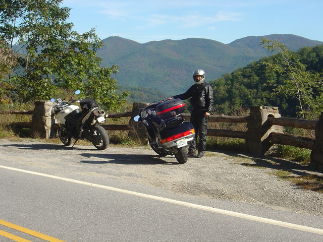
Pausing to admire the view near Hot Springs, NC

I urge you to spend some time riding the great roads found in the mountains east of Great Smoky Mountains National Park. The Smoky Mountains do not end at the border of the park, in fact they continue their long run northward reaching their greatest heights north of Asheville, North Carolina at Mt. Mitchell, highest peak in the east just off the Blue Ridge Parkway. The mountains between the park and Mt. Mitchell are spectacular and beautiful, the valleys dotted with rural farms and tiny hamlets, sections of wild national forest, and roads which trace the serpentine courses of rushing mountain streams.

Photo - entrance to the Hot Springs Spa

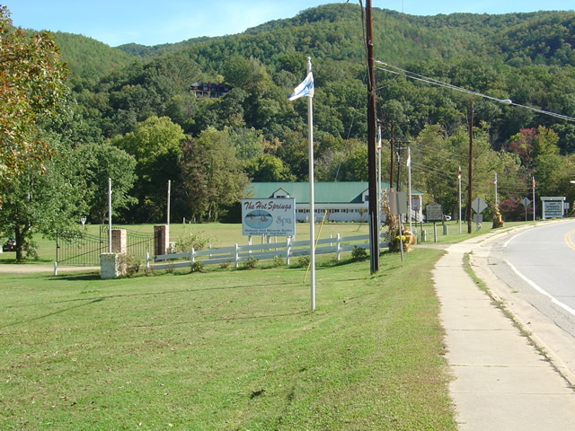
Entrance to the Hot Springs Spa - Natural Mineral Baths and Massage

The hub of this great motorcycle riding area is the small and historic town of Hot Springs. It’s a good place to pause for lunch, do a little sightseeing, and maybe pay a visit to the natural hot springs which give the town its name. Long popular with hikers (the Appalachian Trail passes through town), fly fisherman, and whitewater rafters and kayakers on the French Broad River, it’s also a popular local motorcycle watering hole as it’s a convenient ride from Asheville.

Photo - French Broad River at Hot Springs

The French Broad River flows through Hot Springs

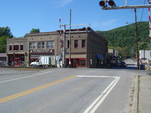
Honestly, there’s not a lot to the town. No traffic light. One gas station. A few shops and restaurants, a campground, and of course the Hot Springs Spa. You can capture the whole thing in a photo. It’s the roads and the beautiful countryside which surrounds that makes it worth the visit.

Photo - Iron Horse Station, Hot Springs

Iron Horse Station - One of several places to grab a bite and quench your thirst in Hot Springs.

If you take but one ride into the area, do the classic section of NC 209 which runs from Lake Junaluska to the heart of town. It’s such a nice ride. It takes about an hour one way. It’s a local classic. Be aware there is plenty more out there if you know where to look for it.

Photo - Fall Color at Lake Junaluska

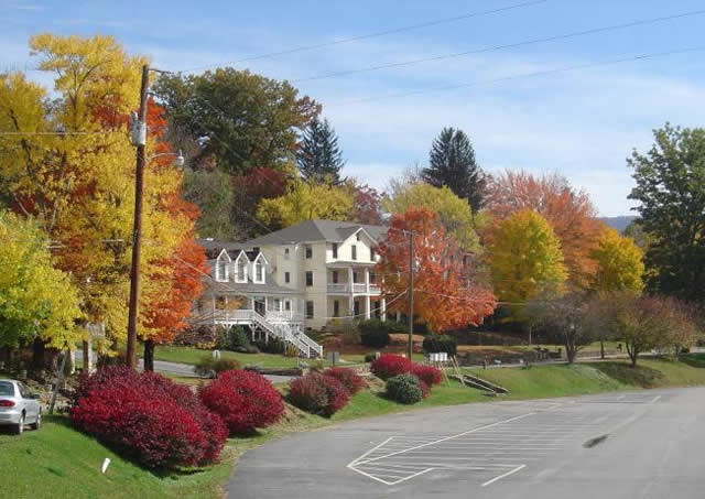
One of the best rides, NC 209, starts near Lake Junaluska

I’ve been working on a video to showcase the area, though the severe winter pretty much closed the door on that for a long while. I’ll be getting back to it ASAP. Here’s the sample that gives you a good idea of what to expect:

http://www.youtube.com/watch?v=3hsCLMCIUOo

For more detail on the area look to America Rides Maps ” East of the Smokies, West of Asheville, All Around Hot Springs” map which catalogues about 400 miles of the best roads in this small area.

Don’t worry, there’s still more great riding alternatives to come in future posts. Closing the Tail of the Dragon opens the door to you discovering just how much you’ve been missing.

Motorcycle Vacation Planning – Great Ride Alternatives

SEE SOME WATERFALLS!

Photo - Whitewater Falls Highest in the east

Whitewater Falls - Highest in the east

With the Tail of the Dragon at Deals Gap on the North Carolina / Tennessee state line now closed due to a rock slide, many who have made reservations in advance may be wondering what to do. Before you cancel those reservations, consider there are plenty of alternatives to discover great motorcycle rides in the area within easy reach.

The Cherohala Skyway, Tennessee’s version of the Blue Ridge Parkway, remains open and is a fine ride, though be aware much of the regional traffic will be shifting onto it. It’s not quite the challenge to ride, but it makes up the deficiency with great scenery as it climbs to over 5000 feet before entering North Carolina.

Of course, NC 28 which intersects US 129 in North Carolina at the southern end of the Tail of the Dragon will be there for those looking for a more challenging motorcycle route. With the Dragon closed, I suspect traffic on it will be light. Don’t let this road fool you, it “bites” more riders than the Dragon in that it is not as predictable. Where the Dragon has one turn after another, you know what to expect,  NC 28 has some more open stretches where you can pick up speed only to find the upcoming 10 mph corner is far sharper than you are ready for.

Many motorcycle tourers who ride this section of NC 28 don’t realize it continues further south into South Carolina and miss out on a great section of road. It grows to 4 lanes as it reaches the intersection with the Great Smoky Mountains Expressway, continues a few miles on the highway, then diverts south again to become a wonderful two lane road again. All in all, it’s more than 100 miles of truly great motorcycle riding with but a few interruptions where it passes through Franklin and Highlands.

Photo - Dry Falls

Dry Falls - You can walk behind them

The first area I highly recommend you spend some time motorcycle riding is often called the “Land of the Waterfalls”. Comprised primarily of the wild mountains of the Nantahala and Pisgah National Forests, this area south of Great Smoky Mountains National Park hosts one of the greatest collections of easy to view roadside waterfalls in the nation including the highest waterfall east of the Rockies.

This rugged area is laced with challenging and scenic motorcycle roads including the highest and most beautiful section of the Blue Ridge Parkway. Springtime is the best season to see them before the summer leaves obscure the views.

Here’s a video sample of them from America Rides Maps;

http://www.youtube.com/watch?v=eBrB5lrtZ9I

Don’t let the closure of the Tail of the Dragon ruin your motorcycle vacation. There are plenty of great rides just over the hill. These are some of the best, more to come.

Contact http://americaridesmaps.com for more suggestions and advice.
New Rock Slide Affects Motorcycle Vacation Plans to Smokies

Add yet another rock slide to the long list of road closures in the mountains of western North Carolina and eastern Tennessee. This one in particular will affect many motorcycle vacation plans to visit one of the most popular and well known rides in the region, the infamous Tail of the Dragon on US 129 at Deals Gap. Located along the western border of Great Smoky Mountains National Park, the 13 mile stretch of US 129 with it’s 311 curves draws hundreds of thousands of motorcycle and sports car enthusiasts each year who come to experience the challenging stretch of road.

It’s been an exceptional year for rock slides in the Smokies, the most notable being the massive slide along the eastern edge of Great Smoky Mountains National Park which has closed Interstate 40 for months. With both the east and west routes around the park closed, the only route allowing north-south travel from Tennessee to North Carolina is US 411 which cuts through the heart of the park and it too has been the scene of slides. US 441 is presently open, though cleanup continues on the northern spur road.

The Tail of the Dragon is still accessible from the North Carolina side. From Tennessee, the best route is through Tellico Plains and onto the Cherohala Skyway. Expect increased traffic loads on TN 68 approaching Tellico Plains due to yet another rock slide on US 64-74 in the Ocoee River Gorge which has shifted traffic onto it. As far as I can tell, it is still possible to reach Pumpkin Center from Vonure on the north end of the Dragon via the popular Dragon – Cherohala loop ride. Still, even more traffic will now be using these roads and you may want to reconsider visiting the area until things improve.

I’ve been reporting on the status of all the rock slides and road closures in my newsletter which you’ll find archived here – http://budurl.com/3smm. As there are so many, so widely scattered, it may be the easiest place to find all the information without bouncing around to various DOT sites (they are rarely as up to date). With so much going on, I’ll probably post an extra edition or two to keep you apprised of the situation and help with your motorcycle vacation plans. There is a lot going on you need to be aware of including the progress on the clean up to the Blue Ridge Parkway after severe winter storm damage, the closed section there, and all the roads which have been closed in Great Smoky Mountains National Park for paving.

If you have early year travel plans to Robbinsville, Townsend, Gatlinburg, Pigeon Forge, Great Smoky Mountains National Park, or Franklin, I suggest you consider them carefully. Better alternative destinations for motorcycle touring would include Maggie Valley and Asheville. I’m am working with local lodgers to find you the best deals and affordable as well as luxury motorcycle friendly accommodations. I’ll be stepping up those efforts. Please email me for help. The changes in traffic patterns have severely impacted their business and there are some deals to be had. Watch the blog as I review them.

Finally, for America Rides Maps patrons, I want you to be aware these rock slides have impacted 3 of the 4 loop rides on the most popular map “Maggie Valley to Deals Gap and the Cherohala Skyway”. I strongly urge you to look at the “Waterfall Package” for the best alternative. These two maps will lead you into some of my favorite areas unaffected by the changing traffic patterns and open up a wealth of fantastic rides which are too often overlooked. These roads are the first place I head when looking for great riding, the first place I take tour groups, and hold everything you’ve come to expect from a motorcycle vacation in the Smokies.

Looking For Motorcycle Adventure? See The Wild Smoky Mountains With GSM Moto Rent

http://www.youtube.com/watch?v=GcAgqmGpiZk

Remember all that fun you had as a kid learning to ride on that dirt bike? Maybe you’ve dreamed of challenging the wilds like Charlie and Ewan, taking the Long Way Round ? Already riding a dual sport bike and looking for motorcycle adventure? Whether you prefer just tooling along on the pavement, groomed fire roads, or gnarly single track trails, you can find them near Townsend, Tennessee.

GSMmotoRent offers dual sport motorcycle rentals, guided & self guided tours and cabin rental on the Little River: All within a half mile of the Great Smoky Mountains National Park.

We invite you to ride some of the greatest paved and gravel roads around! Everyone knows about our great roads in East TN and Western NC, such as the Tail of the Dragon, Blue Ridge Parkway, and Cherohala Skyway, all within an hour or less from our base in Townsend, TN.

But if you want to really avoid the crowds and get in some great motorcycle riding off the beaten path– let GSMmotoRent help. Our fleet includes Kawasaki KLR 650’s, Suzuki DR 650 and 200’s. We can provide the equipment, and with our knowledge of the area provide you with the best routes that fit your needs. On-site river front cabin rental is available as well as transportation to and from the Knoxville, TN regional airport. We also offer secure storage for your bike: short or long term.

The bikes were in great shape and well maintained. We had an unbelievable day riding 180 miles of excellent paved and unpaved roads in and around Smoky Mountain National Park. We arrived back at GSM in the late afternoon very happily tired. We all agreed it was one of the most enjoyable motorcycling days we’ve ever had. This was our first experience with GSM MotoRent and it could not have been better. Dan and Debbie are wonderful people and run a top-notch outfit. Thanks,
Joe Nardy

http://www.youtube.com/watch?v=1Tb1CIolSOw

Visit http://gsmmotorent.com
CALL US AT 865-448-6090