Riders Roost Restaurant – Motorcycles stop here on the Blue Ridge Parkway

Image - Riders Roost Restaurant sign

Riders Roost Restaurant - watch for this sign

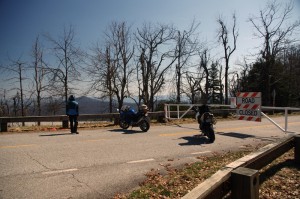
Joanne finally got the new Riders Roost Restaurant signs up after a car took out the old ones on the icy winter roads leading down from the Blue Ridge Parkway at Soco Gap (US 19) near Maggie Valley (LINK TO MAP). Just a little more than a mile downhill from the Blue Ridge Parkway exit heading east, the Riders Roost Restaurant offers the motorcycle traveler and good meal in a beautiful setting convenient to your travels.

I’d hoped to catch Joanne in the kitchen, but with such outstanding weather over the weekend, she was out on her Harley enjoying it like the rest of us. Can you blame her?

Photo-Riders-Roost-Restaurant

Riders Roost Restaurant - Great food, Great view, Great location

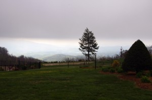
I highly recommend you grab a nice bite to eat and maybe a cold brew on the back porch with it’s commanding view of the mountains. It’s one of my favorite places when the fall colors come, they’re spectacular from the porch.

In addition to the Riders Roost Restaurant, Joanne has her Fireside Cottages available just downhill. Such a nice package – a great place to stay with good food  just minutes from the best section of the Blue Ridge Parkway surrounded by more outstanding motorcycle riding. What could be better?

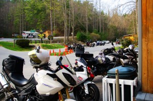
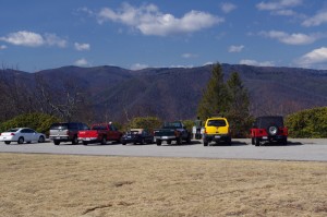
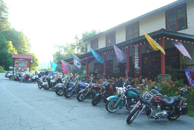
Photo - motorcycles at the Riders Roost Restaurant

Biker friendly Riders Roost Restaurant is obviously the place to be!

Riders Roost Restaurant

Fireside Cottages

_______________________________________________________________________________

Wayne Busch
Wayne Busch – Cartographer
– Wayne Busch lives in Waynesville, NC, where he produces the most detailed and comprehensive and up-to-date motorcycle pocket maps of the Blue Ridge and Smoky Mountains to help you get the most of your vacation experience. See them here – AmericaRidesMaps.com 

How to Make a good Deals Gap Motorcycle Ride Better –

Adding these two roads to one of the four most popular Smoky Mountain motorcycle loop rides near the The Dragon at Deals Gap makes the least of them measure up to the others.

Photo - morning on the Cherohala Skway

Morning on the Cherohala Skyway. I'm parked on the state line between North Carolina and Tennessee.

Smoky Mountain / Blue Ridge motorcycle riders who flock to ride The Dragon at Deals Gap typically take in other rides when in the area. One of the best Smoky Mountain motorcycle rides is a loop through Vonore and Tellico Plains, TN to take in the Cherohala Skyway. Another popular circuit is to loop around Great Smoky Mountains National Park crossing through the heart of the Smoky Mountains on US 441. A third great loop ride links NC 28 at Franklin, NC to Nantahala Gorge via Wayah Road. All of these are great loop rides in the Blue Ridge with unique characters.

The fourth most popular ride is to take the Cherohala Skyway west to Tellico Plains, then go south on TN 68. You then use TN 123 / NC 294 to head east, and follow US 74 / 129 north through the Nantahala Gorge to return to The Dragon at Deals Gap. This loop ride starts out with the outstanding scenery and enjoyable sweeping curves of the 50 mile long Cherohala Skyway as it crosses the Snowbird Mountain Range of the Blue Ridge. It gets nice again once you enter the curvy sections a few miles south of Tellico Plains on NC 68. It’s gets better and better the further south you go, though NC 68 can carry a bit of traffic on weekends.

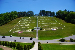
Photo - Field of the Woods

The 10 Commandments at Fields of the Wood - big enough God can read them

Once you turn east on TN 123 / NC 294, the ride is still pretty good, but the road opens up and the ride is not as scenic and challenging as you progress. Here’s how to punch it back up to outstanding.

Watch for Fields of the Wood, it’s the closest landmark to the turn off onto Hiawassee Dam Access Road. Fields of the Wood is worth a stop to see and a nice place for a break. Those with devout religious leanings will be inspired by the hillside with the ten commandments written out in stone, as well as numerous other Biblical icons and monuments. For those inspired more by hellacious and challenging roads, Hiawassee Dam Access Road is next leading to devilish twists and curves.

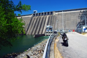
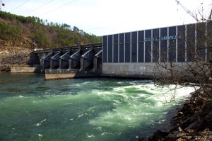
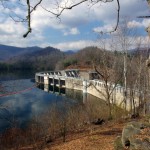
Photo - Hiawassee Dam

The Hiawassee Dam is a nice spot for a break.

Turn onto Hiawassee Dam Access Road to start the fun. You may encounter a little traffic approaching the dam on weekends as many come for boat access to the lake and river. Once past the dam, the excellent and challenging road continues a course around the west side of the lake. Turn right onto Joe Brown Highway when you reach the end of Hiawassee Dam Access Road.

Joe Brown Highway is hardly what any of us think of when the word “highway” comes to mind. This isolated and remote twisty two lane back road is packed with curve after curve and some pretty decent Smoky Mountain scenery, though you’ll be paying more attention to the road than the horizons. It’s a whole lot of fun, usually carries very little traffic, and may be the best section of the entire loop, a nice contrast to the sweeping curves of the Cherohala Skyway.

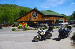
Photo - Nantahala Outdoor Center

The Nantahala Outdoor Center on the river is another great break spot with bathrooms, good food, nice views, and the place to arrange a river trip.

Joe Brown Highway runs you right through downtown Murphy, NC to intersect US 129 / 74 at the junction with US 64 East. Turn north to follow the four lane to Andrews where it funnels down to two lanes again for the ride through scenic Nantahala Gorge. You’re bound to run into traffic in Nantahala Gorge, but the scenery along the popular whitewater river makes up for it. Avoid the gorge on weekends when possible as the buses hauling rafters and kayakers tend to bottle things up.

Once through Nantahala Gorge, turn left onto NC 28 and back into the twists and curves to return to The Dragon at Deals Gap.

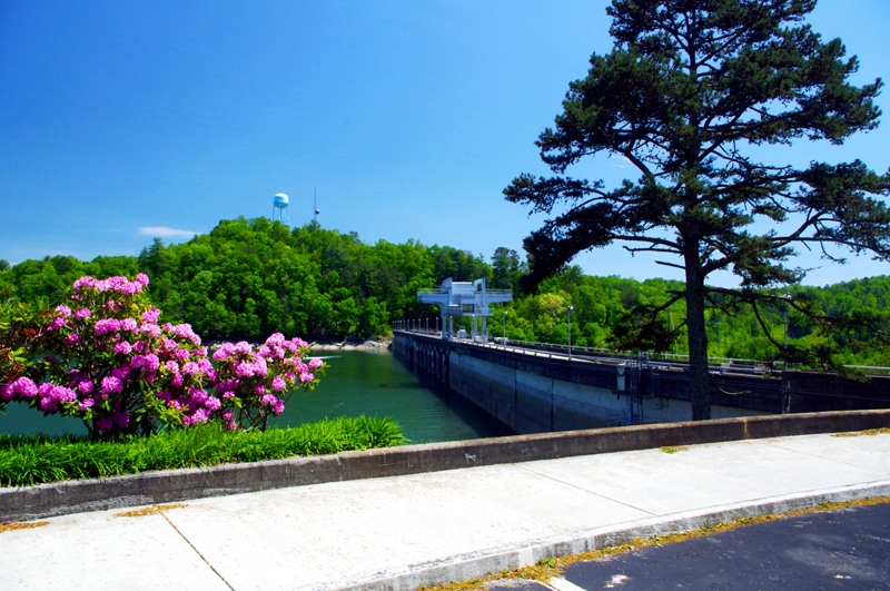
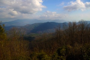
Photo - View from Hiawassee Dam Overlook

There are nice spots for a break both atop and below the Hiawassee Dam. The road runs across it then continues around the lake.

_______________________________________________________________________________

Wayne Busch
Wayne Busch – Cartographer
– Wayne Busch lives in Waynesville, NC, where he produces the most detailed and comprehensive and up-to-date motorcycle pocket maps of the Blue Ridge and Smoky Mountains to help you get the most of your vacation experience. See them here – AmericaRidesMaps.com 

100 miles out on the Blue Ridge Parkway, my motorcycle was stuck in top gear

I’d dropped the bike. Pulling out from a back road along the Blue Ridge Parkway, a car suddenly appeared out of the dense clouds rounding a curve and I stalled the engine on the incline.  It went down hard on it’s left side breaking a turn signal lens and mangling the clutch and shift levers. Minor damage considering I’d avoided the car, but it would prove enough to make the trip home a challenge.

Photo - View From Switzerland Inn

The nicest weather came just before my meeting at the Switzerland Inn - http://SwitzerlandInn.com

Already modified from a prior incident (click to read about that debacle) the shift lever was now wedged beneath the side stand. The clutch lever flopped precariously but it was working, and with a decent foot effort I managed to pry the shifter upwards and snick through the gears to get moving again towards Asheville. It was when I tried to downshift for a curve the real problem became apparent. I could not shift into a lower gear.

Thankfully I was on the Blue Ridge Parkway, uninterrupted in its 469 mile length. No stops, no traffic lights, it would be a manageable inconvenience to be restricted to a single gear. The problems would come when I left the parkway and entered the city traffic. At least I’d have plenty of time to come up with a plan on how I’d get home without slowing or stopping.

Photo - bad weather on the Parkway

It's days like this a waterproof camera comes in handy on the Blue Ridge Parkway

Trying to bend the shift lever into a more useful shape was a last resort. Previously bent once, it would likely break if I stressed it any more. I decided I’d need to find a way home where I would not need to stop even once.

Traffic was light. The weather was already miserable at these high elevations and would continue to deteriorate as a strong front moved in. The wind gusted powerfully, rain squalls spit at me, and I was enveloped by thick clouds as I passed by the signs for Mt. Mitchell, then Craggy Gardens. The low fuel light came on as I drew near to Asheville but I knew there was no way I could negotiate traffic, stopping was not an option. I decided I must go on.

In 20 miles or so I’d reach the US 276 exit south of Waynesville. If I could get off the parkway without stalling, then make it down through the switchbacks on the steep incline, there would be but one traffic light to gamble on to reach home.

Cresting the rise that led into Bethel, I saw the light blink from red to green and rolled on the throttle to cleanly pass through it. 10 minutes later I pulled into my driveway. Just another day on the road.

A little video from the day –

http://www.youtube.com/watch?v=j57PPHa_vVI

_______________________________________________________________________________

Wayne Busch
Wayne Busch – Cartographer
– Wayne Busch lives in Waynesville, NC, where he produces the most detailed and comprehensive and up-to-date motorcycle pocket maps of the Blue Ridge and Smoky Mountains to help you get the most of your vacation experience. See them here – AmericaRidesMaps.com 


The Birthplace of Tennessee – Best Seen on a Motorcycle

Photo - marble campfire

Who knows where this is?

It was the middle of nowhere yet it was the center of everything. I’d stumbled upon the birthplace of Tennessee.

I had low expectations. My research told me most of the roads I’d be riding today would hold little interest to the typical motorcycle rider who had come to ride The Dragon at Deals Gap and the Cherohala Skyway. None of the roads I’d ride on my 450+ mile travels would come anywhere close to those legends. Still, the morning held a surprise I never expected and made the efforts worthwhile.
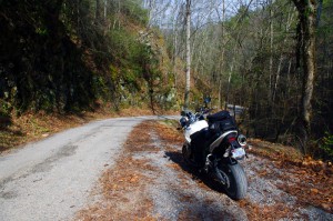
Photo - Cherokee National Forest Road

Parked along Pleasant Mountain Road. It's typical of other roads nearby - of little interest to most. Still I check them all.

Arriving in Tellico Plains, Tennessee, after an early morning motorcycle ride where I’d had the whole of the Cherohala Skyway to myself, I pointed my wheel north onto TN 360 and my workday began. Within a few miles I’d reach the point where I’d previously abandoned my search for great motorcycle rides and the explorations would resume. Rounding a curve a green street sign flashed past with a name I recognized and I clamped on the brakes to swing around.

I could rule this road out as soon as I saw it, it was doubtful it would be of any interest. Consulting my map, I saw it connected to another I wanted to investigate, so I snicked into first gear determined to make quick work of White Plains Road and move on.
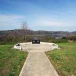
Photo - Tanasi Monument

The Tansi Monument - Tennessee gets it's name from here

It met Smoky Branch Road in a few miles where they both intersected Citico Road. I’d eventually loop back through Smoky Branch Road, also of little interest. Obviously Citico Road was the daddy in this area, the main thoroughfare of better quality, decent pavement, and sporting a faded double yellow line, a proper road.

I expected it would quickly peter out, but after several miles it continued to wind and snake through the mostly bland countryside and I started to wonder if it actually went somewhere in the big empty white space on the map. Curiosity aroused, I couldn’t resist investigating the Tanasi Memorial Site when the sign appeared.
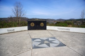
Photo - Tanasi Monument

The empty and isolated setting quickly fills with visions of what must have been

Never heard of it. Turning the motorcycle onto Bacon Ferry Road I ventured out into the nothingness on the barely paved bumpy and potholed  single lane that led out onto a low finger of land surrounded by Tellico Lake. I rode past the pull-off, but a quick glance towards the lake had me circling back when I saw the shoreside monument.
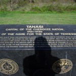
Photo - Tanasi inscription

Inscription transcribed below

Tanasi

Capital of the Cherokee Nation

1721-1730

Origin of the Name for the State of Tennessee

The site of the former town of Tanasi, now underwater, is located about 300 yards west of this marker. Tanasi attained political prominence in 1721 when its civil chief was elected the first “Emperor of the Cherokee Nation”. About the same time, the town name was also applied to the river on which it was located. During the mid 18th century, Tansi became overshadowed and eventually absorbed by the adjacent town of Chota, which was to the immediate north. The first recorded spelling of Tennessee as it is today occured on Henry Timberlakes map of 1762. In 1796, the name Tennessee was selected from among several as most appropriate for the nation’s 16th state. Therfore, symbolized by this monument, those who reside in this beautiful state are forever linked to its Cherokee heritage.
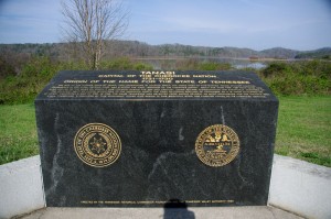
Pho

Cherokee Tanasi to Tennessee - State. A heritage preserved and honored.

I don’t much adhere to theories of “vortexes” or spirituality, but there’s something about this site that is powerful enough to make it worth a visit, it will be on the new map. It’s worth the ride out to it. See it if you have the chance.

_______________________________________________________________________________

Wayne Busch
Wayne Busch – Cartographer
– Wayne Busch lives in Waynesville, NC, where he produces the most detailed and comprehensive and up-to-date motorcycle pocket maps of the Blue Ridge and Smoky Mountains to help you get the most of your vacation experience. See them here – AmericaRidesMaps.com 

Motorcycle the Dragon, the Cherohala Skyway, the Blue Ridge Parkway in one day

Photo - Thermometer at Deals Gap Motorcycle Resort

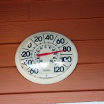
Thermometer at Deals Gap Motorcycle Resort

It was 80 degrees when I pulled up at the Deals Gap Motorcycle Resort yesterday at 5 PM with over 400 miles of Smoky Mountain motorcycle rides already behind me. 8 hours ago I was on the Cherohala Skyway as the soft morning glow and gusty winds made the lonely road seem like it was in another world.  I decided to make the day a trifecta and go home via the Blue Ridge Parkway. It’s hard to believe it’s still March, early spring has arrived!

Photo - morning on the Cherohala Skway

Morning on the Cherohala Skyway. I'm parked on the state line between North Carolina and Tennessee.

I had reservations about going out today, I’d been putting it off. I knew I would not find many good motorcycle rides in the areas I was searching. It was either too far out of the mountains or too far to into them. I was hitting the single lane back roads in the National Forests near The Dragon at Deals Gap and the Cherohala Skyway,  as well as the best ways to pass through the semi-urban areas to the north.

Photo - marble campfire

Who knows where this is?

I found something cool out in the Cherokee National Forest that will get it’s own motorcycle blog post shortly. One of the more useful things I discovered is one of the most direct ways to connect The Dragon at Deals Gap to I-75 south of Lenoir City.

Photo - Cherohala Skyway View

A long view of the Cherohala Skyway as it winds into Tennessee

I suspect many riders follow US 129 to Maryville, then take US 321 north when headed for the Interstate. There is  a way to minimize the traffic and avoid more than half of the four lane US 321.

Take TN 72 north from The Dragon at Punkin Center. When you reach US 411, cross it onto the East Coast Tellico Parkway and follow it along the lake area. It will become Axely Chapel Road at the north end and will intersect US 321. These are not outstanding motorcycle rides, but they are a heck of a lot better than the alternatives and get you off the four lane on some scenic and curvy motorcycle roads.

Photo - Calderwood Lake

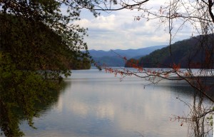
Calderwood Lake is one of several along US 129

I don’t really care much for riding in this area, but it’s only because there are so many really great motorcycle rides once you get in close to Great Smoky Mountains National Park. It’s hard to shine when pitted against them.

I’ve been mostly focusing on find the connections between the better rides so you can link them together. If you have the time when passing through, they are the most enjoyable motorcycle rides I can find for those who would rather stay on the back roads and savor them. The views are certainly more entertaining. Watch out for turkeys in the road.

Photo - Chillowhee Dam

How many of you have seen the Chillowhee Dam from this side?

My “wake up and dream” cruise on the smooth and sweeping curves of the Cherohala Skyway was the highlight of the morning.  The rest of it was on a web of roads which weave through the more remote and rugged sections of the national forest. A few of them start out as decent paved roads, but quickly diminish to single lane unmarked trails that become more potholed and full of gravel as you go. On most, the pavement ends long before the road does.

Photo - motorcycles at Delas Gap Motorcycle Resort

5 PM on a Tuesday evening in late March at the Deals Gap Motorcycle Resort

I’ll need at least one more good day to cover this area as thoroughly as I’d like. I’ve hit almost all the roads. The challenge now is how they work together to become the best motorcycle rides through the area, how well do the linked roads flow, can I find ways to make the good motorcycle rides last longer?

I know I can!

(Click on photos for larger views)
_______________________________________________________________________________

_______________________________________________________________________________

Wayne Busch
Wayne Busch – Cartographer
– Wayne Busch lives in Waynesville, NC, where he produces the most detailed and comprehensive and up-to-date motorcycle pocket maps of the Blue Ridge and Smoky Mountains to help you get the most of your vacation experience. See them here – AmericaRidesMaps.com 

My Search for the Best Mountain Motorcycle Rides Never Ends

Photo - Maple Springs Observation Point

The Maple Springs Observation Point - accessed from Santeetlah Rd

Friday’s search for great Smoky Mountain motorcycle rides, which culminated with a spirited cruise on the Cherohala Skyway, was one of those days that might be looked on as not so productive. It’s not that I didn’t catalogue some good mountain motorcycle riding roads, I added several which will appear on my new map of the area. In my quest to leave no stone unturned, much of the 400 miles I covered was spent on roads which only the most adventurous would bother to travel. Still, there are sights and places some may wish to see, and I’m determined to find as many of them as I can.

Photo - Cherokee National Forest View

View from the Maple Springs Observation Point. I was told you can see 5 states from this spot.

Considering the number of motorcycle riders who are drawn to the area by such notable roads as The Dragon at Deals Gap, the Cherohala Skyway, The Tennessee Foothills Parkway, NC 28 (now renamed “the Moonshiner 28“), finding others that compare in quality is pretty much futile. These are some of the best motorcycle rides in the world. I’m not holding my breath thinking I’m going to discover the next great classic motorcycle ride. So why go to all this effort?

Photo - Santeetlah Dam

Quiet morning at the Santeetlah Dam

There are probably millions of motorcycles that pass through here each year. In most cases, they come, they ride the famous roads, get the t-shirt, then they’re gone to other places following the crowds. It’s the notable roads that get all the attention. Once experienced, it’s back on the four lane or the congested tourist arteries to reach the next great spot. You can rack up a lot of miles playing connect-the-dots, though those droning plods on the connections are the price you pay to reach those popular motorcycle rides.

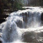
Photo - Bald River Falls

Bald River Falls

It doesn’t have to be that way. I’m filling in the gaps between the famous motorcycle rides with the best quality rides I can find so connecting the dots is as much of an adventure as the roads you’re trying to reach. Where others might show you one good way to get from point A to point B, I look for all the best ways.

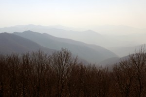
Photo - Cherohala Skyway View

View from the Cherohala Skyway. The Smoky Mountains were especially smoky today and I'll get more photos another time.

Who want’s to spend their time on the 4 lane or in bumper to bumper tourist traffic when there are so many empty two lane scenic and challenging mountain roads that get bypassed? It’s often as simple as crossing over to the next valley to escape the congestion. One little turn can make the difference between cruising along with the wind in your face or cursing the throngs of dawdling codgers, gawking sightseers, lumbering RV’s, and belching commercial trucks struggling up the grades to deliver their wares.

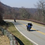
Photo - Motorcycles on the Cherohala Skyway

Bikes on the Cherohala Skyway

I’ve catalogued more than 100 good motorcycle roads so far surrounding Great Smoky Mountains National Park. I’m not done yet. Some of these are outstanding rides. Others will satisfy those looking for adventure. All of them avoid most everyone else who’s come to enjoy the Smoky Mountains just like you and take you to the places they’ll never see while getting you where you want to be.

Keeping you going is what keeps me going. I’m closing in on finishing the map of the Best Motorcycle Rides North of Great Smoky Mountains National Park. Stay tuned and see what I discover. It’s all for you. (Click on the photos for the large versions)


http://www.youtube.com/watch?v=xBbQfR2GqMc

_______________________________________________________________________________

Wayne Busch
Wayne Busch – Cartographer
– Wayne Busch lives in Waynesville, NC, where he produces the most detailed and comprehensive and up-to-date motorcycle pocket maps of the Blue Ridge and Smoky Mountains to help you get the most of your vacation experience. See them here – AmericaRidesMaps.com 


Blue Ridge Parkway Opens Soon, Smoky Mountain Motorcycles Everywhere!

Motorcycle the Blue Ridge Parkway

We parked our motorcycles at the Blue Ridge Parkway gates at Wagon Road Gap. It wasn't open today, but it will be soon.

I knew before we reached the top of the climb the gates to the Blue Ridge Parkway would be closed. The fresh layer of road salt as we glided through the last of the hairpin curves on our motorcycle ride up US 276 south of Waynesville, North Carolina, were evidence of the lingering snow I’d seen on the mountainsides last night. Thin sheets of ice on the roadside rock faces reminded me just how different the world is when you climb up high where the Blue Ridge Parkway crowns the ridge tops.

Photo - waterfall along Buck Springs Trail

Many come to enjoy the hiking nearby. One of several small cascades the Buck Springs Trail shares on it's 6 mile run to the Pisgah Inn.

In the midday warmth, the dusting of white had vanished, but it was not long gone. We found the gates closed at Wagon Road Gap, but a nearly full parking lot at the Cold Mountain overlook proved we were not the only ones who were eager to enjoy the emergence of spring via the nations most popular motorcycle ride.

Photo - Blue Ridge PArkway overlook - Cold Mountain

Cold Mountain Overlook at Wagon Road Gap, Blue Ridge Parkway - Even with the parkway closed, plenty came out to enjoy the hiking, the scenery, and the warm weather on such a nice day.

Photo - Jackie on her Beemer

Come on, Let's Go ! This is great!

It’s early for the Blue Ridge Parkway to be open to traffic at the south end. This is the highest, and in my opinion, the best section of the entire 469 mile motorcycle ride.  If you see just one piece of the Blue Ridge Parkway on your motorcycle vacation, this should be it, the section from Asheville to the south end of the parkway at Great Smoky Mountains National Park near Cherokee. Because it’s the highest section, it’s usually the last to open for the start of the spring season.

The number of outstanding roads that surround and connect to the Blue Ridge Parkway in this area is enough to keep you busy for a season and then some. It was just one stop on a great day of motorcycle rides that followed.  I think we passed more bikes then cars on our ride. If you had a motorcycle, you were out to enjoy it today.

Photo - view from Crabtree Mountain Road

A view from Crabtree Mountain Road north of Canton. You can see a portion of it as it snakes it's way through the pass. Soon, this will all be green and spring flowers.

We doubled back via US 276 then cruised through Canton and headed north on Crabtree Mountain Road. I’d forgotten what a steep climb it was and how tight the switchback  curves are that bring you to the nice overlook at the top of the mountain pass. Up one side, down the other, then follow the serpentine path of the stream that flows through the valley. On to NC 209, out to Hot Springs, then hop from one great motorcycle ride to the next until you’ve had your fill.

Photo - view form blue ridge parkway overlook

Before long, everything will be green and flowers!

It won’t be long until weather like this will be what we expect every day in the Smoky Mountains. The fields are already turning green. The first tiny leaves are emerging on the brush. Buds are fat and swelling almost ready to burst on the trees. Soon, the hillsides will explode with color as all that pent up winter energy is freed. From what I’ve seen so far, the motorcycles are ready for it. Are you?

_______________________________________________________________________________

Wayne Busch
Wayne Busch – Cartographer
– Wayne Busch lives in Waynesville, NC, where he produces the most detailed and comprehensive and up-to-date motorcycle pocket maps of the Blue Ridge and Smoky Mountains to help you get the most of your vacation experience. See them here – AmericaRidesMaps.com 
Rare Valentines Day Parkway Motorcycle Ride

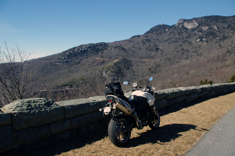
I made my first motorcycle ride on the Blue Ridge Parkway today way earlier than expected. I found the gates open in Blowing Rock and I turned south to enjoy what winter had to show. A few deep snowdrifts still lingered along the road in shady spots, but most of the rest had melted.  It was good to be back on the nations most popular motorcycle ride. I can’t wait for the southern section to open.

Photo - Feb ride on the parkway

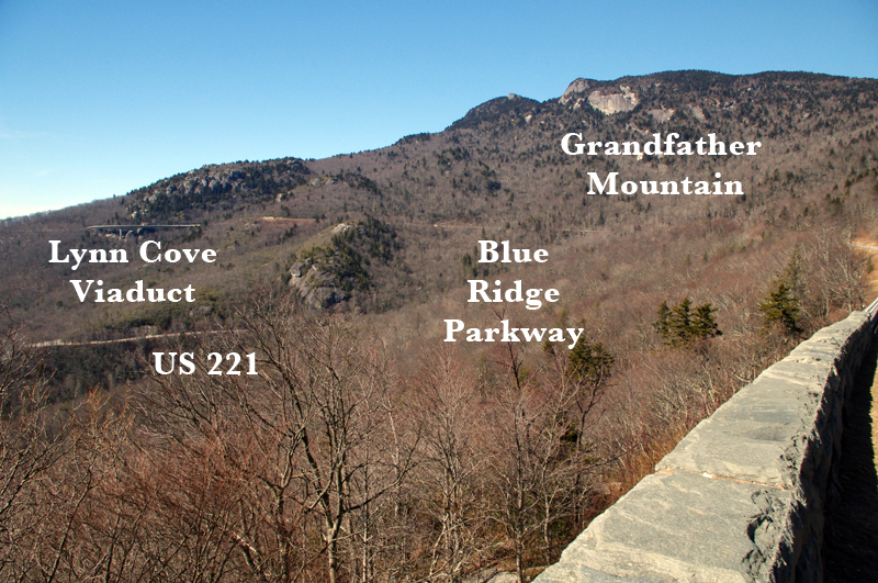
Stopped on the Blue Ridge Parkway near Grandfather Mountain. The Lynn Cove Viaduct is just above my bike. Beautiful day even with the high winds.

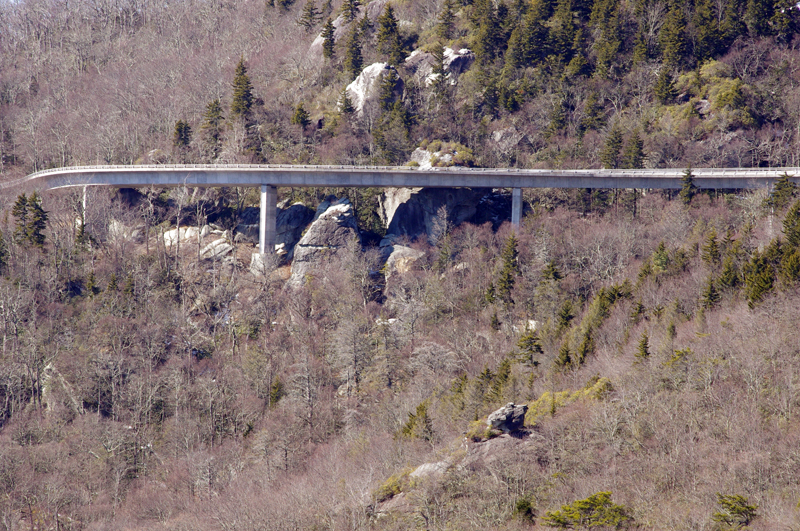
I enjoyed some great views of Grandfather Mountain and the Lynn Cove Viaduct. It was lined with snow and very pretty. The Blue Ridge Parkway is wonderfully free of the gravel and salt that covers nearly every other road in the Smoky Mountains right now, though there were a few spots with some sand on them. There was a high wind advisory in effect today and it was howling up on the ride, but I enjoyed it all the same. No trees had come down (yet), though there were some branches to dodge. Keep your eyes out for rocks in the road with the thaw, and crews are out working on projects.

Photo - Lynn Cove Viaduct

The Lynn Cove Viaduct. It's the newest section of the Blue Ridge Parkway, the last piece completed in 1983. It was cutting edge for the time.

My fun was too short as I hit the first road closure south of Grandfather Mountain. I ducked around it with one of my fun little shortcuts, but had to leave Blue Ridge Parkway in Linville. I couldn’t resist making up run up the Diamondback on the way home. It was in pristine shape and I was on the edge of my tires until the last few switchbacks near the top of the mountain. Here I ran into the sand and salt again and wiggled my way to the top as quickly as it would allow. Unfortunately the parkway was closed here at both exits. I’m still thankful for what I got!

Photo - grandfather Mountain

It's no wonder this area is so well known. There is a great view of the Viaduct from below on US 221 and it's an outstanding motorcycle ride from Grandfather Mountain to Blowing Rock as is the Blue Ridge Parkway.

Tomorrow, a short video of the ride up the Diamondback.

_______________________________________________________________________________

Wayne Busch
Wayne Busch – Cartographer
– Wayne Busch lives in Waynesville, NC, where he produces the most detailed and comprehensive and up-to-date motorcycle pocket maps of the Blue Ridge and Smoky Mountains to help you get the most of your vacation experience. See them here – AmericaRidesMaps.com 

The Blue Ridge Parkway on Snow Skis (6 Photos)

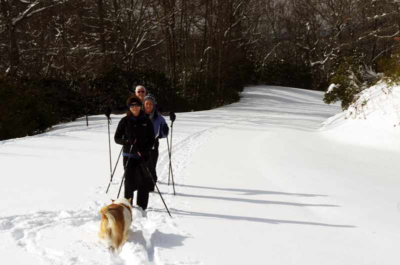
The first wave of snow has come and gone. After a couple days confined to the cabin, the roads cleared enough so we could get out, get some fresh air and exercise, and restock the pantry before the whopper of storms blows in shortly.

photo-3-skiers-on-blue-ridge-parkway

About a foot of snow on the Blue Ridge Parkway near Soco Gap and we had to break our own trail.

With the storm coming we’re likely to be snowed in for the next few days. We should see somewhere around another foot at my house, though things could get pretty deep up on the Blue Ridge Parkway.

Photo-jackie-busch-on-skis

Jackie glides by - it's not rare to see her off her BMW motorcycle when the weather gets cold

We’re grateful for the opportunity to get out. Cabin fever sets in pretty fast, especially when you are used to being outdoors. We start climbing the walls after 3 days.

Photo-snowy-blue-ridge-parkway-view

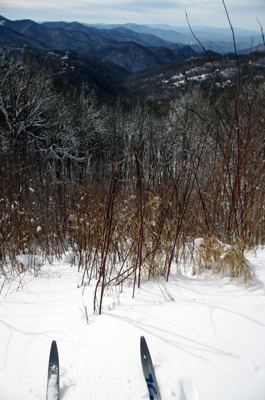
Just aim the pointy ends down hill and relax - looking over the edge of the Blue Ridge Parkway. The drops can be substantial.

So long as the power stays on, and it usually does, we’ll be fine. There are folks further north who would be glad to swap places.

Photo-others-enjoy-snow-on-blue-ridge-parkway

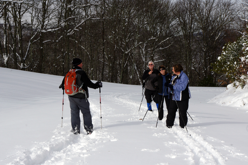
The parkway is not our exclusive winter playground. It's rare to have it all to yourself any time of year. We meet a snow shoer, then more skiers.

I’ll spend the next few days squirreled away in my  office revising another one of my Smoky Mountains motorcycle ride maps. It’s easier to get the tedium accomplished when there’s nothing else you can go do.

Photo-winter-blue-ridge-parkway

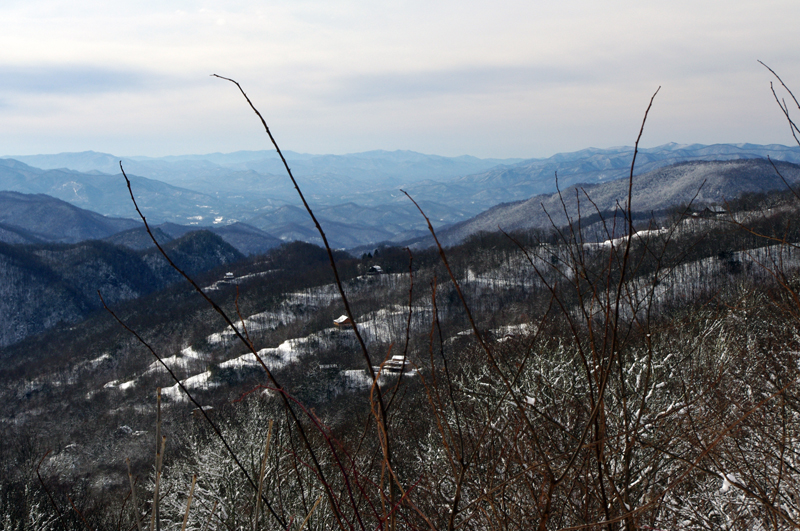
View from about a mile up the parkway. You're looking towards Cherokee though I never saw the casino. From higher up, at Waterrock Knob, you can't miss the huge buildings.

The reason I bother to post something like skiing the Blue Ridge Parkway is that it happens less often than you might think. There are only a few times each year the conditions are just right. They could have been better today, but it was good enough. It was a lot of work busting trail uphill. The downhills were not too bad at all.

Photo-skiing-on-the-Blue-Ridge-Parkway

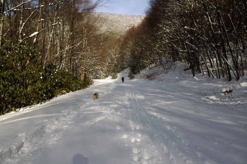
The four of us packed down a nice trail to follow when we turned about for the downhill run. The dogs could barely keep up.

It’s hard to believe I was out on my motorcycle mapping the best rides in the Smoky Mountains just a few days ago. With any luck I’ll be out again by the end of next week. But for now, it’s hunker down time.

_______________________________________________________________________________

Wayne Busch
Wayne Busch – Cartographer
– Wayne Busch lives in Waynesville, NC, where he produces the most detailed and comprehensive and up-to-date motorcycle pocket maps of the Blue Ridge and Smoky Mountains to help you get the most of your vacation experience. See them here – AmericaRidesMaps.com 
Blue Ridge Parkway Snow Photos – 12-5-10 Soco Gap, NC

Riding was out of the question today – too icy. Instead, we took a hike on the Blue Ridge Parkway to enjoy the recent snow fall.

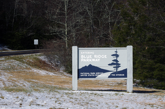
Photo - Parkway entrance at Soco Gap

The Blue Ridge Parkway access at Soco Gap on US 19 just west of Maggie Valley, NC

Soco Gap is the last (paved) Blue Ridge Parkway exit before you reach the south end of the parkway at Great Smoky Mountains National Park just north of Cherokee (13.3 miles).

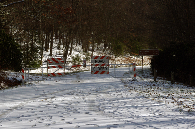
Photo - Parkway gates

Don't think the parkway goes unused when it's closed to traffic for the winter. Look at all those footprints. For the next few months it's a playground for hiking, biking, and skiing.

So far, it’s not much of a snow. There was a bit over an inch accumulated with a layer of ice underneath. If we get a couple more inches tonight, there’s a chance the Blue Ridge Parkway may be decent for cross country skiing tomorrow.  It’s just as likely to melt away.

Photo - snow on the Blue Ridge Parkway

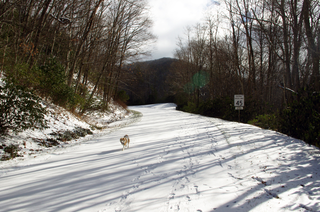
That's not a fox, it's one of my dogs - Sophie. I was surprised to see so much snow had stuck at just 4500 feet elevation.

It doesn’t feel cold enough for a significant amount of snow to accumulate. 1000 feet lower in elevation most of it is already gone. I wonder what it’s like up high? If we get more snow tonight, maybe I’ll go up higher tomorrow.

Photo - Snow on Blue Ridge Parkway

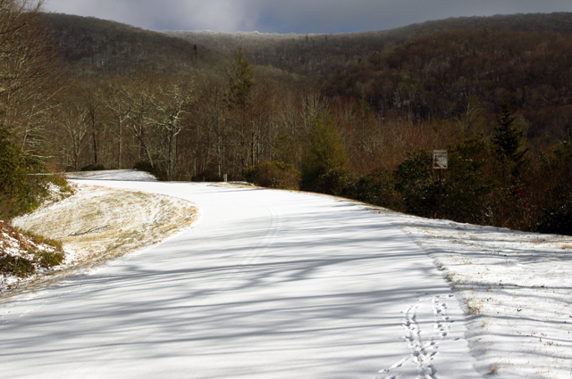
This section of the Blue Ridge Parkway makes a steady climb to reach the Waterrock Knob overlook in about 6 miles. That's a bit more than we wanted to walk today. The first overlook hasn't been cleared and there's no view.

We were fortunate to be out of the wind on this side of the mountain. We dressed expecting it, so we were quite comfortable when the extra protection wasn’t needed.

Photo - Blue Ridge Parkway Snow

The snow is like a ghost - you can see the yellow lines on the road. Rumor has it drunken ghosts wander the parkway at times - just look at those footprints!

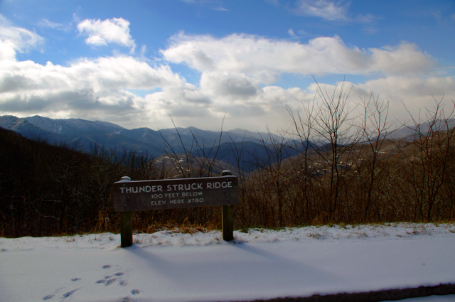
We walked as far as the Thunder Struck Ridge overlook at Milepost 455, about 1 mile.

Photo - Blue Ridge Parkway Snow

Thunder Struck Ridge is a great place for sunset photos.

It’s a faster walk going back – all down hill. The dogs love the Blue Ridge Parkway in the winter and so do Jackie and I.

Photo - dog with snow beard

That's my other dog Ajax wearing a snow beard. The parkway is their playground in the winter too.

_______________________________________________________________________________

Wayne Busch
Wayne Busch – Cartographer
– Wayne Busch lives in Waynesville, NC, where he produces the most detailed and comprehensive and up-to-date motorcycle pocket maps of the Blue Ridge and Smoky Mountains to help you get the most of your vacation experience. See them here – AmericaRidesMaps.com