Favorite Blue Ridge Motorcycle Rides Closed

Favorite Blue Ridge Motorcycle Rides Closed – 

January 17, 2013

Unusually warm weather and extreme rain wash out roads, bridges, and cause landslides, many favorite motorcycle rides affected;

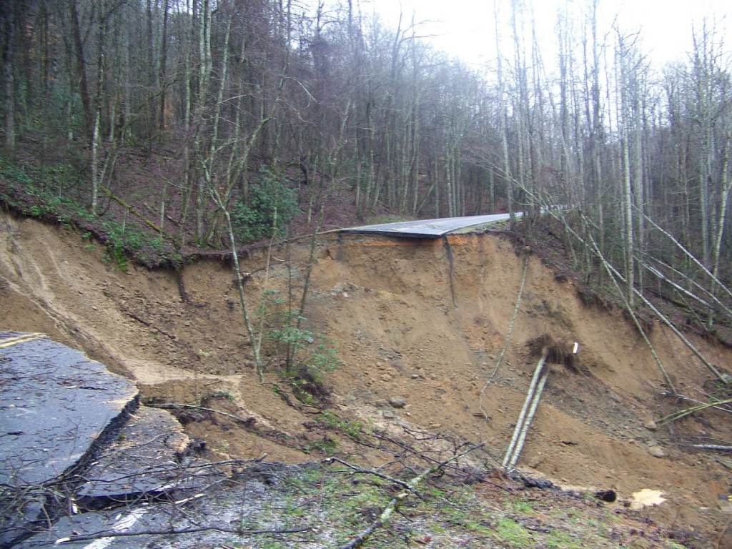
photo - slide closes park

photo source: Great Smoky Mountains National Park – Newfound Road US 441 hit by slide, park closes

Days of pouring rain in the Smoky Mountain region has caused severe damage, flooding, landslides, closing many favorite motorcycle roads – significant roads so far affected:

US 441 – Newfound Road which crosses Great Smoky Mountains National Park. Landslide closes road indefinately

US 19 – west of Cherokee, slide and house sized boulder in road – road closed

Blue Ridge Parkway – Slide near Soco Gap US 19 / Maggie Valley  (MP 455) – road closed

Cherohala Skyway – NC 143 Slide – road closed

US 74 – Nantahala Gorge – slide, one lane closed

Many other bridges / roads washed out, heavy flooding – Still raining. Freeze coming tonight which may dislodge more rock and weaken slopes.

Current updates on Facebook pagehttp://Facebook.com/blueridgemotorcyclerides

Will update with assessment and suggested routing when situation stabilizes.

wayne busch - Smoky Mountain Motorcycle Rider.com

Wayne Busch

– Wayne Busch lives in Waynesville, NC, where he produces the most detailed and comprehensive and up-to-date motorcycle pocket maps of the Blue Ridge and Smoky Mountains to help you get the most of your vacation experience. See them here – AmericaRidesMaps.com

Total Rider Tech Logo

Learn Total Control

Wayne is an advanced motorcycle instructor for Total Rider Tech teaching Lee Parks Total Control Advanced Rider Courses. Isn’t it time you looked into advanced rider training to ride more confidently and safely? It can transform your mountain riding experience.  Total Rider Tech

____________________________________________________________________

Blue Ridge Parkway to Tail of the Dragon Map

Blue Ridge Parkway to Tail of the Dragon Map

Three roads are consistently on the top 10 motorcycle rides list – The Blue Ridge Parkway, the Dragon at Deals Gap, and the Cherohala Skyway. This map shows how connect them.

Blue Ridge Parkway to Tail of the Dragon Map

Blue Ridge Parkway to Tail of the Dragon Map – how to connect 3 of the best motorcycle rides – click for larger view

Many who ride motorcycles on the The Blue Ridge Parkway when motorcycle touring then go on to ride The Dragon at Deals Gap. If you can afford the time, you can make a nice loop ride which connects The Dragon and the Cherohala Skyway using TN 72 / 360.

Best Blue Ridge Parkway Overlooks - highest point

Best Blue Ridge Parkway Overlooks – highest point. The long sweeping overlook compliments the great sweeping views

The southern end of the The Blue Ridge Parkway is near Cherokee, NC. The map includes Maggie Valley / Waynesville as it’s one of the best locations to stay to enjoy the wealth of great motorcycle rides in the surrounding area.

Blue Ridge Parkway to Tail of the Dragon Map - riders come from around the world to experience the Dragon at Deals Gap.

Blue Ridge Parkway to Tail of the Dragon Map – riders come from around the world to experience the Dragon at Deals Gap.

Time / distances are from the eastern junction of the roads for riders starting from Maggie Valley / Waynesville. US 74 is the principal 4 lane road – scenic for a highway, the most direct route east / west. US 19 leads west from Maggie Valley, passes through Cherokee and Bryson City. It’s more curvy, passes through the Cherokee Indian Reservation, and takes a bit longer due to traffic.

Blue Ridge Parkway to Tail of the Dragon map - Cherohala skyway

Blue Ridge Parkway to Tail of the Dragon map – The Cherohala Skyway offers sweeping curves and views to match with scenic overlooks at 5000+ ft.

Approaching Deals Gap and The Dragon, NC 28 is also one of the top rated roads in the area a.k.a the Hellbender or Moonshiner 28 and leads you to the start of the best section of The Dragon near the NC / TN state line.

Blue Ridge Parkway to Tail of the Dragon map - NC 28

Blue Ridge Parkway to Tail of the Dragon map – NC 28 leads you to The Dragon. It traces the shoreline of Fontana Lake and is both beautiful and challenging.

So long as you are in the area, don’t forget about another well known motorcycle ride in Georgia – The Gauntlet. It’s only a short ride to reach it, and you’ll have experienced the best of the southern Blue Ridge motorcycle rides.

The Gauntlet Motorcycle Ride in Georgia

The Gauntlet Motorcycle Ride in Georgia – rounding a curve on GA 348

Several America Rides motorcycle pocket maps cover the Dragon / Cherohala area – see them here;

#7 The Best Motorcycle Rides SOUTH of GSMNP –http://shop.americaridesmaps.com/7-The-Best-Motorcycle-Rides-SOUTH-of-GSMNP-NC021.htm

#8 Best Rides NORTH of Smoky Park – http://shop.americaridesmaps.com/8-Best-Rides-NORTH-of-Smoky-Park-NC020.htm

12 Classic Deals Gap Motorcycle Rides – http://shop.americaridesmaps.com/12-Classic-Deals-Gap-Motorcycle-Rides-NC007.htm

____________________________________________________________________

wayne busch - Smoky Mountain Motorcycle Rider.com

Wayne Busch

– Wayne Busch lives in Waynesville, NC, where he produces the most detailed and comprehensive and up-to-date motorcycle pocket maps of the Blue Ridge and Smoky Mountains to help you get the most of your vacation experience. See them here – AmericaRidesMaps.com

Total Rider Tech Logo

Learn Total Control

Wayne is an advanced motorcycle instructor for Total Rider Tech teaching Lee Parks Total Control Advanced Rider Courses. Isn’t it time you looked into advanced rider training to ride more confidently and safely? It can transform your mountain riding experience.  Total Rider Tech

____________________________________________________________________

Motorcycle Friendly – Tapoco Lodge @ The Tail of the Dragon

Photo-Tapoco Lodge Sign

The Tapoco Lodge

The most luxurious and convenient motorcycle friendly lodging nearest the Tail of the Dragon at Deals Gap, the Tapoco Lodge is historic, unique, classy, and about as close to The Dragon as you can stay.

Greg McCoy from SportBikes4Hire.com had often mentioned the fine dining at the Tapoco Lodge near the Dragon at Deals Gap, but I’d never stopped in to check it out. Honestly, it’s so close to the Tail of the Dragon, I usually blast right past it enjoying the curves on this section of US 129. This week I had the chance to pay a visit and I was impressed with what I found.
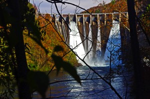
Photo-Tapoco-Dam

The Cheoah Dam - a.k.a. "The Fugitive" Dam, where Harrison Ford's character takes the big leap in the movie "The Fugitive".

The Tapoco Lodge was built in the 1930’s by the Alcoa Corporation which was subsequently involved in building the many power generating dams along the Tennessee River to provide power for the aluminum plants in Maryville and Knoxville, Tennessee. At one time as many as 2000 people lived in the area working both in construction of the many dams nearby and substantial timber operations in the surrounding mountains. What is now the Tapoco Lodge saw service as a hospital, theater, residential and operations headquarters for the company, and you’ll find the lodge filled and adorned with historic artifacts from this era.
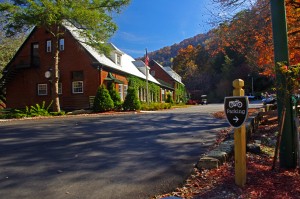
Photo-The-Tapoco-Lodge

The Tapoco Lodge - exclusive, luxurious, AND motorcycle friendly

Visting today, there is little evidence of the thousands of people who lived and worked here in those times past. As the many dams were completed the lakes which formed behind them submerged the roads, railroads, and small communities, and the area seems remote and isolated, pristine and natural, as if it all never happened save the dams which and lakes which remain as a legacy and still generate power.

Riding through the area you may come across the Chillowhee Dam on US 129 north of The Dragon, the Santeetlah Dam just north of Robbinsville, the Calderwood Dam viewed from the popular overlook at the Tennessee end of The Dragon, but the most impressive and notable are the Fontana Dam on NC 28 (a.k.a. The Moonshiner 28) and the Cheoah Dam just up the road from the lodge.
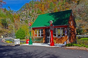
Photo-historic-gas-station-at-Tapoco-Lodge

Visiting the historic Tapoco Lodge is like visiting a living museum!

The Fontana Dam is one of the highest and most impressive, and is a popular stop for riders in the area. The Cheoah Dam is commonly referred to as “the Fugitive Dam” as it was the structure Harrison Ford’s character in the movie “The Fugitive” jumped from (the movie was shot in the surrounding area).

As operations in the area wound down, the Tapoco Lodge property transferred to private ownership and for many years after was used as a corporate retreat center for the company and others. In 2010, it was sold to the current owners who have renovated, upgraded, and restored  the property to a glorious and historic lodge with outstanding accommodations and fine dining in an exclusive setting.

photo-tapoco-lodge-interior view

History surrounds you at the Tapoco Lodge

Unfortunately my untimely visit happened just as the Tapoco Lodge was shutting down operations for the year. I’ve not yet had the opportunity to sample the sumptuous 5 course dinner at Jasper’s Restaraunt ($44 per plate, reservations required) nor the more casual fare in served in the Slickrock Riverside Grill. I trust Greg’s recommendations the food matches the quality of the rest of the establishment.

Photo-Jaspers-Restaraunt-at-Tapoco-Lodge

A quick peek at Jasper's Restaurant

Nor have I had the opportunity to enjoy the luxurious rooms, though I did get the quick tour of the lodge and they are outstanding. I passed on the opportunity to see the cabins this time.

Photo-the-bar-at-the-Tapoco-Lodge

A treat in a dry county! Save me a seat.

I’m particularly interested in the very comfortable looking bar, a unique feature in the last dry county in the State of North Carolina. It looked well stocked and I noted a good variety of wines. I love having a comfy place to enjoy a libation after a hard days riding and this bar will serve the purpose well.

Photo-room-at-Tapoco-Lodge

Spacious and comfortable rooms

I’m really looking forward to a stay at the Tapoco Lodge as it’s the ideal location for riding some of the best motorcycle rides in North Carolina and Tennessee. it’s on the popular Cherohala Skyway / Tail of the Dragon loop ride. Roll out the driveway, and you’re on the ride.
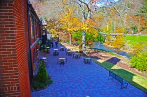
photo-Tapoco-Lodge-view-of-river

Enjoy sitting along the Cheoah River which flows beside the Tapoco Lodge

They are already booking groups for next year, it’s an ideal location for gatherings and they can accommodate a lot of people. Initially, the price of a stay seems high, but once you factor in the cost  of the 5 course dinner and cooked to order all-you-can-eat breakfast, which are included in your room cost, it works out to be an affordable way to enjoy a luxurious, convenient, and comfortable stay in the area.

You won’t find better food, you won’t find anything like it for accommodations, and you don’t have to ride to the next county to enjoy a cold brew at the end of the day.

 The Tapoco Lodge

_______________________________________________________________________________

Wayne Busch

Wayne Busch - Cartographer

Total Rider Tech Logo

Learn Total Control

– Wayne Busch lives in Waynesville, NC, where he produces the most detailed and comprehensive and up-to-date motorcycle pocket maps of the Blue Ridge and Smoky Mountains to help you get the most of your vacation experience. See them here – AmericaRidesMaps.com

Wayne is an advanced motorcycle instructor for Total Rider Tech teaching Lee Parks Total Control Advanced Rider Courses. It’s time you looked into advanced rider training to ride more confidently and safely, it will change your mountain riding experience. It worked so well for me I became an instructor! Total Rider Tech

_______________________________________________________________________________

 I’ll be adding The Tapoco Lodge to America Rides Maps Map #7 – Best Motorcycle Rides SOUTH of GSMNPMap #8 – Best Motorcycle Rides NORTH of GSMNP and map – 12 Classic Deals Gap Motorcycle Rides
Ever seen the Dragon’s Breath on your Deals Gap motorcycle ride?

NC-28-motorcycle

The Dragons breath envelopes riders on NC 28 near Deals Gap

OK, so I made the Dragon‘s Breath thing up – at least the name. The phenomenon is real though, something you may encounter when riding NC 28 along Cheoah Lake on your way to or from The Dragon at Deals Gap.

NC-28-Fontana-lake

NC 28 - Cheoah Lake fog (or is it?) - Remember, there's a Dragon nearby.

The fog, which can be pretty thick at times, is a common occurrence on warm summer days. The water which drives the turbines at nearby Fontana Dam is drawn from the deepest coldest depths of Fontana Lake. When there is enough moisture in the warm air, it condenses when it comes near the cold water of Cheoah Lake.

NC-28-fontana-lake-

NC 28 - Sometimes the NC 28 bridge below the dam sits on a cloud

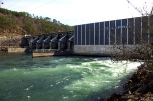
Fontana-Dam

Below the Fontana Dam

A nice side trip when you are in the area is a stop at the Fontana Dam. You can access the bottom of the dam once you cross the bridge over Cheoah Lake. Turn right and follow the paved road to the power station. To see the dam from the top, and you should it’s one of the highest in the east, use the road which intersects NC 28 just beyond Fontana Village. It’s easy to find, it’s the only stop sign on NC 28.

You find NC 28, the Fontana Dam, The Dragon, the Cherohala Skyway, other nearby attractions and scores of two lane twisty back roads which make for great Smoky Mountain motorcycle rides on America Rides Maps;
_______________________________________________________________________________

Wayne Busch
Wayne Busch – Cartographer
– Wayne Busch lives in Waynesville, NC, where he produces the most detailed and comprehensive and up-to-date motorcycle pocket maps of the Blue Ridge and Smoky Mountains to help you get the most of your vacation experience. See them here – AmericaRidesMaps.com 


The Birthplace of Tennessee – Best Seen on a Motorcycle

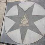
Photo - marble campfire

Who knows where this is?

It was the middle of nowhere yet it was the center of everything. I’d stumbled upon the birthplace of Tennessee.

I had low expectations. My research told me most of the roads I’d be riding today would hold little interest to the typical motorcycle rider who had come to ride The Dragon at Deals Gap and the Cherohala Skyway. None of the roads I’d ride on my 450+ mile travels would come anywhere close to those legends. Still, the morning held a surprise I never expected and made the efforts worthwhile.

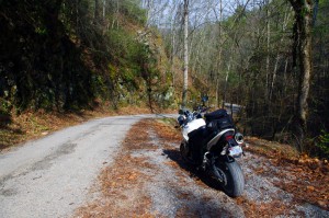
Photo - Cherokee National Forest Road

Parked along Pleasant Mountain Road. It's typical of other roads nearby - of little interest to most. Still I check them all.

Arriving in Tellico Plains, Tennessee, after an early morning motorcycle ride where I’d had the whole of the Cherohala Skyway to myself, I pointed my wheel north onto TN 360 and my workday began. Within a few miles I’d reach the point where I’d previously abandoned my search for great motorcycle rides and the explorations would resume. Rounding a curve a green street sign flashed past with a name I recognized and I clamped on the brakes to swing around.

I could rule this road out as soon as I saw it, it was doubtful it would be of any interest. Consulting my map, I saw it connected to another I wanted to investigate, so I snicked into first gear determined to make quick work of White Plains Road and move on.

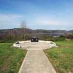
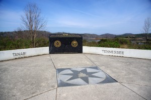
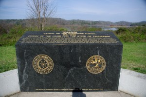
Photo - Tanasi Monument

The Tansi Monument - Tennessee gets it's name from here

It met Smoky Branch Road in a few miles where they both intersected Citico Road. I’d eventually loop back through Smoky Branch Road, also of little interest. Obviously Citico Road was the daddy in this area, the main thoroughfare of better quality, decent pavement, and sporting a faded double yellow line, a proper road.

I expected it would quickly peter out, but after several miles it continued to wind and snake through the mostly bland countryside and I started to wonder if it actually went somewhere in the big empty white space on the map. Curiosity aroused, I couldn’t resist investigating the Tanasi Memorial Site when the sign appeared.

Photo - Tanasi Monument

The empty and isolated setting quickly fills with visions of what must have been

Never heard of it. Turning the motorcycle onto Bacon Ferry Road I ventured out into the nothingness on the barely paved bumpy and potholed  single lane that led out onto a low finger of land surrounded by Tellico Lake. I rode past the pull-off, but a quick glance towards the lake had me circling back when I saw the shoreside monument.

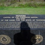
Photo - Tanasi inscription

Inscription transcribed below

Tanasi

Capital of the Cherokee Nation

1721-1730

Origin of the Name for the State of Tennessee

The site of the former town of Tanasi, now underwater, is located about 300 yards west of this marker. Tanasi attained political prominence in 1721 when its civil chief was elected the first “Emperor of the Cherokee Nation”. About the same time, the town name was also applied to the river on which it was located. During the mid 18th century, Tansi became overshadowed and eventually absorbed by the adjacent town of Chota, which was to the immediate north. The first recorded spelling of Tennessee as it is today occured on Henry Timberlakes map of 1762. In 1796, the name Tennessee was selected from among several as most appropriate for the nation’s 16th state. Therfore, symbolized by this monument, those who reside in this beautiful state are forever linked to its Cherokee heritage.

Pho

Cherokee Tanasi to Tennessee - State. A heritage preserved and honored.

I don’t much adhere to theories of “vortexes” or spirituality, but there’s something about this site that is powerful enough to make it worth a visit, it will be on the new map. It’s worth the ride out to it. See it if you have the chance.

_______________________________________________________________________________

Wayne Busch
Wayne Busch – Cartographer
– Wayne Busch lives in Waynesville, NC, where he produces the most detailed and comprehensive and up-to-date motorcycle pocket maps of the Blue Ridge and Smoky Mountains to help you get the most of your vacation experience. See them here – AmericaRidesMaps.com 

Motorcycle the Dragon, the Cherohala Skyway, the Blue Ridge Parkway in one day

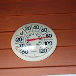
Photo - Thermometer at Deals Gap Motorcycle Resort

Thermometer at Deals Gap Motorcycle Resort

It was 80 degrees when I pulled up at the Deals Gap Motorcycle Resort yesterday at 5 PM with over 400 miles of Smoky Mountain motorcycle rides already behind me. 8 hours ago I was on the Cherohala Skyway as the soft morning glow and gusty winds made the lonely road seem like it was in another world.  I decided to make the day a trifecta and go home via the Blue Ridge Parkway. It’s hard to believe it’s still March, early spring has arrived!

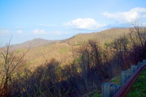
Photo - morning on the Cherohala Skway

Morning on the Cherohala Skyway. I'm parked on the state line between North Carolina and Tennessee.

I had reservations about going out today, I’d been putting it off. I knew I would not find many good motorcycle rides in the areas I was searching. It was either too far out of the mountains or too far to into them. I was hitting the single lane back roads in the National Forests near The Dragon at Deals Gap and the Cherohala Skyway,  as well as the best ways to pass through the semi-urban areas to the north.

Photo - marble campfire

Who knows where this is?

I found something cool out in the Cherokee National Forest that will get it’s own motorcycle blog post shortly. One of the more useful things I discovered is one of the most direct ways to connect The Dragon at Deals Gap to I-75 south of Lenoir City.

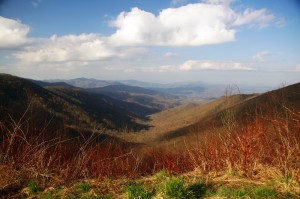
Photo - Cherohala Skyway View

A long view of the Cherohala Skyway as it winds into Tennessee

I suspect many riders follow US 129 to Maryville, then take US 321 north when headed for the Interstate. There is  a way to minimize the traffic and avoid more than half of the four lane US 321.

Take TN 72 north from The Dragon at Punkin Center. When you reach US 411, cross it onto the East Coast Tellico Parkway and follow it along the lake area. It will become Axely Chapel Road at the north end and will intersect US 321. These are not outstanding motorcycle rides, but they are a heck of a lot better than the alternatives and get you off the four lane on some scenic and curvy motorcycle roads.

Photo - Calderwood Lake

Calderwood Lake is one of several along US 129

I don’t really care much for riding in this area, but it’s only because there are so many really great motorcycle rides once you get in close to Great Smoky Mountains National Park. It’s hard to shine when pitted against them.

I’ve been mostly focusing on find the connections between the better rides so you can link them together. If you have the time when passing through, they are the most enjoyable motorcycle rides I can find for those who would rather stay on the back roads and savor them. The views are certainly more entertaining. Watch out for turkeys in the road.

Photo - Chillowhee Dam

How many of you have seen the Chillowhee Dam from this side?

My “wake up and dream” cruise on the smooth and sweeping curves of the Cherohala Skyway was the highlight of the morning.  The rest of it was on a web of roads which weave through the more remote and rugged sections of the national forest. A few of them start out as decent paved roads, but quickly diminish to single lane unmarked trails that become more potholed and full of gravel as you go. On most, the pavement ends long before the road does.

Photo - motorcycles at Delas Gap Motorcycle Resort

5 PM on a Tuesday evening in late March at the Deals Gap Motorcycle Resort

I’ll need at least one more good day to cover this area as thoroughly as I’d like. I’ve hit almost all the roads. The challenge now is how they work together to become the best motorcycle rides through the area, how well do the linked roads flow, can I find ways to make the good motorcycle rides last longer?

I know I can!

(Click on photos for larger views)
_______________________________________________________________________________

_______________________________________________________________________________

Wayne Busch
Wayne Busch – Cartographer
– Wayne Busch lives in Waynesville, NC, where he produces the most detailed and comprehensive and up-to-date motorcycle pocket maps of the Blue Ridge and Smoky Mountains to help you get the most of your vacation experience. See them here – AmericaRidesMaps.com