5 Best Motorcycle Rides in the Smoky Mountains

How do motorcycle riders choose from more than 100 outstanding biker roads in the Smoky Mountains?

America Rides Maps suggests these are the roads to hit first when you visit on your motorcycle tour –
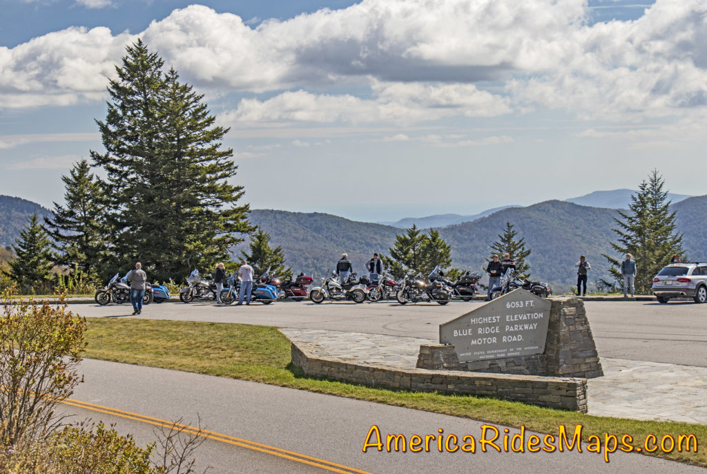
Blue Ridge Parkway Highest PointThe Blue Ridge Parkway –

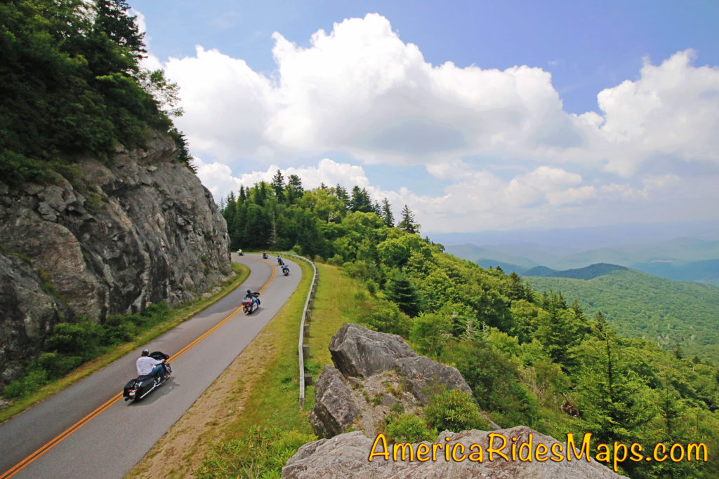
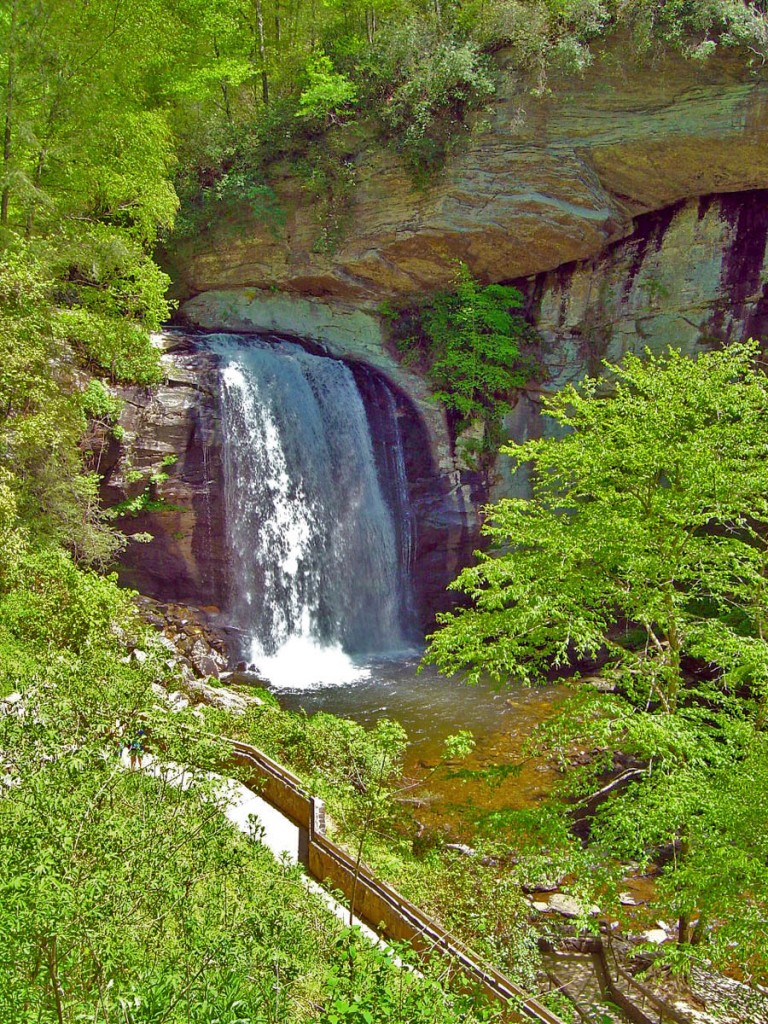
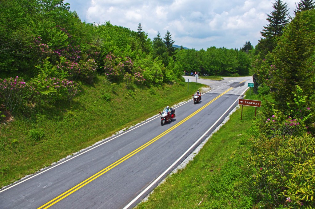
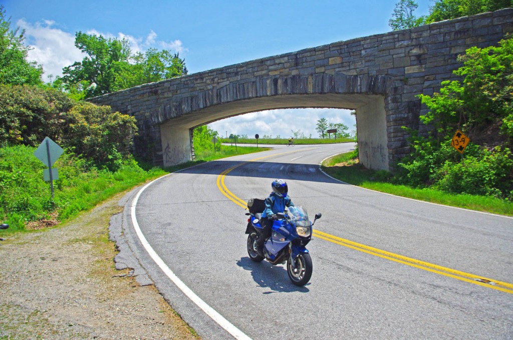
Hands down, the Blue Ridge Parkway should be at the top of your list. The best 50 miles of the 469 mile long scenic road are right here and easy to get to. It’s the highest section of the parkway filled with stunning overlooks as it cuts along the tops of the mile high mountains. Ride the section between US 19 (near Maggie Valley) to US 276 (south of Waynesville). Highlights on this stretch include Waterrock Knob, The Highest Point (classic photo with the sign), the Devils Courthouse, Looking Glass Rock, Second Falls at Graveyard Fields, and so many beautiful viewpoints to enjoy. The grades are gentle, the curves are satisfying. It’s a relaxing and enjoyable ride.

You can do it in a couple of hours or spend the time to stop and savor the sights. If you want to make a day of it, follow the parkway to Great Smoky Mountains National Park and ride across the heart of it on US 441. In the other direction the parkway leads through Asheville then gradually climbs to reach Mt. Mitchell State Park, the highest peak in the east.

More info  – https://miles-by-motorcycle.com/51999/blog/53348/the-best-section-of-the-blue-ridge-parkway
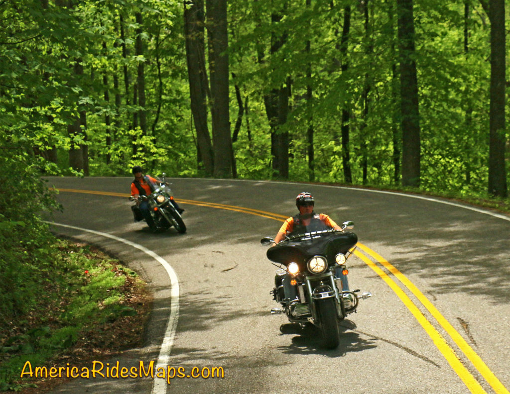
The Dragon

The Dragon & Cherohala Skyway

Located on the west side of Great Smoky Mountains National Park, these roads are two of the most popular rides in the Blue Ridge. The legendary Dragon (US 129) draws motorcycle and car enthusiasts to the 13 miles of tight, technical, challenging curves that hug the border of the park. It can get crowded on weekends and while the road has a notorious reputation a casual run is a lot of fun. You’ll see numerous photographers along the route to capture your vacation shots as you pass. Nearly 100 paved pull-offs let you escape the speed demons on your tail or just pause to watch the carnival. It takes about half an hour to run the Dragon.

The Cherohala Skyway is very much like the Blue Ridge Parkway running 50 miles between the small towns at either end. It climbs to the highest ridges as it courses through the vast wilderness of the Cherokee and Nantahala National Forests. There are numerous nice overlooks to appreciate the views. The curves are more sweeping, the grades easy, and it’s rarely anything you’d call crowded. There are some tighter sections of road as you come off the Skyway at the North Carolina end to choose from. At the Tennessee end of the ride, look for tiny River Road to lead you out to Bald River Falls and Baby Falls. Plan a couple hours for this road if you go out to the falls.

To make a day of it a popular loop ride combines both passing the Vonore, TN. In NC, US 129 is an easy ride south to Robbinsville, or NC 28 takes you on an awesome curvy ride when headed east.

More info – https://miles-by-motorcycle.com/51999/blog/52688/ride-the-dragon-and-the-cherohala-skyway—loop-ride
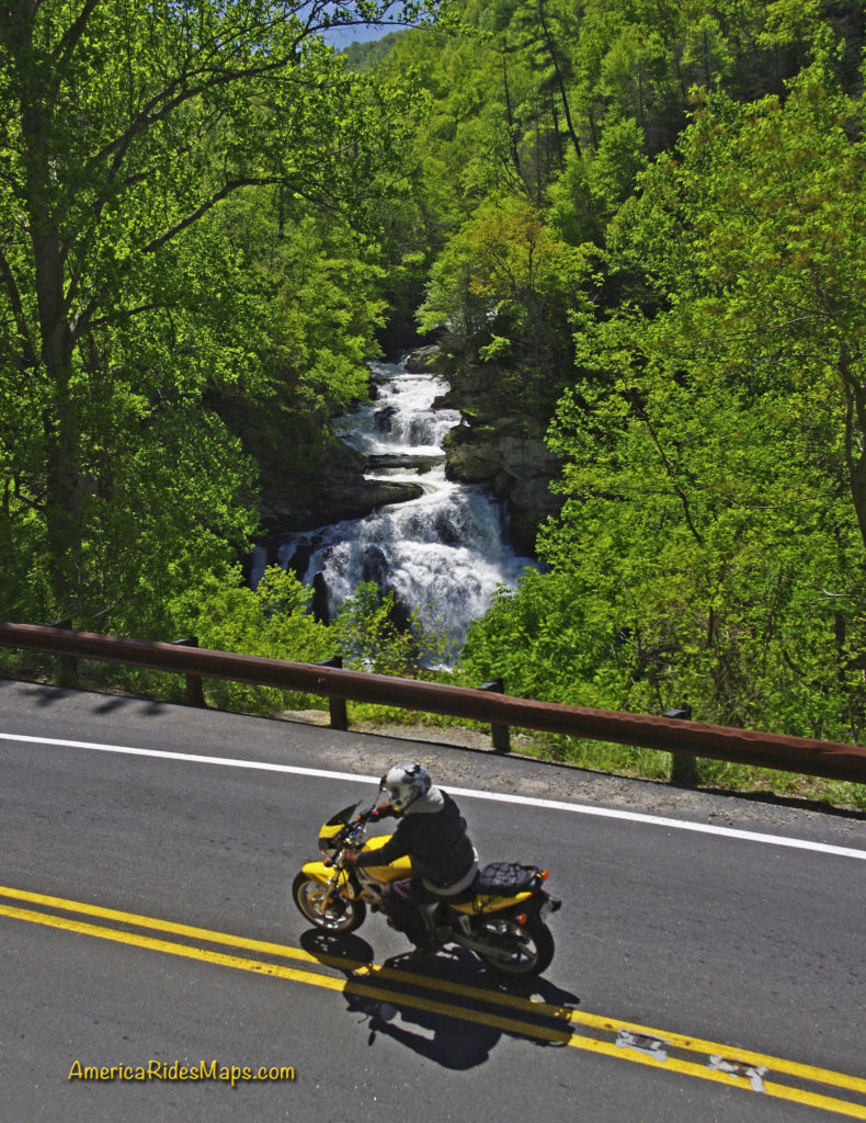
US 64 – The Waterfall Ride –

There are many versions of this ride which is anchored to the section on NC 28 / US 64 between Franklin and Highlands, NC. Cullasaja Falls, Dry Falls, Quarry Falls, and Bridal Veil Falls are found in the Cullasaja Gorge making this one of the easiest spots to see a lot of falls in a short distance. West of Franklin, Wayah Road climbs over the mountains to the Nantahala Gorge. Upper Nantahala Falls is on the way. Wesser Falls and Nantahala Falls are found in the Gorge. To the east of Highlands, Toxaway Falls is on US 64, Whitewater Falls is just a few miles south. A bit further east you’ll find Birdrock Falls and Mill Shoals Falls on NC 215, and Looking Glass Falls and Sliding Rock on US 276. There are so many waterfalls you can take a couple days to see all the easy ones.

The linked map (below) shows one way to see a dozen falls in a day on a reasonable length ride. There are many other ways to link the roads and tour the cascades.

More info – https://miles-by-motorcycle.com/51999/blog/52558/the-easy-waterfall-ride
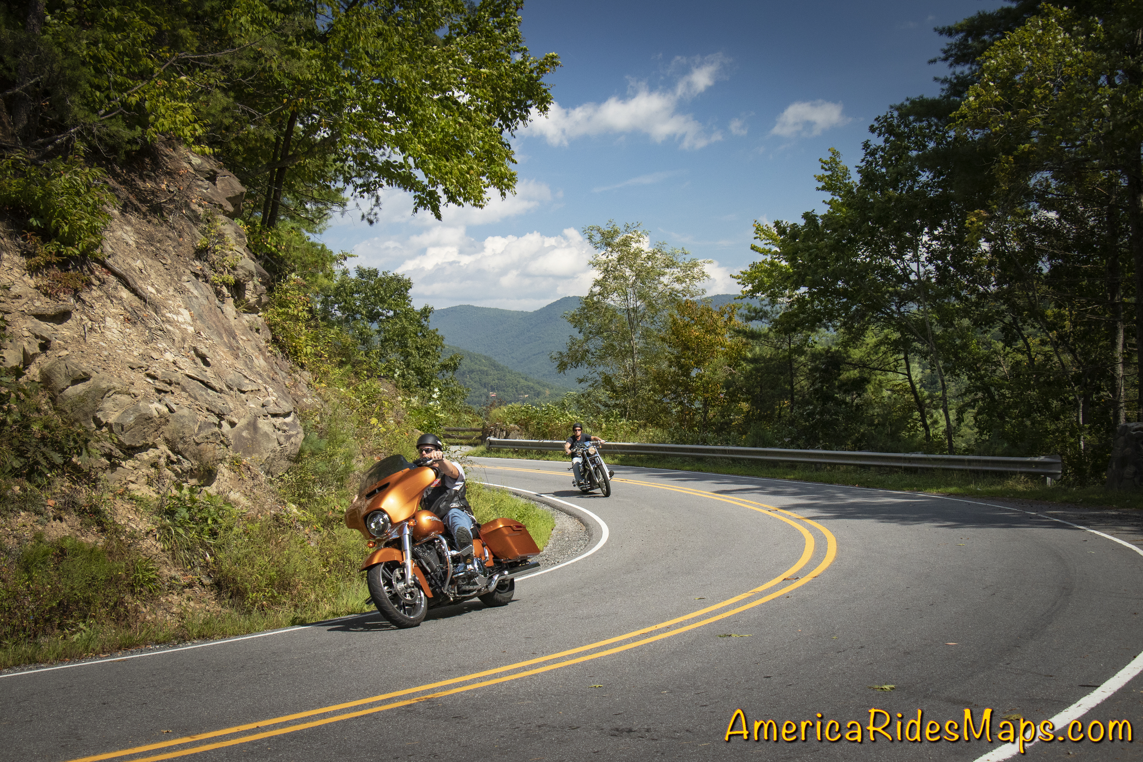
NC 209 - The Rattler

NC 209 – The Rattler –

This easy to access ride on the east side of Great Smoky Mountains National Park is a gem. The 37 mile run from Junaluska to Hot Springs gives you a little bit of everything in nicely spaced doses. There are gentle valley rides, twisty mountain climbs, pretty scenery, rushing rivers, and historic sights. There are a couple spots to eat in Hot Springs and a spa where you can soak in the natural hot spring waters.

The ride takes about an hour. There is a popular loop that can make it a half day ride passing through Marshall then winding over the mountains to return back to NC 209.

More info – https://miles-by-motorcycle.com/51999/blog/52309/the-classic-rattler-loop-ride
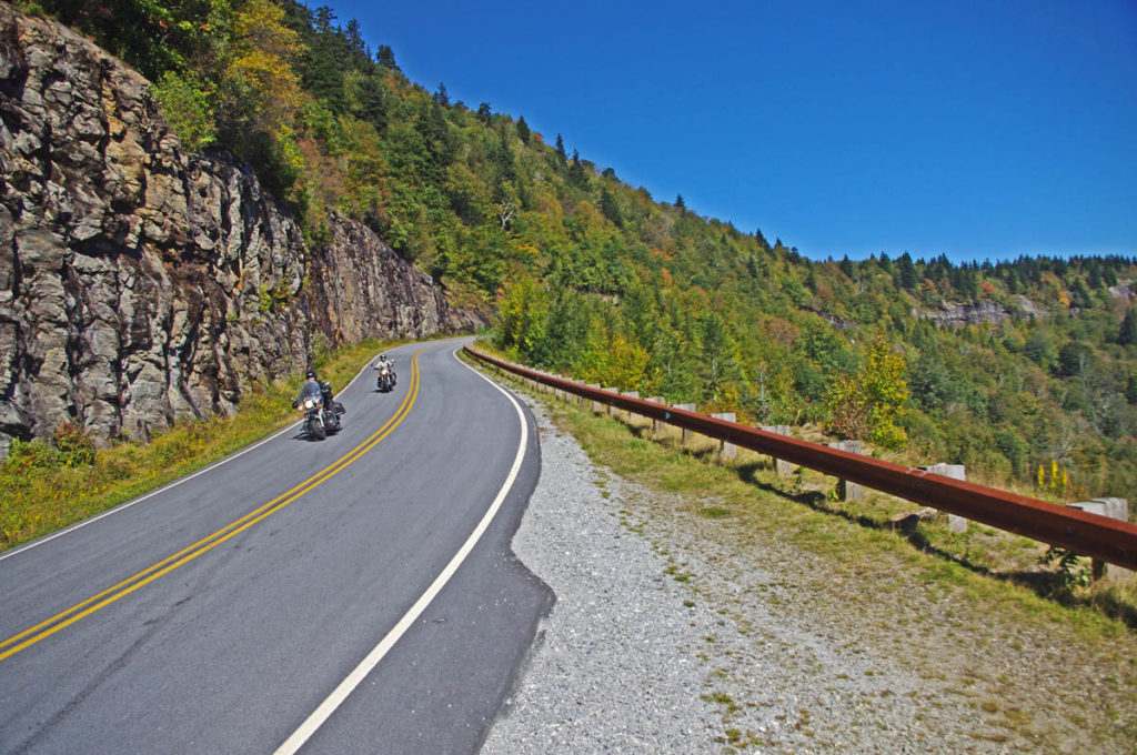
NC 215

The Copperhead Loop –

This ride has a few versions which are all built off two outstanding roads – US 276 and NC 215. Both of these roads run north to south. The Copperhead Loops are made with roads which run between them. Think triangle, not loop – US 276 and NC 215 meet in Bethel, NC. They then both run south more or less parallel to one another crossing the border into South Carolina.

US 276 is the better known of the two roads. From Bethel, it runs along a valley then makes a dramatic climb to intersect the Blue Ridge Parkway. South of the parkway it descends to Brevard with attractions and waterfalls along the way. It then runs into town then shoots south again passing Connestee Falls into South Carolina. It has engaging curves, nice scenery, one of the most popular waterfalls (Looking Glass Falls) , and can get a bit crowded on weekends as so many flock to the beautiful area around the waterfalls.

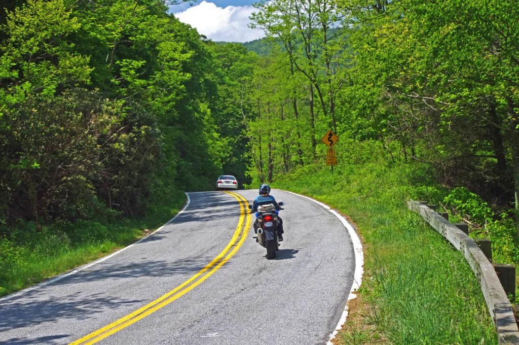
NC 215 also leaves Bethel to follow a valley, then begins a gradual and twisty climb. It’s more technical than US 276 and the challenges are more sustained. There’s little if any traffic. There are waterfalls along the way.

Both roads reach their first connection at the  Blue Ridge Parkway then drop down the south slopes to reach US 64. US 64 links between Rosman and Brevard, it’s the classic easy connecting route, the “standard” loop. South of US 64, NC 215 becomes US 178. Both it and US 276 continue south into South Carolina to reach the southernmost linking road, SC 11.

More info – https://miles-by-motorcycle.com/51999/blog/53429/best-rides-in-the-blue-ridge—the-copperhead

These roads and many more are catalogued on motorcycle ride maps published by America Rides Maps. Buy them online at http://AmericaRidesMaps.com


Wayne BuschAmerica Rides Maps

Wayne Busch searches out the most entertaining roads in the Blue Ridge Mountains then records them on a series of maps which span the Blue Ridge Mountains.

There are more great motorcycle roads in the Blue Ridge and Smoky Mountains than anywhere else. I highlight the best roads then show you the best ways to connect them together into rides. More than a decade of searching has discovered more than 1000 good roads to enjoy. We continue to search so you may enjoy.

Review the maps, order online hereAmericaRidesMaps.com

Source: America Rides Maps Blog @ Miles-by-Motorcycle.com
https://miles-by-motorcycle.com/51999/blog/53524/5-best-motorcycle-rides-in-the-smoky-mountains

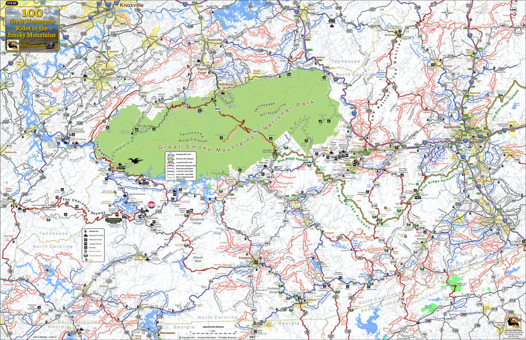
Which is the Best Town to Stay In when Riding the Smokies?

There is no “one size fits all” place for motorcycle riders touring in the Smoky Mountains. Each has it’s advantages and disadvantages, strengths and weaknesses depending on what you want to get out of your motorcycle trip.

100 Smoky Mountain Rides Map

100 Smoky Mountain Rides Map

Great Smoky Mountains National Park

Great Smoky Mountains National Park takes up a huge chunk of real estate on the North Carolina / Tennessee border. Staying within the park means camping, and numerous options present. You’ll find these campgrounds fairly busy and congested though that also means basic facilities are assured and they are in stunningly beautiful settings. It’s nice from a camping standpoint, but you’ll be starting and ending each day on the few park roads as you commute to the surrounding areas cutting into your ride time each day.

US 441 - Great Smoky Mountains National Park

US 441 – Great Smoky Mountains National Park

Outside the Park – Towns around the park can be divided by compass direction – north, south, east, west. Each of these areas is distinctly different reflected in the towns within.

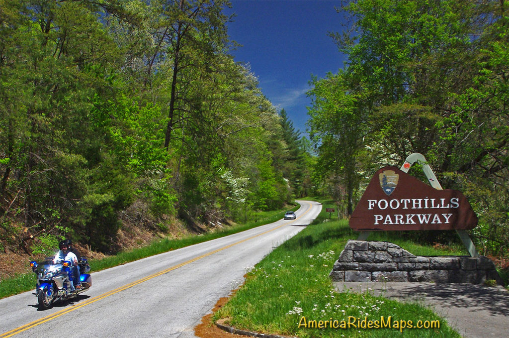
Tennessee Foothills Scenic Parkway

Tennessee Foothills Scenic Parkway

North of the Park:

Gatlinburg / Pigeon Forge – Tourist Mecca. Easy to get to and just half an hour south from Knoxville, these towns are dominated by tourist attractions like Dollywood, Ripley’s, Ober Gatlinburg, the Space Needle, Smoky Mountain Opree, and all kinds of venues geared to kids, families, shopping, nightlife, and the scenic park views. It’s a busy, bustling, and energetic place with loads of places to stay. Riding in this area is comparatively limited and the major roads congested. North of the park the mountains quickly subside into the broad Tennessee River Valley. The riding is to the east and west, look to the lesser traveled valleys and back roads. South takes you into the park.

Townsend – West of the big towns, Townsend stretches along the Little River into the park. It has a large tourism focus but is not as built up. Riding to the east means passing through the big towns, to the south is one entrance to the park. The Tennessee Foothills Parkway takes you west to US 129 on the north side of The Dragon and access to the western rides.

Cosby / Newport – This is pretty rural country except for the main road (US 321) which passes though it. The tourist focus diminishes as you stray north from the park to Newport and it’s more characteristic of the east side of GSMNP. For ADV riders, it sits on the edge of some decent unpaved riding in the Pisgah National Forest.

NC 209 - The Rattler

NC 209 – The Rattler

East of the Park:

Hot Springs – The area on the east side of GSMNP is dominated by the Pisgah National Forest. The mountains continue their arc north from the park to the highest of the peaks still miles distant. This area is rural and undeveloped. The few roads that do run through it are outstanding mountain rides, even Interstate 40 cutting through the Tennessee River Gorge is spectacularly scenic. Small mountain towns dot the landscape, Hot Springs is one of them. The historic town has limited places to stay and eat and a campground on the French Broad River.

Asheville – A vibrant and beautiful small city. The Blue Ridge Parkway passes through it. You’ll find ample places to stay in the surroundings, and the city traffic can be escaped fairly quickly. Known for its food and beer culture, parking is an issue to the point walking is the way to go when downtown. You’ll be paying city prices but also have access to some luxurious and scenic places to stay if that’s your style.

West of the Park: 

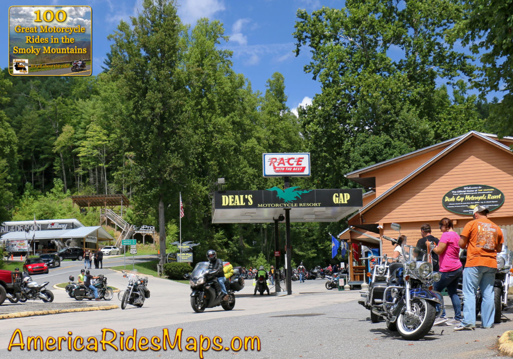
Deals Gap – Both south and west of the park, Deals Gap sits at the NC end of The Dragon. It’s relatively remote with few lodging options, but if you’re a Dragonista it’s heaven.

Robbinsville – at the crossroads of The Dragon and the Cherohala Skyway, Robbinsville is a small town. There’s one large motel, a few motorcycle centered lodgers, and a handful of restaurants. There’s a nice mix of riding in the surroundings.

Tellico Plains – across the Cherohala Skyway, Tellico Plains is a small town. You find a handful of restaurants, a few lodgers, and camping nearby. The best riding is to the east and south, a loop north takes you to the Dragon.

Blue Ridge Parkway

Blue Ridge Parkway

South of the Park:

Waynesville – The largest town in western North Carolina hosts the best food west of Asheville and a popular downtown. Lodging options are scattered. It’s at the hub of the best riding with great roads in every direction. The are numerous roads leading from town which intersect the Blue Ridge Parkway and the Land of the Waterfalls to the south.

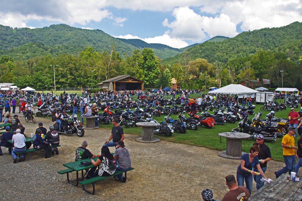
Maggie Valley – On the edge of the park, Maggie Valley has the most places to stay. Like Waynesville, it sits at the epicenter of the best riding and makes an ideal base for a longer stay. Wheels Through Time motorcycle museum is a popular attraction. There are numerous motorcycle events throughout the season. Easy access to the Blue Ridge Parkway and many great rides are found nearby.

Cherokee – Located at the south end of the Blue Ridge Parkway and the entrance to Great Smoky Mountains National Park, Cherokee offers ample places to stay and lots of small restaurants. It’s the heart of Cherokee culture with museums and attractions. Harrah’s Cherokee Casino dominates the landscapes on the outskirts of town. There is riding in all directions though the town itself can be congested and busy and many commutes will be on major roads.

Bryson City – Somewhat isolated, Bryson City is a small town with several good places to eat and limited lodging. The Great Smoky Mountains Railroad is the big tourist draw as is camping at the edge of the park at Deep Creek. Riding is to the east, west, and south.

Stecoah – Barely a town, you’ll find campgrounds and cabins in this area. Few places to eat. It sits on NC 28 leading to Robbinsville and Deals Gap. The best riding is to the west. It’s good location for ADV riders looking to explore the unpaved roads.

Fontana Village – An isolated location, you find the Fontana Village Resort has all you need in one spot. It sits on NC 28 close to the Dragon and rides west. The Fontana Dam is nearby.

Maggie Valley, NC

Maggie Valley, NC

Which is best?

If your focus is being surrounded by the best roads so you can spend your visit riding, the south side of Great Smoky National Park is best. You’ll find the most options for lodging, eating, and other attractions on the southeast side, more remote and quiet places on the southwest side. No matter which area you stay in, you’ll find more great motorcycle rides in the Smoky Mountain area than anywhere else, enjoy!


Wayne BuschAmerica Rides Maps

Wayne Busch searches out the most entertaining roads in the Blue Ridge Mountains then records them on a series of maps which span the Blue Ridge Mountains.

There are more great motorcycle roads in the Blue Ridge and Smoky Mountains than anywhere else. I highlight the best roads then show you the best ways to connect them together into rides. More than a decade of searching has discovered more than 1000 good roads to enjoy. We continue to search so you may enjoy.

Review the maps, order online hereAmericaRidesMaps.com

100 Rides In the Smokies – Full Sized Map
http://miles-by-motorcycle.com/51999/photos/52000/untitled/52073/100-rides-in-the-smokies—full-sized-map)

Source: America Rides Maps Blog @ Miles-by-Motorcycle.com
https://miles-by-motorcycle.com/51999/blog/53524/5-best-motorcycle-rides-in-the-smoky-mountains
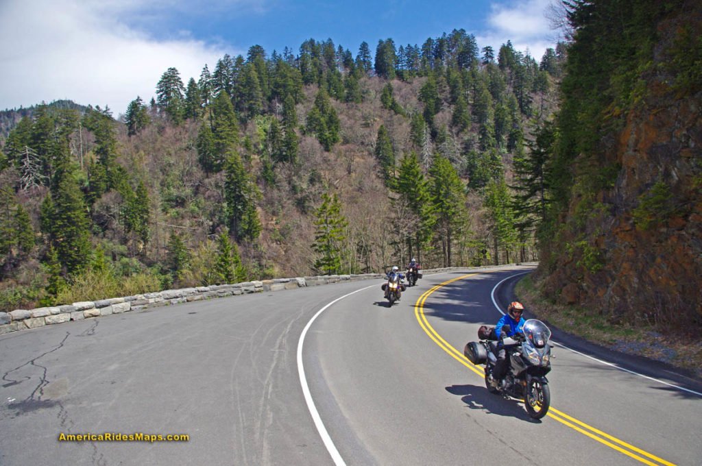
Best Motorcycle Rides in North Carolina – A sport bike loop

Best Motorcycle Rides in North Carolina – A sport bike loop ride

When I’m looking for a “dragon like” challenge close to home, this 90 mile loop satisfies every time!

Section of NC 215 near Lake Logan.

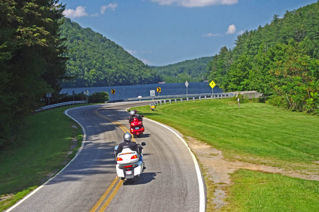
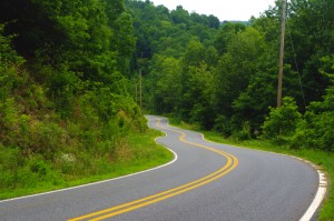
Section of NC 215 near Lake Logan. You’ll find some nice scenery on the popular road. The curves so far are just a warm up for what lies ahead.

As much as I enjoy a ride on the infamous Tail of the Dragon at Deals Gap, it’s a bit of a ride to get out to it from the Waynesville / Maggie Valley area where I live. Fortunately, there are ample challenging roads nearby, and when I really want a peg-scraping ride, this is one of my favorite local loops. For those on sport bikes, it’s a must-do when you are in the area.

The higher you go the better it gets on NC 215.

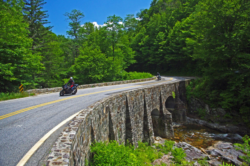
The higher you go the better it gets on NC 215. The road crests where it meets the Blue Ridge Parkway, then plunges down the other side of the gap.

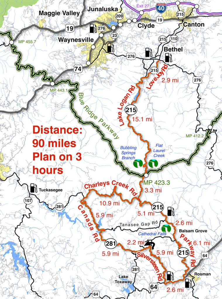
The map originates in the small crossroads town of Bethel, NC south of Waynesville, Canton, Maggie Valley, and Junaluska. It can also be done as a side loop off the Blue Ridge Parkway (exit at Beech Gap, MP 423.3, NC 215 – cuts 36 miles off the route).

Descending from the Blue Ridge Parkway on NC 215

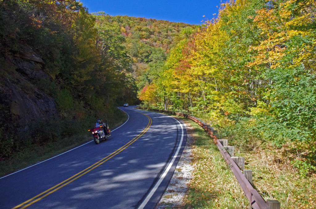
The curves continue as you descend from the Blue Ridge Parkway with a brief break when you enter a valley. The curves that follow really kick it up!

______________________________________________________________________

Length: 90 miles plus your ride to the start in Bethel, NC.
Ride time: 3-4 hours
Difficulty: Very challenging, tight curves, climbs and descents, sustained, varied road surfaces, all paved

Photo-curve-on-Silversteen-Rd

Imagine miles and miles of curves like this one – a.k.a. Silversteen Road

Turn-by-turn route description

Start at traffic light in Bethel (junction US 276, NC 215, NC 110).

Follow NC 215  – starts as Love Joy Road. Easy section through farmland along river with a few sharp turns.

2.9 mi – Turn left @ stop sign to continue on NC 215. Junction Love Joy Road and Lake Logan Rd (NC 215).  Moderately difficult. Rolls through houses, some nice curves, section along Lake Logan very nice.

16.8 mi – Pass Sunburst Campground. Enter Pisgah National Forest. Start climb to Blue Ridge Parkway. Road gets more twisty here. Nice stop at a roadside waterfall. Beware loose gravel on road, especially in turns, most likely to be found in the highest sections. Difficult.

17.9 mi – Pass Blue Ridge Parkway ramp. Popular break spot, if not at the junction, go up to the parkway and turn right to reach a nearby overlook with lots of parking. Continue under the parkway on NC 215. Good views from the highest section. Road surface improves south of parkway. Difficult.

35 mi – Turn right @ stop sign onto US 64. Junction NC 215 (Parkway Road) and US 64. Just a short section on this sometimes busy road. Easy.

Photo-Charlies-Creek-Rd

Charlie’s Creek Rd – typical of the wonderfully empty and inviting rides that abound in the Smokies

37.7 mi  – Turn right onto Silversteen Road. Junction US 64 and Sliversteeen Rd. Sign warns of tight turns ahead, believe it! Difficult.

38.3 mi – Keep right on Silversteen Rd. Junction Silversteen Rd and Golden Road. Difficult.

43.6 mi – Sharp left turn to stay on Silversteen Road. Junction Silversteen Rd and Macedonia Church Road. If you don’t make this turn, you will end up back on NC 215. Difficult.

45.7 mi – Turn right @ stop sign onto NC 281. Junction Silversteen Road and NC 281 (Canada Road). Nice section, a little loose gravel in places. Difficult.

57.6 mi – Turn right onto Charlies Creek Road. Junction NC 281 (Canada Road) and Charlies Creek Road. Be on your guard, surprising turns on this road. Difficult.

Photo - wolf Creek Dam

Wolf Creek Dam near the midpoint of NC 281, one of the scenic points on this great motorcycle ride.

68.4 mi – Turn left onto NC 215. Junction Charlies Creek Road and NC 215. Start back on a road you’ve been on previously.

89.7 mi – Follow NC 215 back to Bethel.

You’ll find gas stations in Bethel, on NC 215 on the south side of the Blue Ridge Parkway, and at the turn off US 64 onto Silversteen Road.

Jukebox Junction is a popular diner in Bethel. It’s mostly gas station food for the remainder of the ride.

Map of the ride

You’ll find these roads and many others in the surroundings on America Rides Maps motorcycle pocket map #6 – The Best Motorcycle Rides Near Great Smoky Mountains National Park – EAST.

____________________________________________________________________

wayne busch - Smoky Mountain Motorcycle Rider.com

Wayne Busch

– Wayne Busch lives in Waynesville, NC, where he produces the most detailed and comprehensive and up-to-date motorcycle pocket maps of the Blue Ridge and Smoky Mountains to help you get the most of your vacation experience. See them here – AmericaRidesMaps.com

Total Rider Tech Logo

Learn Total Control

Wayne is an advanced motorcycle instructor for Total Rider Tech teaching Lee Parks Total Control Advanced Rider Courses. Isn’t it time you looked into advanced rider training to ride more confidently and safely? It can transform your mountain riding experience.  Total Rider Tech

____________________________________________________________________

Great Motorcycle Rides in North Carolina – Pisgah Triangles

Great Motorcycle Rides in North Carolina – The Pisgah Triangles Map

Great Motorcycle Rides in North Carolina - Pisgah Triangles motorcycle map

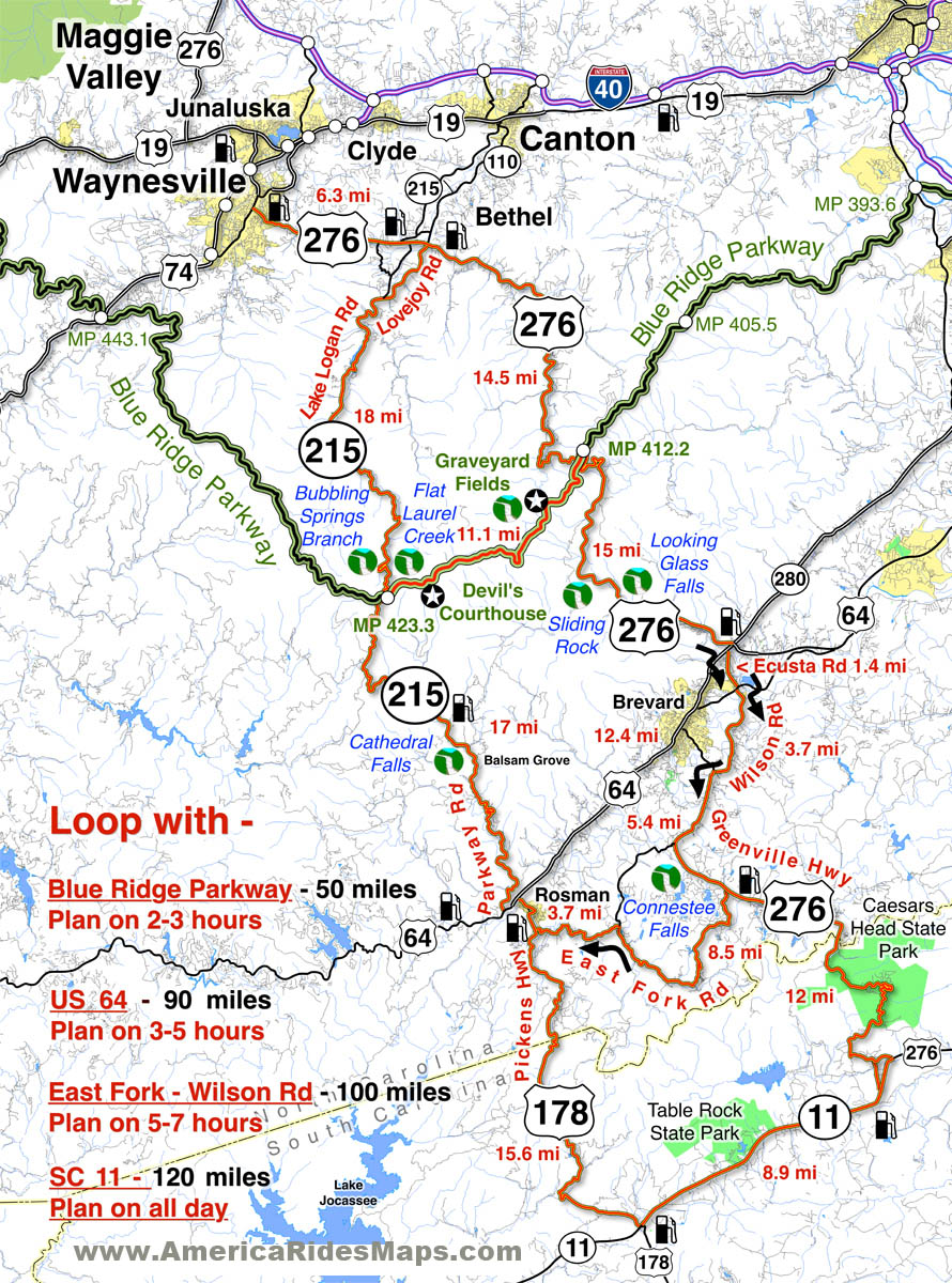
Great Motorcycle Rides in North Carolina – Pisgah Triangles motorcycle map – At least 4 variations, the 3rd is my favorite.

Great Motorcycle Rides in North Carolina – The Pisgah Triangles are some of the best motorcycle rides in the world. You’ll see spectacular views, wonderful waterfalls, and ride curves and twists that go on and on and on!

US 276 and NC 215 are two of the finest motorcycle rides you’ll find. Both roads run south from Waynesville / Maggie Valley forming a large upside-down “V”. Connections between these two long roads make 4 triangle shaped rides.  Ride a short fun loop or have an all day adventure!

Complete your triangle with – The Blue Ridge Parkway, US 64, East Fork Road,
or SC 11

Great Motorcycle Rides in North Carolina - Pisgah Triangles

Great Motorcycle Rides in North Carolina – Pisgah Triangles – Looking Glass Falls on US 276 is one of the most visited roadside waterfalls in North Carolina

Roll into Waynesville or Maggie Valley and ask someone to direct you to the best and most scenic motorcycle rides and their finger will point you to the jagged southern horizon. Home to the highest and best section of the Blue Ridge Parkway, two of the roads that lead out of town and climb to the mile high mountaintops are drop-dead beautiful and filled with the curves and switchbacks that make a biker come alive.

The Pisgah Triangles is a name I use to describe this collection of great  motorcycle rides in western North Carolina as so much of it is through the wilderness of the Pisgah National Forest. These are four good options for rides, though are are several others, including some excellent unpaved forest roads for you adventure bikers. There are also roads which lead out to even more fabulous riding not shown on this map.

Great Motorcycle Rides in North Carolina - Pisgah Triangles - NC 215

Great Motorcycle Rides in North Carolina – Pisgah Triangles – NC 215 is the lesser known leg of the Pisgah Triangles, crossing the parkway midway. It’s a popular rest stop in the middle of the wilderness.

Any of these 3 roads – the Blue Ridge Parkway, US 276, and NC 215 are great motorcycle rides you never, ever, tire of enjoying on your motorcycle vacation trip. It’s the first place we local bikers head to as well. Here are 4 outstanding North Carolina motorcycle loop rides you can choose from to get the most out of your precious time while out motorcycle touring in the Blue Ridge.

Great Motorcycle Rides in North Carolina - Pisgah Triangles - Cradle-of-Forestry

Great Motorcycle Rides in North Carolina – Pisgah Triangles – Cradle-of-forestry is one of several stops on US 276, along with Pink Beds, Sliding Rock, Looking Glass Falls, Blue Ridge Motorcycle Campground, Jukebox Junction, …

While you could blast through the shortest loop in less than 3 hours, chances are you won’t. There are so many great views you can’t help but stop and admire them along the ride. The first of the Pisgah Triangles is the first motorcycle ride I recommend to visitors after the Blue Ridge Parkway – it’s that good.

Great Motorcycle Rides in North Carolina - Pisgah Triangles -NC-215-cathedral-falls

Great Motorcycle Rides in North Carolina – Pisgah Triangles -NC 215 – Cathedral Falls is hidden just off the road, but is worth the stop as there are 4 other waterfalls with just a short walk.

The second of the loops climbs to the Blue Ridge Parkway, then down into the next valley near Brevard and Rosman. If you want to include a few roadside  waterfalls in your motorcycle tour, this is the way to get in some good ones and enjoy some more great curvy sections of road. I usually avoid using US 64 through Brevard and the traffic on the 4-lane, as the 3rd loop is so much nicer.

Great Motorcycle Rides in North Carolina - Pisgah Triangles - US 276

Great Motorcycle Rides in North Carolina – Pisgah Triangles – US 276 junction with the Blue Ridge Parkway. As both NC 215 and US 276 connect, you can always hop up and take a quick break with the best of views.

The third loop is just a little tricky as you jump from backroad to backroad, but it is such a nice and scenic motorcycle ride it is worth the effort and one of my favorite motorcycle rides of all. Dodging south of US 64 gets you off the four lane and on to some great rides along trout rivers and streams. Hard not to come back smiling from this one!


Great Motorcycle Rides in North Carolina - Pisgah Triangles -

Great Motorcycle Rides in North Carolina – Pisgah Triangles – The climbs up to the highest section of the Blue Ridge Parkway then down to the next valley are packed with switchbacks, curves, and twists that are so much fun to ride!

The longest loop takes you into South Carolina to the very edge of the Blue Ridge Mountains, follows a long straight section of the Foothills Scenic Highway (SC 11), then comes back into North Carolina and a wonderfully twisty ride. The plunge into South Carolina from Caesar’s Head State Park is one you’ll remember!

Great Motorcycle Rides in North Carolina - Pisgah Triangles - view from Caesar's Head

Great Motorcycle Rides in North Carolina – Pisgah Triangles – Chances are you’ll miss this view plunging down from Caesar’s Head State Park into South Carolina and US 276 carves through the tight switchbacks.

Shortest loop 50 miles. 3 hours, more with stops.
Longest loop 120 miles – All day ride 

Routes:

Loop 1 – use Blue Ridge Parkway. 50 miles, 2 -3 hours or more.

Starts in Waynesville  – Leave downtown Waynesville on US 276 south to reach the top point of the Pisgah Triangles.

6.3 mi Continue straight at traffic light on US 276.

20.8 mi Turn left to follow ramp to the Blue Ridge Parkway at Wagon Road Gap.

20.9 mi Turn left at stop sing onto the Blue Ridge Parkway (towards Cherokee).

31.9 mi Exit the Blue Ridge Parkway at NC 215.

40 mi Turn Left at stop sign onto NC 215 (towards Canton). NC 215 becomes Lake Logan Rd.

 49.9 mi End of loop 1 in Bethel. 6.3 miles back to Waynesville on US 276.

Loop 2 – Use US 64. 90 miles, 3-5 hours

Starts in Waynesville  – Leave downtown Waynesville on US 276 south

6.3 mi Pass through the traffic light in Bethel.

20.8 mi Pass under the Blue Ridge Parkway

35.3 mi Turn right @ traffic light onto US 64. 

47.8 mi Turn Right onto NC 215 (Parkway Road).

64.8 mi Pass under Blue Ridge Parkway

90+ mi. Follow directions for loop 1 return to Waynesville

Loop 3 – Use East Fork Rd /  Wilson Rd. 100 miles, 5 -7 hours

Starts in Waynesville  – Leave downtown Waynesville on US 276 south.

35.3 mi Turn right @ traffic light onto US 64. Move into the left lane.

35.4 mi Turn left @ traffic light onto Ecusta Rd. Follow 1.6 miles to next traffic light at Old Hendersonville Highway.

37 mi Turn right, go about 200 yards, then turn left onto Wilson Rd. Follow Wilson Rd to US 276 (Greenville Highway

40.7 mi Turn left @ stop sign onto US 276 (Greenville Highway).

46.1 mi Turn right onto East Fork Road.

54.6 mi Turn left to stay on East Fork Road. Watch for gray metal barn on left near this turn. Follow East Fork Road to US 178 (Pickens Highway).

58.3 mi Turn right @ stop sign onto US 178 (Pickens Highway) and follow into Rosman.

59 mi Turn left @ traffic light when you enter Rosman to reach US 64.

60 mi Turn left at stop sign onto US 64

60.5 mi Turn right onto NC 215 (Parkway Road)

95.5 mi Turn left onto US 276 in Bethel. 6.3 miles to Waynesville.

Loop 4 – Use NC 11 – (Foothills Scenic Parkway)

Follow Loop 3 directions to mile 46.1. Continue south on Greenville Highway (US 276)  into South Carolina.

58.1 mi Turn right @ stop sign onto SC 11. Follow 8.9 mi.

67 mi Turn right onto US 178 (Moorefield Memorial Highway). Follow 15.6 miles to Rosman.

Return to Bethel using Loop 3 directions. 120 miles.

Here’s a video that shows riding in the area:

This is it. These are the rides you should do. They have everything you come to the mountains for. This is bucket-list quality stuff. These are some of the best motorcycle rides in North Carolina. Don’t miss the Pisgah Triangles on your next trip.

You find these great motorcycle rides on America Rides Maps #6 – The Best Motorcycle Rides Near Smoky Park – EAST  http://shop.americaridesmaps.com/6-The-Best-Motorcycle-Rides-Near-Smoky-Mountains-Park-EAST-NC017.htm

__________________________________________________________________

Wayne Busch

Wayne Busch – Cartographer

Total Rider Tech Logo

Learn Total Control

– Wayne Busch lives in Waynesville, NC, where he produces the most detailed and comprehensive and up-to-date motorcycle pocket maps of the Blue Ridge and Smoky Mountains to help you get the most of your vacation experience. See them here – AmericaRidesMaps.com

Wayne is an advanced motorcycle instructor for Total Rider Tech teaching Lee Parks Total Control Advanced Rider Courses. Isn’t it time you looked into advanced rider training to ride more confidently and safely? It can transform your mountain riding experience.  Total Rider Tech

____________________________________________________________________

SportBikes4Hire.com – I Spend A Day With a Customer. What fun!

Wayne – had an absolute blast riding with you today. Your knowledge and these roads add up to a experience that should be had by all that like freespirited riding. I’m glad that I rented the Aprilla from Greg @SportBikes4hire.com and that he told me about you. I will tell all my riding buddies back in PA about my excellent experience and I highly recomend your maps or you as a tour guide or both. WOW I had fun. Thanks much  – Jim M.,Riegelsville,PA

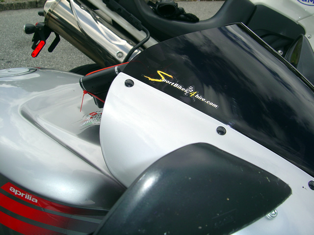
Photo - logo on windscreen

SportBikes4Hire.com offers one of the best experiences you can find on a motorcycle.

When I first heard about SportBikes4hire.com I, and others, were skeptical. Turn loose someone you barely know one of these “crotch rockets” on some of the most challenging roads in the world?  It sounds like Julia Child’s favorite Halloween recipe for death, carnage, and mayhem.  Thoughts quickly conjure up grisly scenes and visions of bikes in pieces. After more than a year in operation, it turns at such is not the case. Quite the contrary, the clients of SportBikes4hire.com end up with the experience of a lifetime.

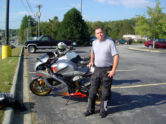
Photo - Sportbikes4hire

I met Jimmy and his rented Aprilla Mille in Brevard on a beautiful Smoky Mountain Saturday morning.

It all came about quite suddenly. Friday evening I got a call from Greg asking how one of his customers could get a hold of some of my maps. Evidently the guy had no clue about any of the local roads and needed help. He was making a short visit to family south of Asheville, saw the add for SportBikes4hire.com and couldn’t resist the opportunity. I asked Greg to give him my cell phone number so I could suggest some roads. Jimmy called me later that evening.

We talked for a little while, and I gave him a list of roads. As I ticked them off I kept thinking to myself, “I can lead him to the major roads, but he’s never going to find the real gems without getting hopelessly lost, and without knowing something about the roads he could quickly get in trouble.” While he’d have a GPS, it wouldn’t do the job and he’d end up missing out.

Photo - on the ride

Jimmy quickly adapted to the bike and the warmup ride went well.

I asked him to give me a call in the morning when he was ready to head out. Maybe, just maybe, I’d run down and bring him some maps. I even hinted I might ride along with him. I had my concerns. What if he was a bumbly and had no business on a bike like this on these roads? What if I took him out, pushed too hard, and he got hurt or worse? I needed to sleep on it.

Saturday morning was one of those early fall days in the Smoky Mountains that postcards feature. Still warm, skies blue and clear of morning fog that so often blankets the valleys, I was sipping coffee on the porch when the cell phone tweeted. What the heck. If nothing else I’d have a nice ride over and back to meet him and give him the maps if he didn’t size up. I threw on my gear and headed for the high ground.

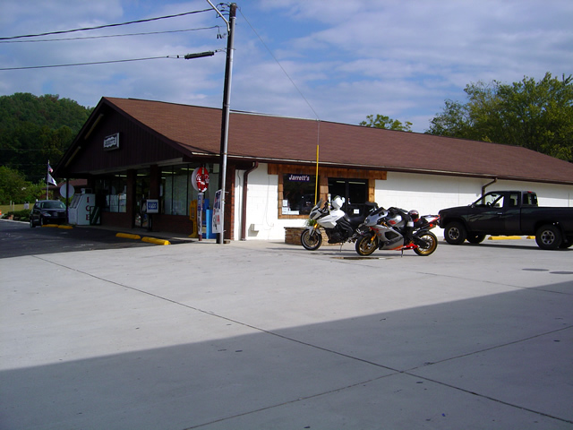
Photo - Stopped in Rosman for the first break

By the time we reached the first break in Rosman, it was obvious Jimmy knew what he was doing. Time to bump it up.

We met in a shopping center parking lot in Brevard. Time for the quick assessment. He had the right gear – good. The bike, a 1000cc Aprilla Mille was impeccable and fitted with top equipment (save the GPS which had been zip tied on in a decent jury rig). Jimmy was used to riding a BMW K bike so he was accustomed to handling the power. He was honest and humble in describing his abilities and experience – all good. When I asked for next-of-kin contact info he didn’t flinch. And he’d admitted never ridden a full on sport bike. Let’s go.

Photo - out on the ride

Approaching the Blue Ridge Parkway and enjoying the fresh pavement on the climb.

I led him out south of Brevard on some roads to let him get his bearings where I could watch in my mirrors to see how he was adapting. No problems. Turning south I bypassed one side road at the last minute thinking it was a bit much to throw at him this soon. We turned west and started on another great road that would start to put him to the test. He did well. Cautious where he needed to be, but willing and able to use the bike where he was comfortable. I stopped in Rosman to see how he was doing.

He was having fun and getting comfortable with the bike. It was a good choice for these roads. I was having fun. Time to kick it up a notch.

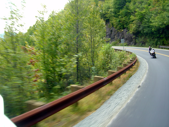
Photo - shot from motorcycle while riding

Look Ma, no Hands! Pitching through the curves while snapping photos.

We spent another few hours zipping through some of my favorite roads, old and new, with a little bit of everything thrown in. Spanking fresh new asphalt, crumbly bumpy back roads, first gear hairpins and high speed sweepers, one lane bridges, a break on the Blue Ridge Parkway. Jimmy soaked it up and rode with a controlled enthusiasm that showed he was aware of his comfort zone yet able to enjoy what the bike had to offer.

Photo - motorcycles at Devil's Courthouse

We made only one brief visit to the Blue Ridge Parkway for a break at Devil's Courthouse. Everything else was on more challenging roads.

We were both smiling when I left him 30 miles or so from where we started with directions to follow US 276 back to our meeting place. It was a good day riding. I’d do it again. I hope he comes back.

Photo - tank with logo

The Aprilla is one of many choices. For today's ride, it was one of the best.

SportBikes4hire.com offers a great service. Fly in and they meet you at the airport. They’ll bring the bike to you all ready to go. It’s an experience that you’ll treasure and a chance to ride a great bike on the best of roads. When you consider all the time and expense of hauling or riding your bike here, it’s a superb option – heck you can make it a quick weekend trip. Find a cheap airfare and come on. Spending some time in the mountains and want a day to get away from the family and do something exhilarating? This is it.

_______________________________________________________________________________

Wayne Busch

Wayne Busch - Cartographer


– Wayne Busch lives in Waynesville, NC, where he produces the most detailed and comprehensive and up-to-date motorcycle pocket maps of the Blue Ridge and Smoky Mountains to help you get the most of your vacation experience. See them here – AmericaRidesMaps.com


Sights From The Road – Alligator Rock

The jaws of Alligator Rock loom ominously over the roadway on NC 215 not far from Rosman, NC., near the point where NC 215 makes a brief intersection with US 64. Beleive it or not, it’s easy to miss Alligator rock as you zip beneath it – this section of road is very tight and twisty and your attention is more likely to be on the pavement, not the scenery above.

This view is from the north side and there is little to warn you it’s about to appear as you round the bend. If you are approaching from the south side, look for the stone entrance sign that tells you that you are entering the Pisgah National Forest. Alligator rock is on the next bend in the road.

NC 215 is full of spectacular sights and it’s long and twising climb up to the Blue Ridge Parkway then down again to approach Waynesville and Canton is one of my favorite rides. There are roadside waterfalls, some obvious, some hidden, inspiring long range views from the higher elevations, and some of the most fabulous serpentine motorcycle riding to be found in the mountains of North Carolina. This is another one of the great roads featured on America Rides Maps NC001 – The Best Roads South of Great Smoky Mountains National Park – EAST.

I’ve heard a rumor there is a possibility NC215 is going to be re-engineered sometime in the future. It would certainly be nice to see it get a fresh coat of pavement, there are sections that are really starting to show their age, particularly up high. Unfortuantely, it seems they may try to relax some of the curves a bit and Alligator Rock will be one of the casualties of the plan. I’m hoping the economy forces them to cut it back a bit and just freshen up the tarmac. Leave the curves just as they are, it’s close to perfection now.

Wayne@americaridesmaps.com

>> Go To America Rides Maps.comhttp://americaridesmaps.com