How to Ride Your Motorcycle more Confidently when it Rains in the Mountains

I see a lot of riders intimidated by rain when they visit the Blue Ridge and Smoky Mountains. It’s something we all try to avoid, yet its inevitable that someday you’ll be caught in a downpour or ride through the wash of one on your motorcycle travels. The key to riding wet roads with confidence is being super smooth with the throttle and the brakes.

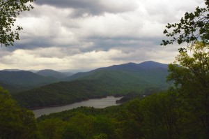
Photo - Rain over Deals Gap / Fontana Lake

Rain over Deals Gap this morning

We all know to slow down and take it easy in the rain. Still, I come up on too many riders who put themselves at greater risk by riding hesitantly and overcautiously.  That car looming up on you also has less grip and his visibility is reduced. Don’t become a hazard on the road when it rains. The crop of tires available for your motorcycle has never been better and the wet grip from a good set of rubber nowadays is amazing. On decent pavement you can usually match the speed of other traffic. Corner with the confidence your tires are up to the task by practicing flowing smoothly on/off the throttle and the brake.  See post – Tire Testing at Deals Gap Here

To fully exploit your tires wet weather capabilities load and unload them gently. There’s a surprising amount of grip available to be used, but sudden or abrupt actions will overwhelm it. A smooth and even approach puts the load on your tires gradually so the reduced limits of grip on a wet road are not exceeded. Demanding less grip for hard braking and aggressive throttle input leaves more grip available for the tire to use cornering. You can and should still use your brakes and throttle in a turn, just use less of them and apply them more slowly and evenly.

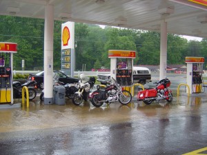
Photo - Motorcycles shelter from rain at gas station

Sometimes it's best to let the worst of it pass. Bikes seek shelter at gas station.

The real challenge is getting some lean on in the turns. There’s only so much tire grip available. You can only brake or twist the throttle so hard before you exceed the total grip available and the tire skids. In a straight line, all the weight of the motorcycle and rider is straight down on the tires. All of the tires available grip is used to either propel the bike forward or slow it down. Once you lean into a curve, some of that total amount of  tire grip is used up fighting the sideways push on the tires. The more you lean, the harder the tire has to grip the road to hold on as the sideways push gets stronger and stronger. That leaves less tire grip available to work on stopping the bike as it’s taking more and more of the tires capacity to work against the sideways force. At the extreme, 100% of the tire’s grip is being used to just to fight the sideways push on the tires and keep the bike from skidding off the road. The slightest touch of the brakes or gas at 100% lean demands more grip from the tires and there is none left to give.

Since there’s less tire grip available on a wet road, we all know you can’t lean as hard nor brake as hard. But if you’re smooth and easy with your throttle and brakes demanding less grip from your tires, you’ll have that much more grip left to use leaning into a turn. Find the balance where the grip needed to accelerate or decelerate plus the amount of grip used by the leaning bike doesn’t exceed what your tires have to offer, and carve sweetly and confidently through the curves even in a downpour.
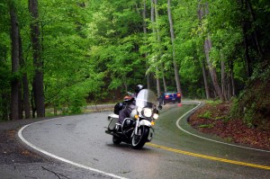
Photo - motorcycle at the Dragon in rain

A confident rider tames the Dragon with grace and smoothness in the rain this morning. Experience made it look so easy.

Practice on the dry days. Learn to judge the entrance speed at which you can cruise smoothly into a turn without using your brakes while holding the throttle steady through it to maintain a constant speed. Do this over and over and you’ll find your confidence improves and you’re comfortably leaning deeper through the curves. Then practice using closing the throttle to slow you into the turn then gently rolling it on to maintain your lean and pull out of it. Next practice gently feathering your front brake well into the turn, during the turn, and to slow on exit. Play with gently using both brakes. Focus on being smooth, gentle, and flowing.

The experience you’ll gain will make your next mountain motorcycle ride in a downpour a lot easier. You’ll be using the skills you’ve gained to ride more confidently and safely at speed. Knowing how your bike behaves in the curves will give you the ability to make the most of the surprising amount of rain grip a modern tire has to offer. The smoother you are, the easier it will be.

_______________________________________________________________________________

Wayne Busch
Wayne Busch – Cartographer
– Wayne Busch lives in Waynesville, NC, where he produces the most detailed and comprehensive and up-to-date motorcycle pocket maps of the Blue Ridge and Smoky Mountains to help you get the most of your vacation experience. See them here – AmericaRidesMaps.com 
Motorcycling in the Land of the Waterfalls – Shouldn’t You be in these Photos?

Photo - Soco Road Exit Blue Ridge Parkway

We started from the Soco Rd Exit (US 19) on the Blue Ridge Parkway @ MP 455.7

Absolutely gorgeous weather over the holiday weekend did not go to waste. We took advantage of the opportunity to enjoy riding a “tourist” loop we typically avoid. While the good folks were in church, we knew the traffic would be light and the timing would be right to get out for a Smoky Mountain motorcycle ride that would take us by some of the best scenery the area has to offer and a trip through the Land of the Waterfalls.

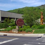
Photo - Museum of the Cherokee Indian

Museum of the Cherokee Indian

We made our way to Maggie Valley and started the loop from the Soco Gap exit on the Blue Ridge Parkway at MP 455.7. Careening down through the curves towards Cherokee, we had the road to ourselves and got the rare chance to enjoy this twisty section of two lane which is normally crowded with travelers and commuters.

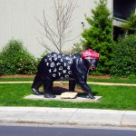
Photo - Bear in Cherokee

Cherokee is full of these bears

Cherokee was quiet as we sneaked into town for a quick photo then continued on US 19 into Bryson City on the south side of Great Smoky Mountains National Park.  On Easter Sunday, the trains of the Great Smoky Mountain Railroad sat in reverence as we passed through the back side of town to check out a road I’d been curious about – (I never stop looking for new roads for America Rides Maps).

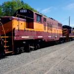
Photo - Great Smoky Mountains Railway Train

Great Smoky Mountains Railroad train in Bryson City

After 10 minutes on the Great Smoky Mountains Expressway (US 74 /19/23/28), we forked south into the Nantahala Gorge and paused for a break at the Nantahala Outdoor Center on the river.  From now on, this beautiful road which follows the course of one of the most popular whitewater rivers in the east will be filled with lumbering buses hauling rafters and kayakers upstream for the chilly and thrilly ride through the rapids. Thanks to the holiday, there was no commercial traffic, though plenty of others were here to enjoy the hiking, biking, and other pursuits in this hub of outdoor activity.

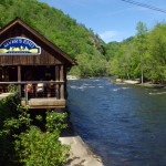
Photo - Rivers End Restaurant

The Rivers End Restaurant sits on the Natahala River at NOC.

Enduring 10 miles of relatively light traffic, we turned off for the climb over Wayah Bald. Snaking up along the cascading river, we passed fishermen gracefully floating their flies in the quiet pools beneath the numerous falls, then paused for a picnic lunch on the shore of crystal clear alpine Nantahala Lake.

Photo - motorcycle on Wayah Road

Jackie cruises Wayah Road

The ride across the top of the mountain is more challenging than it is scenic filled with curves and twists that attract riders to this favorite motorcycle route. Easing down through the hairpin curves on the back side of the hump, the road traces the course of another stream which builds to flow into the Little Tennessee River once you reach Franklin.  We passed through town then headed south again on US 64 / NC 28 to enter the Cullasaja River Gorge.

Waterfall along Wayah Road

The ride along the river on Wayah Road is spectacular!

It looked like our luck was changing as we found ourselves behind several cars, but each peeled off on side roads before we reached the outstanding curves that carve through the rugged canyon and we actually got to enjoy the ride at speed. That is a rare treat and we appreciated it. Good rains this spring have the waterfalls roaring and they were spectacular.

Photo - motorcycles at Nantahala Lake

Picnic lunch at alpine Nantahala Lake

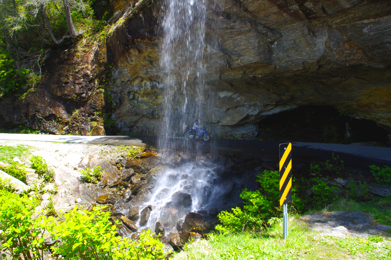
There are four easy to spot major waterfalls along this stretch of US 64 leading into Highlands, Cullasaja Falls (the largest), Dry Falls, Quarry Falls, and delicate Bridal Veil Falls. We stopped for a unique photo at Bridal Veil Falls where a small paved loop runs behind the cascade.

Photo - Cullasaja Falls

Cullasaja Falls on US 64 / NC 28

The remainder of the ride on US 64 is outstanding for scenery but by mid afternoon the tourist traffic was picking up and we did not always get to exploit the wonderful curves as much as we would have liked. The horizons are flanked with glimpses of the highest naked cliffs in North Carolina, some more than 1000 feet tall, and you cruise through some of the most expensive real estate in the country.

We completed the loop by heading north again on US 215 from Rosman climbing to reach the highest section of the Blue Ridge Parkway on a freshly paved road that snakes through outstanding turns and scenery that make it one of the locals favorite rides.

Photo - Motorcycle behind Bridal Veil Falls

Jackie poses for a photo on her motorcycle behind Bridal Veil Falls just outside Highlands, NC on US 64 / NC 28. How cool is that?

Click on photos for larger view

_______________________________________________________________________________

Wayne Busch
Wayne Busch – Cartographer
– Wayne Busch lives in Waynesville, NC, where he produces the most detailed and comprehensive and up-to-date motorcycle pocket maps of the Blue Ridge and Smoky Mountains to help you get the most of your vacation experience. See them here – AmericaRidesMaps.com 
100 miles out on the Blue Ridge Parkway, my motorcycle was stuck in top gear

I’d dropped the bike. Pulling out from a back road along the Blue Ridge Parkway, a car suddenly appeared out of the dense clouds rounding a curve and I stalled the engine on the incline.  It went down hard on it’s left side breaking a turn signal lens and mangling the clutch and shift levers. Minor damage considering I’d avoided the car, but it would prove enough to make the trip home a challenge.

Photo - View From Switzerland Inn

The nicest weather came just before my meeting at the Switzerland Inn - http://SwitzerlandInn.com

Already modified from a prior incident (click to read about that debacle) the shift lever was now wedged beneath the side stand. The clutch lever flopped precariously but it was working, and with a decent foot effort I managed to pry the shifter upwards and snick through the gears to get moving again towards Asheville. It was when I tried to downshift for a curve the real problem became apparent. I could not shift into a lower gear.

Thankfully I was on the Blue Ridge Parkway, uninterrupted in its 469 mile length. No stops, no traffic lights, it would be a manageable inconvenience to be restricted to a single gear. The problems would come when I left the parkway and entered the city traffic. At least I’d have plenty of time to come up with a plan on how I’d get home without slowing or stopping.

Photo - bad weather on the Parkway

It's days like this a waterproof camera comes in handy on the Blue Ridge Parkway

Trying to bend the shift lever into a more useful shape was a last resort. Previously bent once, it would likely break if I stressed it any more. I decided I’d need to find a way home where I would not need to stop even once.

Traffic was light. The weather was already miserable at these high elevations and would continue to deteriorate as a strong front moved in. The wind gusted powerfully, rain squalls spit at me, and I was enveloped by thick clouds as I passed by the signs for Mt. Mitchell, then Craggy Gardens. The low fuel light came on as I drew near to Asheville but I knew there was no way I could negotiate traffic, stopping was not an option. I decided I must go on.

In 20 miles or so I’d reach the US 276 exit south of Waynesville. If I could get off the parkway without stalling, then make it down through the switchbacks on the steep incline, there would be but one traffic light to gamble on to reach home.

Cresting the rise that led into Bethel, I saw the light blink from red to green and rolled on the throttle to cleanly pass through it. 10 minutes later I pulled into my driveway. Just another day on the road.

A little video from the day –

http://www.youtube.com/watch?v=j57PPHa_vVI

_______________________________________________________________________________

Wayne Busch
Wayne Busch – Cartographer
– Wayne Busch lives in Waynesville, NC, where he produces the most detailed and comprehensive and up-to-date motorcycle pocket maps of the Blue Ridge and Smoky Mountains to help you get the most of your vacation experience. See them here – AmericaRidesMaps.com 


The Best Motorcycle Rides NORTH of Great Smoky Mountains National Park – NEW MAP

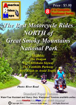
Photo - map cover

The newest motorcycle pocket map, “The Best Motorcycle Rides NORTH of Great Smoky Mountains National Park,” is the latest release from America Rides Maps adding a host of  great new motorcycle roads never publicized before to the already extensive collection from north Georgia to north Virginia.


The focus of this map was to locate and identify the best rides, shortcuts, and bypasses to avoid the traffic and congestion in one of the most popular tourist areas in the nation – the north side of Great Smoky Mountains National Park.

“I’ve avoided this area for years” says Wayne Busch, cartographer, explorer, and designer for America Rides Maps. “Now I have new favorite roads I ride again and again”.

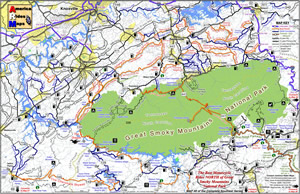
Photo - image of map

The most thorough coverage of Great Smoky Mountains National Park

Having completed the revisions and updates to the 6 Map Blue Ridge Parkway Series this winter, this new map is the second of three  maps which will form the Smoky Mountain Series.

The first, “The Best Motorcycle Rides Near Smoky Park – EAST “ contains the southern end of the Blue Ridge Parkway near Cherokee and follows it east to Asheville.

The third map in the Smoky Mountain Series will combine and expand on several maps which currently detail the wealth of great motorcycle rides south of the national park.

Between the three maps, more than 100 outstanding motorcycle rides will be detailed surrounding Great Smoky Mountains National Park.

“I‘ve already got the most detailed and comprehensive coverage of great motorcycle rides which connect or lie adjacent to the entire length of the 469.1 mile long Blue Ridge Parkway”, Wayne reports, “These maps expand that parkway experience and add to it some of the most challenging motorcycle roads found anywhere including the famous “Dragon” at Deals Gap”.

Expect the final map in the Smoky Mountain Series, “The Best Motorcycle Rides SOUTH of Great Smoky Mountains National Park”  in about a month.

America Rides Maps – http://AmericaRidesMaps.com – The most comprehensive, inexpensive, easy to use motorcycle pocket maps

BUY THIS MAP HERE  – http://shop.americaridesmaps.com/Map-8-Best-Rides-NORTH-of-Smoky-Park-NC020.htm

  • Standard Paper – $5.00
  • Water / Tear Resistant – (Best Value) – $5.99
  • Heavy Duty Waterproof – $8.00

Free Shipping via 1st Class mail included!

_______________________________________________________________________________

Wayne Busch
Wayne Busch – Cartographer
– Wayne Busch lives in Waynesville, NC, where he produces the most detailed and comprehensive and up-to-date motorcycle pocket maps of the Blue Ridge and Smoky Mountains to help you get the most of your vacation experience. See them here – AmericaRidesMaps.com 
Smoky Mountains Adventurous Spring Motorcycle Ride Photos

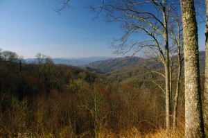
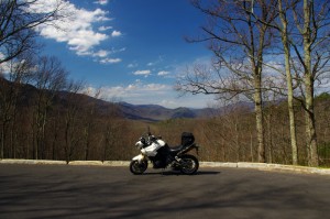
Photo - Soco view

Morning view on Soco Rd - Click on pics for LG view

15 minutes from home and already I was fighting the urge to jump off the motorcycle and start snapping pictures. It was a beautiful Smoky Mountain spring morning. Rounding every curve the canvas repainted another fabulous scene as I droned down from the Blue Ridge Parkway at Soco Gap towards Cherokee.

Photo - view from Clingman's Dome

Clingman's Dome view

Not a car on the road ahead of me, I let the bike stretch it’s legs through the curves effortlessly riding every last inch of rubber as my Triumph Tiger charged down the incline in pursuit of it’s prey.

Photo - view from Roaring Fork Rd

Roaring Fork Road - must be Roaring Fork!

It felt so good, all is right with the world when you’re on your motorcycle in the mountains. Wrapping around a rock face with the mellow grace of a cat arching it’s back, I flicked left to begin my plunge to the valley floor on the first of the new roads I’d see today.

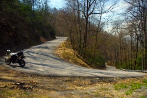
Photo - hairpin curve on Alpine Rd

Alpine Rd - one of my newest favorites

How had I missed this road? I’ve bypassed it many times on my passages to Cherokee. It’s not like I haven’t studied the area and it’s so close to home. Yet when we came through on a motorcycle ride Saturday, a road I was vaguely familiar with suddenly jumped out at me and said, “Come back and take a closer look”.

Photo - Cherokee Orchard Rd

Cherokee Orchard Road Overlook

The clue  that tipped me off  was the name – “Old Soco Road”. It suggested I was riding the “new” Soco Rd (US 19). “Old” Soco Rd was the way things used to be. Sometimes these “old” roads are gems.

It was like riding off a cliff and I had to quickly adapt to the more primitive road surface. Gliding through turn after turn I delicately parachuted through the  loose gravel and the windblown debris that had rained down on the switchbacks on this third day of roaring mountain wind. April was coming in with a bang.

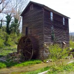
Photo - Old mill

I passed this old mill again today

So began a day that took me across Great Smoky Mountains National Park and out into the wilds to the north as I clicked off road after road on my search for the best motorcycle rides. The afternoon would bring me into a violent storm navigated on what were now familiar byways through seemingly remote and isolated hidden valleys where angry streams threatened to crest their banks and wash across the pavement.

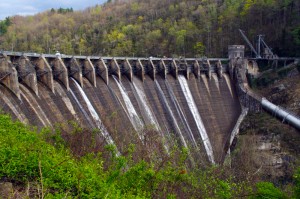
Photo - Tapoco Dam

The Dam at Tapoco

Looping around the west side of Great Smoky Mountains National Park near the end of the day, I’d arrive at Deals Gap to find the motorcycle resort closed due to the lack of electricity as a wind blown forest fire raged up a flank of the park consuming the lines and felling trees in it’s path. I’d squeeze through a gap between the fire trucks parked on a back road to ride through the smoke and smolder where crews fought the flames and mended the wires.

As the day drew to an end the lightening and rains caught up to me again, followed me home bringing the fury of the storm with them, and toppled trees that would have me without power for the next few days.

I’ve lost a couple days of work and will now double-down to make it up. With each new day the grays and browns of winter give way to the soft pastel greens of emerging leaves as spring wrestles the cold grip from the old season to bring the warm blooms of the new.  The fuse is lit for the explosion of color. It’s time to point your wheels towards the high country, its ready for you.

_______________________________________________________________________________

Wayne Busch
Wayne Busch – Cartographer
– Wayne Busch lives in Waynesville, NC, where he produces the most detailed and comprehensive and up-to-date motorcycle pocket maps of the Blue Ridge and Smoky Mountains to help you get the most of your vacation experience. See them here – AmericaRidesMaps.com