Sights from the Road – Bible Covered Bridge in East Tennessee

  • 10/30/2019

Easy-to-see Bible Covered Bridge near Greeneville is a good stop on your motorcycle ride in East Tennessee.
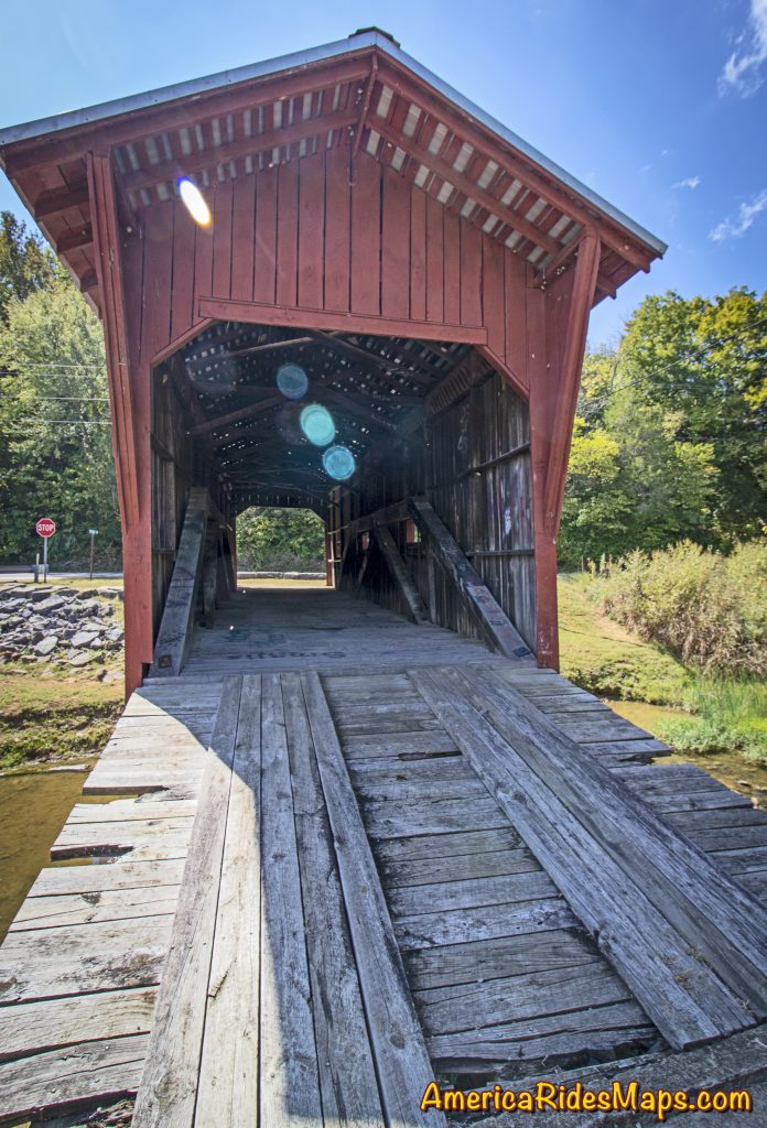
Bible Covered Bridge, east Tennessee

Bible Covered Bridge, east Tennessee

When your motorcycle finds Warrensburg Road (TN 349) in East Tennessee you’re in for an enjoyable ride. The road is big and in good shape, a little hilly, and has some nice twisty sections along the creek.  It’s a pleasant way to pass through the are near Greeneville avoiding the traffic on the more prominent roads.
Bible Covered Bridge, east Tennessee

Bible Covered Bridge, east Tennessee

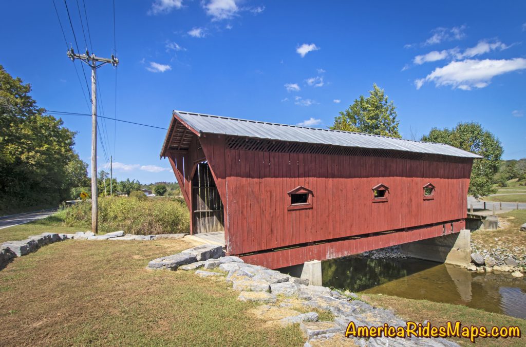
Along the way you’ll pass the easy-to-spot Bible Covered Bridge where Bible Branch Road turns off from TN 349. Once you cross the creek a gravel parking lot connects to that road. The covered bridge spans the creek.
Bible Covered Bridge, east Tennessee

Bible Covered Bridge, east Tennessee

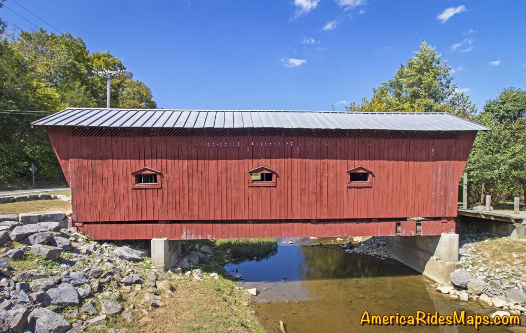
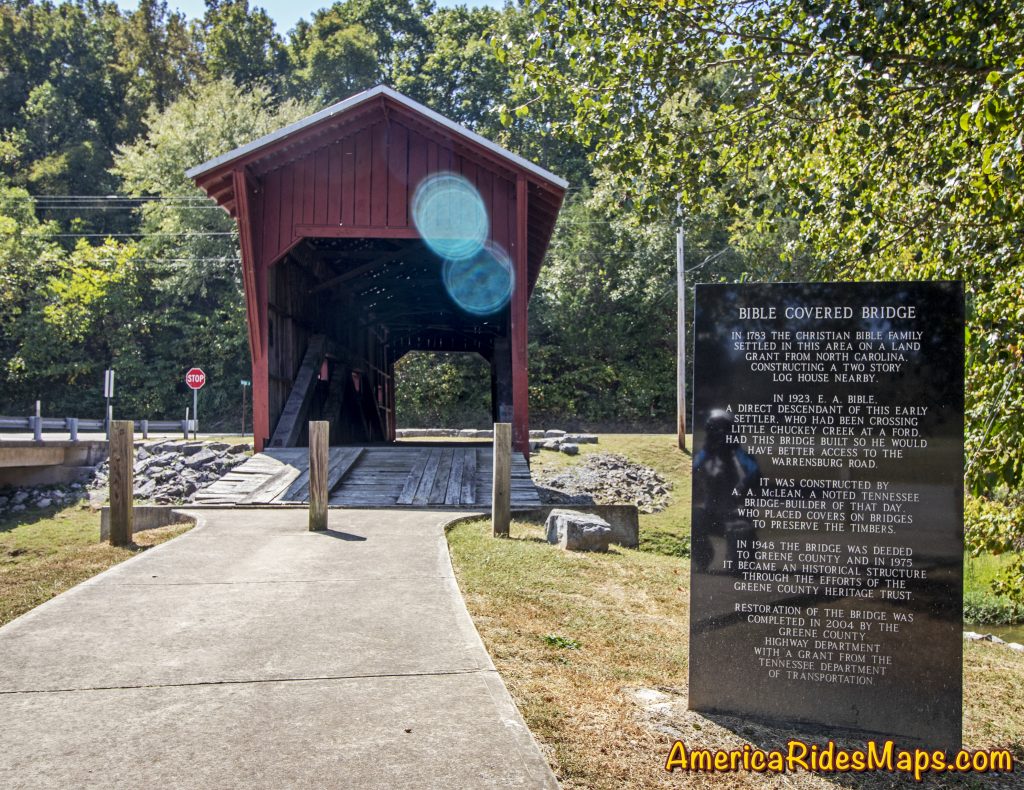
The Bible Covered Bridge straddles Little Chuckey Creek connecting the Bible farm with Warrensburg Road. In 1923, the E.A. Bible family hired A.A. McLean to build this bridge to improve access to the main road from their farm. At the time, it had no side windows. In 1940, Greene County purchased it for $750. The Greene County Heritage Trust rehabilitated it, including a new exterior covering with three pedimented windows on each side, also roof bracings and a shingle roof. in 1975 it became a historical structure.  Restoration of the bridge was completed in the fall of 2004 by the Greene County Highway Department with the help of a grant from the Tennessee Department of Transportation. The bridge retains the original wooden and steel truss members from 1923, the original concrete substructure, the original floor. Sources: https://bridgehunter.com/tn/greene/bible-covered/ , https://www.tnvacation.com/local/greeneville-bible-covered-bridge
Bible Covered Bridge, east Tennessee

Bible Covered Bridge, east Tennessee

This area of East Tennessee is 15 minutes north of the mountains found along the border with North Carolina. It’s not a highly scenic area, there are not a lot of reasons to stop your motorcycle ride. The Bible Covered Bridge is one of them. You can’t ride across the bridge, but it is an easy place to visit, close to parking, perfect for a short break and some photos of a historic sight.

Wayne Busch - AMERICA RIDES MAPS

Wayne Busch – AMERICA RIDES MAPS

Article by Wayne Busch, America Rides Maps

We produce detailed maps of the best roads to enjoy on your motorcycle travels in the Blue Ridge and Allegheny Mountains.

Get the maps at AmericaRidesMaps.com
Source: America Rides Maps Blog on Miles-by-Motorcycle.com

The Motorcycle Ride that Shouldn’t Be There – Go with the Flow

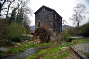
Photo - old mill in Tennessee

Sights like these are the rewards for exploring the back roads. So few ever see them.

“Turn around. Go back. You’re missing something”. The signs were there, little hints and clues that more was going on than meets the eye. It was near time to head for home but I couldn’t shake those compelling thoughts and I swung the motorcycle around.

I’m not unfamiliar with the area. I’d studied it in depth and detail and ridden through it seeking out great motorcycle rides of which I’d already found a slew. I was on such an exploration now following a road I’d selected as having a good chance of being a decent ride, and it had rewarded me with a nice twisty rolling romp through the foothills of English Mountain in Tennessee that my motorcycle seemed to enjoy as much as I did. Still, I felt there was more here.

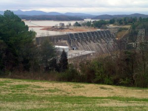
Photo - Douglas Dam, Sevierville, Tennessee

My travels included a stop at the Douglas Dam near Sevierville. While not very scenic in winter, it's a nice place for a break.

I wasn’t sure exactly where I was. It’s not that I was lost, I knew contextually where I was in relation to other roads and landmarks. But the road names were not familiar anymore, they didn’t match what I had planned out on paper. That happens often enough as I don’t so much ride by the suggestions on the map but by how the roads flow one into another – the natural route. I’d turned left at the stop sign to see where this new road connected to the main artery, but I’d seen it maintained it’s character to the right as well, and it was calling me back.

The natural flow of a ride is something thats very hard to pick out from a map or satellite imagery.  When a web of roads connected and intersect, there’s typically a path of least resistance. It’s the instinctual choice you make when two roads meet, the split second decision you make to follow the dominant or more interesting road as you cruise along. It’s the way that keeps you moving, keeps the ride going, it’s what you’re looking for.

Photo - B&W view from the Foothills Parkway

It was a cool, damp, overcast day, a mood better captured without color. View from the Foothills Parkway on my way home.

I couldn’t ignore the clues. The old mill I’d stumbled upon meant this was a long established community that had been connected enough to support such commerce. There would be old roads leading to it. There was the sign for Hidden Caverns – roads to tourist attractions are usually well kept. As I started up the valley, the “Chains and 4-Wheel Drive Required in Winter” sign told me somebody had a reason to go this way, even when the snows come.

The climb was “steep as a mules face” and I expected the quality of the pavement to evaporate as I reached the heights, yet it maintained. Heck, there was even a painted line you could make out in places – that’s a good sign. I rolled on with pretty much certainty the road would just end when the mountaintop was reached, but it didn’t. It snaked around the crest a bit, then plunged down the back side. It was easy to pick the right path up high as all the connecting roads were unpaved, but as I cascaded towards the valley I went with the flow, following the natural course of one road leading into another. The lower I got the more certain I was this ride would lead to familiar territory, but where would it come out?

I finally came to a stop sign and recognized where I’d arrived. I knew this next road, it was one I’d already selected as a great motorcycle ride. It led to more. I then realized where I must have travelled, through an area where I didn’t think there was a decent paved road, an empty white space on the map no longer. It had already been a good day. This great motorcycle ride was the icing on the cake. I can’t wait to go back!

_______________________________________________________________________________

Wayne Busch
Wayne Busch – Cartographer
– Wayne Busch lives in Waynesville, NC, where he produces the most detailed and comprehensive and up-to-date motorcycle pocket maps of the Blue Ridge and Smoky Mountains to help you get the most of your vacation experience. See them here – AmericaRidesMaps.com