Motorcycle Loop Ride near Hot Springs, NC

French Broad River in Hot Springs, NC

French Broad River

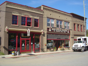
The small historic town of Hot Springs, NC, has long been a familiar pit stop for mountain area motorcycle riders. It is situated north and west of Asheville near the border with Tennessee on the banks of the French Broad River. The town is popular with rafters and hikers, has couple biker friendly places to eat, and there are natural hot springs to soak in at the spa.

Hot Springs, NC

Hot Springs, NC

Motorcycle riders are attracted to this area for the wonderful and tricky two lane back roads which thread through the surrounding mountains. The newfound popularity of NC 209 a.k.a. “The Rattler” as one of the top 10 motorcycle rides in the Blue Ridge Mountains is bringing more motorcycle touring enthusiasts to discover this playground of nice biker roads.

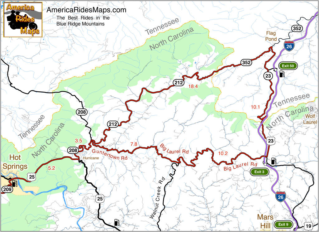
Hot Springs to Flag Pond Motorcycle Ride Map

The map shows a motorcycle loop ride that takes you across the border to Flag Pond, TN., then loops you back to Hot Springs.

  • Leaving Hot Springs, go east on US 25 / 70 making the gentle climb then descent to the junction with NC 208 at Hurricane.
  • Turn north (left) and follow NC 208 along the winding river. As you come to the junction of NC 208 and NC 212 note the small bridge over the creek. Guntertown Road is on the right just before the bridge, NC 212 is at the stop sign once you cross the bridge.
  • The north leg ( NC 212 / TN 352 ) of the triangle shaped motorcycle ride is a pretty nice cruise following along creeks and streams for the most part with a few tricky curves thrown in to keep you on your toes.
  • The east leg ( TN 23 / US 23 ) is pretty relaxed riding, there are a couple passing zones on the long inclines. You’ll want to keep an eye out for the turn onto Big Laurel Road, then hold on for the wild ride back.
  • Big Laurel Road is the south leg of the loop and full of tricky curves. Be alert for scattered debris in a couple of the hairpins around bluff faces. Walnut Creek Road spurs off to the south, be sure you veer in the correct direction when you reach this junction to remain on Big Laurel Road.
  • Guntertown Road leads you east to the small bridge on NC 208. Retrace your path to return to Hot Springs.
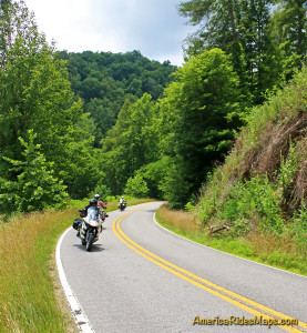
Motorcycles on Big Laurel Road

Big Laurel Road

The roads in this area can be extremely challenging and tight. If you prefer an easier course, the ride to Flag Pond on NC 212 / TN 352 can be done out-and-back. There is a large pull off riders use for a break at the junction of TN 352 & TN 23.

————————————————————————————

wayne busch - Smoky Mountain Motorcycle Rider.com

Wayne Busch

– Wayne Busch lives in Waynesville, NC, where he produces the most detailed, comprehensive, up-to-date motorcycle pocket maps of the Blue Ridge and Smoky Mountains to help you get the most of your vacation experience. See them here – AmericaRidesMaps.com

The Birthplace of Tennessee – Best Seen on a Motorcycle

Photo - marble campfire

Who knows where this is?

It was the middle of nowhere yet it was the center of everything. I’d stumbled upon the birthplace of Tennessee.

I had low expectations. My research told me most of the roads I’d be riding today would hold little interest to the typical motorcycle rider who had come to ride The Dragon at Deals Gap and the Cherohala Skyway. None of the roads I’d ride on my 450+ mile travels would come anywhere close to those legends. Still, the morning held a surprise I never expected and made the efforts worthwhile.

Photo - Cherokee National Forest Road

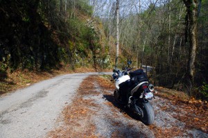
Parked along Pleasant Mountain Road. It's typical of other roads nearby - of little interest to most. Still I check them all.

Arriving in Tellico Plains, Tennessee, after an early morning motorcycle ride where I’d had the whole of the Cherohala Skyway to myself, I pointed my wheel north onto TN 360 and my workday began. Within a few miles I’d reach the point where I’d previously abandoned my search for great motorcycle rides and the explorations would resume. Rounding a curve a green street sign flashed past with a name I recognized and I clamped on the brakes to swing around.

I could rule this road out as soon as I saw it, it was doubtful it would be of any interest. Consulting my map, I saw it connected to another I wanted to investigate, so I snicked into first gear determined to make quick work of White Plains Road and move on.

Photo - Tanasi Monument

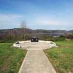
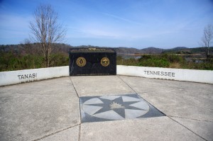
The Tansi Monument - Tennessee gets it's name from here

It met Smoky Branch Road in a few miles where they both intersected Citico Road. I’d eventually loop back through Smoky Branch Road, also of little interest. Obviously Citico Road was the daddy in this area, the main thoroughfare of better quality, decent pavement, and sporting a faded double yellow line, a proper road.

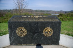
I expected it would quickly peter out, but after several miles it continued to wind and snake through the mostly bland countryside and I started to wonder if it actually went somewhere in the big empty white space on the map. Curiosity aroused, I couldn’t resist investigating the Tanasi Memorial Site when the sign appeared.

Photo - Tanasi Monument

The empty and isolated setting quickly fills with visions of what must have been

Never heard of it. Turning the motorcycle onto Bacon Ferry Road I ventured out into the nothingness on the barely paved bumpy and potholed  single lane that led out onto a low finger of land surrounded by Tellico Lake. I rode past the pull-off, but a quick glance towards the lake had me circling back when I saw the shoreside monument.

Photo - Tanasi inscription

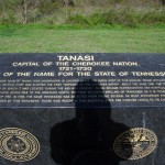
Inscription transcribed below

Tanasi

Capital of the Cherokee Nation

1721-1730

Origin of the Name for the State of Tennessee

The site of the former town of Tanasi, now underwater, is located about 300 yards west of this marker. Tanasi attained political prominence in 1721 when its civil chief was elected the first “Emperor of the Cherokee Nation”. About the same time, the town name was also applied to the river on which it was located. During the mid 18th century, Tansi became overshadowed and eventually absorbed by the adjacent town of Chota, which was to the immediate north. The first recorded spelling of Tennessee as it is today occured on Henry Timberlakes map of 1762. In 1796, the name Tennessee was selected from among several as most appropriate for the nation’s 16th state. Therfore, symbolized by this monument, those who reside in this beautiful state are forever linked to its Cherokee heritage.

Pho

Cherokee Tanasi to Tennessee - State. A heritage preserved and honored.

I don’t much adhere to theories of “vortexes” or spirituality, but there’s something about this site that is powerful enough to make it worth a visit, it will be on the new map. It’s worth the ride out to it. See it if you have the chance.

_______________________________________________________________________________

Wayne Busch
Wayne Busch – Cartographer
– Wayne Busch lives in Waynesville, NC, where he produces the most detailed and comprehensive and up-to-date motorcycle pocket maps of the Blue Ridge and Smoky Mountains to help you get the most of your vacation experience. See them here – AmericaRidesMaps.com 

The Motorcycle Ride that Shouldn’t Be There – Go with the Flow

Photo - old mill in Tennessee

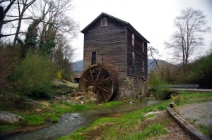
Sights like these are the rewards for exploring the back roads. So few ever see them.

“Turn around. Go back. You’re missing something”. The signs were there, little hints and clues that more was going on than meets the eye. It was near time to head for home but I couldn’t shake those compelling thoughts and I swung the motorcycle around.

I’m not unfamiliar with the area. I’d studied it in depth and detail and ridden through it seeking out great motorcycle rides of which I’d already found a slew. I was on such an exploration now following a road I’d selected as having a good chance of being a decent ride, and it had rewarded me with a nice twisty rolling romp through the foothills of English Mountain in Tennessee that my motorcycle seemed to enjoy as much as I did. Still, I felt there was more here.

Photo - Douglas Dam, Sevierville, Tennessee

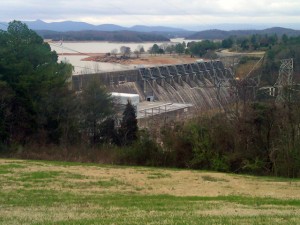
My travels included a stop at the Douglas Dam near Sevierville. While not very scenic in winter, it's a nice place for a break.

I wasn’t sure exactly where I was. It’s not that I was lost, I knew contextually where I was in relation to other roads and landmarks. But the road names were not familiar anymore, they didn’t match what I had planned out on paper. That happens often enough as I don’t so much ride by the suggestions on the map but by how the roads flow one into another – the natural route. I’d turned left at the stop sign to see where this new road connected to the main artery, but I’d seen it maintained it’s character to the right as well, and it was calling me back.

The natural flow of a ride is something thats very hard to pick out from a map or satellite imagery.  When a web of roads connected and intersect, there’s typically a path of least resistance. It’s the instinctual choice you make when two roads meet, the split second decision you make to follow the dominant or more interesting road as you cruise along. It’s the way that keeps you moving, keeps the ride going, it’s what you’re looking for.

Photo - B&W view from the Foothills Parkway

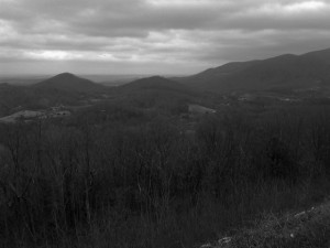
It was a cool, damp, overcast day, a mood better captured without color. View from the Foothills Parkway on my way home.

I couldn’t ignore the clues. The old mill I’d stumbled upon meant this was a long established community that had been connected enough to support such commerce. There would be old roads leading to it. There was the sign for Hidden Caverns – roads to tourist attractions are usually well kept. As I started up the valley, the “Chains and 4-Wheel Drive Required in Winter” sign told me somebody had a reason to go this way, even when the snows come.

The climb was “steep as a mules face” and I expected the quality of the pavement to evaporate as I reached the heights, yet it maintained. Heck, there was even a painted line you could make out in places – that’s a good sign. I rolled on with pretty much certainty the road would just end when the mountaintop was reached, but it didn’t. It snaked around the crest a bit, then plunged down the back side. It was easy to pick the right path up high as all the connecting roads were unpaved, but as I cascaded towards the valley I went with the flow, following the natural course of one road leading into another. The lower I got the more certain I was this ride would lead to familiar territory, but where would it come out?

I finally came to a stop sign and recognized where I’d arrived. I knew this next road, it was one I’d already selected as a great motorcycle ride. It led to more. I then realized where I must have travelled, through an area where I didn’t think there was a decent paved road, an empty white space on the map no longer. It had already been a good day. This great motorcycle ride was the icing on the cake. I can’t wait to go back!

_______________________________________________________________________________

Wayne Busch
Wayne Busch – Cartographer
– Wayne Busch lives in Waynesville, NC, where he produces the most detailed and comprehensive and up-to-date motorcycle pocket maps of the Blue Ridge and Smoky Mountains to help you get the most of your vacation experience. See them here – AmericaRidesMaps.com 

Making Gatlinburg Tolerable for Motorcycles (1 photo)

Gatlinburg. I cringe just thinking about the traffic, congestion, and development.  It’s one of the last places I consider when thinking of good motorcycle riding. Today, my outlook may be changing.

Photo-US-321-north-of-great-smoky-mountains-national-park

US 321 north of Great Smoky Mountains National Park. 90% of the east-west traffic between I-40 and Gatlinburg will be on this road.

I’m closing in on the GatlinburgPigeon ForgeSevierville area, mapping west from I-40 in search of the best motorcycle rides. I’ve already found my best route to reach the city limits avoiding the traffic on US 321 along the north edge of Great Smoky Mountains National Park. A few back roads linked together turn the chore of crossing the foothills downright enjoyable but now I’m getting into the towns.

Even so, I found a couple nice shortcuts today to skirt around the tourists, and there are number of promising roads waiting. The short winter days and roads strewn with road salt, grit, and lingering icy patches limit the miles I can cover efficiently before I turn tail and head home.

I shouldn’t complain about the traffic as it’s the dead of winter. Dollywood is closed. Much of Great Smoky Mountains National Park is closed. The memories of what happens once things warm up give me chills. I won’t quit until I find the best ways to go.

_______________________________________________________________________________

Wayne Busch
Wayne Busch – Cartographer
– Wayne Busch lives in Waynesville, NC, where he produces the most detailed and comprehensive and up-to-date motorcycle pocket maps of the Blue Ridge and Smoky Mountains to help you get the most of your vacation experience. See them here – AmericaRidesMaps.com 

Photos from Todays Tennessee Smoky Mountains Motorcycle Ride 12-10-10

I spent the day riding in Tennessee mostly around Newport. It’s not a particularly scenic area hence so few photos. Most of the motorcycle rides I explored were not up to the quality I was looking for, but I more or less expected that. Even so, I did add a few good connectors and found a couple of outstanding rides.

Photo - Rocky Flats Rd, TN

This is Rocky Flats Road on the north side of Great Smoky Mountains National Park. It's freshly paved and a very nice ride through some tight and hilly country.

There are a lot of little single lane roads, barely paved, in this region. It reminded me of some of the roads in western Virginia. If you’re into adventure riding you won’t run short of options. I strayed down a lot of bumpy little backroads, but few have enough scenery to make me want to revisit them. Unfortunately, when good scenery did present, the winter sun was so low in the sky I couldn’t get a decent photo.

Roadside creek in Tennessee

It's common for the back roads to follow creeks and streams. It was difficult to find sunny spots to shoot photos as the winter sun is so low and the valleys so steep.

I think I covered what was needed for the motorcycle ride map I’m working on. If not, I’ll be back through this way once I get into the next map. I’ve still got to head south again and make a sweep along the border with South Carolina and Georgia. There are a handful of possibilities I want to check on there.

View from the Foothills Parkway

The Foothills Parkway was closed when I rode over this morning, but open on my return. I hit once patch of snow on it but it was no problem. I snapped this photo from an overlook.

The weather is supposed to turn for the worse with rain / snow moving in tomorrow. I’d chance another half day out but I’ve run out of tread on the rear tire. It will be Monday before I can get it replaced, though the coming snow may delay rides for several more days. Glad I got this done now.

_______________________________________________________________________________

Wayne Busch
Wayne Busch – Cartographer
– Wayne Busch lives in Waynesville, NC, where he produces the most detailed and comprehensive and up-to-date motorcycle pocket maps of the Blue Ridge and Smoky Mountains to help you get the most of your vacation experience. See them here – AmericaRidesMaps.com 

Fall leaves – Photos from The Snake Motorcycle Ride

With such a beautiful day I was itching for an excuse to get out of the office, onto my motorcycle, and enjoy it when an email came in from David at the Shady Valley Country Store at The Snake Motorcycle Ride in Tennessee. He needed to be restocked on maps, and I was curious about a recommended road in the area – Denton Valley Road. Thats all it took.

Photo - Fall leaves on the Snake - US 421

The were some nice spots of fall color on US 421 a.k.a. "The Snake" yesterday. I was delivering a load of maps to the Shady Valley Country Store.

The big question was “How to get there?” Normally I’d take the Blue Ridge Parkway north to Linville, then jump on the back roads to skirt around the traffic in Boone. Knowing the Blue Ridge Parkway would be heavy with leaf peeping traffic, I considered going east to take the most common routes, but I also knew US 321 would be clogged with traffic and I’d get held up going through Boone. That left a western approach, so I went to Asheville, then up I-26 to US 19E from which I could jump on the back roads once I neared Elk Park. Looking back, I should have just followed the back roads all the way. I got held up in the construction on US 19E and could probably have made the trip in the same amount of time and had a lot more fun. Time was an issue as it was after noon before I left the house.

Photo - Fall leaves on The Snake - US 421

I snapped this photo just before I started down Denton Valley Road from US 421. The sun hit just right, the colors are real, not enhanced. I tried to tone them down, but decided to go with what the camera captured.

It was nearing 4 PM when I concluded my business at the Shady Valley Country Store and continued west on US 421 enjoying the twists and curves of The Snake to reach Denton Valley Road. It was a decent ride, though I hadn’t researched it well enough and ended up spending the next hour and a half exploring it and the roads which connect to it to determine the best and most natural routes. I rolled into Bristol, Virginia, around 6 to refuel and resigned to taking the Interstates back home as it was the most efficient course. It’s not the first time I’ve made that trip in the dark, and unprepared to be out so late I once again suffered the chills of going through the high pass on I-26 at Buckner Gap at night – it ‘s always cold there.

I pulled into the driveway at 8PM, shivering but happy after a decent 350 miles and a collection of new roads to add to America Rides Maps collection.

_______________________________________________________________________________

Wayne Busch
Wayne Busch – Cartographer
– Wayne Busch lives in Waynesville, NC, where he produces the most detailed and comprehensive and up-to-date motorcycle pocket maps of the Blue Ridge and Smoky Mountains to help you get the most of your vacation experience. See them here – AmericaRidesMaps.com

The Most Challenging Motorcycle Ride Found? A day with the map guy.

I am either;

  1. Getting too old and out of shape
  2. Coming down with the flu
  3. Rode harder than I have in a long time

It’s probably a combination of the first point and the last. I awoke last night sore from the chest down due to throwing my bike around all day in my never ending quest to discover the best motorcycle rides in the Smoky Mountains. It was not planned to be such a day but it turned out to be quite an adventure.

I set out around 8AM for Shady Valley, Tennessee, home of “the Snake” motorcycle ride to make a delivery of motorcycle maps to the Shady Valley Country Store. Plan was to ride up, enjoy the Snake, make the delivery, then check out half a dozen roads nearby in hopes to add some to my motorcycle pocket maps. I knew one would just be a connector route. I didn’t have high hopes for many of the others, though a couple held promise.

It was beautiful and cool up on the Blue Ridge Parkway in the morning. Skies were clear and bright. Even the half hour on Interstate 40 to Asheville was pleasant. There’s little traffic before 10AM once you leave the highway and I pretty much had the road to myself. I watched hopefully for bears north of the city, then enjoyed the run up the wonderful new sections of pavement to pass Mt. Mitchell. Looks like they’ve pretty much wrapped that job up. Saw one grouse, a few hawks, but no bruins.
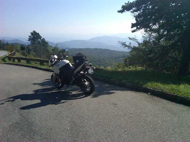
Photo - on the Blue Ridge Parkway

Clear, cool, breezy morning on the Blue Ridge Parkway near Altapass.

I stopped to tweet my first photo at an overlook where I could count on cell phone reception. Though hurricane Earl was approaching the coast, here in the mountains no impact was expected. Even so it was noticeably breezy.

I hit one brief delay for tree work, and another for guardrail replacement. I surprised a flock of turkeys as I came near Little Switzerland. Passing Linville, I left the Blue Ridge Parkway at Roseborugh Road, one of those handy unmarked crossroads that descends through a series of tight turns to NC 105 at Grandfather Mountain. NC 105 took me north through the congestion of Banner Elk. Broadstone Road led me west of Boone to Valle Crucis. NC 194 led to US 421 which I followed through Mountain City and into Tennessee to reach Shady Valley.

A brief pit stop turned into a decent delay as I took time to chat with several riders, mostly locals, and return phone calls when the intermittent cell reception cooperated. I figured it would take a couple hours to see the roads I wanted, then I’d zip back home as I came.

Photo - Shady Valley Country Store

The sun was still shining at the Shady Valley Country Store though the winds were getting gusty. Things would change as the afternoon wore on.

The first few roads proved less than expected. They were a decent ride for a cruiser maybe, though it was not type of rural scenery that makes a road interesting. I explored another after a couple bikes passed in the opposite direction to find it intersected the fourth road at an unknown point. Still nothing special. I turned to backtrack on the fourth road so I would be sure to ride it end to end and was thrilled to find the short leg wonderful. Nice sweeping turns through pretty countryside. Hopeful, I spun about at the intersection with 197 and headed back. The remainder disappointed. Too much straight and only mildly interesting. It was worth adding to the map but not recommending highly. The natural flow dictated I bypass the next on the list meaning another backtrack to explore the better alternative.

The last of the most promising roads was accessed from US 321 near Watauga Lake. It was tight, it was twisty, but it didn’t appeal. It was then that serendipity  struck. Rather than continue on my planned path, instinct told me to detour onto another road. I followed it through turn after turn after turn and it went on and on and on. All the while I expected it would peter out  into a goat trail but it just kept going without letting up. Mile after mile on narrow, sometimes poor, blacktop it climbed through the mountains finally dumping me out at Banner Elk Highway. I pulled into an abandoned gas station to take my notes and decide how to describe it.

I kept asking myself, “But was it fun?” There was no doubt it was challenging, very challenging. It kept you on the edge the whole time. It never let up. I ride the Dragon routinely and this road is much more difficult and sustained. I’d come up on some traffic and had to simply ride behind it, no room to pass, so I didn’t feel I could give it an accurate evaluation. Nor was I sure what lay at the other end. Only choice was to ride it back and see where it came out.

As I turned about my heart sank. A school bus turned onto the road ahead of me. While it looked empty, this would still be an exercise in pain as it could only crawl through the narrow serpentine climb ahead. What a relief when it pulled off within a few hundred feet. It wasn’t long before I had my answer. This road WAS fun.

Unimpeded I rode it enthusiastically back as I’d come. A few miles in I remember thinking, “If you get out of second gear on this road, look down – you’re riding a moped”. I reached the point where I’d first turned on to it and continued past. The road name changed, but its character did not. I continued mile after mile carving through the exquisitely tight turns, dodging gravel patches, potholes, and debris now falling on the road from the increasing wind. I was so happy when US 321 appeared at the margin of the screen on the GPS. I’d found a new way to link a couple major roads. Awesome.

That ride was worth the trip. I stopped and entered the notes in my Blackberry. From there I turned onto US 321 to head on to check out the last couple roads. The weather was deteriorating. Skies dark, winds gusting, it didn’t bother me a bit. Shortly, I came up on another biker who suddenly veered off on another road back in the area where I’d just been riding. I circled back out of curiosity to see what business this cruiser guy had in such a rugged area. The road he chose was a superb cruiser road and I caught up to him just as he pulled into his yard at the junction with the first great road. Bonus! Instinct paid off again.

I returned to US 321 via the cruiser road to make time. It was getting late and the weather would soon add more to the challenge of these tight roads. After a short ride on US 321, I started down the last of them which turned out to be a disappointment. A few miles in I spied a road connecting to it I felt needed exploring and eventually found a better approach though I did waste a good bit of time on dead ends and gravel lanes. Plan was to take this road a few miles, then turn onto another to make my way back towards Mountain City. As I approached the turn, instinct took over again and I purposefully rode past it.

The GPS showed the road I was on getting tighter and twistier and it was climbing higher into the mountains. Thats usually a pretty good indication it’s going to deteriorate to nothing once it nears the top and the road grew narrower and more challenging as it went on. I considered just giving up on it, but something made me go on. The smell of fresh rain on a dry road filled the air and I started hitting dark patches of pavement. I was really questioning myself when I emerged  atop a pass with a rugged valley stretched below and signs warning of a steep descent and switchbacks appeared. It would have been beautiful in nicer weather, but the dark and angry clouds only hastened my urgency to continue on, dreading the thought of having to retrace my steps.

I’ve ridden a lot of miles in the mountains yet never seen switchbacks as tight as these. I plunged down through the valley wondering where I’d end up, hoping I’d find some landmark to steer me back to something familiar. When the road ended, I looked at the sign ahead to see I was on the road I’d meant to explore next. Another great ride found, and I was ready to wrap things up after this last road.

It was longer then I thought and I reached US 421 south of Mountain City. It was now 5 PM. Rain was coming down in sheets. I turned south towards Boone. The Friday evening traffic before the holiday weekend crawled and stalled in the rain. I dreaded the idea of going into Boone and  veered off on 194 to bypass it. More traffic. I stopped near Banner Elk to top off the tank and called home to let my wife know I wouldn’t be there for dinner. We discussed the weather, the traffic, and decided I’d prefer the exposure to the elements on the Blue Ridge Parkway over the hazards of this crazy traffic. It was the right choice. The rain let up once I got up high.

I coursed through the mountains in the twilight relatively unimpeded. It got cold but I made good time. Reaching Asheville, I merged into the traffic jam that clogged Interstate 40 all the way home. Arriving in my driveway as darkness fell, I’d had a successful day. I’d discovered some great roads. I had reason to go back with hopes of more. I had money in my pocket. Sometimes, a cartographers life is to be envied. I wish I had more photos, but I got swept up in the riding. Maybe next time.

wayne@americaridesmaps.com

America Rides Maps – from north Georgia to north Virginia, the best motorcycle rides

_______________________________________________________________________________

Wayne Busch

Wayne Busch - Cartographer


– Wayne Busch lives in Waynesville, NC, where he produces the most detailed and comprehensive and up-to-date motorcycle pocket maps of the Blue Ridge and Smoky Mountains to help you get the most of your vacation experience. See them here – AmericaRidesMaps.com


Motorcycle Touring the Blue Ridge Parkway in One Day – What was it Like?

On Thursday I rode the Blue Ridge Parkway on my motorcycle from the start at Waynesboro, Virginia, 469 miles to the southern end at Great Smoky Mountains National Park in North Carolina. As I progressed I paused to snap photos and posted them on Facebook and Twitter. Here’s a recap of the experience;

Photo - sign at start of Blue Ridge Parkway

The Blue Ridge Parkway starts where the Skyline Drive ends near Waynesboro, Virginia.

I chose to start at the north end as I knew I’d need to leave at daybreak. The morning fog has been so heavy at the southern end I didn’t want to chance it slowing me down or making for pictures of nothing but white mist. I spent the previous night in Richmond and left before 5 AM to make the 1 1/2 hour ride to Waynesboro in the darkness.

Photo - sign at the start of the Blue Ridge Parkway in Virginia

I took these photos the previous day as I expected it would be too dark to take them on the actual trip. I was right.

I fueled up in Waynesboro, grabbed a cup of coffee and a pack of doughnuts to sustain me, and headed on my way. It would be the last time I stopped to eat or drink. 469 miles is a long way at the 45 mph speed limit. I had no time to waste. At least that was my attitude early on.

Photo - morning at the lake on Otter Creek

The sun comes up at the lake on Otter Creek. Easy ride so far.

I had the road to myself in the early morning twilight. Within a few minutes I’d seen both deer and turkey. The road starts a gradual climb to elevation here though nothing like the heights reached further south. With no other traffic on the road, my speed crept up a bit, something I’d fight the remainder of the trip. As you get comfortable and into the rhythm of the road, the temptation to take things at your more comfortable pace is always there taunting you. Knowing how far I had left to go didn’t help.

Photo - Above the clouds approaching Roanoke

I paused at this overlook to top up on oil, lube what was left of the chain, and take a few moments to savor the views I was rushing by.

I was also facing the challenge of not knowing if my chain would last the trip. It was already shot before I left, adjusted to the end of the swingarm, far beyond the normal limit. It now sagged precariously and was making noises that had me wondering when it would snap. I’d never seen a chain smoke when lubed before, and I took advantage of opportunities to slather it with lubricant whenever my concerns peaked. I prayed it would not jump the sprockets when carving through a turn and catapult me into a rock face or over a precipice.

Photo - me and my bike along the Blue Ridge Parkway

A fellow biker snapped this photo of me at a rest stop. Riding from Florida to Maine and back, he and his wife were enjoying the parkway on their return.

Traffic remained surprisingly light through the morning with few holdups to pass slower vehicles. I watched the parkway wake up, the rangers and maintenance crews come to work and start their labors. Finding cell phone coverage to post my photos was always a challenge. You never know when it will be available, sometimes there in what looks like the most unlikely spots, other times absent where you think it should be a strong signal.

Photo - near Doughton Park

By mid morning there were plenty of other motorcycles on the road. This photo was taken somewhere near Doughton Park.

My first stop for gas necessitated a detour into Floyd, VA. Knowing where the nearest gas stations are is one reason I map the area so throughly. You can waste a lot of time looking for them if you don’t know which way to go. While in Floyd I popped in for a minute to see Derek at the Hotel Floyd, one of my favorite places to stay.

Photo - Historic cabin on the Blue Ridge Parkway

There are a few historic cabins along the road in southern Virginia.

As I crossed into North Carolina and entered the high mountains I knew cell phone coverage would be much more limited. The curves tightened up bit and the road was often wet from spotty showers. It would be another day with temps approaching near 100 in the valleys, but at elevation things remained tolerable so long as I was moving. I somehow avoided all but a slight peppering of rain which felt wonderful at the time.

Photo - Grandfather Mountain

Passing Grandfather Mountain I felt I was back on home turf though still a long, long way to go.

Delays had been brief so far, and I planned my next fuel stop to coincide with a quick stop to say hello at the Switzerland Inn in Little Switzerland, one of my favorite places to eat or overnight. I fueled up in Spruce Pine. It was tempting to get a good meal, but I forced myself to press on. The real hold ups came as I approached Asheville. Tree crews and road construction caused significant delays and I hit the “commuter section” during evening rush hour.

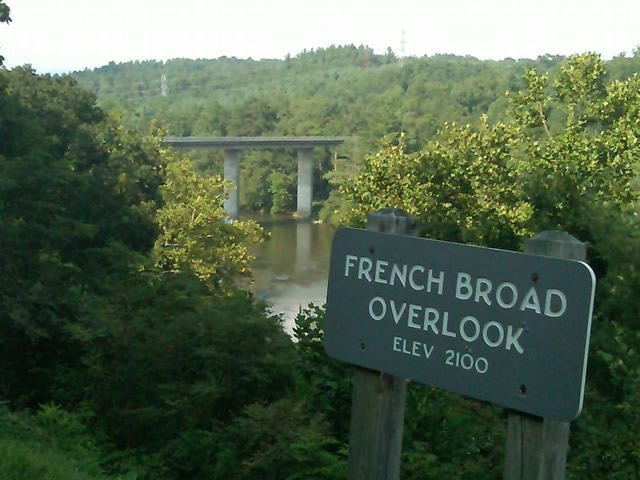
Photo - French Broad River Overlook

It was a great relief to finally cross the French Broad River southwest of Asheville and begin the climb to the highest and most scenic section of the Blue Ridge Parkway.

The sun was drawing near the horizon as I carved my way along the high ridge tops of the section of the Blue Ridge Parkway I consider my back yard. Thunderheads lurked and the road was wet in places, but my luck continued.

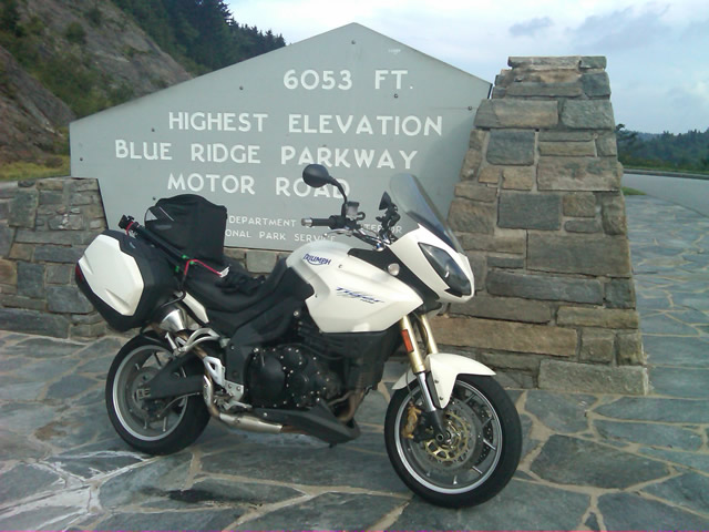
Photo - at the highest point on the Blue Ridge Parkway

Reaching the highest point on the Blue Ridge Parkway, I knew there was less than 40 miles to go to reach my goal.

I reached the southern end of the 469 mile ride with daylight to spare and took a pause at the Oconoluftee Visitor Center in Great Smoky Mountains National Park. I grabbed a few photos but found the battery was now dead on my cell phone. Here they are now –

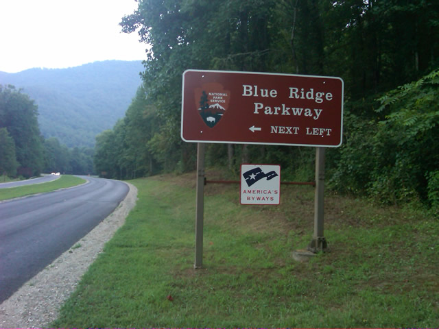
Photo - start of the Blue Ridge Parkway in North Carolina

The Southern end of the Blue Ridge Parkway near the Oconoluftee Visitor Center.

While my Blue Ridge Parkway in a day adventure was completed, I still needed to get home. Noting the evening traffic, I chose to avoid going into Cherokee and got back on the Blue Ridge Parkway now headed in the opposite direction. I rode through to Soco Gap, then passed through Maggie Valley to finally get to my home in Waynesville.

Photo - sign at the southern end of the Blue Ridge Parkway

Go through Cherokee or back the way I'd come? I chose to return home via the Blue Ridge Parkway of course.

My chain lasted the trip. My rear tire is bald. It’s time for some service on the engine. New parts are on order and it will take this week to get the bike roadworthy again. Next week? I might just poke into east Tennessee. I’ve too long ignored the area between Great Smoky Mountains National Park and Knoxville. If I can locate at least a dozen good rides there it will warrant a new motorcycle pocket map. I discovered some great roads along the Virginia / West Virginia border on this trip, several of which will be added to existing America Rides Maps. It will take a few more trips north to determine how the map of that region will lay out but it will come. For now, it’s catch up on the work I left, update the existing maps with the new rides I discovered, and make preparations for the roads ahead.

America Rides Maps on Facebook

America Rides Maps on Twitter

America Rides Maps – the best motorcycle pocket maps money can buy

_______________________________________________________________________________

Wayne Busch

Wayne Busch - Cartographer


– Wayne Busch lives in Waynesville, NC, where he produces the most detailed and comprehensive and up-to-date motorcycle pocket maps of the Blue Ridge and Smoky Mountains to help you get the most of your vacation experience. See them here – AmericaRidesMaps.com
 

12 Classic Deals Gap Motorcycle Rides now at Thunder Mountain

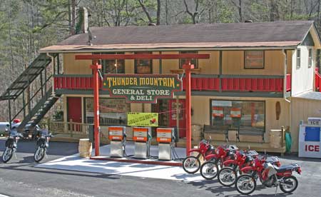
Photo - Thunder Mountain Country Store and Deli

Photo from Thunder Mountain Country Store and Deli - http://thundermountainnc.com/
America Rides Maps newest map, 12 Classic Deals Gap Motorcycle Rides, is now available at the Thunder Mountain Country Store and Deli located at the Robbinsville end of the Cherohala Skyway. You can’t miss it as you carve through the tight curves at the start of the the Cherohala. Say hello to Paul and Tina when you stop in for gas or refreshments on your motorcycle ride.

Now that the rock slide has been resolved on the Dragon at Deals Gap, the motorcycle traffic is really picking up again and riding the Cherohala loop is one of the prime attractions for motorcycle touring. Tennessee’s version of the Blue Ridge Parkway, it’s a very similar motorcycle ride with it’s high vantage points and overlooks, paved pull-outs, and quality pavement. After the Dragon, it’s the most popular motorcycle ride in the area and well worth the time.

Be aware enforcement is heavy right now with 8 troopers in the Dragon yesterday. Don’t be silly or you WILL pay the price. With a heavy weekend predicted, I’d suspect they’ll be out in force. Also be careful – I regret to relate there was a motorcycle fatality on the Cherohala yesterday, and the passenger was airlifted to Knoxville. I don’t know the details, it was unfolding while I was there.

Motorcycle Friendly – The Shady Valley Country Store at The Snake

There’s a reason my wife rarely tags along with me while I’m out working from my motorcycle – I only stop for two things, one is fuel. The other can be remedied at any clump of shrubbery. Rarely do I ever stop to eat, drink, or grab photos. It’s all about covering the miles. Those creature comforts can wait until I retire for the evening when darkness makes any further progress futile. I think that’s about to change and one of the first places I’m going to visit is the Shady Valley Country Store the home of “The Snake”.
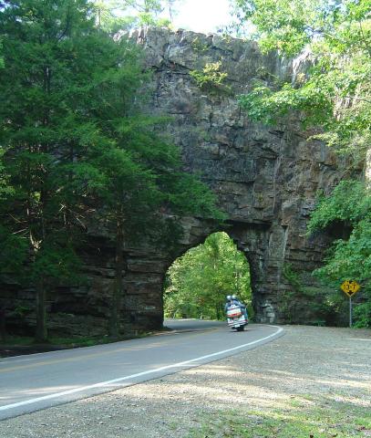
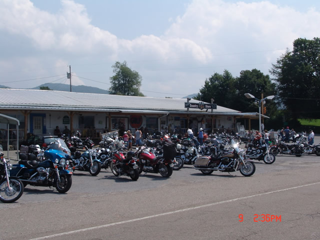
Photo - Shady Valley Country store

Shady Valley Country Store serves thousands of motorcycles weekly who come to ride "The Snake" and surrounding roads.

Located at the junction of NC 133, NC 91 and US 421 (a.k.a. “The Snake”), the Shady Valley Country Store is at the hub of some of the best motorcycle rides found in the Smoky Mountains where North Carolina, Virginia and Tennessee meet. Serving thousands of motorcycles every week, it provides a convenient fuel stop with regular as well as premium “Snake Venom” for your thirsty motorcycle. I’m told the 1/2 lb. black angus burgers, the thick bologna sandwiches and great chili dogs will keep you going full speed as well.

Backbone Rock on TN/NC 133

Backbone Rock on TN/NC 133 not far from the Shady Valley Country Store

I’ve blasted past the Shady Valley Country Store enough times. Next time I’m up there I’m stopping in to check it out, maybe get me a T-shirt or some other Snake memorabilia. Expect to get a first hand report ASAP.

The Shady Valley Country Store