Great Motorcycle Rides Easy to Find Online

Great Blue Ridge & Smoky Mountain Motorcycle Rides discussed live online @ Map Chat

I’ve kicked off a new series of live online interactive webinars discussing the best motorcycle rides in the Blue Ridge & Smoky Mountains called Map Chat.

First Tuesday of each month at 8 PM eastern time, join me as I review one of my America Rides Motorcycle ride maps in detail.

Get the schedule and links to the webinars at http://americaridesmaps.com/map chat.html

Here’s a 5 min edited version of the first of the Map Chat series where we discussed Map #1 – Great Rides Near the Start of the Blue Ridge Parkway in Virginia.

The full (40 minute) version of the webinar is posted online at: http://youtu.be/8g4GatVrUNc

_______________________________________________________________________________

Wayne Busch

Wayne Busch - Cartographer

Total Rider Tech Logo

Learn Total Control

– Wayne Busch lives in Waynesville, NC, where he produces the most detailed and comprehensive and up-to-date motorcycle pocket maps of the Blue Ridge and Smoky Mountains to help you get the most of your vacation experience. See them here – AmericaRidesMaps.com

Wayne is an advanced motorcycle instructor for Total Rider Tech teaching Lee Parks Total Control Advanced Rider Courses. It’s time you looked into advanced rider training to ride more confidently and safely, it will change your mountain riding experience. It worked so well for me I became an instructor! Total Rider Tech

_______________________________________________________________________________

image-virigina-motorcycle-ride-map

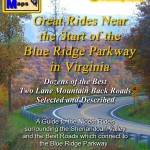
#1 Great Rides near the Start of the Blue Ridge Parkway in Virginia

See  / purchase the map discussed – Map #1 Great Rides Near the Start of the Blue Ridge Parkway in Virginia 

Bargain Motorcycle Tires Online? Caveat Emptor

The most important piece of gear on your motorcycle is one where I often see riders make poor choices.  Riding a motorcycle,  particularly on the curvy back roads of the Blue Ridge and Smoky Mountains,  is an exercise in maintaining and maximizing traction. Your tires are your two points of contact with the road. Losing traction on either of them can quickly have severe consequences.

Too often though, I stumle across discussions where the emphasis is on finding the cheapest tires with the longest lifespan, and buyers often turn to online discount outlets to purchase them. If you’re buying a newly released tire online, you’ll probably do OK. If you are buying an old stand-by tire however, you may not be getting such a bargain after all.

photo-marking-on-tire

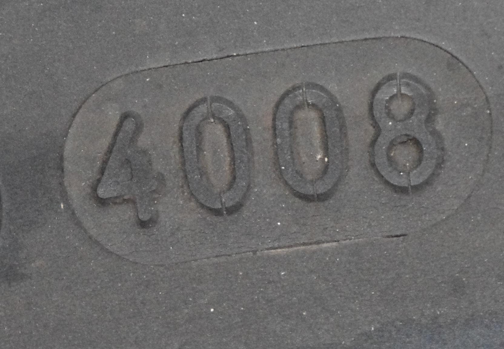
How fresh are your tires? Look for this code. This tire was manufactured in the 40th week of 2008.

Tires have a shelf life. The rubber compounds degrade with time, becoming harder and loosing flexibility. High performance tires may have a shelf life of less than 2 years. Sport bike tires are usually good for about 3 years. Touring bike tires may go as long as 5 years before they are degraded to where performance is affected.

The problem one can run into buying online is you have no way of knowing how old the tires you purchase are. It’s very possible they’ve been sitting in a wharehouse for years. Much of their life has been used up before they were ever mounted.

I once bought a 6 year old bike which had 600 miles on the original tires. Great deal. I quickly noticed a steering wobble that had me wondering if I’d been duped. It rapidly got worse and worse. All thoughts of causes ran through my mind, none of them good. The first remedy was to try fresh tires. It was an immediate cure.

Photo-tire-age-code

This tire was produced in the 12th week of 2010. Note the difference in the appearance of the rubber - you can see in the photos which tire looks older.

The old tires looked brand new. They had very few miles on them. Time had taken it’s toll, and I was concerned at how quickly they got to approaching dangerous levels of performance.

So how do you know how old a tires is? It’s listed on the tire. Amongst all that DOT code, manufacturer info, and branding, look for a small rounded rectagle with 4 numbers in it. The first 2 numbers are the week the tire was manufactured, the second two the year. For example, 44/10 indicates the tire was made in the 44th week of 2010.

I believe it’s best to buy tires from a local shop where you can see what you’re getting. As important as they are to your safety and riding enjoyment, insuring you have fresh tires should be standard practice for good motorcycle riders. Old tires may be cheaper, but there’s a good reason for it.

_______________________________________________________________________________

Wayne Busch
Wayne Busch – Cartographer
– Wayne Busch lives in Waynesville, NC, where he produces the most detailed and comprehensive and up-to-date motorcycle pocket maps of the Blue Ridge and Smoky Mountains to help you get the most of your vacation experience. See them here – AmericaRidesMaps.com 

Best Motorcycle Rides in North Georgia – digital soon?

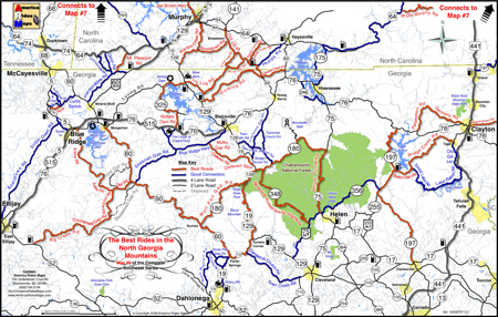
Wow! It’s taken me 18 months to completely revise and update all my Smoky Mountain / Blue Ridge motorcycle ride maps, but the last of them is done – Map #9 “The Best Rides in the North Georgia Mountains” has been released.

image-best-rides-in-the-north-georgia-mountains

Roads are really bold, map is easy to and quick to read. Road descriptions on back of map.

If you have one of my Georgia motorcycle maps you honestly don’t need to replace the map you have. I had almost all of the really outstanding Georgia motorcycle rides on the earlier version. I did find a couple more really nice north Georgia motorcycle rides on the periphery of the main area of the map as you make your way to the classic rides  – you’ve got to ride GA 60,  Blood Mountain area, and I love to play back and forth across the North Carolina state line.

image-georgia-motorcycle-map

Map #9 - The Best Rides in the North Georgia Mountains

So what’s the big deal? The reason this revision took so long was prepare the maps for digital use! I’ve looked at phone apps but decided the limiting factor in the mountains is reception. Live GPS positioning via phone just isn’t there yet for this region.

A solution I’ve been testing instead is map downloads which can be scaled and used from an ipad, ipod, iphone, or any other smart phone provided you’ve got a decent sized memory card. Got your phone? You’ve got your maps. It worked well on the ipad. I’ll be testing ipod, iphone, etc. next. If it goes well, you can expect to see them available in about 2-3 weeks.

So what about GPS? Next project. I have the software. I need the time.

See more about the new map here – goo.gl/ifTNr

_______________________________________________________________________________

Wayne Busch
Wayne Busch – Cartographer
– Wayne Busch lives in Waynesville, NC, where he produces the most detailed and comprehensive and up-to-date motorcycle pocket maps of the Blue Ridge and Smoky Mountains to help you get the most of your vacation experience. See them here – AmericaRidesMaps.com 

Blue Ridge Motorcycle Touring – Natural Bridge, Virginia

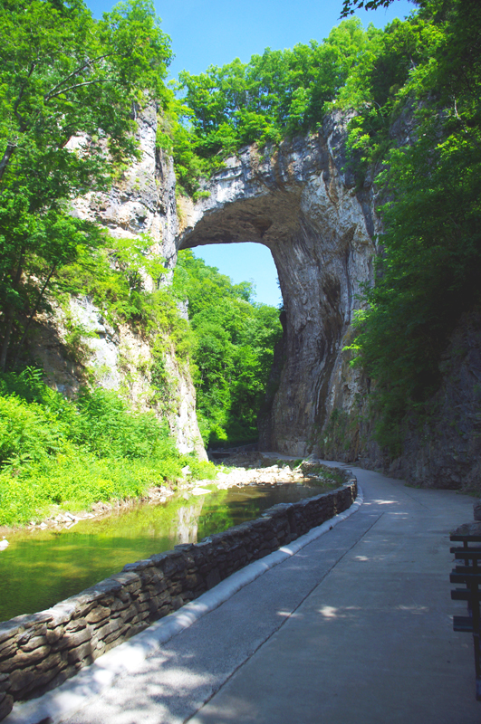
In general, I avoid the touristy sights on my motorcycle travels as I get my kicks from the road. It’s the hundreds of great motorcycle rides in the Blue Ridge and Smoky Mountains I most enjoy, and that is best done with the kickstand up and the throttle open. I need a pretty good reason to park the motorcycle and go for a walk, and Natural Bridge, Virginia, is worth time the time to stop and see.

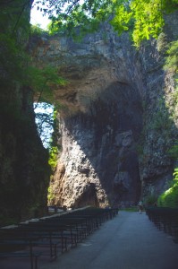
Photo-Natural-Bridge-view

The Natural Bridge, a Viriginia landmark worth seeing.

Photo-Natural-Bridge-Hotel

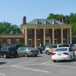
The Natural Bridge Hotel, a historic landmark

Natural Bridge has been around for a long time. It was already a tourist destination when Thomas Jefferson visited. This 200 foot high natural arch started as a cavern millennia ago. Over the eons erosion collapsed the majority of it leaving only the dramatic and inspiring rock formation that has drawn thousands of spectators over the last few centuries.

Photo-Natural-Bridge-Entrance-and-Gift-Shop

Natural Bridge Entrance and Gift Shop

This long history was part of the attraction for me. There are many early sketches and historic reports of the landmark displayed in the museum, it is part of our national heritage. This legacy though has come at the cost of commercialization of the natural attraction with manufactured ones added to woo the crowds and entice them to part with their dollars.

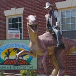
Photo-Cowboy-on-a-dinosaur

I managed to escape the Dinosaur Kingdom

We passed on the wax museum, the butterfly room, and most all the other man-made enhancements designed to lure the tourist. I was particularly amused by the hook for the “Escape from the Dinosaur Kingdom” with a statue of a cowboy riding a dinosaur. Easy to pass on that one, I’m quite satisfied with the Flintsone’s version of pre-history. Yabba-dabba dumb, but I’ll bet the kids like it as well as the Haunted Monster Museum.

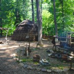
Photo-Indian-village

The Indian Village re-creation.

We did walk the trail to view the re-created native indian village, but it pales in comparison to the main attraction.

We paid $18 a piece for a ticket that gave us partial access to all the attractions. All we really wanted to see was the Natural Bridge. It’s a short walk and worth the time, and while I we could have seen all the other kitschy stuff, I felt my money well spent avoiding it.

A side trip to Natural Bridge, Virginia is an easy and pleasant ride from the Blue Ridge Parkway. Exit near the James River Visitor Center on US 501 (milepost 63.7) or VA 130  a couple miles north (milepost 61.6, and the better ride). Follow Us 501 / VA 130 to Glasgow, turning right on VA 130 to pass through the small town for another 4 miles or so. Don’t worry, you can’t miss it when you arrive.

Photo-Natural-Bridge-view

View of the other side of the Natural Bridge

Natural Bridge, Virginia

The Natural Bridge and other scenic attractions nearby are found on Map #1 of the 6 map Blue Ridge Parkway series of motorcycle pocket maps by America Rides Maps. Don’t miss all the great motorcycle rides in this area.

Image-map-cover

Great rides Near the Start of the Blue Ridge Parkway in Virginia

_______________________________________________________________________________

Wayne Busch
Wayne Busch – Cartographer
– Wayne Busch lives in Waynesville, NC, where he produces the most detailed and comprehensive and up-to-date motorcycle pocket maps of the Blue Ridge and Smoky Mountains to help you get the most of your vacation experience. See them here – AmericaRidesMaps.com 

How to Make a good Deals Gap Motorcycle Ride Better –

Adding these two roads to one of the four most popular Smoky Mountain motorcycle loop rides near the The Dragon at Deals Gap makes the least of them measure up to the others.

Photo - morning on the Cherohala Skway

Morning on the Cherohala Skyway. I'm parked on the state line between North Carolina and Tennessee.

Smoky Mountain / Blue Ridge motorcycle riders who flock to ride The Dragon at Deals Gap typically take in other rides when in the area. One of the best Smoky Mountain motorcycle rides is a loop through Vonore and Tellico Plains, TN to take in the Cherohala Skyway. Another popular circuit is to loop around Great Smoky Mountains National Park crossing through the heart of the Smoky Mountains on US 441. A third great loop ride links NC 28 at Franklin, NC to Nantahala Gorge via Wayah Road. All of these are great loop rides in the Blue Ridge with unique characters.

The fourth most popular ride is to take the Cherohala Skyway west to Tellico Plains, then go south on TN 68. You then use TN 123 / NC 294 to head east, and follow US 74 / 129 north through the Nantahala Gorge to return to The Dragon at Deals Gap. This loop ride starts out with the outstanding scenery and enjoyable sweeping curves of the 50 mile long Cherohala Skyway as it crosses the Snowbird Mountain Range of the Blue Ridge. It gets nice again once you enter the curvy sections a few miles south of Tellico Plains on NC 68. It’s gets better and better the further south you go, though NC 68 can carry a bit of traffic on weekends.

Photo - Field of the Woods

The 10 Commandments at Fields of the Wood - big enough God can read them

Once you turn east on TN 123 / NC 294, the ride is still pretty good, but the road opens up and the ride is not as scenic and challenging as you progress. Here’s how to punch it back up to outstanding.

Watch for Fields of the Wood, it’s the closest landmark to the turn off onto Hiawassee Dam Access Road. Fields of the Wood is worth a stop to see and a nice place for a break. Those with devout religious leanings will be inspired by the hillside with the ten commandments written out in stone, as well as numerous other Biblical icons and monuments. For those inspired more by hellacious and challenging roads, Hiawassee Dam Access Road is next leading to devilish twists and curves.

Photo - Hiawassee Dam

The Hiawassee Dam is a nice spot for a break.

Turn onto Hiawassee Dam Access Road to start the fun. You may encounter a little traffic approaching the dam on weekends as many come for boat access to the lake and river. Once past the dam, the excellent and challenging road continues a course around the west side of the lake. Turn right onto Joe Brown Highway when you reach the end of Hiawassee Dam Access Road.

Joe Brown Highway is hardly what any of us think of when the word “highway” comes to mind. This isolated and remote twisty two lane back road is packed with curve after curve and some pretty decent Smoky Mountain scenery, though you’ll be paying more attention to the road than the horizons. It’s a whole lot of fun, usually carries very little traffic, and may be the best section of the entire loop, a nice contrast to the sweeping curves of the Cherohala Skyway.

Photo - Nantahala Outdoor Center

The Nantahala Outdoor Center on the river is another great break spot with bathrooms, good food, nice views, and the place to arrange a river trip.

Joe Brown Highway runs you right through downtown Murphy, NC to intersect US 129 / 74 at the junction with US 64 East. Turn north to follow the four lane to Andrews where it funnels down to two lanes again for the ride through scenic Nantahala Gorge. You’re bound to run into traffic in Nantahala Gorge, but the scenery along the popular whitewater river makes up for it. Avoid the gorge on weekends when possible as the buses hauling rafters and kayakers tend to bottle things up.

Once through Nantahala Gorge, turn left onto NC 28 and back into the twists and curves to return to The Dragon at Deals Gap.

Photo - View from Hiawassee Dam Overlook

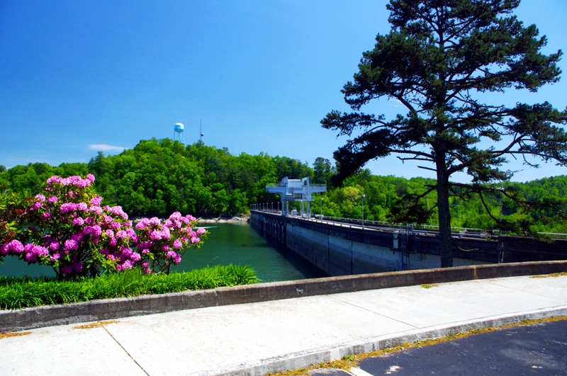
There are nice spots for a break both atop and below the Hiawassee Dam. The road runs across it then continues around the lake.

_______________________________________________________________________________

Wayne Busch
Wayne Busch – Cartographer
– Wayne Busch lives in Waynesville, NC, where he produces the most detailed and comprehensive and up-to-date motorcycle pocket maps of the Blue Ridge and Smoky Mountains to help you get the most of your vacation experience. See them here – AmericaRidesMaps.com 

Motorcycle the Dragon, the Cherohala Skyway, the Blue Ridge Parkway in one day

Photo - Thermometer at Deals Gap Motorcycle Resort

Thermometer at Deals Gap Motorcycle Resort

It was 80 degrees when I pulled up at the Deals Gap Motorcycle Resort yesterday at 5 PM with over 400 miles of Smoky Mountain motorcycle rides already behind me. 8 hours ago I was on the Cherohala Skyway as the soft morning glow and gusty winds made the lonely road seem like it was in another world.  I decided to make the day a trifecta and go home via the Blue Ridge Parkway. It’s hard to believe it’s still March, early spring has arrived!
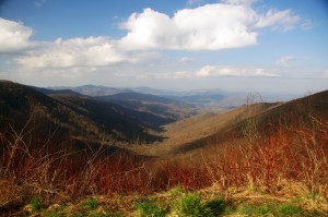
Photo - morning on the Cherohala Skway

Morning on the Cherohala Skyway. I'm parked on the state line between North Carolina and Tennessee.

I had reservations about going out today, I’d been putting it off. I knew I would not find many good motorcycle rides in the areas I was searching. It was either too far out of the mountains or too far to into them. I was hitting the single lane back roads in the National Forests near The Dragon at Deals Gap and the Cherohala Skyway,  as well as the best ways to pass through the semi-urban areas to the north.
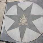
Photo - marble campfire

Who knows where this is?

I found something cool out in the Cherokee National Forest that will get it’s own motorcycle blog post shortly. One of the more useful things I discovered is one of the most direct ways to connect The Dragon at Deals Gap to I-75 south of Lenoir City.
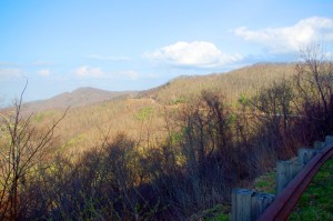
Photo - Cherohala Skyway View

A long view of the Cherohala Skyway as it winds into Tennessee

I suspect many riders follow US 129 to Maryville, then take US 321 north when headed for the Interstate. There is  a way to minimize the traffic and avoid more than half of the four lane US 321.

Take TN 72 north from The Dragon at Punkin Center. When you reach US 411, cross it onto the East Coast Tellico Parkway and follow it along the lake area. It will become Axely Chapel Road at the north end and will intersect US 321. These are not outstanding motorcycle rides, but they are a heck of a lot better than the alternatives and get you off the four lane on some scenic and curvy motorcycle roads.
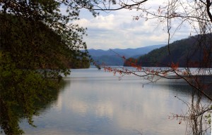
Photo - Calderwood Lake

Calderwood Lake is one of several along US 129

I don’t really care much for riding in this area, but it’s only because there are so many really great motorcycle rides once you get in close to Great Smoky Mountains National Park. It’s hard to shine when pitted against them.

I’ve been mostly focusing on find the connections between the better rides so you can link them together. If you have the time when passing through, they are the most enjoyable motorcycle rides I can find for those who would rather stay on the back roads and savor them. The views are certainly more entertaining. Watch out for turkeys in the road.
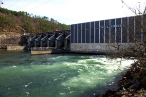
Photo - Chillowhee Dam

How many of you have seen the Chillowhee Dam from this side?

My “wake up and dream” cruise on the smooth and sweeping curves of the Cherohala Skyway was the highlight of the morning.  The rest of it was on a web of roads which weave through the more remote and rugged sections of the national forest. A few of them start out as decent paved roads, but quickly diminish to single lane unmarked trails that become more potholed and full of gravel as you go. On most, the pavement ends long before the road does.
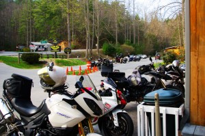
Photo - motorcycles at Delas Gap Motorcycle Resort

5 PM on a Tuesday evening in late March at the Deals Gap Motorcycle Resort

I’ll need at least one more good day to cover this area as thoroughly as I’d like. I’ve hit almost all the roads. The challenge now is how they work together to become the best motorcycle rides through the area, how well do the linked roads flow, can I find ways to make the good motorcycle rides last longer?

I know I can!

(Click on photos for larger views)
_______________________________________________________________________________

_______________________________________________________________________________

Wayne Busch
Wayne Busch – Cartographer
– Wayne Busch lives in Waynesville, NC, where he produces the most detailed and comprehensive and up-to-date motorcycle pocket maps of the Blue Ridge and Smoky Mountains to help you get the most of your vacation experience. See them here – AmericaRidesMaps.com 

Blue Ridge Parkway Opens Soon, Smoky Mountain Motorcycles Everywhere!

Motorcycle the Blue Ridge Parkway

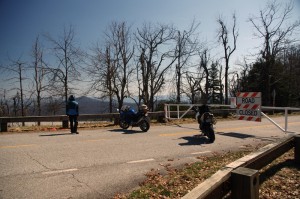
We parked our motorcycles at the Blue Ridge Parkway gates at Wagon Road Gap. It wasn't open today, but it will be soon.

I knew before we reached the top of the climb the gates to the Blue Ridge Parkway would be closed. The fresh layer of road salt as we glided through the last of the hairpin curves on our motorcycle ride up US 276 south of Waynesville, North Carolina, were evidence of the lingering snow I’d seen on the mountainsides last night. Thin sheets of ice on the roadside rock faces reminded me just how different the world is when you climb up high where the Blue Ridge Parkway crowns the ridge tops.

Photo - waterfall along Buck Springs Trail

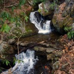
Many come to enjoy the hiking nearby. One of several small cascades the Buck Springs Trail shares on it's 6 mile run to the Pisgah Inn.

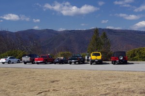
In the midday warmth, the dusting of white had vanished, but it was not long gone. We found the gates closed at Wagon Road Gap, but a nearly full parking lot at the Cold Mountain overlook proved we were not the only ones who were eager to enjoy the emergence of spring via the nations most popular motorcycle ride.

Photo - Blue Ridge PArkway overlook - Cold Mountain

Cold Mountain Overlook at Wagon Road Gap, Blue Ridge Parkway - Even with the parkway closed, plenty came out to enjoy the hiking, the scenery, and the warm weather on such a nice day.

Photo - Jackie on her Beemer

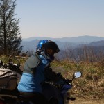
Come on, Let's Go ! This is great!

It’s early for the Blue Ridge Parkway to be open to traffic at the south end. This is the highest, and in my opinion, the best section of the entire 469 mile motorcycle ride.  If you see just one piece of the Blue Ridge Parkway on your motorcycle vacation, this should be it, the section from Asheville to the south end of the parkway at Great Smoky Mountains National Park near Cherokee. Because it’s the highest section, it’s usually the last to open for the start of the spring season.

The number of outstanding roads that surround and connect to the Blue Ridge Parkway in this area is enough to keep you busy for a season and then some. It was just one stop on a great day of motorcycle rides that followed.  I think we passed more bikes then cars on our ride. If you had a motorcycle, you were out to enjoy it today.

Photo - view from Crabtree Mountain Road

A view from Crabtree Mountain Road north of Canton. You can see a portion of it as it snakes it's way through the pass. Soon, this will all be green and spring flowers.

We doubled back via US 276 then cruised through Canton and headed north on Crabtree Mountain Road. I’d forgotten what a steep climb it was and how tight the switchback  curves are that bring you to the nice overlook at the top of the mountain pass. Up one side, down the other, then follow the serpentine path of the stream that flows through the valley. On to NC 209, out to Hot Springs, then hop from one great motorcycle ride to the next until you’ve had your fill.

Photo - view form blue ridge parkway overlook

Before long, everything will be green and flowers!

It won’t be long until weather like this will be what we expect every day in the Smoky Mountains. The fields are already turning green. The first tiny leaves are emerging on the brush. Buds are fat and swelling almost ready to burst on the trees. Soon, the hillsides will explode with color as all that pent up winter energy is freed. From what I’ve seen so far, the motorcycles are ready for it. Are you?

_______________________________________________________________________________

Wayne Busch
Wayne Busch – Cartographer
– Wayne Busch lives in Waynesville, NC, where he produces the most detailed and comprehensive and up-to-date motorcycle pocket maps of the Blue Ridge and Smoky Mountains to help you get the most of your vacation experience. See them here – AmericaRidesMaps.com 

A Winter Day Searching for Great Smoky Mountain Motorcycle Rides

The Smoky Mountains of the Blue Ridge aren’t waiting for the official arrival of the solstice – winter time is pretty much here and now. Last week was messy, wrapping up with a deluge of rain.  When the weather broke a little yesterday, I finally got out to do some motorcycle riding. I waited for the sun to get high enough to minimize any icy patches on the road, then set out on a cold and mostly overcast day. It’s good that I did. It looks like we’re in for a cold wet stretch of dismal gray skies and the constant threat of rain or snow over the next few days. It’s hardly the kind of winter weather that inspires one to go dashing over the river and through the woods on your motorcycle no matter how much Grandma wants to see you. When the skies clear, you shouldn’t chance missing the opportunity to get out and ride. The good riding days will be more and more rare.

Photo - morning clouds bring us snow

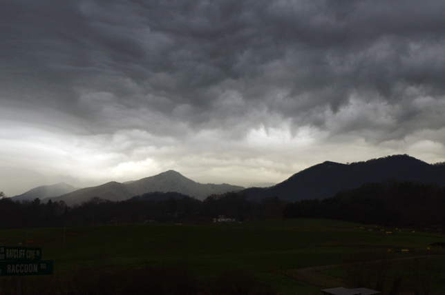
After yesterdays break in the weather, clouds are moving back in this morning. Rain will turn to snow tonight, but not a significant amount. Blustery for the next few days.

I spent the afternoon prospecting for great motorcycle rides near Hendersonville, Mountain Home, Pisgah Forest, and Mills River. I’d not paid this area much attention before as it was not a piece of real estate previously included in one of my motorcycle maps.  There’s relatively high traffic and congestion around here and I tend to avoid going through, but I’m already thinking about the Asheville Bikefest in the spring and I want to become more knowledgable of this nearby area. It turns out there are a number of nice roads passing through it and I managed to locate and explore several good new ones I can now recommend as more enjoyable alternatives to the main roads.

Photo - flooded road near Mills River

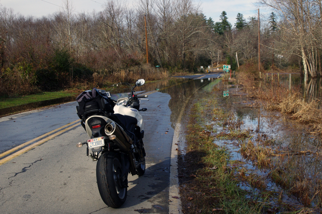
This area got hammered by recent heavy rains and I forded a few flooded roads this afternoon. While some were several feet deep yesterday and some cars got stranded, the water was only inches deep today.

Located south and slightly west of Asheville, the mountains in this area are not as high as those to the north in the Pisgah Forest. There are a number of rivers which flow through here, some farmland, a few high end neighborhoods, and some rugged and forested areas like the Dupont Forest with it’s many waterfalls. I -26 runs north-south just a few miles east and the border with South Carolina in only minutes away. It’s a pretty area, but the mountains of the Pisgah Forest and the Blue Ridge Parkway to the north overshadow it.

Photo - Looking Glass Falls

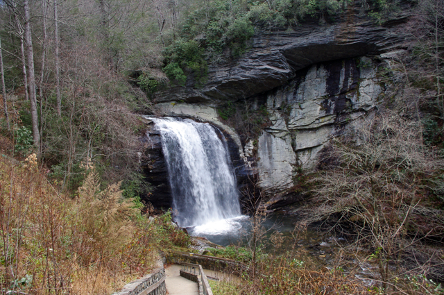
I commuted via US 276 from Waynesville to Brevard to reach the area. No ride on US 276 is complete without a stop at Looking Glass Falls.

The areas I have left to scout for this map revision (in progress) are scattered across 4 states. I’ve still got to press a little further into South Carolina then sweep west into the corner of Georgia to look at one potentially good road. The bulk of the remaining riding is in Tennessee, just north of Great Smoky Mountains National Park. I’ll need two really good days to thoroughly re-explore that area.

If the weather doesn’t break soon, I’ll start working on the next map, the companion to this one. I’ve got plenty to occupy my time. Still, I’d rather be out riding.

_______________________________________________________________________________

Wayne Busch
Wayne Busch – Cartographer
– Wayne Busch lives in Waynesville, NC, where he produces the most detailed and comprehensive and up-to-date motorcycle pocket maps of the Blue Ridge and Smoky Mountains to help you get the most of your vacation experience. See them here – AmericaRidesMaps.com 
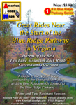
Photos From Another Great Smoky Mountain Motorcycle Riding Day

Photo - 15 mph road sign

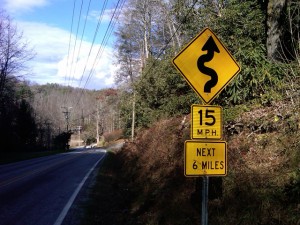
15 MPH NEXT 6 MILES - You've probably discovered a good ride when you see signs like this.

So I’m wrapping up this new motorcycle ride map which covers best motorcycle rides in the eastern half of Great Smoky Mountains National Park and I’m finally to the “get out and ride” stage. Most of the really tedious work is done, the stuff that keeps me in front of the computer. Today I took the afternoon to go out and ride some of the closer roads and it was superb.

When I do a map revision, I typically re-ride almost all the roads from the existing map to re-familiarize myself with them.  I think it’s the best way to judge newly discovered roads against the others I already know by making a fresh comparison. As some of my maps now have more than 50 featured roads I’ve got a lot of miles to cover. Sometimes a road I once considered top-notch pales a bit when new and better ones are discovered. When I do find a new road, I then seek out the best routes to connect them all together. All-in-all it adds up to a lot of mileage.

With a good frost this morning and temperatures that never creeped out of the 40’s, I saw only a few other motorcycles out on the road.  It was warm enough to leave the heated gear on the coat rack. Mid-week traffic was light and it was a great day to be out on the bike. Recent rains had helped clear the roads of the de-icing coating and gravel that had been laid down during the last cold snap.

Photo - Mountain view from one of the roads

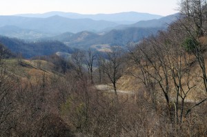
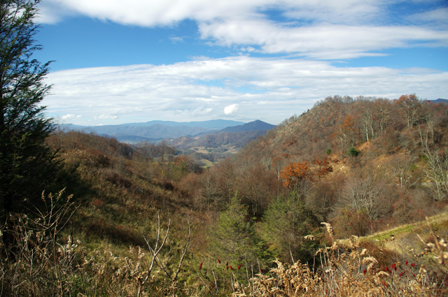
I snapped this photo atop the climb one of the great new roads made over a mountain. Views are sometimes better once the leaves are off the trees.

As is usual only a few of the new roads were really good rides though the two I found were so outstanding either would have made for a successful day. I routed my commute between them to include NC 215 so I could shoot some more video along the way for the upcoming production. Damn, that road is fun now that the south end has been repaved. The fresh asphalt has been exposed long enough that the oily surface has aged and the grip on the baby bottom smooth tarmac is outstanding. It’s a Jeckyl and Hyde experience though – as soon as you pass under the Blue Ridge Parkway the new pavement ends and the road quality becomes dangerous in places. Be on your toes where they started patching and paving the north side. I wonder if it didn’t get compacted enough as the gravel in the asphalt is loose. It’s really hard to see how bad it is until you’re in it and by then you’re slipping and sliding just as you enter the hairpin curves.

Photo - NC 215 winter view

Winter riding has it's own beauty - I enjoy the contrast to summers lush growth. This is NC 215 south of the parkway, one of the better sections.

The first road I added was one surprisingly close to home – Crabtree Mountain Road. The last time I explored it there was a long section that wasn’t paved. That’s not unusual in the mountains. The easy sections along the valley floors get paved. The steep sections that climb up and over the mountain passes don’t as it requires so much effort and expense to prepare and then maintain a decent roadbed in the steep and rocky terrain.

Photo - View from Crabtree Mountain Rd

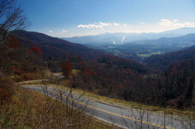
Outstanding views from atop the pass on Crabtree Mountain Road. The smoke plume from paper mill in Canton is easy to spot

Crabtree Mountain Road connects NC 209 (now known as “The Rattler” video here) to NC 215 at the town of Canton. It not only makes a connection between two already great rides, but is a great motorcycle ride on it’s own merits. The scenery in the valley is picturesque as the road winds along with the course of a stream through a collection of nice curves, then darts south to start the steep climb over a high pass. Two of the photos included were from the high point on the road. It then plunges down the mountainside through a series of hairpin turns and switchbacks before it runs into Thickety Road and connects to NC 215 near I-40. Watch for gravel near the top of the pass, but otherwise the road is in good condition and a nice ride.

Photo - Silversteen Road

High quality pavement on Silversteen Road gives you the confidence to exploit the unending series of curves.

The second road I added was near Lake Toxaway and I suspect it may become one of my new favorites. Silversteen Road connects the fabulous riding on NC 281 to one of the twistiest sections of US 64. This road had me thinking of The Dragon at Deals Gap. Though a third shorter than the Dragon at at 8.1 miles in length, the tight curves are relentless throughout the ride. Also, like the Dragon, while it doesn’t offer much in the way of scenery, you’re too engaged in just maintaining control to let your eyes wander to the horizon. It’s easy to find from NC 281 as it intersects on a hairpin curve, and the southern end at at US 64 is marked by a gas station.

Progress is going to have to wait a week as I’m taking a short vacation. I be back in the saddle after Thanksgiving. I posted some of the video I shot today at my Youtube Channel – http://youtube.com/americaridesmaps. Until then, enjoy the ride.

http://www.youtube.com/watch?v=t1HbSTAk7C4

_______________________________________________________________________________

Wayne Busch
Wayne Busch – Cartographer
– Wayne Busch lives in Waynesville, NC, where he produces the most detailed and comprehensive and up-to-date motorcycle pocket maps of the Blue Ridge and Smoky Mountains to help you get the most of your vacation experience. See them here – AmericaRidesMaps.com 
 

I Just Keep Finding More Great Motorcycle Rides

Image - Map CoverAsheville

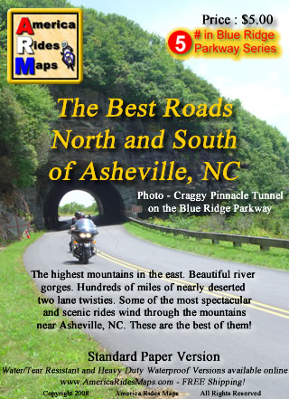
Map - The Best Roads North and South of Asheville, NC - the revision is so close to being done.

I’ve resigned myself to the fact it’s going to take at least one more day on the road to investigate some roads for the revision of America Rides MapsThe Best Roads North and South of Asheville, NC“. I’ve already added more than a dozen new roads to the hundreds of miles of great motorcycle rides I’d already charted, roads which link the existing great rides together and expand the options to stay out on the two lane back roads enjoying the twisty bliss of carving through the tallest mountains in the east. I’ve got at least a dozen more yet to be evaluated and judged.

I systematically go through each of the dozen maps I now produce, re-evaluating each of the roads by riding them again, noting any changes along the way to insure you get the most up to date and best ride info I can produce. I’ve been reworking this Asheville map for well over a month now and thought I was closing in on wrapping it up. I sat down to knock off the last chunk of it today, and as the clock now approaches midnight my efforts have only yielded yet more possibilities that must be explored. The devil is in the details, and I too often find as I get down to the final detail work I start to ask questions. Has this road been paved? Is there a way to find a link between these two great rides? If this road was so good, what about this one nearby? The questions just keep coming and I research them as best I can then pencil in the ones I can’t rule out. There are enough unanswered to warrant another long day in the saddle, maybe two.
I’ll spend tomorrow getting things as close to finished as I can. Then, I’ll go out on the road and spend the day or two that’s needed to ride each and every one of them to see if they measure up. Though my last trip was very rewarding, this time I suspect it will be mostly disappointment – that’s the norm. Still, if one or two of them pan out, I’ll come home happy. These are the last of the last, kind of like sifting through the tailings at a gold mine to see if any small nuggets were missed. A real bonus is finding another reliable out of the way gas station. Maybe, just maybe, I’ll stumble across a real jewel. You never know until you ride it.


Photo - Wayne and his motorcycle

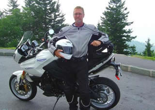
A couple more days on the road should do it. I'm really excited to get to the next map, I have some big plans for expansion.

Addendum: This region north of Asheville is one of the most undiscovered areas of great mountain motorcycle rides. Few venture into this area though there are a wealth of fabulous motorcycle rides through the tallest mountains in the east virtually devoid of any traffic. This time of year, when leaf peepers clog most of the backroads, you can ride all day through this area and count the cars on one hand. This map will give you a vacations worth of great rides and you’ll still come back for the ones you didn’t get to.

America Rides Maps – nobody covers the Smoky Mountains as comprehensively so you can make the most of your precious riding time.

_______________________________________________________________________________

Wayne Busch
Wayne Busch – Cartographer
– Wayne Busch lives in Waynesville, NC, where he produces the most detailed and comprehensive and up-to-date motorcycle pocket maps of the Blue Ridge and Smoky Mountains to help you get the most of your vacation experience. See them here – AmericaRidesMaps.com