I am either;
- Getting too old and out of shape
- Coming down with the flu
- Rode harder than I have in a long time
It’s probably a combination of the first point and the last. I awoke last night sore from the chest down due to throwing my bike around all day in my never ending quest to discover the best motorcycle rides in the Smoky Mountains. It was not planned to be such a day but it turned out to be quite an adventure.
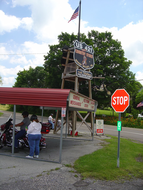
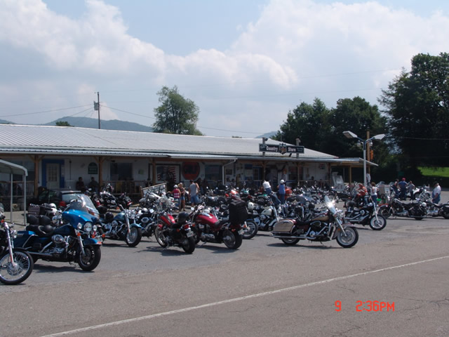
I set out around 8AM for Shady Valley, Tennessee, home of “the Snake” motorcycle ride to make a delivery of motorcycle maps to the Shady Valley Country Store. Plan was to ride up, enjoy the Snake, make the delivery, then check out half a dozen roads nearby in hopes to add some to my motorcycle pocket maps. I knew one would just be a connector route. I didn’t have high hopes for many of the others, though a couple held promise.
It was beautiful and cool up on the Blue Ridge Parkway in the morning. Skies were clear and bright. Even the half hour on Interstate 40 to Asheville was pleasant. There’s little traffic before 10AM once you leave the highway and I pretty much had the road to myself. I watched hopefully for bears north of the city, then enjoyed the run up the wonderful new sections of pavement to pass Mt. Mitchell. Looks like they’ve pretty much wrapped that job up. Saw one grouse, a few hawks, but no bruins.
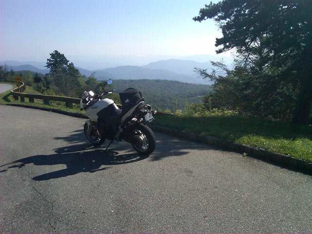
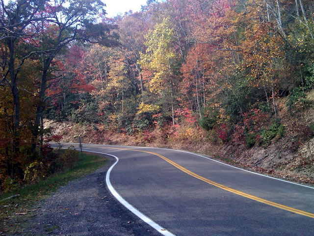
Clear, cool, breezy morning on the Blue Ridge Parkway near Altapass.
I stopped to tweet my first photo at an overlook where I could count on cell phone reception. Though hurricane Earl was approaching the coast, here in the mountains no impact was expected. Even so it was noticeably breezy.
I hit one brief delay for tree work, and another for guardrail replacement. I surprised a flock of turkeys as I came near Little Switzerland. Passing Linville, I left the Blue Ridge Parkway at Roseborugh Road, one of those handy unmarked crossroads that descends through a series of tight turns to NC 105 at Grandfather Mountain. NC 105 took me north through the congestion of Banner Elk. Broadstone Road led me west of Boone to Valle Crucis. NC 194 led to US 421 which I followed through Mountain City and into Tennessee to reach Shady Valley.
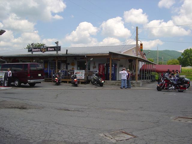
A brief pit stop turned into a decent delay as I took time to chat with several riders, mostly locals, and return phone calls when the intermittent cell reception cooperated. I figured it would take a couple hours to see the roads I wanted, then I’d zip back home as I came.

The sun was still shining at the Shady Valley Country Store though the winds were getting gusty. Things would change as the afternoon wore on.
The first few roads proved less than expected. They were a decent ride for a cruiser maybe, though it was not type of rural scenery that makes a road interesting. I explored another after a couple bikes passed in the opposite direction to find it intersected the fourth road at an unknown point. Still nothing special. I turned to backtrack on the fourth road so I would be sure to ride it end to end and was thrilled to find the short leg wonderful. Nice sweeping turns through pretty countryside. Hopeful, I spun about at the intersection with 197 and headed back. The remainder disappointed. Too much straight and only mildly interesting. It was worth adding to the map but not recommending highly. The natural flow dictated I bypass the next on the list meaning another backtrack to explore the better alternative.
The last of the most promising roads was accessed from US 321 near Watauga Lake. It was tight, it was twisty, but it didn’t appeal. It was then that serendipity struck. Rather than continue on my planned path, instinct told me to detour onto another road. I followed it through turn after turn after turn and it went on and on and on. All the while I expected it would peter out into a goat trail but it just kept going without letting up. Mile after mile on narrow, sometimes poor, blacktop it climbed through the mountains finally dumping me out at Banner Elk Highway. I pulled into an abandoned gas station to take my notes and decide how to describe it.
I kept asking myself, “But was it fun?” There was no doubt it was challenging, very challenging. It kept you on the edge the whole time. It never let up. I ride the Dragon routinely and this road is much more difficult and sustained. I’d come up on some traffic and had to simply ride behind it, no room to pass, so I didn’t feel I could give it an accurate evaluation. Nor was I sure what lay at the other end. Only choice was to ride it back and see where it came out.
As I turned about my heart sank. A school bus turned onto the road ahead of me. While it looked empty, this would still be an exercise in pain as it could only crawl through the narrow serpentine climb ahead. What a relief when it pulled off within a few hundred feet. It wasn’t long before I had my answer. This road WAS fun.
Unimpeded I rode it enthusiastically back as I’d come. A few miles in I remember thinking, “If you get out of second gear on this road, look down – you’re riding a moped”. I reached the point where I’d first turned on to it and continued past. The road name changed, but its character did not. I continued mile after mile carving through the exquisitely tight turns, dodging gravel patches, potholes, and debris now falling on the road from the increasing wind. I was so happy when US 321 appeared at the margin of the screen on the GPS. I’d found a new way to link a couple major roads. Awesome.
That ride was worth the trip. I stopped and entered the notes in my Blackberry. From there I turned onto US 321 to head on to check out the last couple roads. The weather was deteriorating. Skies dark, winds gusting, it didn’t bother me a bit. Shortly, I came up on another biker who suddenly veered off on another road back in the area where I’d just been riding. I circled back out of curiosity to see what business this cruiser guy had in such a rugged area. The road he chose was a superb cruiser road and I caught up to him just as he pulled into his yard at the junction with the first great road. Bonus! Instinct paid off again.
I returned to US 321 via the cruiser road to make time. It was getting late and the weather would soon add more to the challenge of these tight roads. After a short ride on US 321, I started down the last of them which turned out to be a disappointment. A few miles in I spied a road connecting to it I felt needed exploring and eventually found a better approach though I did waste a good bit of time on dead ends and gravel lanes. Plan was to take this road a few miles, then turn onto another to make my way back towards Mountain City. As I approached the turn, instinct took over again and I purposefully rode past it.
The GPS showed the road I was on getting tighter and twistier and it was climbing higher into the mountains. Thats usually a pretty good indication it’s going to deteriorate to nothing once it nears the top and the road grew narrower and more challenging as it went on. I considered just giving up on it, but something made me go on. The smell of fresh rain on a dry road filled the air and I started hitting dark patches of pavement. I was really questioning myself when I emerged atop a pass with a rugged valley stretched below and signs warning of a steep descent and switchbacks appeared. It would have been beautiful in nicer weather, but the dark and angry clouds only hastened my urgency to continue on, dreading the thought of having to retrace my steps.
I’ve ridden a lot of miles in the mountains yet never seen switchbacks as tight as these. I plunged down through the valley wondering where I’d end up, hoping I’d find some landmark to steer me back to something familiar. When the road ended, I looked at the sign ahead to see I was on the road I’d meant to explore next. Another great ride found, and I was ready to wrap things up after this last road.
It was longer then I thought and I reached US 421 south of Mountain City. It was now 5 PM. Rain was coming down in sheets. I turned south towards Boone. The Friday evening traffic before the holiday weekend crawled and stalled in the rain. I dreaded the idea of going into Boone and veered off on 194 to bypass it. More traffic. I stopped near Banner Elk to top off the tank and called home to let my wife know I wouldn’t be there for dinner. We discussed the weather, the traffic, and decided I’d prefer the exposure to the elements on the Blue Ridge Parkway over the hazards of this crazy traffic. It was the right choice. The rain let up once I got up high.
I coursed through the mountains in the twilight relatively unimpeded. It got cold but I made good time. Reaching Asheville, I merged into the traffic jam that clogged Interstate 40 all the way home. Arriving in my driveway as darkness fell, I’d had a successful day. I’d discovered some great roads. I had reason to go back with hopes of more. I had money in my pocket. Sometimes, a cartographers life is to be envied. I wish I had more photos, but I got swept up in the riding. Maybe next time.
wayne@americaridesmaps.com
America Rides Maps – from north Georgia to north Virginia, the best motorcycle rides
_______________________________________________________________________________

Wayne Busch - Cartographer
– Wayne Busch lives in Waynesville, NC, where he produces the most detailed and comprehensive and up-to-date motorcycle pocket maps of the Blue Ridge and Smoky Mountains to help you get the most of your vacation experience. See them here – AmericaRidesMaps.com
