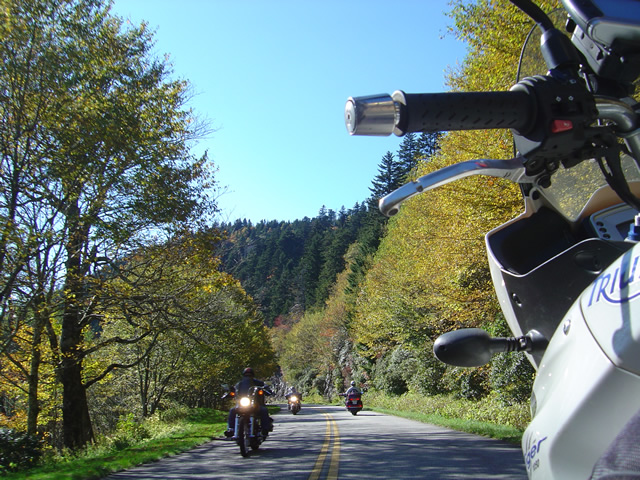
Best Blue Ridge Parkway Overlooks by Motorcycle

Best Blue Ridge Parkway Overlooks by Motorcycle – Waterrock Knob

Waterrock Knob Overlook
Elevation – 5820 feet
Milepost – 451.2
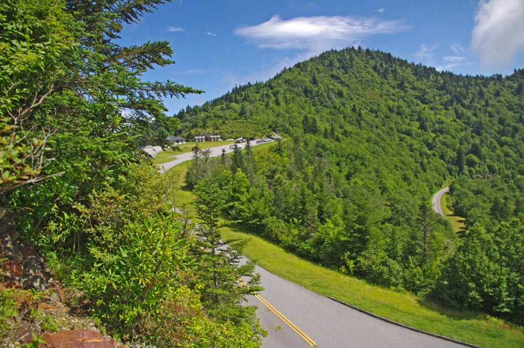
Best Blue Ridge Parkway Overlooks by Motorcycle - Waterrock Knob

Best Blue Ridge Parkway Overlooks by Motorcycle – Waterrock Knob is a beautiful spot with outstanding views

Easy to find, convenient to reach from nearby towns of Waynesville and Maggie Valley, Waterrock Knob is a popular stop when motorcycle riding on the Blue Ridge Parkway.
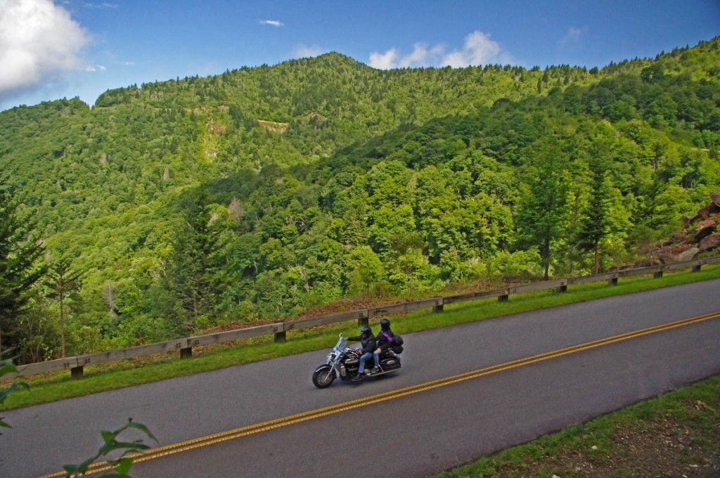
Best Blue Ridge Parkway Overlooks - waterrock knob view

Best Blue Ridge Parkway Overlooks – It’s a steady climb to Waterrock Knob from either direction on the Blue Ridge Parkway. It’s only 18 miles from the south end of the ride.

Once you’ve passed the highest point on the Blue Ridge Parkway it’s all downhill to the southern end at Great Smoky Mountains National Park just outside Cherokee, NC.
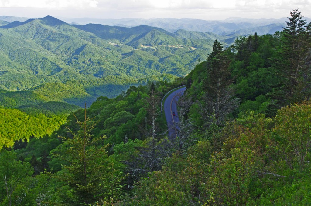
Best Blue Ridge Parkway Overlook by Motorcycle - Waterrock Knob

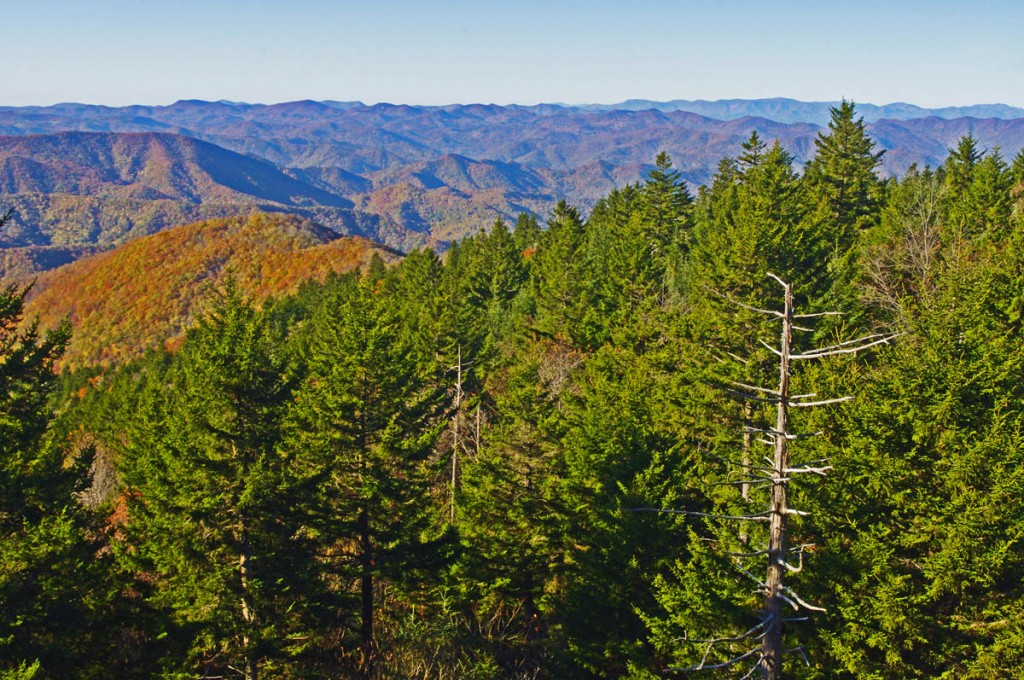
Best Blue Ridge Parkway Overlook by Motorcycle – Waterrock Knob – view looking south into South Carolina and Georgia.

It’s hardly time to pull in the clutch and coast – there are a few good mountains you’ll need to climb along the way. One of them is Waterrock Knob.
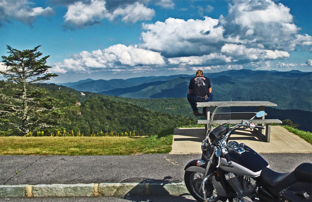
Best Blue Ridge Parkway Overlooks by Motorcycle - Waterrock Knob view

Best Blue Ridge Parkway Overlooks by Motorcycle – Waterrock Knob view – looking east into South Carolina. Clear days provide outstanding views. Take some time and enjoy.

Just 10 miles from the south end of the Blue Ridge Parkway, Waterrock Knob is a large overlook sitting near the mountain top with outstanding views both east and west. On clear days it’s easy to spot Harrah’s Casino in Cherokee almost 20 miles distant.
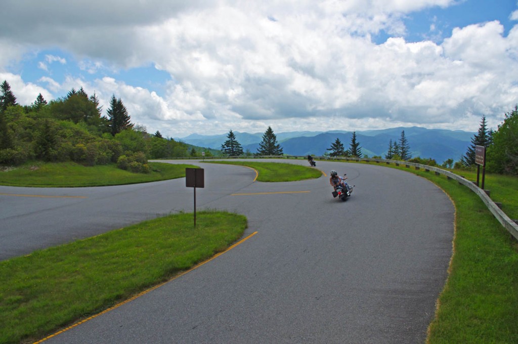
Best Blue Ridge Parkway Overlooks by Motorcycle - Waterrock Knob  - the turn

Best Blue Ridge Parkway Overlooks by Motorcycle – It’s easy to spot the short access road that leads to Waterrock Knob as the parkway divides here for one brief section

The overlook is located on a short spur road that is well marked and easy to spot – the road briefly becomes divided here with a median as you reach the top of the climb.

Best Blue Ridge Parkway Overlooks by Motorcycle - west view

Best Blue Ridge Parkway Overlooks by Motorcycle – looking west, you can see the casino in Cherokee almost 20 miles distant

The overlook has a large parking lot, bathrooms, and a Blue Ridge Parkway Visitor Center. A  strenuous footpath makes a 1 mile climb to the top of the mountain. There are several picnic tables and it’s a nice place for it.
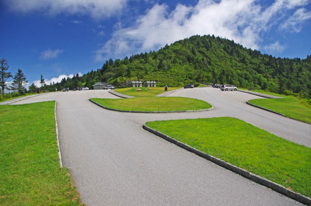
Best Blue Ridge Parkway Overlooks by Motorcycle - Waterrock Knob

Best Blue Ridge Parkway Overlooks by Motorcycle – It’s a great place for a pit stop at Waterrock Knob, plenty of room and places to view from, and a visitor center with info and bling.
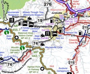
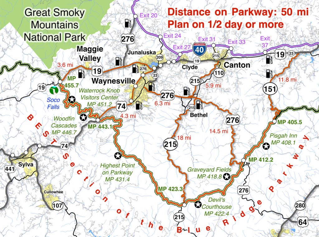
Best Blue Ridge Parkway Overlooks - Waterrock Knob - map

Best Blue Ridge Parkway Overlooks – Waterrock Knob – map – a section of Map #6 shows where to find Waterrock Knob on the Blue Ridge Parkway. There are lots of other things to see nearby.

You’ll find Waterrock Knob on America Rides Motorcycle pocket maps –

#6 The Best Motorcycle Rides Near Smoky Mountains Park – EAST
http://shop.americaridesmaps.com/6-The-Best-Motorcycle-Rides-Near-Smoky-Mountains-Park-EAST-NC017.htm

#7 The Best Motorcycle Rides SOUTH of GSMNP
http://shop.americaridesmaps.com/7-The-Best-Motorcycle-Rides-SOUTH-of-GSMNP-NC021.htm

____________________________________________________________________

wayne busch - Smoky Mountain Motorcycle Rider.com

Wayne Busch

– Wayne Busch lives in Waynesville, NC, where he produces the most detailed and comprehensive and up-to-date motorcycle pocket maps of the Blue Ridge and Smoky Mountains to help you get the most of your vacation experience. See them here – AmericaRidesMaps.com

Total Rider Tech Logo

Learn Total Control

Wayne is an advanced motorcycle instructor for Total Rider Tech teaching Lee Parks Total Control Advanced Rider Courses. Isn’t it time you looked into advanced rider training to ride more confidently and safely? It can transform your mountain riding experience.  Total Rider Tech

____________________________________________________________________

Best Blue Ridge Parkway Overlooks by Motorcycle

Best Blue Ridge Parkway Overlooks by Motorcycle – Highest Point

Richland Balsam Overlook
Elevation – 6053 feet
Milepost – 431.4 

Best Blue Ridge Parkway Overlooks - highest point

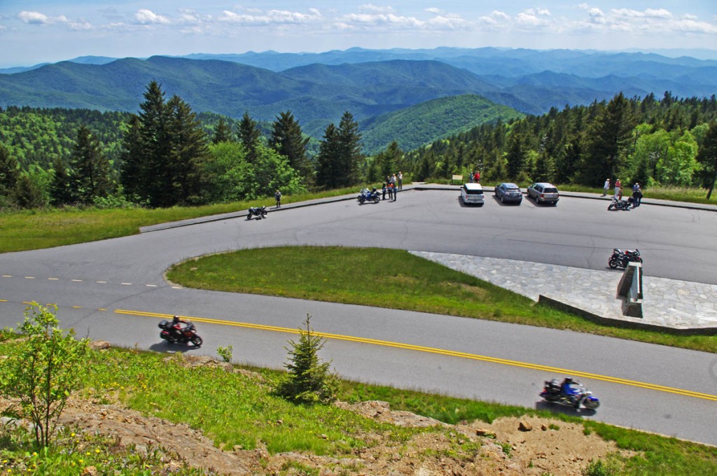
Best Blue Ridge Parkway Overlooks – highest point. The long sweeping overlook  provides expansive views of the mountains which comprise ‘The Land of the Waterfalls”

The highest point on the Blue Ridge Parkway is in North Carolina at milepost 431.4. Here, the nations top motorcycle ride reaches an elevation of 6053 feet as it carves it’s way along  the southern exposure of the Balsam mountain range.

Best Blue Ridge Parkway Overlooks by Motorcycle - highest point

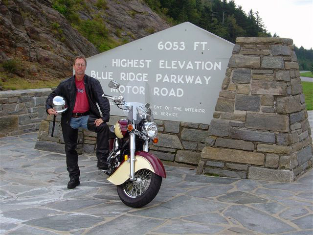
Best Blue Ridge Parkway Overlooks by Motorcycle – Getting your picture with the sign at the highest point on the Blue Ridge Parkway is one of those “must have” photos from your trip to reach the long paved overlook which spans the radius of the curve around the mountain.

There is no dramatic climb to reach the long paved overlook which spans the radius of the broad curve around the mountain. The Blue Ridge Parkway maintains a steady altitude through this long remote and isolated section of the national park rarely dipping below 5000 feet. While the grades are gentle, the curves are full of surprises and the drop-offs along the roadside inspire a real respect for the altitude on this best motorcycle ride in the USA.

Best Blue Ridge Parkway Overlooks by Motorcycle - high point

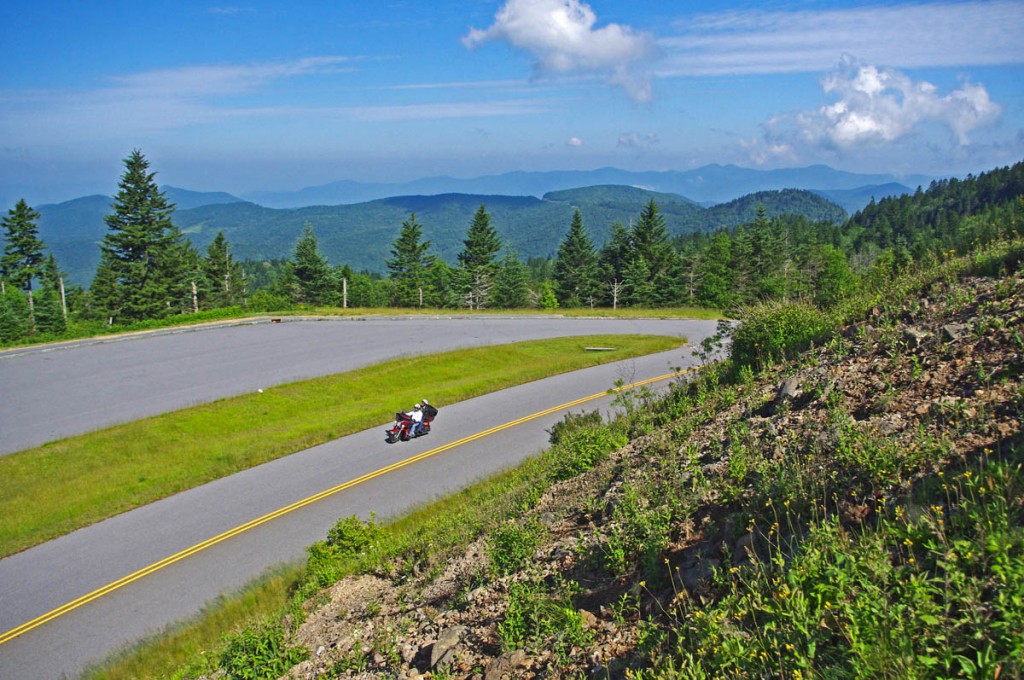
Best Blue Ridge Parkway Overlooks by Motorcycle – peer into several states from the highest point on clear days, but it not place to be in bad weather

Only 37.7 miles from the southern end of the Blue Ridge Parkway at Great Smoky Mountains National Park near Cherokee, NC, a ride to the high point is an easy one to squeeze in even if you’re not on an end-to-end parkway ride on your motorcycle. From Asheville, Waynesville and Maggie Valley, it’s a wonderful way to spend a few hours riding a motorcycle on one of the the best scenic motorcycle rides you’ll find anywhere.

Best Blue Ridge Parkway Overlooks by Motorcycle - high point

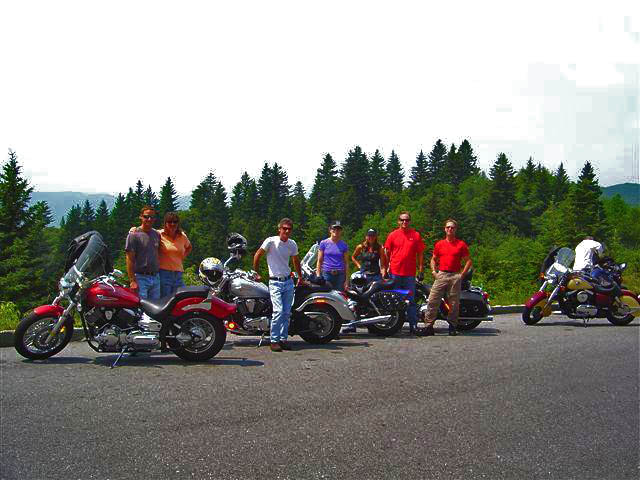
Best Blue Ridge Parkway Overlooks by Motorcycle – Few can resist a stop at the high point. The large parking area is able to handle the crowds, and it’s a great lace to get shots of large groups of riders.

As you might suspect, this spot is one of the most remote and isolated on your Blue Ridge Parkway motorcycle ride. It’s a long ride for gas, tank up before you go. The high parts get the wet weather first – if it looks cloudy from the valley, you may not see much when you get up high. It will be a lot cooler than down in the valley and more windy, be prepared.

Best Blue Ridge Parkway Overlooks by Motorcycle - high point

Best Blue Ridge Parkway Overlooks by Motorcycle – A fall view from the high point overlook. Clear days are just spectacular!

Map of the best section of the Blue Ridge Parkway

Blue Ridge Parkway Map best

Map of the best 50 mile section of the Blue Ridge Parkway shows the location of the high point and the ways to reach it from nearby towns. Click for larger image –

See a 360 degree panoramic view at Virtual Blue Ridge – http://www.virtualblueridge.com/parkway_tour/overlooks/00431b.asp

image-motorcycle-ride-map-cover

You’ll find the highest point on the Blue Ridge Parkway on America Rides Maps motorcycle pocket map

#6 The Best Motorcycle Rides Near Smoky Mountains National Park – EAST http://shop.americaridesmaps.com/6-The-Best-Motorcycle-Rides-Near-Smoky-Mountains-Park-EAST-NC017.htm

____________________________________________________________________

wayne busch - Smoky Mountain Motorcycle Rider.com

Wayne Busch

– Wayne Busch lives in Waynesville, NC, where he produces the most detailed and comprehensive and up-to-date motorcycle pocket maps of the Blue Ridge and Smoky Mountains to help you get the most of your vacation experience. See them here – AmericaRidesMaps.com

Total Rider Tech Logo

Learn Total Control

Wayne is an advanced motorcycle instructor for Total Rider Tech teaching Lee Parks Total Control Advanced Rider Courses. Isn’t it time you looked into advanced rider training to ride more confidently and safely? It can transform your mountain riding experience.  Total Rider Tech

____________________________________________________________________

The Blue Ridge Parkway’s Best Kept Secret Waterfall

The Mount Lyn Lowry overlook is  a large and welcoming pull-off on the Blue Ridge Parkway that holds more than appears on a drive-by.

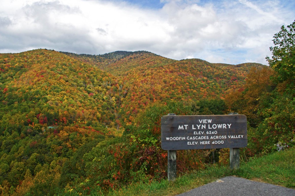
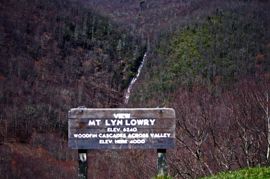
Motorcycle the Blue Ridge Parkway in the early spring and you’ll be rewarded with sights unseen by those who visit later in the year. One of them is Woodfin Cascades at the Mt Lyn Lowry overlook (MP 446.7). Once leaves cover the trees when summer arrives, most of this waterfall disappears from view.

Photo-woodfin-cascades-on-the-blue-ridge-parkway

Woodfin Cascades are viewed from the Mt. Lyn Lowry overlook on the Blue Ridge Parkway

Another secret revealed to those who spend a little time observing at this Blue Ridge Parkway overlook is the 60 foot high illuminated cross atop Mt. Lyn Lowry. You can use the cross as a reference to fid the falls, they are located beneath it on the mountainside.

Photo-mt-lyn-lowry-fall

The cross is located atop the mountain. Even though it's 60 ft tall, on a 6240 mountain it's just a speck! The falls are hiding behind the leaves.

Mt Lyn Lowry overlook is located on the section of the Blue Ridge Parkway between Waynesville at US 74 and Maggie Valley at US 19. This is one of the most scenic stretches of the national park as it climbs to the heights of Waterrock Knob, then descends to Soco Gap and Maggie Valley. There are numerous long range overlooks.  Be sure to bring your camera for some of the best views you’ll find.

photo-woodfin-cascades

In spring, the entire 235 foot run of Woodfin Cascades can be admired. It dissapears when things green up.

Here’s a 2 min video closeup of Woodfin Cascades –

__________________________________________________________________

Wayne Busch

Wayne Busch - Cartographer

Total Rider Tech Logo

Learn Total Control

– Wayne Busch lives in Waynesville, NC, where he produces the most detailed and comprehensive and up-to-date motorcycle pocket maps of the Blue Ridge and Smoky Mountains to help you get the most of your vacation experience. See them here – AmericaRidesMaps.com

Wayne is an advanced motorcycle instructor for Total Rider Tech teaching Lee Parks Total Control Advanced Rider Courses. Isn’t it time you looked into advanced rider training to ride more confidently and safely? It can transform your mountain riding experience.  Total Rider Tech

____________________________________________________________________
Scenic Motorcycle Rides – Dry Falls, NC

The beautiful region south of Great Smoky Mountains National Park is often called “The Land of the Waterfalls” and is one of the most popular areas to ride on a motorcycle.  More than 20 nice waterfalls are located close to the roadside, another 40 or so require more serious hiking than most bikers are willing or equipped to tackle.

photo-Dry-Falls

A path leads behind Dry Falls so you can pass beneath it without getting wet.

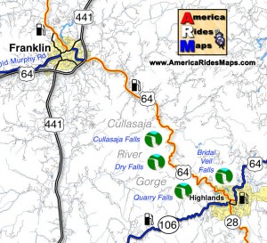
Dry Falls is one of the most unique though it’s an easy one to miss on your motorcycle ride despite being well marked. It’s easy to miss as it’s not directly visible from the road so you’re not tempted off the wonderfully curvy section of US 64 as it snakes through the spectacular Cullasaja Gorge between Franklin and Highlands.

This section of US 64 can be a very enjoyable ride on a motorcycle, though it’s too often hampered by other traffic drawn to see the sights and wonders. On those typical days when there is a good amount on traffic on the road, it’s definitely worth the time to stop for a break and make the short walk from the parking area to admire Dry Falls.

image-map-of-waterfalls

Dry Falls got it’s name because you can walk beneath the falls without getting wet. A large cavern beneath the rock ledge at the top of the falls has a path where you can pass behind the cascade to emerge on the other side. It has the largest and best improved parking area of all the falls in the area, so it’s an easy place to stop and enjoy.


image Great Smokies south map coverFind more than a dozen roadside waterfalls on America Rides Maps map #7The Best Roads SOUTH of Great Smoky Mountain National Park

__________________________________________________________________
Wayne Busch

Wayne Busch - Cartographer

Total Rider Tech Logo

Learn Total Control

– Wayne Busch lives in Waynesville, NC, where he produces the most detailed and comprehensive and up-to-date motorcycle pocket maps of the Blue Ridge and Smoky Mountains to help you get the most of your vacation experience. See them here – AmericaRidesMaps.com

Wayne is an advanced motorcycle instructor for Total Rider Tech teaching Lee Parks Total Control Advanced Rider Courses. It’s time you looked into advanced rider training to ride more confidently and safely, it will change your mountain riding experience. It worked so well for me I became an instructor! Total Rider Tech

____________________________________________________________________
Nice Motorcycle Ride Near Maggie Valley, North Carolina

The locals know this good biker road well. Shouldn’t you?

Hard to believe Jan 1, 2012, and we’re out for a spin on the bikes. Unusually warm, the day also brought some showers so we kept our ride short and local. As we’re pretty much surrounded by great motorcycle rides here in the Waynesville / Maggie Valley area, even those short rides can be a lot of fun.

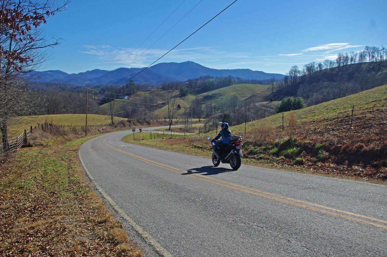
photo-jackie-on-rabbit-skin-road

Jackie welcomes the New Year with a ride on Rabbit Skin Road. Nice curves, nice views, it’s a local favorite.

Rabbit Skin Road is easy to find. From Waynesville / Maggie Valley, head north on US 276 across the broad expanse of Jonathan Valley as it skirts the edge of Great Smoky Mountains National Park. The top of the ridge line to the west is the park border. To the north you’ll see more impressive mountains including 6000 Max Patch Bald. Even though it’s a long straight stretch of 4 lane, US 276 is a scenic and relaxing ride and a good chance to get settled on the bike before the challenge that is soon to come.

US 276 ends at the intersection with Interstate 40 at Exit 20. Pass under the Interstate as if you are continuing north to Tennessee and look for Rabbit Skin Road on the right before you head up the ramp to the highway.

This video includes some shots of the bridge where the roads meet

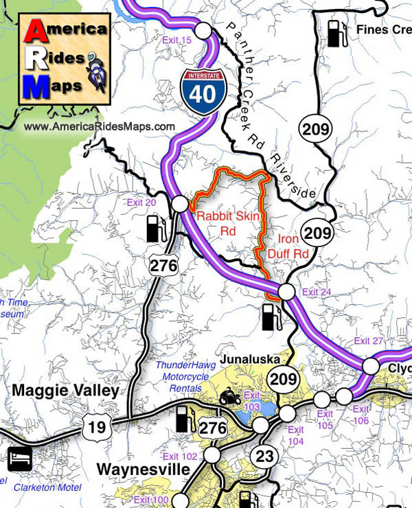
Rabbit Skin Road is one of several very challenging and scenic motorcycle rides through the mountains which lie north of Waynesville / Lake Junaluska / and Maggie Valley. It’s only 3.5 miles in length, but it doesn’t really end, it just continues on as Iron Duff Road for another 4.1 miles before it connects to NC 209 (a.k.a. The Rattler) near Exit 24 on Interstate 40.

The junction of Rabbit Skin Road and Iron Duff Road occurs at a bridge which crosses the Pigeon River. Across the river, are two more good motorcycle rides, Riverside Road and Panther Creek Road. Still more good motorcycle rides link to them.

While none of these roads is very long, all of them are scenic and fun to ride, and they interconnect. They are good toknow about when you have only a short time available to get in a motorcycle ride or are darting out for a cruise between rainy spells. If you know where they are, you can just keep linking roads together and spend a couple hours looping through the mountains and never leave the county nor ride the same one twice.

Image-map-shows-the-motorcycle-ride

Rabbit Skin Road and Iron Duff Road – Local Favorites


All Roads Lead to Maggie

The Rattler

America Rides Maps Map #6 – The Best Motorcycle Rides EAST of Great Smoky Mountains National Park

_______________________________________________________________________________
Wayne Busch

Wayne Busch – Cartographer

Total Rider Tech Logo

Learn Total Control

– Wayne Busch lives in Waynesville, NC, where he produces the most detailed and comprehensive and up-to-date motorcycle pocket maps of the Blue Ridge and Smoky Mountains to help you get the most of your vacation experience. See them here – AmericaRidesMaps.com

Wayne is an advanced motorcycle instructor for Total Rider Tech teaching Lee Parks Total Control Advanced Rider Courses. It’s time you looked into advanced rider training to ride more confidently and safely, it will change your mountain riding experience. It worked so well for me I became an instructor! Total Rider Tech

_______________________________________________________________________________
Section of Blue Ridge Parkway May Reopen After All

photo - Motorcycles on the Blue Ridge Parkway

Motorcyclists enjoy the scenic section of the Blue Ridge Parkway near the closure site.

Good news for those of you planning your motorcycle trip. While I’m having some trouble finding hard confirmation on this from an “official” source,  it appears the National Park Service will be trying to open one lane of the Blue Ridge Parkway which has been closed due to an unstable slope. The section affected by the closure lies south of Asheville near milepost 400. Design plans to remove unstable material and bolt the slope have been crafted, and one lane could be open again by July of this year.

The current closure prevents access to the Pisgah Inn from Asheville, though it can be reached by backtracking from Wagon Road Gap (US 276) south of Waynesville.  As this section of the Blue Ridge Parkway makes the climb from the French Broad River Valley at Asheville to gain the highest elevations along the scenic roadway, it will be a welcome relief to have it opened and avoid any detours. Expect the remainder of the Blue Ridge Parkway to be open by the end of April barring discovery of any further problems and the continued enthusiasm of the clean up crews.

For the first time in a long while our nations most popular scenic motorcycle ride could be open from end-to-end, just in time to celebrate the 75th anniversary of the park.